Cycling Paradise in the Rhône-Alpes!
Cycling routes from Cellieu
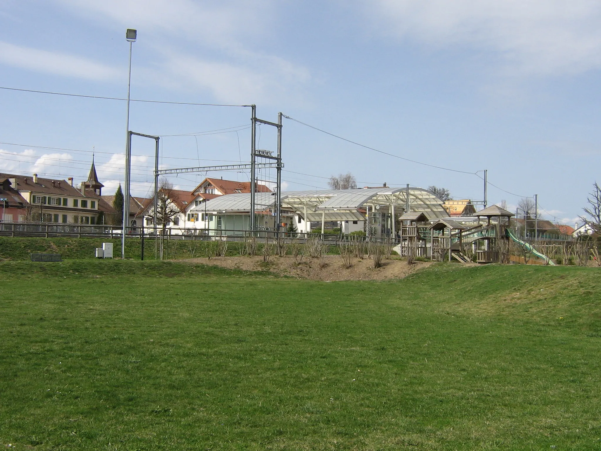
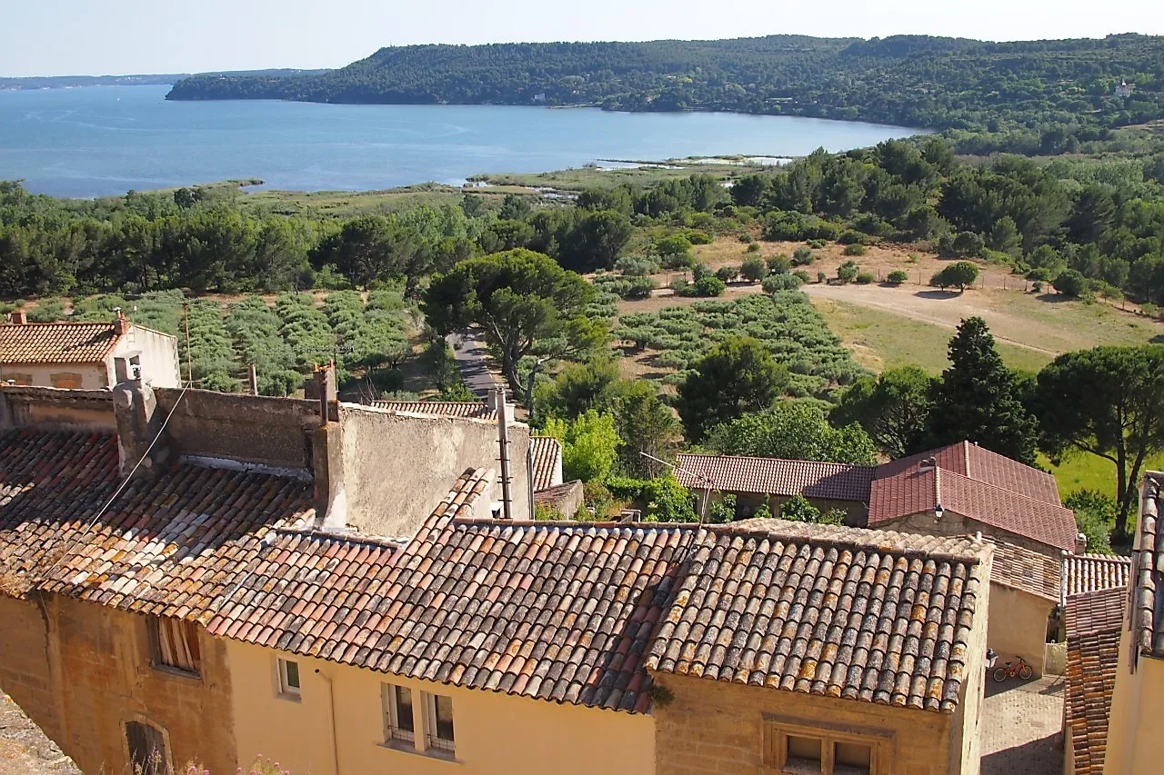
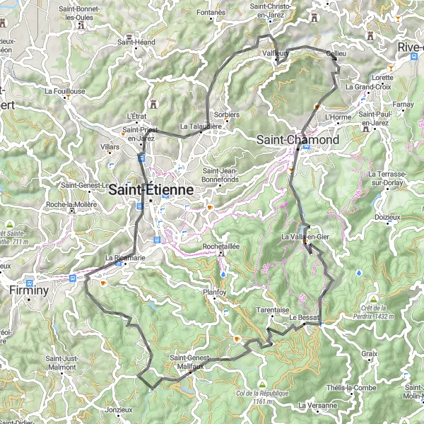
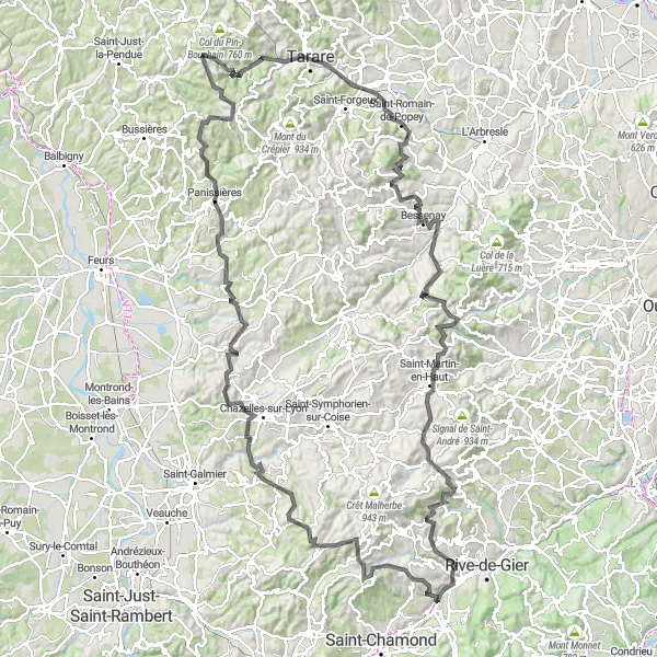
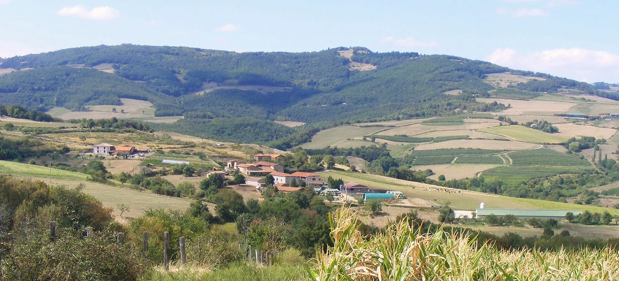
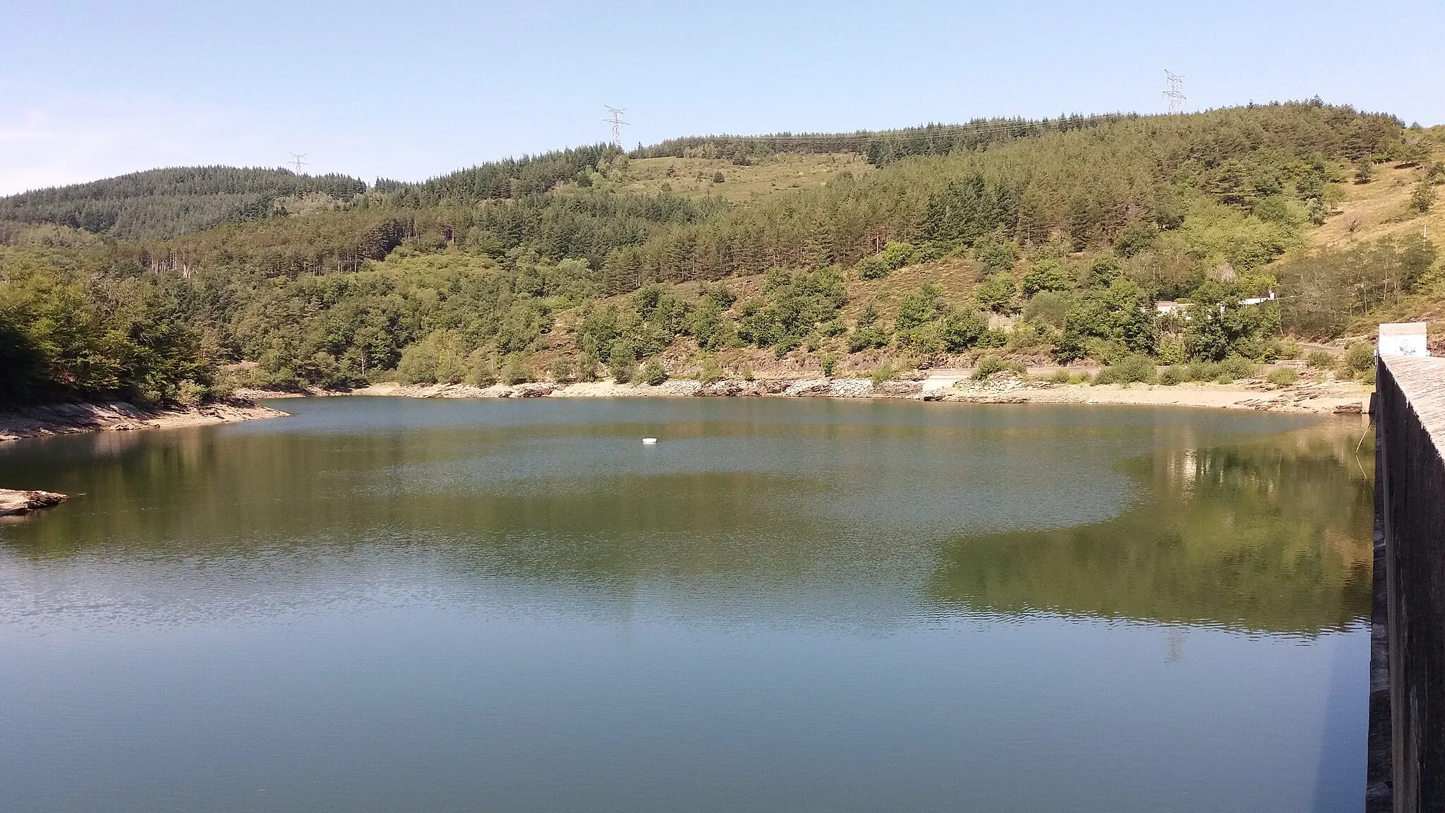
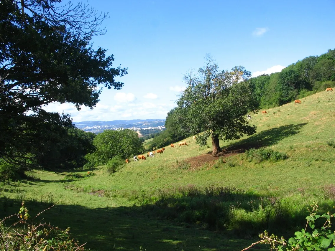
Cellieu is a charming locality located in the Rhône-Alpes region of France. From a cyclist's perspective, it offers a mix of road and gravel rides with beautiful scenery. The area is known for its hilly terrain, making it a great destination for cyclists looking for a challenge. Nearby, you can find the Col de la Croix de Chaubouret, a well-known climb that attracts cycling enthusiasts from all over. Cellieu also features a few local cafes and restaurants where cyclists can refuel and relax after a ride. Overall, Cellieu is a great cycling destination with plenty of options for both road and gravel riders.
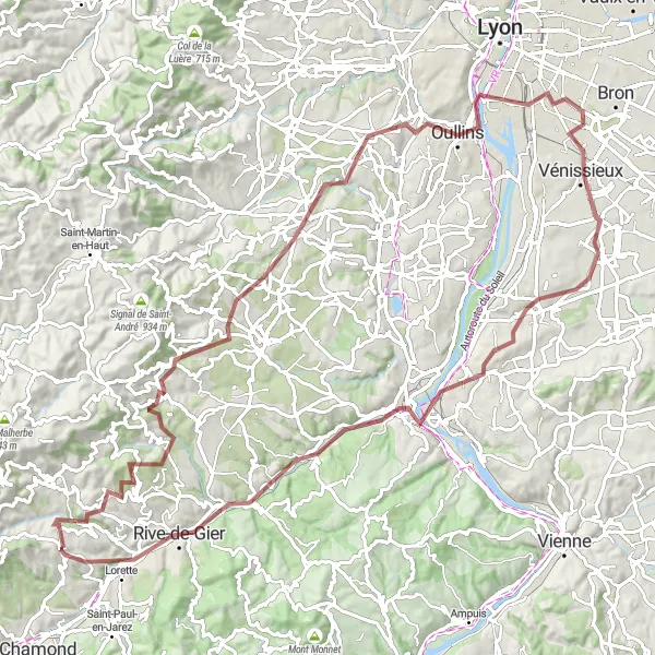
Embark on a challenging gravel adventure through the idyllic Rhône Valley
Embark on a thrilling gravel adventure starting near Cellieu that will take you through the stunning landscapes of Crêt de Chagneux, Saint-Sorlin, and Commnay. This challenging route covers a distance of 101 km with a total ascent of 1470 meters. Enjoy the breathtaking scenery from Crêt de Piralougnon and take a moment to explore the historic towns of Chaponost and Vénissieux.
The Gravel Adventure
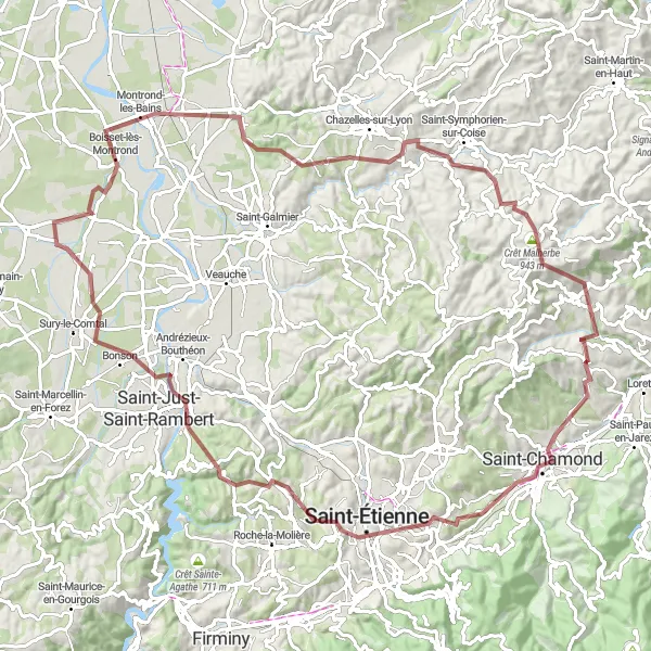
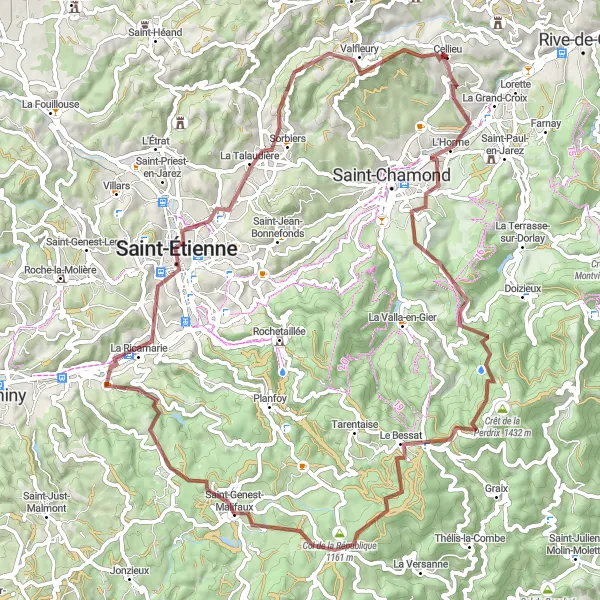
Discover the rugged terrain and breathtaking scenery of Saint-Chamond and Montrond-les-Bains
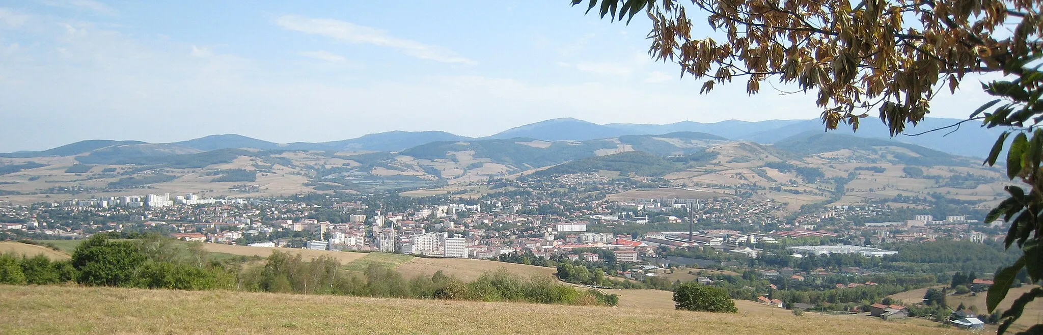
Embark on an epic gravel adventure starting near Cellieu that will take you through the picturesque towns of Saint-Chamond, Saint-Étienne, and Montrond-les-Bains. This challenging route covers a distance of 99 km with a total ascent of 1621 meters. You'll conquer the sommet de Saint-Just and enjoy sweeping views from L'Hôpital-le-Grand. Don't forget to take a break in the charming village of Chagnon along the way.
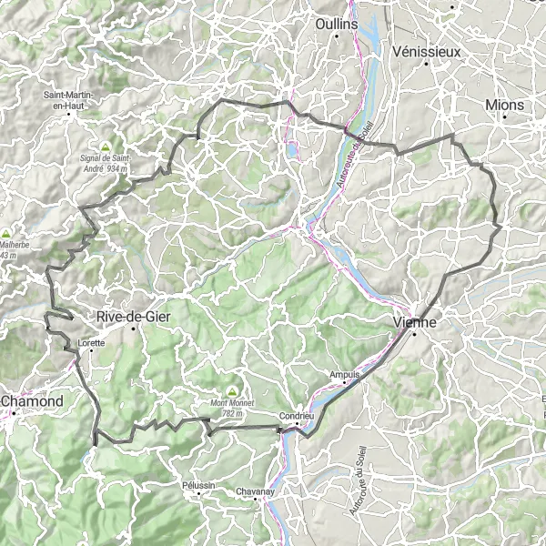
Conquer the tough climbs and enjoy the scenic roads.
This road cycling route in Rhône-Alpes offers a challenging experience for cyclists. With a total ascent of 1847 meters and a distance of 121 kilometers, it is suitable for well-trained amateurs looking for a tough ride. The route features highlights such as Chagnon, Grand Châtelard, Brignais, Chaponnay, Serpaize, Belvédère de Pipet, Les Roches-de-Condrieu, Col de Pavezin, and La Grand-Croix. These highlights offer breathtaking views, historic landmarks, and interesting stops along the way. The route is rated as a difficulty level 4, making it a moderately tough ride. It has an epicness rating of 4, which means it provides an unforgettable cycling experience. It is an exceptional route for those seeking a challenge and a chance to explore the beautiful region of Rhône-Alpes.
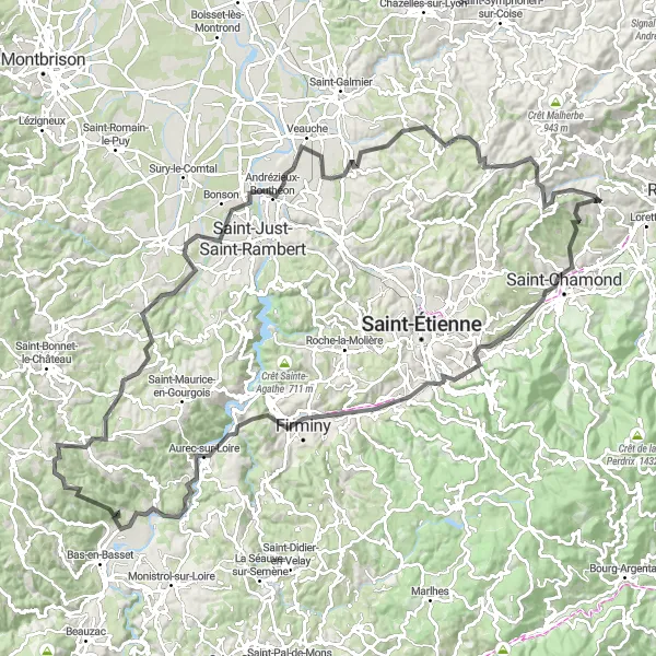
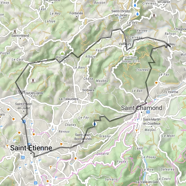
Conquer the challenging ascent and enjoy breathtaking views of Crêt Saint-Georges
Embark on this road cycling route starting near Cellieu and challenge yourself with a steep ascent and thrilling descents. Along the way, you will pass through several towns and villages, each offering a unique charm. One of the highlights of the route is the climb to Crêt Saint-Georges, where you will be rewarded with breathtaking panoramic views. This route is recommended for experienced cyclists who are looking for a thrilling adventure and enjoy tackling difficult climbs.
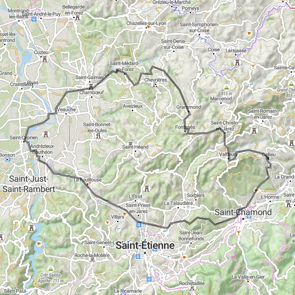
Experience the beauty of Saint-Étienne and Mont Morin in this picturesque road loop
Embark on a scenic road loop starting near Cellieu that will take you through the charming towns of Saint-Étienne and Saint-Chamond. This route covers a distance of 51 km with a total ascent of 991 meters. Marvel at the observatory tower at Tour-observatoire and soak in the stunning views from Mont Morin. Take a break at the idyllic village of Saint-Christo-en-Jarez along the way.
Discover the city of Saint-Étienne on this gravel route
This gravel route takes you through the countryside and brings you to the city of Saint-Étienne. Along the way, you'll pass through picturesque villages and enjoy scenic views. The highlight of the route is Saint-Étienne, a vibrant city known for its cultural attractions and industrial heritage. The route includes challenging climbs and descents, providing a true cycling adventure for experienced riders. Overall, this route offers a mix of natural beauty and urban exploration.
Around the Hills
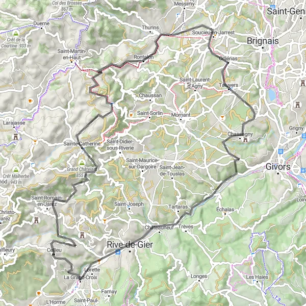
Conquer the challenging terrain and enjoy stunning views in Soucieu-en-Jarrest and Rive-de-Gier
Embark on a road cycling adventure starting near Cellieu that will take you through the scenic landscapes of Soucieu-en-Jarrest and Rive-de-Gier. This route covers a distance of 79 km with a total ascent of 1332 meters. Challenge yourself with the climb to Signal de Saint-André and soak in the panoramic vistas at Chassagny. Don't forget to explore the vibrant city center of Saint-Étienne along the way.
Ride through picturesque countryside to the village of Saint-Christo-en-Jarez
This road route takes you through beautiful countryside and brings you to the picturesque village of Saint-Christo-en-Jarez. Along the way, you'll pass through charming villages and admire scenic views. The highlight of the route is Saint-Christo-en-Jarez, a traditional village with narrow streets and stone houses. The route includes moderate climbs and descents, making it suitable for cyclists of various skill levels. Overall, this route offers a scenic and enjoyable cycling experience.
Conquer the challenging climb to Crêt Saint-Georges on this road route
This road route takes you through diverse landscapes and brings you to the iconic summit of Crêt Saint-Georges. Along the way, you'll pass through charming villages and enjoy scenic views. The highlight of the route is Crêt Saint-Georges, a legendary climb that offers panoramic views of the surrounding area. The route includes challenging ascents and descents, providing a true test of endurance for experienced riders. Overall, this route offers a mix of natural beauty and cycling challenge.
A thrilling route for experienced road cyclists seeking an adventure in the Rhône-Alpes region.
This round-trip cycling route near Cellieu offers a challenging and memorable experience for experienced road cyclists. Spanning a distance of 161 kilometers and with an ascent of 3,077 meters, this route takes riders through stunning sceneries and showcases some of the best natural landscapes in the region. The difficulty level is rated as 4 out of 5, making it suitable for well-trained amateurs seeking a demanding ride. The epicness factor is also high, with several legendary climbs and famous spots along the way.
Cycling routes nearby:
Nearby regions: