Picturesque cycling in the Rhône-Alpes region of France.
Cycling routes from Montagnat
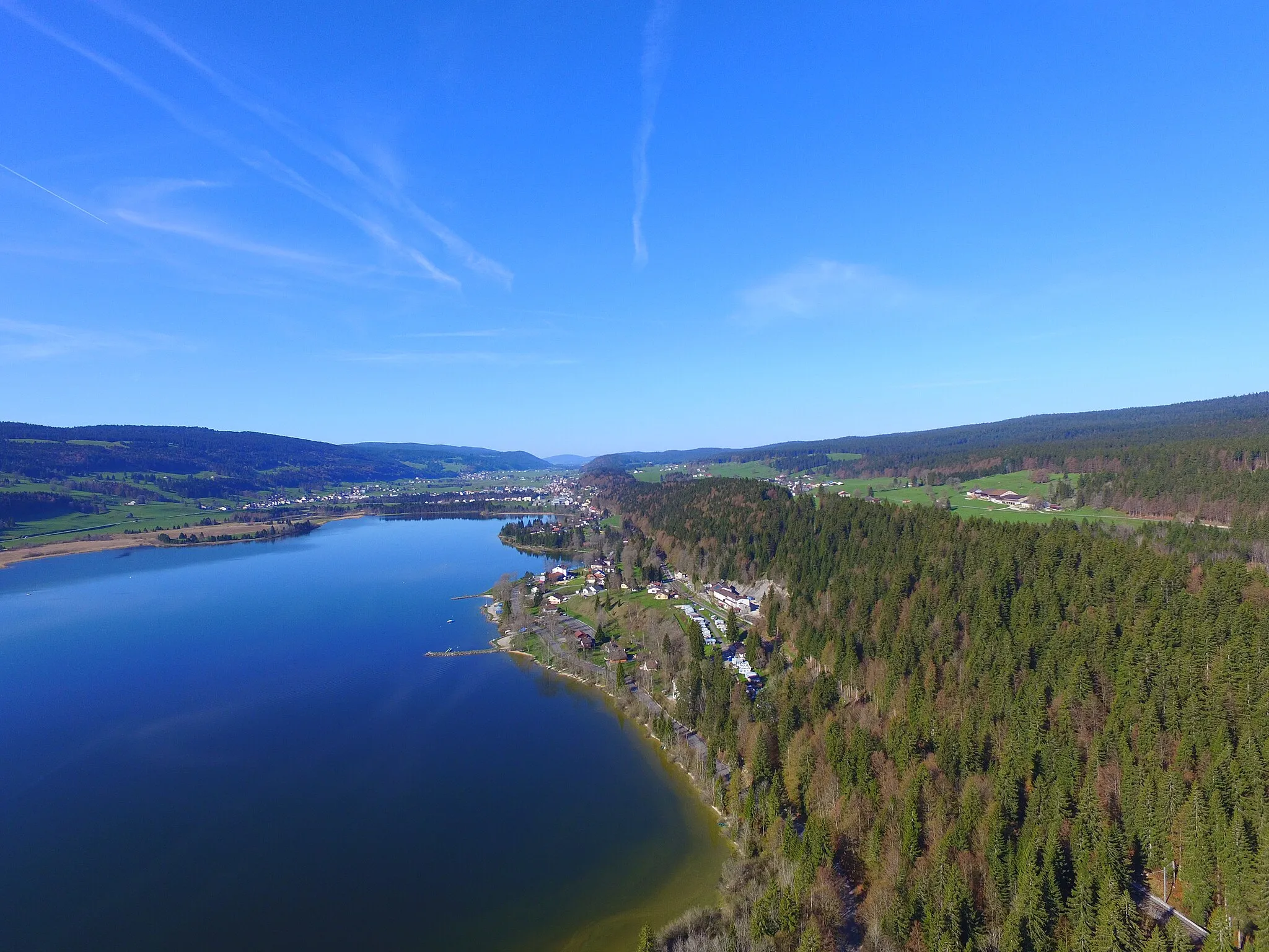
Montagnat is a lovely locality situated in the Rhône-Alpes region of France. From a cyclist's perspective, it offers a mix of flat roads and rolling hills, providing a variety of cycling terrain. The picturesque surroundings and quiet country roads create an enjoyable cycling experience. Although Montagnat itself does not have any well-known cycling spots, it is conveniently located near popular cycling destinations such as Bourg-en-Bresse. Cyclists can explore the beautiful landscapes of the Jura mountains and tackle challenging climbs like Col de la Biche. Montagnat serves as a great base for cycling adventures in the region.
Gravel and Hill Challenge
Embark on a thrilling gravel cycling adventure with challenging hills along the way.
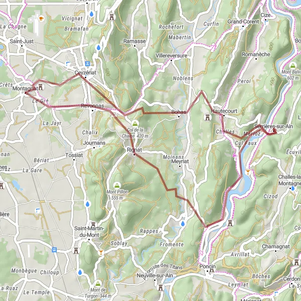
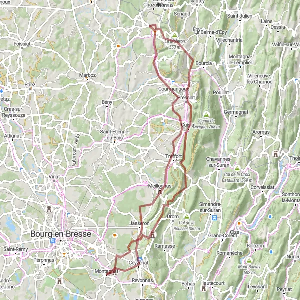
This round-trip cycling route starting from Montagnat offers a thrilling gravel adventure with challenging hills to test your skills. With a total ascent of 853 meters and a distance of 42 kilometers, this route is suitable for experienced gravel riders. The difficulty rating for this route is 4 out of 5, making it a challenging and rewarding experience. The epicness rating for this route is 3 out of 5, thanks to the scenic landscapes and famous climbs you'll encounter along the way.
Gravel and Hills
Rocky gravel roads await you on this route full of challenging hills.
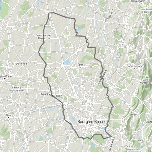
This round-trip cycling route near Montagnat is perfect for those looking for a mix of difficulty and adventure. The route takes you through a series of rocky gravel roads and offers stunning views of the surrounding countryside. With a total ascent of 519 meters and a distance of 92 kilometers, this route is suitable for experienced cyclists. The epicness rating for this route is 4 out of 5, making it a memorable and exciting ride.
Get ready for an unforgettable journey through challenging hills and breathtaking scenery.
This round-trip cycling route starting from Montagnat offers a challenging adventure for experienced cyclists. With a total ascent of 1114 meters and a distance of 98 kilometers, this route will test your endurance and climbing skills. The epicness rating for this route is 5 out of 5, thanks to the legendary climbs and famous spots along the way. Tourists will be thrilled with the stunning views and picturesque landscapes that make this route truly special.
Embark on an exciting gravel adventure in the scenic Boucle de l'Ain.
Explore the charming region of Boucle de l'Ain on this gravel route. With a total distance of 70 km and an ascent of 1597 m, this route offers a challenging yet rewarding cycling experience. You'll encounter picturesque landscapes, quaint villages, and beautiful panoramic views along the way.
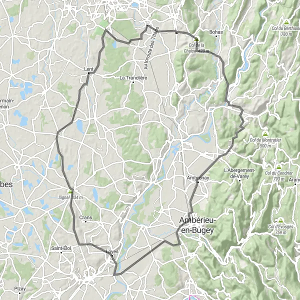
Explore the picturesque landscapes of Montagnat and Revonnas on this scenic cycling route.
This route takes you on a 62-kilometer journey through the beautiful countryside around Montagnat and Revonnas. With a total ascent of 492 meters, it offers a moderate challenge that is suitable for most cyclists. The highlights of the route include Montagnat, Pressiat, Chavannes-sur-Suran, Col de la Chaise, and Revonnas.
Explore the scenic beauty and challenging terrains of Rhône-Alpes
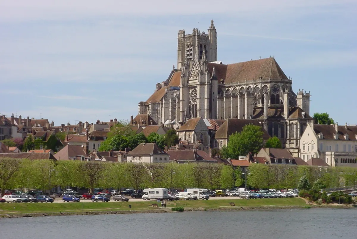
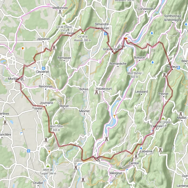
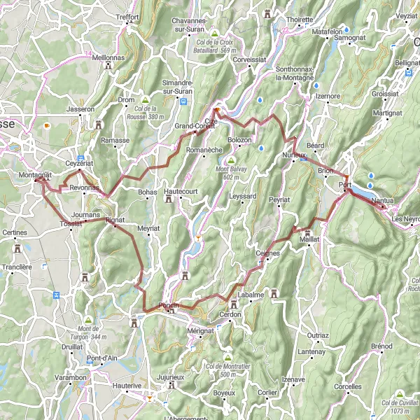
This gravel route takes you through the picturesque countryside of Montagnat in Rhône-Alpes, France. With a total distance of 82 km and an elevation gain of 1621 meters, it offers a challenging ride for experienced riders. The route highlights include Ceyzériat, Col de la Chaise, Grand-Corent, Panorama de la boucle de l'Ain, La source de la Doye, Nantua, Col de Ceignes, Poncin, and Journans. These highlights offer stunning viewpoints, beautiful landscapes, and cultural landmarks along the way.
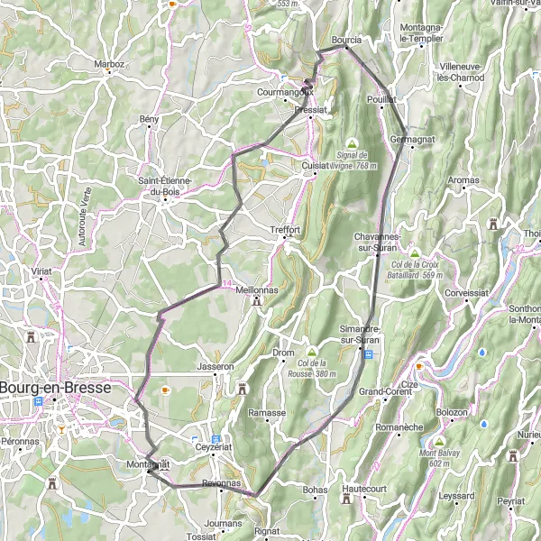
Enjoy a scenic ride through beautiful roads and tackle some challenging hills along the way.
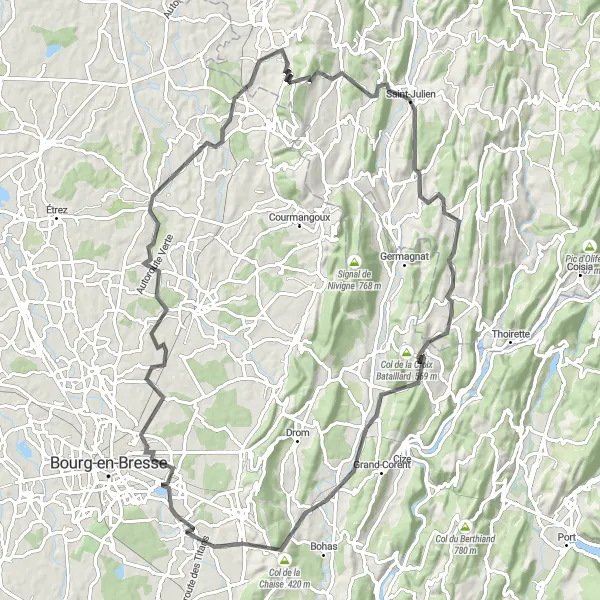
This round-trip cycling route starting from Montagnat offers a scenic journey through picturesque roads and challenging hills. With a total ascent of 735 meters and a distance of 94 kilometers, this route is suitable for intermediate-level cyclists. The difficulty rating for this route is 3 out of 5, making it a good choice for those looking for a mix of challenge and enjoyment. The epicness rating for this route is 4 out of 5, thanks to the stunning natural landscapes and charming villages you'll encounter along the way.
The Jasseron Adventure
Experience the beauty and challenge of the Jasseron route
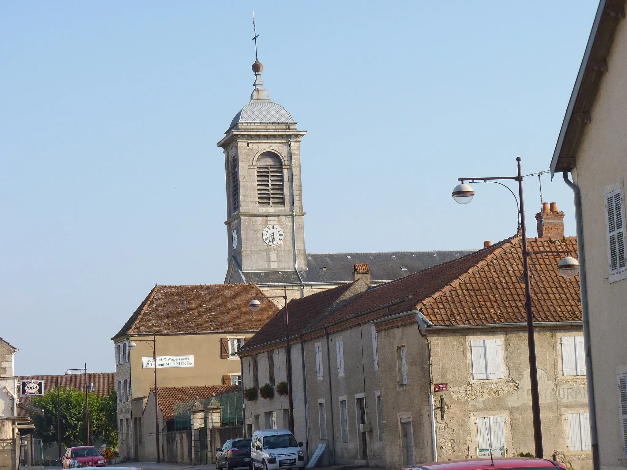
Embark on an exciting cycling journey with the Jasseron Adventure. This distinctive route offers a unique and captivating experience, taking you through charming villages and magnificent landscapes. With a total distance of 91km and an ascent of 1850m, this challenging ride is perfect for well-trained amateurs. As you pedal your way through the route, you'll come across various highlights that add to the epicness of this adventure.
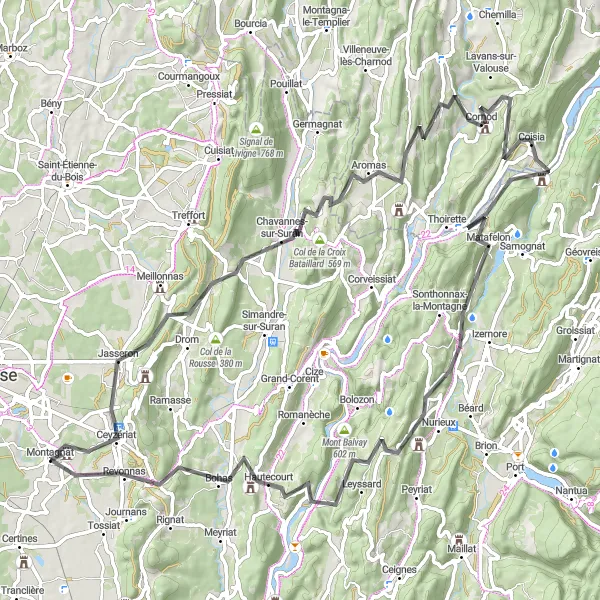
Discover the charm and serenity of rural Rhône-Alpes
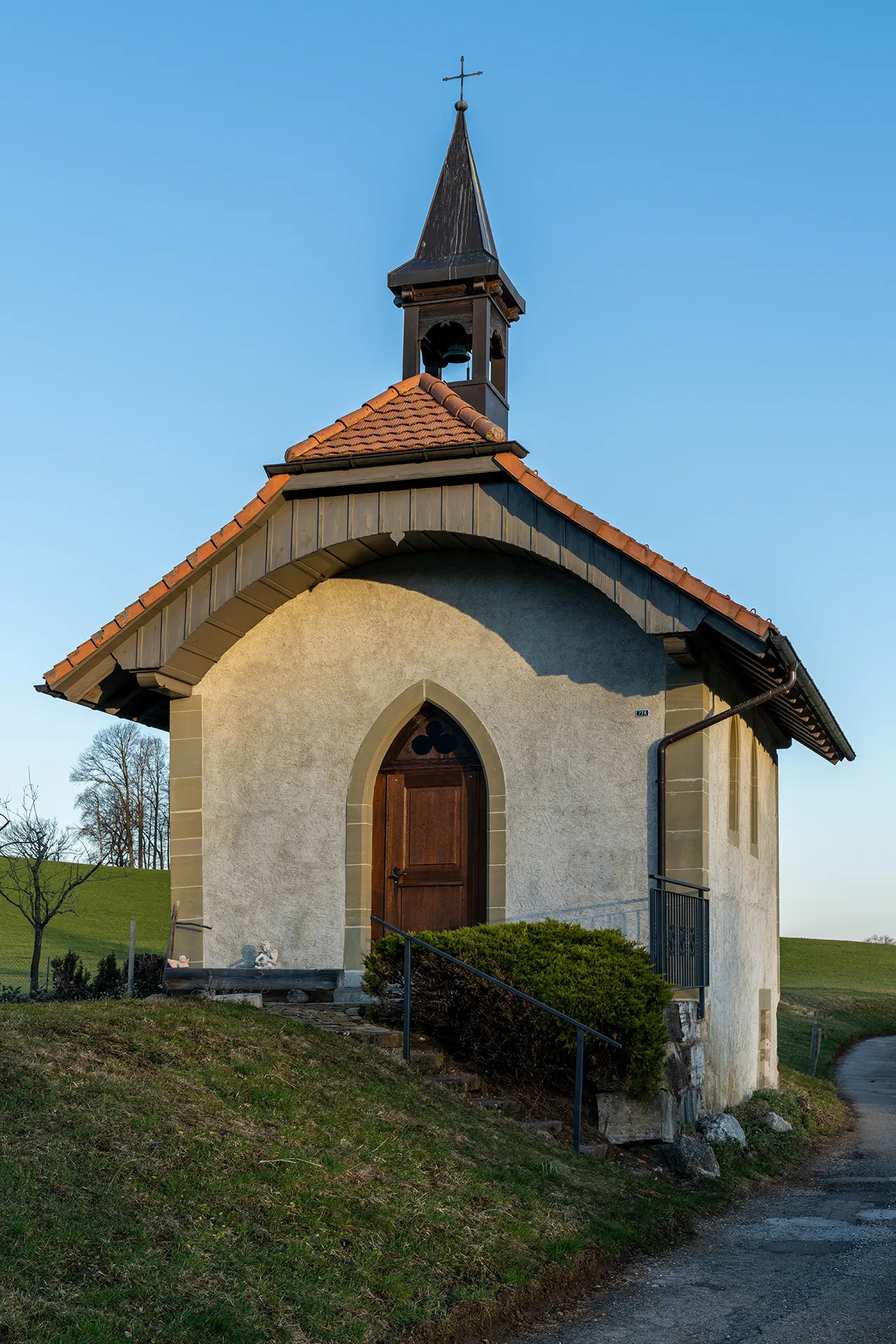
Indulge in the beauty of the Rhône-Alpes countryside with this picturesque gravel loop. The 70-kilometer route boasts an ascent of 1324 meters, providing a moderate level of challenge for riders. Highlights along this route include Montagnat, Col de France, Pressiat, Le Moleron, Courmangoux, Jasseron, and Château de Montplaisant. Each highlight offers unique features, from stunning viewpoints to historical landmarks, that showcase the essence of this region.
Countryside Tours
Enjoy a leisurely ride through scenic countryside roads and discover charming villages along the way.
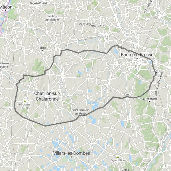
This round-trip cycling route near Montagnat is perfect for leisurely rides and countryside tours. With a total ascent of 567 meters and a distance of 102 kilometers, this route is suitable for all levels of cyclists. The difficulty rating for this route is 2 out of 5, making it an easy and enjoyable ride. The epicness rating for this route is 3 out of 5, thanks to the peaceful countryside landscapes and charming villages you'll come across along the way.
Cycling routes nearby:

Nearby regions: