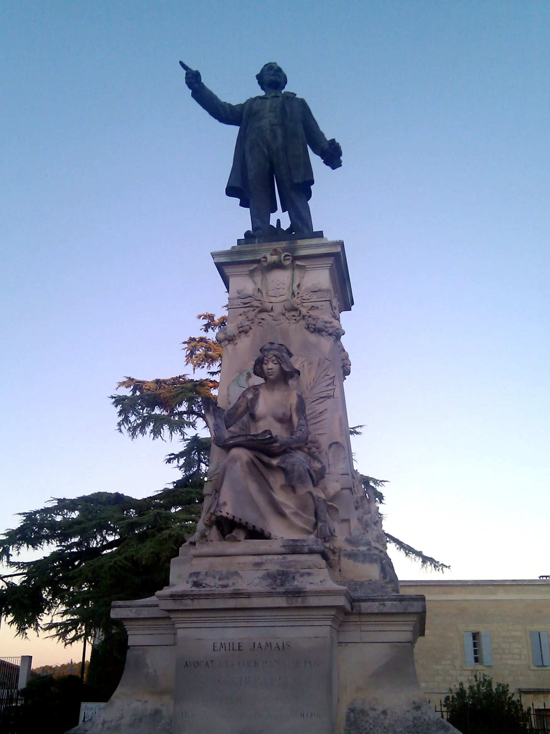
A town with scenic routes and the challenging Col de la Loge nearby.
Cycling routes from Saint-Romain-le-Puy
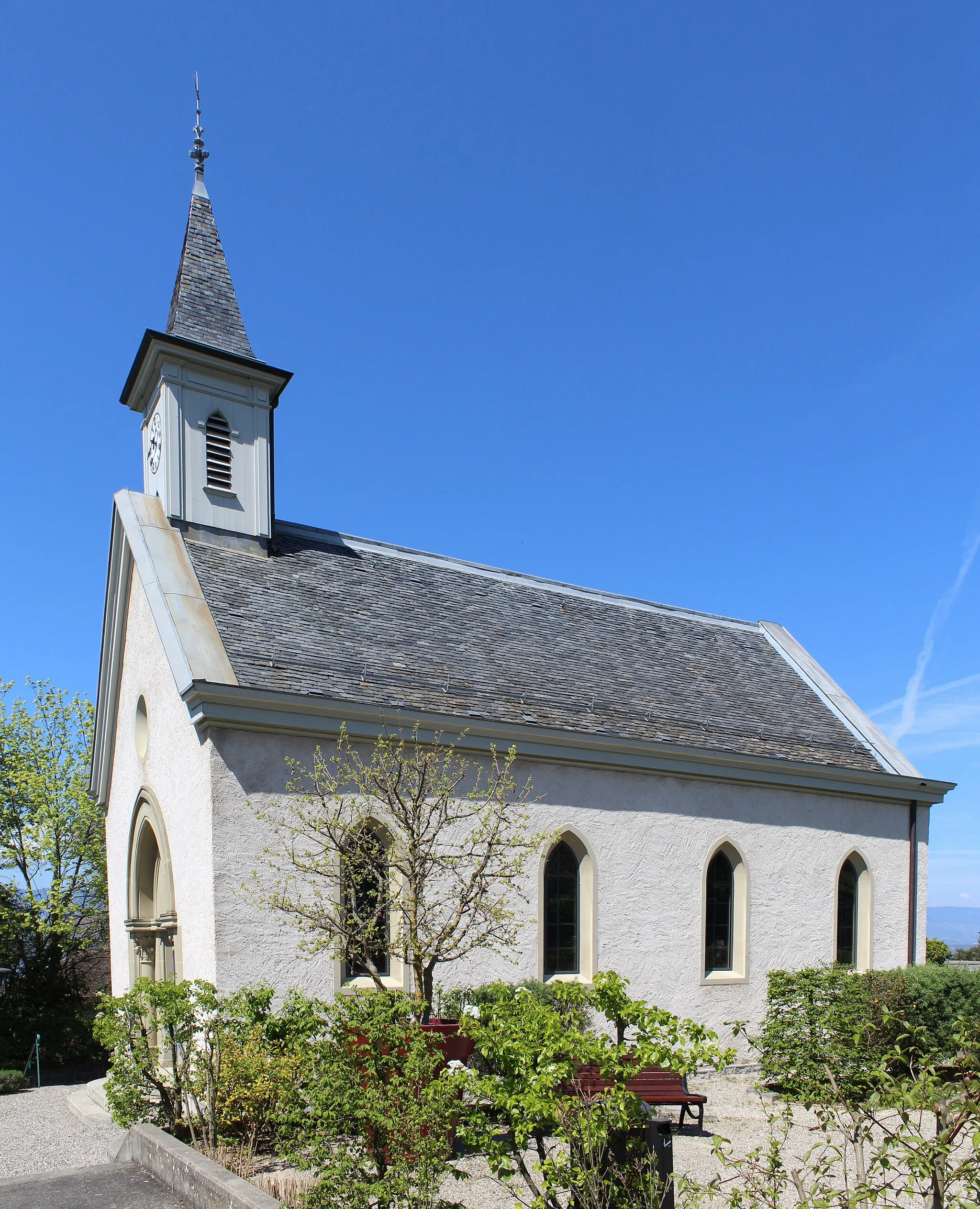
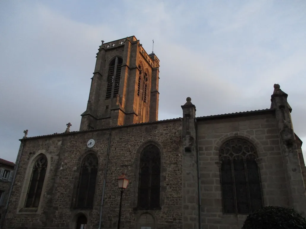
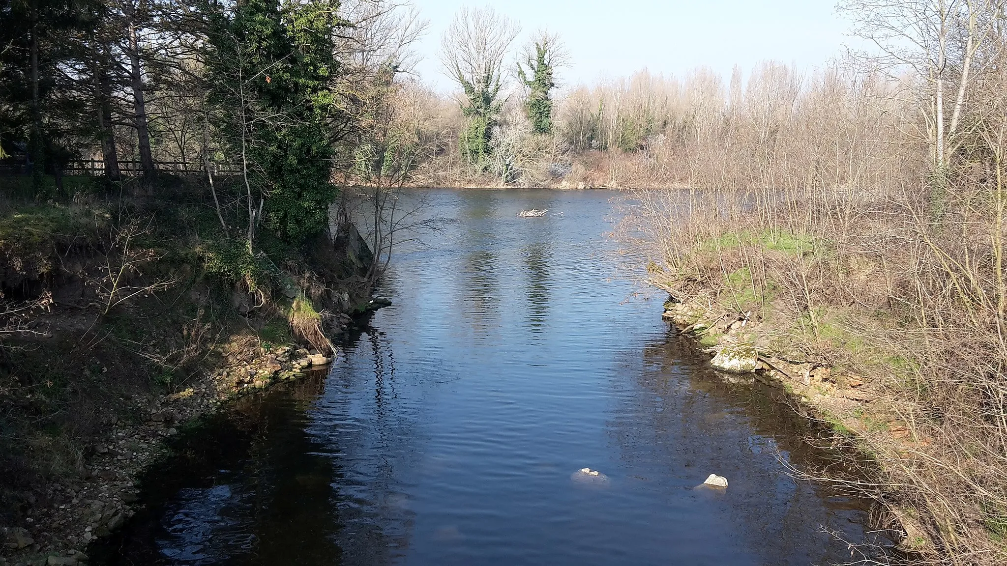
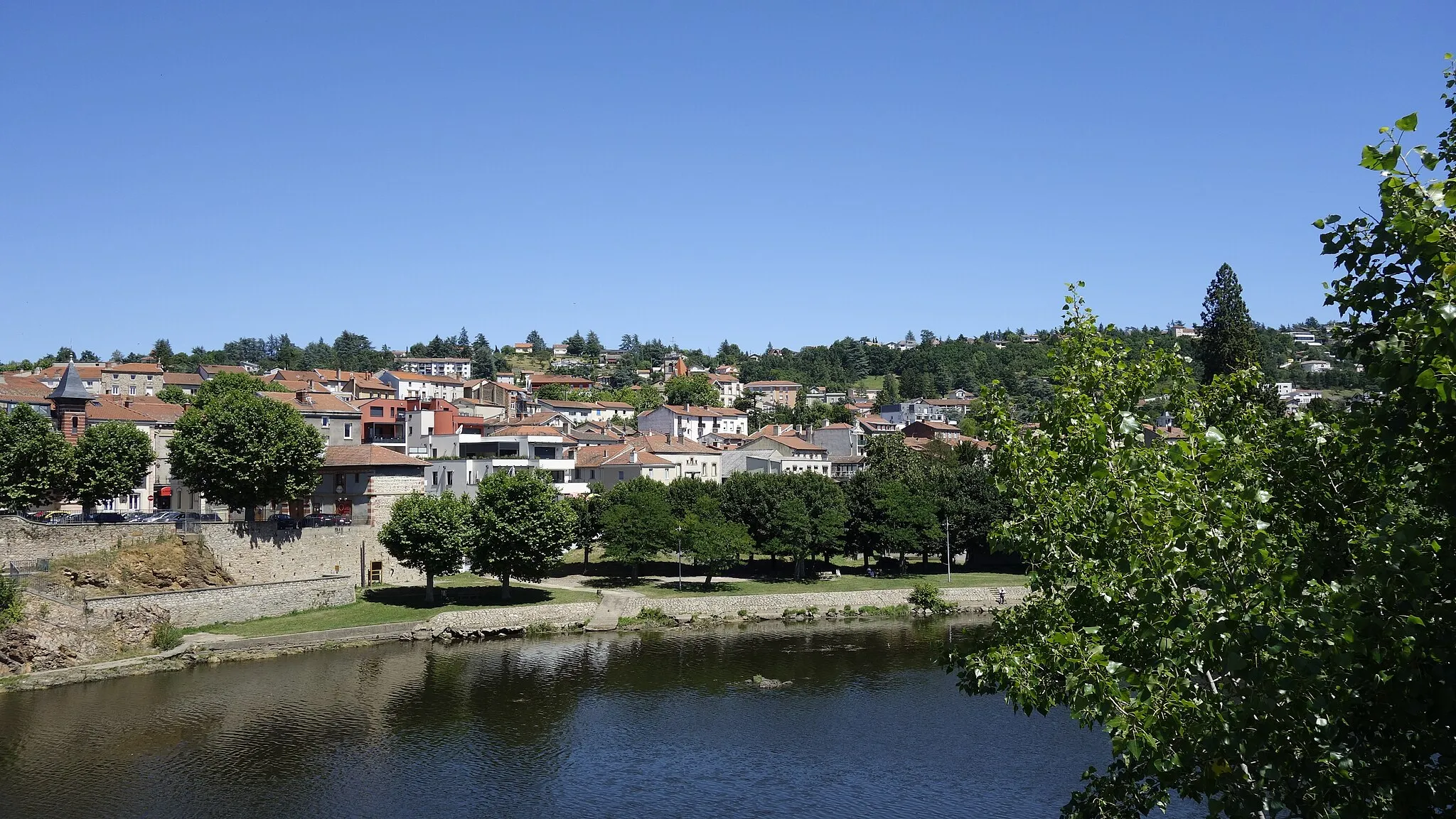
Saint-Romain-le-Puy is a town situated in the Rhône-Alpes region of France. From a cyclist's perspective, the locality provides a mix of scenic routes and some challenging climbs in the surrounding area. Cyclists can enjoy riding through picturesque countryside and exploring nearby hills. One notable climb that can be found close to Saint-Romain-le-Puy is the Col de la Loge, offering a good challenge for those seeking an uphill ride. Overall, Saint-Romain-le-Puy provides a pleasant and diverse cycling experience, suitable for riders of various abilities.
Explore the stunning Forez region on this challenging gravel adventure
Embark on a thrilling gravel adventure through the scenic Forez Mountains. This 54 km route starts near Saint-Romain-le-Puy and takes you through picturesque towns and villages, with a total ascent of 915 meters. Get ready to conquer gravel trails and immerse yourself in the natural beauty of the Rhône-Alpes region.
Experience the breathtaking beauty of the Hautes-Chaumes on this challenging road cycling route
Embark on a scenic road cycling adventure through the picturesque Hautes-Chaumes region. This 67 km route, starting near Saint-Romain-le-Puy, boasts a total ascent of 1363 meters. Pedal through winding roads surrounded by breathtaking landscapes and be prepared for some challenging climbs along the way.
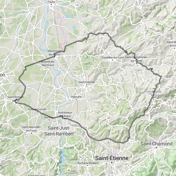
Discover charming villages and picturesque landscapes in the Loire Valley
Immerse yourself in the beauty of the Loire Valley with this 100-kilometer road cycling route. With a total ascent of 1,171 meters, the route offers a moderate challenge for intermediate cyclists. Explore highlights such as Précieux, Montrond-les-Bains, Saint-Cyr-les-Vignes, Saint-Symphorien-sur-Coise, Crêt Malherbe, Saint-Christo-en-Jarez, L'Étrat, Andrézieux-Bouthéon, and Saint-Romain-le-Puy. This route is suitable for cyclists looking to discover the charm of the Loire Valley villages.
Take on the ultimate road cycling challenge in the stunning Forez Mountains
Prepare yourself for the ultimate road cycling challenge in the Forez Mountains. This 105 km route, starting near Saint-Romain-le-Puy, features a grueling ascent of 2337 meters. Push your limits as you conquer iconic climbs and enjoy the breathtaking beauty of the Rhône-Alpes region.
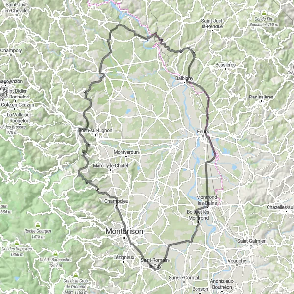
Embark on a challenging route through the scenic hills of Rhône-Alpes
Get ready to tackle the landscapes of Rhône-Alpes with this 121-kilometer road cycling route. With a total ascent of 1,350 meters, this ride is recommended for experienced cyclists seeking a challenging adventure. Highlights along the way include Montbrison, Pralong, Pic de Purambard, Sail-sous-Couzan, Saint-Germain-Laval, Saint-Jodard, Balbigny, Feurs, Montrond-les-Bains, and Précieux. Expect stunning views, challenging climbs, and unforgettable cycling moments throughout.
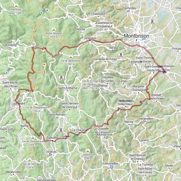
Uncover the hidden gems of the Forez region on this scenic gravel route
Embark on a captivating gravel adventure through the lesser-known gems of the Forez region. This 56 km route, starting near Saint-Romain-le-Puy, offers a pleasant ascent of 782 meters. Immerse yourself in the rustic beauty of the Rhône-Alpes countryside and discover hidden villages along your way.
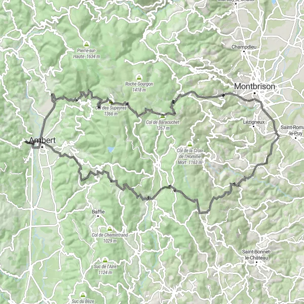
Embark on an epic mountainous journey in Rhône-Alpes
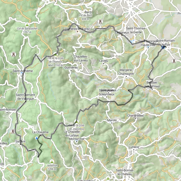
Experience the thrill of a challenging 87-kilometer gravel ride through the breathtaking Rhône-Alpes region. With a total ascent of 2,210 meters, this route is not for the faint-hearted. Highlights along the way include Saint-Jean-Soleymieux, Puy du Mont, Baffie, Les Pradeaux, Col des Supeyres, Pic de Bard, and Écotay-l'Olme. This route is perfect for experienced gravel cyclists seeking an epic adventure.
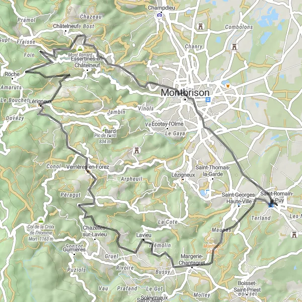
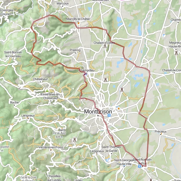
Discover the scenic beauty of Montbrison and its surroundings on this road cycling route
Venture into the heart of the Montbrison region with this 53-kilometer road cycling route. With a total ascent of 937 meters, the ride provides a moderate challenge for intermediate cyclists. Highlights along the way include Saint-Georges-Haute-Ville, Chazelles-sur-Lavieu, Pic de Chaudabry, Roche, Châtelneuf, Mont Renard, and Montbrison. Fall in love with the picturesque landscapes and charming villages as you pedal your way through this unforgettable cycling journey.
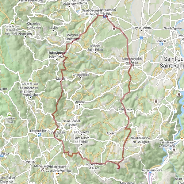
Experience the beautiful gravels of Saint-Romain-le-Puy region.
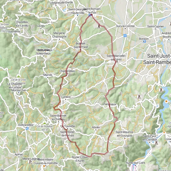
This challenging gravel route takes you from Saint-Romain-le-Puy to Saint-Georges-Haute-Ville, covering a distance of 62 km and ascent of 1120 m. You'll ride through picturesque villages and enjoy stunning views of the countryside. The route is suitable for well-trained amateur cyclists and offers a thrilling riding experience. It is an epic route with a score of 4 in terms of difficulty and 3 in terms of epicness. There are several highlights along the way, including the charming town of Saint-Marcellin-en-Forez, the historic village of Marols, and the beautiful Col de Pichillon. These highlights are worth exploring and add to the overall appeal of the route.
Exploring the Forez Mountains
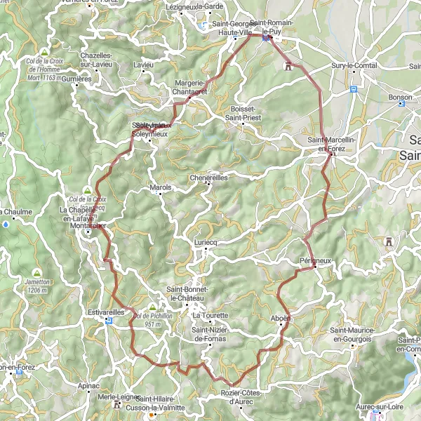
Discover the rugged beauty of the Forez Mountains in this gravel cycling route
This 61-kilometer gravel route takes you through the stunning landscapes of the Forez Mountains. With a challenging ascent of 1,192 meters, the ride offers a thrilling experience for adventurous cyclists. Explore highlights such as Saint-Marcellin-en-Forez, Aboën, Château de Marandière, Col de la Croix de Joanziecq, Saint-Jean-Soleymieux, and Saint-Georges-Haute-Ville along the way. The route is suitable for experienced cyclists looking for an off-road adventure.
Cycling routes nearby:


Nearby regions: