Scenic cycling routes and historic medieval town.
Cycling routes from Bad Muenstereifel
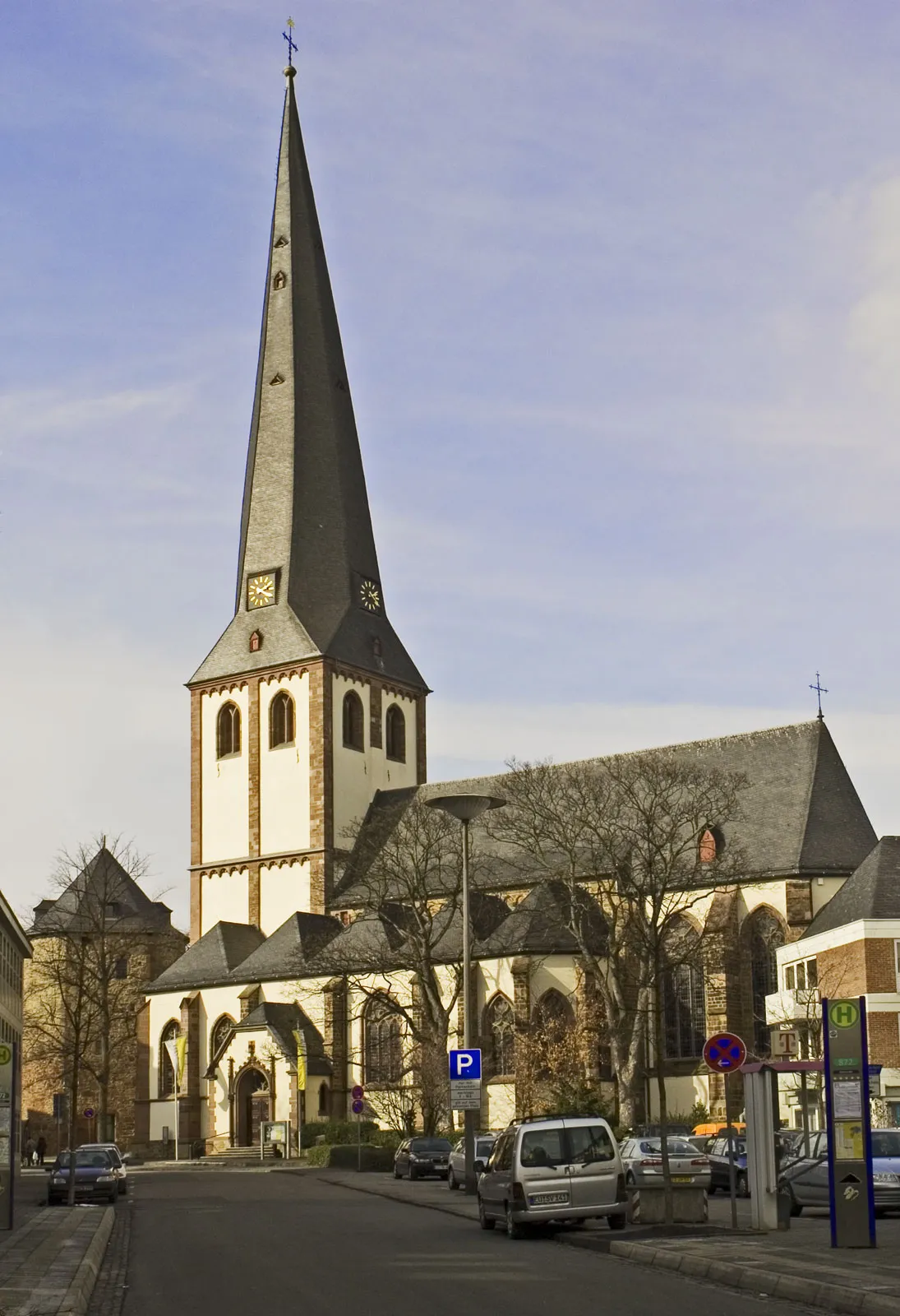
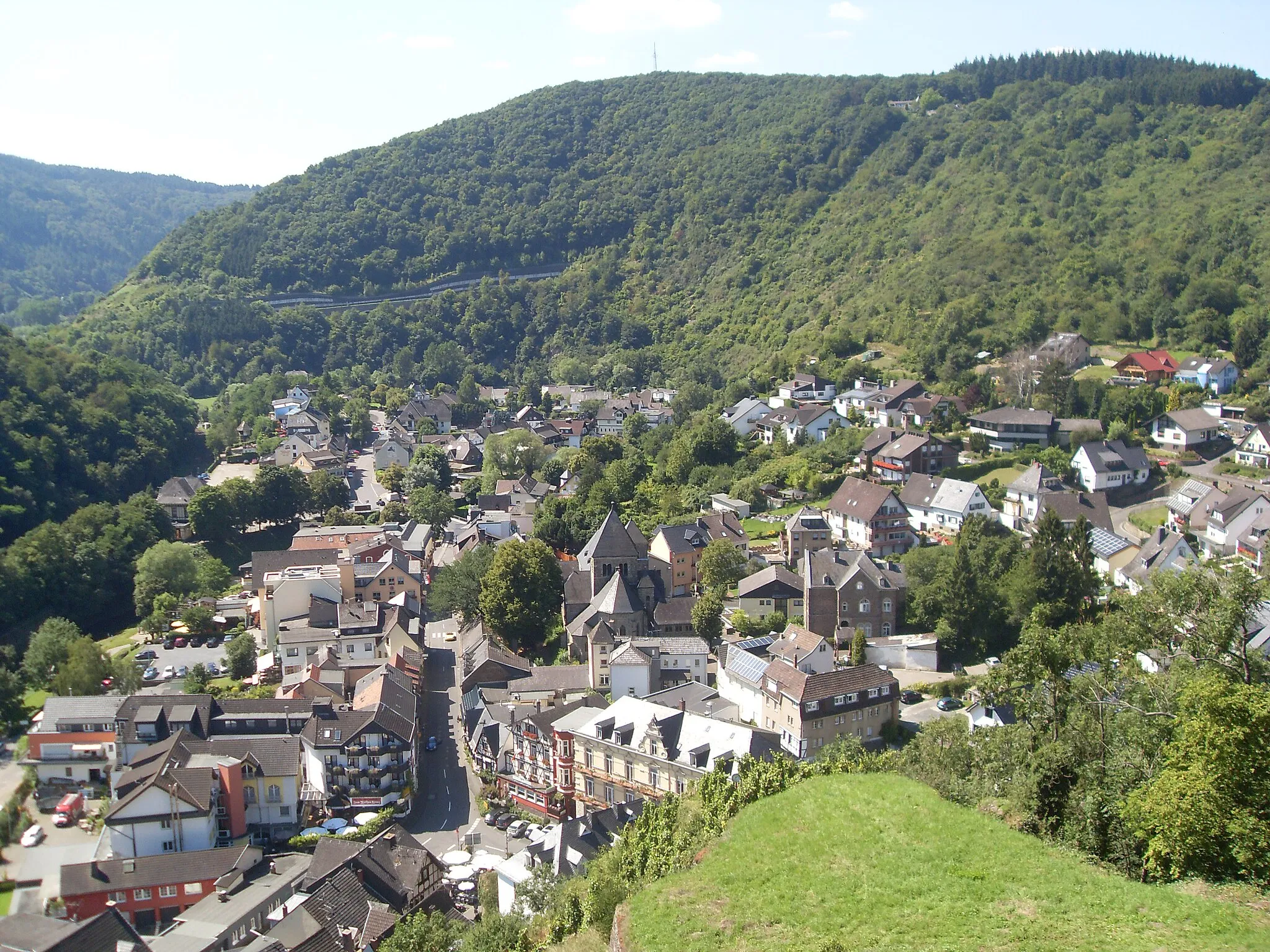
Bad Münstereifel is a small town located in Köln, Germany. From a cyclist's perspective, Bad Münstereifel offers a mix of scenic routes, historic charm, and vibrant atmosphere. In this area, cyclists can explore the surrounding nature parks, enchanting forests, and picturesque villages. The town itself has a medieval feel with its well-preserved buildings and cobblestone streets, adding an extra layer of charm to cycling adventures. Well-known cycling spots nearby include the Nürburgring, famous for its challenging race track surrounded by beautiful landscapes. With its variety of cycling options and historic appeal, Bad Münstereifel is a captivating destination for cyclists.
Bad Münstereifel Gravel Route
An adventurous gravel ride near Bad Münstereifel
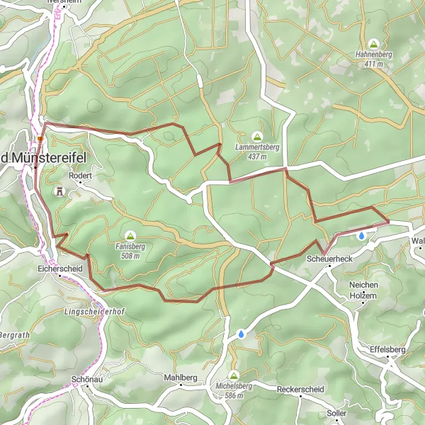
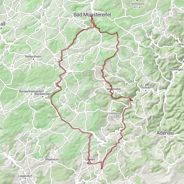
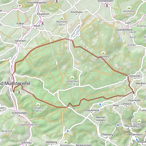
This gravel route near Bad Münstereifel offers a thrilling adventure for gravel riders. With a distance of 22km and an ascent of 439m, it includes highlights such as the historic Burg Münstereifel and the picturesque town of Eierberg.
Road Tour of Bad Münstereifel
Explore the scenic roads around Bad Münstereifel
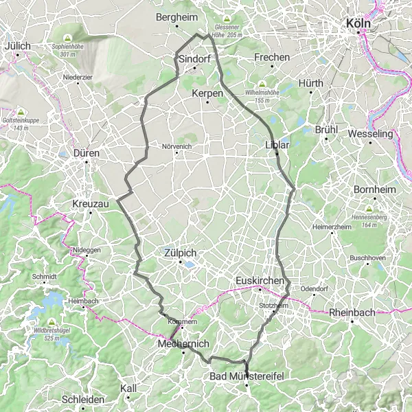
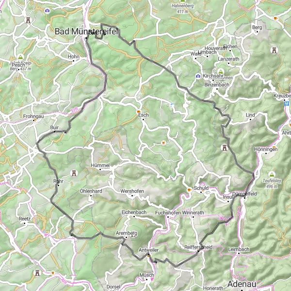
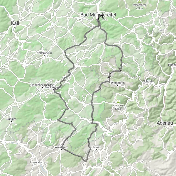
Experience the beauty of the countryside around Bad Münstereifel on this road tour. With a challenging distance of 117km and an ascent of 579m, this tour takes you through picturesque villages and offers remarkable highlights along the way.
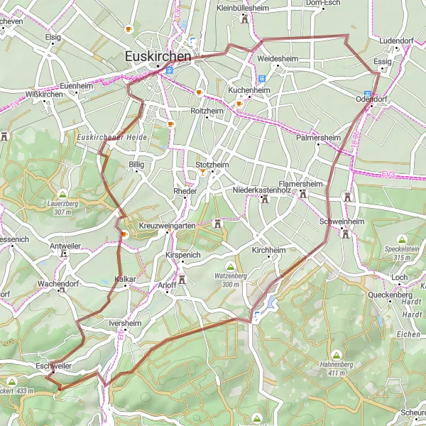
Immerse yourself in nature on this thrilling gravel tour around Eschweiler.
With a distance of 40 km and an ascent of 420 meters, this gravel route takes you through the beautiful landscapes surrounding Eschweiler. Explore the scenic trails of Rothenberg, discover the Stele Foto-Beobachtungsstation/Forscherstation, and enjoy the tranquility of Schweinheim. The Uhlenberg provides a rewarding challenge and panoramic views. Overall, this gravel tour combines natural beauty, cultural highlights, and adventurous riding.
Experience the charm of Bad Münstereifel on this gravel tour
This scenic gravel tour near Bad Münstereifel takes you through picturesque villages and diverse landscapes. With a distance of 83km and an ascent of 1408m, this tour offers a mix of challenging gravel sections and beautiful scenery, allowing you to truly immerse yourself in the charm of the Eifel region.
A challenging road tour with epic climbs near Bad Münstereifel
This epic road tour near Bad Münstereifel offers a thrilling challenge for experienced cyclists. With a distance of 69km and an ascent of 1303m, this tour includes several demanding climbs and stunning highlights that will leave you breathless with their beauty.
Embark on a thrilling road adventure through the beautiful Eifel region, tackling challenging climbs and enjoying scenic views.
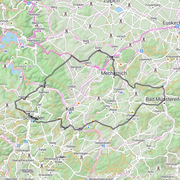
Covering a distance of 70 km with 1259 meters of ascent, this road route promises an adventurous journey through the Eifel region. Starting in Bad Münstereifel, you'll ride through Bosset and Pesch, tackle the tough climb up Pferdekopf, and enjoy the stunning vistas at Gemünd and Eifelblick Kreuzberg. With multiple highlights along the way, this route offers a mix of challenging climbs, scenic landscapes, and historical landmarks.
Embark on an exciting gravel adventure through the scenic Engelgau region near Bad Münstereifel.
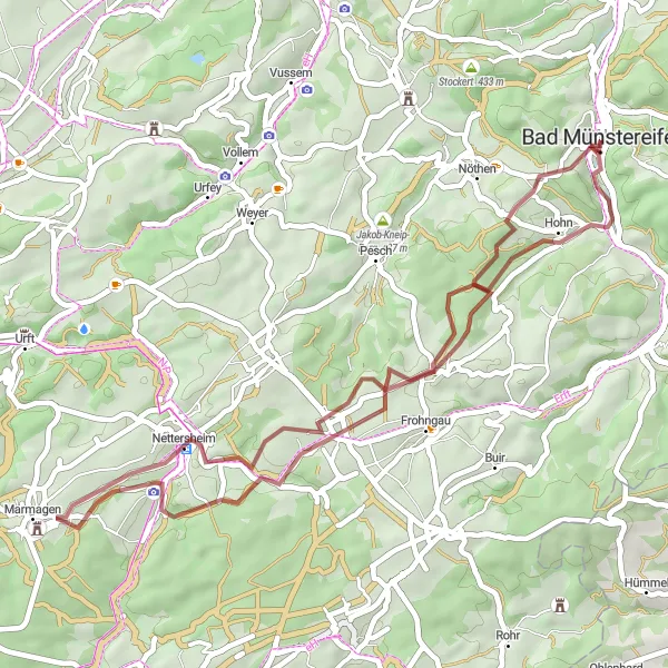
With a distance of 41 km and an ascent of 572 meters, this gravel route explores the natural beauty of Engelgau. Pedal through lush landscapes, pass ancient Roman ruins on Via Agrippa, and enjoy the serenity of Nettersheim. The highlight of this route is the Windeckhaus, offering beautiful views and a challenging climb. Overall, this loop provides a thrilling gravel adventure in an area blessed with natural wonders and rich history.
Explore the charming town of Bad Münstereifel and its surrounding countryside on this enjoyable gravel loop.
This 28 km gravel route takes you through picturesque landscapes near Bad Münstereifel. Ride past the historic Burg Münstereifel and enjoy the scenic views from Silberberg and Langer Kopf. Although the ascent is moderate, the off-road terrain adds an extra challenge for gravel enthusiasts. Overall, this route offers a mix of history, nature, and gravel riding.
A challenging road tour with stunning viewpoints
This challenging road tour from Bad Münstereifel takes you through some of the most beautiful landscapes in the region. With a distance of 86km and a significant ascent of 1400m, this tour offers breathtaking viewpoints and a chance to immerse yourself in the natural beauty of the Eifel.
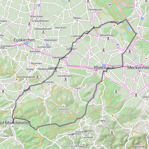
Discover the scenic beauty of the surrounding landscapes on this picturesque road loop near Bad Münstereifel.
Covering a distance of 57 km with 482 meters of ascent, this road route takes you through beautiful rural areas near Bad Münstereifel. Enjoy peaceful cycling through picturesque towns like Palmersheim and Buschhoven, take in the panoramic views from Römerblick, and experience the tranquility of Merzbach. The highlight of this route is the Martinstuhl, offering stunning vistas and a rewarding climb. Overall, this road loop showcases the scenic beauty and charm of the Eifel region.
Cycling routes nearby:


Nearby regions: