Road Cycling through Teublitz's Hilltop Towns
A road cycling route starting from Teublitz
Ride through picturesque hilltop towns and enjoy scenic countryside views.
Map
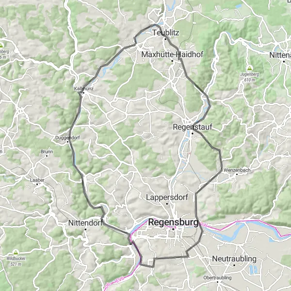
This road cycling route takes you through the charming hilltop towns near Teublitz in Oberpfalz, Germany. With a total distance of 81 kilometers and an altitude gain of 698 meters, this route is of moderate difficulty. The highlights along the route include the Muenchshofener Berg, known for its panoramic views, the historic Schlossbergturm (Castle Hill Tower), and the beautiful Schloss Pürkelgut. With an overall difficulty level of 3 and epicness rating of 4, this route offers a great combination of natural beauty and cultural heritage.
road
81 km
698 m
Tough
Route profile
Highlights on the route
0 km
0 km
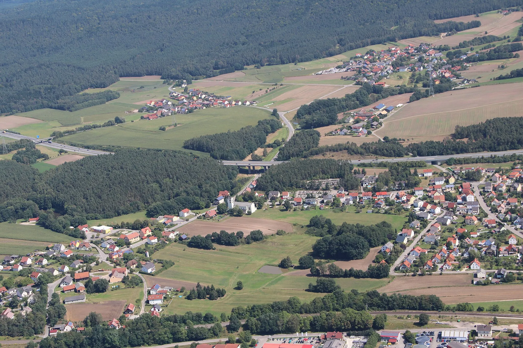
Start: Premberg Village centerTeublitz: Cycling through the scenic Oberpfalz region in Germany
Teublitz is a small town located in the Oberpfalz region of Germany. From a cyclist's perspective, Teublitz offers a mix of rural roads and charming landscapes to explore. The area is fairly flat, making it suitable for all levels of cyclists. One of the highlights is the nearby Naab cycle path, which follows the course of the river Naab and provides scenic views along the way. Teublitz also serves as a gateway to the Bavarian Forest, offering more challenging routes for experienced cyclists. Overall, Teublitz is a pleasant destination for road and gravel cyclists looking to enjoy the beauty of the Oberpfalz region.0 km
0 km
Muenchshofener BergViewpointLocated at kilometer distance 0, Muenchshofner Berg offers breathtaking panoramic views of the surrounding countryside. Take a break and soak in the picturesque landscapes.
5 km
5 km
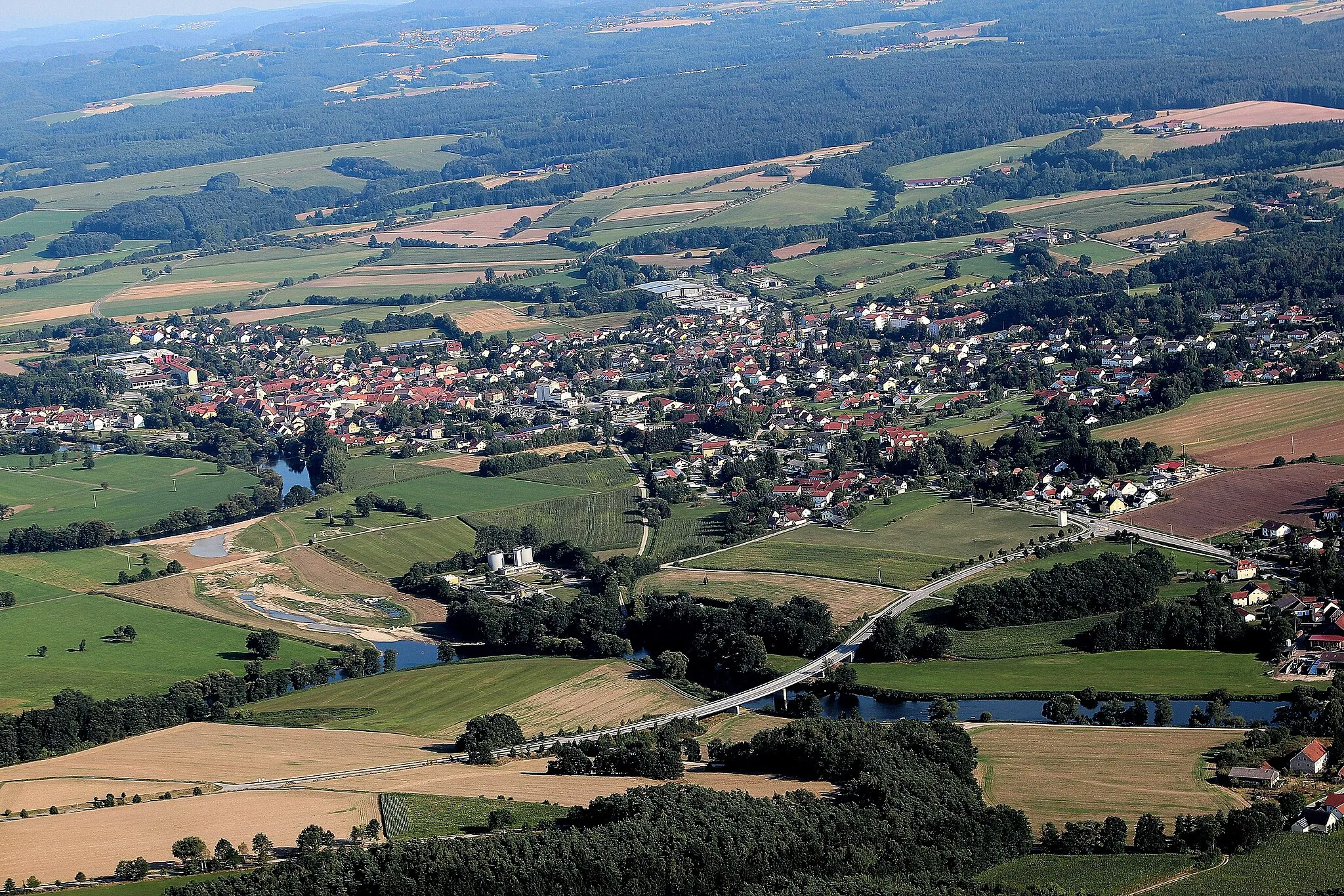
Maxhütte-HaidhofTownAt kilometer 15, Maxhütte-Haidhof is a scenic town with historic charm. Explore its picturesque streets and take in its rich industrial heritage.
15 km
15 km
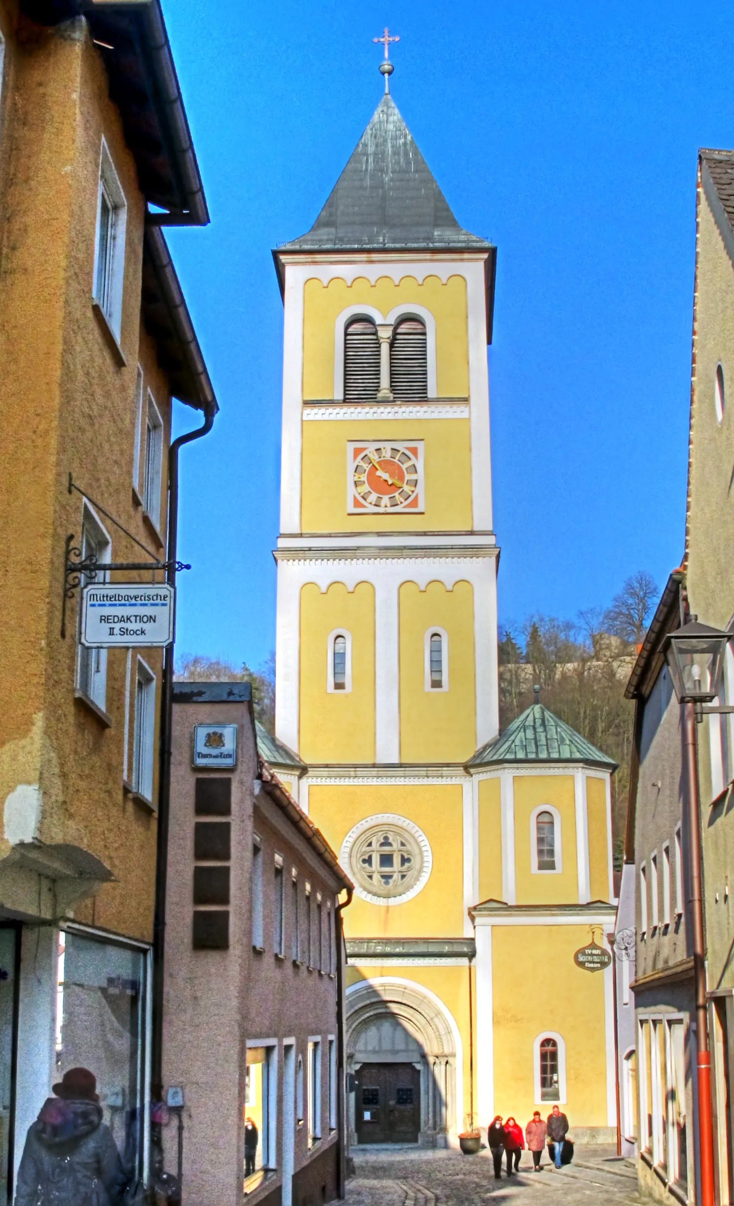
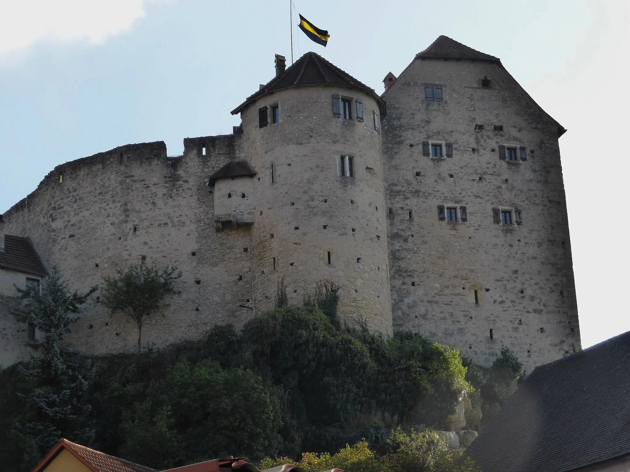
SchlossbergturmViewpointAround kilometer 33, visit the Schlossbergturm (Castle Hill Tower) for a stunning view of the region. Marvel at the tower's architecture and appreciate the beauty of the area.
33 km
33 km
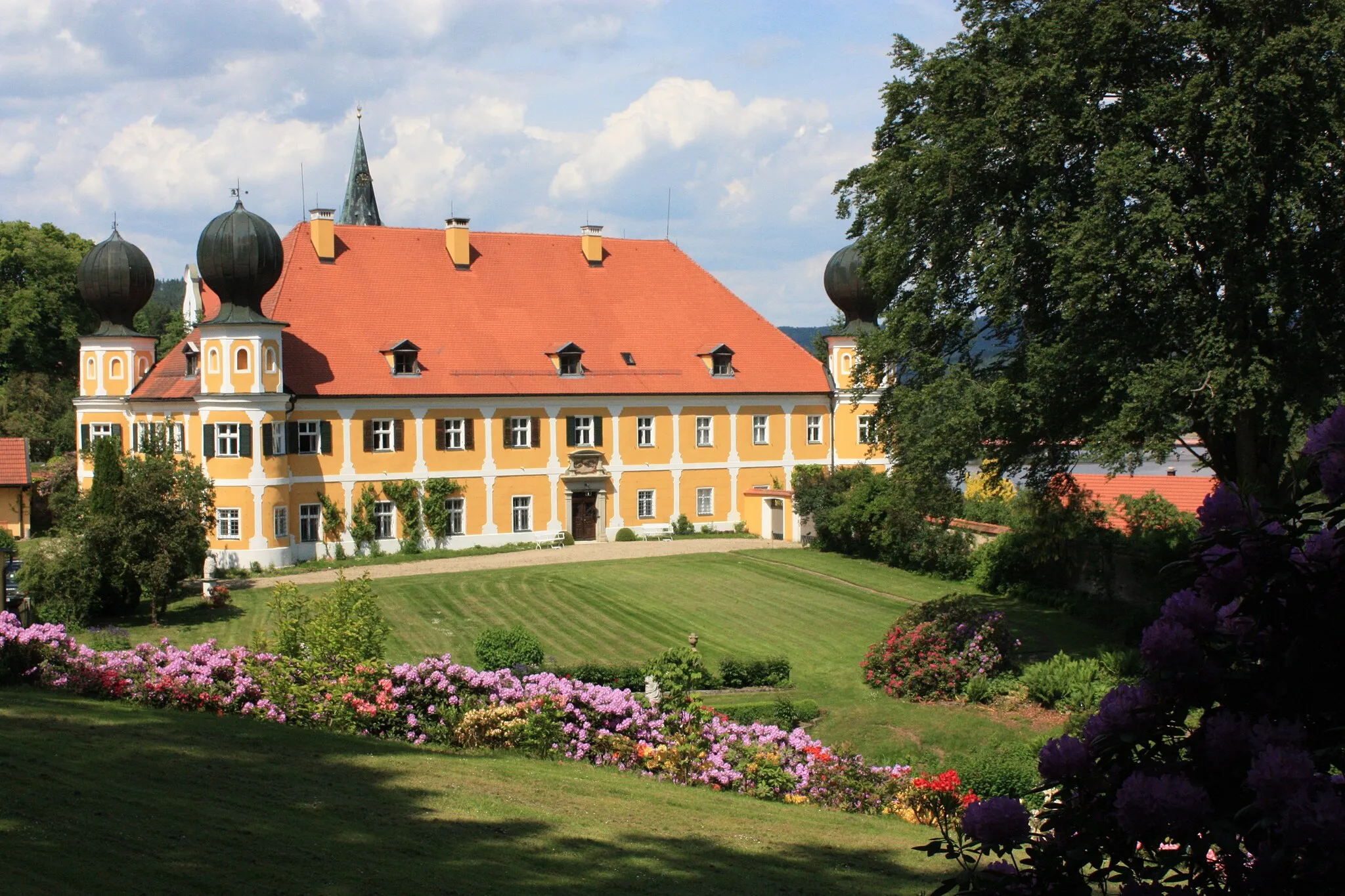
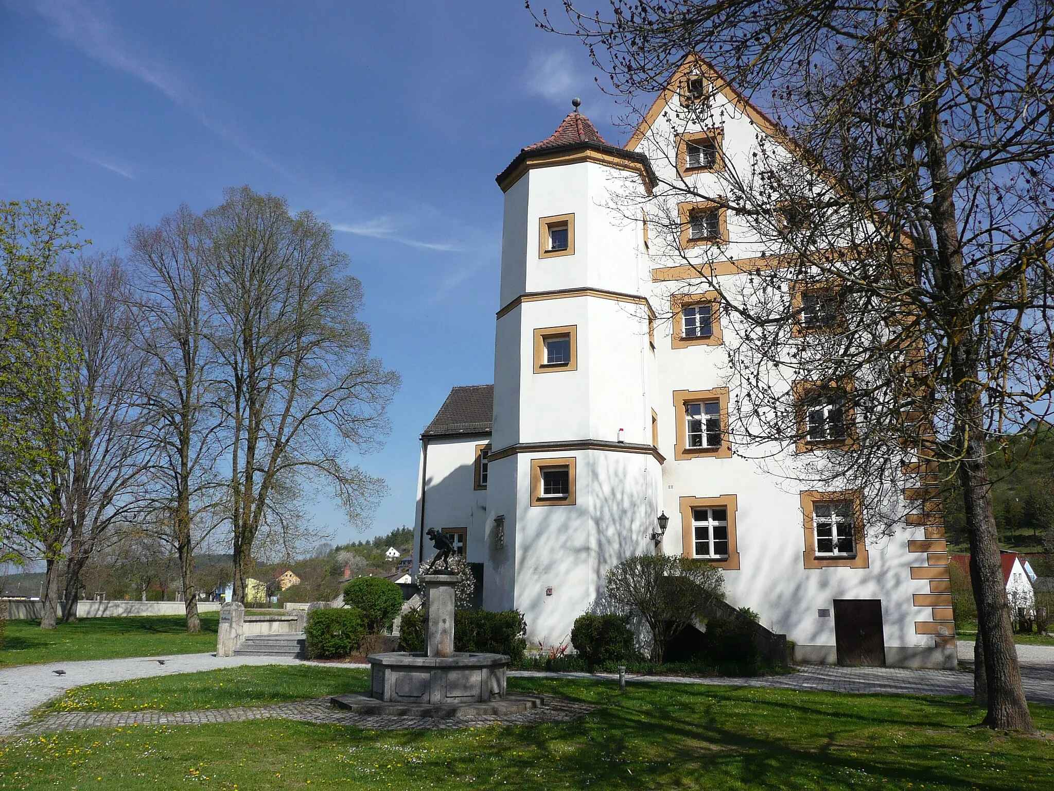
Schloss PürkelgutCastleAt kilometer 39, Schloss Pürkelgut is a beautiful castle surrounded by well-maintained gardens. Take a peaceful stroll in the castle grounds and discover its fascinating history.
39 km
39 km
Ziegetsberg440 mPeakThe Ziegetsberg, located at kilometer 39, offers a peaceful and serene spot for reflection amidst nature. It's an ideal place to take a break and enjoy the tranquility.
47 km
47 km
NaabblickViewpointAround kilometer 47, Naabblick provides stunning views of the river Naab. Take a moment to admire the flow of the river and enjoy the natural beauty around.
62 km
62 km
DuggendorfVillageAt kilometer 62, Duggendorf is a charming village known for its well-preserved traditional architecture. Enjoy the peaceful atmosphere and take a stroll through its quaint streets.
81 km
81 km
PrembergVillageAs you reach the end of the route, at kilometer 81, Premberg offers spectacular views and a rewarding sense of accomplishment. Look out over the surrounding countryside and congratulate yourself on completing a challenging and rewarding ride.
81 km
81 km
Finish: Premberg Village centerTeublitz: Cycling through the scenic Oberpfalz region in Germany
Cycling routes from Teublitz:
Challenging Gravel Ride through Oberpfalz Scenic Road Loop through Teublitz and Beyond Road Cycling through Teublitz's Hilltop Towns Gravel Adventure through Teublitz's Countryside The Gravel Adventure Discovering Hidden Gems of Oberpfalz on Gravel From Lakes to Hills Road Route Teublitz: Exploring the Upper Palatinate Challenging Hills of Oberpfalz Gravel Delight
Cycling routes nearby: