Thrilling climbs and stunning landscapes in Seebach, Germany
Cycling routes from Seebach
Seebach is a locality in Thüringen, Germany. From a cyclist's perspective, Seebach offers a range of cycling routes that showcase the region's natural beauty. The area is known for its hilly terrain, providing challenging climbs and breathtaking descents. Seebach is also home to the Rennsteig, a famous long-distance hiking trail that is popular among cyclists. With its stunning landscapes and challenging cycling options, Seebach is a great destination for road and gravel cyclists seeking an adventurous ride.
The Thüringen Adventure
An exciting ride through scenic Thüringen landscapes.
Embark on a thrilling cycling adventure through the picturesque landscapes of Thüringen. This route takes you through charming villages, lush green fields, and rolling hills, providing a truly immersive experience. With a total distance of 73 km and an ascent of 873 meters, this route is perfect for well-trained amateur cyclists looking for a challenge. Choose the road bike version for a smooth ride or opt for the gravel bike route for a more off-road experience.
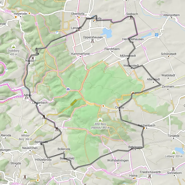
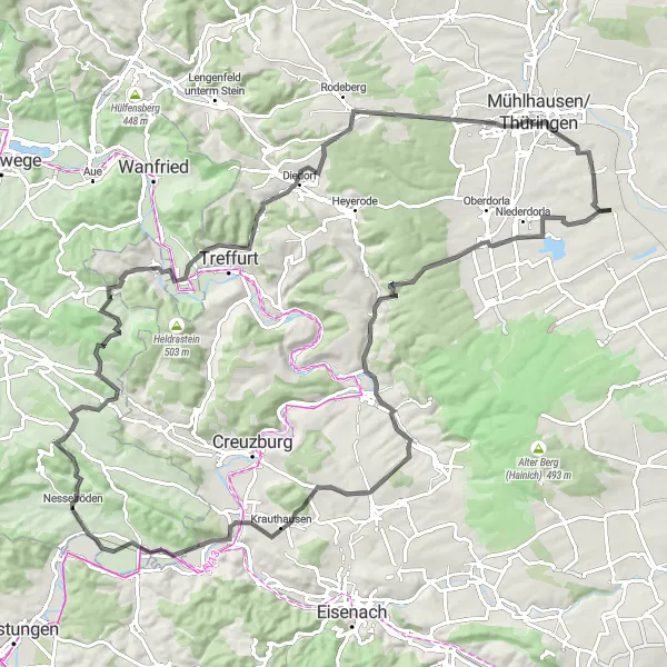
Embark on an adventurous road cycling journey through Mülverstedt, Baumkronenpfad, Ebenheim, Kälberfeld, Zimmerberg, Mihlaer Berg, Rotes Schloss, Elsberg, and Langula.
This challenging road cycling route from Mülverstedt to Langula is perfect for cyclists seeking a thrilling and scenic experience. With a total ascent of 1096 meters and a distance of 97 kilometers, it offers an exciting challenge for well-trained amateurs. The route features breathtaking views, historical landmarks, and picturesque villages. Highlights include the famous Baumkronenpfad, a treetop walkway offering panoramic views of the surrounding forests, and Mihlaer Berg, a scenic hill known for its natural beauty and diverse flora. With a difficulty rating of 4 out of 5 and an epicness rating of 4 out of 5, this route will surely satisfy any adventurous cyclist.
Through the Gravel Trails
Get off the beaten path and explore Thüringen's gravel trails.
Experience the thrill of gravel biking as you navigate through Thüringen's scenic landscapes. This 42 km route with 409 meters of ascent is perfect for adventurers seeking a unique and off-road cycling experience. Pedal through idyllic villages and dense forests, immersing yourself in the beauty of nature. The gravel bike route provides a different perspective of Thüringen, allowing cyclists to explore lesser-known paths and hidden gems.
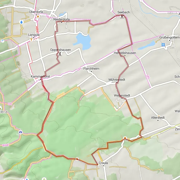
Explore the rural beauty of Thüringen on this scenic road cycling route.
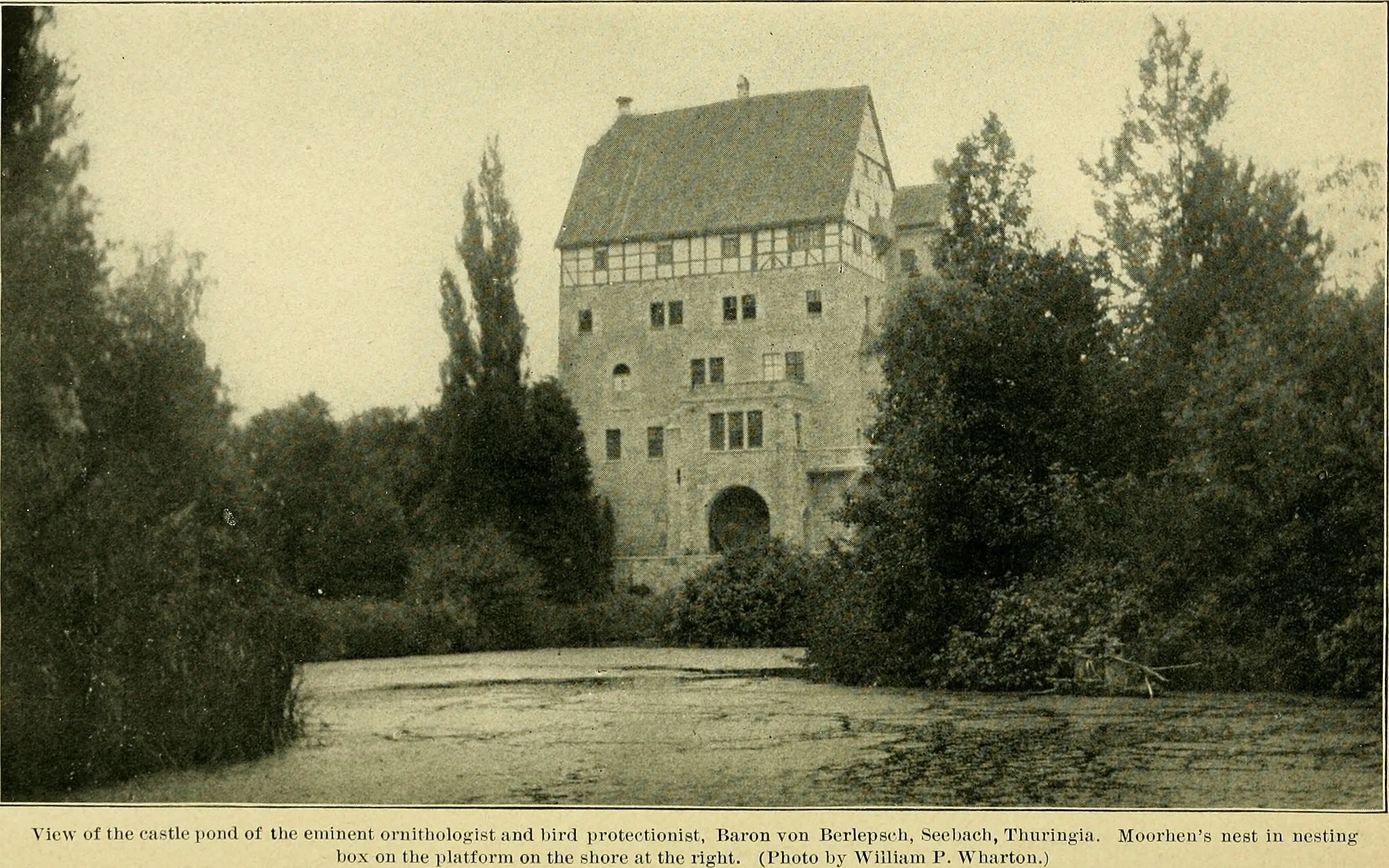
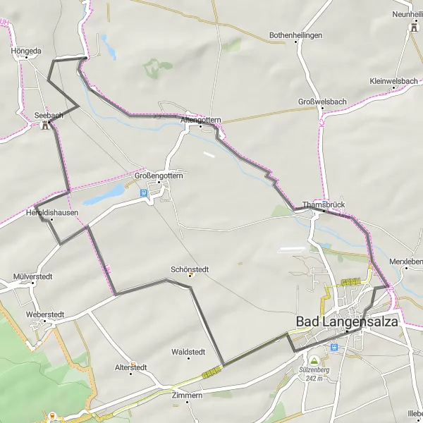
Saddle up and soak in the rural beauty of Thüringen on this 49 km road cycling route. With a manageable ascent of 387 meters, this route is perfect for cyclists of all skill levels. Traverse through charming villages, spot magnificent birdlife at Vogelschutzwarte Seebach, and revel in the tranquility of the countryside.

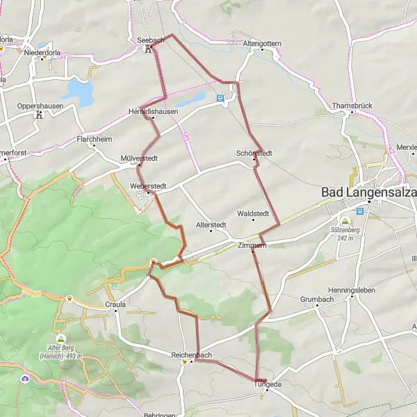
Experience the beauty of gravel cycling along the routes from Höngeda to Bothenheilingen, Kaiserlinde, Thamsbrück, and Vogelschutzwarte Seebach.
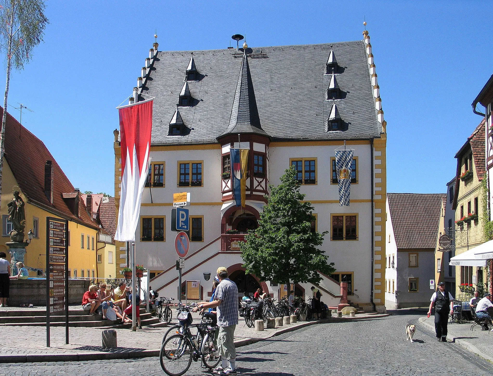
This moderate gravel cycling route showcases the scenic beauty and rich history of the surrounding region. With a total ascent of 217 meters and a distance of 43 kilometers, it is suitable for beginners and offers a relaxed cycling experience. Highlights include the historic Höngeda, a village with centuries-old houses and charming cobblestone streets. Explore the magnificent Kaiserlinde, a grand linden tree symbolizing the historical significance of the region. Satisfy your birdwatching desires at Vogelschutzwarte Seebach, a bird sanctuary offering diverse species of birds. With a difficulty rating of 1 out of 5 and an epicness rating of 2 out of 5, this route is perfect for leisurely gravel cycling.
Discover the hidden gems of Thüringen's gravel paradise.
Experience the magic of Thüringen's gravel paradise as you navigate through scenic landscapes and charming villages. This 39 km gravel route, with an ascent of 417 meters, is perfect for cyclists looking to explore off-the-beaten-path trails. Immerse yourself in the peaceful surroundings, pedal through picturesque forests, and enjoy the tranquility of nature.
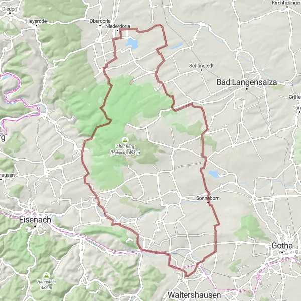
Embark on an epic gravel adventure through Thüringen's rugged terrains.
Prepare yourself for an epic gravel adventure in Thüringen, featuring challenging terrains and breathtaking landscapes. With a distance of 83 km and an ascent of 953 meters, this route is recommended for experienced cyclists seeking a thrilling off-road experience. Explore hidden trails, pedal through dense forests, and conquer steep hills as you immerse yourself in Thüringen's natural beauty.
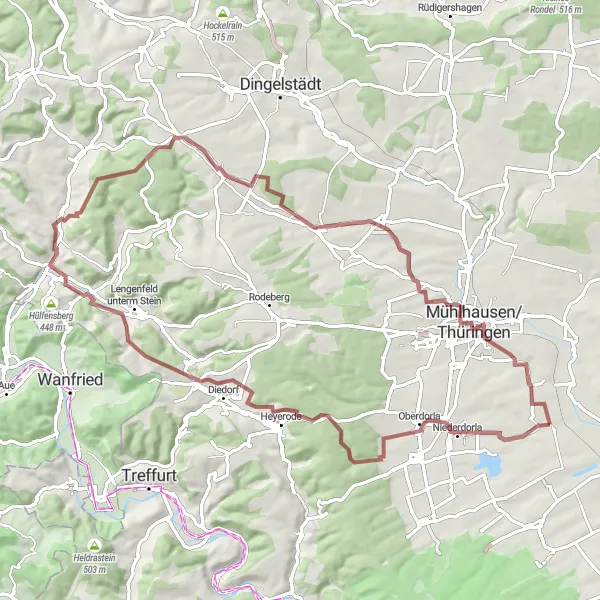
Explore the gravel roads of Höngeda, Bothenheilingen, Kaiserlinde, Thamsbrück, and Vogelschutzwarte Seebach.
For gravel enthusiasts, this route offers a delightful adventure through scenic landscapes and charming villages. With a total ascent of 901 meters and a distance of 76 kilometers, it is suitable for intermediate-level cyclists. Highlights include the Grenzhaus Heyerode, an old border house with historical significance, and Vogelschutzwarte Seebach, a bird sanctuary with various species of birds. Explore the quaint village of Bothenheilingen and marvel at the majestic Kaiserlinde, a centuries-old linden tree. With a difficulty rating of 2 out of 5 and an epicness rating of 3 out of 5, it provides a pleasant gravel cycling experience.
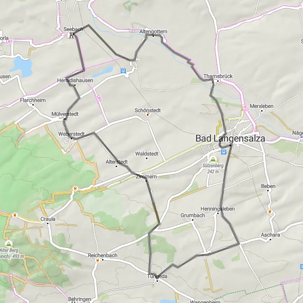
Experience a scenic road cycling route from Seebach to Thamsbrück, Sülzenberg, and Ufhoven.
Enjoy a road cycling adventure in Seebach and explore the picturesque areas of Thamsbrück, Sülzenberg, and Ufhoven. This route offers beautiful landscapes and moderate difficulty suitable for amateur cyclists. With a total ascent of 197 meters and a distance of 38 kilometers, it provides a great option for a day trip. Immerse yourself in the natural beauty of the Vogelschutzwarte Seebach, a renowned bird sanctuary along the way. The route is rated 3 out of 5 for difficulty and 3 out of 5 for epicness.
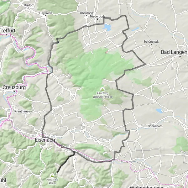
Embark on a challenging road cycling adventure through Elsberg, Nazza, Schloss Bischofroda, Lerchenberg, Wommen, Weinberg, Lüderbach, Töpferberg, Eigenrieden, and Der Löwe.
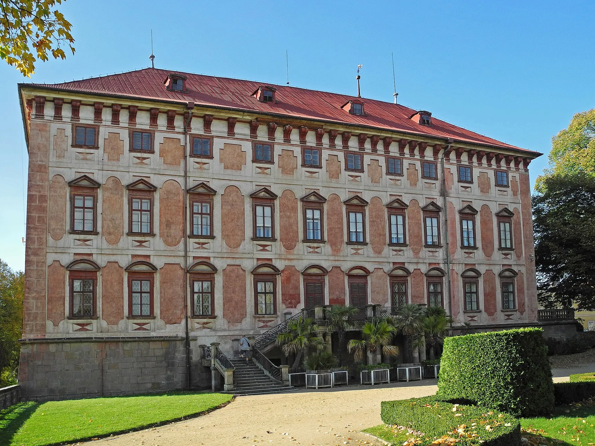
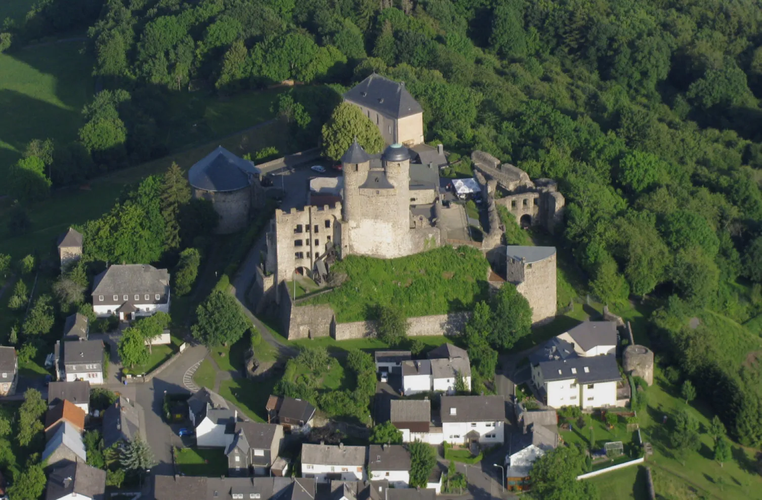
This demanding road cycling route takes you through the picturesque landscapes of Elsberg, Nazza, Schloss Bischofroda, and other enchanting destinations. With a total ascent of 1461 meters and a distance of 105 kilometers, this route offers a thrilling challenge for experienced cyclists. Highlights include the impressive Schloss Bischofroda, a medieval castle perched on a hilltop, and Wommen, a charming village with its quaint streets and historic buildings. With a difficulty rating of 5 out of 5 and an epicness rating of 4 out of 5, this route is not for the faint-hearted.
Cycling routes nearby:
Nearby regions: