Cycling paradise in Bad Neustadt an der Saale
Cycling routes from Bad Neustadt an der Saale
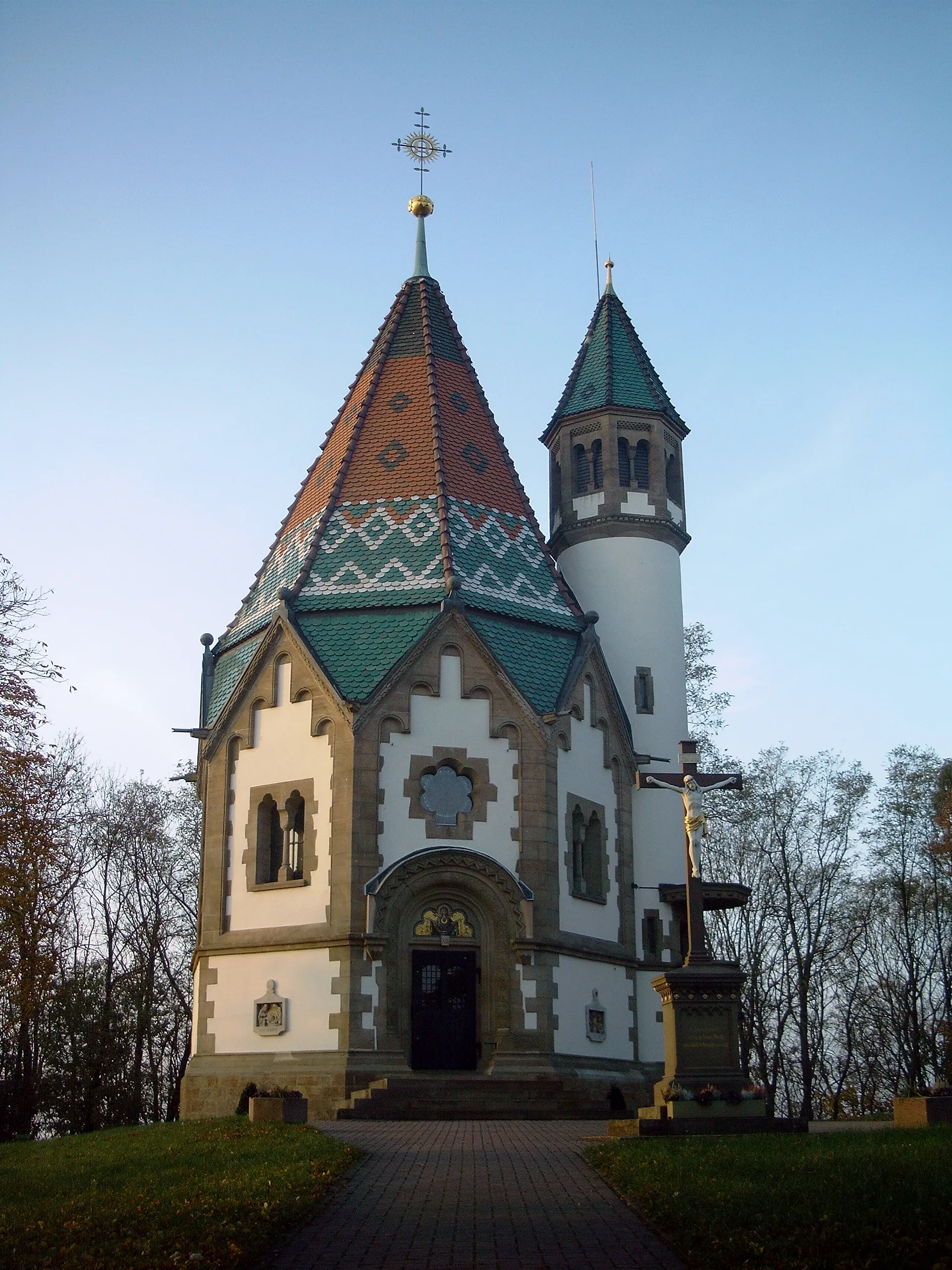
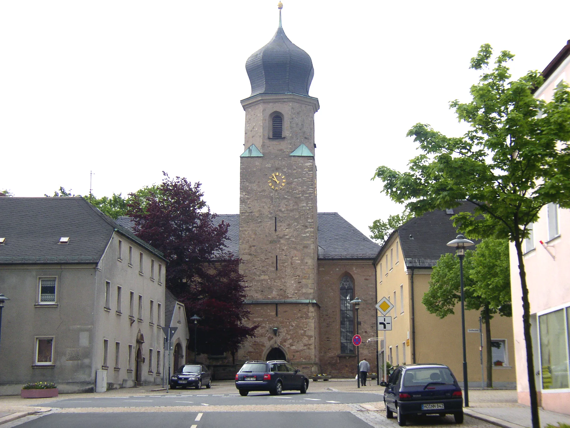
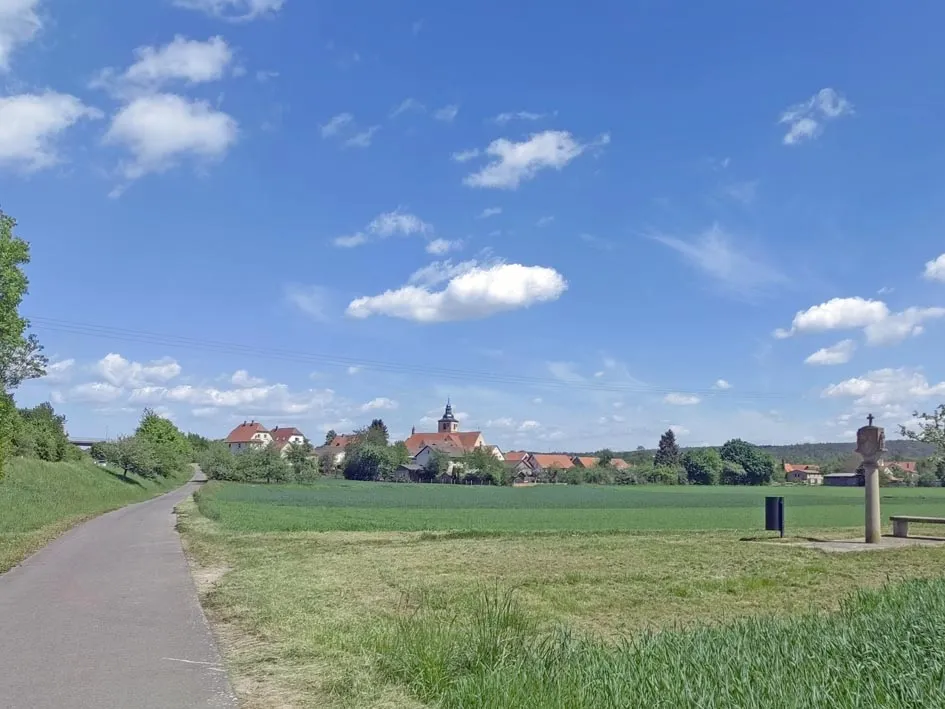
Bad Neustadt an der Saale is located in Unterfranken, Germany. It is a cyclist-friendly locality with well-maintained roads and numerous cycling routes. The surrounding region offers a mix of flat terrain and challenging hills, providing options for all types of cyclists. One of the highlights for cycling enthusiasts is the nearby Rhön Mountains, which offers famous climbs and scenic views. Bad Neustadt an der Saale is a must-visit destination for cyclists seeking diverse terrain and challenging rides.
Embark on an epic cycling journey through the stunning landscapes of the Rhön region.
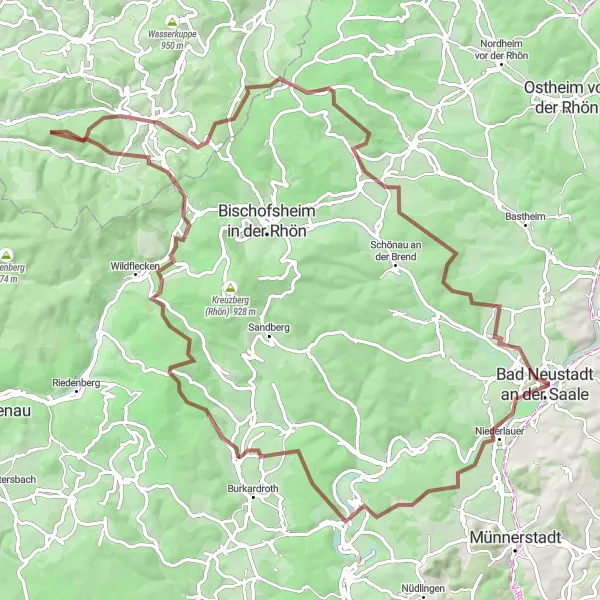
This challenging round-trip gravel cycling route near Bad Neustadt an der Saale covers a distance of 100 km, with an ascent of 2021 meters. The route explores the diverse landscapes of the Rhön region and offers a true adventure for experienced cyclists. Start your journey in Bad Bocklet, where you can immerse yourself in tradition and charm. As you continue, reach Stangenroth and enjoy a thrilling cycling experience on the slopes of the Totnansberg. The route also includes a stop in Oberwildflecken, known for its picturesque surroundings and stunning landscapes. Don't miss the Kleiner Nallenberg, a highlight that offers panoramic views of the Rhön on clear days. Continue your journey to Barockschloss, where you can admire its elegant architecture and enjoy the peaceful surroundings. Heidelstein, one of the highest peaks in the Rhön, offers breathtaking views and completes this epic cycling adventure. This route is only suitable for experienced gravel riders due to its challenging terrain and significant ascent. It promises an unforgettable experience combining natural beauty and cultural highlights.
Conquer the hills of Unterfranken with this challenging road cycling route starting near Bad Neustadt an der Saale
Prepare yourself for a tough climb and stunning views with this road cycling route through the hills of Unterfranken. Covering a distance of 81 kilometers and offering a total ascent of 920 meters, it is suitable for experienced cyclists. Highlights along the way include the Luitpold Höhe viewpoint, the historic town of Bad Neustadt an der Saale, the scenic Zehntberg climb, and the Schwedenschanze fortress ruins.
Embark on a thrilling gravel adventure through the stunning Rhön Forest.
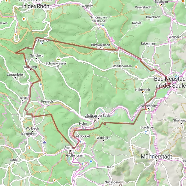
This gravel cycling route near Bad Neustadt an der Saale covers a distance of 57 km, with an ascent of 978 meters. The route promises an exciting adventure through the scenic Rhön Forest. Begin your journey in Niederlauer, where you can explore its charming village center. As you continue, make sure to visit Bad Bocklet with its picturesque surroundings and a soothing spa atmosphere. Another highlight of this route is Gefäll, a small village known for its beautiful countryside views. The Rhönflieger, a popular paragliding spot, is also worth a stop as you cycle through to Rhönflieger. Feel the adrenaline rush and enjoy the amazing views of the region. The route ends in Brendlorenzen, offering a unique mixture of history and natural beauty. Overall, this route offers a challenging adventure through diverse landscapes, combining natural highlights with cultural experiences.
The Rhön Rollercoaster
Experience the thrilling ups and downs of the Rhön mountains
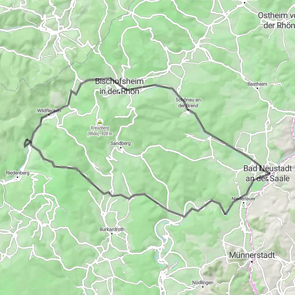
This challenging road cycling route takes you through the beautiful Rhön mountains, providing stunning views and plenty of climbing. With a total ascent of 968 meters and a distance of 68 kilometers, it is suitable for experienced cyclists. The route starts near Bad Neustadt an der Saale and passes through picturesque towns like Niederlauer and Palmsberg. Highlights along the way include the Gefäll waterfall, the Totnansberg viewpoint, and the scenic village of Brendlorenzen.
Rhön Adventure Challenge
Test your limits with this epic road cycling route through the breathtaking landscapes of the Rhön region near Bad Neustadt an der Saale
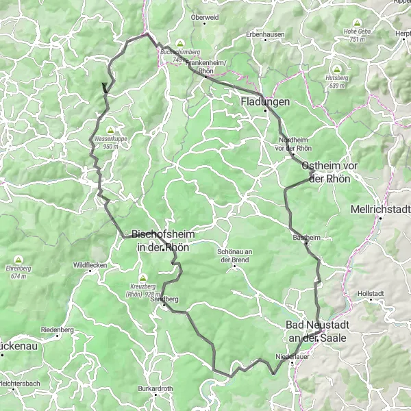
If you are a seasoned cyclist looking for a thrilling adventure, this road cycling route through the Rhön region is for you. Covering a distance of 110 kilometers and offering a total ascent of 1750 meters, it is a challenging test of strength and endurance. Highlights along the way include the historic town of Bad Neustadt an der Saale, the Palmsberg climb with its panoramic views, the scenic villages of Fladungen and Altväter, the Hilders valley, and the famous Bastheim fairy rock formation.
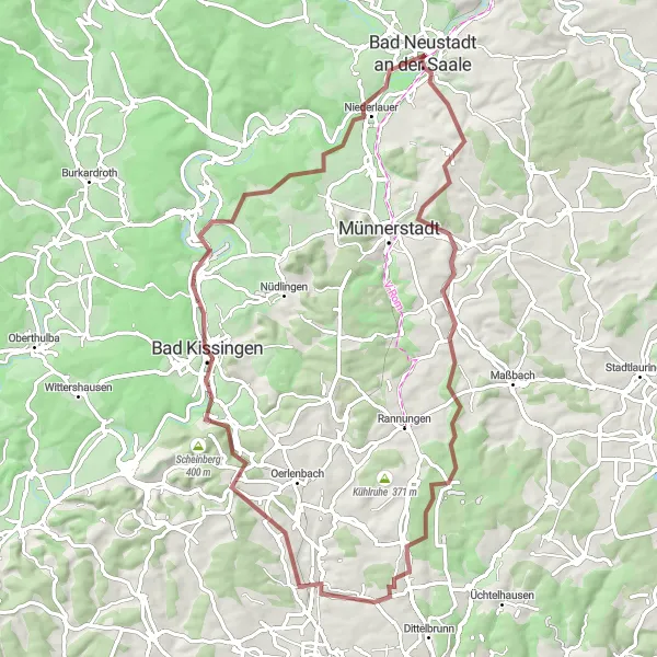
The Rhön Forest Loop
Experience the beauty of the Rhön forest and enjoy stunning views along the route.
This round-trip cycling route takes you through the picturesque landscape of the Unterfranken region, specifically the Rhön Forest. With a total distance of 56 km and an ascent of 805 meters, this route is suitable for gravel biking. The route passes through several charming towns and offers breathtaking views from various viewpoints. Cycling through Münnerstadt, you can explore its historical buildings and learn about its rich cultural heritage. Bad Kissingen, famous for its spa culture, is also worth a stop. Don't miss the stunning Balustrade with its panoramic views over the entire region. As you reach the Klaushöhe and Hohenroth, you'll be rewarded with breathtaking vistas of the surrounding countryside. Overall, this route offers a great balance of natural beauty, cultural experiences, and challenging terrain.
Hills and Castles
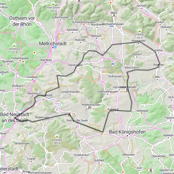
Embark on a journey through history and enjoy cycling amidst beautiful landscapes.
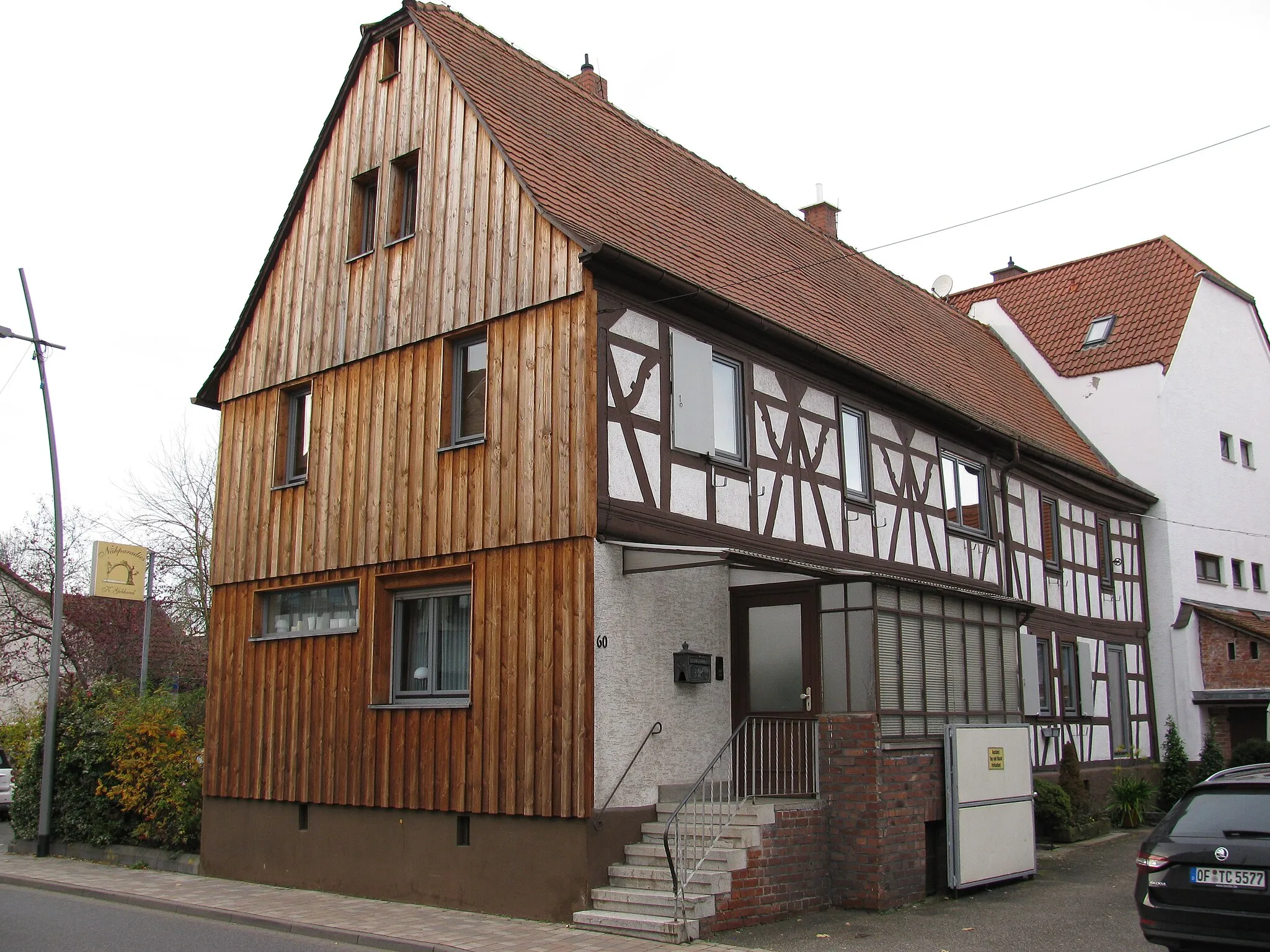
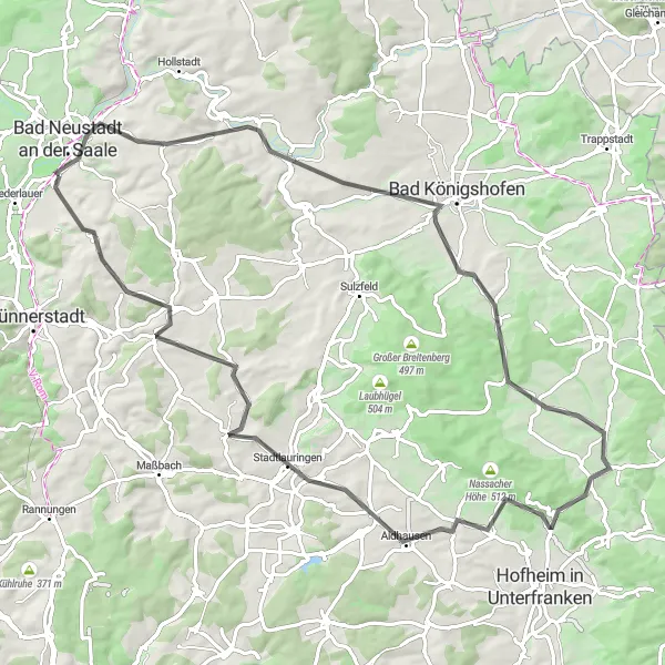
This road cycling route near Bad Neustadt an der Saale covers a distance of 69 km and includes 614 meters of ascent. The route takes you through scenic landscapes and past historical landmarks. Start your journey in Bad Neustadt an der Saale, a town known for its charming old town and traditional half-timbered houses. As you cycle through Hendungen, you'll have the opportunity to visit the town's medieval castle ruins and learn about its rich history. Continuing on, you'll pass through Römhild, where you can explore the impressive Römhild Abbey. The route also includes the Galgenberg, offering panoramic views of the surrounding countryside. Keep going to get a glimpse of the village of Großeibstadt, known for its well-preserved half-timbered houses. Finally, reach the Luitpold Höhe for a stunning panoramic view of the picturesque landscape. This route offers a good balance between historical sights, picturesque landscapes, and moderate difficulty.
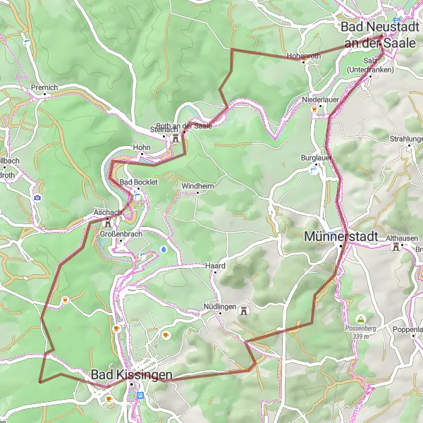
Bad Neustadt Gravel Adventure
Discover the gravel roads around Bad Neustadt
Embark on a thrilling gravel adventure around Bad Neustadt, Unterfranken, and explore the beautiful rolling landscapes of the region. This 77 km round-trip route offers a mix of scenic views, challenging climbs, and exciting gravel roads. With a total ascent of 964 meters, you'll test your legs and enjoy the rewards of beautiful vistas. Experience the Luitpold Höhe, a peaceful hilltop spot that offers panoramic views of the surrounding countryside. Ride through the charming villages of Strahlungen, Poppenlauer, and Poppenhausen, each offering their own unique highlights along the way. Don't miss the Feldherrenhügel, a prominent hill known for its historical significance. Push your limits and reach the Hart summit after a challenging climb. Finally, you'll pass through Niederlauer, a picturesque village, before returning to Bad Neustadt.
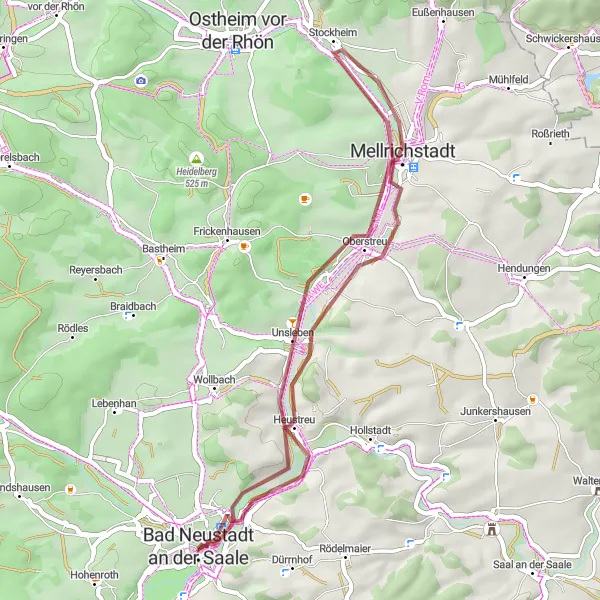
Enjoy a leisurely ride along picturesque waterways and explore charming villages.
This gravel cycling route near Bad Neustadt an der Saale covers a distance of 40 km, with an ascent of 172 meters. The route takes you alongside scenic waterways and through picturesque villages. Start your journey in Heustreu, where you can admire the idyllic Lauertal nature reserve. Continue cycling to Mellrichstadt, a charming town with well-preserved historical buildings. Feel the tranquility as you pass through Unsleben, known for its beautiful castle and wonderful countryside. The final stage of the route includes a stop in Herschfeld, with its lovely village center and peaceful atmosphere. This route offers a great opportunity for a relaxed and pleasurable cycling experience amidst scenic landscapes.
Embark on an adventurous gravel route through scenic landscapes near Bad Neustadt an der Saale
Experience the thrill of off-road cycling with this gravel route starting near Bad Neustadt an der Saale. Covering a distance of 53 kilometers and offering a total ascent of 945 meters, it is suitable for cyclists who enjoy a bit of adventure. Highlights along the way include the picturesque town of Bad Neustadt an der Saale, the Tannenkopf summit with panoramic views, the charming village of Unterweißenbrunn, and the idyllic town of Salzburg.
Cycling routes nearby:


Nearby regions: