Leisurely rides in scenic landscapes.
Cycling routes from Grettstadt
Grettstadt is a small locality situated in Unterfranken, Germany. From a cyclist's perspective, Grettstadt provides mild but enjoyable road and gravel cycling experiences. The locality does not offer extraordinary or famous cycling spots, nor are there well-known climbs nearby. However, the surrounding area offers beautiful countrysides and quiet roads, making it an appealing destination for leisurely rides. Grettstadt is a suitable choice for casual cyclists seeking picturesque routes with a relaxed ambiance.
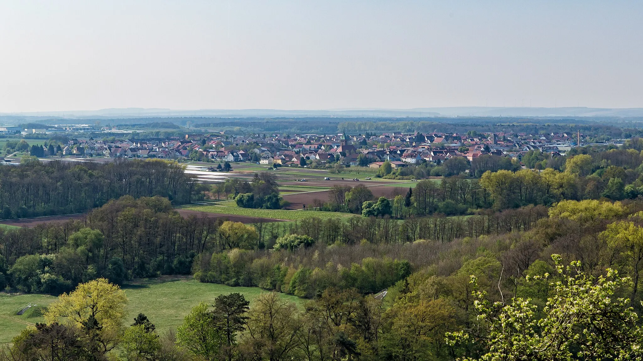
The Steigerwald Loop
Cycling through the hilly landscapes of Steigerwald Forest
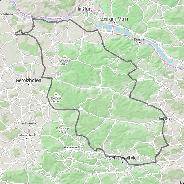
The Steigerwald Loop takes you on a scenic journey through the beautiful hilly landscapes of Steigerwald Forest. With a distance of 122 km and an elevation gain of 1147 m, this road cycling route offers a challenging but rewarding experience. Along the way, you'll pass through picturesque villages like Wonfurt, Hohe Lohe, and Unterschleichach. The highlight of the route is the panoramic view from the village of Grettstadt, where you can admire the stunning countryside. Overall, the Steigerwald Loop offers a great mix of challenging climbs, scenic views, and charming villages.
A scenic road route with a mix of countryside and charming villages
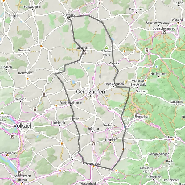
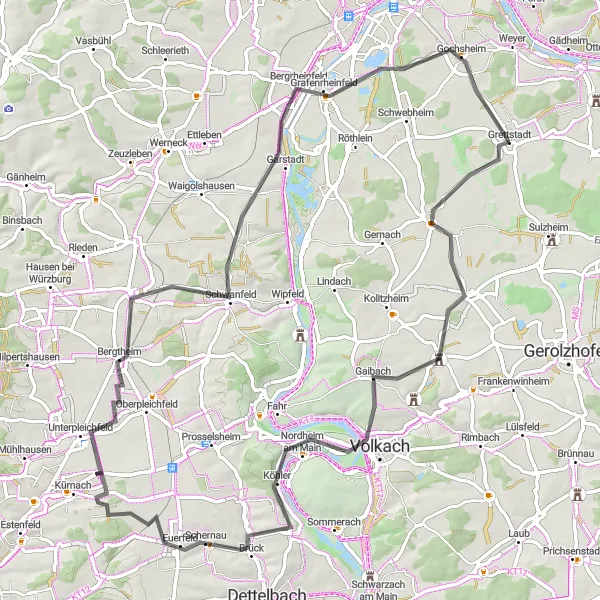
The Eichelberg Loop is a scenic road cycling route that takes you through the countryside, passing by charming villages along the way. With a total distance of 54 kilometers and an ascent of 319 meters, this route is suitable for beginners and leisurely cyclists. The highlights along the route include Eichelberg, a quaint village with picturesque landscapes, Dingolshausen known for its vineyards and wine culture, Prichsenstadt with its charming medieval old town, Lülsfeld surrounded by rolling hills and beautiful scenery, and Grettstadt where the tour starts and ends.

A challenging road route with stunning views of Marienberg Castle
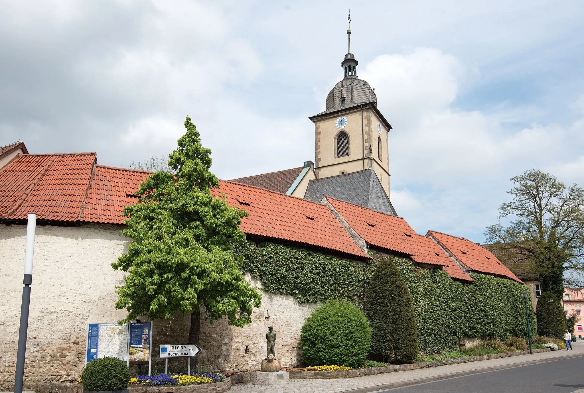
The Marienberg Road Adventure is a challenging road cycling route that takes you past Marienberg Castle and offers stunning views of the surrounding landscapes. With a total distance of 131 kilometers and an ascent of 1187 meters, this route is suitable for well-trained amateur cyclists seeking a more demanding challenge. The highlights along the route include Aussichtsturm am Schuttplatz, where you can enjoy panoramic views of Schweinfurt, Bergrheinfeld with its natural beauty, Euerbach with its historic buildings, Marienberg Castle, which dominates the landscape with its majestic presence, Balustrade with its impressive architecture, Bad Kissingen famous for its thermal baths and gardens, Burghäuser Blick offering breathtaking views, Burglauer known for its beautiful river scenery, Bad Neustadt an der Saale with its charming old town, Zehntberg offering panoramic views, Oberlauringen with its picturesque surroundings, Reichmannshausen known for its rolling hills, and Gochsheim with its friendly atmosphere.
Explore the beautiful wine region of Unterfranken on this road cycling route.
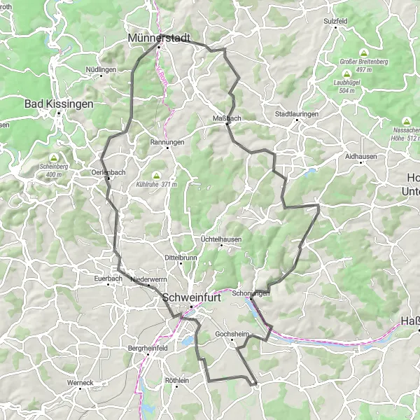
Embark on a breathtaking journey through the scenic wine region of Unterfranken with this road cycling route. With an ascent of 850 meters and a total distance of 94 kilometers, this route offers a challenging yet rewarding cycling experience. The highlights along the way include the Aussichtsturm am Schuttplatz, where you can enjoy panoramic views of the surrounding vineyards, and Schwebheim, a picturesque village known for its charming architecture and welcoming locals. As you pedal through Oerlenbach, take a moment to appreciate the peaceful countryside and rolling hills. Don't miss the opportunity to visit Münnerstadt, a historic town with a rich cultural heritage, and indulge in some local delicacies. Maßbach offers a great spot to rest and recharge, while Reichmannshausen is known for its postcard-worthy landscapes. Finally, the route concludes in Grettstadt, a welcoming town with plenty of opportunities for relaxation and exploration.
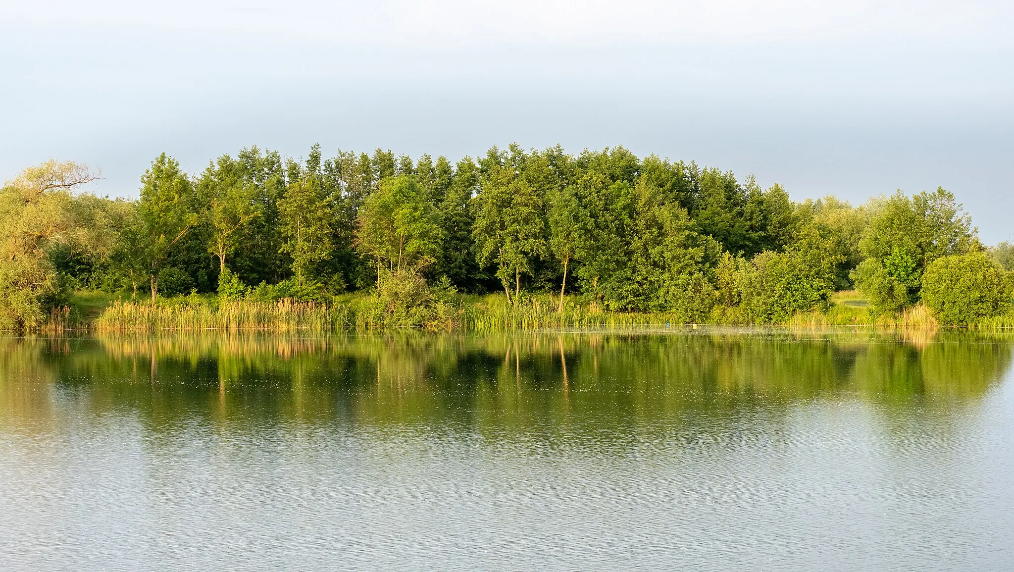
Exploring the vineyards of Wonfurt and Rotenberg
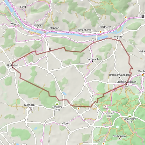
Discover the scenic beauty of Lower Franconia's vineyards with this 35 km gravel loop. With a moderate elevation gain of 290 m, this route is perfect for gravel bike enthusiasts looking for a shorter but rewarding ride. Experience the unique charm of Wonfurt and Rotenberg as you cycle through their picturesque vineyards and rolling hills. The highlight of the route is the panoramic view from the village of Wonfurt, where you can enjoy sweeping vistas of vineyard-covered landscapes. Overall, the Vineyard Gravel Loop offers a delightful mix of gravel paths, vineyards, and beautiful Franconian villages.
Zeilitzheim Loop
A scenic road route through the beautiful vineyards near Zeilitzheim
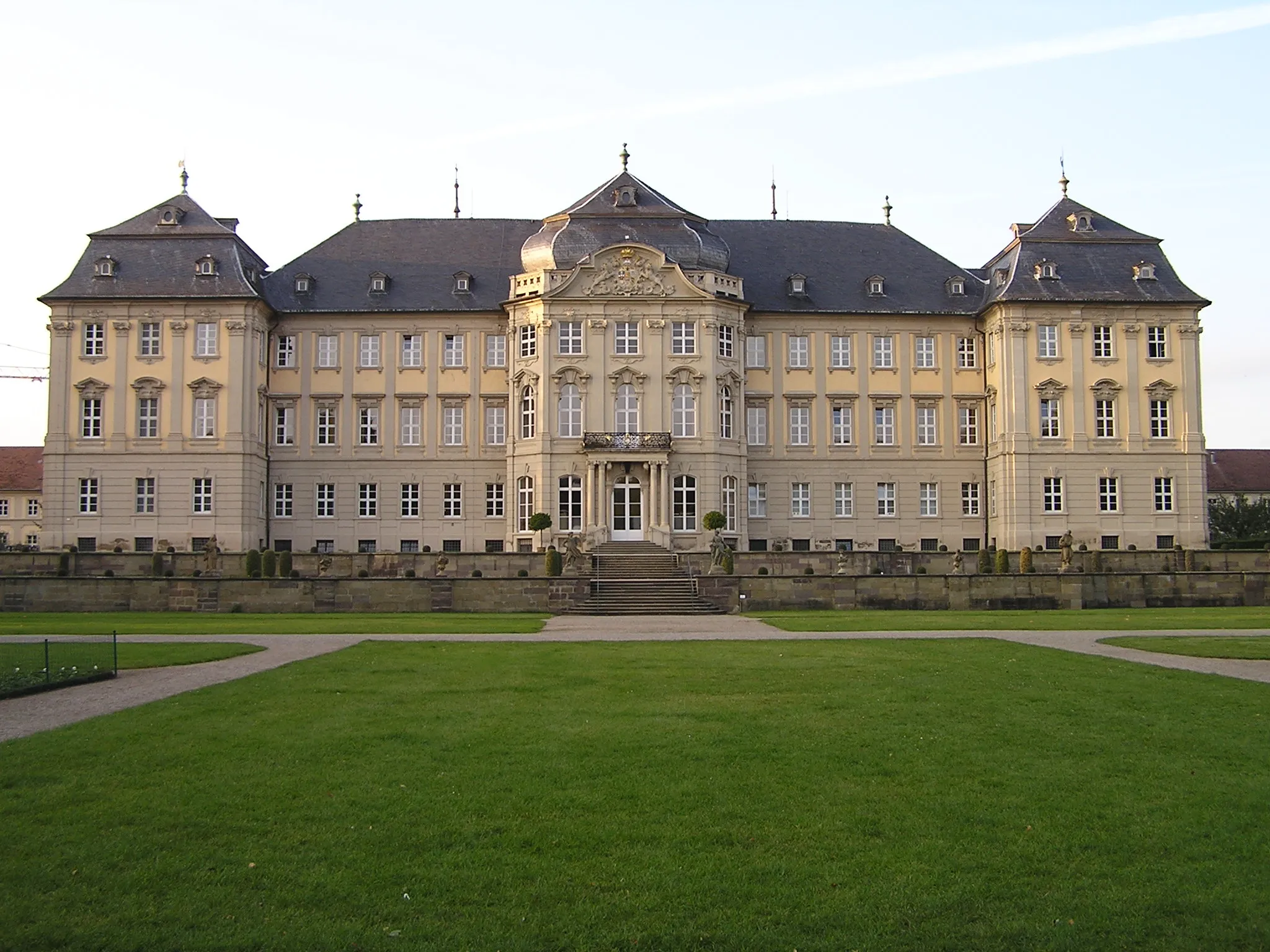
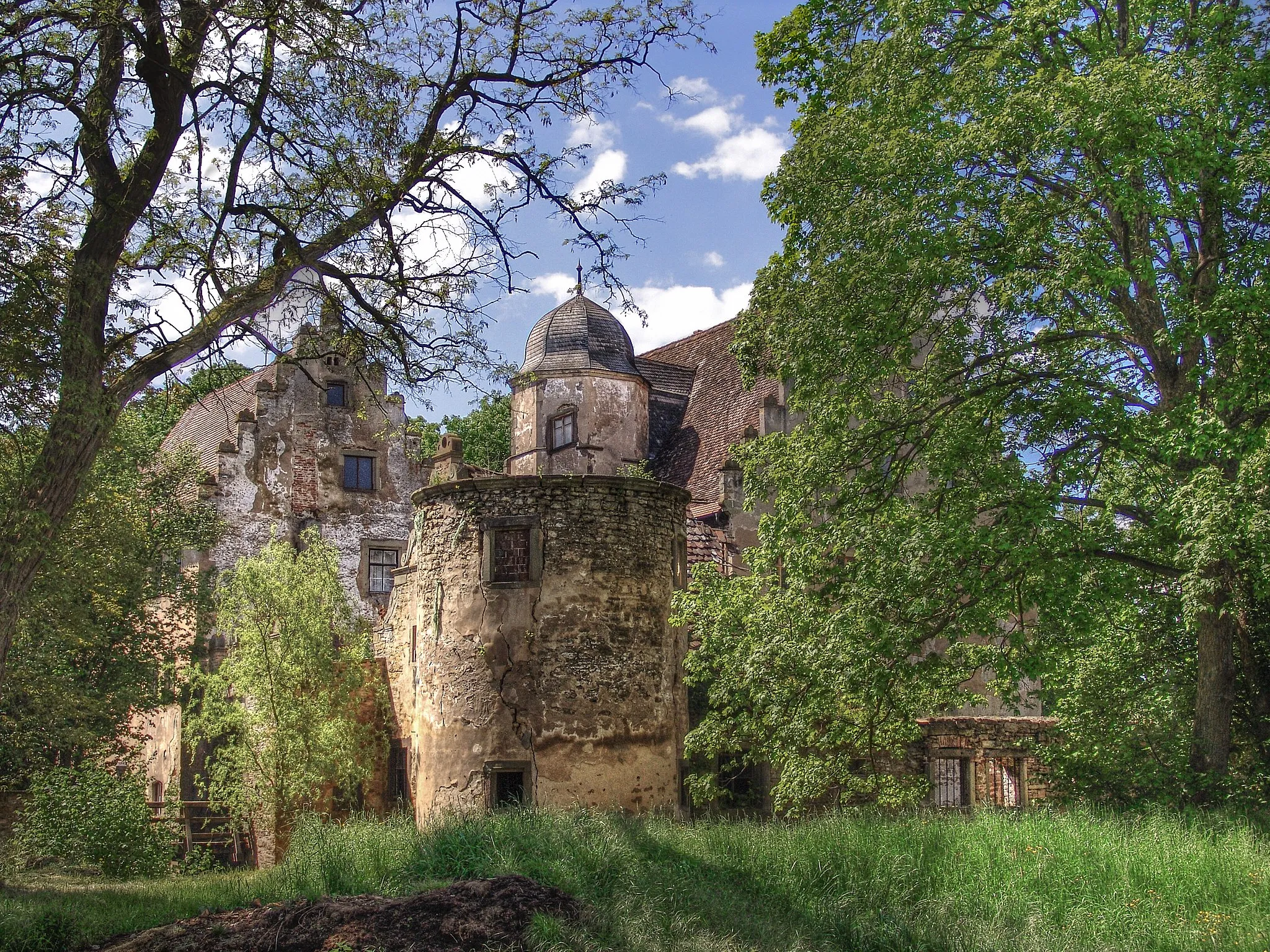
The Zeilitzheim Loop is a picturesque road cycling route that takes you through rolling countryside and vineyards near Zeilitzheim. With a total distance of 77 kilometers and an ascent of 413 meters, this route is suitable for well-trained amateur cyclists. The highlights along the route include Zeilitzheim, a charming village known for its wineries, Nordheim am Main with its historic old town, Bergtheim with its impressive castle ruins, Bergrheinfeld with its beautiful landscapes, and Grettstadt where the tour starts and ends.
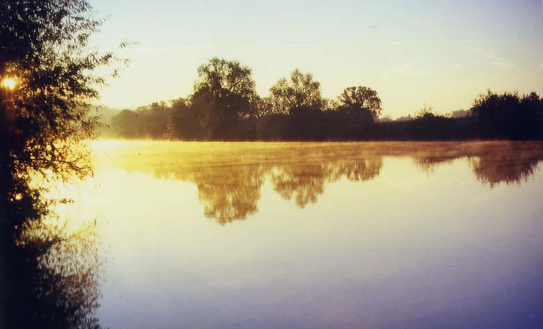
Gravel Adventure to Volkach
A scenic gravel route leading to the charming town of Volkach
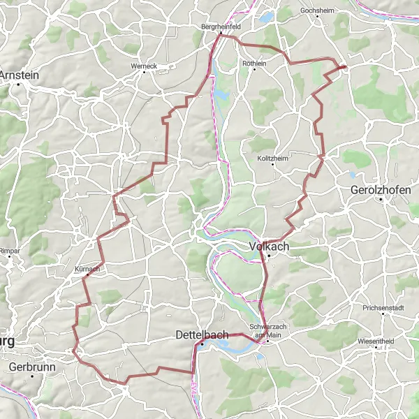
Embark on a gravel adventure with this 95 km route that takes you through picturesque landscapes to the charming town of Volkach. With a moderate elevation gain of 504 m, this route offers a mix of gravel paths and quiet roads, perfect for gravel bike enthusiasts. Along the way, you'll pass through Herlheim, Mainstockheim, and Rottendorf, experiencing the peacefulness and beauty of the Lower Franconian countryside. The highlight of the route is the panoramic view from the Aussichtsturm am Schuttplatz, where you can admire the Main River and the surrounding vineyards. Overall, this gravel adventure to Volkach offers a great balance between scenic beauty and off-road excitement.
An exciting gravel route that explores the outskirts of Schweinfurt
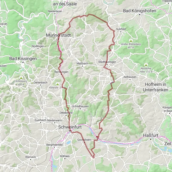
The Schweinfurt Gravel Adventure is a thrilling gravel cycling route that takes you through the outskirts of Schweinfurt. With a total distance of 103 kilometers and an ascent of 1174 meters, this route is suitable for experienced gravel cyclists. The highlights along the route include Schweinfurt, a vibrant city with a rich industrial history, Rannungen with its idyllic lakes and beautiful nature, Possenberg, which offers stunning panoramic views, Strahlungen with its charming half-timber houses, Kieshügel where gravel enthusiasts can enjoy challenging climbs, Stadtlauringen with its historic castle, Marktsteinach known for its medieval charm, and Weyer with its picturesque countryside.
Grettstadt Gravel Adventure
A thrilling gravel route passing through Schweinfurt and scenic countryside
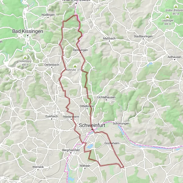
The Grettstadt Gravel Adventure is an exhilarating gravel cycling route that takes you through Schweinfurt and scenic countryside. With a total distance of 78 kilometers and an ascent of 775 meters, this route offers a mix of challenging terrain and beautiful landscapes. The highlights along the route include Grettstadt, the starting and ending point of the route, Schweinfurt, a vibrant city with a rich industrial heritage, Possenberg with its panoramic views, Schwarze Pfütze, a hidden gem offering a peaceful getaway, Niederwerrn with its charming village atmosphere, Schwebheim known for its historic buildings, and Aussichtsturm am Schuttplatz, a lookout tower offering breathtaking views.
Exploring the hilly landscapes and vineyards of Lower Franconia
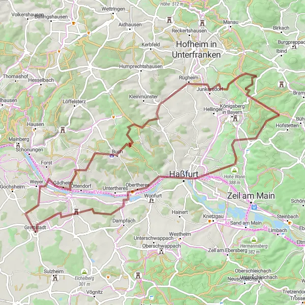
Embark on a thrilling gravel adventure through the hilly landscapes and picturesque vineyards of Lower Franconia with this 77 km route. With an elevation gain of 1005 m, this challenging gravel route offers a perfect balance between scenic beauty and off-road excitement. Along the way, you'll pass through Grettstadt, Buchner Höhe (405.8m), and Mechenried, enjoying stunning views of the countryside. The highlight of the route is the panoramic view from Obereuerheim, where you can admire the vineyards and rolling hills of the region. Overall, the Hillside Gravel Adventure provides an unforgettable experience for gravel bike enthusiasts looking for a mix of challenging climbs and beautiful landscapes.
Cycling routes nearby:


Nearby regions: