Gravel Loop from Angyalföld
A gravel cycling route starting from Angyalfoeld
Explore the outskirts of Budapest on this scenic gravel route.
Map
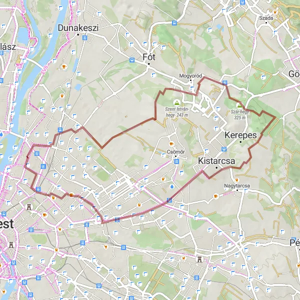
This gravel route starts near Angyalföld and takes you through beautiful countryside and small villages. The route is mostly flat with some gentle rolling hills, making it suitable for all levels of cyclists. Along the way, you'll pass by Rákospalota, Szent István-hegy, Bolnoka, Kistarcsa, Királydomb, and finish back in Angyalföld. This route is a great opportunity to escape the city and experience the peacefulness of nature.
gravel
53 km
453 m
Tough
Route profile
Highlights on the route
0 km
0 km
Start: Locality centerAngyalföld: Discovering Budapest's urban cycling scene in Angyalföld
Angyalföld is a district located in Budapest, Hungary. From a cyclist's point of view, Angyalföld offers diverse cycling opportunities within the bustling city. With its extensive network of bike lanes and flat terrain, it's an excellent locality for commuting and leisure cycling. Cyclists will appreciate the ease of navigating the city streets and the chance to explore iconic landmarks such as Margaret Island and the sweeping banks of the Danube River. While Angyalföld may not offer significant mountain climbs, it provides a cyclist-friendly environment with vibrant urban scenery.6 km
6 km
RákospalotaSub-urbRákospalota is a historic neighborhood with picturesque streets and charming buildings.
14 km
14 km
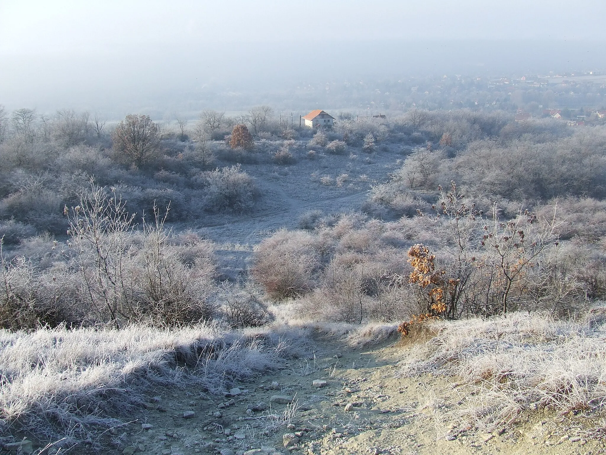
Szent István-hegy183 mPeakSzent István-hegy offers stunning views of the surrounding countryside and the city of Budapest.
25 km
25 km
Bolnoka322 mPeakBolnoka is a quaint village with traditional Hungarian architecture and friendly locals.
33 km
33 km
KistarcsaTownKistarcsa is a small town with a beautiful town square and nearby parks for relaxation.
42 km
42 km
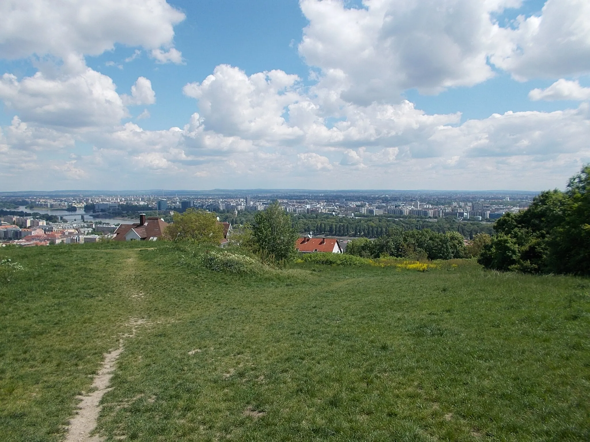
Királydomb137 mPeakKirálydomb is a hill with a medieval fortress at the top, offering panoramic views of the region.
52 km
52 km
AngyalföldSub-urbAngyalföld is a vibrant neighborhood in Budapest, known for its lively atmosphere and trendy cafes.
53 km
53 km
Finish: Locality centerAngyalföld: Discovering Budapest's urban cycling scene in Angyalföld
Cycling routes from Angyalfoeld:
Famous Gravel Circuit Scenic Gravel Escape Challenging Road Cycling Loop from Angyalföld Scenic Road Cycling Route from Angyalföld Serene Road Cycling Route near Angyalföld Mountain Adventure Leisurely Road Cycling Route near Angyalföld Gravel Roller-Coaster City Road Escape Gravel Loop from Angyalföld
Cycling routes nearby: