Bray to Glencree Loop
A road cycling route starting from Bray
Experience the stunning scenery of the Glencree German War Cemetery
Map
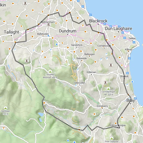
Embark on a challenging road cycling route starting from Bray. This 58km loop will take you on a journey through picturesque landscapes and historic sites. Brace yourself for a total ascent of 636m as you ride through Sugarlump and Montpelier Hill. The highlight of this route is undoubtedly the Glencree German War Cemetery, located at the 18km mark. Delve into its solemn atmosphere and pay homage to the fallen soldiers. Other notable highlights include Rathgar, Stillorgan, and Cabinteely.
road
58 km
636 m
Tough
Route profile
Highlights on the route
0 km
0 km
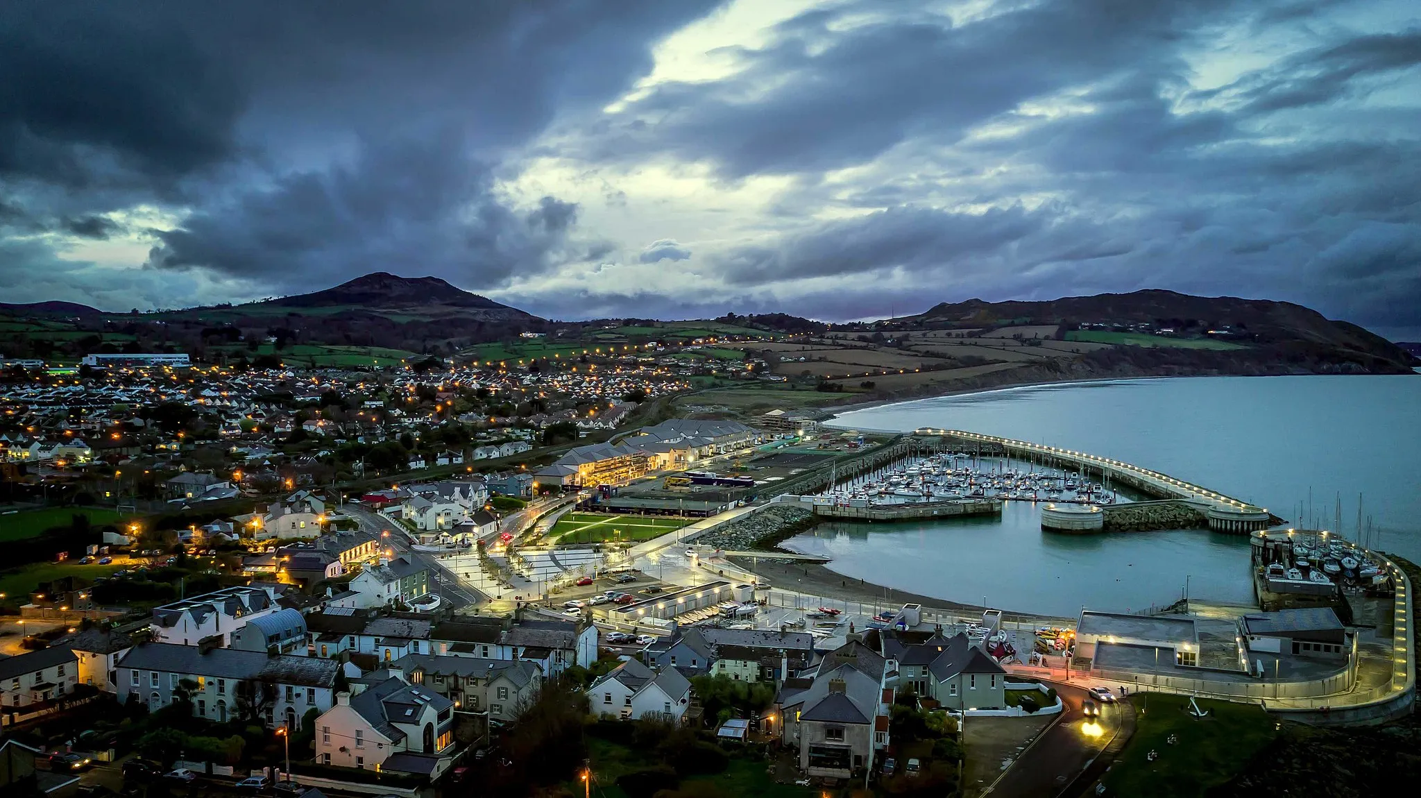
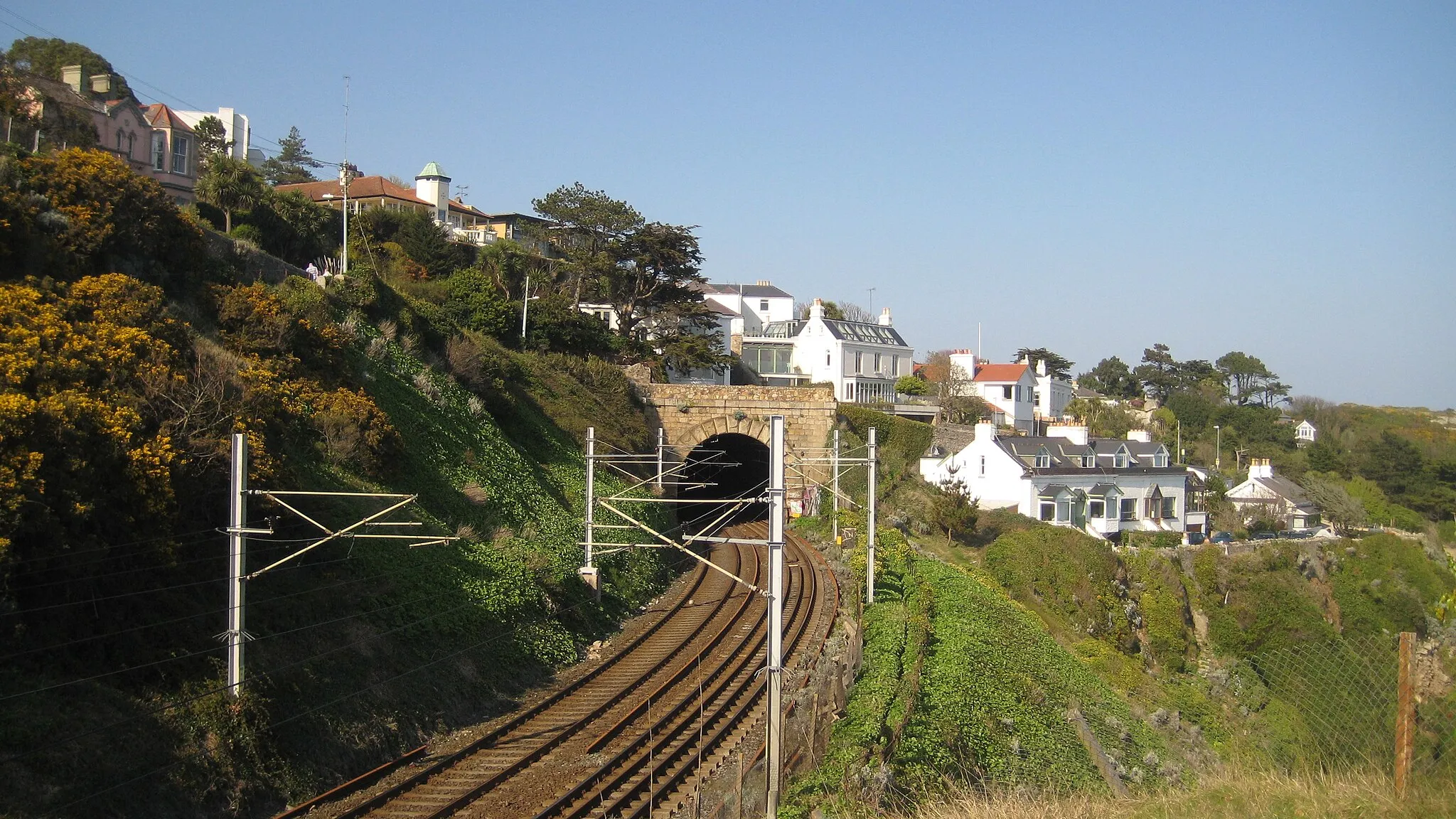
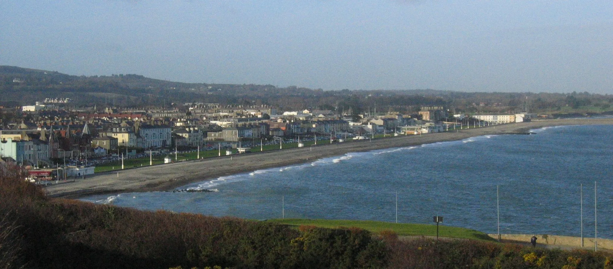
Start: Bray City centerBray: Coastal cycling and epic mountain climbs near vibrant Bray.
Located in the Eastern and Midland region of Ireland, Bray is a vibrant locality with plenty to offer cyclists. Road cyclists can enjoy scenic routes along the coast, with stunning views of the Irish Sea. The locality is also a gateway to the Wicklow Mountains, a famous cycling destination with challenging climbs such as Sally Gap. Gravel cyclists will find numerous paths to explore in the nearby Wicklow Mountains National Park. Bray's lively atmosphere, combined with its proximity to stunning natural landscapes, make it an attractive destination for cyclists of all levels.0 km
0 km
BrayTownBray, the starting point of the route, offers stunning views of the coast.
6 km
6 km
Sugarlump323 mPeakSugarlump provides a challenging climb that rewards you with splendid panoramic vistas.
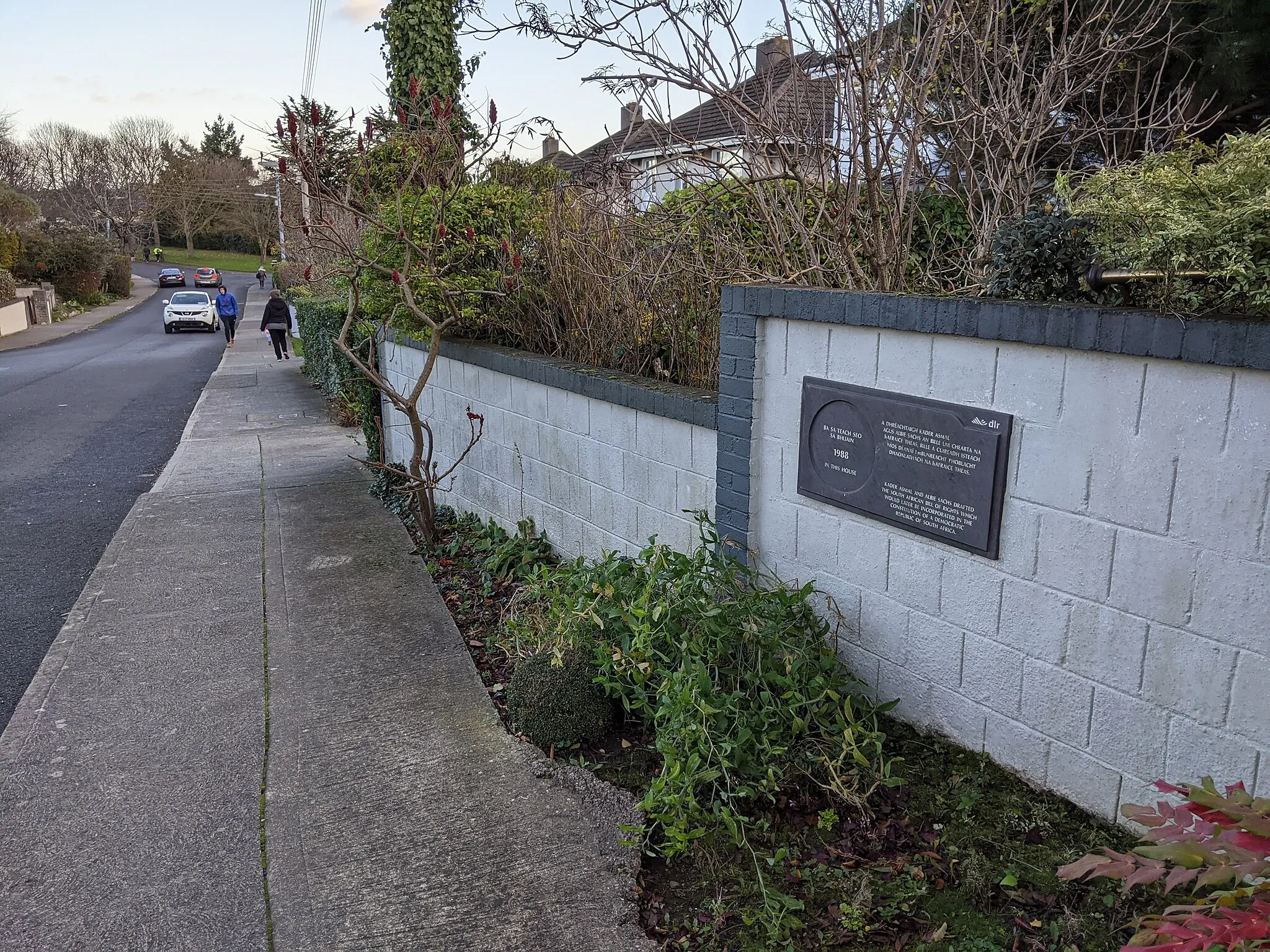
18 km
18 km
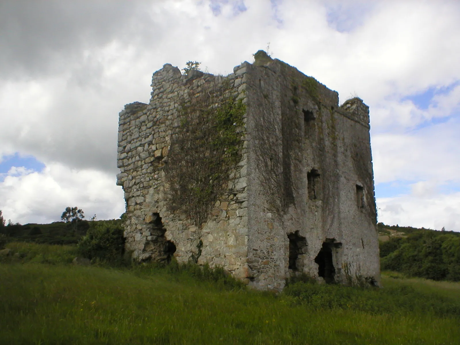
Glencree German War CemeteryAttractionThe Glencree German War Cemetery is a somber reminder of Ireland's connection to World War II.
25 km
25 km
Montpelier Hill383 mPeakMontpelier Hill, also known as the Hell Fire Club, is steeped in myths and folklore.
37 km
37 km
RathgarSub-urbRathgar is a residential suburb boasting elegant period homes and lush green spaces.
45 km
45 km
StillorganSub-urbStillorgan is a bustling town with excellent shopping and dining options.
51 km
51 km
CabinteelySub-urbCabinteely offers a beautiful park and charming village atmosphere.
58 km
58 km
Finish: Bray City centerBray: Coastal cycling and epic mountain climbs near vibrant Bray.
Cycling routes from Bray:
Cycling routes nearby: