Tranquil cycling getaway in the heart of nature's beauty
Cycling routes from Sant'Antonino di Susa
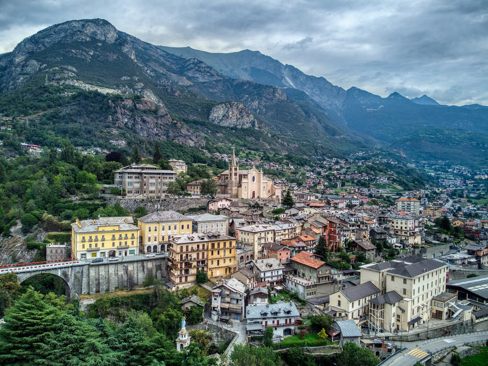
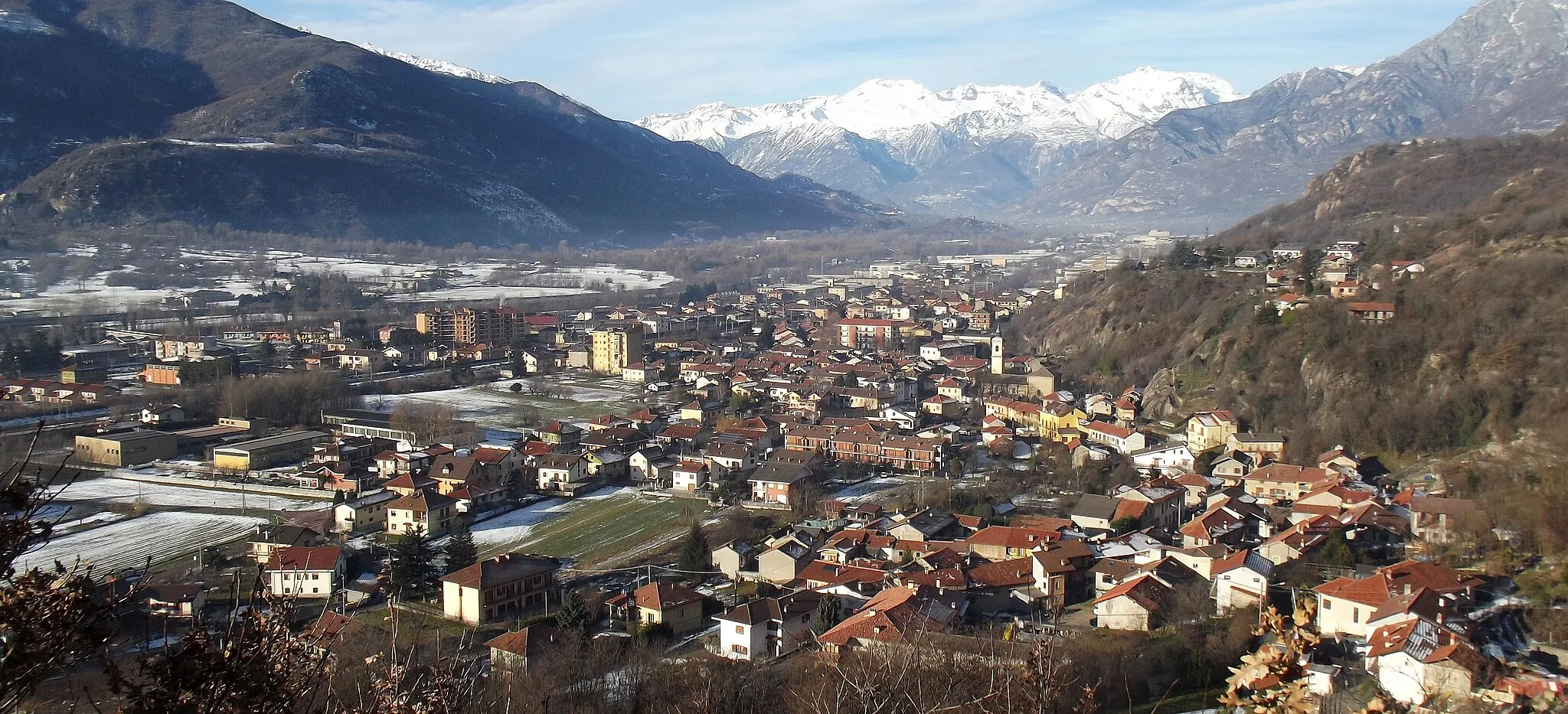
Sant'Antonino di Susa, located in Piemonte, Italy, is a hidden gem for road and gravel cyclists. The locality offers a mix of flat and rolling terrains, making it ideal for cyclists of all levels. Sant'Antonino di Susa is surrounded by beautiful nature, including the Susa Valley, providing cyclists with stunning views as they ride. While there are no famous climbs in the immediate area, the locality's cycling-friendly roads and peaceful atmosphere make it an excellent choice for exploring the region on two wheels.
The Gravel Adventure
Embark on an exciting gravel ride starting near Sant'Antonino di Susa
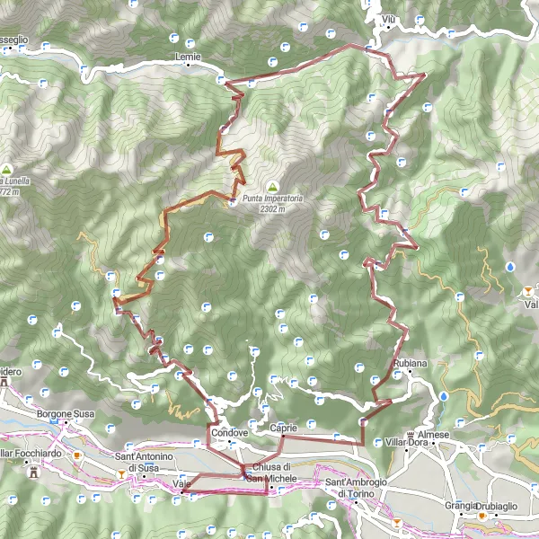
This route is a thrilling gravel adventure that takes cyclists on a 76 km journey with 2702 m of ascent. The challenging terrain adds to the excitement and offers stunning views along the way.
Climb Mount Pirchiriano for stunning views of the Susa Valley.
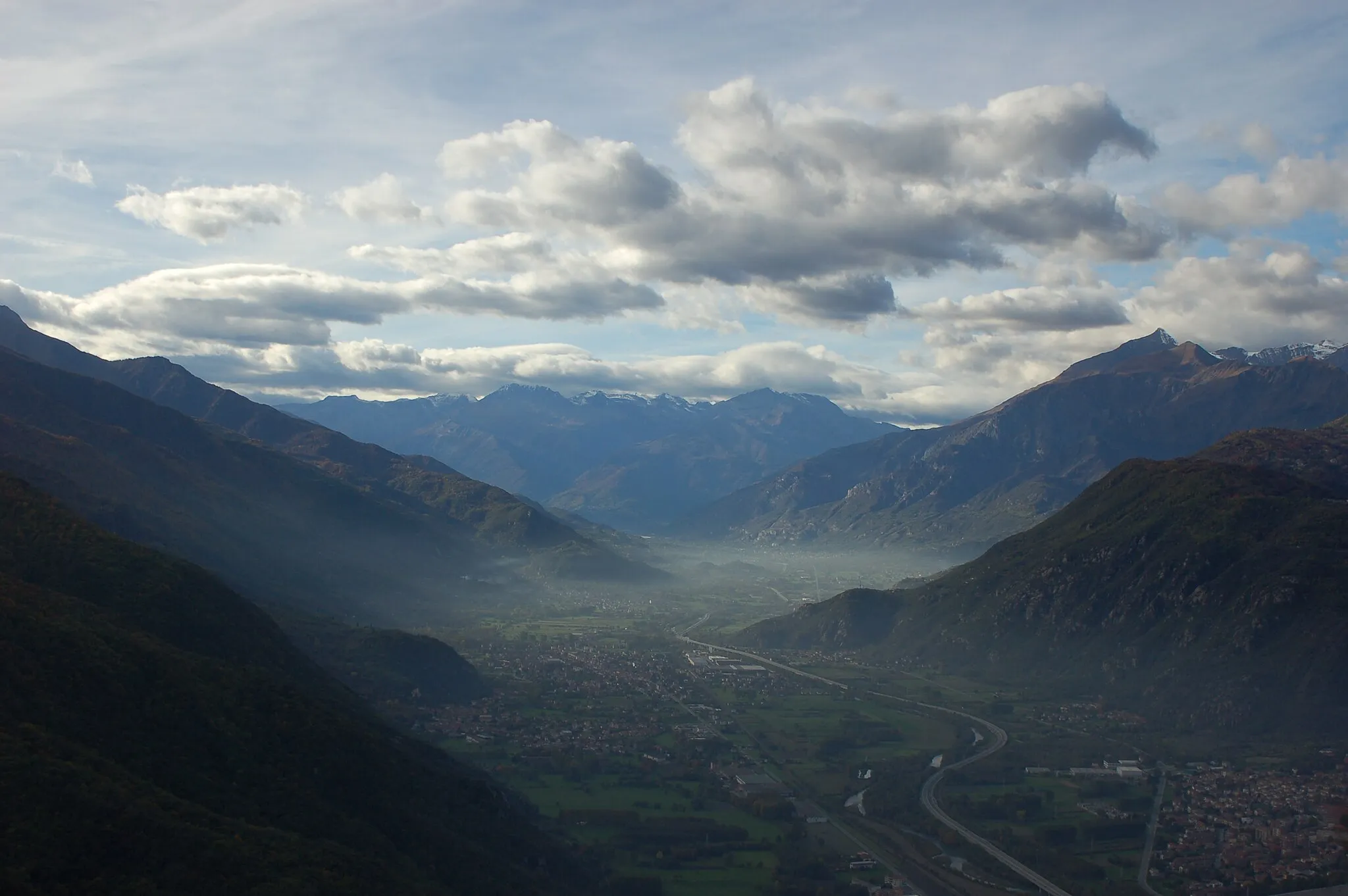
This road cycling route takes you from Sant'Antonino di Susa to Monte Pirchiriano, offering breathtaking views of the Susa Valley along the way. With a total ascent of 1373 meters and a distance of 78 kilometers, this route is moderately difficult. The highlight of the route is the climb up to the summit of Monte Pirchiriano, where you can enjoy panoramic vistas of the surrounding mountains and countryside.
The Scenic Road
Experience the beauty of nature on this breathtaking road cycling route near Sant'Antonino di Susa
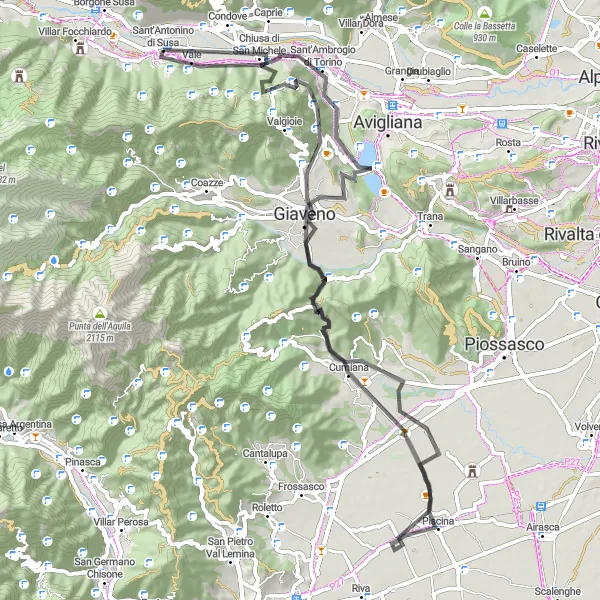
Immerse yourself in the stunning natural beauty of the region on this 112 km road cycling route with 2181 m of ascent. The picturesque landscapes, charming villages, and challenging climbs will make this ride unforgettable.
Gravel Challenge
Embark on a challenging gravel ride near Sant'Antonino di Susa
Get ready for a cycling challenge as you tackle this 124 km gravel route with 2878 m of ascent. The diverse terrain and breathtaking landscapes will keep you engaged throughout the ride.
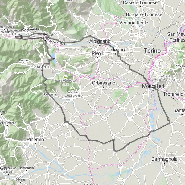
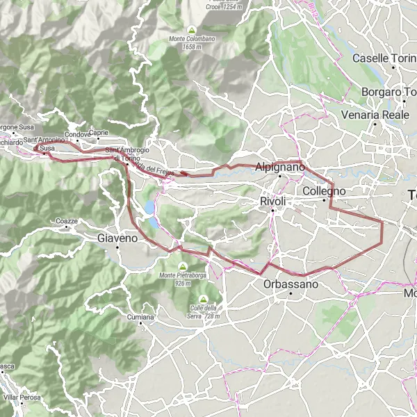
Explore historic towns and conquer mountain passes in this road cycling adventure.
This road cycling route takes you through various historic towns and over challenging mountain passes. With a total ascent of 709 meters and a distance of 122 kilometers, this route is suitable for intermediate cyclists. The highlights of the route include the towns of Condove and Collegno, known for their rich history and charming architecture. You will also conquer the famous Monte Pirchiriano, offering stunning views of the surrounding landscape.
Mountain Gravel Epic
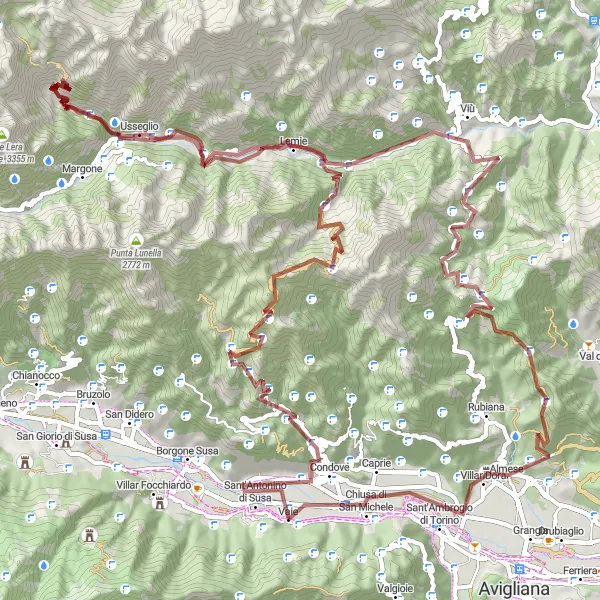
Embark on an epic gravel adventure through challenging mountain terrain in this long-distance cycling route.
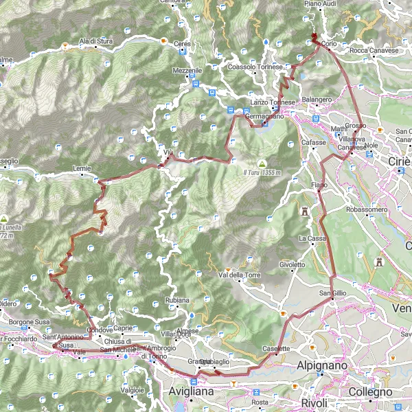
Prepare yourself for an epic gravel adventure through the challenging mountain terrain near Sant'Antonino di Susa. With a total ascent of 4104 meters and a distance of 115 kilometers, this route is recommended for experienced and well-prepared cyclists. Conquer various mountain passes, including Perabrun-a, Colle del Colombardo, and Monte Bassa. Enjoy breathtaking views of the surrounding alpine landscape and test your limits on challenging gravel roads.
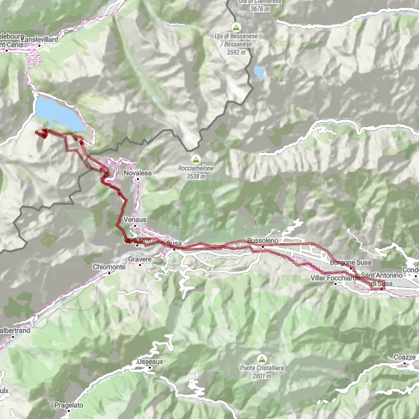
Conquer mountain gravel roads and enjoy stunning alpine views in this challenging gravel cycling route.
This gravel cycling route takes you through the beautiful alpine scenery near Sant'Antonino di Susa. With a total ascent of 2564 meters and a distance of 97 kilometers, this route is recommended for experienced and well-trained cyclists. Get ready to conquer challenging mountain gravel roads and enjoy breathtaking views of Giaglione and Bar Cenisio. The highlight of the route is the climb up to Moncenisio, offering stunning vistas of the surrounding mountains and lakes.
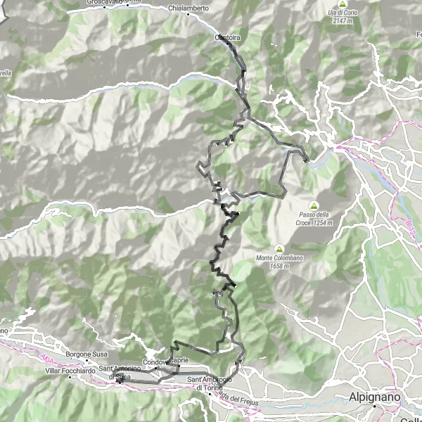
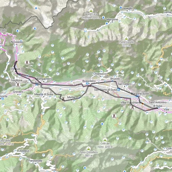
Experience the beauty of nature on this scenic road cycling route near Sant'Antonino di Susa
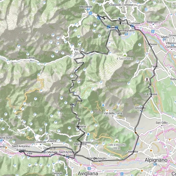
Get ready for a scenic road adventure as you tackle this 139 km route with 3947 m of ascent. The route offers stunning views of the surrounding mountains, charming villages, and picturesque landscapes.
Gravel Delight
Embark on a delightful gravel ride starting near Sant'Antonino di Susa
Enjoy a scenic gravel ride along this 81 km route with 548 m of ascent. The relatively flat terrain allows for leisurely cycling while admiring the picturesque landscapes and charming villages.
Cycle through scenic countryside landscape in this shorter road cycling route.
This road cycling route takes you through the picturesque countryside surrounding Sant'Antonino di Susa. With a total ascent of 703 meters and a distance of 55 kilometers, this route is suitable for cyclists of all levels. Enjoy the peacefulness of the countryside as you pass by charming villages and vineyards. The highlight of the route is the climb up to Punta Cantalupo, offering stunning views of the surrounding hills and valleys.
Cycling routes nearby:
Nearby regions: