Yayvantepe to Öğündük Loop
A road cycling route starting from Yayvantepe
Cycle through Yayvantepe to Öğündük and witness the beauty of the surrounding nature.
Map
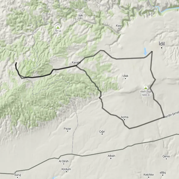
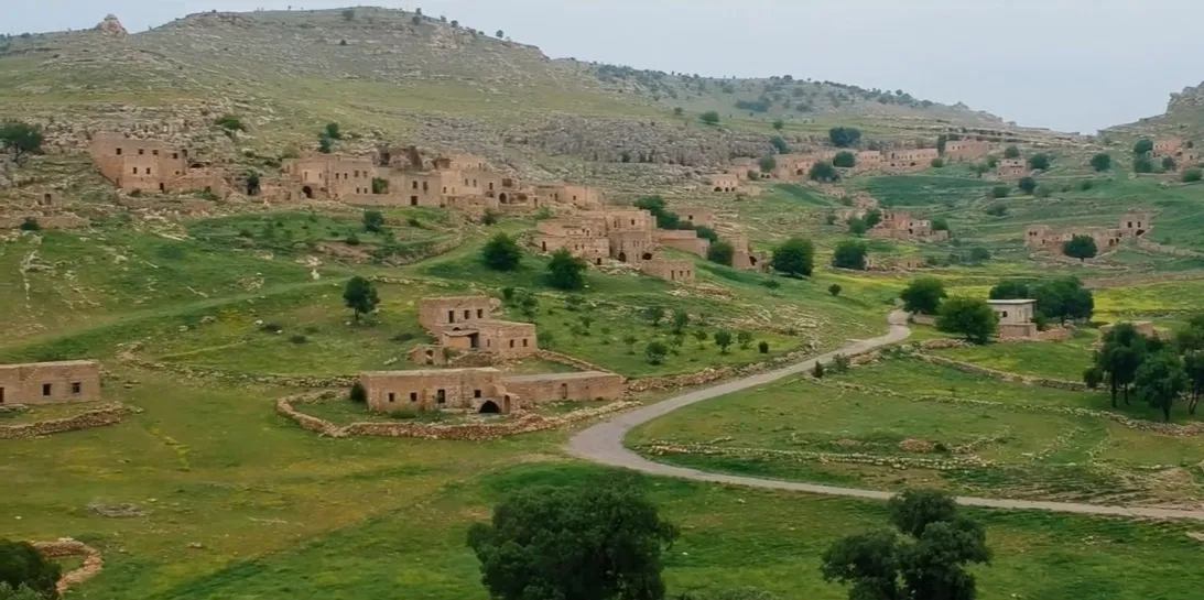
Embark on a scenic cycling journey from Yayvantepe to Öğündük, exploring the picturesque landscape of the region. This moderate route spans 99 kilometers and includes an elevation gain of 802 meters. Experience the charm of rural Turkey as you pedal through quaint villages and breathtaking scenery. With highlights such as Mağaraköy, where you can explore fascinating caves, this route offers a memorable cycling adventure.
road
99 km
802 m
Tough
Route profile
Highlights on the route
0 km
0 km
Start: Yayvantepe Village centerYayvantepe: Discover the mix of flat and hilly routes in Yayvantepe.
Yayvantepe is a locality located in the Mardin, Batman, Şırnak, Siirt region of Turkey. The area offers road and gravel cycling opportunities with a mix of terrain. Cyclists can enjoy both flat sections and hilly climbs. There are several well-known cycling spots nearby, such as the Dara Ruins, an ancient archaeological site that can be visited while cycling through Yayvantepe. Overall, Yayvantepe is a suitable locality for cyclists looking for varied terrain and historical sights.0 km
0 km
YayvantepeVillageYayvantepe is a charming starting point showcasing the beauty of this region.
23 km
23 km
ÖğündükVillageÖğündük is a scenic village that captivates visitors with its tranquil ambiance.
91 km
91 km
MağaraköyVillageDiscover the mesmerizing Mağaraköy caves and delve into their hidden wonders.
99 km
99 km
Finish: Yayvantepe Village centerYayvantepe: Discover the mix of flat and hilly routes in Yayvantepe.
Cycling routes from Yayvantepe:
Yayvantepe to İzbırak Scenic Road Ride Yayvantepe to Mağaraköy Road Cycling Route Yayvantepe to Öğündük Loop Yayvantepe to Dibek Dağı Gravel Adventure Yayvantepe to Anıtlı Road Cycling Route Yayvantepe to Midyat Cultural Discovery Yayvantepe to Mağaraköy Road Cycling Route (Extended) Yayvantepe to Altıntaş Nature Escape Yayvantepe to Elbeğendi Gravel Cycling Route Yayvantepe to Nurlu Road Cycling Route