Cycling through tranquil countryside and exploring charming villages in East Anglia.
Cycling routes from Harleston
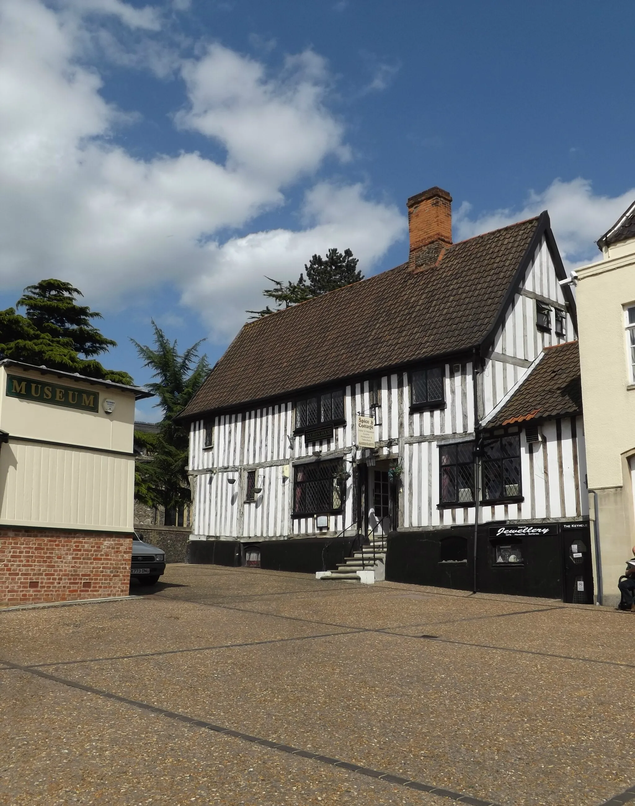
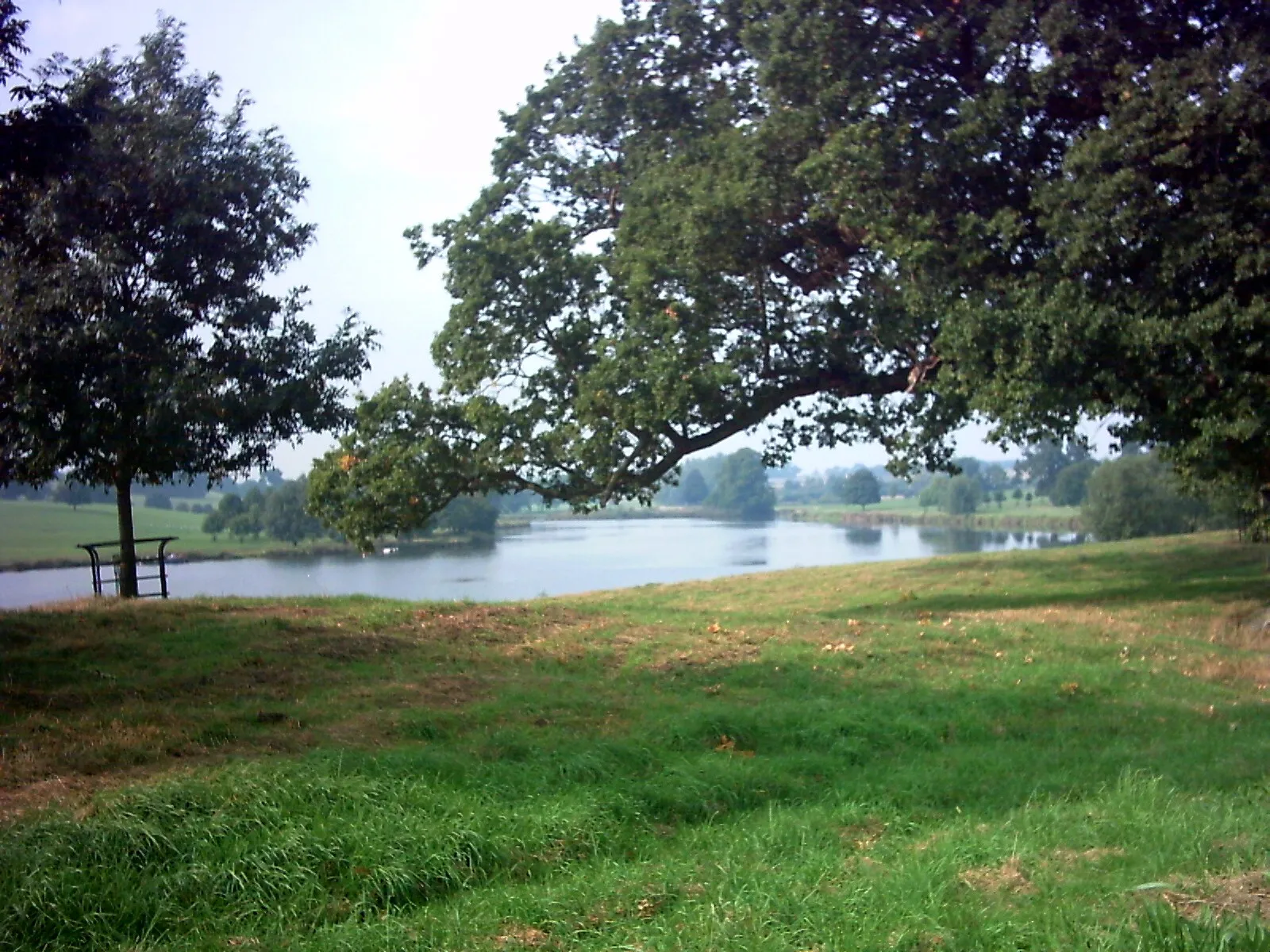
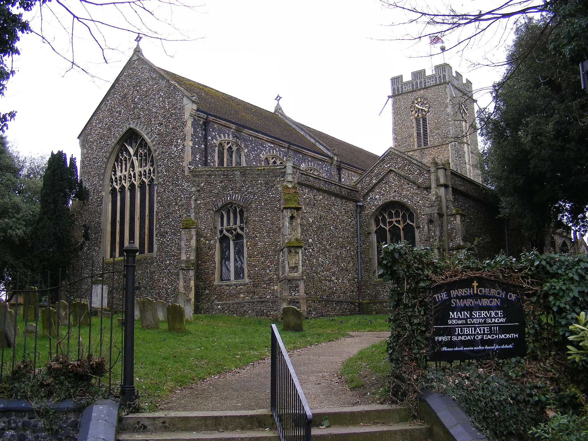
Harleston, located in East Anglia, United Kingdom, provides an enjoyable cycling experience for road and gravel cyclists. Nestled in the picturesque Norfolk countryside, Harleston offers cyclists a peaceful escape with its quiet country lanes and charming villages. The locality is also close to the Waveney Valley, an Area of Outstanding Natural Beauty, offering cyclists scenic routes along the river and through idyllic meadows. Additionally, Harleston is within reach of notable cycling spots in the region, such as the South Norfolk Broads and Waveney Forest. Cyclists visiting Harleston can also explore the town's historic landmarks and enjoy the hospitality of local cafes and pubs. With its tranquil surroundings and access to beautiful natural landscapes, Harleston is an ideal destination for cyclists seeking a peaceful yet rewarding cycling experience.
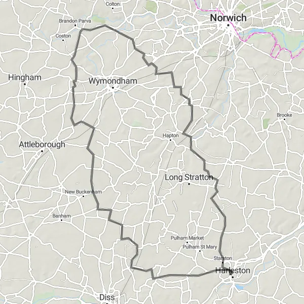
Immerse yourself in the stunning countryside surrounding Harleston on this road cycling route
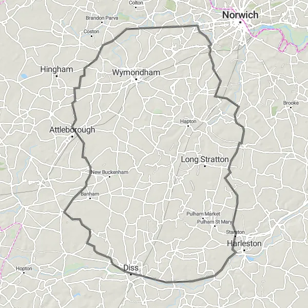
Experience the picturesque landscapes and charming villages as you cycle through the countryside around Harleston. This route offers a great mix of rolling hills, peaceful roads, and beautiful scenery. With a total distance of 94 kilometers and an elevation gain of 406 meters, it provides a moderate challenge suitable for well-trained amateur cyclists. Along the way, you'll encounter highlights such as Diss, Attleborough, Colney, Hempnall, and Starston, each offering their own unique charm and attractions. This route is perfect for those looking to explore the beauty of East Anglia.
Discover the picturesque Suffolk countryside on this scenic cycling route.
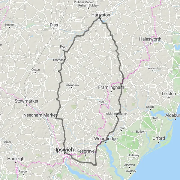
Embark on this circular cycling route that showcases the beauty of the Suffolk countryside. Starting in Harleston, you will ride through Laxfield, Wickham Market, Woodbridge, Ipswich, Henley, Stonham Aspal, Hoxne, and Needham. The route covers a distance of 114 kilometers with an ascent of 536 meters. It is a moderately challenging ride suitable for well-trained amateurs.

Cycle through picturesque East Anglian landscapes on this delightful route.
Embark on a picturesque cycling journey from Harleston to Diss, immersing yourself in the breathtaking landscapes of East Anglia. The 52-kilometer route features an ascent of 150 meters, making it a relatively moderate ride suitable for cyclists of all levels. Enjoy the scenic villages of Bunwell and Pulham St Mary along the way.

Escape the bustle of city life and immerse yourself in East Anglia's serene countryside along this road cycling route.
Leave the hustle and bustle of urban life behind and embark on a journey through East Anglia's tranquil countryside. This road cycling route takes you through expansive green meadows, alongside babbling brooks, and beneath towering oak trees. Enjoy the peace and serenity of the rural landscapes as you pedal through charming villages, offering a taste of idyllic rural life. Experience the warm hospitality of the locals, soak in the spectacular views, and breathe in the fresh country air. A perfect escape for those seeking solace in nature's embrace.
Indulge in a culinary exploration along this road cycling route filled with delicious highlights.
Embark on a gastronomic adventure through picturesque East Anglia. This road cycling route combines scenic landscapes with mouth-watering cuisine, making it a delight for both the cycling enthusiasts and the foodies. From the charming village of Gissing to the historic town of Starston, immerse yourself in the region's rich culinary heritage and discover hidden gems of local cuisine. Pedal through quaint towns and vibrant marketplaces, stopping at artisanal bakeries, traditional pubs, and quaint tearooms to sample homemade treats and signature dishes.

Explore the scenic countryside from Harleston to Little Whittingham Green
This delightful round-trip cycling route takes you through the charming countryside of East Anglia. Starting from Harleston, you'll pedal along peaceful roads and gravel paths, enjoying the beautiful landscapes along the way. The route offers a moderate level of challenge, making it suitable for well-trained amateur cyclists. With a total distance of 44 kilometers and an ascent of 115 meters, it's a perfect day trip for cycling enthusiasts.
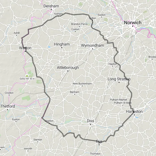
Embark on an unforgettable road cycling adventure through the heart of East Anglia starting from Harleston
Experience the diverse landscapes and rich history of East Anglia on this road cycling route that spans 131 kilometers, with an elevation gain of 469 meters. This challenging route is best suited for well-trained amateur cyclists seeking a thrilling and rewarding adventure. Along the way, you'll encounter highlights such as Eye, Hinderclay, East Harling, Watton, Wramplingham, Tasburgh, and Starston. From the medieval castle in Eye to the scenic beauty of Starston, each highlight offers its own unique flavor of East Anglia's charm. This route showcases the best of what this region has to offer.
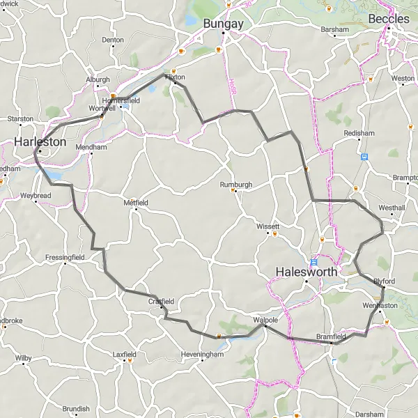
Experience the peaceful countryside and quaint villages on this lovely cycling route.
Enjoy a scenic cycling route from Harleston to Wortwell, taking in the peaceful countryside and charming villages of East Anglia. The 58-kilometer loop has an ascent of 191 meters, making it a relatively easy ride suitable for cyclists of all levels. Explore delightful destinations such as St. Margaret, Ilketshall, Thorington, Walpole, Cratfield, and Harleston.
Harleston to Botesdale Loop
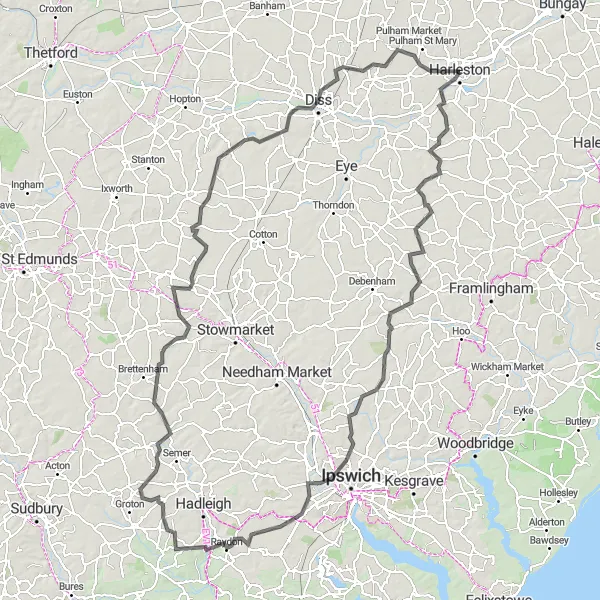
Cycle through the beautiful countryside and picturesque villages of East Anglia.
This round-trip cycling route takes you through the scenic countryside and charming villages of East Anglia. Starting in Harleston, you will ride through Needham, Bedfield, Ashbocking, Washbrook, Shelley, Bildeston, Wetherden, Botesdale, Palgrave, and Starston. The route covers a distance of 148 kilometers with an ascent of 623 meters. It is a moderately challenging ride suitable for well-trained amateurs.
Explore the scenic landscapes and charming villages of South Norfolk on this cycling route.
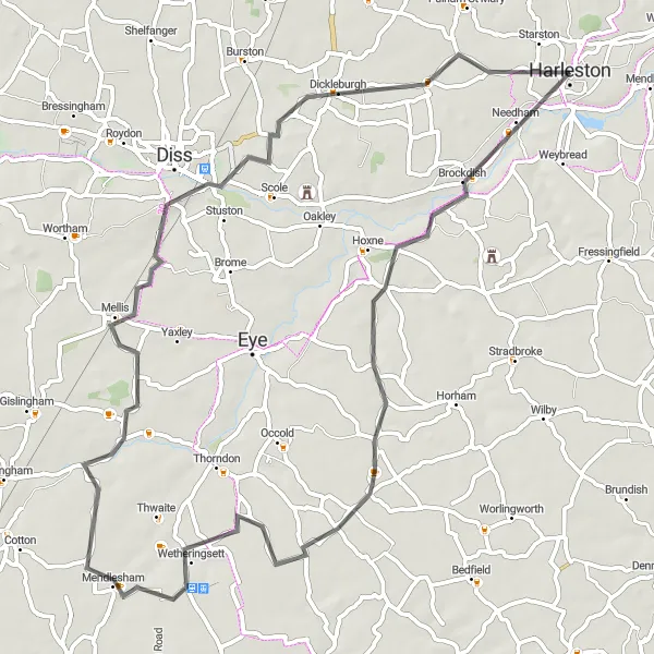
Take in the beauty of the South Norfolk countryside on this delightful cycling loop from Harleston to Brockdish. The 64-kilometer route features an ascent of 192 meters, offering a moderate challenge for cyclists with some experience. Enjoy the picturesque villages of Redlingfield, Mendlesham, Palgrave, and Starston along the way.
Cycling routes nearby:
Nearby regions: