Tranquil cycling in the heart of East Anglia
Cycling routes from West Walton
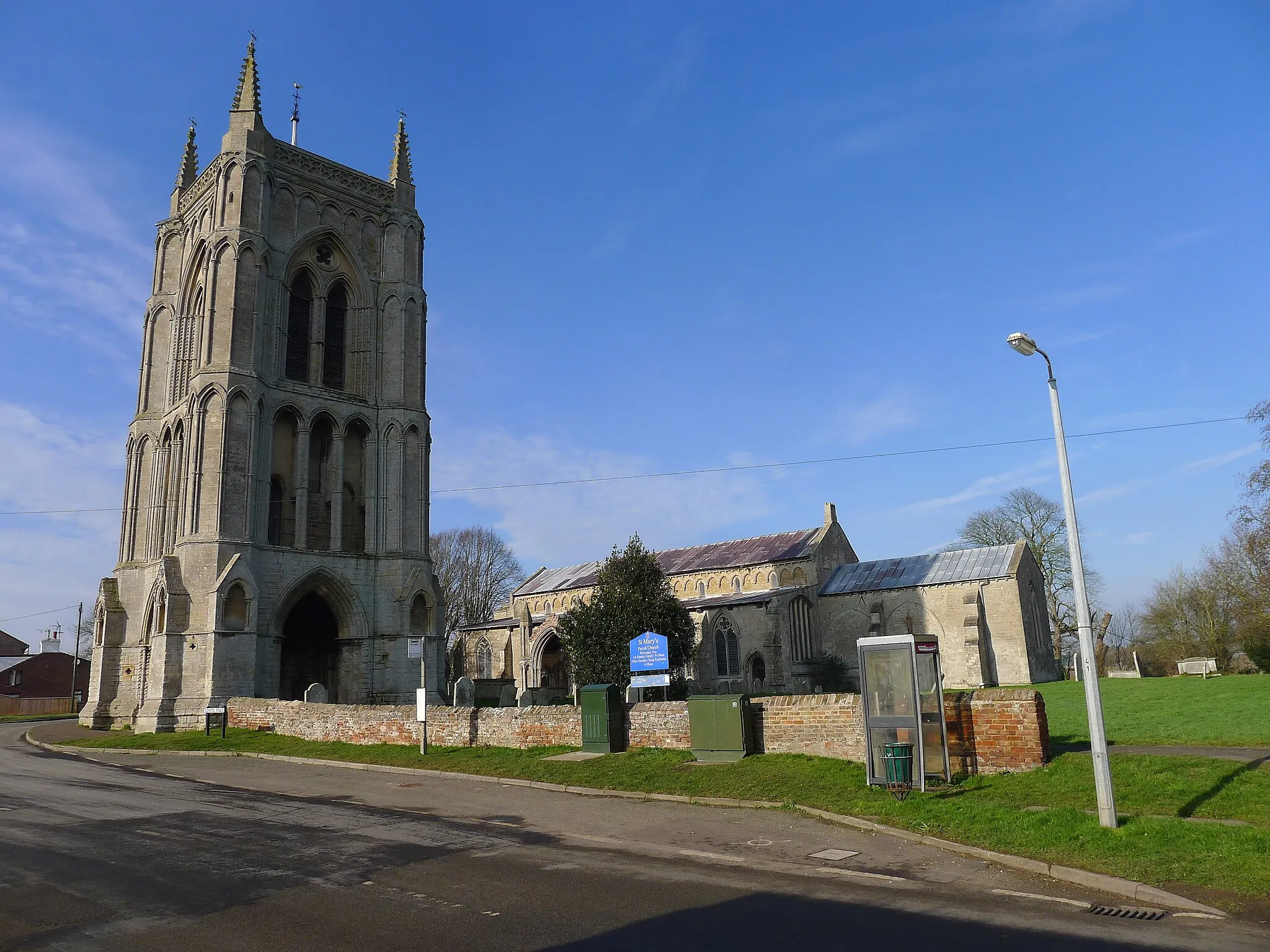
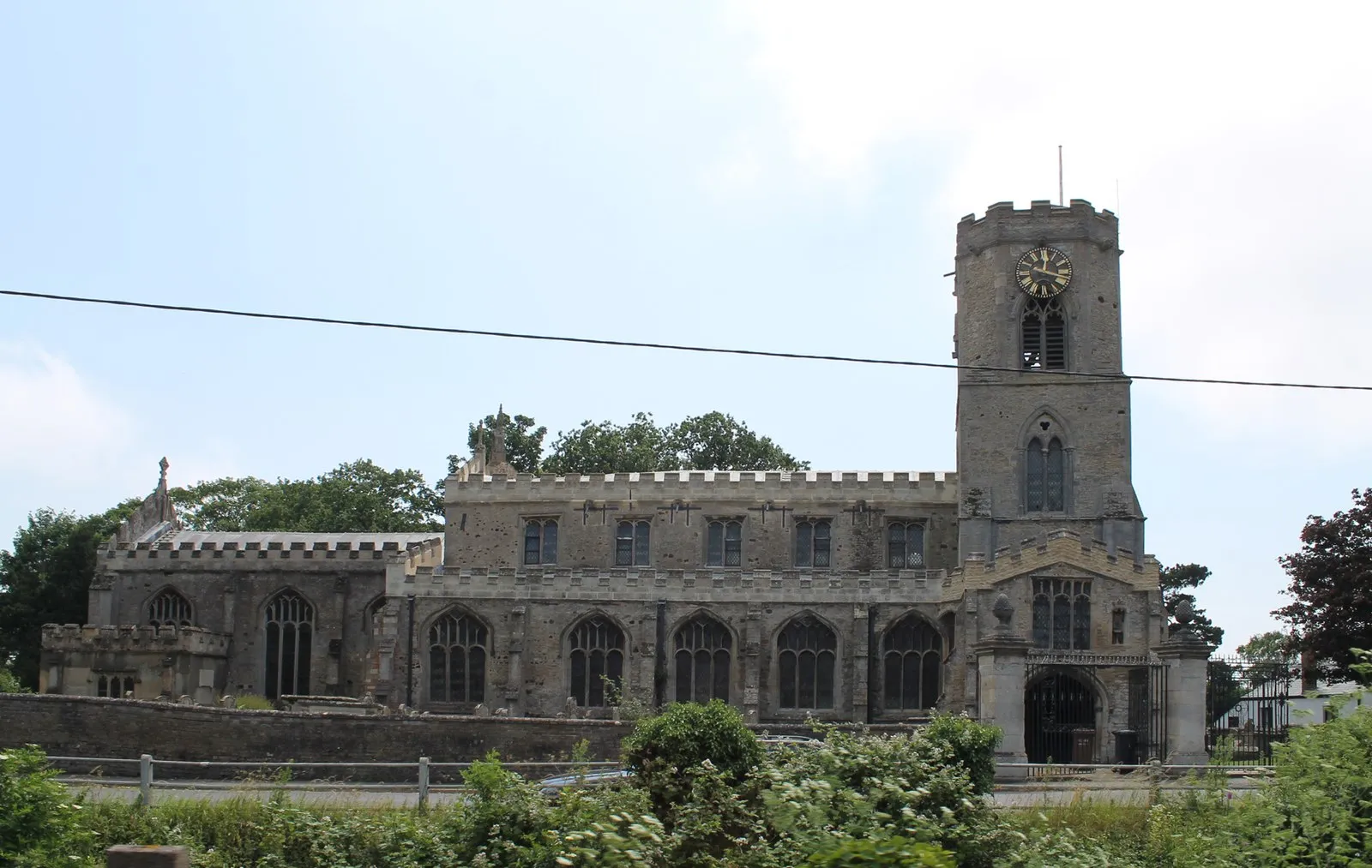
West Walton, located in East Anglia, United Kingdom, offers a peaceful and scenic cycling experience for road and gravel cyclists. The area is characterized by its rolling countryside, peaceful villages, and charming rural roads. Cyclists can enjoy leisurely rides through the idyllic landscape, with plenty of opportunities to explore the surrounding nature reserves and historic sites. Although West Walton may not offer any famous cycling spots or well-known climbs, its tranquil atmosphere and scenic beauty make it a delightful destination for cyclists seeking a serene riding experience.
Benwick Bypass

Cycle through picturesque Fenland villages and enjoy the serene surroundings.
This route takes you through the beautiful Fenland countryside, with its endless flat landscapes and charming villages. The terrain is mostly flat, making it ideal for cyclists of all levels. As you cycle through Elm, March, Doddington, Benwick, Ring's End, and Gorefield, you'll be treated to stunning views of open fields and peaceful waterways. The route covers a distance of 83km with a total ascent of 25m, making it a relatively easy and enjoyable ride.
Fenland Gravel

Embark on an off-road adventure through the rugged Fenland countryside.
Get off the beaten path and discover the rugged beauty of the Fenland countryside on the Fenland Gravel route. This 47km gravel trail is perfect for off-road enthusiasts looking for a thrilling cycling experience. Starting in West Walton, you'll venture through Wiggenhall St Mary Magdalen, Nordelph, Outwell, and Elm. The route is relatively flat, but the gravel terrain adds an extra challenge to your ride. Immerse yourself in the untamed landscapes of the Fens and enjoy the freedom of cycling through unspoiled nature.

Cycle through the picturesque landscapes of East Anglia on this gravel adventure starting in West Walton.
Discover the beauty of East Anglia on this gravel adventure through the stunning landscapes of Wisbech, Ring's End, Eastrea, Guyhirn, and The Boat House. With a relatively low ascent of 12 meters and a distance of 63 kilometers, this route is suitable for all skill levels. Explore the charming town of Wisbech and enjoy the peacefulness of the local countryside.
Guyhirn Gravel Explorer
Embark on a gravel adventure starting in West Walton and explore the beautiful surroundings of Guyhirn.
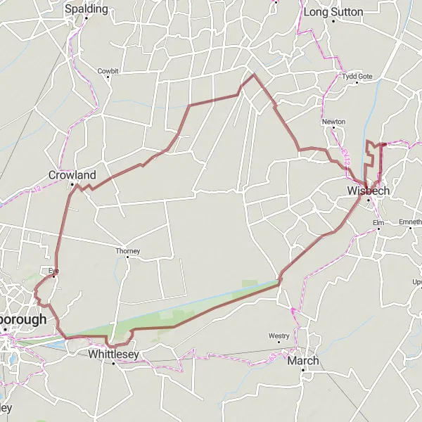
Get off the beaten path and discover the beauty of Guyhirn and its surroundings on this gravel cycling adventure. With an ascent of 29 meters and a distance of 85 kilometers, this route offers a mix of scenic countryside and charming villages. Explore highlights such as Guyhirn, Whittlesey, Eye Green, Shepeau Stow, and Leverington. Enjoy the tranquility of the rural landscapes and experience the hidden gems of this lesser-known area of East Anglia.
Explore the charming villages around Wisbech on this road cycling tour starting in West Walton.
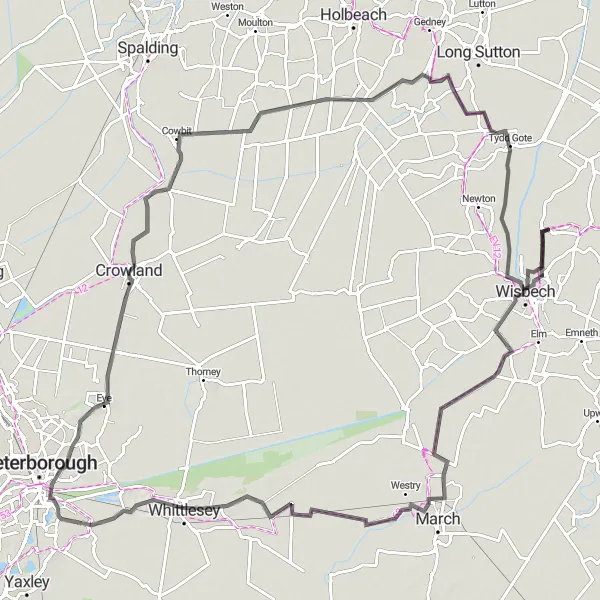
Immerse yourself in the beauty of the surrounding villages of Wisbech on this road cycling tour. With an ascent of 39 meters and a distance of 107 kilometers, this route offers a mix of picturesque countryside and charming villages. Explore attractions in Wisbech, Westry, Coates, Eye Green, Moulton Chapel, and The Boat House. Enjoy the peacefulness of the rural landscape and discover the hidden gems of these smaller villages.
Embark on a road cycling adventure starting in West Walton and explore the picturesque surroundings.
Experience the beauty of West Walton and its surroundings on this road cycling tour. With an ascent of 147 meters and a distance of 77 kilometers, this route is suitable for experienced cyclists. Explore the charming village of West Walton before venturing towards Walpole St Andrew, Wiggenhall St Germans, Barton Bendish, Ryston, and Walton Highway. Enjoy the stunning countryside views and immerse yourself in the tranquility of the rural landscape.
Fenland Flare
Embark on an epic cycling adventure through the flatlands of the Fenland region.
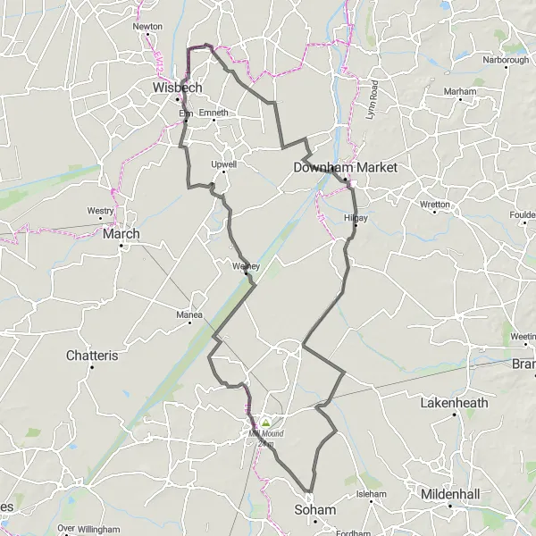
The Fenland Flare route offers a challenging yet rewarding cycling experience. With a distance of 109km and an ascent of 160m, this route is best suited for experienced cyclists. Starting in West Walton, you'll pass through Marshland St James, Hilgay, Prickwillow, Little Downham, Welney, and Elm. As you navigate the flatlands and winding country lanes, you'll be captivated by the beauty of the Fenland scenery. From expansive fields to serene waterways, this route showcases the best of East Anglia's natural landscapes.

Immerse yourself in the idyllic Fenland landscapes on this leisurely cycling route.
Experience the beauty of the Fenland region on the Fenland Explorer route. This 47km route is suitable for cyclists of all levels, with its gentle terrain and scenic countryside views. Starting in West Walton, you'll pass through Walpole Highway, Nordelph, Outwell, and Walsoken. Along the way, you'll encounter charming villages, historic churches, and peaceful waterways. The route offers a leisurely cycling experience, allowing you to fully appreciate the tranquility and natural beauty of the Fenland landscapes.
Embark on a road adventure from West Walton and explore the marshes of East Anglia.
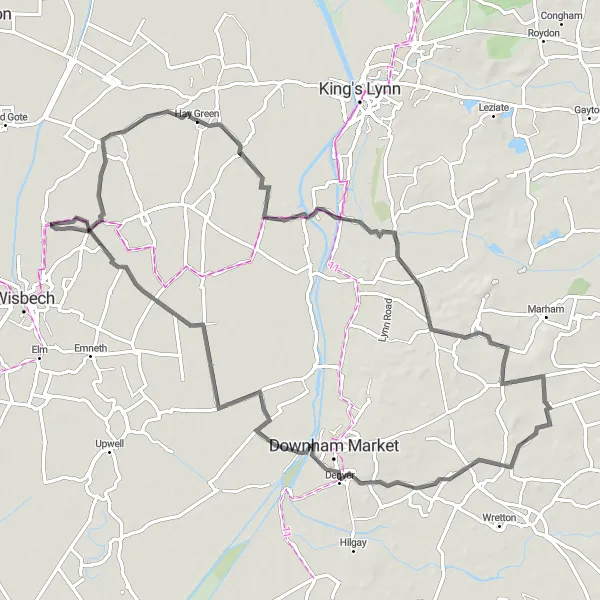
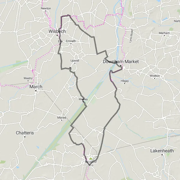
Discover the unique beauty of East Anglia's marshland areas on this road cycling adventure starting in West Walton. With an ascent of 113 meters and a distance of 99 kilometers, this challenging route is ideal for experienced cyclists. Explore Marshland St James, Mill Mound, Oliver Cromwell's House, Welney, and Elm. Cycle through the marshland areas and witness the unique flora and fauna while enjoying views of the vast landscape.
Take on the ultimate cycling challenge and conquer the Fenland region's toughest gravel routes.
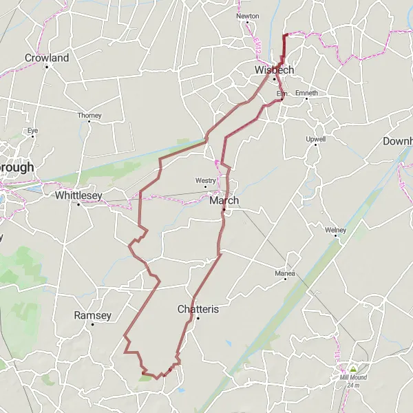
Prepare for an epic adventure through the challenging terrain of the Fenland region. The Fenland Challenge route covers a distance of 93km with an ascent of 61m, making it suitable for experienced gravel cyclists seeking a thrill. Starting in Elm, you'll pass through March, Chatteris, Benwick, Guyhirn, and Wisbech. This route offers a mix of gravel trails, country lanes, and picturesque villages, providing a diverse and exciting cycling experience. Be prepared for tough climbs, fast descents, and breathtaking views of the Fenland landscapes.
Cycling routes nearby:


Nearby regions: