Cycle through the stunning landscapes of Stainforth, South Yorkshire
Cycling routes from Stainforth
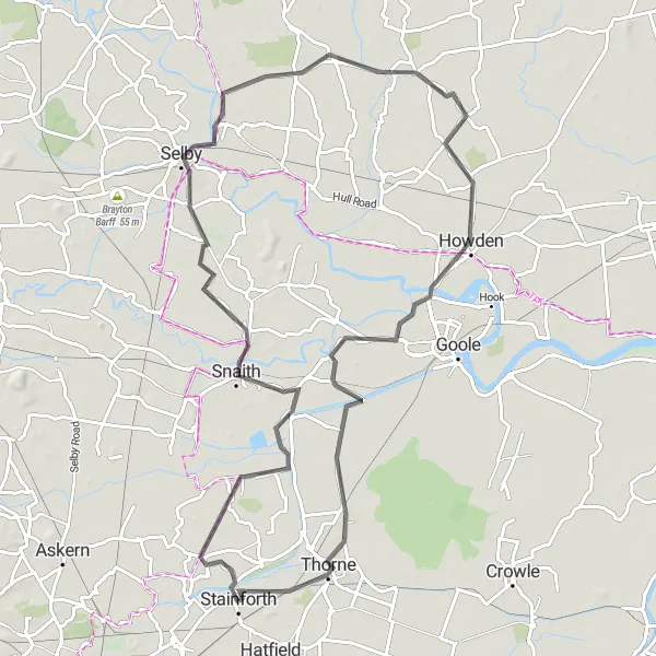
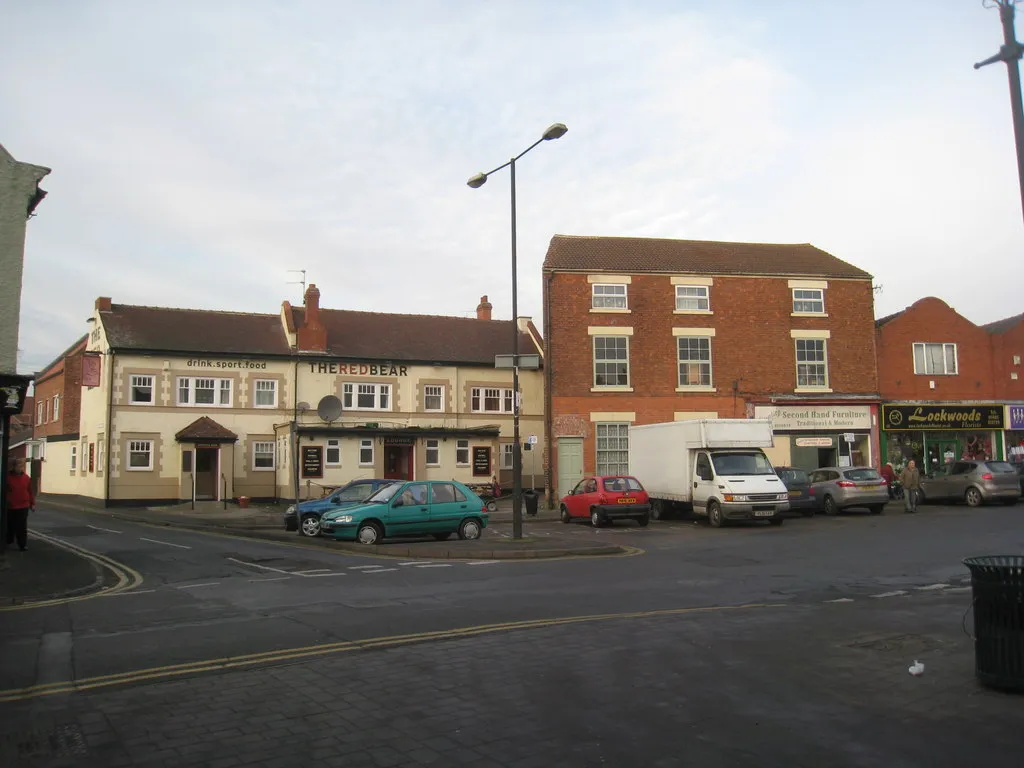
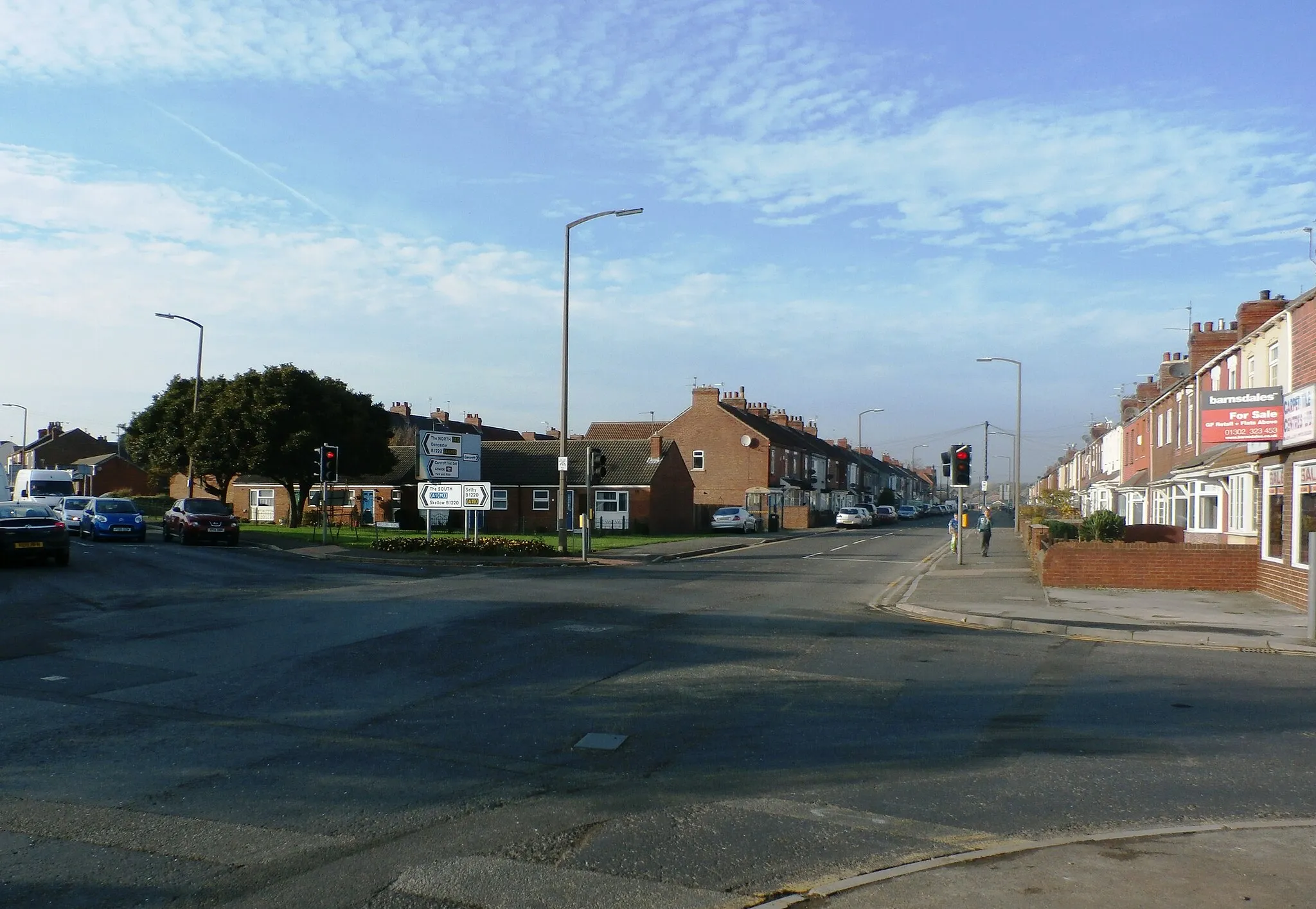
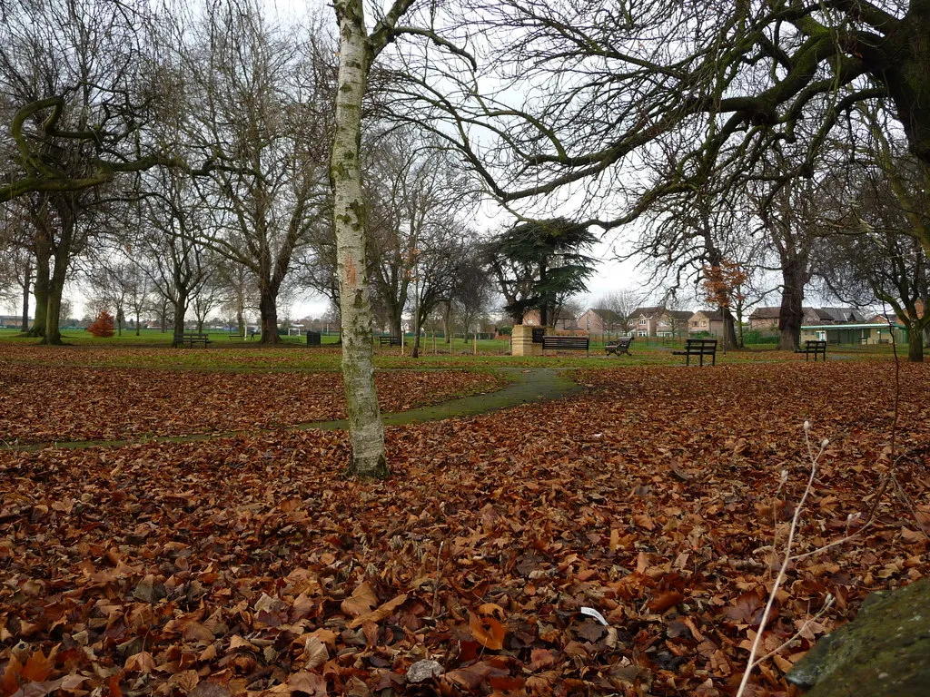
Stainforth, located in South Yorkshire, United Kingdom, offers a mix of road and gravel cycling routes with varying levels of difficulty. Cyclists can explore the picturesque countryside, enjoying the scenic views and peaceful atmosphere. Notable cycling spots near Stainforth include Thorne Moors and Old Moor Nature Reserve, presenting diverse landscapes and opportunities for wildlife spotting. With its combination of accessible routes and natural beauty, Stainforth is a great destination for cyclists seeking both enjoyable rides and a connection with nature.
Challenge Ride to Stainforth
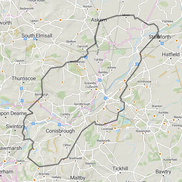
Take on the challenge of a ride to Stainforth
This challenging road route to Stainforth covers a total distance of 71 km with an elevation gain of 355 meters. Recommended for experienced cyclists, this route features highlights like Barnby Dun, Old Edlington, Barnburgh, Askern, and Stainforth.

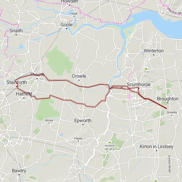
A thrilling gravel ride through diverse landscapes
The Gravel Adventure combines challenging gravel roads with diverse landscapes, offering a thrilling experience for cyclists. With moderate difficulty and an ascent of 383 meters, this route is suitable for well-trained amateurs seeking a more adventurous cycling experience. Covering a distance of 65 km, this route provides cyclists with picturesque scenery and an opportunity to admire the area's natural beauty. The epicness level is high, as the route passes through unique and scenic locations.
The Countryside Escape
Immerse yourself in the beauty of South Yorkshire's countryside
The Countryside Escape takes you on a scenic journey through South Yorkshire's picturesque countryside. With a moderate difficulty level and an ascent of 175 meters, this gravel route provides a refreshing escape for amateur cyclists. Covering a distance of 78 km, it offers a mix of panoramas, rural landscapes, and charming villages along the way. The epicness of this route is moderate, with opportunities to explore the tranquil countryside.
The Stainforth Explorer
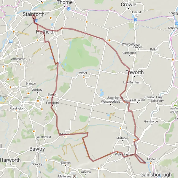
Cycling adventure through quaint villages and scenic landscapes
The Stainforth Explorer takes you on a journey through picturesque villages and scenic landscapes, offering a mix of gravel roads and beautiful countryside. With a moderate difficulty level, this route is perfect for amateur cyclists looking for an enjoyable cycling experience. It covers a distance of 71 km with an ascent of 61 meters, making it a relatively easy but refreshing ride. The epicness level is moderate, offering pleasant views and charming highlights along the way.
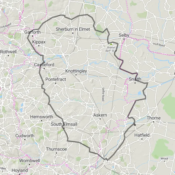
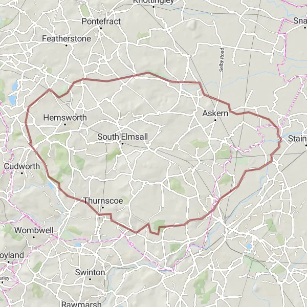
Embark on a challenging road ride starting from Stainforth
This demanding road route starting near Stainforth covers a distance of 118 km and has an ascent of 442 meters. With its high difficulty level, this route is recommended for experienced cyclists. Along the way, you'll discover highlights like Doncaster, South Elmsall, Castleford, Garforth, Church Fenton, Thorpe Willoughby, Brayton Barff, Snaith, and Stainforth.
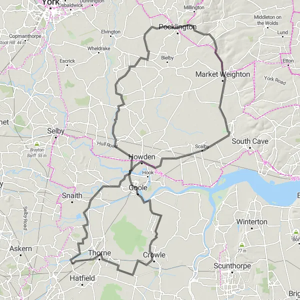
Embark on a scenic road journey starting from Stainforth
This road route starting near Stainforth covers a distance of 137 km and has an ascent of 269 meters. With a moderate difficulty level, this route is suitable for experienced amateurs. The highlights along this route include Fishlake, Airmyn, Ellerton, Market Weighton, North Cave, Goole, Crowle, and Thorne.
A thrilling climb through scenic landscapes
The Hill Challenge is a gravel route that takes you on a thrilling journey through scenic landscapes with challenging climbs. With a moderate to difficult difficulty level and an ascent of 417 meters, this route is ideal for well-trained cyclists seeking a challenging adventure. Covering a distance of 67 km, the route offers picturesque views and rewarding climbs, making it a favorite among cycling enthusiasts. The epicness level is high, featuring some of the region's most impressive natural landmarks.
Scenic Road Trip to Stainforth
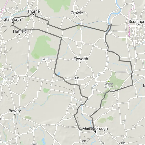
Embark on a scenic road trip to Stainforth
Discover the beauty of Stainforth on this 97 km road route. With an ascent of 66 meters, this route is suitable for amateur cyclists. Along the way, you'll come across highlights like Thorne, Burringham, Scotter, Gainsborough, Haxey, and Stainforth.
Stainforth Gravel Route

Explore the scenic beauty of Stainforth on a gravel route
This gravel route starting from Stainforth takes you through picturesque landscapes with a total distance of 37 km and an ascent of 13 meters. Its relatively low difficulty level makes it suitable for amateurs. The route offers a unique opportunity to visit highlights like Thorne Moor Viewing Tower, Crowle, and Hatfield Woodhouse.
Selby Adventure
Discover the charming town of Selby and its surrounding countryside
The Selby Adventure takes you on a delightful road cycling journey through the charming town of Selby and its scenic countryside. With a relatively easy difficulty level and an ascent of 34 meters, this road route is perfect for amateur cyclists looking for an enjoyable experience. The 82 km distance allows riders to immerse themselves in the beauty of the region and appreciate the peacefulness of the countryside. The epicness level is moderate, offering pleasant landscapes and interesting highlights along the way.
Cycling routes nearby:


Nearby regions: