Exploring the historical attractions of Canteleu
Cycling routes from Canteleu
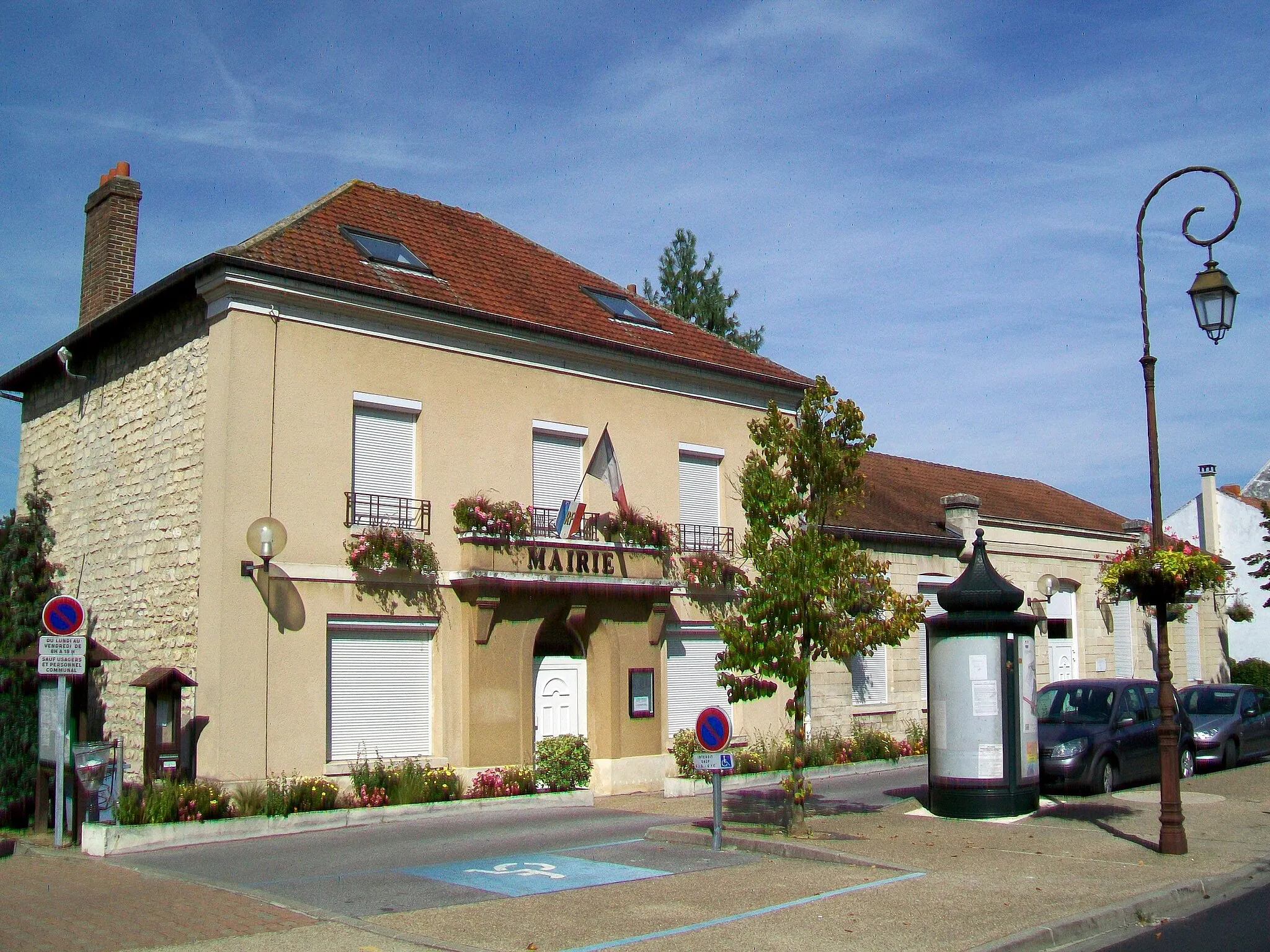
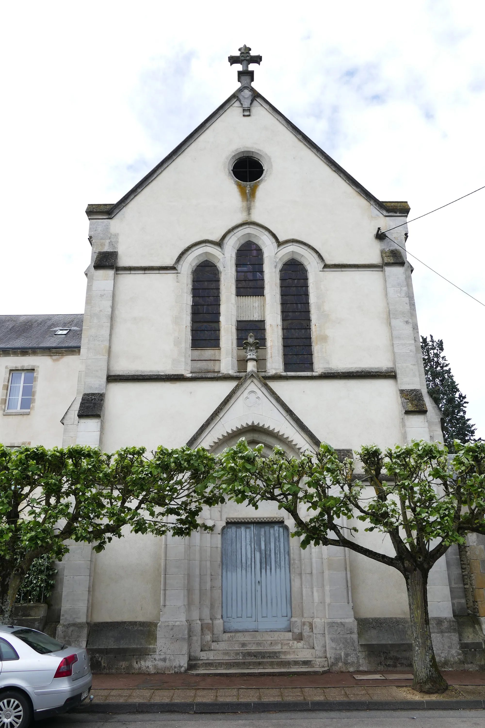
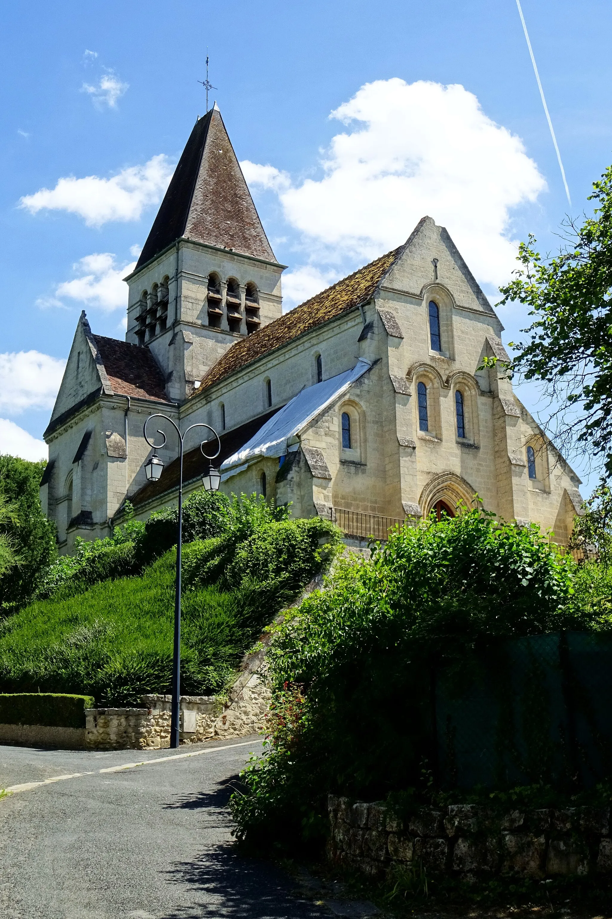
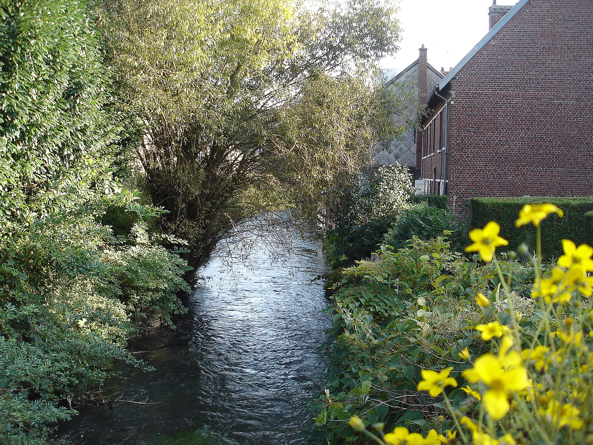
Canteleu is a town located in the region of Haute-Normandie, France. When it comes to cycling, Canteleu may not be the most thrilling destination. The terrain around Canteleu is mostly flat, with limited opportunities for challenging climbs or off-road cycling. However, the town itself has some interesting historical attractions, such as the Church of Saint-Martin and the Château de Canteleu. Canteleu also provides easy access to the city of Rouen, which offers more cycling opportunities and cultural experiences. While not a top cycling spot, Canteleu can still offer cyclists a pleasant base for exploring the region.
Discover the rural charm of Haute-Normandie on this gravel cycling route.
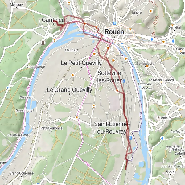
This 32-kilometer gravel cycling route starting from Canteleu takes you through the picturesque countryside of Haute-Normandie. With an ascent of 179 meters, this route offers a moderate level of difficulty suitable for gravel enthusiasts. The highlight of this route is the panoramic view of Rouen, which you can enjoy at the 29-kilometer mark. With a difficulty level of 2 and an epicness rating of 2, this route promises a delightful gravel adventure. Other highlights along the way include the charming town of Sotteville-lès-Rouen and the beautiful panorama of Mont-Saint-Aignan. Immerse yourself in the peaceful ambiance and tranquility of rural Haute-Normandie as you pedal through this scenic delight.
Seine Valley Scenic Tour
Embark on a scenic road journey along the Seine Valley.
This 95-kilometer road cycling route starting from Canteleu takes you on a scenic tour along the picturesque Seine Valley. With a cumulative ascent of 685 meters, this route offers a moderate level of difficulty suitable for well-trained amateur cyclists. The highlight of the route is the quaint village of Croisset, located at the 7-kilometer mark, famous for being the home of French author Gustave Flaubert. With an epicness rating of 3, this route promises stunning landscapes and cultural discoveries. Other highlights along the way include the charming village of Val-de-la-Haye and the historical town of Duclair. Immerse yourself in the beauty of the Seine Valley as you ride through this enchanting journey.
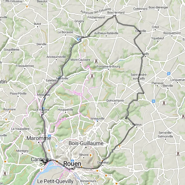
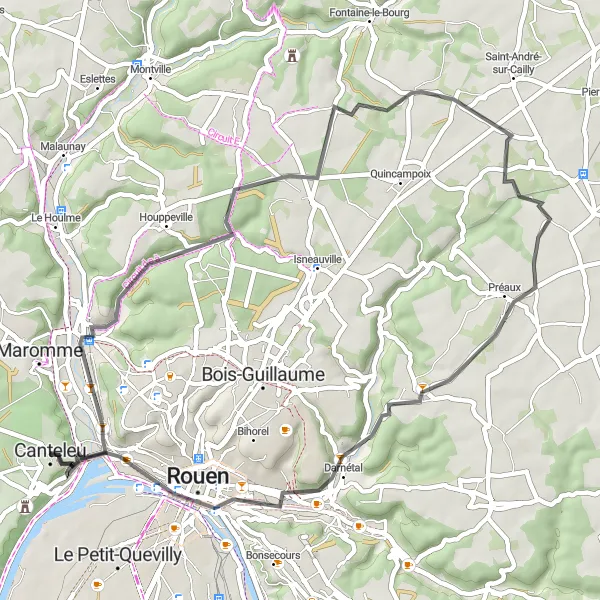
Embark on an adventurous ride from Canteleu to Panorama de Mont-Saint-Aignan, taking in panoramic views along the way.
This road cycling route starts in Canteleu and leads you through Déville-lès-Rouen, Clères, Saint-André-sur-Cailly, Darnétal, and Panorama de Mont-Saint-Aignan. With a total distance of 67 kilometers and an ascent of 588 meters, this route offers a moderate challenge for well-trained amateur cyclists. The highlights of this route include the scenic town of Déville-lès-Rouen, the charming village of Clères with its beautiful gardens and wildlife park, and the panoramic views from Panorama de Mont-Saint-Aignan. With a difficulty level of 3 and an epicness rating of 4, this cycling route provides an exciting and memorable experience.
Rouen Explorer
Embark on a scenic road journey from Canteleu to Rouen.
This 105-kilometer road cycling route starting from Canteleu takes you on a fascinating journey through the region's most iconic attractions. With a cumulative ascent of 909 meters, this route offers a moderate level of difficulty suitable for well-trained amateur cyclists. The highlight of the route is the Table d'orientation de la cote des deux amants, located at the 31-kilometer mark, offering breathtaking views over the Seine Valley. With an epicness rating of 3, this route promises an enriching cultural and historical experience. Other highlights along the way include the picturesque town of Pîtres and the historic city of Rouen, with its stunning architecture and rich heritage. Discover the beauty of Haute-Normandie's landscapes and immerse yourself in its fascinating history as you ride through this captivating journey.
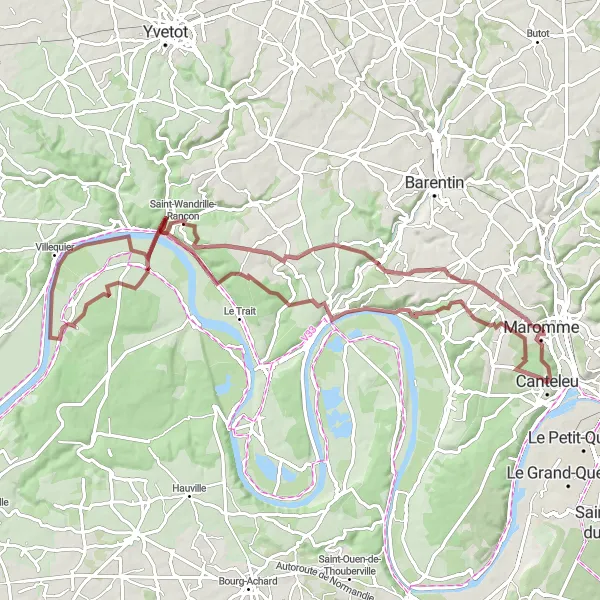
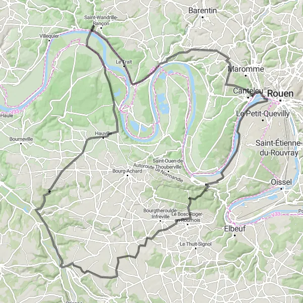
Cycle from Canteleu to Saint-Wandrille-Rançon, exploring the scenic countryside and charming villages along the way.
This road cycling route takes you from Canteleu to Val-de-la-Haye, Saint-Ouen-de-Thouberville, Routot, Saint-Wandrille-Rançon, Duclair, and La Vaupalière. With a total distance of 91 kilometers and an ascent of 605 meters, this route offers a moderate challenge for well-trained amateur cyclists. The highlights of this route include the tranquil village of Val-de-la-Haye, the historic village of Saint-Ouen-de-Thouberville known for its imposing church, and the picturesque town of Duclair with its charming waterfront promenade. With a difficulty level of 3 and an epicness rating of 3, this cycling route provides a perfect balance between physical challenge and scenic beauty.
Hénouville Gravel Adventure
Embark on a gravel expedition through the scenic countryside of Haute-Normandie.
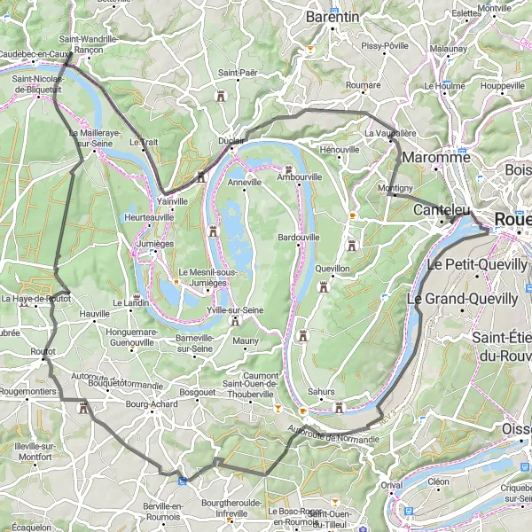
This 83-kilometer gravel cycling route starting from Canteleu takes you on an off-road adventure through the beautiful landscapes of Haute-Normandie. With a total ascent of 814 meters, this route challenges even the most experienced gravel riders. The highlight of this route is the village of Hénouville, situated at the 10-kilometer mark, where you can explore its historic charm and enjoy the tranquil countryside. With a difficulty level of 4 and an epicness rating of 3, this route promises an unforgettable gravel cycling experience. Other highlights along the way include the scenic village of Saint-Nicolas-de-Bliquetuit and the picturesque town of Maromme. Immerse yourself in the stunning natural beauty and rich history of the region as you pedal through this thrilling adventure.
Explore the beautiful suburbs and panoramas of the Neckar Valley.
This 49-kilometer road cycling route starting from Canteleu takes you through stunning landscapes and charming villages. You will ascend 472 meters, giving you a challenging but rewarding ride. The highlight of this route is the panoramic view of Mont-Saint-Aignan, which you can enjoy at the 46-kilometer mark. With a difficulty level of 3 and an epicness rating of 2, this route is suitable for moderately experienced cyclists seeking a scenic adventure. Other highlights along the way include the picturesque town of Déville-lès-Rouen and the historical village of Darnétal. Savor the beauty of Haute-Normandie as you pedal through this unforgettable journey.
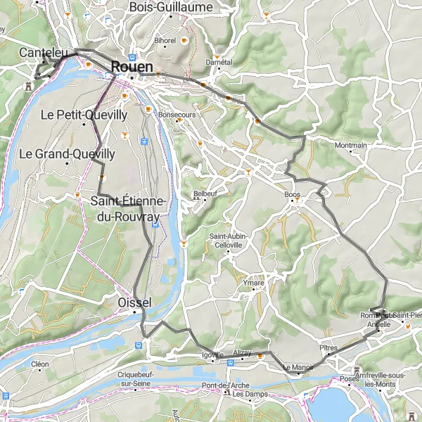
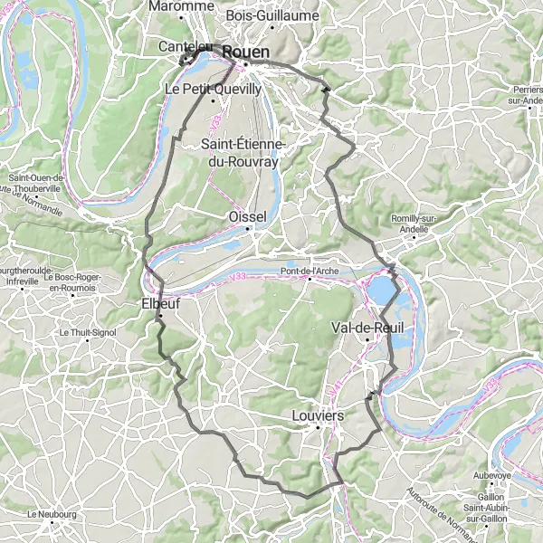
Embark on a scenic ride from Canteleu to Mairie Oissel, exploring famous landmarks and charming villages along the way.
This road cycling route starts in Canteleu and takes you through Panorama de Mont-Saint-Aignan, Darnétal, La Neuville-Chant-d'Oisel, Table d'orientation de la cote des deux amants, Alizay, Mairie Oissel, Saint-Étienne-du-Rouvray, and finally back to Canteleu. With a total distance of 67 kilometers and an ascent of 490 meters, this route offers a moderate challenge for well-trained amateur cyclists. The highlights of this route include the stunning panoramic views from Panorama de Mont-Saint-Aignan, the historic town of Darnétal, the scenic Table d'orientation de la cote des deux amants, and the peaceful village of Mairie Oissel. With a difficulty level of 3 and an epicness rating of 3, this cycling route provides a perfect combination of natural beauty and cultural heritage.
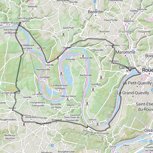
Cycle from Canteleu to Le Bosc-Roger-en-Roumois and enjoy the picturesque valleys and charming towns along the way.
This road cycling route takes you through the beautiful countryside of Haute-Normandie, with stunning views of rivers and meadows. The route starts in Canteleu and follows a scenic path, passing through Val-de-la-Haye, Le Bosc-Roger-en-Roumois, Malleville-sur-le-Bec, Routot, Notre-Dame-de-Bliquetuit, Duclair, and La Vaupalière. With a total distance of 126 kilometers and an ascent of 797 meters, this route offers a moderate challenge for well-trained amateur cyclists. The highlights of this route include the charming village of Le Bosc-Roger-en-Roumois and the historic town of Duclair, known for its beautiful riverside setting. With a difficulty level of 3 and an epicness rating of 3, this cycling route provides a balanced mix of scenic beauty and physical challenge.
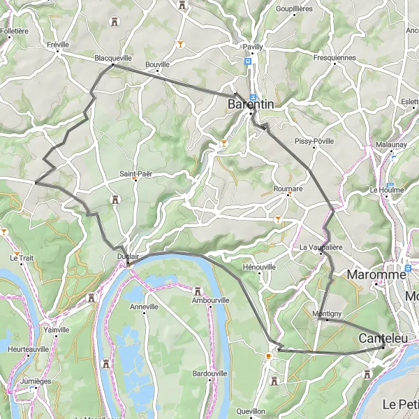
Embark on a scenic journey from Canteleu to Blacqueville, passing through charming villages and picturesque landscapes.
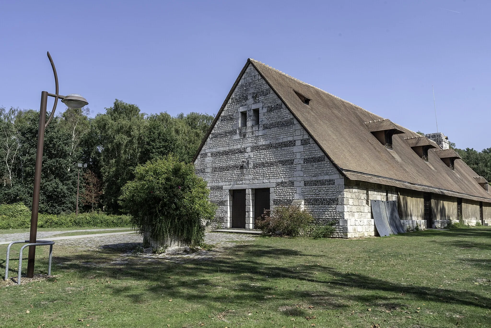
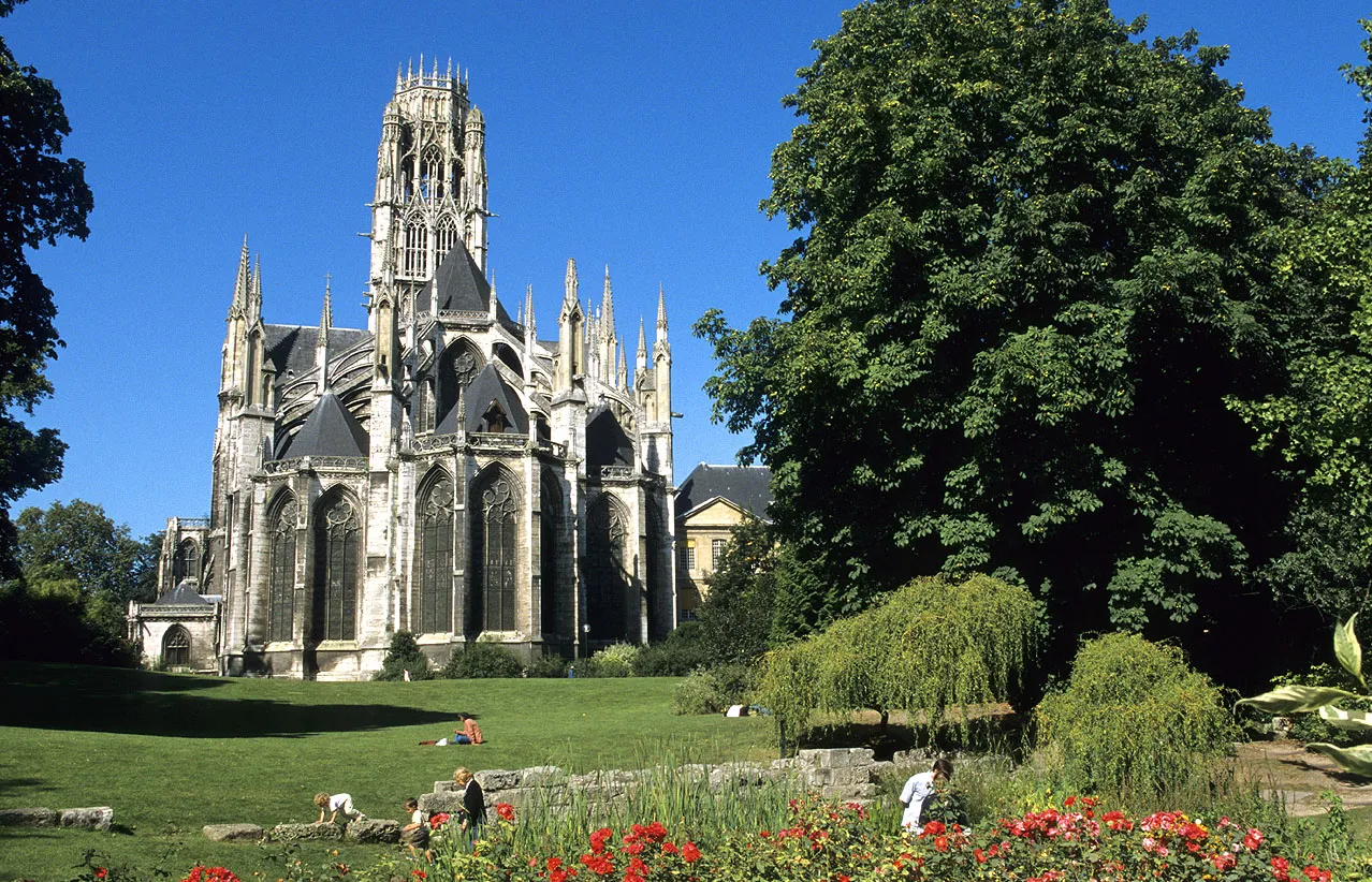
This road cycling route starts in Canteleu and takes you through Saint-Martin-de-Boscherville, Duclair, Blacqueville, Barentin, and La Vaupalière. With a total distance of 52 kilometers and an ascent of 464 meters, this route offers a relatively easy ride for well-trained amateur cyclists. The highlights of this route include the stunning Abbey of Saint-Georges de Boscherville, the picturesque town of Duclair along the Seine River, and the peaceful village of Blacqueville surrounded by idyllic landscapes. With a difficulty level of 2 and an epicness rating of 3, this cycling route provides a pleasant and enjoyable experience for cyclists of all levels.
Cycling routes nearby:

Nearby regions: