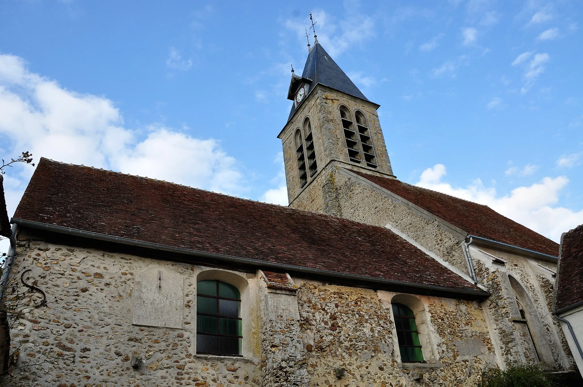
Serene landscapes and challenging climbs in France
Cycling routes from Lery
Léry in Haute-Normandie, France is a hidden gem for road and gravel cyclists. The area offers a mix of flat and hilly terrains, providing a variety of cycling experiences. Cyclists can ride through charming villages, lush forests, and along the banks of the Seine River. Léry is located near the famous Les 2 Amants climb, which offers a challenging ascent and rewards riders with panoramic views of the surrounding countryside. With its peaceful atmosphere and scenic beauty, Léry is a perfect getaway for cycling enthusiasts.
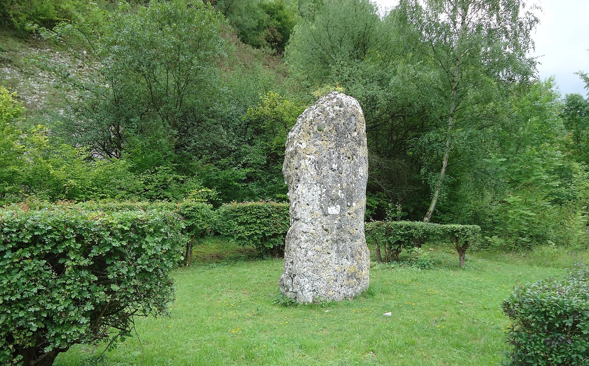
Panoramic views from the Table d'Orientation on the coast of the two lovers
This route takes you through the beautiful countryside near Léry, offering stunning views from the Table d'Orientation de la cote des deux amants. With a total distance of 64 km and an ascent of 246 m, it provides a moderate challenge for well-trained amateur cyclists. The route is suitable for road bikes and has a score of 3 in difficulty and 4 in epicness.
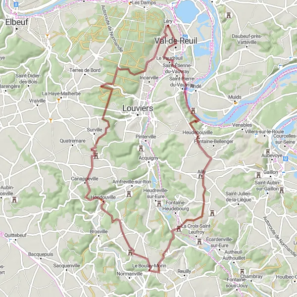
A challenging gravel route with breathtaking natural beauty.
Prepare yourself for a thrilling gravel cycling adventure near Léry, offering a highly challenging and rewarding experience. This route takes you through stunning natural landscapes and presents several exciting highlights. Val-de-Reuil, a modern town known for its remarkable urban planning and architecture, is an excellent starting point. Dardez, a small village tucked away in picturesque surroundings, offers tranquility and a chance to admire the beauty of rural France. Le Mesnil-Fuguet beckons with its historical buildings and cultural significance. Houetteville is the perfect stop to enjoy serene countryside views. Cycle through Le Mesnil-Jourdain for a glimpse of its rich heritage and traditional charm. Lastly, Incarville offers a scenic exploration of the region's natural beauty.
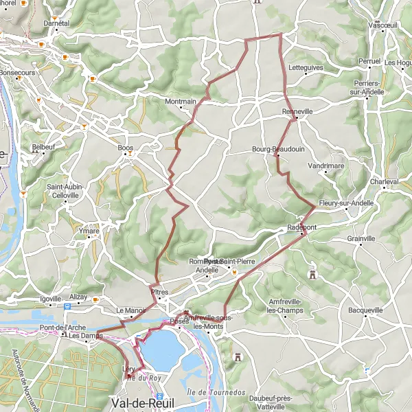
A rugged gravel route that takes you through scenic landscapes.
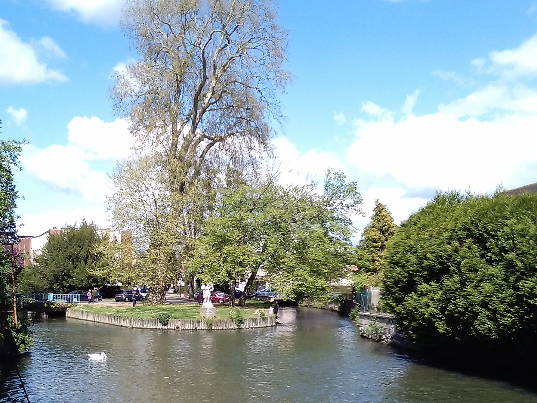
Get ready for an adventure-filled gravel cycling experience near Léry. This route offers a mix of rugged terrains and breathtaking natural beauty. Highlights along the way include the picturesque town of Pîtres, situated on the banks of the river Seine. Auzouville-sur-Ry, another highlight, is a tranquil village known for its charm and quaint rural atmosphere. Visit Douville-sur-Andelle, where you can explore the beautiful Andelle River and soak in the peaceful surroundings. The Château de Canteloup is a notable stop with its stunning architecture and historical significance. The Table d'orientation de la cote des deux amants offers panoramic views that are not to be missed. Lastly, don't forget to visit the Île du Roy, a small island on the Seine River, providing a unique natural setting.
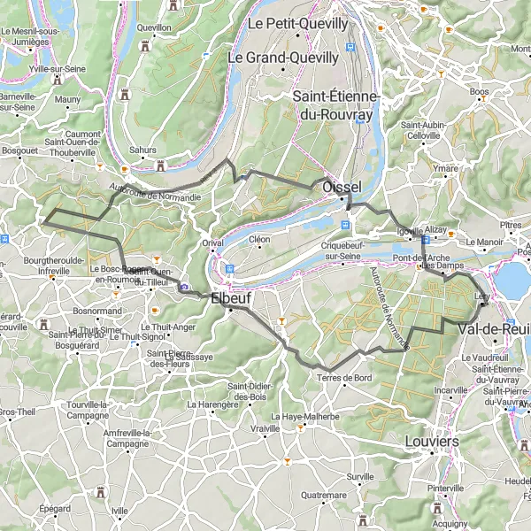
Léry - Le Boulay-Morin
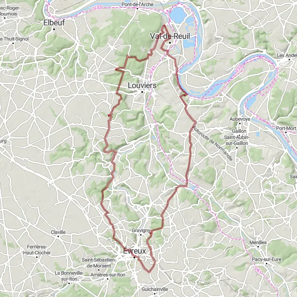
Explore the countryside on a gravel adventure to Le Boulay-Morin
This gravel route takes you through the rural landscapes near Léry, culminating in the picturesque village of Le Boulay-Morin. With a total distance of 68 km and an ascent of 595 m, this route is more challenging than the previous one, suited for experienced gravel riders. The difficulty score for this route is 4, and the epicness score is 3.
The Two Lovers' Coast Loop

Spectacular views and historic landmarks await in this scenic round-trip route
Embark on a thrilling journey along the Two Lovers' Coast Loop, where you will be treated to breathtaking views of the Normandy countryside and encounter charming towns and landmarks. This route is suitable for well-trained amateur cyclists seeking a moderate challenge.
An exhilarating gravel route with riverside views and rustic charm.
Embark on a thrilling gravel adventure near Léry and experience the beauty of the region's natural landscapes. This challenging route takes you through rugged terrains and offers breathtaking riverside views. Tostes, a small village tucked away in idyllic surroundings, provides a glimpse of picturesque rural life. Saint-Pierre-lès-Elbeuf offers a chance to discover its rich history and architecture. La Bouille is a charming riverside village with captivating views of the Seine River. Moulineaux is home to historic buildings and a peaceful atmosphere. Elbeuf invites you to explore its cultural heritage and unique charm. Terres de Bord is an ideal place to relax and enjoy the tranquility of the countryside. Lastly, don't miss the opportunity to visit the Île du Roy, a serene island offering stunning river vistas.
Léry - Criquebeuf-sur-Seine
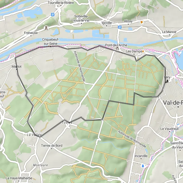
Cycle through scenic routes to Criquebeuf-sur-Seine near Léry
This shorter road cycling route takes you from Léry to the charming village of Criquebeuf-sur-Seine and back. With a distance of 30 km and an ascent of 218 m, this route is perfect for a quick ride to explore the beautiful countryside. It has a difficulty score of 2 and an epicness score of 3.
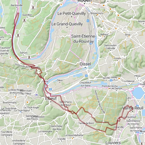
Embark on an adventurous journey to Île du Roy near Léry
This road cycling route offers an exciting journey through the picturesque landscapes surrounding Léry, leading you to the mesmerizing Île du Roy. With an ascent of 648 m and a distance of 66 km, this route is ideal for experienced cyclists seeking a challenging ride. It boasts a difficulty score of 5 and an epicness score of 4.
Léry - Château de Val-Freneuse
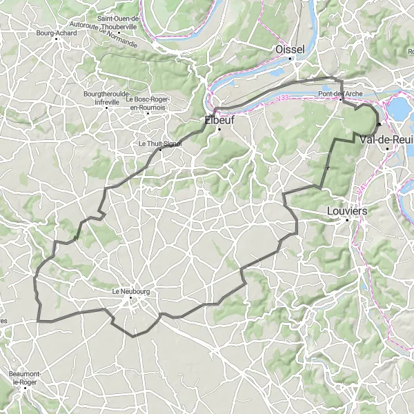
Discover the historic Château de Val-Freneuse on this challenging road cycling route
This road cycling route will take you through the scenic landscapes surrounding Léry, showcasing the magnificent Château de Val-Freneuse along the way. With a total distance of 96 km and an ascent of 553 m, this route is suited for well-trained cyclists looking for a challenging ride. It has a difficulty score of 4 and an epicness score of 3.
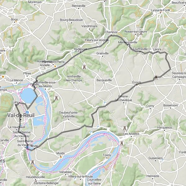
A route offering panoramic views and visits to historical landmarks.
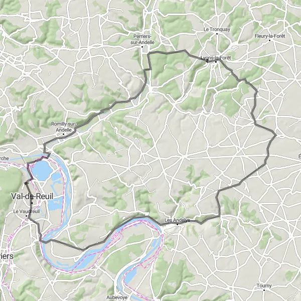
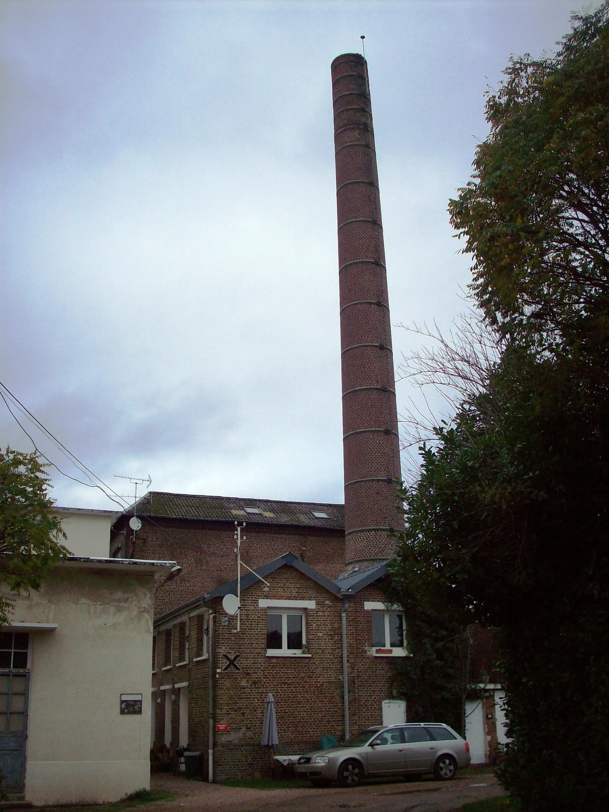
This cycling route near Léry takes you through picturesque landscapes and offers breathtaking views along the way. You'll encounter several highlights including the Table d'orientation de la cote des deux amants, providing a stunning viewpoint. The Filature Levavasseur is a notable stop where you can explore an old textile factory with a rich industrial history. Lyons-la-Forêt, a charming village known for its half-timbered houses, is another highlight along the route. Heading further, the Notre-Dame de Bellegarde, an impressive church perched on a hill, is worth a visit. Overall, this road cycling route provides an enjoyable journey with plenty of interesting sights to discover.
Cycling routes nearby:


Nearby regions: