Exploring Rhône-Alpes on two wheels
Cycling routes from Saint-Pierre-la-Palud
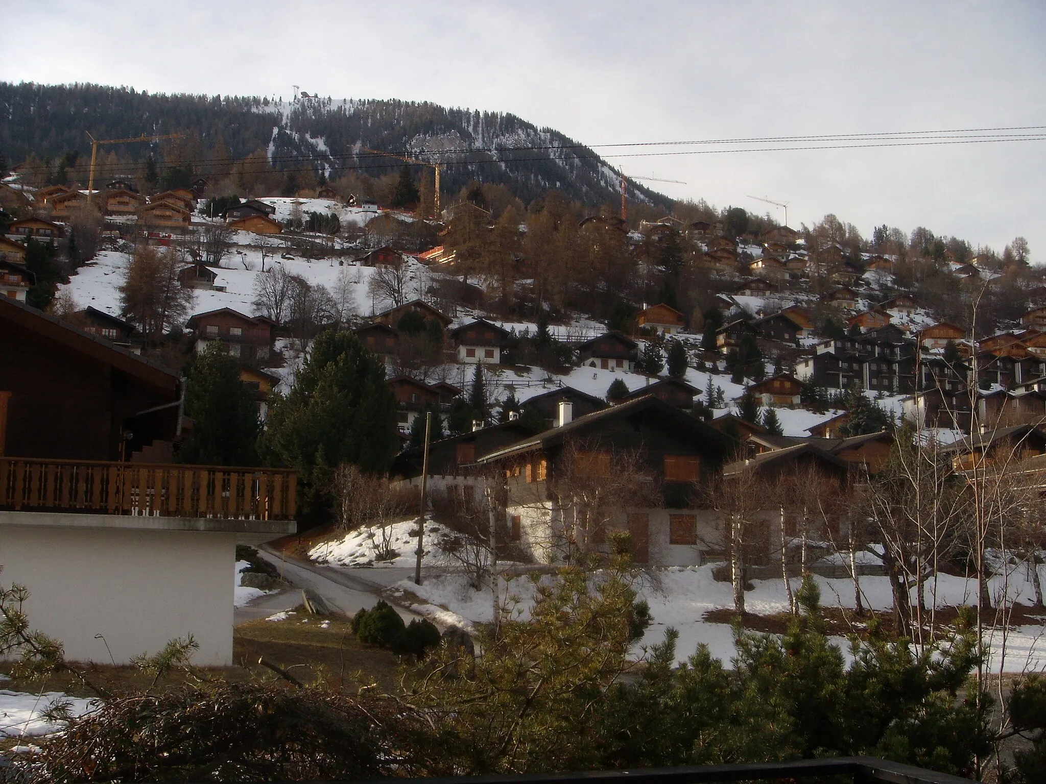
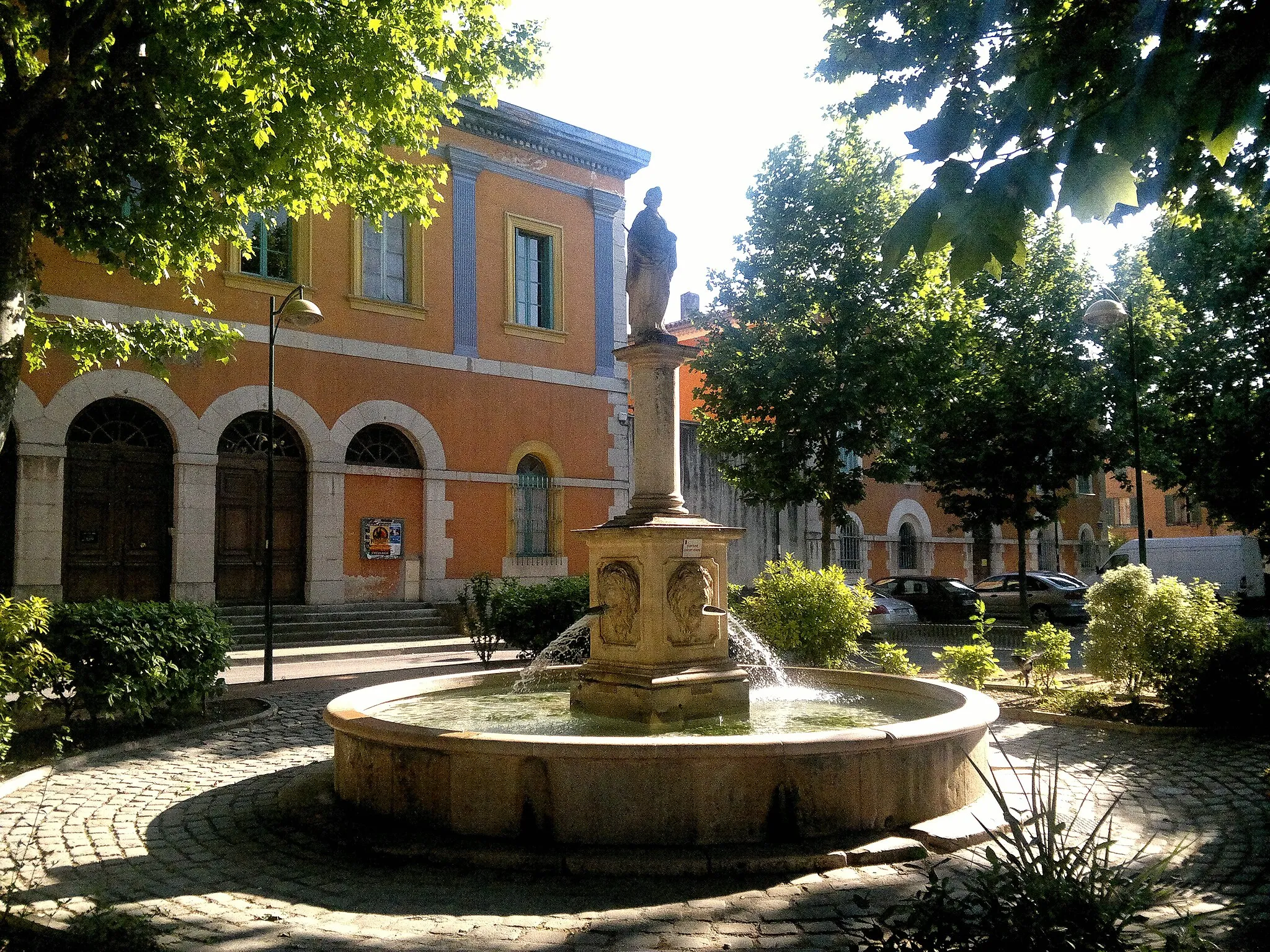
Saint-Pierre-la-Palud in Rhône-Alpes, France, offers an exceptional cycling experience amidst breathtaking natural beauty. The locality is surrounded by lush green forests, rolling hills, and picturesque valleys, attracting road and gravel cyclists alike. Road cyclists can conquer the jaw-dropping ascents of the Monts du Lyonnais, while gravel cyclists can explore the rustic trails that wind through dense woodlands. Saint-Pierre-la-Palud is also a gateway to the renowned climb, Col de la Chaux, which hosts several cycling events. With its stunning terrain and cycling-friendly atmosphere, Saint-Pierre-la-Palud is a top-choice for cyclists seeking an unforgettable adventure.
Gravel Adventure
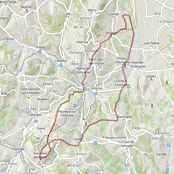
Embark on a thrilling gravel cycling adventure near Saint-Pierre-la-Palud.
Calling all gravel cycling enthusiasts! This adventurous route near Saint-Pierre-la-Palud provides an exhilarating experience through off-road terrains and scenic landscapes. With an elevation gain of 668 meters and a distance of 36 kilometers, this gravel adventure promises excitement and serenity. Cyclists will explore off-the-beaten-path highlights such as Morancé, Château de Chazay, and Lentilly, where they can immerse themselves in the region's natural beauty, experience small-town charm, and savour the tranquility of the open countryside.
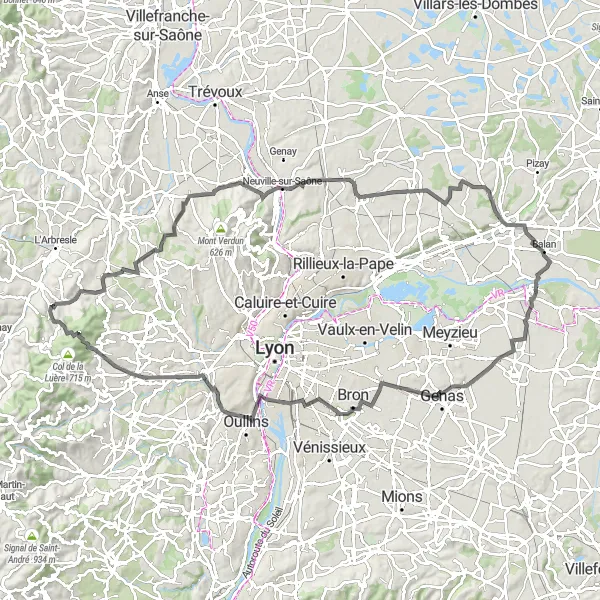
Embark on a captivating road cycling journey through the enchanting countryside near Saint-Pierre-la-Palud.
This road cycling route near Saint-Pierre-la-Palud invites cyclists to explore the mesmerizing countryside of the Rhône-Alpes region. With an elevation gain of 1033 meters and a distance of 110 kilometers, this route promises to be both challenging and rewarding. Lissieu, Montanay, Panorama St Barthélémy, Moulin Girard, Jons, Passage Comtois, Aqueduc de Beaunant, and Col de la Croix du Ban are among the captivating highlights that cyclists will encounter along this picturesque journey. These destinations offer unforgettable views, historical landmarks, and serene natural beauty.
The Majestic Adventure
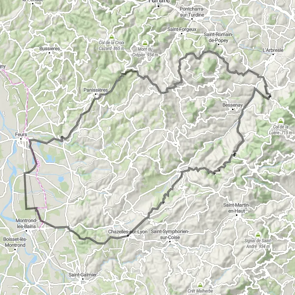
Embark on a majestic road cycling adventure through scenic landscapes near Saint-Pierre-la-Palud.
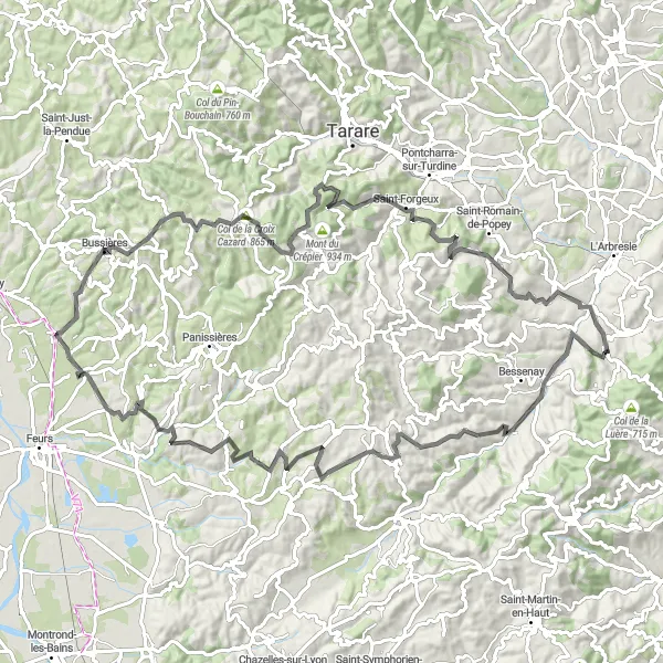
Prepare to be captivated by the awe-inspiring landscapes of the Rhône-Alpes region. This road cycling route offers an elevation gain of 1627 meters and covers a distance of 110 kilometers, promising a challenging but rewarding experience. Courzieu, Saint-Genis-l'Argentière, Chazelles-sur-Lyon, Bellegarde-en-Forez, Salt-en-Donzy, Villechenève, Crêt Pélerat, and Savigny are the stunning highlights awaiting cyclists along the way. These locations provide cyclists with extraordinary panoramas, historic landmarks, and a profound connection with the surrounding nature.
Test your cycling skills on this challenging road cycling route near Saint-Pierre-la-Palud, featuring steep climbs and stunning descents.
This challenging road cycling route near Saint-Pierre-la-Palud is specifically designed for experienced cyclists seeking a thrilling and demanding ride. With a total ascent of 1106 meters and a distance of 66 kilometers, this route offers a mix of challenging climbs and exhilarating descents. The difficulty level of this route is rated 5 out of 5, making it suitable only for extremely skilled and well-trained cyclists. The epicness level of this route is 4 out of 5, providing cyclists with memorable moments and breathtaking landscapes.
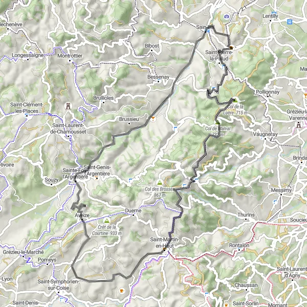
Experience the scenic beauty and challenging ascents on this road cycling route near Saint-Pierre-la-Palud.
This round-trip cycling route near Saint-Pierre-la-Palud is perfect for experienced cyclists looking for a challenging ride. With a total ascent of 1903 meters and a distance of 101 kilometers, this route offers stunning views of the surrounding countryside. The difficulty level of this route is rated 4 out of 5, making it suitable for well-trained amateur cyclists. The epicness level of this route is 3 out of 5, offering a thrilling experience without being overly difficult.
Embark on an exciting gravel cycling adventure near Saint-Pierre-la-Palud, exploring scenic routes and rugged terrains.
This gravel cycling route near Saint-Pierre-la-Palud is perfect for adventurous cyclists looking to explore the off-road terrains of the region. With a total ascent of 1659 meters and a distance of 70 kilometers, this route offers a mix of challenging climbs and thrilling descents. The difficulty level of this route is rated 4 out of 5, making it suitable for experienced off-road cyclists. The epicness level of this route is 3 out of 5, offering a variety of terrains and stunning natural landscapes.

Enjoy a picturesque road cycling route near Saint-Pierre-la-Palud, passing through charming villages and scenic countryside.
This road cycling route near Saint-Pierre-la-Palud offers a scenic and enjoyable ride for cyclists of all experience levels. With a total ascent of 896 meters and a distance of 43 kilometers, this route allows riders to soak in the beautiful landscapes of the region. The difficulty level of this route is rated 2 out of 5, making it suitable for leisurely rides or beginners. The epicness level of this route is 2 out of 5, offering a pleasant cycling experience without any major challenges.
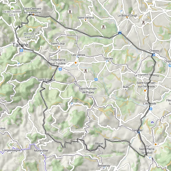
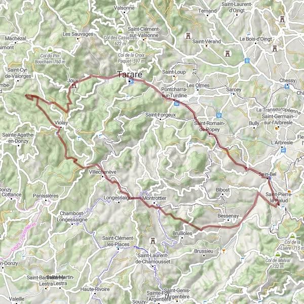
Embark on a demanding road cycling adventure starting from Saint-Pierre-la-Palud
This remarkable road cycling route showcases the breathtaking Rhône-Alpes region of France. With an elevation gain of 1239 meters and a distance of 67 kilometers, this challenging route is ideal for well-trained amateur cyclists seeking an unforgettable experience. The route begins at Saint-Pierre-la-Palud and offers spectacular highlights such as Chevinay, Col de Malval, Crêt de la Madonne, Saint-Martin-en-Haut, Sainte-Foy-l'Argentière, and Sourcieux-les-Mines. These enchanting locations promise to bewitch cyclists with natural beauty, historical richness, and cultural heritage.
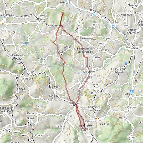
Experience a leisurely gravel cycling route near Saint-Pierre-la-Palud, passing through charming villages and beautiful landscapes.
This leisurely gravel cycling route near Saint-Pierre-la-Palud is perfect for cyclists looking for a relaxed and scenic ride. With a total ascent of 536 meters and a distance of 27 kilometers, this route allows riders to enjoy the picturesque countryside at a leisurely pace. The difficulty level of this route is rated 1 out of 5, making it suitable for beginners or those looking for a shorter ride. The epicness level of this route is 2 out of 5, offering scenic views without any challenging climbs.
Embark on an exhilarating road cycling journey through picturesque valleys near Saint-Pierre-la-Palud.
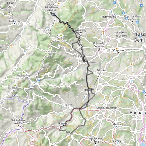
This road cycling route is a gateway to a stunning cycling experience in the Rhône-Alpes region. The route boasts an elevation gain of 1084 meters and spans 51 kilometers, making it ideal for well-trained amateur cyclists seeking a scenic adventure. Pollionnay, Messimy, Crêt du Bouchat, Vaugneray, and Saint-Pierre-la-Palud are among the highlights that cyclists will discover along the way. These locations offer breathtaking natural beauty, historic charm, and the opportunity to immerse oneself in the region's heritage.
Cycling routes nearby:


Nearby regions: