Conquer the Legendary Climb of Monts du Lyonnais in Rhône-Alpes
Cycling routes from Vaugneray
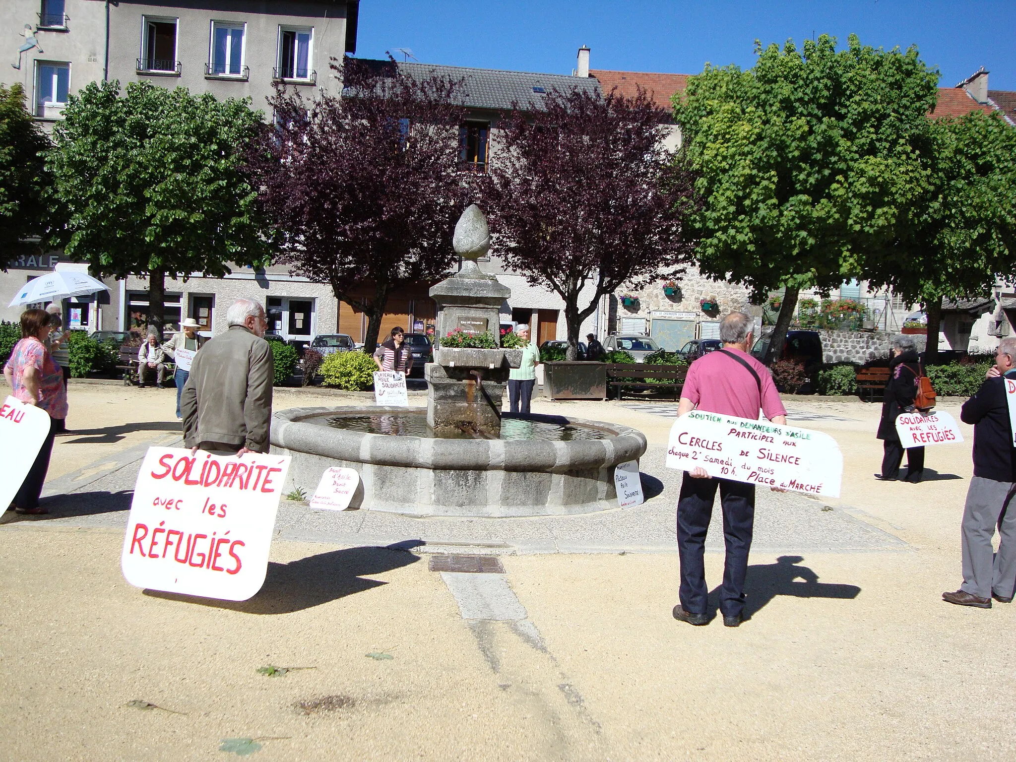
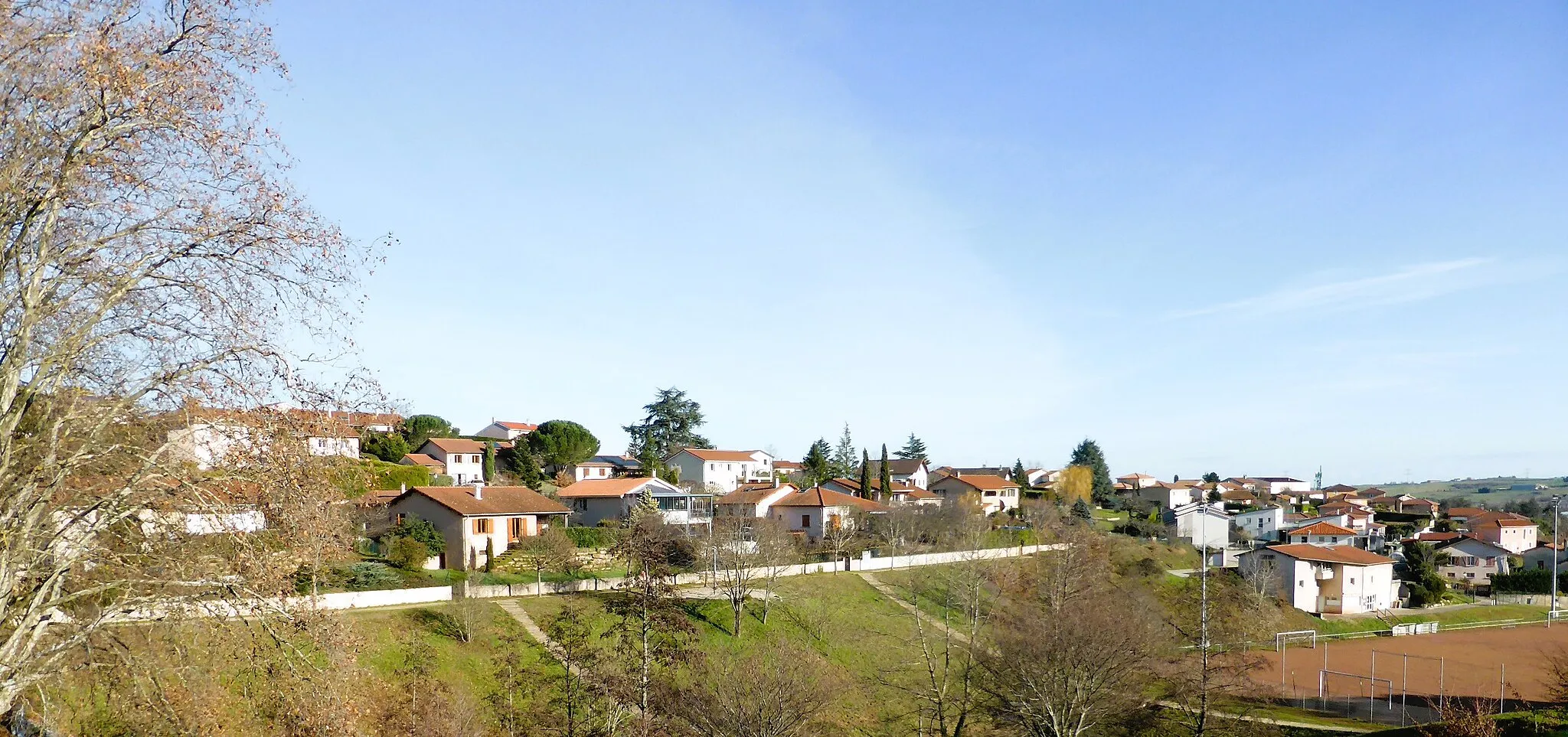
Vaugneray is a commune in the Rhône-Alpes region of France that offers an engaging environment for road and gravel cyclists. The locality is renowned for being the starting point of the challenging Monts du Lyonnais climb, which attracts both professional and amateur cyclists. Vaugneray also features a mix of rolling hills and scenic country roads, creating a cyclist-friendly atmosphere for riders seeking a variety of terrain. The commune itself is quaint and picturesque, with charming architecture and historic sites to explore. With its well-known climb and scenic routes, Vaugneray is a must-visit destination for cyclists seeking challenging and rewarding rides.
Experience the challenging Vaugneray Loop, featuring stunning views and beautiful countryside
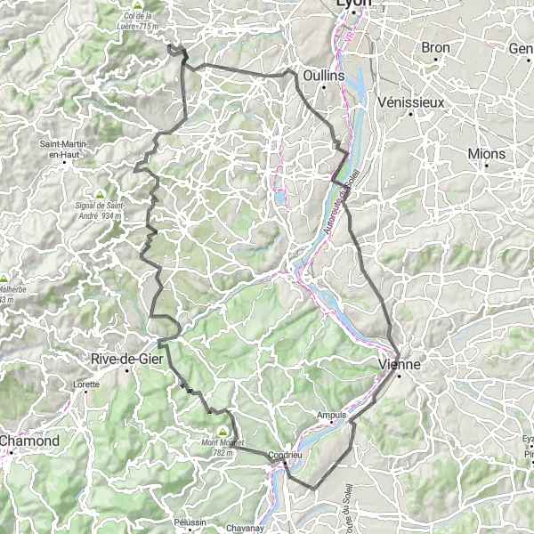
The Vaugneray Loop road cycling route is a challenging 110-km route, featuring a total ascent of 1,816 meters. This picturesque ride takes cyclists through various highlights, including Saint-Genis-Laval, Belvédère de Pipet, Vienne, and Mont Monnet. The difficulty level of this route is rated 4 out of 5, suitable for very well-trained amateur cyclists. With an epicness rating of 4 out of 5, this route offers a thrilling and memorable cycling experience. The route showcases the beautiful landscapes of Rhône-Alpes, making it a must-visit for cycling enthusiasts and nature lovers alike.
Embark on a scenic road cycling adventure through the mesmerizing landscapes of Northern Rhône.
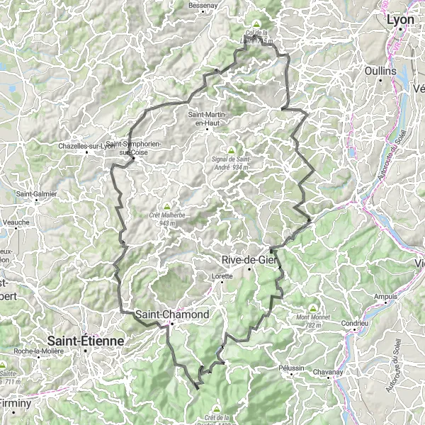
This 138-km road cycling route starting near Vaugneray promises breathtaking scenery and exciting challenges. With a total ascent of 2656 meters, it is suitable for cyclists with good endurance. Highlights of this route include Saint-Laurent-d'Agny, Châteauneuf, La-Croix-du-Mazet, and Col de Malval. Delight in the picturesque valley views, discover charming towns, and breathe in the fresh countryside air on this unforgettable cycling journey in Northern Rhône.
Explore the stunning landscapes and charming villages of Western Rhône in this adventurous road cycling route.
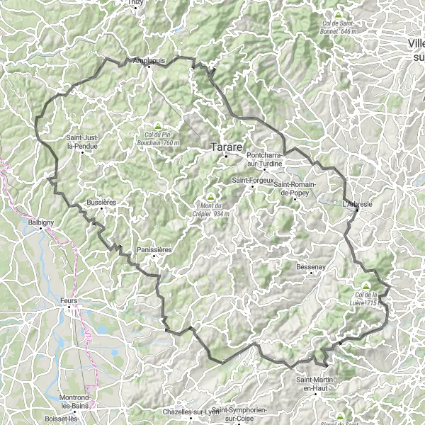
This 150-km road cycling route starting near Vaugneray takes you through picturesque towns, beautiful countryside, and challenging climbs. With a total ascent of 2717 meters, this route is recommended for well-trained cyclists. The route passes highlights such as Crêt de la Madonne, Yzeron, Le Crêt des Fées, and Haute-Rivoire. Be prepared to be amazed by the diverse scenery and rich cultural heritage along the way.
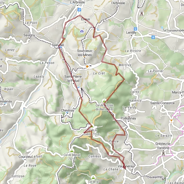
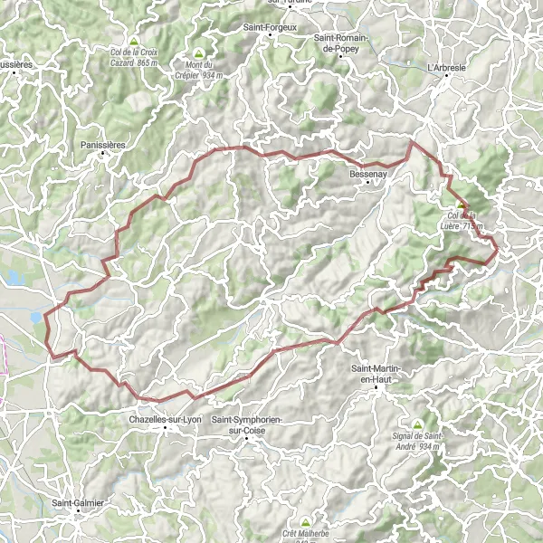
Experience the thrill of gravel cycling through the scenic routes near Vaugneray.
Explore the beautiful countryside near Vaugneray on this gravel adventure. With a total ascent of 987m and a distance of 32km, this route is perfect for those looking for a shorter but challenging ride. Be prepared for breathtaking views and rugged terrain as you conquer the Col de la Luère, Sain-Bel, Col de la Croix du Ban, and Pollionnay.
Roads Less Traveled
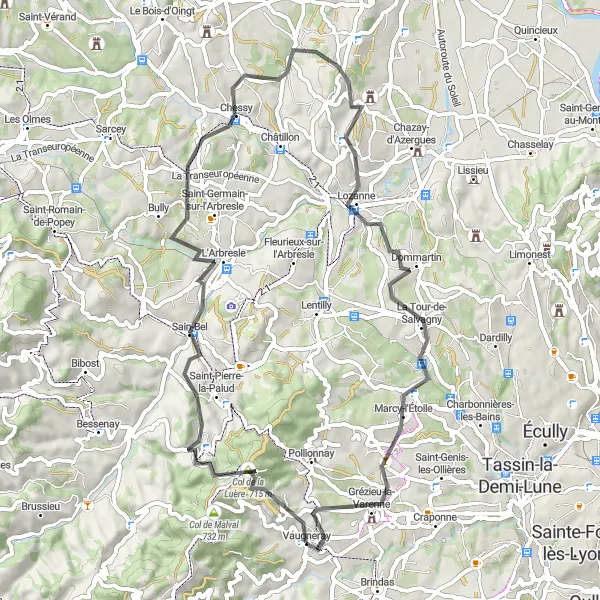
Navigate the tarmac roads near Vaugneray and explore captivating sights along the way.
Get ready to explore the quiet roads surrounding Vaugneray. This road cycling route offers a total ascent of 1328m and covers a distance of 61km. Enjoy the challenging climb to the Col de la Luère, discover the picturesque village of Sain-Bel, cycle through the charming town of Chessy, pass through the scenic landscapes of Dommartin, Marcy-l'Étoile, and finally reach Vaugneray for a well-deserved rest.
Vaugneray Gravel Adventure Route
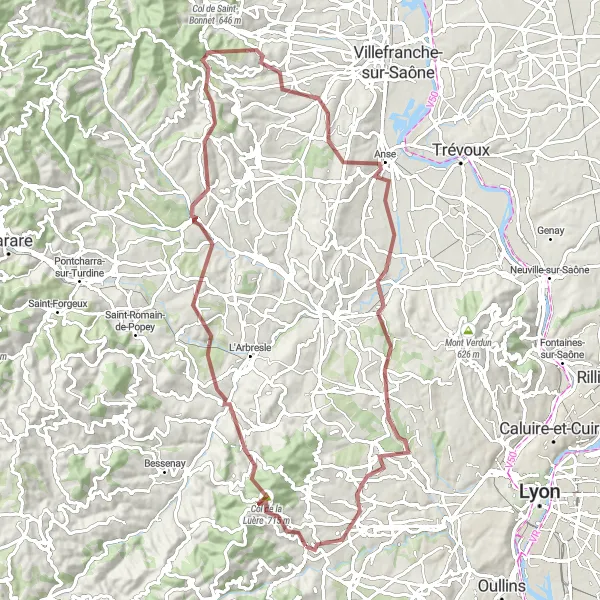
Embark on an gravel adventure through the stunning Vaugneray region
The Vaugneray Gravel Adventure is an 83-km route perfect for adventure-seekers and gravel bike enthusiasts. With a total ascent of 1,830 meters, this off-road cycling experience takes cyclists through various highlights, including Col de la Luère, Sain-Bel, Le Breuil, and Chazay-d'Azergues. The difficulty level of this route is rated 3 out of 5, suitable for moderately experienced gravel riders. With an epicness rating of 3 out of 5, this route provides an exciting and thrilling journey through the beautiful landscapes of Rhône-Alpes.
Gravel Discovery
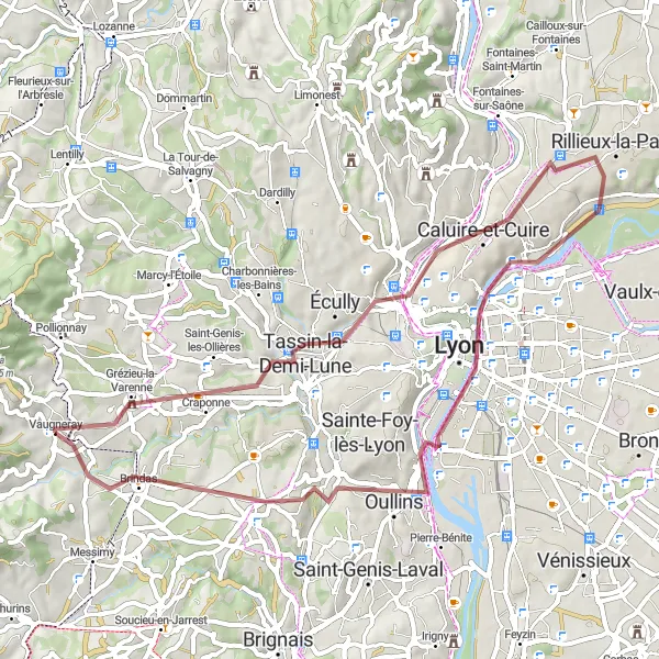
Embark on a gravel adventure and discover hidden gems near Vaugneray.
Unleash your adventurous spirit and explore the scenic gravel routes around Vaugneray. With an ascent of 585m and a distance of 54km, this route offers a perfect balance of challenging climbs and picturesque landscapes. From the vibrant town of Craponne to the breathtaking Belvédère de Bourg and Rillieux-la-Pape, every moment of this journey is filled with unique experiences. Cycle through Lyon, passing by its famous monuments, before reaching Chaponost and finally arriving in Vaugneray, where you can relax and enjoy the beauty of this hidden gem.
Discover the scenic countryside and hidden gems of Rhône-Alpes on this gravel cycling route.
This 85-km gravel cycling route starting near Vaugneray takes you through picturesque countryside, charming villages, and gravel roads. With an ascent of 2059 meters, it is suitable for intermediate gravel cyclists. Highlights of this route include Yzeron, Col des Brosses, Maringes, Saint-Barthélemy-Lestra and Montrottier. Immerse yourself in the rural landscape and enjoy the peaceful surroundings and rustic charm of this off-the-beaten-path route.
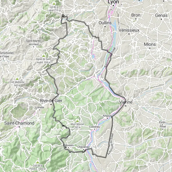
Embark on a legendary road cycling adventure around Vaugneray, featuring challenging climbs and breathtaking views.
Experience the thrill of conquering challenging climbs on this epic road cycling route. With a daunting total ascent of 1720m and a distance of 131km, this challenge will push you to your limits. Prepare to tackle Brindas, Charly, Belvédère de Pipet, Vienne, Saint-Maurice-l'Exil, Pélussin, Col de Pavezin, Châteauneuf, Crêt du Bouchat, and Rontalon on your way to Vaugneray.
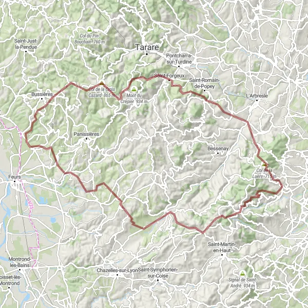
Embark on a gravel adventure through the scenic valleys and challenging hills of Southern Rhône.
This 105-km gravel cycling route starting near Vaugneray offers a mix of rugged terrain, stunning natural landscapes, and charming villages. With an ascent of 2751 meters, it is recommended for experienced gravel riders. Highlights of this route include Col des Brosses, Duerne, Souzy, and Haute-Rivoire. Get ready for an exciting off-road journey that will take you through remote trails and hidden gems of Southern Rhône.
Cycling routes nearby:


Nearby regions: