Conquer the Legendary Climbs of Rhône-Alpes!
Cycling routes from Grezieu-la-Varenne
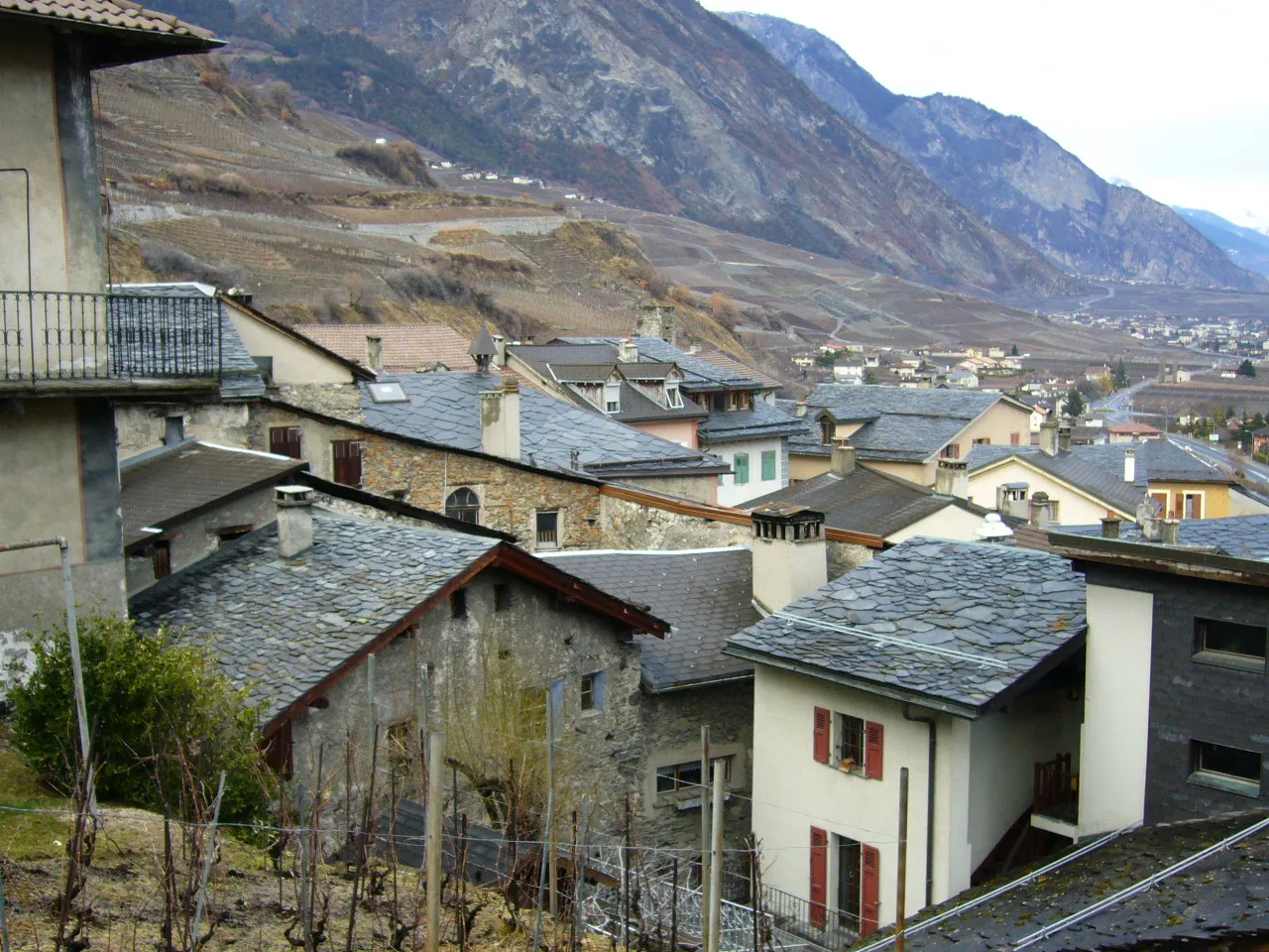
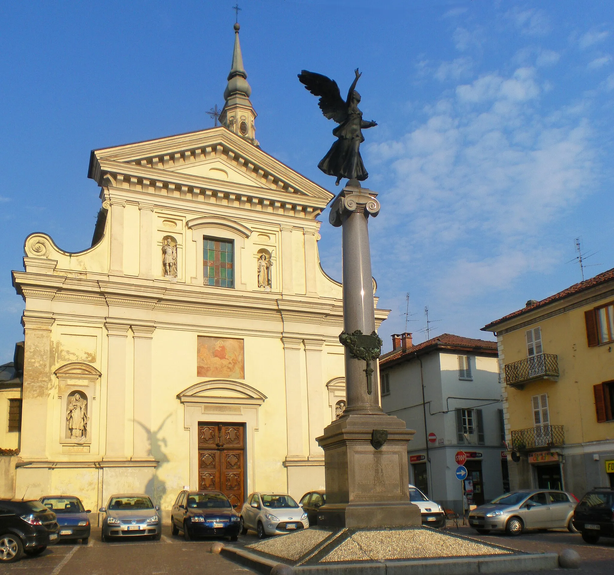
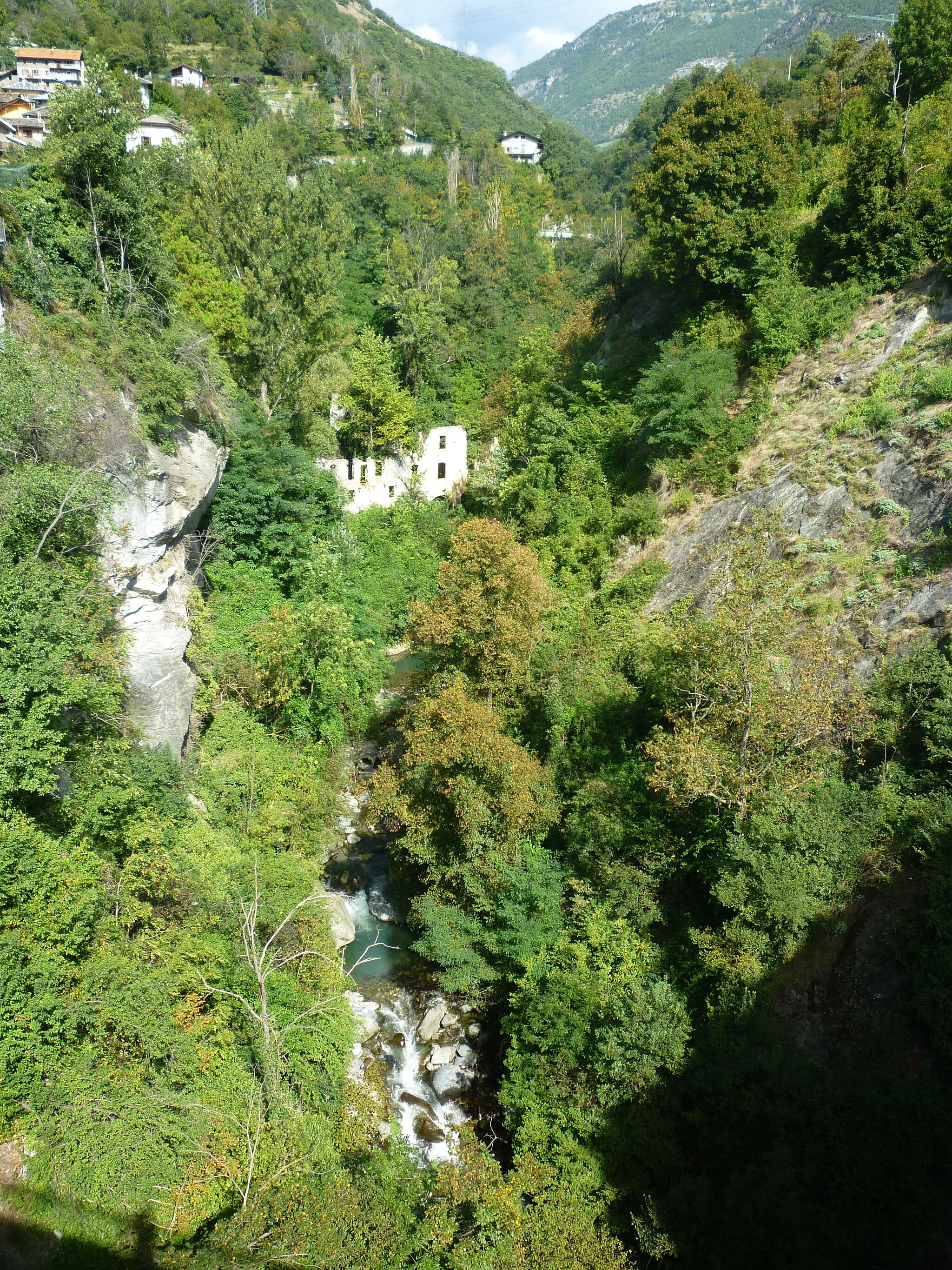
Grézieu-la-Varenne, located in the Rhône-Alpes region of France, is a great locality for road and gravel cyclists. The area offers a mix of challenging climbs and scenic roads, providing plenty of opportunities for cyclists to push their limits and enjoy the beautiful surroundings. One of the most famous cycling spots in the region is the Mont du Chat climb, which has been featured in numerous professional races, including the Tour de France. Whether you're a competitive cyclist or simply looking to enjoy a leisurely ride, Grézieu-la-Varenne has something for everyone.
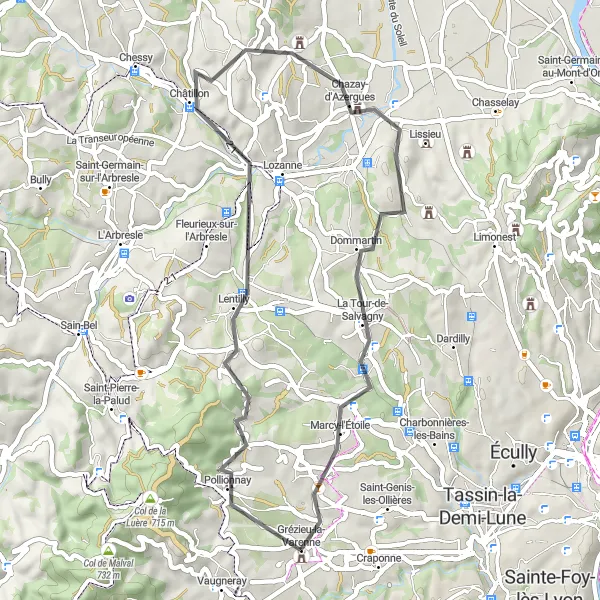
Enjoy a scenic tour from Grézieu-la-Varenne to Charnay
Embark on a pleasant road cycling tour from Grézieu-la-Varenne to Charnay. With an ascent of 731 meters and a distance of 45 kilometers, this route is suitable for cyclists of moderate fitness levels. Highlights of the route include Lentilly, Charnay, La Tour-de-Salvagny, and Grézieu-la-Varenne. The route offers charming countryside scenery and is ideal for those looking for a leisurely ride in picturesque surroundings.
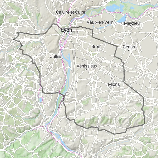
Gravel Adventure to Jons
Explore the scenic landscapes on a gravel adventure to Jons
Embark on a thrilling gravel adventure from Grézieu-la-Varenne to Jons. This 85-kilometer route features scenic landscapes and picturesque villages. With an ascent of 561 meters, this gravel route is suitable for cyclists looking to explore off-the-beaten-path trails. Highlights of the route include Esplanade, Lyon, Neyron, Jons, Sathonay-Camp, and Craponne. The overall touristic attractiveness of this route is high, as it allows cyclists to discover hidden gems and enjoy the serenity of nature.
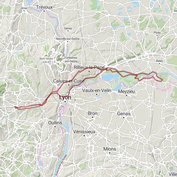
Exploring Lyon's Surroundings
Discover the outskirts of Lyon and its hidden gems on this picturesque road route
Experience a diverse landscape and the vibrant outskirts of Lyon on this 94 km road route. Begin your journey at Grézieu-la-Varenne and make your way to Lyon, a city renowned for its rich history and culture. Admire the grandeur of the Esplanade, flanked by beautiful historic buildings and bustling outdoor cafes. As you pedal further, explore the charming town of Chassieu, home to medieval castles and scenic parks. En route to Saint-Pierre-de-Chandieu, soak in picturesque countryside setting, contrasting with the urban backdrop of Chuzelles. Conclude your adventure by ascending to Haut de Cornavan and admire the sweeping views. The path takes you down to Chaponost, known for its architectural treasures and idyllic landscapes. With a moderate difficulty level and an epicness score of 3, this route promises an unforgettable exploration of Lyon's surroundings.
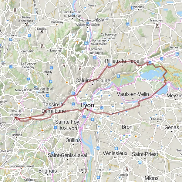
Discover Tassin-la-Demi-Lune and Lyon on this scenic gravel route
Embark on a gravel adventure through the beautiful Western suburbs of Lyon. This 61 km route will take you through Tassin-la-Demi-Lune, offering stunning views of the city from Le Belvédère. Continue your journey to Neyron, where you can admire the charming village before heading back to Grézieu-la-Varenne. Along the way, you will also pass through the vibrant city of Lyon, known for its rich history and culture. With a moderate difficulty level, this route is perfect for well-trained amateurs looking for a scenic and adventurous ride.

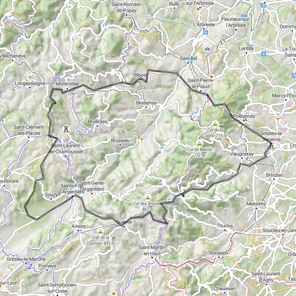
Conquer legendary climbs and enjoy breathtaking viewpoints along this epic road route
This challenging road route is a must-try for experienced cyclists seeking a thrilling climbing challenge. Covering a distance of 91 km, it showcases the natural beauty of the Rhône-Alpes region. Starting from Grézieu-la-Varenne, you will encounter the iconic Crêt du Bouchat where you can take in mesmerizing panoramic views. Push yourself further to reach Saint-Romain-en-Jarez and admire the Table d'orientation, which offers a stunning vista of the surrounding landscapes. As you continue your journey, Larajasse and Duerne will charm you with their quaint atmosphere. The route also features the picturesque Col des Brosses and concludes in Marmottes, providing a sense of accomplishment. With a difficulty level of 4 and a scenic epicness, this road route guarantees an unforgettable experience.
Round Trip to Esplanade
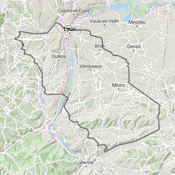
A ride to Esplanade with stunning views
This round-trip cycling route takes you to Esplanade, offering breathtaking views along the way. With an ascent of 941 meters and a distance of 100 kilometers, this road route is suitable for well-trained amateurs. The route starts near Grézieu-la-Varenne and passes through Lyon, Saint-Pierre-de-Chandieu, Oytier-Saint-Oblas, Serpaize, Haut de Cornavan, Vernaison, and Craponne. The overall touristic attractiveness of this route is high, as it combines challenging climbs with beautiful landscapes.

Take on the challenge of the ride to Villechenève
Experience a thrilling and challenging road cycling route from Grézieu-la-Varenne to Villechenève. With an ascent of 2171 meters and a distance of 102 kilometers, this route is recommended for experienced cyclists seeking an epic adventure. Highlights along the route include Saint-Laurent-de-Vaux, Col de la Croix de Part, Sainte-Foy-l'Argentière, Essertines-en-Donzy, Villechenève, Mont Girard, Crêt Pélerat, Sain-Bel, and Grézieu-la-Varenne. This route combines tough climbs with breathtaking landscapes, making it a truly memorable cycling experience.
Valleys and Vineyards Experience

Venture through picturesque landscapes and discover hidden gems of Rhône-Alpes
Embark on a 62 km gravel adventure that encapsulates the beauty of Rhône-Alpes. Beginning in Grézieu-la-Varenne, you will pass through idyllic Francheville, famous for its scenic vistas. Journey through Sérézin-du-Rhône and Givors, two charming towns known for their rich cultural heritage and historical landmarks. As you traverse the route, immerse yourself in the stunning vineyards of Sérézin-du-Rhône and Messimy, where you can learn about the region's winemaking traditions. With a moderate difficulty level and an epicness score of 3, this route is ideal for those seeking a balance between adventure and relaxation.
Embark on an unforgettable journey through mountains and hilltop villages
Indulge in an adventurous road route spanning 71 km, taking you through breathtaking landscapes and the heights of Rhône-Alpes. Begin your ascent at Grézieu-la-Varenne and conquer the legendary Crêt de la Madonne, offering impressive panoramic views of the surrounding mountains. Cycle through Yzeron and witness the architectural marvel of Le Crêt des Fées, capturing the allure of the region's history. Continue onwards to Les Halles, a charming hilltop village famous for its stunning scenery. As you approach Bibost, the enchanting medieval village will mesmerize you with its medieval charm. Conclude your journey with an exhilarating climb to the majestic Col de la Croix du Ban, granting you awe-inspiring vistas. With a difficulty level of 4 and an epicness score of 4, this road route is tailored for thrill-seekers seeking unforgettable moments in nature.
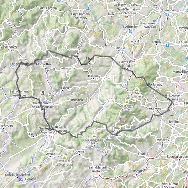
Experience the challenge of climbing to Saint-Clément-les-Places
Embark on this challenging road cycling route from Grézieu-la-Varenne to Saint-Clément-les-Places. With an ascent of 1608 meters and a distance of 69 kilometers, this route is recommended for experienced cyclists. Along the way, you'll pass through Yzeron, Col de la Croix de Part, Saint-Clément-les-Places, Chavagny, Saint-Julien-sur-Bibost, Saint-Pierre-la-Palud, and Col de la Croix du Ban. The route offers beautiful mountain scenery and is a popular choice among cyclists looking for a challenging adventure.
Cycling routes nearby:


Nearby regions: