Cycling paradise in Rhône-Alpes region
Cycling routes from Voiron
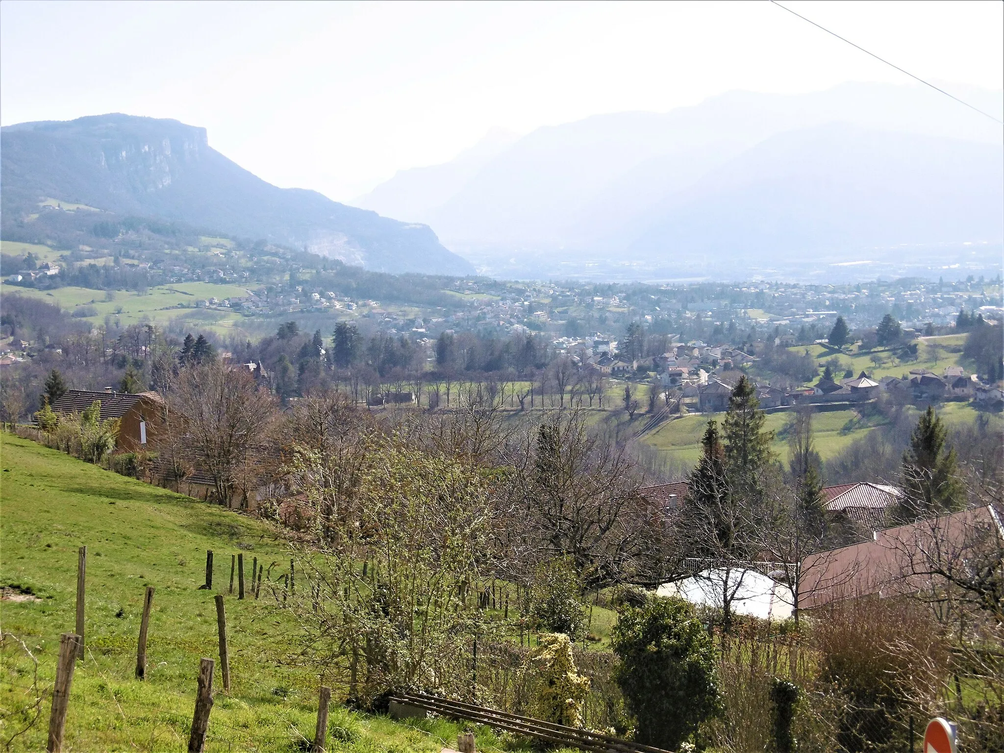
Voiron, located in the Rhône-Alpes region of France, is a great locality for road and gravel cyclists. The area offers a mix of flat roads and challenging climbs, making it suitable for cyclists of all skill levels. One famous cycling spot nearby is Mont Revard, a legendary climb frequented by professional cyclists. With its beautiful scenic routes and well-maintained roads, Voiron is a popular destination for cycling enthusiasts. The town itself has a cycling-friendly atmosphere, with bike lanes and facilities available. Overall, Voiron ranks 4 for its cycling opportunities.
Voiron to Saint-Aupre Loop
A scenic loop through Voiron to Saint-Aupre
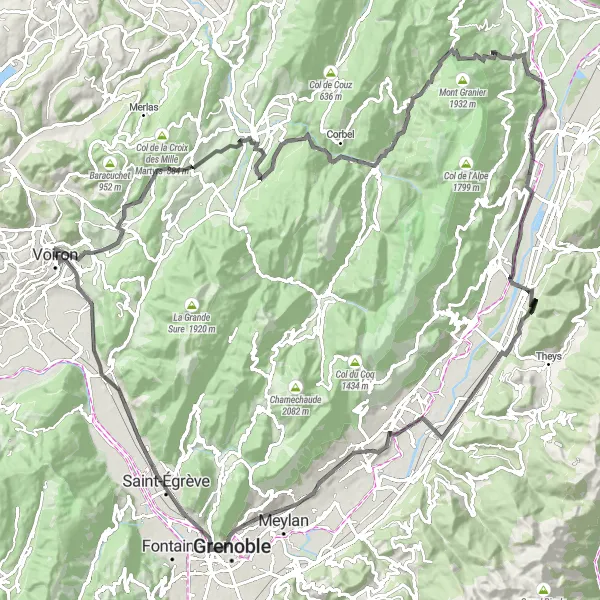
This route takes you on a beautiful cycling journey from Voiron to Saint-Aupre. With a total distance of 128 km and an ascent of 2447m, this route is challenging yet rewarding. The scenic highlights along the way include the Tourniquet de Pierre-Chave, Pointe du Frou, Col du Granier, and Mont Jalla. With a difficulty rating of 4 and an epicness rating of 3, this route is suitable for experienced cyclists looking for a challenging adventure.
Experience the scenic beauty of Voiron while cycling through Rives, Izeaux, Le Truc, Brézins, Apprieu, and Tour Barral.
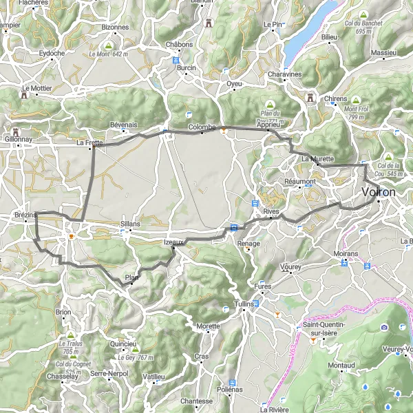
This round-trip cycling route near Voiron takes you through picturesque towns and beautiful landscapes. With a total distance of 59 km and an ascent of 653 meters, the route offers a moderate level of difficulty suitable for well-trained amateurs. Along the way, you'll pass through highlights such as Rives, Izeaux, Le Truc, Brézins, Apprieu, and Tour Barral. These charming towns offer plenty of opportunities to stop and explore local culture and cuisine. The route provides both recreational cycling and a chance to appreciate the natural beauty of Rhône-Alpes.
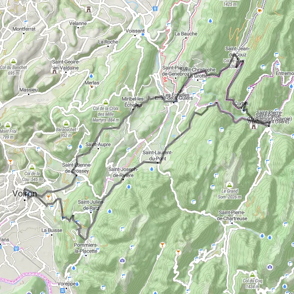
Embark on a challenging road cycling route from Voiron to ride through breathtaking landscapes including Pointe du Frou, Col du Cucheron, and Col de la Placette.
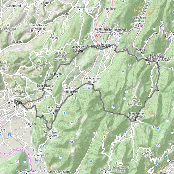
This challenging road cycling route starting from Voiron offers an immersive journey through stunning mountainous landscapes. With a total distance of 74 km and an ascent of 2220 meters, the route is suitable for experienced cyclists seeking breathtaking natural beauty coupled with adrenaline-inducing climbs. Highlights include Saint-Aupre, a picturesque mountain village renowned for its idyllic setting. The twisty and scenic Tourniquet de Pierre-Chave provides stunning views of the surrounding valleys. As you ride through Saint-Christophe-sur-Guiers, enjoy the peaceful atmosphere of this charming riverfront village. Pointe du Frou offers panoramic vistas of the Alps, while Col du Cucheron and Col de la Placette test your fitness and reward you with awe-inspiring alpine landscapes. The route concludes with a scenic descent to Voiron, leaving you with unforgettable memories of the spectacular Rhône-Alpes region.

Cycle from Voiron to Lac d'Aiguebelette
Discover the natural beauty of the region as you cycle from Voiron to Lac d'Aiguebelette. This 98 km route features an ascent of 1826m, offering a mix of challenging climbs and scenic descents. Highlights of this route include Monure, Pont-de-Beauvoisin, and Col de la Crusille. With a difficulty rating of 4 and an epicness rating of 3, this cycling route provides a thrilling adventure for experienced cyclists.

Embark on an adventurous road cycling route from Voiron to ride through dramatic landscapes including Saint-Aupre, Saint-Pierre-de-Chartreuse, and Col de Porte.
This exciting road cycling route starting from Voiron takes you on an adventurous journey through diverse landscapes. With a total distance of 78 km and an ascent of 2233 meters, the route is suitable for experienced cyclists looking for a challenging ride. Highlights along the route include Saint-Aupre, a picturesque village surrounded by panoramic mountain views, and Tourniquet de Pierre-Chave, a twisty mountain road with stunning scenic overlooks. As you ride through Saint-Pierre-de-Chartreuse, enjoy the breathtaking alpine setting and discover the historical importance of the region. The challenging climb to Col de Porte rewards riders with spectacular views of the Chartreuse Massif. Sarcenas and Rocher du Cornillon offer unique natural wonders amidst dramatic landscapes. The route ends with a scenic ride through Voreppe before returning to Voiron.
Experience gravel cycling from Voiron to Sommet de Monure
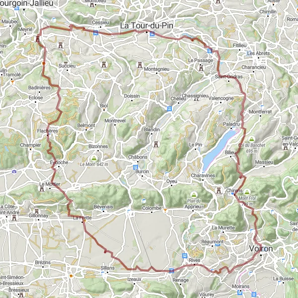
Embark on a thrilling adventure through Voiron to Sommet de Monure with this gravel route. Spanning a distance of 101 km and an ascent of 1441m, this route offers a mix of challenging terrains and picturesque landscapes. Highlights along the way include Charnècles, Col de Banchet, and Sommet de Monure. With a difficulty rating of 3 and an epicness rating of 3, this route is suitable for experienced gravel cyclists.
Discover scenic landscapes from Voiron to Coublevie
Experience the beauty of the Rhône-Alpes region with this scenic road cycling route from Voiron to Coublevie. Covering a total distance of 75 km and ascent of 1903m, this route offers a mix of challenging climbs and breathtaking descents. Highlights along the way include Saint-Étienne-de-Crossey, Tourniquet de Pierre-Chave, and Col des Égaux. With a difficulty rating of 4 and an epicness rating of 3, this route is ideal for experienced cyclists seeking scenic beauty.
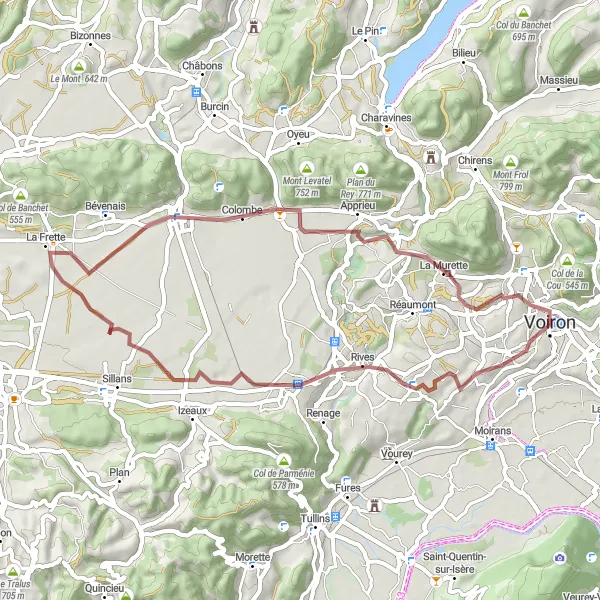
Embark on a gravel adventure from Voiron to explore the pristine landscapes of Beaucroissant, La Frette, La Murette, and Tour Barral.
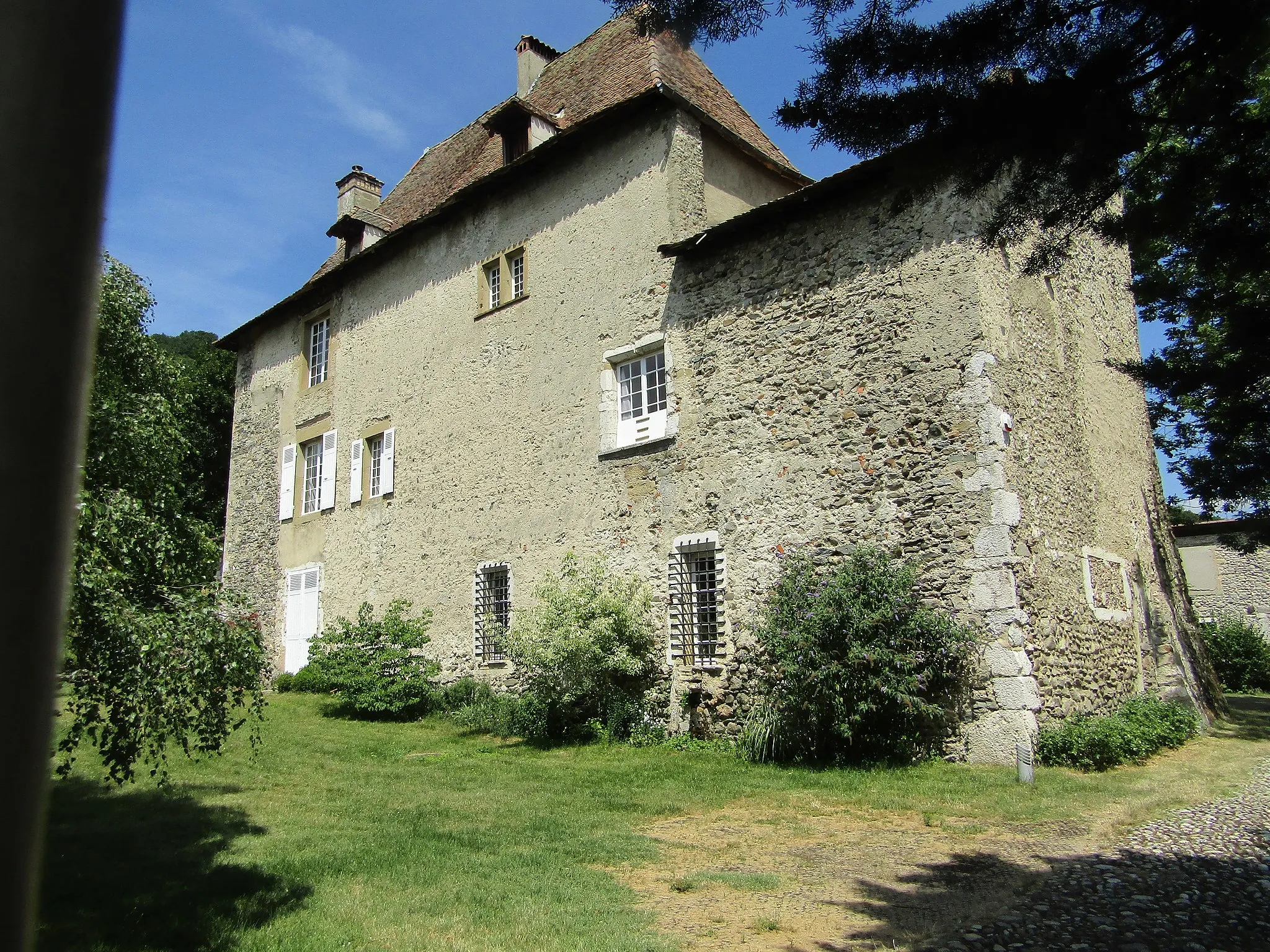
This gravel cycling route starting from Voiron offers an exciting off-road adventure through stunning natural landscapes. With a total distance of 48 km and an ascent of 493 meters, the route provides a moderate level of difficulty suitable for experienced cyclists. Highlights along the way include Beaucroissant, known for its charming countryside and traditional markets, and La Frette, a picturesque village surrounded by rolling hills. La Murette offers breathtaking views of the Alps and is perfect for panoramic photo stops. The route ends at Tour Barral, a historical castle with a rich architectural heritage. Experience the thrill of gravel biking while exploring the hidden gems of Rhône-Alpes.
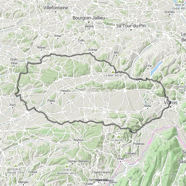
Embark on a challenging road cycling route from Voiron to explore Tullins, Col de Châtain, Saint-Michel-de-Saint-Geoirs, and more.
This epic road cycling route starting from Voiron offers a challenging adventure through scenic landscapes. With a total distance of 136 km and an impressive ascent of 1874 meters, the route is suitable for well-trained amateur cyclists seeking a thrilling challenge. Highlights of the tour include Tullins, a charming town with rich historical heritage, and Col de Châtain, a mountain pass offering breathtaking panoramic views. Saint-Michel-de-Saint-Geoirs and Viriville also reward riders with stunning natural scenery. As you ride through Beaurepaire and Meyssiez, you'll discover hidden treasures and local culture. The challenging climbs of Châtonnay, Bizonnes, and Col de Rossatière test your endurance before reaching the final destination: the historic Tour Barral. This route is a true testament to the beauty and cycling opportunities of Rhône-Alpes.
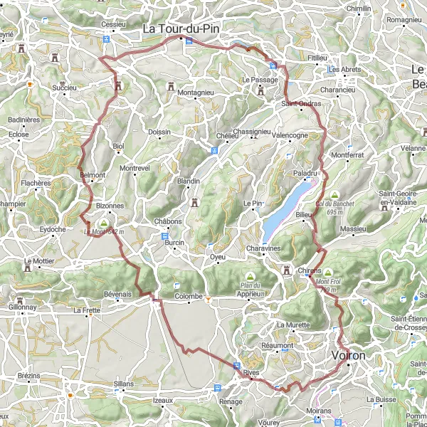
Explore the gravel roads surrounding Voiron
Gear up for an exciting gravel adventure as you cycle through the beautiful landscapes around Voiron. This 87 km route features a total ascent of 1422m, making it a moderate challenge for gravel enthusiasts. Highlights include Rives, Le Mont, and Tour Barral. With a difficulty rating of 3 and an epicness rating of 3, this route is perfect for adventurous cyclists seeking new experiences.
Cycling routes nearby:


Nearby regions: