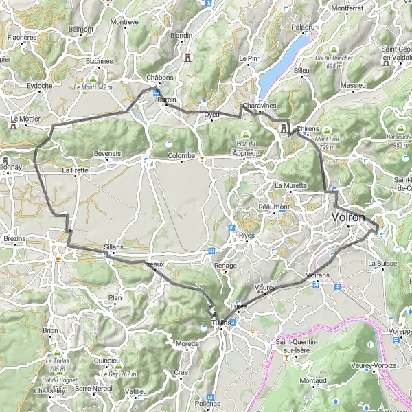
Exploring diverse cycling routes and conquering the Col du Granier in the Rhône-Alpes region.
Cycling routes from Coublevie
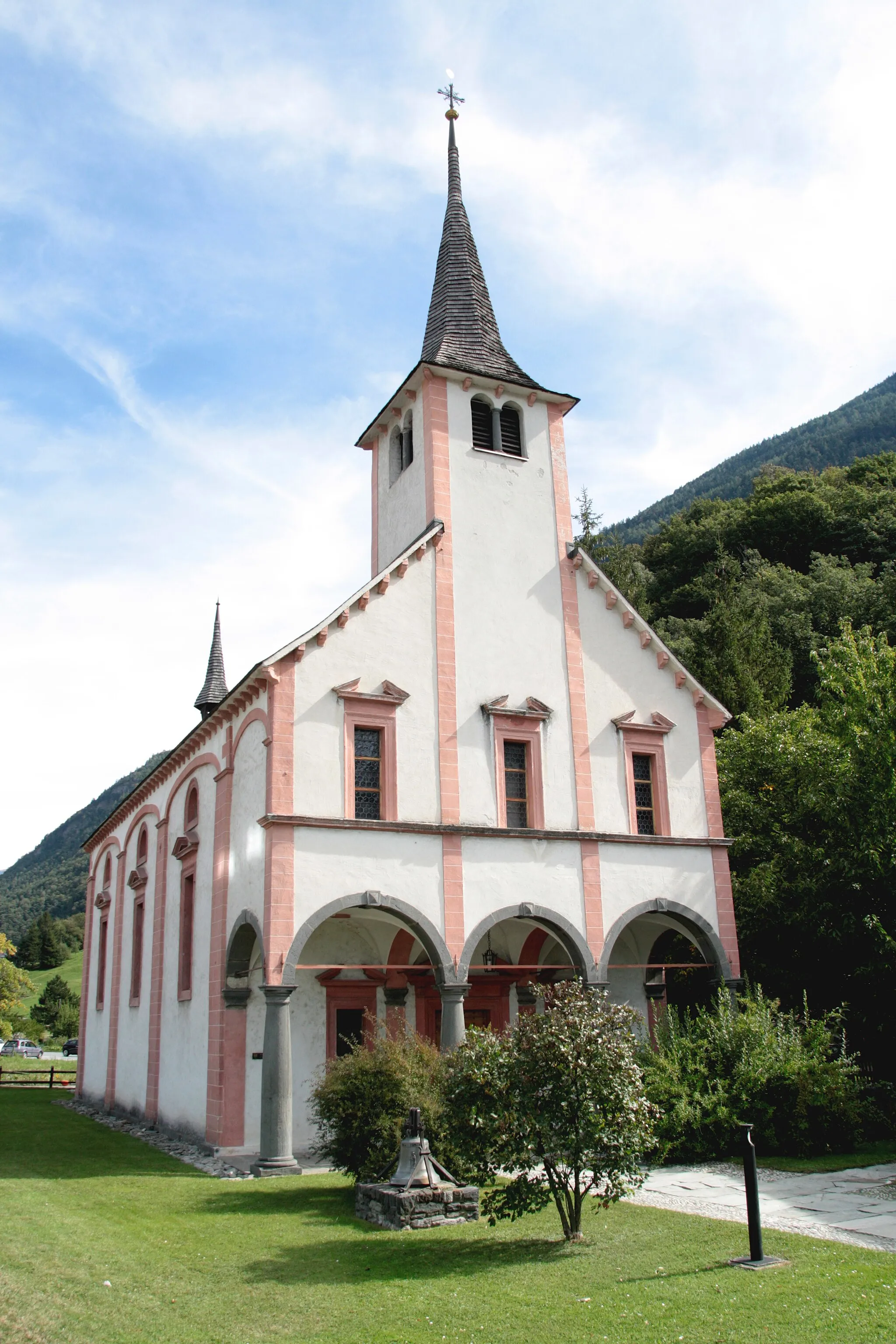
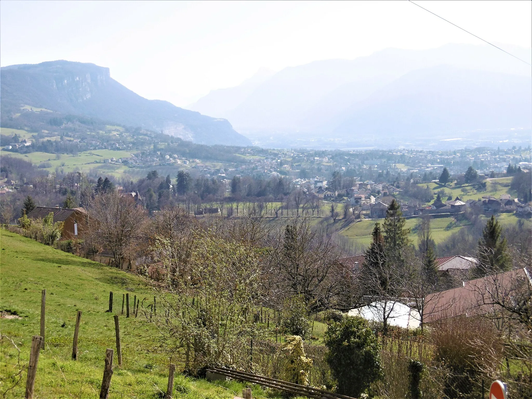
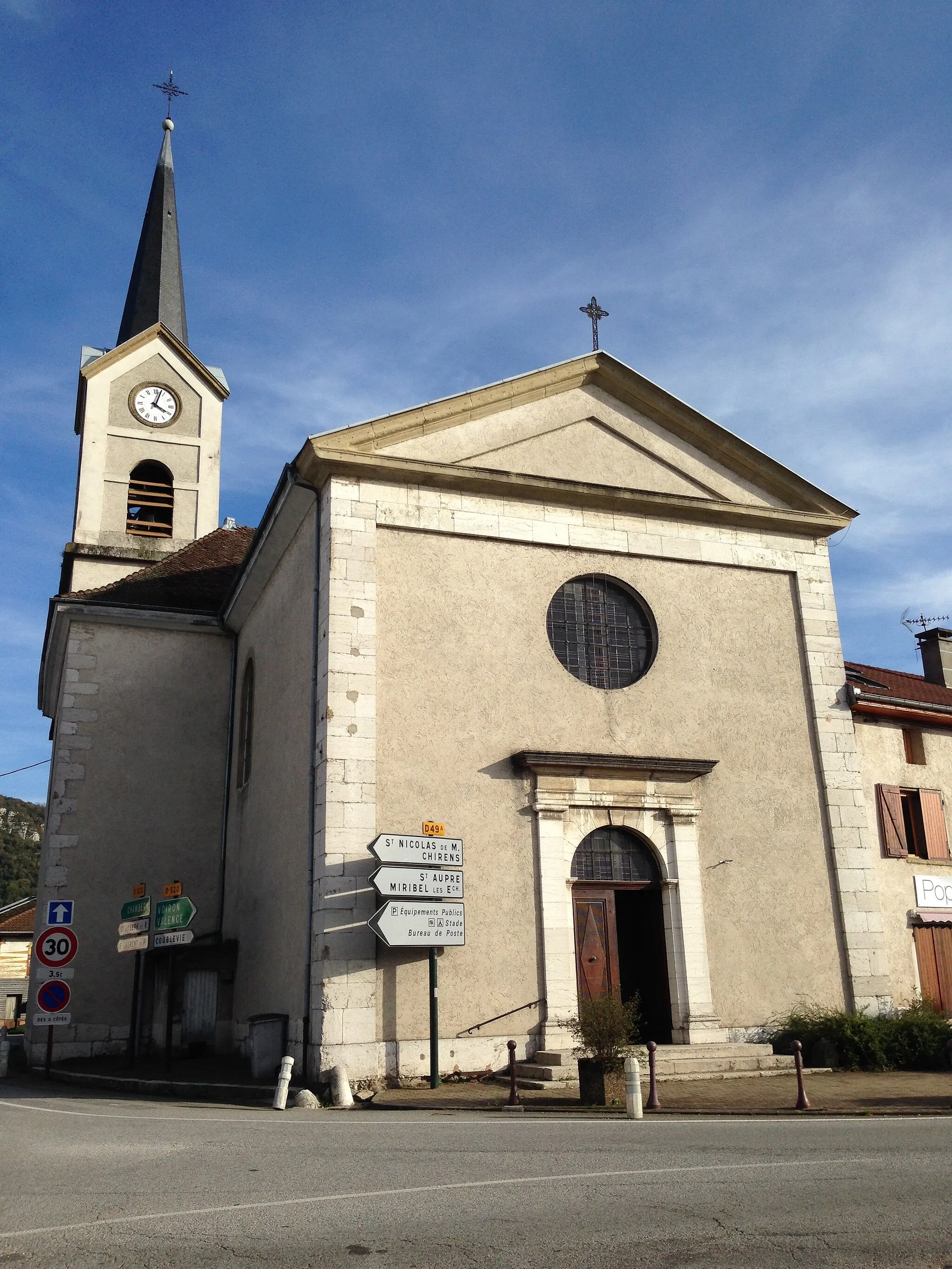
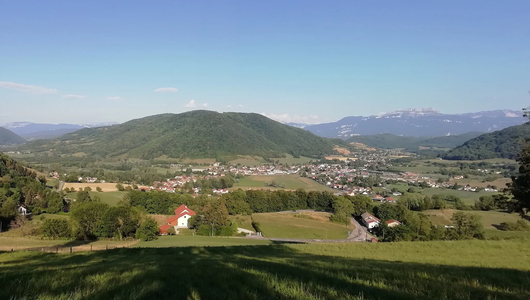
Coublevie is a locality in the Rhône-Alpes region of France. As a cyclist, you'll find a variety of cycling routes in the area, suitable for all skill levels. The region offers a mix of hilly terrain and flat routes, allowing cyclists to explore picturesque landscapes. One well-known cycling spot near Coublevie is the Col du Granier, a popular climb for road cyclists. With its diverse cycling routes and beautiful scenery, Coublevie is a great destination for cyclists looking to experience the beauty of the Rhône-Alpes.
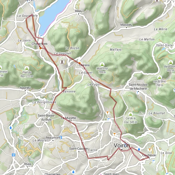
Experience the tranquility of the French countryside on this scenic gravel route
Escape from the hustle and bustle of city life with this 36-kilometer gravel cycling route starting near Coublevie in Rhône-Alpes, France. With a total ascent of 603 meters, this route allows you to explore the rural beauty of the region. The difficulty level of this route is moderate, making it suitable for amateur cyclists. During the ride, you'll pass through charming villages such as La Murette and Charavines, where you can take a break and enjoy the peaceful atmosphere.
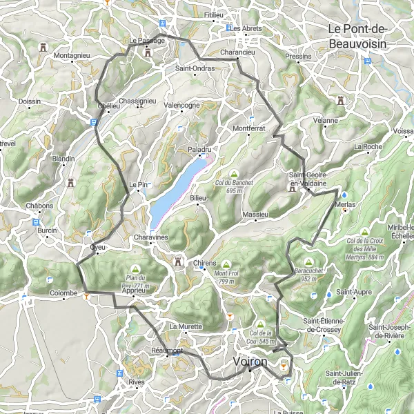
Test your climbing skills on this ultimate challenge near Coublevie.
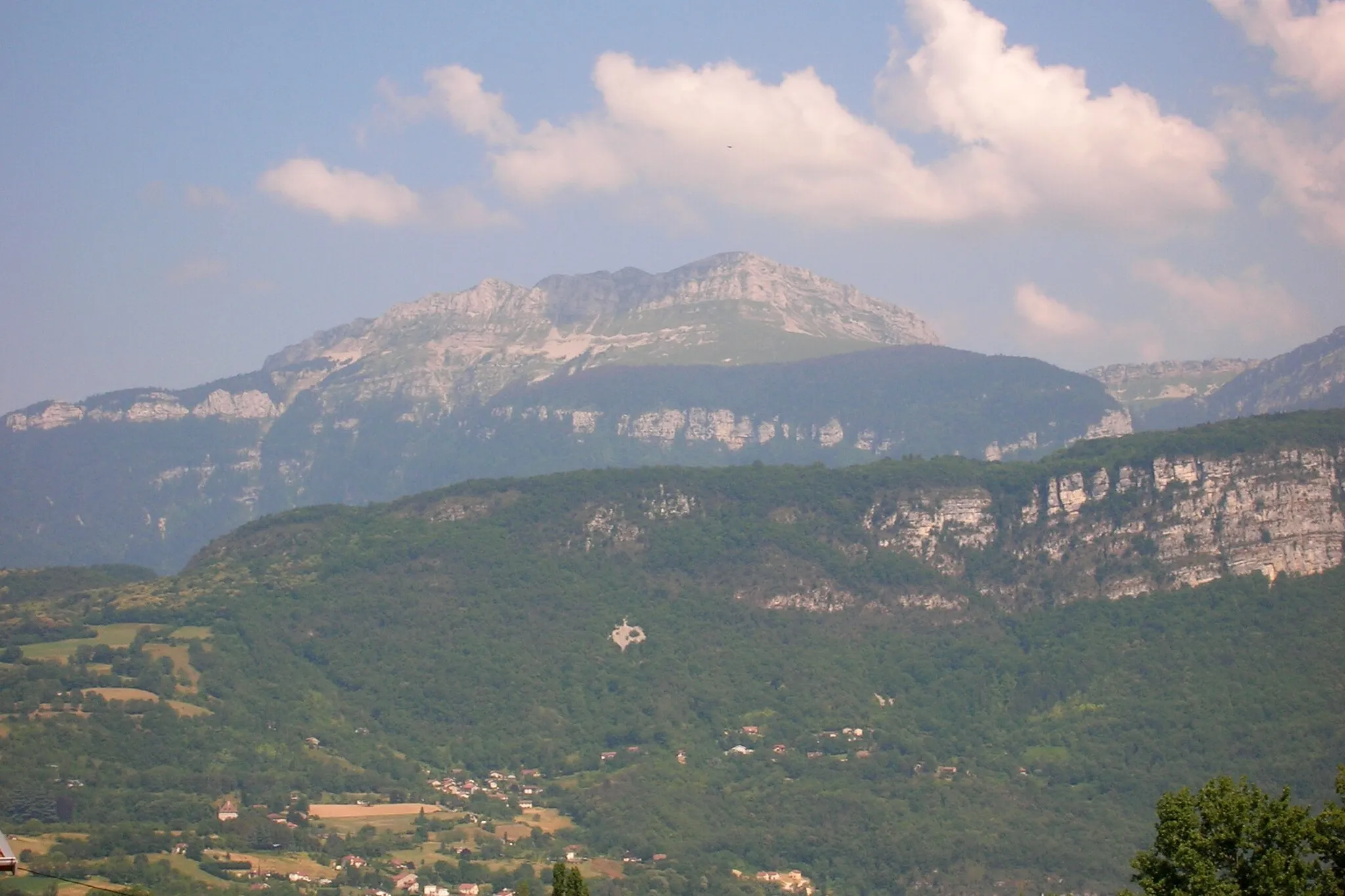
For those seeking an ultimate climbing challenge, this route will push your limits. With significant elevations and thrilling descents, this road cycling route near Coublevie offers an adrenaline-packed adventure. The difficulty rating of 5 ensures only the most experienced cyclists should attempt this route. Highlights include the breathtaking views from Tour Barral, combined with the adrenaline rush of tackling challenging climbs like Apprieu and Chélieu. Charancieu offers serenity and natural beauty, while Merlas presents picturesque views of the surrounding landscapes. Baracuchet is a must-visit for its scenic splendor, and the iconic Col de la Croix Bayard will make you truly feel like a champion.

Explore the countryside around Coublevie, passing through picturesque villages and scenic landscapes.
This gravel route takes you on a scenic journey through the beautiful Rhône-Alpes region of France. Starting from Coublevie, you'll cycle through charming villages, rolling hills, and stunning natural landscapes. The route offers a good mix of challenging climbs and exhilarating descents, making it suitable for experienced gravel cyclists. Along the way, you'll encounter highlights such as the Saint-Étienne-de-Crossey, famous for its historic charm; Croix de Côte Curt, offering panoramic views; and Bec Charvet, a beautiful natural site. The difficulty level of this route is moderate, making it an excellent choice for well-trained amateurs. With its epicness rating of 3, this route promises an exciting gravel adventure.
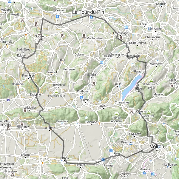
Scenic Road Tour
Discover the beauty of Voiron and its surroundings on this picturesque road tour
Explore the stunning landscapes around Voiron with this 76-kilometer road cycling tour starting near Coublevie in Rhône-Alpes, France. The route includes scenic sections with a total ascent of 1325 meters, offering both challenging climbs and rewarding downhill sections. The difficulty level of this route is moderate, making it suitable for experienced amateur cyclists. During the tour, you'll pass through charming towns and villages such as La Bâtie-Divisin and Le Pont-de-Beauvoisin.

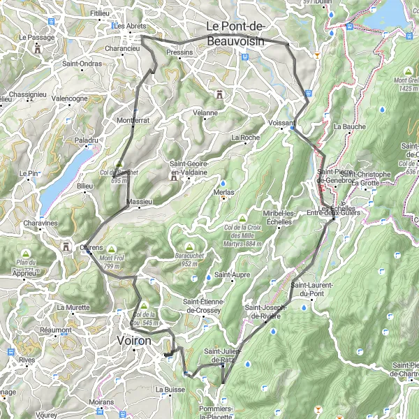
Embark on a challenging road ride with stunning views near Coublevie.
If you're looking for a challenging road cycling adventure with breathtaking views, this route is for you. Starting from Coublevie, you'll tackle challenging climbs and enjoy thrilling descents while surrounded by the stunning natural beauty of the Rhône-Alpes region. With a difficulty rating of 4 and an epicness score of 3, this route is recommended for experienced riders seeking an adrenaline rush. Highlights along the way include Tour Barral, a medieval fortress offering magnificent views; Bilieu, a charming village known for its traditional architecture; and Saint-Bueil, a peaceful rural village with picturesque landscapes. Experience the charm of Charancieu and Baracuchet, and don't miss the opportunity to visit Saint-Étienne-de-Crossey, a town with a rich history and cultural scene.
The Moirans Loop
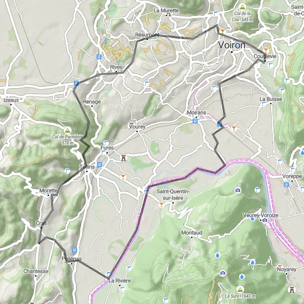
Experience the beautiful Saint-Jean-de-Moirans to Tullins route
The Moirans Loop is a 53-kilometer road cycling route starting near Coublevie in Rhône-Alpes, France. With a total ascent of 592 meters, this scenic route takes you through picturesque towns and offers stunning views along the way. The difficulty level of this route is moderate, making it suitable for amateur cyclists with good training. The highlight of this route is the Tour Barral, where you can explore the historic tower and enjoy the panoramic views of the surrounding countryside.
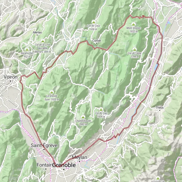
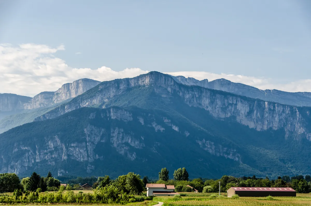
Embark on an epic gravel journey through the breathtaking Chartreuse mountains
Experience the thrill of gravel cycling with this 116-kilometer route starting near Coublevie in Rhône-Alpes, France. The Col de la Croix Bayard is a challenging climb that rewards you with stunning views over the surrounding mountains. With a total ascent of 1970 meters, this route is suitable for experienced cyclists looking for a challenge. The epicness level of this route is high, as it takes you through some of the most scenic areas in Chartreuse.
Experience the beauty of the Rhône-Alpes region on this scenic road loop around Coublevie.
Immerse yourself in the breathtaking landscapes of the Rhône-Alpes region with this road cycling route around Coublevie. As you pedal along the well-paved roads, you'll witness stunning natural scenery, peaceful villages, and challenging climbs. With a moderate difficulty level and an epicness rating of 3, this route is ideal for experienced road cyclists seeking a memorable journey. Highlights include Izeaux, a picturesque village with charming architecture; Col de Banchet, offering panoramic views of the surrounding mountains; and Sérézin-de-la-Tour, known for its historical landmarks. Explore the beauty of Eydoche and Saint-Didier-de-la-Tour, and don't miss the opportunity to visit Tour Barral, a medieval fortress with a rich history and magnificent views.
Embark on a gravel adventure to the charming town of Voiron.
This gravel route leads you from Coublevie to Voiron, a picturesque town located in the heart of the Rhône-Alpes region of France. The scenic journey takes you through rolling hills, quaint villages, and beautiful countryside. With moderate difficulty and an epicness rating of 2, this route is suitable for gravel enthusiasts of all levels. Highlights along the way include Voiron, known for its historical landmarks and vibrant atmosphere; Le Gey, a hidden gem worth a visit; and the charming village of Quincieu. This route offers a mix of smooth gravel paths and challenging off-road sections, providing a thrilling gravel adventure for cyclists.
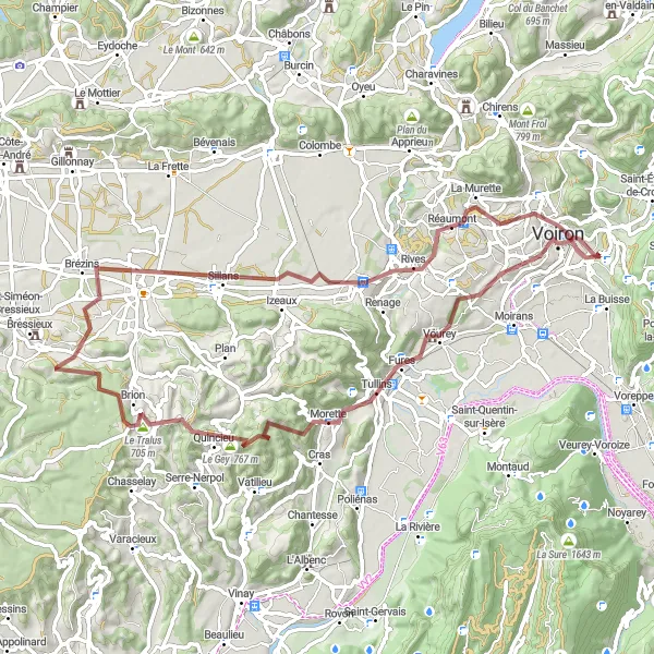
Conquer the legendary Col de Parménie on this challenging road cycling route
Take on the challenge of Col de Parménie with this 70-kilometer road cycling route starting near Coublevie in Rhône-Alpes, France. This route includes a total ascent of 1041 meters, making it suitable for experienced cyclists looking for a demanding climb. Along the way, you'll pass through picturesque towns and villages, such as Longechenal and Charavines. The highlight of this route is the Tour Barral, where you can enjoy panoramic views of the surrounding countryside.
Cycling routes nearby:


Nearby regions: