The Bölsberg Loop
A road cycling route starting from Hoehenberg
Explore a challenging road cycling route with stunning views.
Map
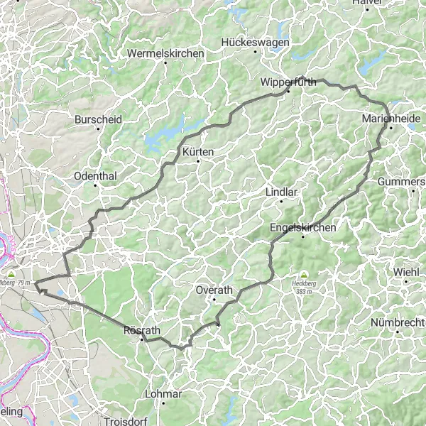
This road cycling route starting near Höhenberg takes you on a challenging journey through picturesque landscapes and offers mesmerizing views along the way. With a total distance of 106 kilometers and an ascent of 1,216 meters, this route is suitable for very well-trained amateurs seeking a thrilling experience. The scenic highlights along the route include the Bölsberg, Dörnchen, Kluse, and Windberg. These stops offer unique attractions and panoramic views that make the ride even more rewarding.
road
106 km
1216 m
Tough
Route profile
Highlights on the route
0 km
0 km
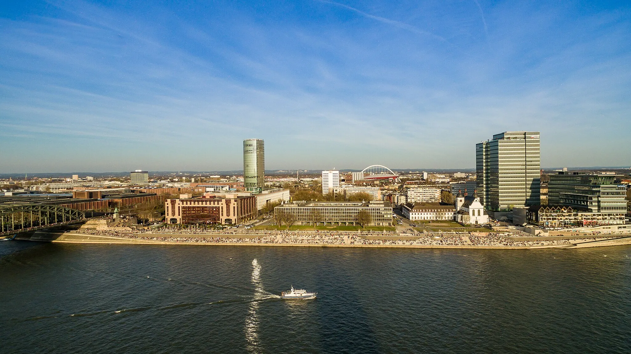
Start: Locality centerHöhenberg: Enjoy the best of both worlds – urban amenities and scenic cycling routes – in Höhenberg, Köln.
Höhenberg is a locality located in Köln, Germany. For road and gravel cyclists, Höhenberg offers a range of cycling opportunities within close proximity to urban amenities. The region boasts a mix of flat and hilly terrain, allowing cyclists to choose routes that cater to their preferences. Höhenberg itself may not have any specific famous cycling-related spots, but its location within Köln provides easy access to well-known cycling routes along the Rhine River. Overall, Höhenberg offers a convenient cycling base with access to urban delights and scenic pathways along the Rhine.20 km
20 km
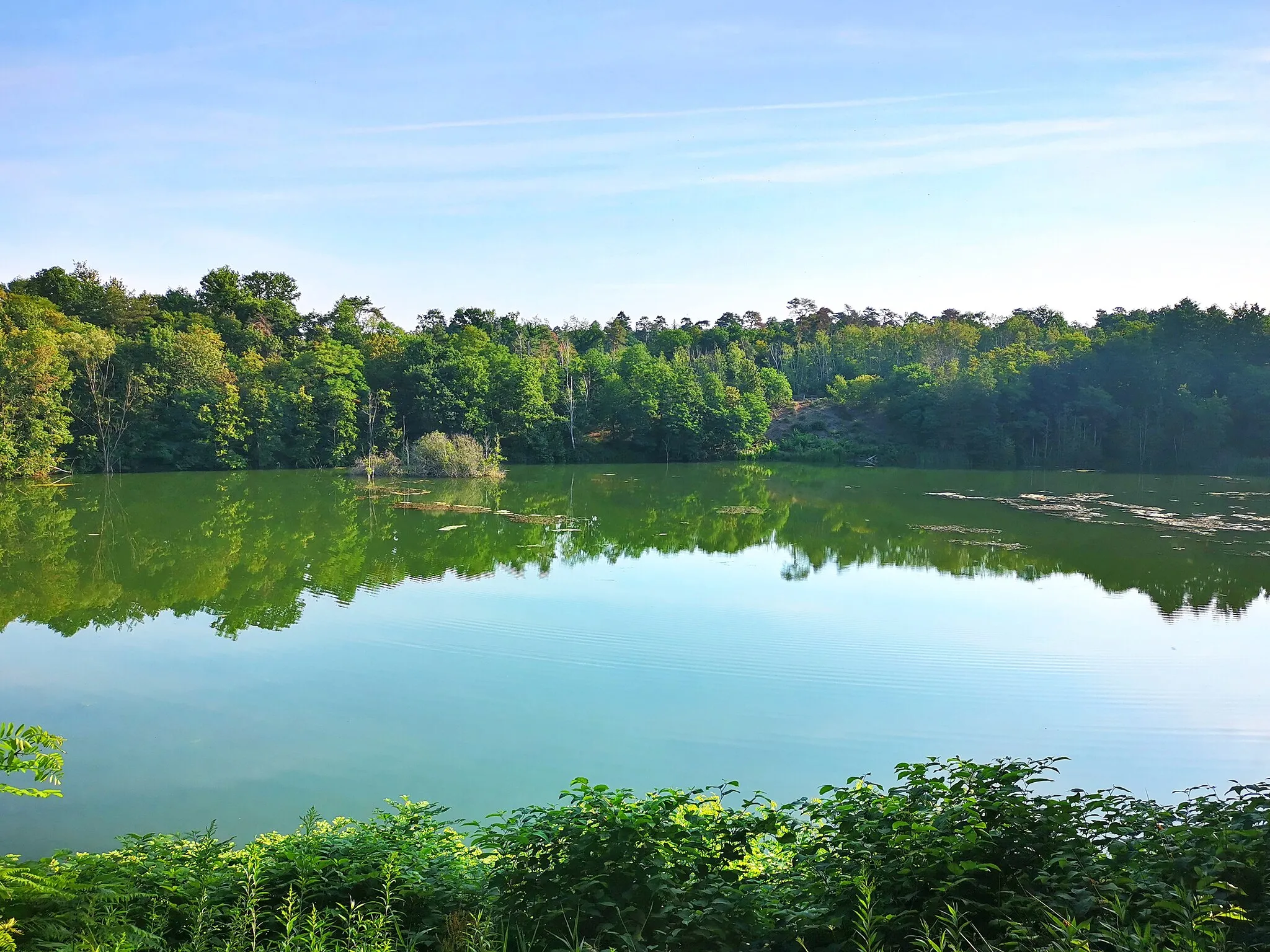
Bölsberg245 mPeakDiscover the enchanting Bölsberg, known for its rich history and breathtaking vistas.
28 km
28 km
DörnchenHamletExperience the tranquil beauty of Dörnchen with its idyllic surroundings.
36 km
36 km
KluseHamletMake a stop at Kluse, where you can marvel at ancient ruins while taking in the stunning scenery.
46 km
46 km
Windberg327 mPeakVenture up to Windberg, a legendary spot among cyclists, and enjoy magnificent panoramic views.
54 km
54 km
NiederwetteHamletNiederwette offers a charming village atmosphere and a chance to relax in natural surroundings.
55 km
55 km
Moosberg346 mPeakMoosberg provides a serene setting amidst nature with its verdant landscapes.
70 km
70 km
Huhhardt281 mPeakCycle through Huhhardt, a hidden gem known for its picturesque countryside and charming villages.
75 km
75 km
KaltenbornHamletPass through the historic town of Kaltenborn, famous for its architectural heritage and cultural significance.
84 km
84 km
AggertalViewpointExplore the scenic Aggertal and enjoy the tranquility offered by its lush green landscapes.
88 km
88 km
WahlscheidVillageMarvel at the panoramic view from Wahlscheid and capture the beauty of the surrounding countryside.
97 km
97 km
KleineichenVillageDiscover the natural beauty of Kleineichen, a charming village nestled in the rolling hills.
100 km
100 km
Aussicht auf Becken 3ViewpointWitness stunning views from the vantage point at Aussicht auf Becken 3 and immerse yourself in the beauty of the surrounding area.
106 km
106 km
Finish: Locality centerHöhenberg: Enjoy the best of both worlds – urban amenities and scenic cycling routes – in Höhenberg, Köln.
Cycling routes from Hoehenberg:
Discover the Gravel Wonder: Deutz to Höhenberg Vohwinkel Adventure Alfter Loop Höningen Adventure Escape to Natural Beauty: Enchanting Gravel Loop Röttgen Loop Idyllic Gravel Exploration from Höhenberg The Aggertal Challenge: Thrilling Gravel Adventure The Gravel Adventure: Kleiner Steinberg Loop Road Cycling Bliss: Schildgen to Ostheim The Herrenstrunden Circuit The Bölsberg Loop
Cycling routes nearby: