Discovering the Natural Beauty of Odenthal on Two Wheels
Cycling routes from Odenthal
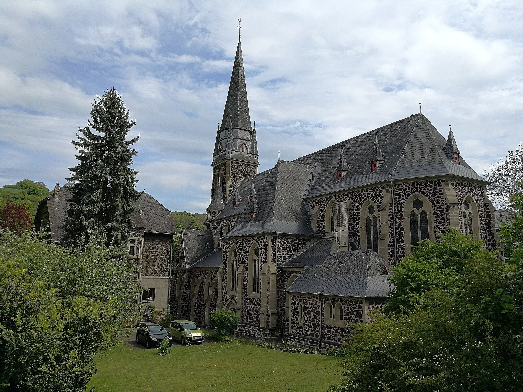
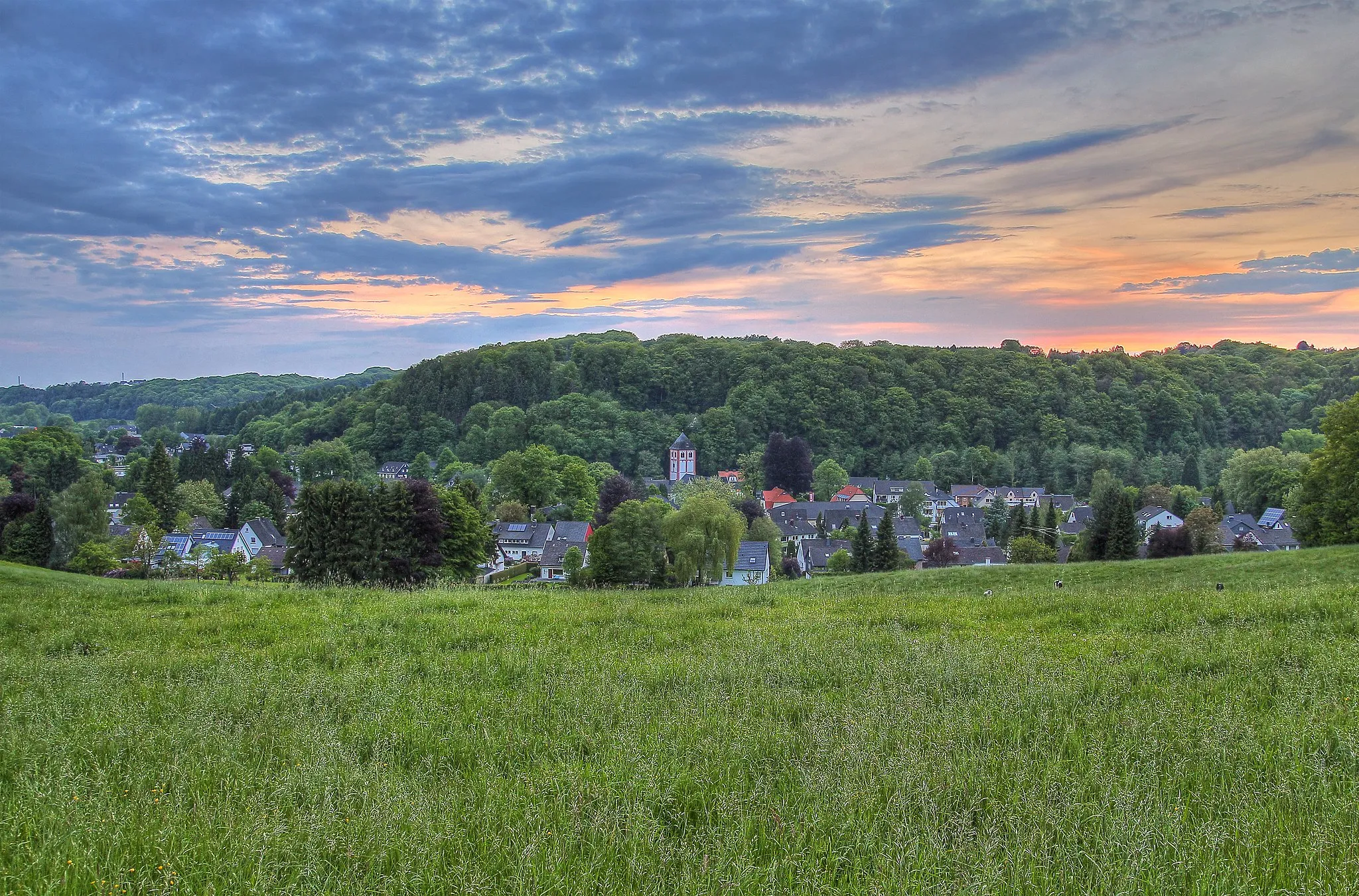
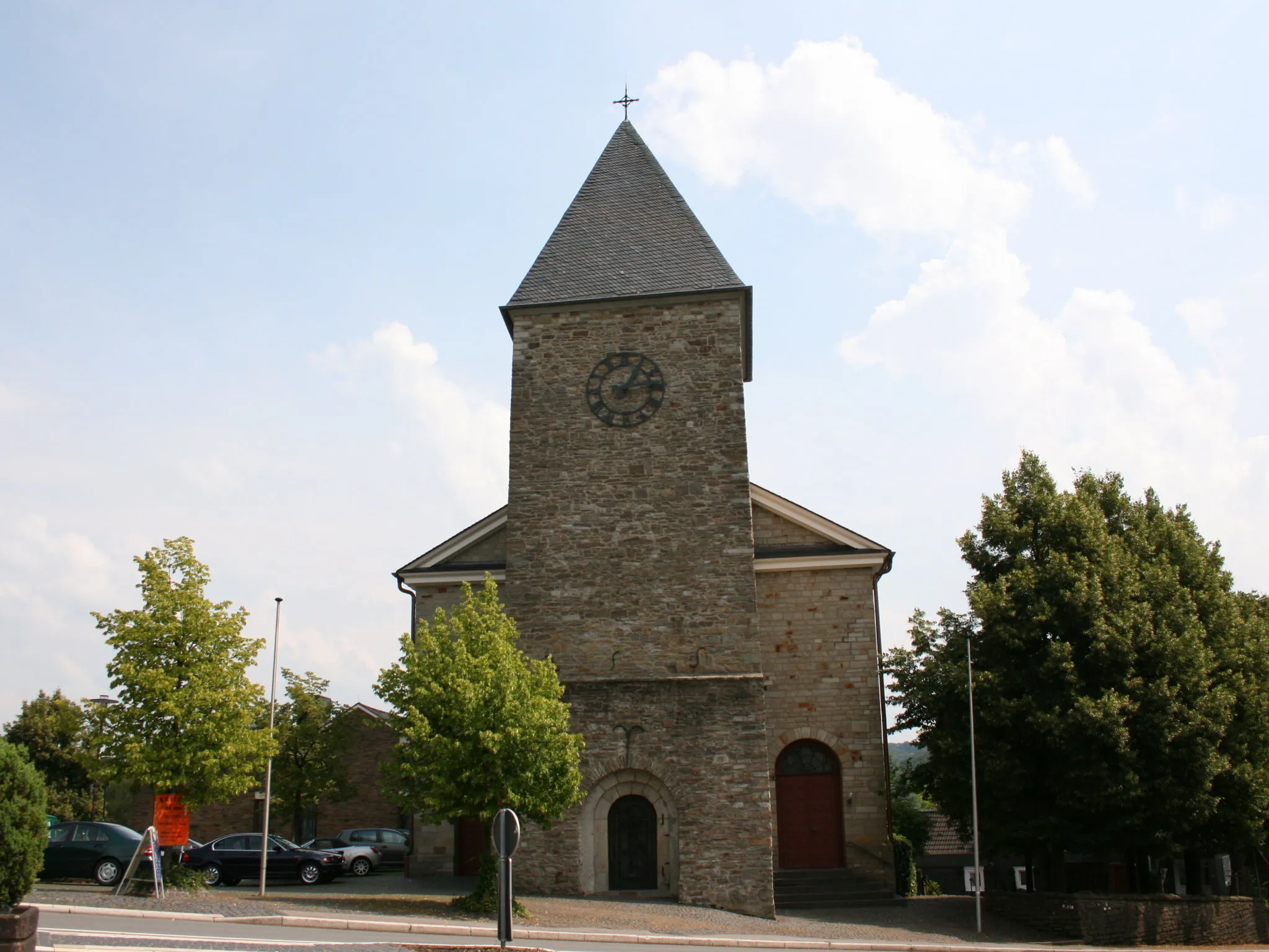
Odenthal is a locality in the Köln region of Germany. From a cyclist's perspective, Odenthal offers a mix of road and gravel cycling routes, with scenic landscapes and charming villages to discover. The area is known for its beautiful countryside, featuring rolling hills and picturesque views. One of the popular cycling-related spots nearby is the Bergisches Land region, which offers stunning nature parks and challenging climbs. Overall, Odenthal is a great destination for cyclists looking for a combination of scenic beauty and varied terrain.
Conquer the challenging Witzhelden ascent in this scenic road route
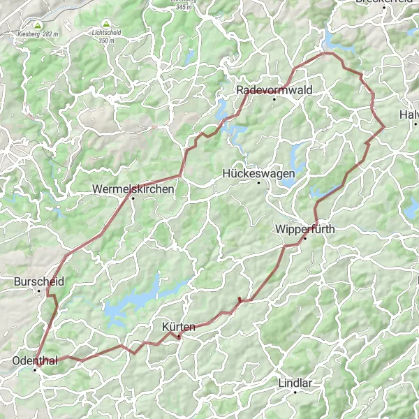
Embark on an adventurous road cycling journey from Odenthal to Witzhelden, tackling the challenging ascent along the way. This 110km route offers breathtaking views of the countryside and takes you through charming villages and serene landscapes. With an elevation gain of 1629m, this route is suitable for experienced riders looking for a challenge.
The Odenthal-Hoheberg Road Loop
Ride through meadows and forests to Hoheberg
Enjoy a scenic journey from Odenthal to Hoheberg, passing through picturesque meadows and enchanting forests. This road loop is perfect for nature lovers and offers breathtaking views along the way. The route covers a total distance of 77km with an elevation gain of 1334m, challenging but rewarding for intermediate level riders.
The Natural Beauty of Odenthal
Experience the natural wonders of Odenthal in this scenic road route
Explore the natural beauty of Odenthal in this 64km road cycling route. As you traverse through the stunning countryside and charming villages, you'll be captivated by the picturesque landscapes and rich cultural heritage. The route includes an elevation gain of 1011m, suitable for intermediate-level riders looking for a scenic adventure.
Altenberg Loop

Ride through picturesque towns and forests, tackling tough climbs
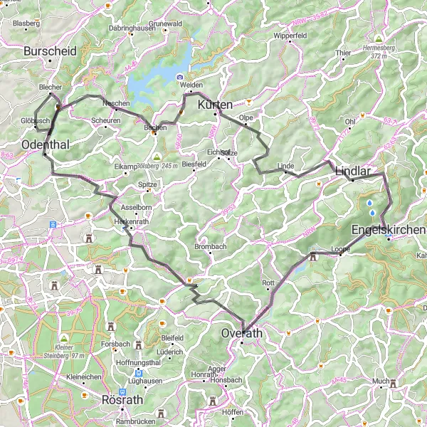
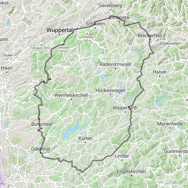
The Altenberg Loop is a challenging cycling route that takes you through the beautiful landscapes around Odenthal. With a total distance of 84 kilometers and an ascent of 1440 meters, this gravel route is perfect for experienced riders looking for a tough challenge. The route passes through highlights such as Hoheberg, Burscheid, Wermelskirchen, and scenic viewpoints on the Dhünn-Talsperre. The Altenberg Loop offers stunning views and a mix of urban and rural landscapes, making it a must-ride for gravel enthusiasts.
The Gravel Adventure in Odenthal
Experience off-road cycling bliss on the gravel roads near Odenthal
Get an adrenaline rush as you explore the gravel roads near Odenthal. This off-road adventure covers a distance of 83km with an elevation gain of 1212m, making it suitable for intermediate to advanced gravel riders. Immerse yourself in the natural beauty of the surrounding landscapes and discover hidden gems along the way.

Experience a scenic gravel loop around Bergisch Gladbach.
Escape the city and explore the beautiful landscapes around Bergisch Gladbach on this scenic gravel loop. With a total ascent of 384m over a distance of 43km, this route offers a tranquil cycling experience through nature. Soak in the peaceful surroundings as you pedal through forests and idyllic countryside. Make sure to stop at the highlights along the way for a moment of relaxation and take in the sights. This route is perfect for those looking for a short and picturesque gravel adventure.
The Odenthal Gravel Excursion

Experience the thrill of gravel biking on this 34km adventure near Odenthal
Embark on an exhilarating 34km gravel biking journey near Odenthal. With an elevation gain of 723m, this route is suitable for intermediate-level gravel enthusiasts seeking an adrenaline rush. Traverse through the stunning countryside and discover hidden gems along the way, making for a memorable off-road adventure.
Cycling through quaint villages and scenic landscapes
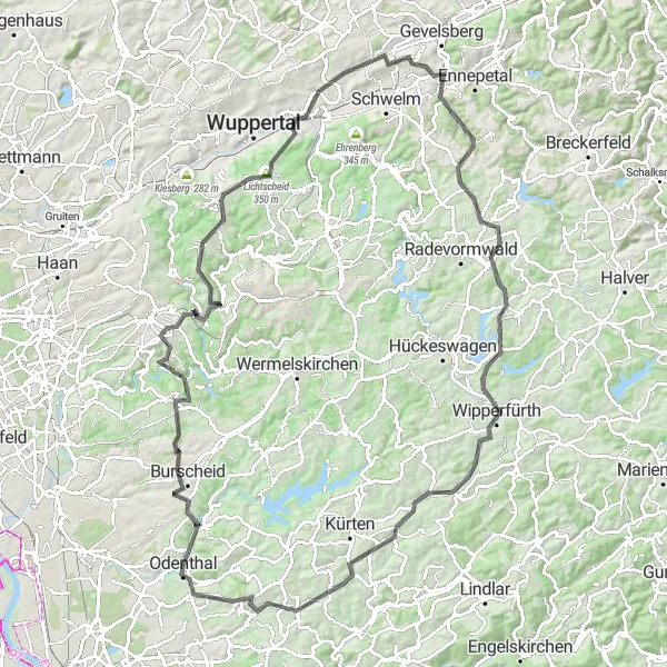
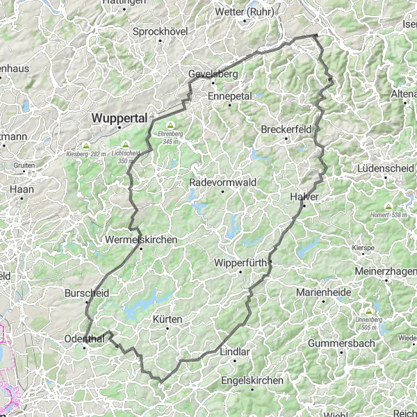
This round-trip cycling route takes you through the charming villages of Hoheberg and Burscheid, offering stunning countryside views along the way. With a significant ascent of 1997 meters and a distance of 140 kilometers, this route is suitable for experienced riders. The route is challenging but rewarding, perfect for those looking to push their limits. Embark on this epic cycling adventure and witness the beauty of Odenthal and its surrounding areas.

Explore the picturesque countryside of Odenthal on this gravel adventure.
This gravel route takes you through the scenic landscapes surrounding Odenthal. Prepare to be surrounded by rolling hills, dense forests, and charming villages along the way. The route is moderately challenging, with a total ascent of 364m over a distance of 99km. It offers a perfect mix of off-road and paved paths, making it suitable for gravel bike enthusiasts looking for a rewarding adventure. Don't forget to take a break at the highlights along the route to soak in the beautiful views and immerse yourself in nature.
Embark on a epic road cycling journey through challenging climbs and breathtaking views
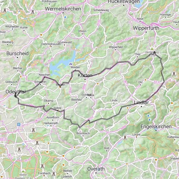
The Mountain Adventure is an epic road cycling route starting near Odenthal. This 125-kilometer long route offers a total ascent of 1923 meters, making it a challenging adventure for well-trained amateurs. The route takes you through highlights such as Odenthal, Hoheberg, Müngstener Brücke, and Diederichstempel. You'll have the opportunity to ride alongside the iconic Müngstener Brücke, the highest railway bridge in Germany, and enjoy panoramic views from the top. The route also includes tough climbs like Roppersthal and Dörrenberg, which are well-known among cyclists for their difficulty. The Mountain Adventure offers a thrilling mix of natural beauty and challenging terrain, making it a must-ride for road cycling enthusiasts.
Cycling routes nearby:


Nearby regions: