Tranquil cycling destination in Niederbayern with scenic routes along the Inn River.
Cycling routes from Ering
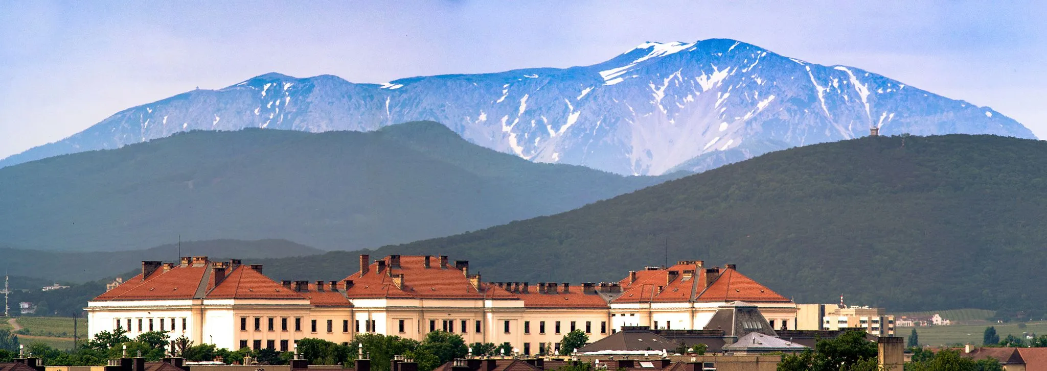
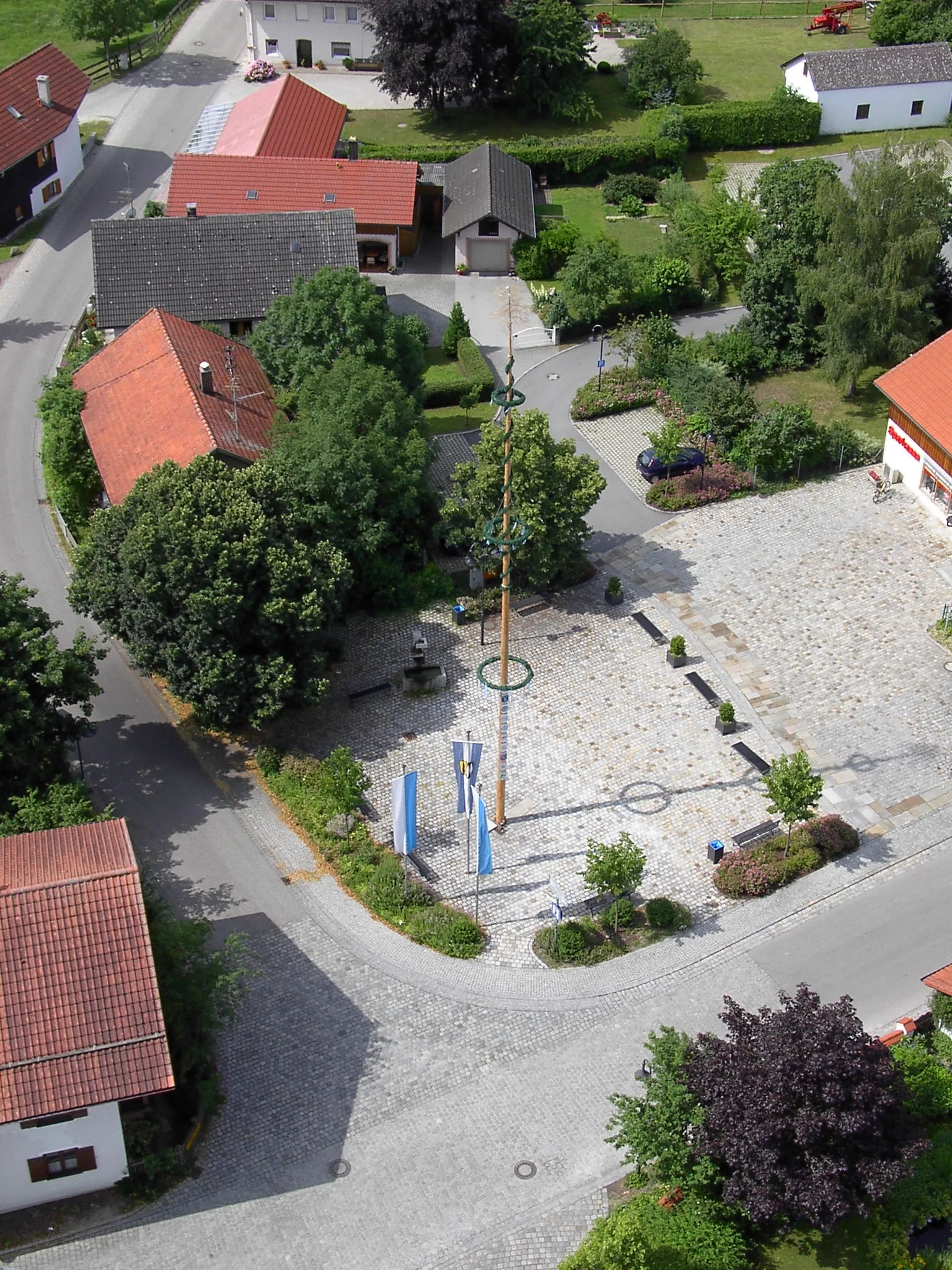
Ering, nestled in the Niederbayern region of Germany, is an ideal locality for road and gravel cyclists seeking tranquility and natural beauty. Cyclists can explore the idyllic countryside, ride along peaceful roads, and admire the stunning views of the Inn River. Ering is a gateway to the nature reserve of Unterer Inn, which offers diverse cycling trails amidst the scenic river landscape. While not featuring any particularly famous climbs, the area provides a charming and rewarding cycling experience. With its serene ambience and picturesque routes, Ering is a hidden gem for cyclists looking to connect with nature and indulge in a peaceful ride.
Prienbach Loop
Enjoy a scenic loop that takes you through Prienbach and surrounding towns, offering beautiful countryside views.
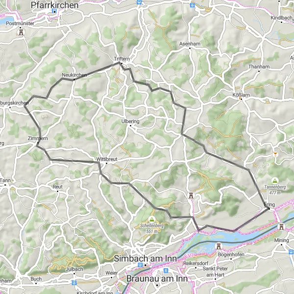
The Prienbach Loop is a scenic road cycling route that takes you through Prienbach and the surrounding towns near Ering, Germany. With a distance of 53 kilometers and an elevation gain of 559 meters, this route provides a moderate challenge for well-trained amateur cyclists. The highlights along the way include Prienbach, Schellenberg, Wittibreut, Triftern, and Prenzing. These highlights offer stunning countryside views, historic landmarks, and opportunities for outdoor exploration. Overall, this route offers a delightful cycling experience with breathtaking scenery and cultural attractions.
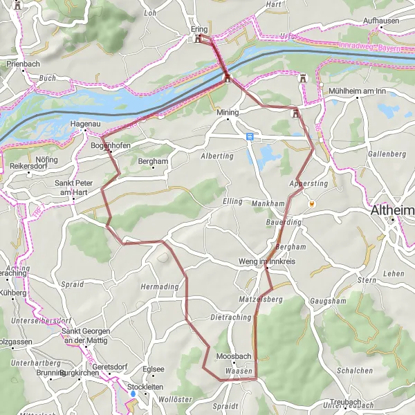
Conquer the challenging terrains of St. Georgen bei Obernberg am Inn and Saustallberg
Prepare yourself for a challenging ride through the rugged terrains of St. Georgen bei Obernberg am Inn and Saustallberg. This gravel route spans a distance of 82 kilometers with an elevation gain of 815 meters, making it suitable for experienced riders seeking an exhilarating adventure. Discover the hidden gem of Köpfstätte, a charming village famous for its traditional architecture and panoramic views. Make a stop at Sankt Georgen bei Obernberg am Inn and soak in the serene atmosphere surrounded by vibrant greenery. Admire the natural beauty of Kirchheim im Innkreis and immerse yourself in its tranquil ambiance. Viehberg, known for its untouched landscapes, will leave you in awe with its unspoiled charm. The journey concludes at Moosbach, a serene village embraced by idyllic settings. Get ready to conquer this challenging route and experience unforgettable moments.
Ering Discovery
Explore the scenic surroundings and charming villages near Ering on this relatively easy road cycling route.
The Ering Discovery is a relatively easy road cycling route that takes you through the scenic surroundings and charming villages near Ering, Germany. With a distance of 56 kilometers and an elevation gain of 404 meters, this route is suitable for well-trained amateur cyclists looking for a more relaxed ride. The highlights along the way include Ering, Mühlheim am Inn, Höhnhart, Mauerkirchen, and Alberting. These highlights offer picturesque landscapes, quaint village charm, and opportunities to discover local culture. Overall, this route provides a pleasant cycling experience with beautiful scenery and cultural attractions.
Embark on an adventurous road cycling journey to Simbach am Inn and discover the natural beauty of the region.
The Simbach Adventure is an adventurous road cycling route that takes you to Simbach am Inn, a scenic town located near Ering, Germany. With a distance of 95 kilometers and an elevation gain of 809 meters, this route offers a challenging and rewarding experience for well-trained amateur cyclists. The highlights along the way include Simbach am Inn, Stammham, Mitterskirchen, Walburgskirchen, and Prenzing. These highlights offer diverse landscapes, historic landmarks, and opportunities for outdoor adventure. Overall, this route provides a thrilling cycling experience with breathtaking scenery and cultural attractions.
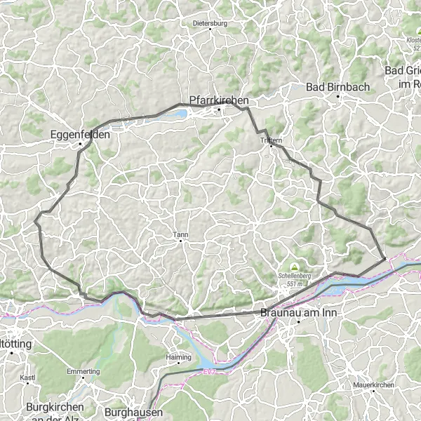
Bavarian Delight
Experience the stunning beauty of Bavaria on this challenging road cycling route
Get ready for an unforgettable cycling adventure through the picturesque landscapes of Niederbayern. Starting near Ering, this 150-km round-trip route will take you on a journey through charming towns, rolling hills, and breathtaking scenery. With a total ascent of 1655 meters, the Bavarian Delight is a challenging ride that is suitable for very well-trained amateur cyclists. The route offers a harmonious blend of natural beauty and historical treasures, making it a must-try for cycling enthusiasts.
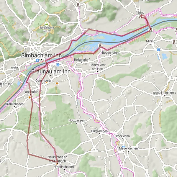
Cycle through the tranquil landscapes of Ering and Schloss Hagenau
Embark on a scenic cycling adventure through the peaceful countryside of Ering and Schloss Hagenau. This 32-kilometer gravel route offers a relaxed and leisurely ride, perfect for cyclists of all skill levels. Admire the natural beauty of Ering, a charming village known for its idyllic landscapes and relaxed atmosphere. Enroute, make a stop at Weng im Innkreis and immerse yourself in the traditional charm of this quaint hamlet. As you approach Schloss Hagenau, be captivated by the beauty of this historic landmark nestled amidst lush greenery. Enjoy the serenity and the picturesque views this route has to offer.
Conquer the challenging terrain of the Simbach region and discover its beautiful landscapes and historic landmarks.
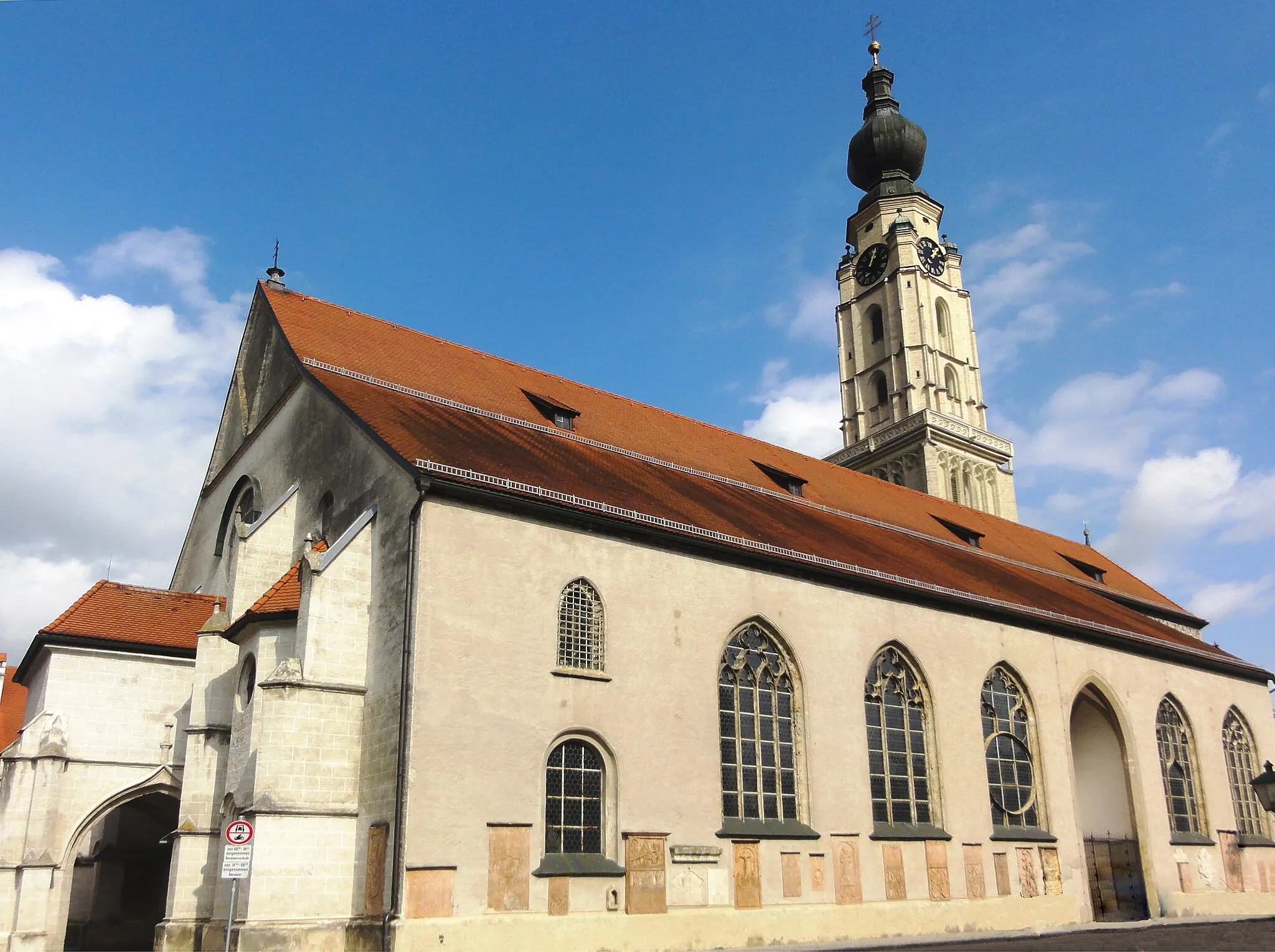
The Simbach Challenge is a challenging road cycling route that takes you through the scenic Simbach region near Ering, Germany. With a distance of 94 kilometers and an elevation gain of 735 meters, this route offers a thrilling adventure for well-trained amateur cyclists. The highlights along the way include Simbach am Inn, Schloßberg, Marktl, Reischach, Hirschhorn, Postmünster, and Triftern. These highlights offer a mix of natural beauty, historic architecture, and cultural attractions. Overall, this route provides a challenging and rewarding cycling experience with breathtaking scenery and diverse attractions.
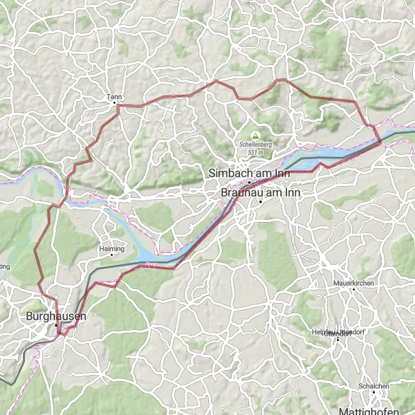
Unleash your adventurous spirit while exploring the picturesque landscapes of Simbach am Inn and Marktl
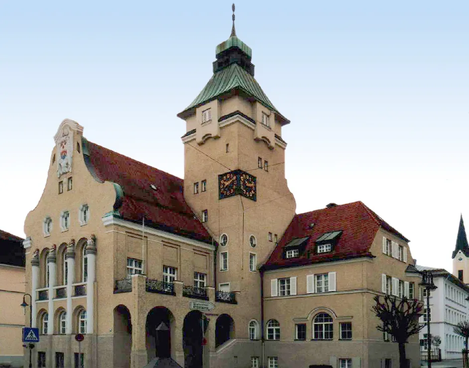
Get ready for an expedition along the stunning Inn River as you cycle through Simbach am Inn and Marktl. This gravel route spans 81 kilometers and incorporates challenging ascents of 854 meters, suitable for intermediate to advanced cyclists seeking excitement. Don't miss out on taking a break at Schwammerl, a serene spot known for its panoramic views and peaceful surroundings. Capture breathtaking photographs at Burghausen, home to the longest castle complex in the world. Cycle through the charming village of Reut and revel in its tranquil ambiance before reaching the final highlight, Marktl, the birthplace of Pope Benedict XVI. Get ready to embark on this epic cycling journey, perfect for adventure enthusiasts looking for an unforgettable experience.
Braunau Adventure
Discover the scenic beauty of Braunau am Inn and Schloss Frauenstein
Embark on an adventurous cycling journey through the picturesque landscapes of Braunau am Inn. Experience the thrill of riding past historical landmarks like Schloss Frauenstein, while enjoying the tranquil atmosphere of the region. The route offers a challenging ascent of 166 meters over a distance of 48 kilometers, making it suitable for moderately experienced cyclists. It is a gravel route perfect for off-road enthusiasts looking for a unique and thrilling ride.
Malching Loop
Expolre the scenic countryside and charming towns near Ering in this challenging road cycling route.
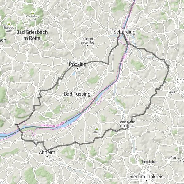
The Malching Loop is a challenging road cycling route that takes you through picturesque countryside and charming towns near Ering, Germany. With a distance of 94 kilometers and an elevation gain of 739 meters, this route offers a good challenge for well-trained amateur cyclists. The highlights along the way include Malching, Pocking, Schärding, Mayrhof, Hoher Schachen, Geinberg, and Schloss Frauenstein. These highlights offer beautiful scenery, historic landmarks, and unique cultural experiences. Overall, this route offers a great mix of challenging terrain, scenic beauty, and cultural attractions.
Cycling routes nearby:


Nearby regions: