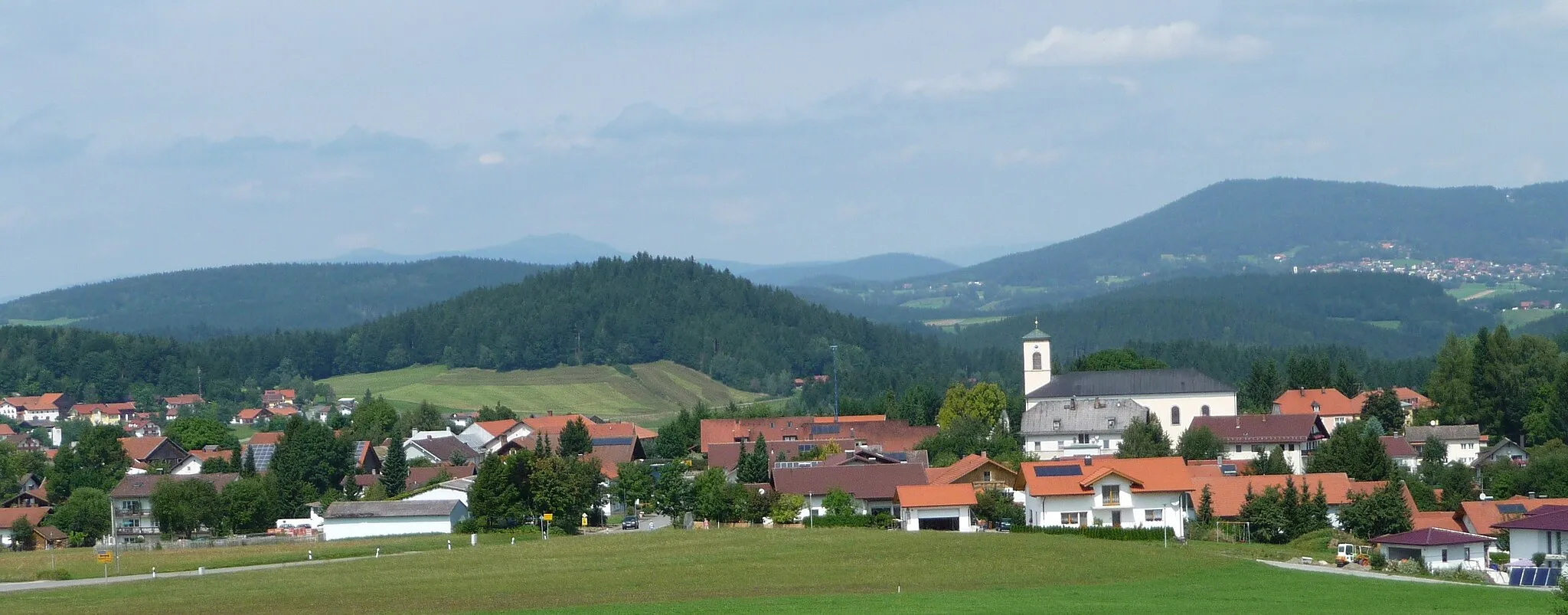
Cycling paradise in Niederbayern
Cycling routes from Thurmansbang
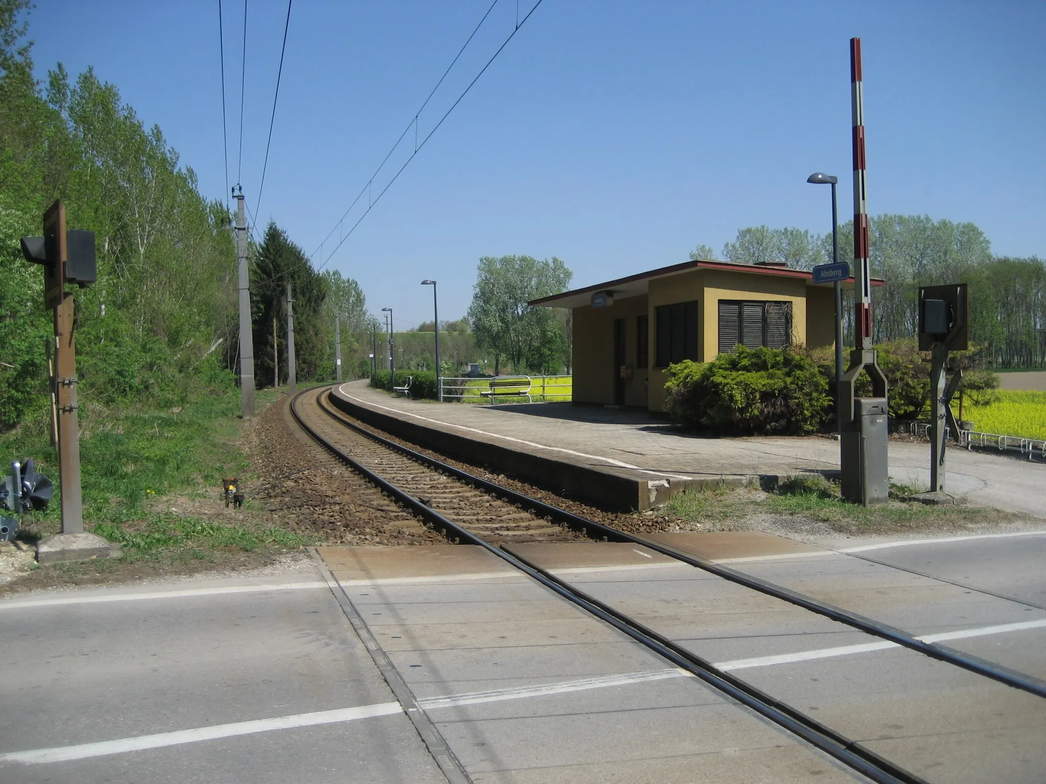
Thurmansbang, situated in Niederbayern, Germany, offers great cycling options for road and gravel cyclists. The region is characterized by picturesque landscapes, challenging climbs, and well-maintained roads. Notable cycling spots nearby include the Bavarian Forest and the Donau Cycle Path. Overall, Thurmansbang is a fantastic destination for cyclists seeking thrilling rides and breathtaking scenery.
A thrilling road cycling journey with highlights including Saldenburg, Glockenberg, and Thyrnau
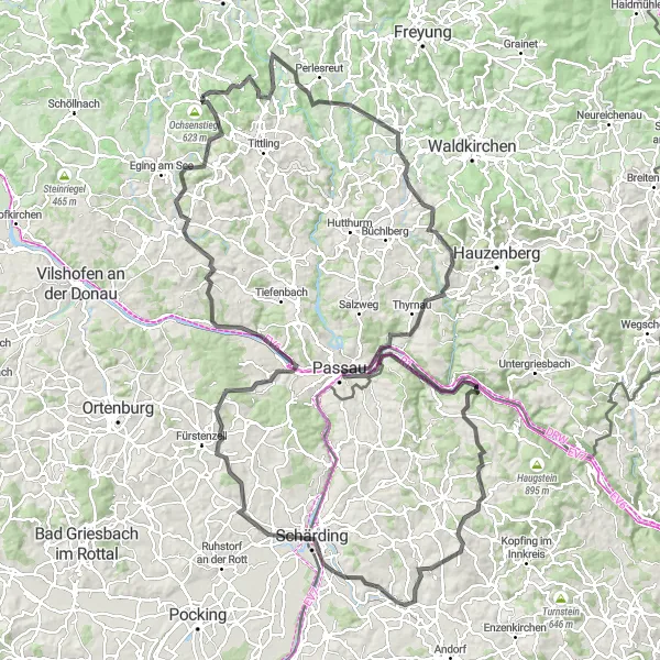
This road cycling route near Thurmansbang takes you on a thrilling adventure towards the beautiful city of Passau. The route covers a distance of 159 kilometers with a total ascent of 2606 meters, making it suitable for experienced cyclists. Along the way, you will encounter several highlights, including the scenic Saldenburg, the breathtaking Glockenberg, and the charming town of Thyrnau. These highlights offer stunning views and unique cultural experiences, making the journey even more memorable.
Nature and Culture in Zenting
Embark on a scenic journey to Zenting and immerse yourself in its captivating blend of nature and culture.
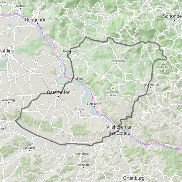
This road cycling route near Thurmansbang takes you through breathtaking landscapes on a 98 km ride with an ascent of 1135 m. Uncover the natural beauty and charm of Ochsenstiegl at the beginning of your adventure, showcasing lush greenery and a peaceful atmosphere. Eging am See at 8 km invites you to enjoy its idyllic lake and picturesque surroundings. Vilshofen an der Donau at 23 km captivates you with its stunning riverside views and historic architecture. Don't miss the opportunity to visit Piske-Turm at 28 km, offering panoramic vistas of the surrounding countryside. As you continue your journey, Osterhofen at 60 km invites you to unwind in its serene rural setting. Hengersberg at 72 km showcases scenic landscapes and offers a taste of Bavarian hospitality. At 86 km, the picturesque town of Eisenberg allures visitors with its captivating beauty. Finally, at 91 km, Zenting welcomes you with its harmonious blend of natural splendor and cultural attractions.
Embark on an epic journey to Hauzenberg and explore its hidden gems.
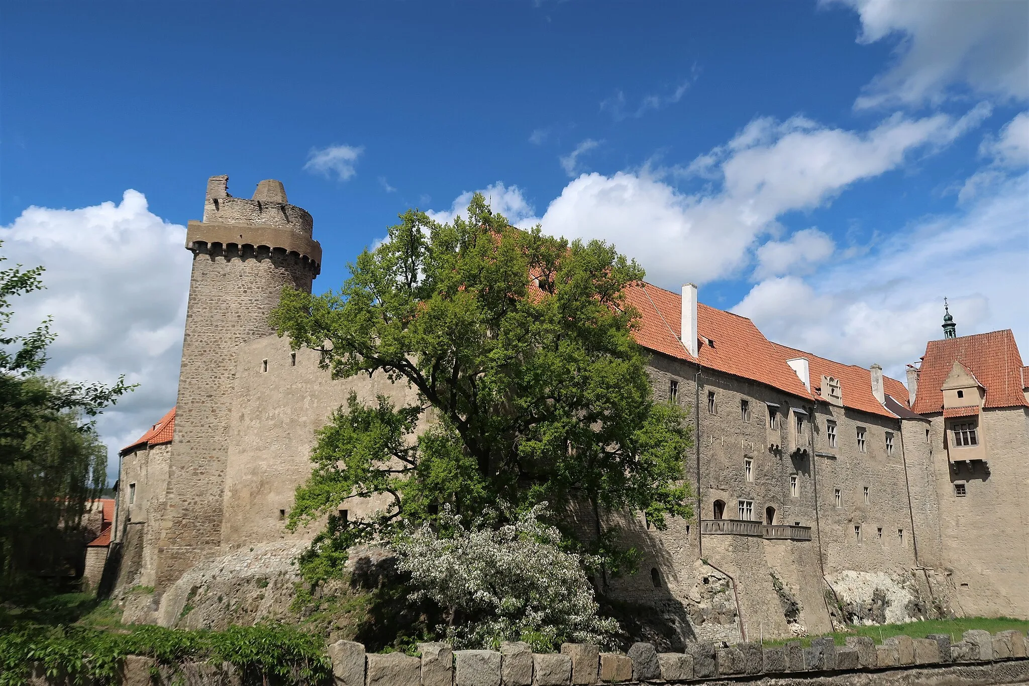
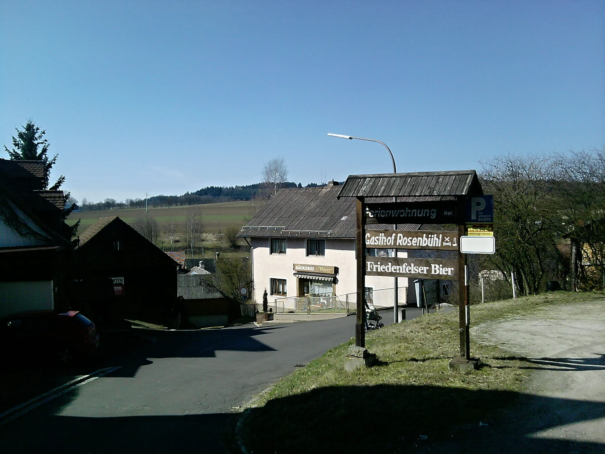
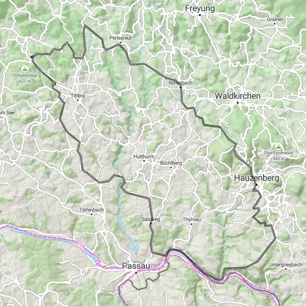
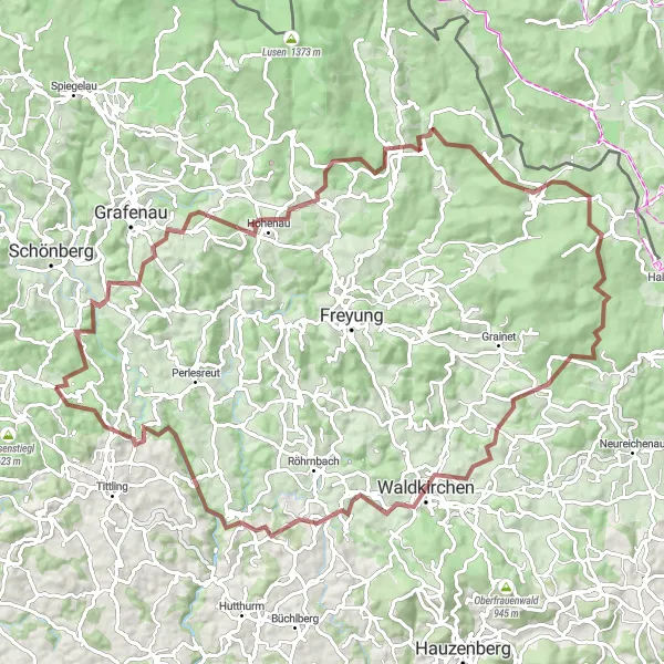
This road cycling route near Thurmansbang takes you on a thrilling adventure, covering a distance of 98 km with an ascent of 1917 m. The highlights along the route include Glockenberg at 10 km, offering stunning views of the surrounding mountains and forests. Perlesreut at 16 km showcases a charming village with traditional Bavarian architecture. Steinberg at 36 km is renowned for its medieval castle ruins, capturing the essence of the region's history. As you proceed, make sure to visit Hauzenberg at 40 km, where you can marvel at its vibrant culture and captivating landscapes. Burg Krempelstein welcomes you at 58 km, showcasing the remains of an ancient castle and providing a glimpse into the past. Salzweg at 70 km and Neukirchen vorm Wald at 85 km offer a blend of breathtaking scenery and cultural landmarks. Finally, at 99 km, you'll arrive back in Thurmansbang.
The Eging Exploration

Embark on a journey to Eging am See and be enchanted by its rustic charm.
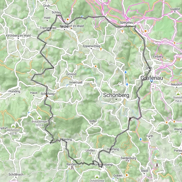
This road cycling route near Thurmansbang takes you through the picturesque countryside of Niederbayern. With a total distance of 80 km and an ascent of 1756 m, the ride offers a decent challenge for amateur cyclists. The scenic highlights along the route include the charming town of Eging am See at 9 km, the panoramic views from Ellerberg at 16 km, and the quaint village of Grattersdorf at 26 km. As you continue your adventure, don't forget to stop by Hausstein at 39 km and Kirchberg im Wald at 51 km to immerse yourself in the beauty of nature. Finally, at 76 km, you'll reach Thurmansbang, where you can rejuvenate after a fulfilling cyclilng journey.
Discover hidden gems and natural wonders on this scenic gravel route near Thurmansbang.
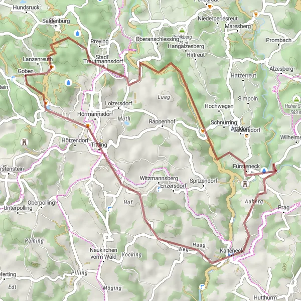
Explore the hidden gems and natural wonders of Niederbayern on this scenic gravel route near Thurmansbang. Covering a distance of 37 kilometers with a total ascent of 855 meters, this route is perfect for cyclists looking to discover off-the-beaten-path attractions. Highlights of the route include Diebstein, a picturesque viewpoint offering panoramic views of the surrounding landscapes, and Saldenburg, a charming village known for its traditional architecture and tranquil atmosphere. Tittling is another highlight on the route, famous for its well-preserved medieval castle and historical significance. With its diverse landscapes and cultural attractions, this route promises an exciting gravel adventure.
Bavarian Hills and Forests
Experience the beauty of Niederbayern's hills and forests on this diverse cycling route.
This round-trip cycling route starting near Thurmansbang showcases the distinctive natural landscapes of Niederbayern. As you cycle through the region, you'll be greeted by rolling hills, dense forests, and scenic viewpoints. The route offers a mix of smooth asphalt and gravel roads, providing both road cyclists and gravel bikers with an enjoyable experience. With a total ascent of 1428 meters and a distance of 66 kilometers, this route is of moderate difficulty and suitable for well-trained amateur cyclists. The Bavarian Hills and Forests route appeals to nature lovers and those seeking a peaceful cycling journey.
Magical Forest Gravel Adventure
Journey through dense forests and rolling hills
Embark on a 100-kilometer gravel adventure starting near Thurmansbang in Niederbayern, Germany. This route will take you through picturesque landscapes as you cycle through dense forests and conquer rolling hills. With a total ascent of 2,291 meters, this challenging ride is perfect for experienced cyclists looking for a thrilling off-road experience. The route showcases the natural beauty of the region and offers breathtaking views along the way.
Embark on an epic mountain cycling adventure exploring the peaks and valleys of Niederbayern.
Get ready for an epic mountain cycling adventure that takes you through the diverse peaks and valleys of Niederbayern. This 63-kilometer gravel route is designed for experienced cyclists who are up for a challenge and offer plenty of climbing opportunities. Highlights of the route include Bärnstein, a towering peak known for its panoramic views of the surrounding mountains and picturesque landscapes. Another highlight is Altschönau, where you can explore the quaint village nestled in a beautiful valley and surrounded by rolling hills. The route also takes you to Steinberg, famous for its impressive rock formations and pristine nature. With its diverse landscapes and challenging ascents, this route offers an unforgettable mountain cycling experience.

Embark on a challenging gravel ride through the mountainous terrain of Niederbayern.
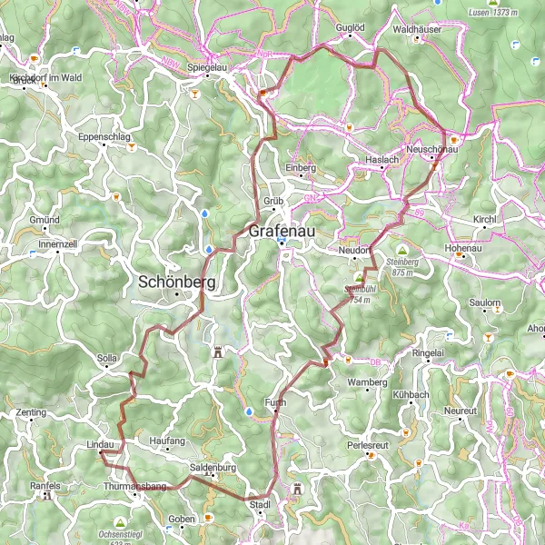
Get ready for a thrilling gravel adventure through the mountainous terrain of Niederbayern. Covering a distance of 112 kilometers and with a total ascent of 2,781 meters, this route is not for the faint-hearted. Along the way, you will pass through stunning highlights such as Grafenau, known for its traditional Bavarian architecture, and Neuschönau, home to the renowned Baumwipfelpfad, a treetop walkway offering panoramic views of the surrounding forests. With its epic ascents and breathtaking views, this route is a true test of endurance and offers an unforgettable experience for gravel enthusiasts.
The Classic Road Ride
Enjoy a classic road cycling experience through the scenic landscapes of Niederbayern.
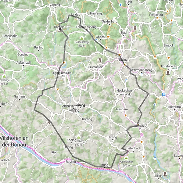
Saddle up and embark on a classic road ride through the scenic landscapes of Niederbayern. Covering a distance of 62 kilometers with a total ascent of 1,137 meters, this route is perfect for well-trained amateur cyclists looking for a challenging yet enjoyable ride. Along the way, you will pass through highlights such as the picturesque Höhenberg, the charming town of Tittling, and the scenic Ruderting. The route also takes you to Eging am See, known for its stunning lake views and recreational activities. With its smooth road surfaces and breathtaking landscapes, this route guarantees a memorable road cycling experience.
Cycling routes nearby:


Nearby regions: