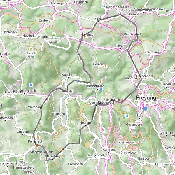
Immersing in the serene countryside of Perlesreut
Cycling routes from Perlesreut
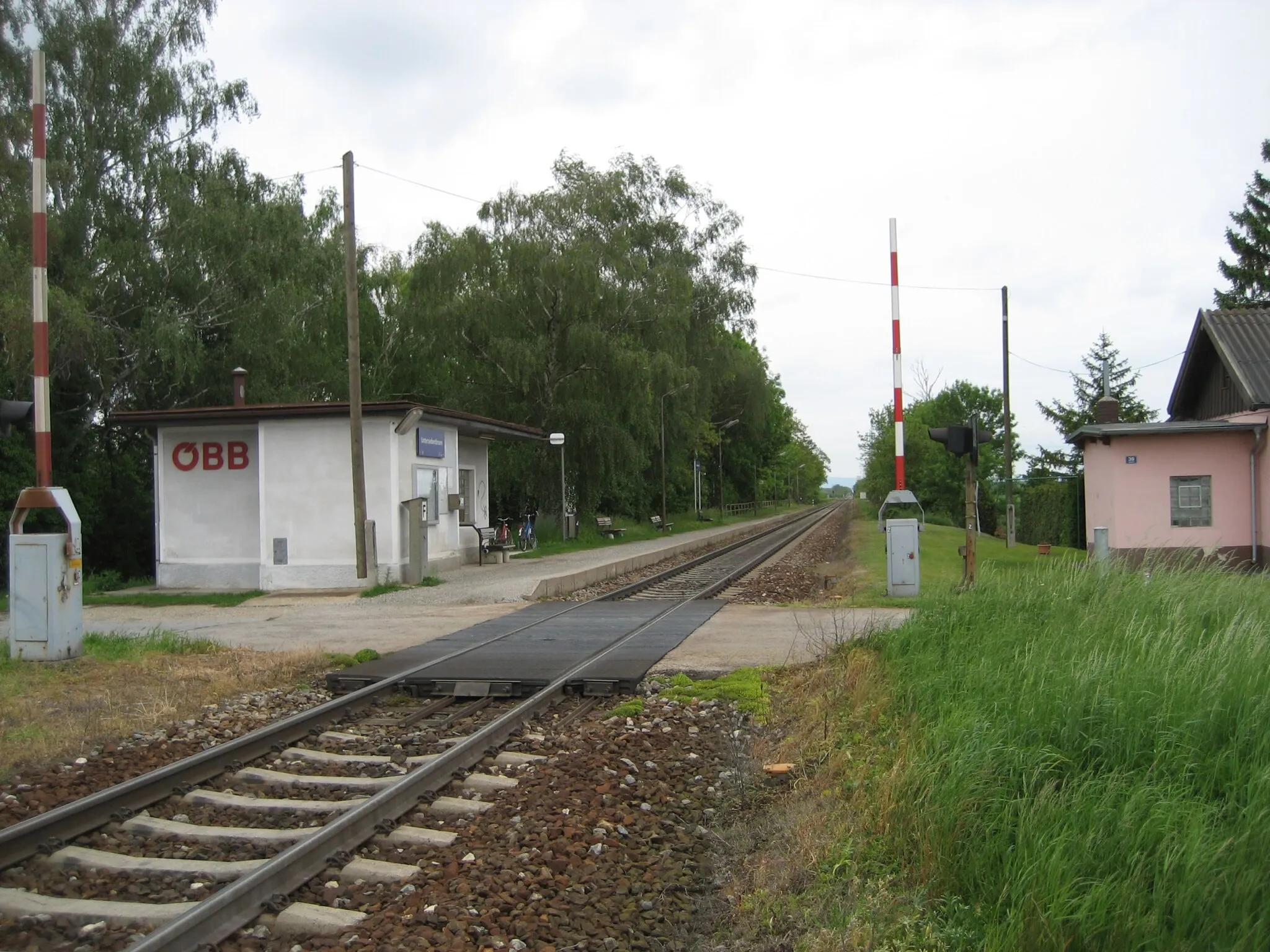
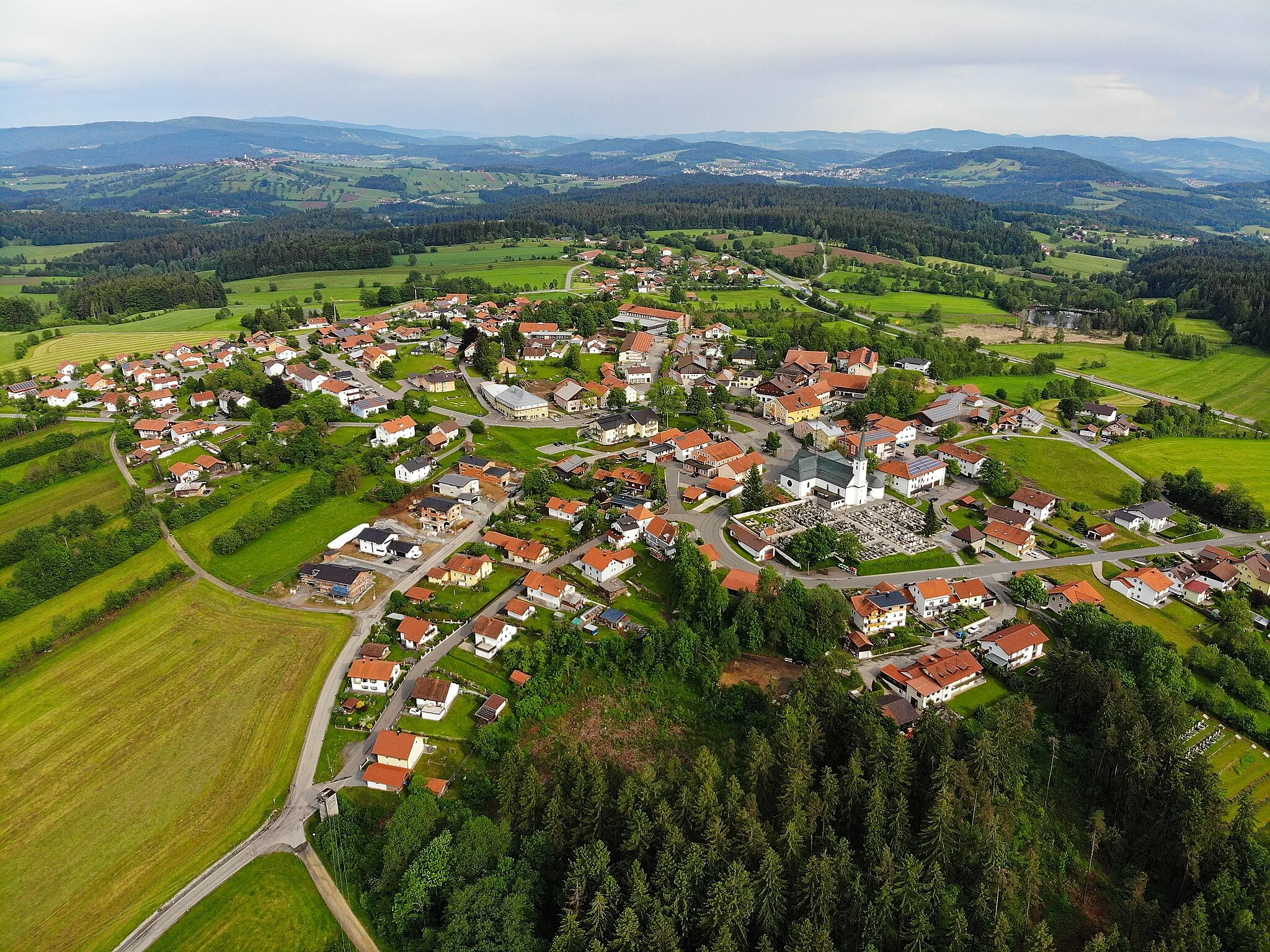
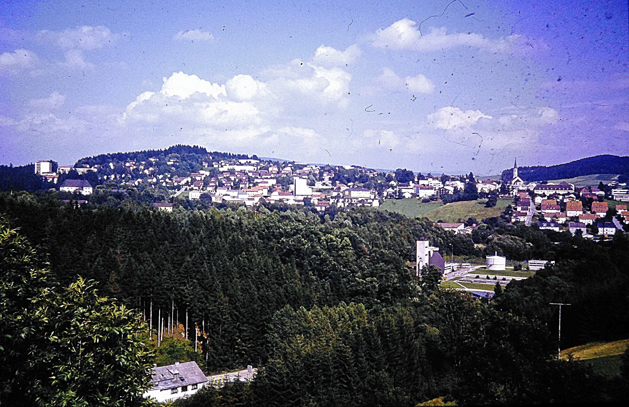
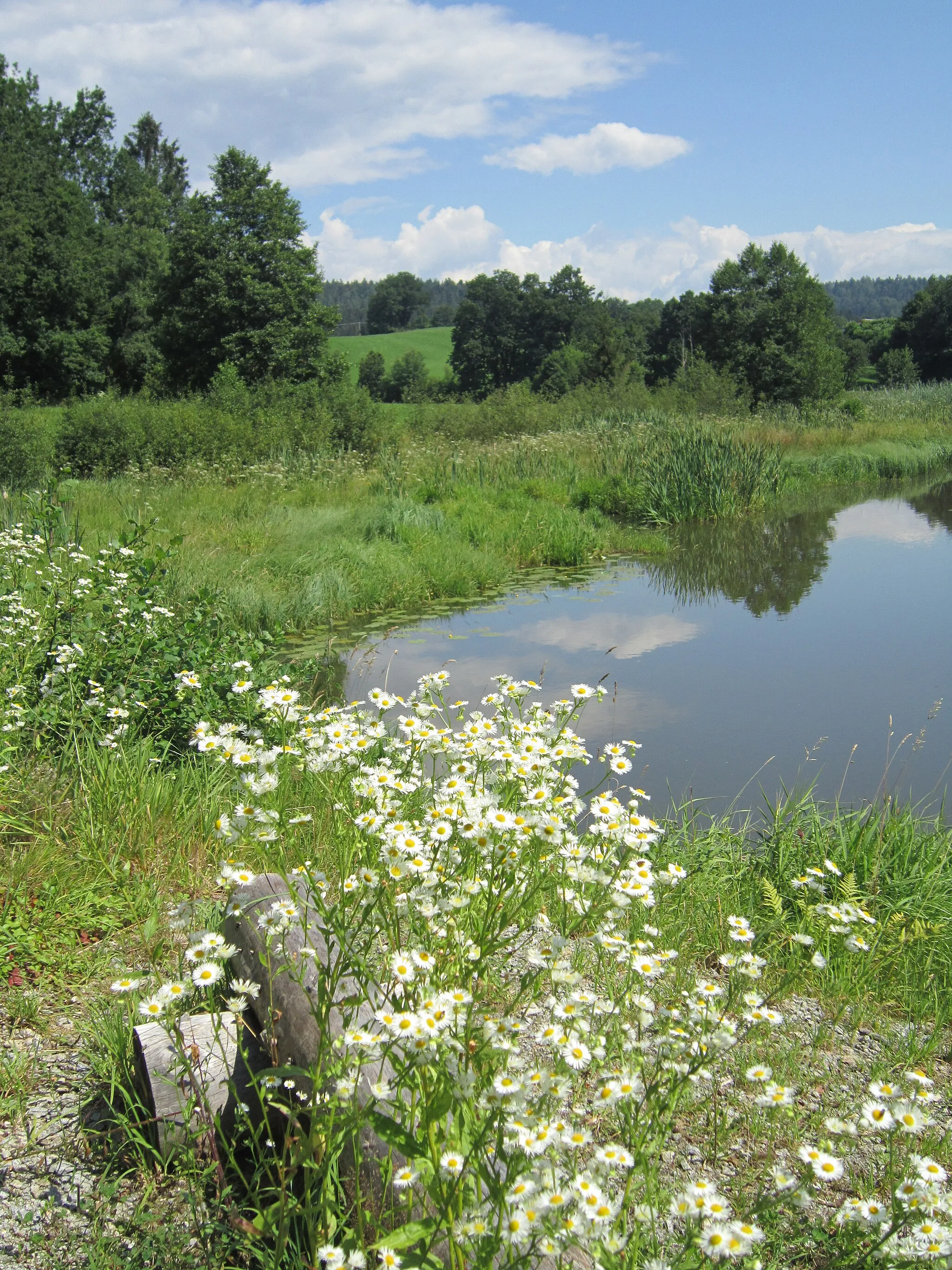
Perlesreut, located in Niederbayern, Germany, offers a peaceful countryside setting perfect for road and gravel cycling. Cyclists can savor the tranquility as they pedal through rolling hills and picturesque landscapes featuring charming Bavarian villages and farmlands. The area features well-maintained roads and gentle climbs, making it suitable for cyclists of all levels. Gravel cyclists can also explore the surrounding forest paths and discover hidden gem trails. Perlesreut is a great base for cycling adventures, with numerous routes leading to nearby attractions such as the Bavarian Forest National Park.
Embark on a road cycling adventure from Hauzenberg to Lindberg, and discover the beauty of the Bavarian countryside.
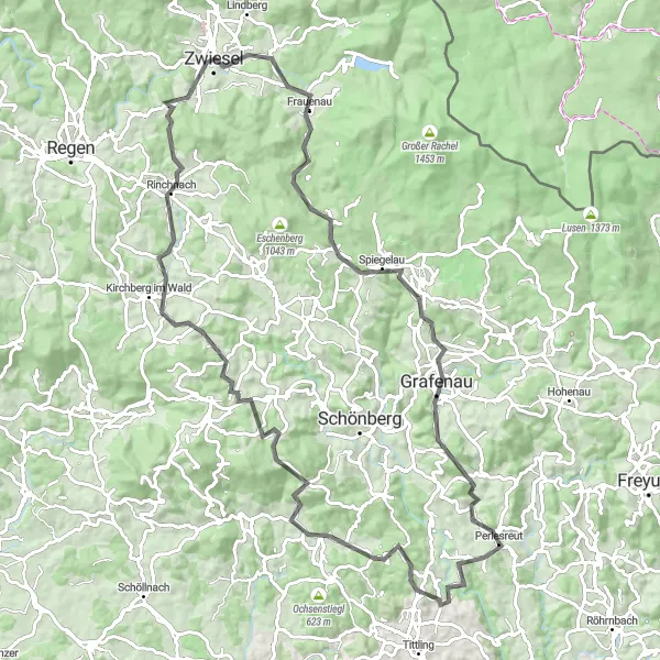
This road cycling adventure takes you from Hauzenberg to Lindberg, covering a distance of 94 kilometers with an ascent of 1826 meters. Along the way, you'll encounter highlights such as Hauzenberg, Saldenburg, Untermitterdorf, Rinchnach, Hiermesbügel, Frauenau, Spiegelau, Bienstand, and Lindberg. It offers a mix of rural landscapes, charming towns, and cultural attractions.
Scenic Road Tour to Fürsteneck
Embark on a scenic road cycling tour to Fürsteneck and discover the beauty of Bavarian countryside.
This captivating road cycling route takes cyclists on a scenic journey to Fürsteneck, showcasing the beauty of the Bavarian countryside. With a distance of 79 kilometers and a total ascent of 1363 meters, this tour offers moderate challenges and stunning landscapes. Starting near Perlesreut, the route passes through the picturesque village of Ruderting, offering enchanting views of rolling hills and idyllic countryside. Heining entices cyclists with its serene atmosphere and cultural highlights, providing a perfect spot to take a break and explore the local charm. Aicha vorm Wald presents a beautiful backdrop for outdoor enthusiasts, with its rich natural landscapes and enchanting forests. Bubikberg offers breathtaking vistas and a memorable cycling experience, surrounded by panoramic beauty. With a difficulty level of 3 and an epicness score of 3, this road tour to Fürsteneck is a perfect choice for cyclists seeking a balanced blend of natural beauty and cultural explorations.
The Forest Adventure Ride
Embark on a thrilling adventure through the forests of Niederbayern.
The Forest Adventure Ride takes you on a 67-kilometer journey through the enchanting forests of Niederbayern. With a total ascent of 1374 meters, this route is suitable for intermediate cyclists. Starting in Perlesreut, you will pass through picturesque towns and villages such as Haus im Wald, Bauernberg, and Eppenschlag. The route offers stunning views of the surrounding landscapes, dense forests with diverse flora and fauna, and idyllic countryside. Highlights of this route include Hessenstein, a historic castle offering panoramic views, and Baumwipfelpfad, a treetop walkway that provides a unique perspective of the forest. Overall, the Forest Adventure Ride offers an exhilarating cycling experience through the natural wonders of Niederbayern.
Experience the diverse landscapes of the Bavarian Forest.
The Bavarian Forest Loop is a challenging cycling route that takes you through the majestic Bavarian Forest. With a total ascent of 2477 meters and a distance of 142 kilometers, this route is suitable for well-trained amateur cyclists. The route starts in Perlesreut and passes through beautiful towns and villages such as Lindberg, Mauth, and Philippsreut. Along the way, you will experience breathtaking views, dense forests, and charming traditional Bavarian architecture. Highlights of this route include Almberg, the highest peak in the Bavarian Forest, and Lenora, a picturesque village known for its historic buildings. Overall, the Bavarian Forest Loop offers a unique cycling experience through one of Germany's most stunning natural areas.
Embark on a gravel adventure through the wilderness near Perlesreut and enjoy the beauty of nature.
This gravel route takes you through the wilderness near Perlesreut, covering a distance of 77 kilometers with an ascent of 1608 meters. Along the way, you'll encounter highlights such as Bauernberg, Schönberg, Kirchdorf im Wald, Wagensonnriegel, Neuschönau, and Wasching. It's a challenging ride that rewards you with stunning natural landscapes and unique attractions.
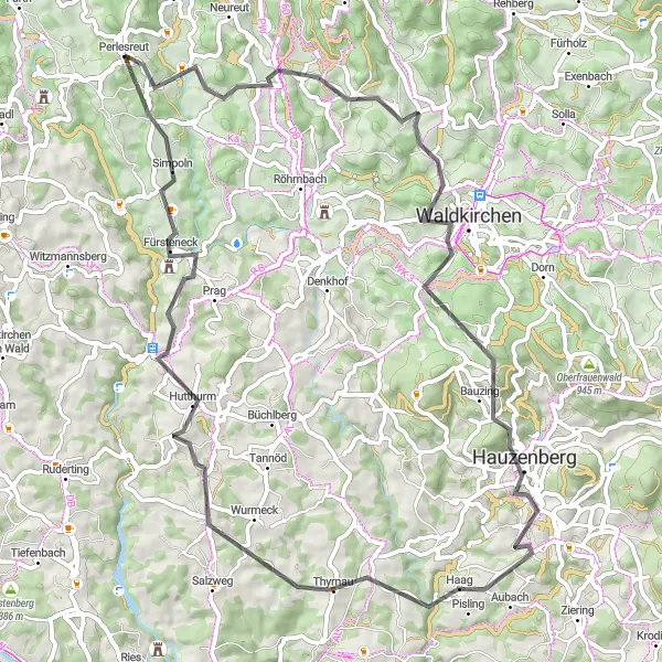
Embark on a challenging road adventure starting from Perlesreut and take on exhilarating climbs and stunning landscapes.
For experienced and adventurous cyclists, this road cycling route offers a thrilling challenge with exhilarating climbs and unforgettable landscapes. With a distance of 70 kilometers and a total ascent of 1722 meters, this route is designed for those seeking a demanding and rewarding cycling experience. Starting near Perlesreut, the route passes through the iconic Perlesreut, known for its picturesque charm and cultural heritage. Sicklinger Berg awaits cyclists with its steep inclines and panoramic views, while Waldkirchen offers a delightful blend of nature and urban attractions. Hauzenberg enchants with its idyllic setting and mesmerizing vistas, perfect for a peaceful break and appreciation of the surrounding beauty. Fürsteneck showcases its architectural splendor and rich history, inviting cyclists to explore its cobblestone streets and cultural landmarks. Thyrnau provides scenic river views and peaceful tranquility, contrasting the challenges of the road. Eisenbernreut tops off the journey with its rural charm and welcoming atmosphere. With a difficulty level of 5 and an epicness score of 4, this road adventure is for seasoned cyclists seeking an intense and awe-inspiring ride.
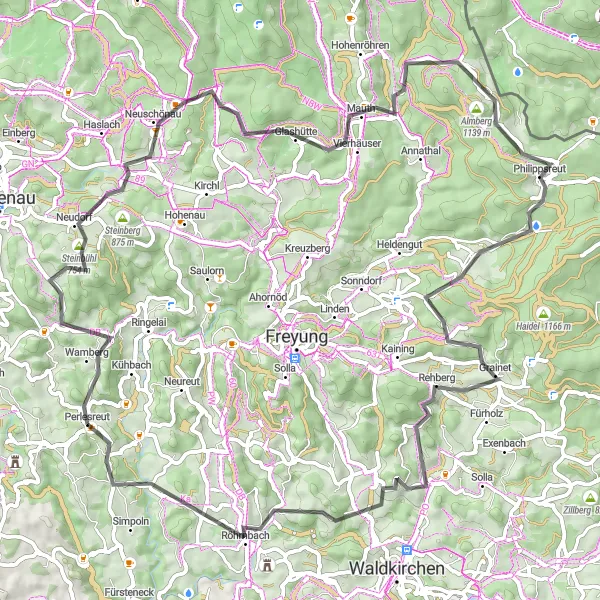
Embark on a mountainous adventure to Röhrnbach, tackling challenging climbs and embracing panoramic vistas.
This mountainous road cycling route invites cyclists on a thrilling adventure to Röhrnbach, showcasing the beauty of the Bavarian Alps. With a distance of 79 kilometers and a total ascent of 1837 meters, this route is tailored for cyclists seeking a challenging and visually breathtaking experience. Starting near Perlesreut, the route features highlights such as Steinberg, offering a challenging climb and rewarding panoramic views. Neuschönau enchants with its idyllic charm, inviting cyclists to explore its natural beauty and rich culture. Almberg presents a pinnacle of the journey, providing majestic views and celebrating the triumph of conquering a remarkable climb. Philippsreut captivates visitors with its scenic location and cultural heritage, while Grainet offers peaceful landscapes and traditional Bavarian ambiance. Röhrnbach crowns the adventure, welcoming cyclists with its warm hospitality and beautiful surroundings. With a difficulty level of 5 and an epicness score of 4, this mountainous adventure promises a mesmerizing experience for cyclists looking to test their skills and embrace the grandeur of the Alps.
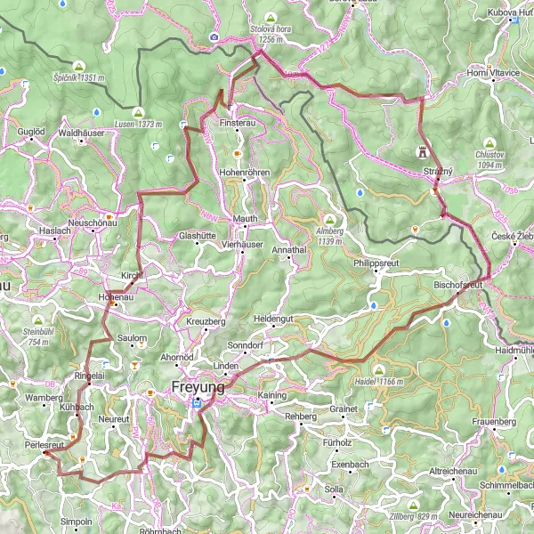
Conquer the ultimate gravel challenge from Perlesreut to Maresberg, with breathtaking views and demanding ascents.
This epic gravel route takes you from Perlesreut to Maresberg, covering a distance of 90 kilometers with a challenging ascent of 2314 meters. Along the way, you'll encounter highlights such as Perlesreut, Hohenau, Bučina, Nad Bučinou, Polecký vrch, Strážný, Haidel, Vorderschmiding, Großwiesen, and Maresberg. It's a demanding ride that offers stunning panoramic views and a sense of accomplishment.
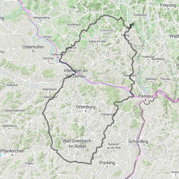
Embark on a scenic journey through the beautiful Rottal Valley.
The Rottal Valley Expedition is a 149-kilometer cycling route that takes you through the stunning landscapes of the Rottal Valley. With a total ascent of 2204 meters, this route is suitable for experienced cyclists. Starting in Perlesreut, you will pass through charming towns and villages such as Blümersberg, Tittling, and Ruderting. The route offers breathtaking views of the valley, rolling hills, and picturesque countryside. Highlights of this route include Bad Höhenstadt, a spa town known for its healing waters, and Vilshofen an der Donau, a historic town located on the banks of the Danube River. Overall, the Rottal Valley Expedition offers a scenic and challenging cycling experience through one of Germany's most beautiful regions.
Lindberg Round-Trip
The enchanting Lindberg round-trip takes cyclists through scenic landscapes and charming villages.
This road cycling route offers a delightful journey through picturesque Bavarian countryside. Starting near Perlesreut, the route passes through the beautiful village of Lindberg, showcasing its idyllic charm. Cyclists can enjoy the rolling hills and green meadows along the way, with a total ascent of 877 meters over a distance of 35 kilometers. The route also includes highlights such as Hohenau, where cyclists can soak in the serenity of nature, and Augustin Kanzel, a viewpoint providing stunning panoramic views. Aigenstadl and Maresberg also offer unique attractions for cyclists to explore. With a difficulty level of 3 and an epicness score of 3, this route is perfect for moderately experienced cyclists looking to enjoy a scenic and refreshing ride.
Cycling routes nearby:


Nearby regions: