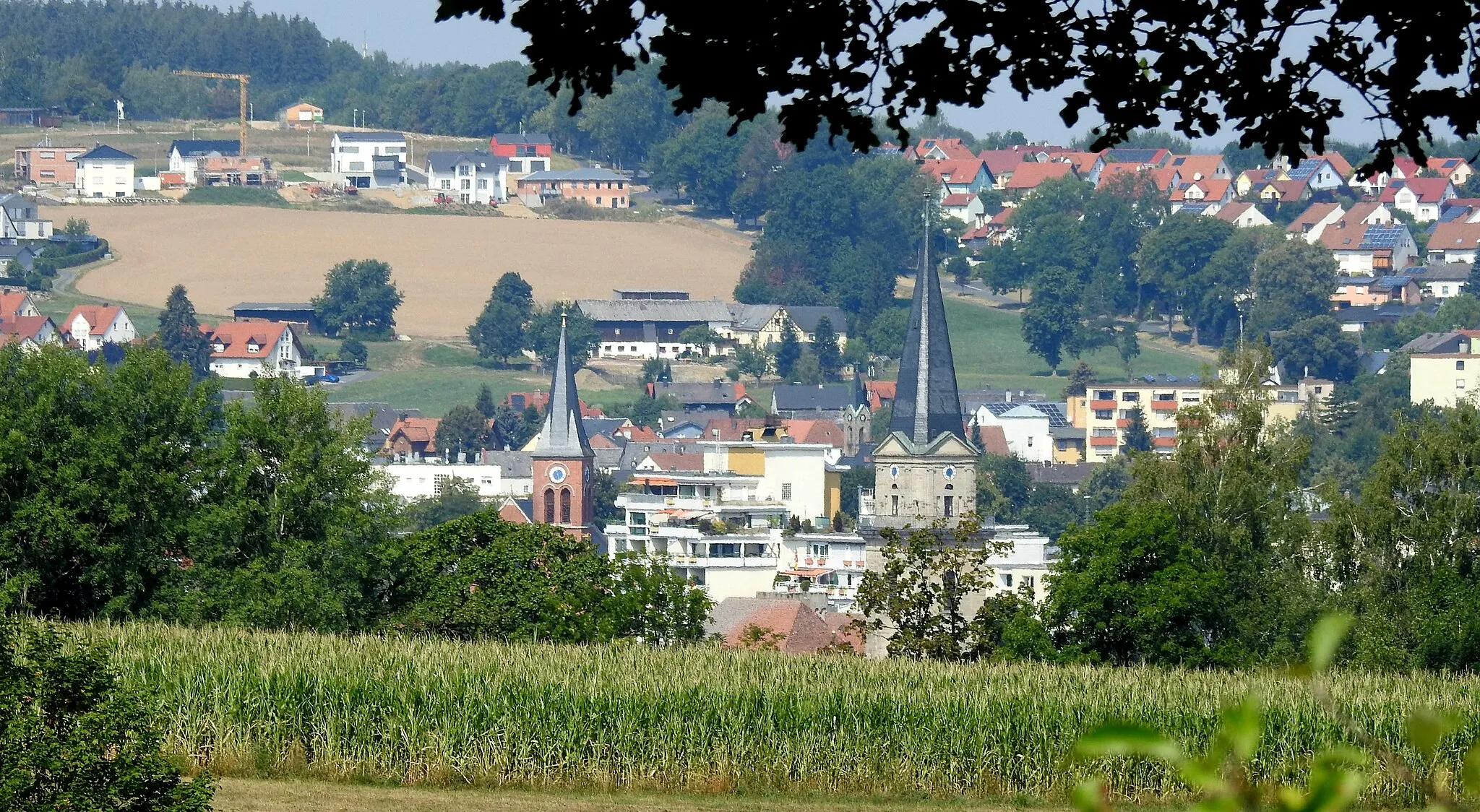
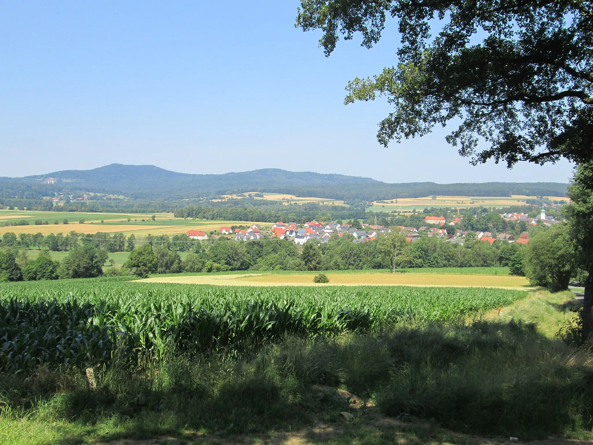
Enjoy leisurely cycling in Thiersheim's gentle hills.
Cycling routes from Thiersheim
Thiersheim, situated in the Oberfranken region of Germany, offers moderate cycling opportunities. The locality features gentle hills and countryside roads suitable for road and gravel cyclists. While not known for any famous cycling spots or well-known climbs, Thiersheim provides a pleasant setting for leisure rides. It receives a rank of 3.

Experience the thrill of road cycling in Oberfranken on this scenic adventure.
This road biking adventure takes you through some of Oberfranken's most beautiful landscapes, with highlights including the town of Waldsassen, Mitterteich, and the Finkenrangen. With a total ascent of 742m over 56km, this route is perfect for intermediate road cyclists looking for a moderately challenging ride. Enjoy the stunning scenery and explore the charming towns along the way.
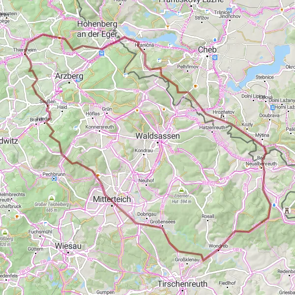
Gravel Adventure
Embark on a thrilling gravel adventure through the picturesque landscapes near Thiersheim.
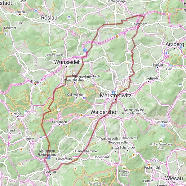
Join us on a gravel adventure through the picturesque landscapes near Thiersheim. This 57 km route with an ascent of 848 m offers an exciting challenge for gravel enthusiasts. Along the way, you will pass highlights such as Wartberg at 3 km, Marktredwitz at 13 km, Harlachberg at 23 km, Neusorg im Fichtelgebirge at 29 km, and Ochsenkopf at 35 km. These highlights provide unique experiences that showcase the beauty of the region. With its varying terrain and stunning scenery, this gravel adventure is suitable for intermediate level riders seeking a mix of challenge and natural beauty.
Thiersheim Epic Gravel Adventure

Experience the rugged beauty of Oberfranken on this challenging gravel route
This epic gravel route takes you through some of the most stunning landscapes in Oberfranken, with highlights including the Basalthügel, Wolfenstein, and the Himmelsleiter. Get ready for a physically demanding adventure with a total ascent of 1,537m over 110km. A must for gravel enthusiasts and nature lovers.
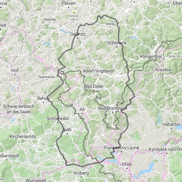
Winding Paths of Upper Franconia

Immerse yourself in the picturesque landscape of Upper Franconia along this challenging road cycling route.
Explore the beautiful countryside of Upper Franconia on this 110 km road cycling route starting near Thiersheim. The route takes you through charming towns and villages as well as stunning natural landscapes. It offers a good balance of challenging climbs, exhilarating descents, and relaxing flat sections. With a total ascent of 1601 meters, this route provides a moderate to high level of difficulty, suitable for very well-trained amateurs. The scenic highlights along the way provide an even greater sense of achievement and enjoyment.
Discover the charming towns and natural beauty of Oberfranken on this gravel paradise route
This gravel paradise will take you through picturesque landscapes, with highlights including Thiersheim, Bad Neualbenreuth, and Ruhberg. With a total ascent of 1,147m over 79km, this route is perfect for gravel enthusiasts looking for a moderate challenge. Enjoy the scenic views and explore the fascinating local culture along the way.
Embark on a challenging road cycling adventure through picturesque hills and valleys
Get ready for an exhilarating road cycling experience as you navigate the undulating terrain of Oberfranken. From the picturesque Mühlberg to the historic Františkovy Lázně, this route will take you through stunning landscapes and cultural landmarks. With its challenging ascents and rewarding descents, this journey is perfect for road cycling enthusiasts looking for a memorable challenge.
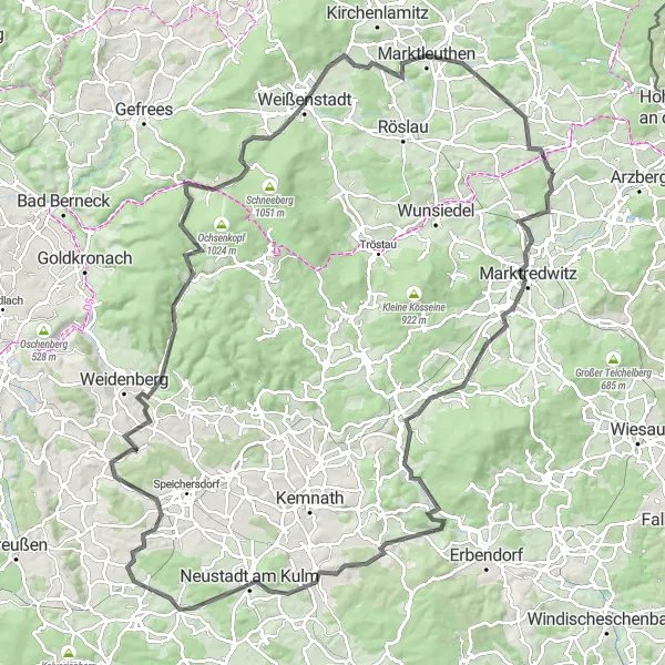
Embark on the ultimate road cycling adventure through the stunning landscapes of Oberfranken.
This challenging road cycling route takes you on a journey through some of Oberfranken's most breathtaking landscapes, with highlights including Marktredwitz, Neustadt am Kulm, and the Hohen Eichig. Prepare to tackle a total ascent of 1,780m over 130km, making this route perfect for experienced road cyclists looking for an epic challenge. Take in the magnificent views and discover the rich history and culture of the Oberfranken region along the way.
Mountain Challenge
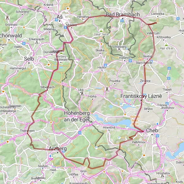
Challenge yourself on this epic gravel route featuring legendary climbs near Thiersheim.
The Mountain Challenge is an epic gravel route that takes you through legendary climbs near Thiersheim. With a distance of 80 km and an ascent of 1227 m, this route is recommended for experienced riders seeking a challenging adventure. Along the way, you will encounter highlights such as Stráž at 25 km, Bad Brambach at 28 km, Františkovy Lázně at 47 km, Chebská stráž at 52 km, Krátery at 59 km, and Arzberg at 73 km. These highlights offer unique experiences and breathtaking views of the surrounding landscapes. The Mountain Challenge is a must-try for gravel riders looking for an unforgettable adventure.
Discover the beautiful landscapes surrounding Thiersheim in this scenic road cycling loop.
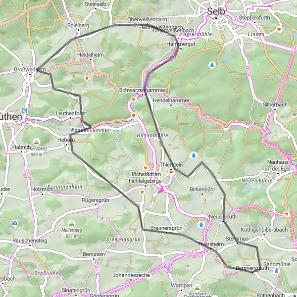
The Thiersheim Loop is a scenic road cycling route that showcases the beautiful landscapes surrounding Thiersheim. With a distance of 39 km and an ascent of 535 m, this route is suitable for riders of all skill levels. Along the way, you will pass highlights such as Lenker at 9 km, Spielberg at 19 km, Mühlberg at 27 km, and Kothigenbibersbach at 37 km. These highlights offer interesting spots to explore and take a break. Overall, the Thiersheim Loop is a delightful road cycling route that combines scenic beauty with cultural highlights.
Fichtelberg Circuit
Discover the stunning landscapes around Thiersheim in this challenging gravel route.
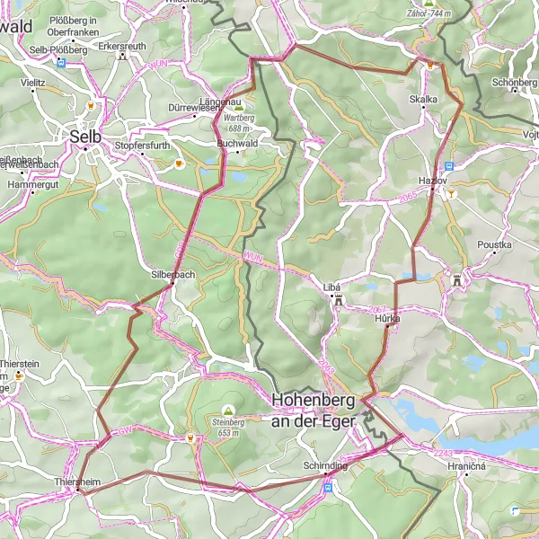
The Fichtelberg Circuit is a challenging gravel route that takes you through the beautiful landscapes surrounding Thiersheim. With a distance of 47 km and an ascent of 674 m, this route offers a true adventure for gravel enthusiasts. Along the way, you will encounter highlights such as the Goethův vrch at 21 km, Hazlov at 27 km, Schirnding at 39 km, and Kothigenbibersbach at 45 km. These highlights provide interesting spots to explore and take in the scenery. Overall, the Fichtelberg Circuit is a thrilling route for riders seeking a gravel adventure in Oberfranken.
Cycling routes nearby:

Nearby regions: