Kaiserslautern Valley Loop
A road cycling route starting from Hochspeyer
Explore the beautiful Kaiserslautern Valley and ride through picturesque villages on this road cycling route.
Map
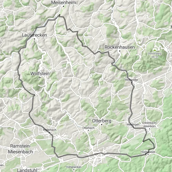
This road cycling route takes you through the scenic Kaiserslautern Valley, passing by the charming villages of Kaiserslautern, Weilerbach, and Dörrmoschel. With a moderate difficulty level, it is suitable for well-trained amateur cyclists. The route covers a distance of 106 km and includes an ascent of 1077 m. Highlights along the route include the Aussichtspunkt Rummelshald, a viewpoint with panoramic views, and the Kriegerdenkmal war memorial in Kriegerdenkmal.
road
106 km
1077 m
Tough
Route profile
Highlights on the route
0 km
0 km
Start: Fischbach Village centerHochspeyer: Exploring scenic routes in Rheinhessen-Pfalz, Germany
Hochspeyer is a small town located in the Rheinhessen-Pfalz region of Germany. It offers a variety of cycling routes that pass through the beautiful countryside and charming villages. Road cyclists can enjoy smooth paved roads, while gravel cyclists can explore the forest trails surrounding the town. Hochspeyer is not particularly famous for cycling, but it provides a peaceful and scenic environment for cyclists to enjoy. The nearby Palatinate Forest is a popular destination for outdoor enthusiasts, offering various activities such as hiking and mountain biking.7 km
7 km
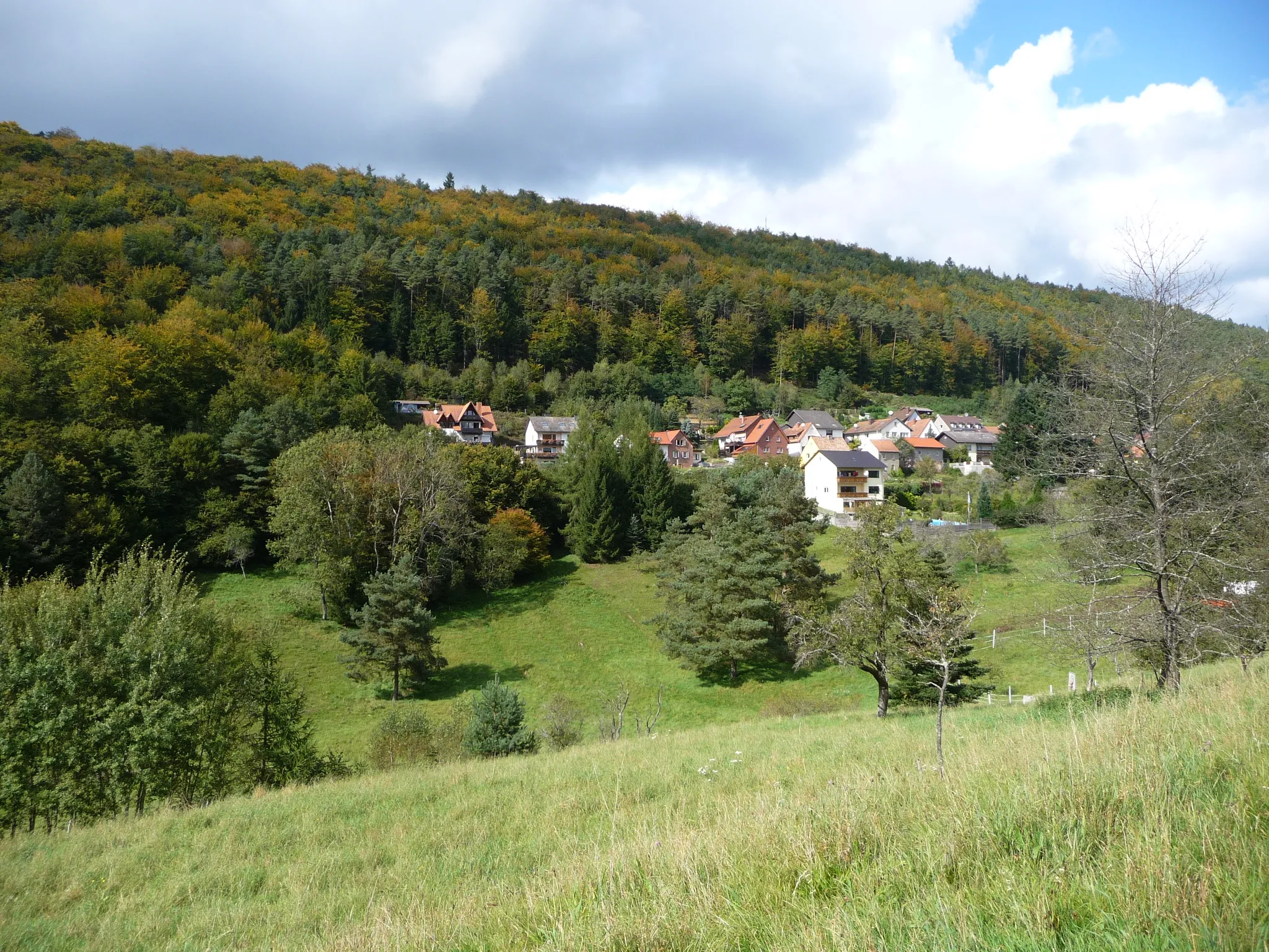
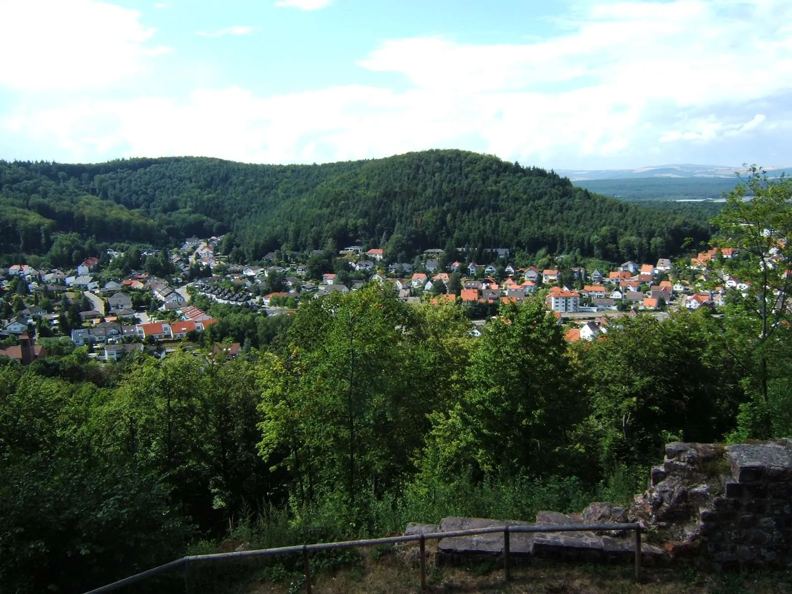
Aussichtspunkt RummelshaldViewpointAussichtspunkt Rummelshald - Enjoy breathtaking views of the surrounding landscapes.
12 km
12 km
KaiserslauternCityKaiserslautern - Explore the vibrant city known for its historic architecture and outdoor activities.
27 km
27 km
WeilerbachVillageWeilerbach - Cycle through this picturesque village with its quaint streets and timber-framed houses.
32 km
32 km
Mühlhöhe338 mPeakMühlhöhe - Take a break and enjoy beautiful views from this hilltop lookout.
53 km
53 km
LautereckenTownLauterecken - Discover the historic town nestled in the Lautertal Nature Park.
74 km
74 km
DörrmoschelVillageDörrmoschel - Explore this picturesque village with its half-timbered houses and narrow streets.
79 km
79 km
Hubberg347 mPeakHubberg - Enjoy scenic views from this hilltop.
87 km
87 km
KriegerdenkmalViewpointKriegerdenkmal - Visit the war memorial dedicated to fallen soldiers.
87 km
87 km
WinnweilerVillageWinnweiler - Discover the charm of this historic town located in the Palatinate Forest.
100 km
100 km
Enkenbach-AlsenbornVillageEnkenbach-Alsenborn - Cycle through this delightful village surrounded by nature.
106 km
106 km
Finish: Fischbach Village centerHochspeyer: Exploring scenic routes in Rheinhessen-Pfalz, Germany
Cycling routes from Hochspeyer:
Burg Beilstein Loop Hochspeyer - Burg Breitenstein Gravel Adventure Enkenbach-Alsenborn Loop Spazierweg am Eiswoog Circuit Hochspeyer - Salweidenkopf Gravel Loop Hochspeyer to Dreispitz Round-Trip Cycling Route Fischbach - Gimmeldingen Gravel Adventure Fischbach Gravel Adventure Hochspeyer - Burg Beilstein Gravel Loop Kaiserslautern Valley Loop The Palatinate Adventure Palatinate Gravel Getaway
Cycling routes nearby: