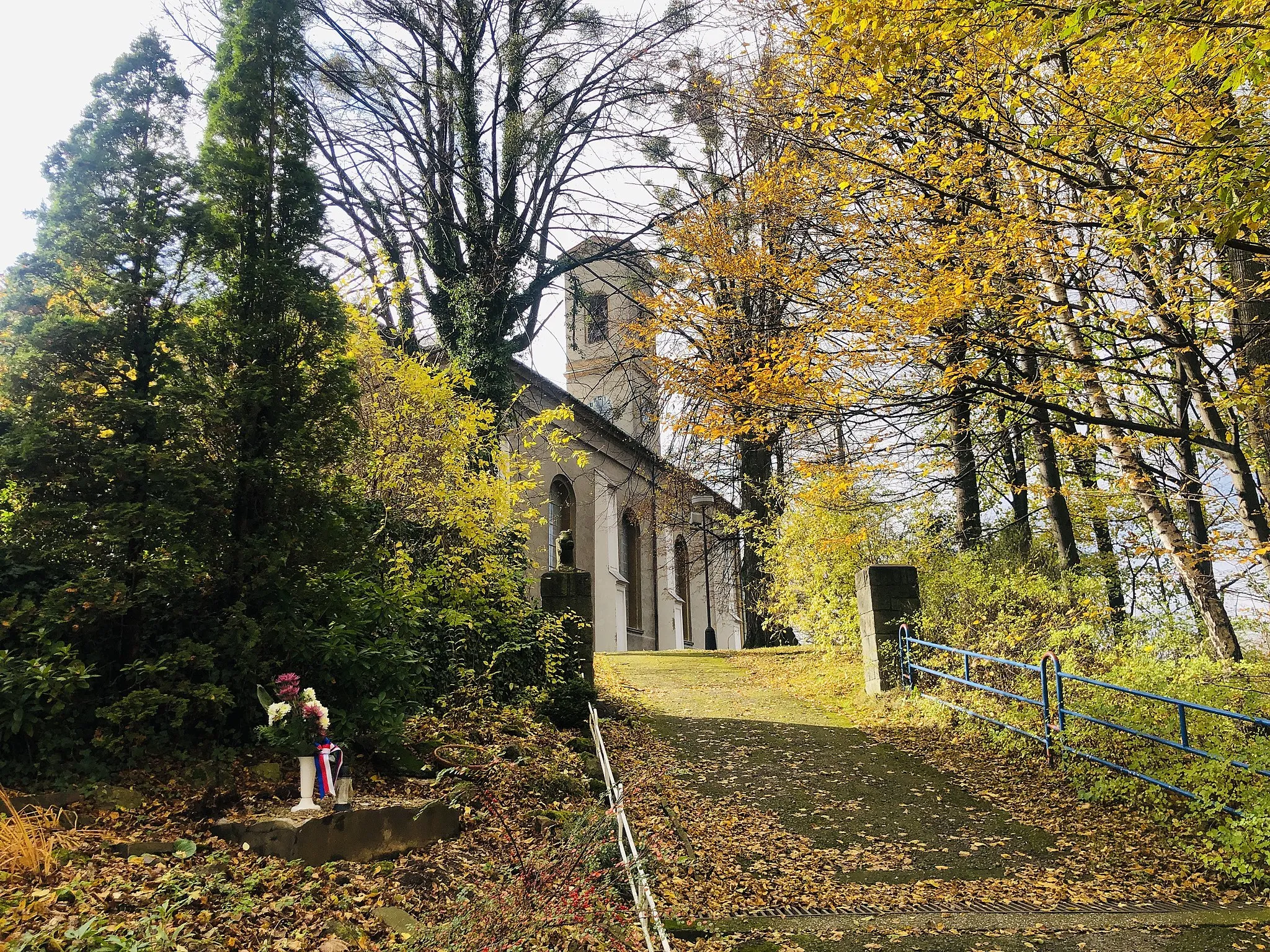
Idyllic Cycling in Podwilk
Cycling routes from Podwilk
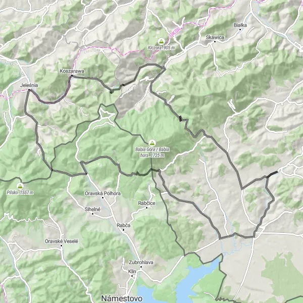
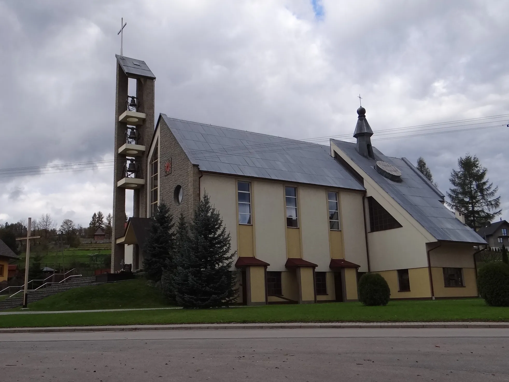
Podwilk is a delightful locality situated in the Małopolskie region of Poland. From a cyclist's perspective, it offers a mix of quaint villages, open fields, and rolling hills, providing an enjoyable road and gravel cycling experience. Cyclists can discover charming routes through the countryside, taking in the scenic vistas along the way. Not far from Podwilk, cyclists can test their skills on the famous climb to Stępinka Mountains, known for its challenging gradients and rewarding views. With its idyllic surroundings and cycling opportunities, Podwilk is a great choice for leisurely rides and challenging climbs.
Skawica Gravel Adventure
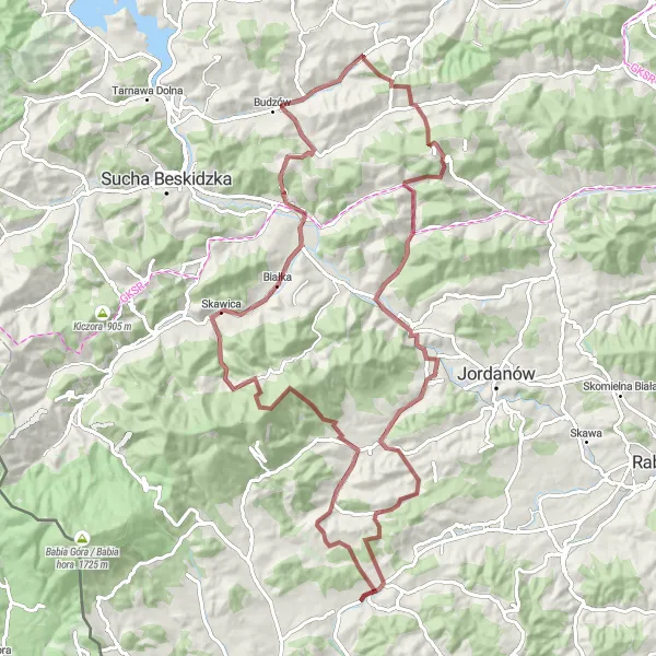
Embark on an epic gravel adventure through the scenic beauty of Skawica.
Get ready for an epic gravel adventure through the scenic landscapes of Skawica. This 91-kilometer route boasts an elevation gain of 2083 meters, offering thrilling climbs and exhilarating descents. Starting in Sidzina, the route passes through Krupówka, Skawica, Sarnia, Jachówka, Babica Zachodnia, Bystra Podhalańska, and ends at Targoszów. With a difficulty level of 5 and an epicness rating of 5, this route is perfect for experienced gravel cyclists seeking a legendary riding experience. Highlights include the stunning natural beauty of Sidzina, the vibrant atmosphere of Krupówka, and the breathtaking views from Skawica. Immerse yourself in the picturesque landscapes and discover the hidden treasures of this extraordinary region.
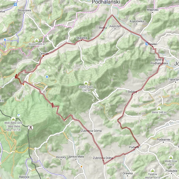
Górale Ride
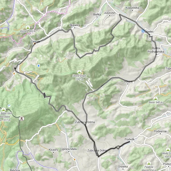
Take on the challenging Górale Ride through the scenic beauty of Podhale.
Embark on a thrilling cycling adventure through the scenic beauty of Podhale. This road cycling route covers 85 kilometers with an ascent of 1302 meters. Traveling through captivating landscapes and charming villages, this route offers a mix of challenging climbs and rewarding descents. Starting near Podwilk, the route takes you through Zubrzyca Dolna, Przełęcz Krowiarki, Kolisty Groń, Zawoja, Jawor, Osielec, Wielka Polana, Przełęcz Zubrzycka, and ends at Kuligowa Góra. With a difficulty level of 5 and an epicness rating of 4, this route caters to experienced cyclists seeking a memorable riding experience. Highlights include the beautiful scenery of Zubrzyca Dolna, the panoramic views from Przełęcz Krowiarki, and the challenging climb to Kolisty Groń.
Podhale Highlights
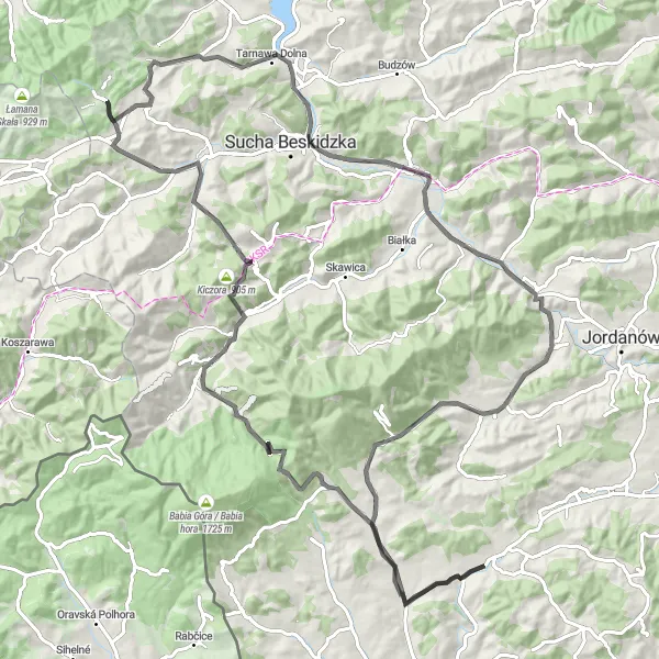
Discover the picturesque beauty of Podhale region on this road cycling route.
The Podhale Highlights route takes you through the stunning landscapes of the Podhale region in Małopolskie, Poland. The route spans 111 kilometers with a total elevation gain of 1408 meters. Suitable for road cycling, this picturesque route showcases the unique charm of Zubrzyca Dolna, Przełęcz Krowiarki, Przełęcz Przysłop, Stryszawa, Tarnawa Górna, and Kuligowa Góra. With a difficulty level of 4 and an epicness rating of 5, this route offers a challenging yet rewarding riding experience. Explore the sweeping panoramic views from the platforma widokowa and expect several highlights along the way, such as scenic mountain passes and historical landmarks.
Discover the scenic beauty of Spytkowice and its surrounding natural wonders.
This road cycling route near Podwilk takes you through the scenic landscapes surrounding Spytkowice. With a total distance of 54 kilometers and an ascent of 690 meters, the route offers both a pleasant ride and a few challenges along the way. Highlights include Przełęcz Spytkowicka, a mountain pass with panoramic views, and Odrowąż, a charming village worth exploring. The difficulty of this route is rated 2 out of 5, suitable for cyclists with moderate training. In terms of epicness, it scores a solid 2 out of 5, providing a relaxing and enjoyable tour of the region.
Embark on a gravel journey through the beautiful Beskidy mountain range.
Experience the rugged beauty of the Beskidy mountains on this gravel cycling route. Spanning 42 kilometers with an elevation gain of 674 meters, this route takes you through some of the most stunning landscapes in Małopolskie, Poland. Traveling through regions like Beskidy, Sidzina, Jordanów, and Przełęcz Spytkowicka, this route offers a mix of challenging terrain and captivating scenery. Suitable for gravel bikes, it provides an exciting adventure for cyclists of all skill levels. With a difficulty level of 3 and an epicness rating of 4, this route promises an unforgettable cycling experience. Highlights include the picturesque beauty of Beskidy, the charming village of Sidzina, and the breathtaking views from Przełęcz Spytkowicka.
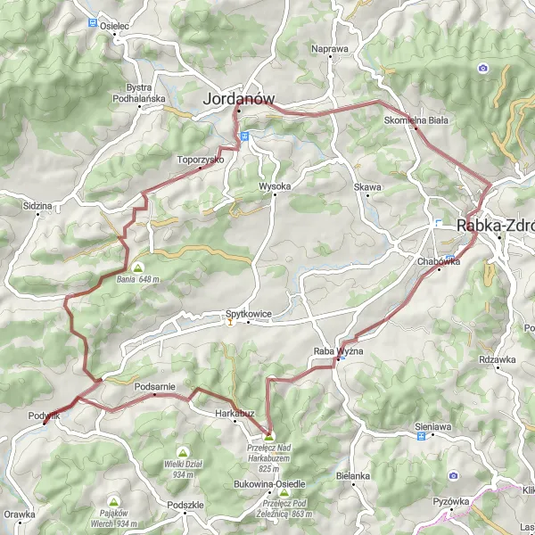
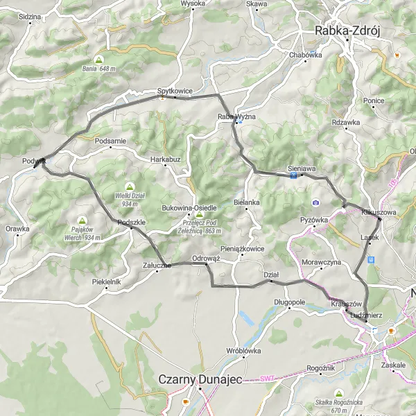
Embark on a gravel adventure through the scenic Bory region.
With a distance of 54 kilometers and an ascent of 915 meters, this gravel route starting near Podwilk takes you through the beautiful Bory region. The route offers a mix of gravel roads and scenic trails, providing a unique cycling experience. Highlights along the way include Przełęcz Spytkowicka, a mountain pass offering stunning views of the surrounding landscape, and Raba Wyżna, a charming village known for its traditional architecture. The difficulty of this route is rated 3 out of 5, suitable for moderately experienced gravel cyclists. In terms of epicness, it scores a solid 2 out of 5, offering a pleasant and enjoyable ride through picturesque countryside.
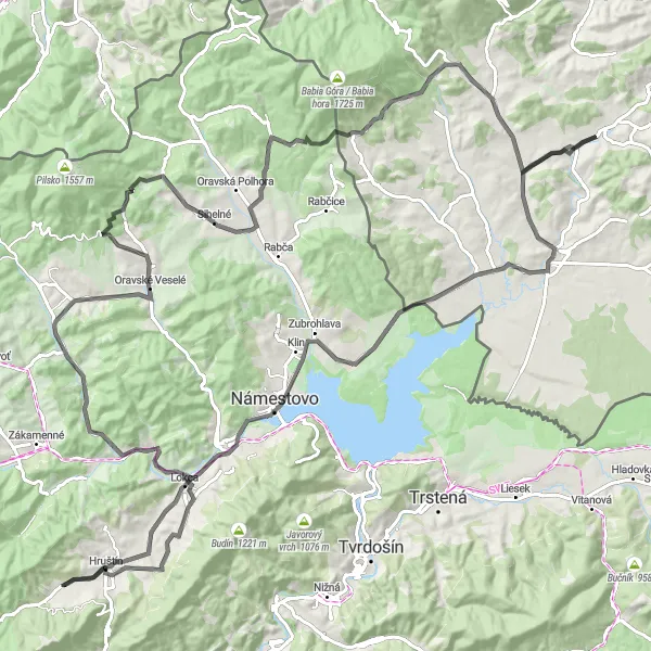
Orava Adventure
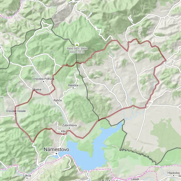
Embark on a gravel adventure exploring the idyllic countryside and historical treasures of Orava.
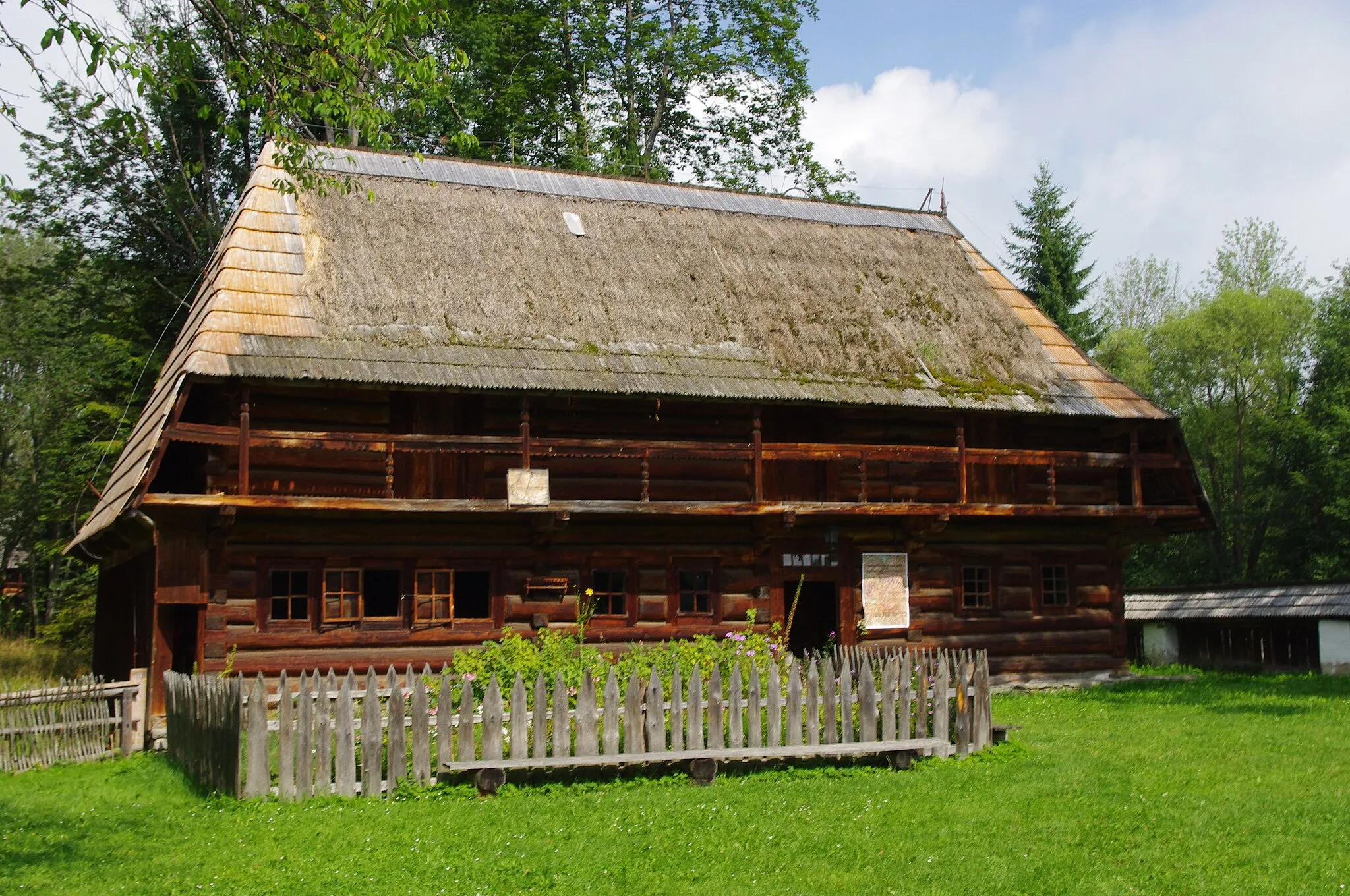
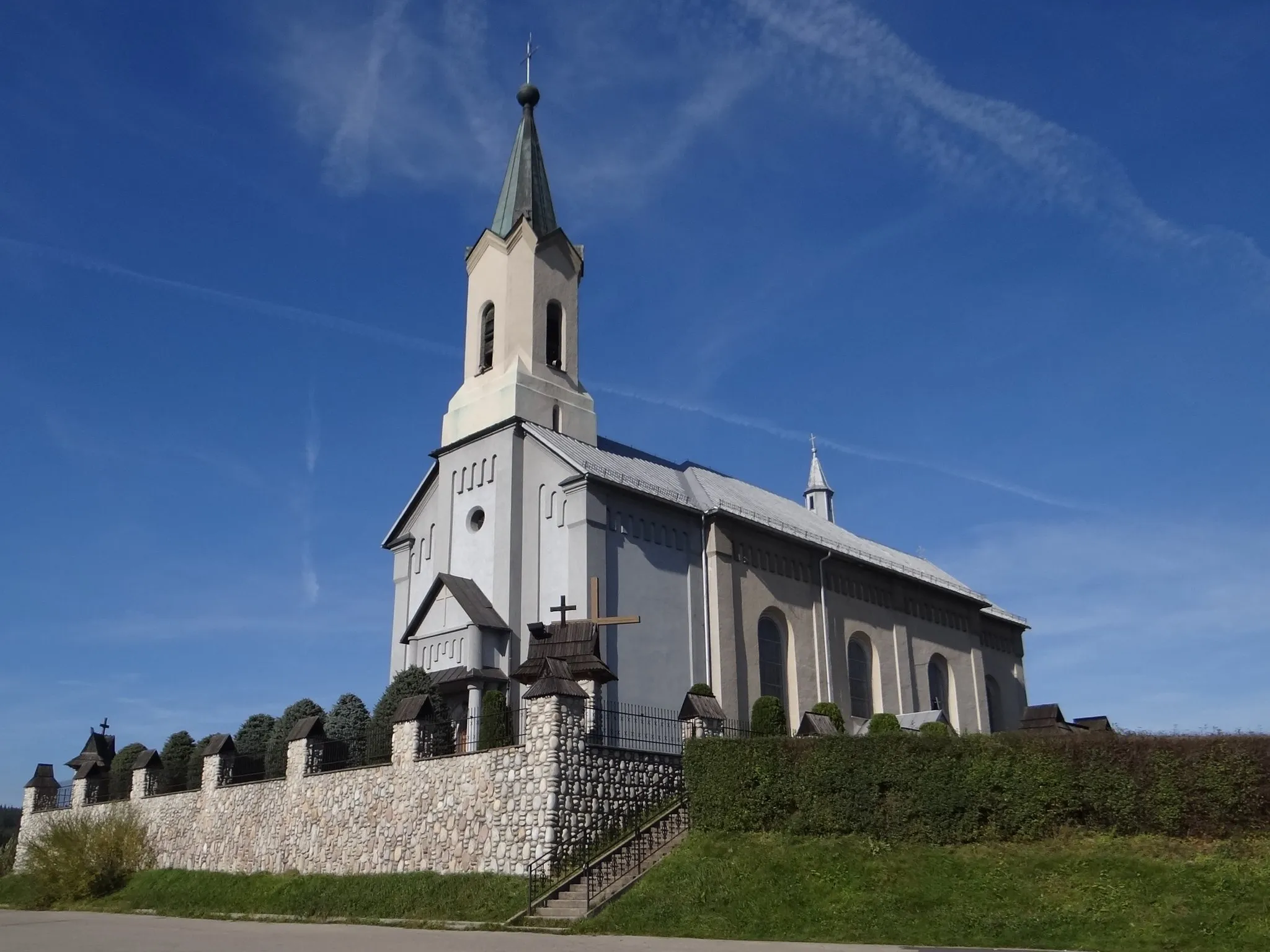
Discover the rich history and natural beauty of the Orava region on this 82-kilometer gravel cycling route. With an elevation gain of 1225 meters, this route takes you on a journey through picturesque landscapes and captivating historical sites. Starting at Podwilk, the route passes through Dział, Bobrov, Pálenica, Oravské Veselé, Rozhľadňa Trchovnica, Zubrzyca Górna, Przełęcz Nad Wąwozem, Nowoć, and ends at Podwilk Kościół. With a difficulty level of 4 and an epicness rating of 3, this route offers both challenges and cultural immersion. Highlights include the historic village of Podwilk, the natural beauty of Bobrov, and the panoramic views from Rozhľadňa Trchovnica.
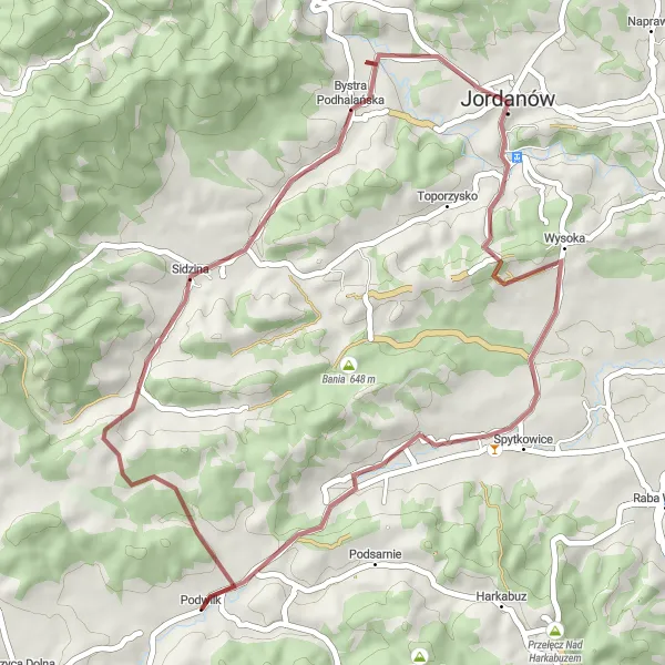
Embark on a thrilling gravel adventure through Podwilk and surrounding areas
Discover the scenic beauty and rich cultural heritage of Małopolskie, Poland on this exciting cycling route. With a good mix of asphalt roads and gravel paths, you'll experience the thrill of off-road cycling while enjoying the stunning countryside views. The route includes several challenging climbs and descents, offering a satisfying and rewarding cycling experience. Whether you're a local cyclist or a visitor, this round-trip is a must-try for all gravel enthusiasts.
Pilsko Challenge
Embark on an epic cycling adventure to conquer the famous Pilsko mountain.
This challenging road cycling route starting near Podwilk takes you on an exhilarating journey to conquer the famous Pilsko mountain. With a distance of 104 kilometers and an ascent of 1676 meters, this route offers a true test of endurance and willpower. Highlights include Przełęcz Glinne, a mountain pass with stunning views of the surrounding peaks, and Zakopaniec, a picturesque village nestled at the foot of the Western Beskids. The difficulty of this route is rated 5 out of 5, suitable for highly trained cyclists with experience in climbing mountains. In terms of epicness, it scores a solid 4 out of 5, promising an unforgettable adventure amidst breathtaking scenery.
Around Orava
Explore the beautiful region of Orava with its stunning mountains and charming villages.
This round-trip cycling route starting near Podwilk takes you through the picturesque region of Orava. With a total distance of 132 kilometers and an ascent of 1754 meters, the route provides a challenge for both road cyclists. Along the way, you'll encounter highlights such as the scenic viewpoint of Rozhľadňa Trchovnica and the Slaná Voda mineral springs. The difficulty of this route is rated 4 out of 5, suitable for well-trained amateurs. In terms of epicness, it scores a solid 3 out of 5, offering a mix of challenging climbs and scenic landscapes.
Cycling routes nearby:


Nearby regions: