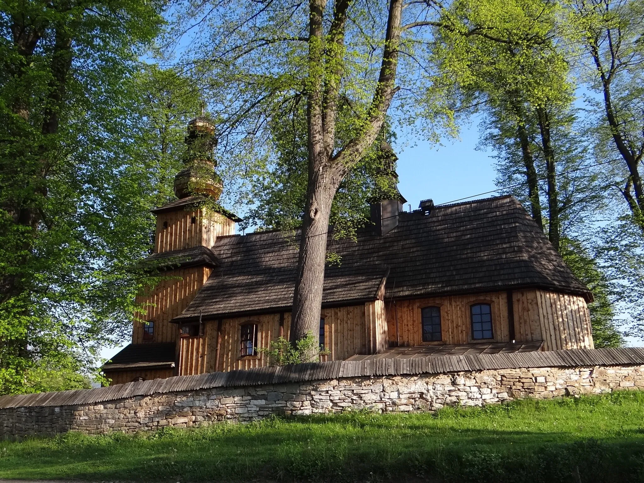
Offers leisurely rides and exploration of traditional wooden architecture.
Cycling routes from Stropkov
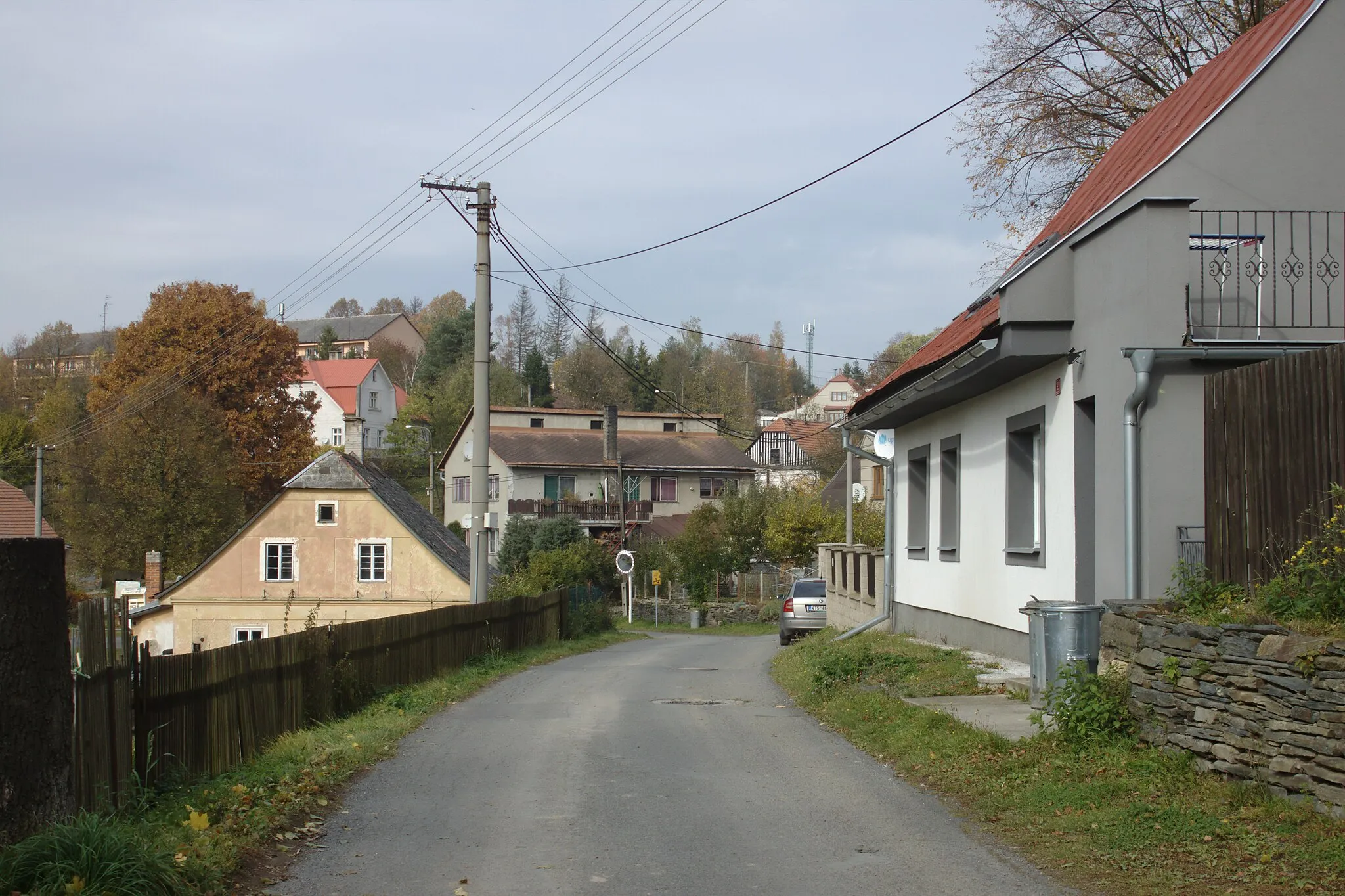
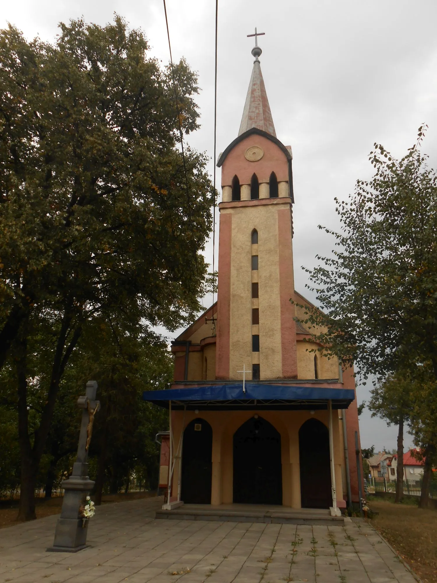
Stropkov is a locality in Východné Slovensko, Slovakia. As a road and gravel cyclist, you will find limited cycling options in Stropkov. The immediate surrounding area does not offer famous cycling-related spots or well-known climbs. However, the town does have some cycling-friendly facilities, with bike lanes and shared pathways. Stropkov is known for its traditional wooden architecture, which adds to its charm as a tourist destination. While the area may not be optimal for intense cycling challenges, it still provides a pleasant atmosphere for leisurely rides and exploration of the local culture. Overall, Stropkov is a suitable location for casual road and gravel cycling, but it may not meet the expectations of avid cyclists seeking advanced challenges.
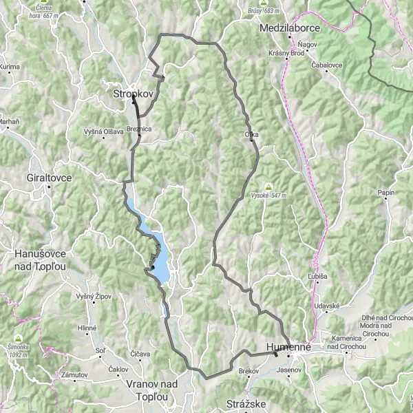
Experience the enchantment of Vodná nádrž Veľká Domaša on this awe-inspiring cycling route.
Get ready for a cycling adventure through the captivating landscapes surrounding Vodná nádrž Veľká Domaša. With a challenging ascent of 947 meters and a distance of 126 kilometers, this road cycling route promises stunning views and a truly immersive experience. Highlights along the route include the quaint village of Vojtovce, the picturesque Matovec, and the enchanting Dúbrava. Discover hidden gems like the breathtaking Hora and the charming Benkovce. Conclude your journey at the majestic Vodná nádrž Veľká Domaša, where the scenic beauty will leave you awe-struck.
Búčie and Rajsova Hora Adventure

Embark on a thrilling adventure through the captivating Búčie and Rajsova Hora regions.
Embark on an exhilarating cycling journey through the remarkable Búčie and Rajsova Hora regions. With a total ascent of 749 meters and a distance of 65 kilometers, this road cycling route offers a perfect blend of challenge and natural beauty. Highlights of this route include exploring the tranquil countryside of Búčie, discovering the captivating Rajsova Hora and Incova Hora hills, and experiencing the rich cultural heritage of Stropkov. Get ready for a truly rewarding and unforgettable cycling experience.
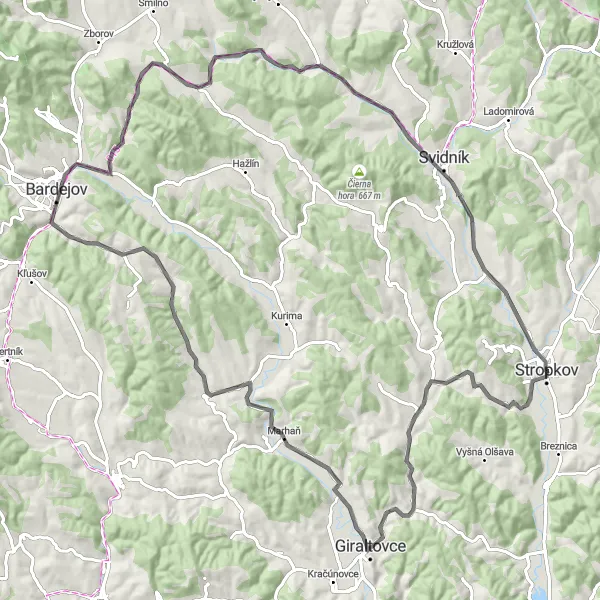
Explore the scenic route from Stropkov to Chovanec, Šibeň, Bardejov, Šadrovka, Svidník, and reach the peak of Incova Hora.
This 100 km road cycling route takes you through picturesque towns and provides breathtaking views of the surrounding natural beauty. With a total ascent of 795m, this route is moderately challenging, perfect for well-trained amateurs. The highlights along the route include Chovanec, Šibeň, Bardejov, Šadrovka, Svidník, and Incova Hora, each with its own unique charm and historical significance. Score the highlights from 4 to 5, as they are must-visit spots.
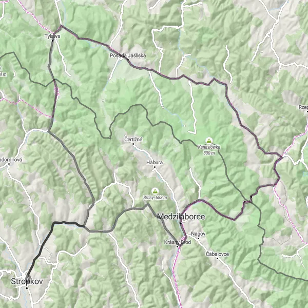
Embark on an epic adventure through the scenic Lysá hora and Jaśliska regions.
Get ready for an unforgettable cycling journey through the remarkable landscapes of the Lysá hora and Jaśliska regions. With a challenging ascent of 1338 meters and a total distance of 127 kilometers, this road cycling route promises thrilling experiences and breathtaking sights. Highlights along the route include Lysá hora, offering stunning panoramic views, the charming village of Bodružal, and the scenic Przełęcz Dukielska pass. Whether you're a cycling enthusiast or a nature lover, this route will not disappoint.

Discover the hidden gems of Stropkov, Baranov, Miňovce, Giraltovce, Hliny, and Búčie on this 72 km road cycling route.
Embark on a journey through Stropkov and explore the captivating towns of Baranov, Miňovce, Giraltovce, Hliny, and Búčie. This 72 km road cycling route offers moderate difficulty with 716m of ascent, catering to well-trained amateurs. Enjoy the picturesque landscapes, charming architecture, and historic landmarks along the way. Don't miss the opportunity to visit Stropkov, known for its rich cultural heritage and beautiful natural surroundings. Score the highlights from 3 to 4, as they offer interesting cultural and natural attractions.
Baranov and Vichter Loop

Explore the scenic Baranov and Vichter region on this exhilarating cycling route.
Embark on a thrilling journey through the picturesque Baranov and Vichtner regions. With a total ascent of 1019 meters and a distance of 93 kilometers, this road cycling route offers ample opportunities for both challenge and awe-inspiring views of the surrounding countryside. The route features several highlights, including the beautiful town of Búčie and the charming village of Kuková.
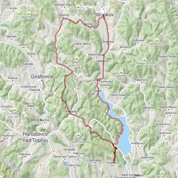
Embark on a gravel cycling adventure from Stropkov to Baranov, Kvakovce, Detrík, Turenka, and Rojov.
This gravel cycling route takes you on a thrilling 75 km journey from Stropkov to Baranov, Kvakovce, Detrík, Turenka, and Rojov. With an ascent of 1169m, this route is more challenging and suitable for experienced cyclists. Get ready to traverse off-road paths, scenic countryside, and peaceful forest trails. Marvel at the beauty of Baranov, a picturesque village known for its rural charm and traditional wooden houses. Score the highlights from 3 to 4, as they offer unique natural beauty and a connection to local traditions.
The Eastern Gem

Experience the cultural and natural beauty of Eastern Slovakia on this captivating gravel cycling route.
Embark on a breathtaking journey through the stunning landscapes of Eastern Slovakia. This unique gravel route will take you through quaint villages, lush forests, and beautiful countryside, providing a diverse and immersive cycling experience. With a challenging ascent of 745 meters and a distance of 53 kilometers, this route is ideal for well-trained amateur cyclists seeking a thrilling adventure. Along the way, you will encounter remarkable highlights, each offering their own distinct charm and history.

Indulge in the beauty of Slovakian castles and countryside on this enchanting cycling route.
Embark on a captivating cycling experience through the stunning Slovakian countryside, filled with rich history and breathtaking landscapes. With a moderate ascent of 293 meters and a distance of 52 kilometers, this road biking route allows you to immerse yourself in the region's natural beauty while exploring its magnificent castles. Highlights along the route include Kaštielik, a charming castle with a fascinating history, the picturesque village of Ladomirová, and the tranquil Pstriná village. This route offers a perfect blend of cultural exploration and scenic cycling.

Embark on a 71 km road cycling adventure through Stropkov, Obrúbané, Rokytovce, Zadný vrch, and Kozubová.
This road cycling route covers a distance of 71 km and includes highlights such as Obrúbané, Rokytovce, Zadný vrch, and Kozubová. With 787m of ascent, the route provides a moderate challenge for well-trained amateurs. Get ready to explore picturesque villages, rolling hills, and stunning viewpoints along the way. Don't miss the charming town of Stropkov, the starting point of this scenic journey. Score the highlights from 4 to 5, as they offer unique experiences and beautiful landscapes.
Cycling routes nearby:
Nearby regions: