Limited cycling opportunities in an urban setting of Burngreave, South Yorkshire.
Cycling routes from Burngreave
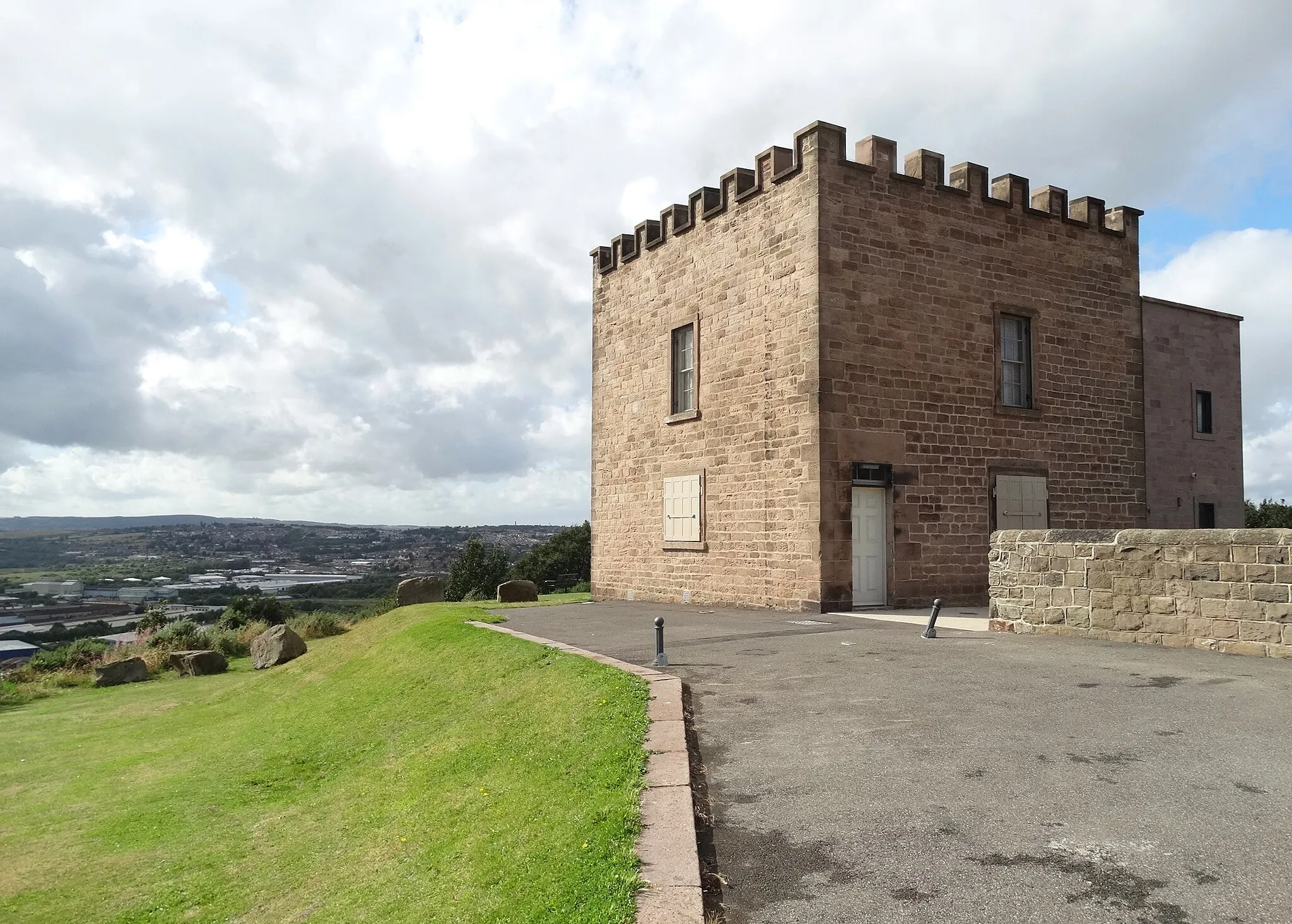
Burngreave is a locality located in South Yorkshire, United Kingdom. From a cyclist's perspective, Burngreave might not offer extensive cycling opportunities. The area mainly consists of urban streets, and there are limited cycling-related spots or notable climbs nearby. However, cyclists can still explore the surrounding countryside and enjoy casual rides. Consequently, Burngreave receives a rank of 2.
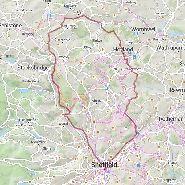
Discover the hidden gems of Rotherham on this scenic gravel loop
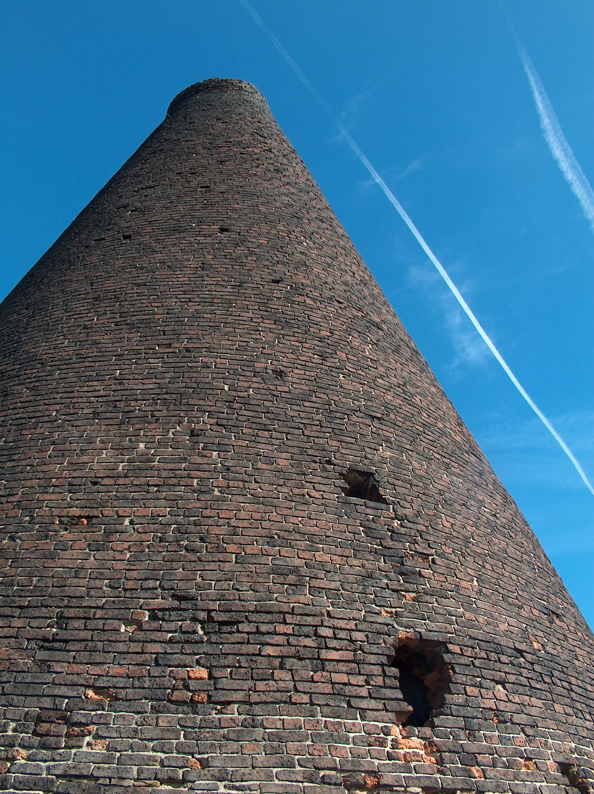
Embark on an exciting gravel adventure around Rotherham and immerse yourself in its rich history and stunning surroundings. Starting near Burngreave, this 55km route takes you through picturesque villages and past iconic highlights like the Don Valley Bowl Arc Furnace Charking Basket. With a total ascent of 569m, this route offers a challenging ride suitable for experienced gravel cyclists.

Explore Sheffield landmarks and uncover historical gems on this road cycling route.
Discover the historical treasures of Sheffield on this road cycling route near Burngreave. Begin your journey with a visit to Sheffield, where you can marvel at iconic landmarks such as Park Hill and South Street Park Amphitheatre. As you continue, you'll pass through Killamarsh, where you can explore the local history and enjoy the scenic surroundings. Bolsover Castle and Chesterfield are next on the route, offering a chance to immerse yourself in medieval architecture and rich heritage. With a total ascent of 776 meters and a distance of 67 kilometers, this route is suitable for intermediate cyclists looking to combine a cultural experience with their cycling adventure.

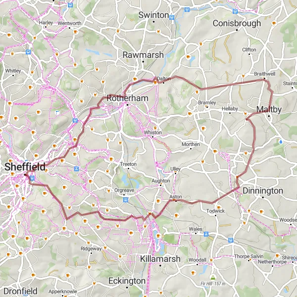
Conquer the hills of South Yorkshire on this exhilarating road challenge
Join other avid road cyclists on this thrilling 61km journey to conquer the hills of South Yorkshire. Starting near Burngreave, this challenging route rewards your efforts with stunning vistas and iconic highlights such as Walkley, Stocksbridge, and the Steel Project View Point. With a total ascent of 1161m, this route is suitable for experienced road cyclists looking for a demanding and adventurous ride through picturesque landscapes.

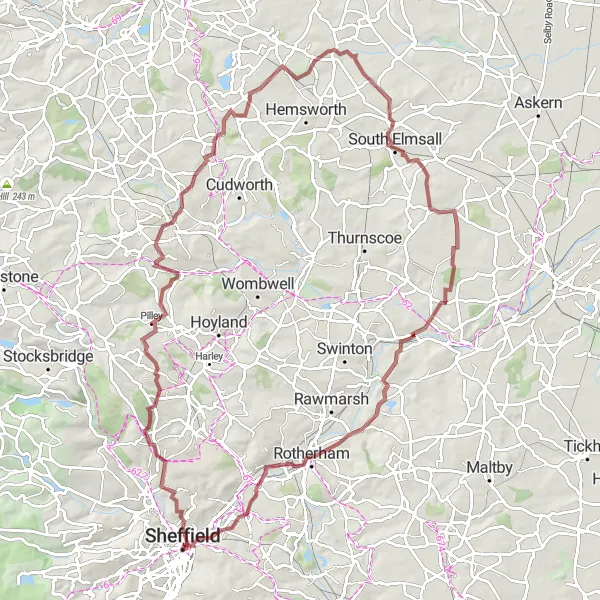
Embark on a journey through scenic countryside and discover historic sites.
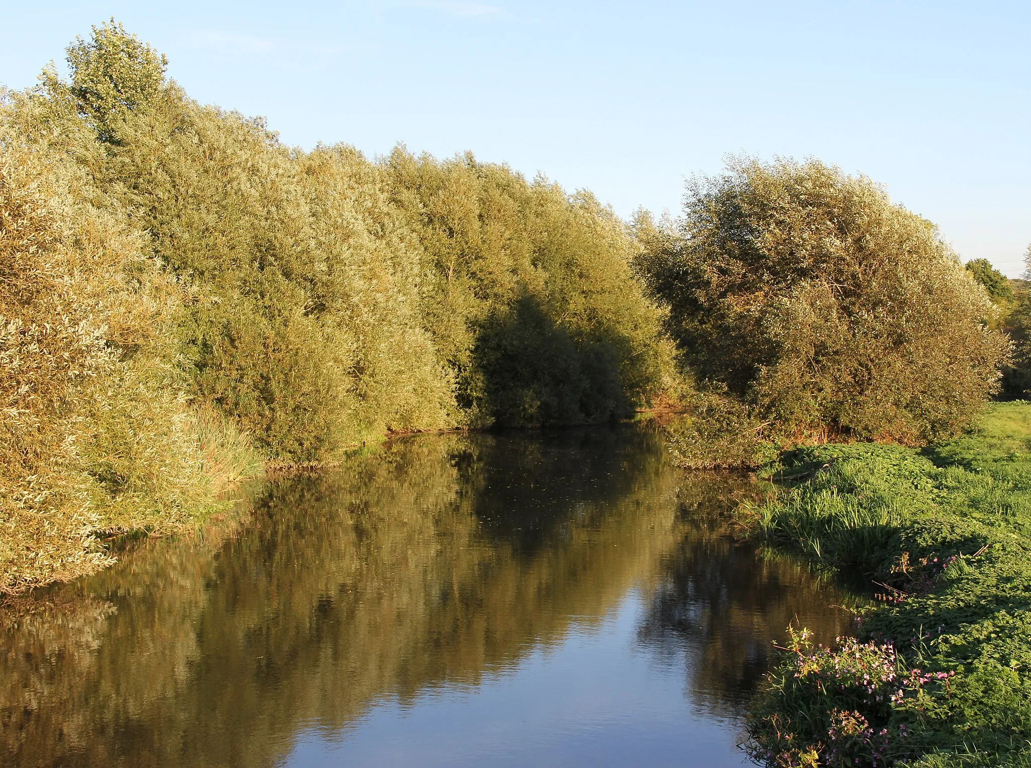
This road cycling route near Burngreave takes you through picturesque landscapes and historic sites. From Kelham Weir to Rotherham, you'll be immersed in nature's beauty, passing by Hillsborough and Silkstone. As you pedal on, Woolley Edge and Sharlston await, offering stunning views and significant historical heritage. With a total ascent of 1149 meters and a distance of 94 kilometers, the route offers a moderate challenge for well-trained cyclists. This diverse and captivating ride provides a mix of natural and cultural highlights, making it a great choice for adventurous spirits.
Ride through South Yorkshire's industrial history
Experience an epic gravel adventure through historic South Yorkshire. This challenging route takes you through the scenic landscapes of Burngreave, passing by iconic highlights such as the Don Valley Bowl Arc Furnace Charking Basket. With a total ascent of 484m and a distance of 82km, this route is suitable for experienced gravel riders. Prepare to be awed by the beauty and history of the area as you explore the Don Valley.
Experience the beauty of South Yorkshire on this scenic gravel loop
Explore the beautiful landscapes of South Yorkshire on this 50km scenic gravel loop. Starting near Burngreave, this route takes you through picturesque villages and past iconic highlights such as Kelham Weir and the Don Valley Bowl Arc Furnace Charking Basket. With a total ascent of 600m, this route offers a moderate challenge perfect for gravel enthusiasts wanting to experience the natural beauty of South Yorkshire.
Embark on a scenic gravel road adventure through the South Yorkshire countryside.
Experience the beauty of the South Yorkshire countryside on this gravel road cycling route near Burngreave. Starting in Sheffield, you'll have the opportunity to admire landmarks such as Park Hill and Kelham Weirl, before venturing into Tankersley and Barnsley. Along the way, you'll encounter Badsworth, High Melton, and Rotherham, each offering their own unique charm and scenic views. With a total ascent of 1047 meters and a distance of 92 kilometers, this route is suitable for experienced gravel cyclists seeking a mix of natural beauty and cultural highlights. Escape the city and immerse yourself in the tranquility of the countryside on this epic gravel adventure.

Discover the beauty of Kelham Weir and picturesque villages on this road cycling route near Burngreave.
Immerse yourself in the beauty of South Yorkshire's countryside and picturesque villages on this road cycling route. Start your journey at Kelham Weir and continue through Grenoside, Tankersley, Barnsley, Cudworth, Wombwell, and Tinsley. With a total ascent of 787 meters and a distance of 64 kilometers, this route is suitable for moderately experienced cyclists seeking a charming and peaceful ride. Explore the historical significance of each village and take in the scenic surroundings as you pedal along. This enjoyable ride offers a taste of local culture and natural beauty, perfect for a day trip near Burngreave.
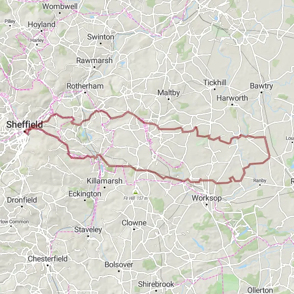
Sheffield to Worksop Circular
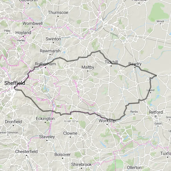
Discover the beautiful countryside surrounding Sheffield on this challenging circular road cycling route.
Explore the South Yorkshire countryside on this challenging 94-kilometer road cycling route. Beginning in Burngreave, the route takes you through the picturesque areas of Thrybergh, Bawtry, Mattersey, Worksop, Harthill, and Fir Hill, before returning to Sheffield. You will encounter varying terrains and stunning landscapes, with a total ascent of 739 meters. The route passes by several highlights, including Sheffield, the Don Valley Bowl Arc Furnace Charking Basket, and the Manor Lodge. Overall, this route provides a thrilling cycling experience with breathtaking scenery.

Explore the Don Valley Bowl and historic landmarks on this road cycling route.
This route takes you through the scenic South Yorkshire countryside near Burngreave. Along the way, you'll pass through the Don Valley Bowl, known for its unique arc furnace charking basket. You'll also visit Rotherham, Maltby, Carlton in Lindrick, and Market Warsop, each offering a glimpse into the area's rich history. The route is moderately challenging, with a total ascent of 831 meters and a distance of 98 kilometers. Overall, it's a great ride for adventure enthusiasts looking to soak in the region's cultural highlights.
Cycling routes nearby:
Nearby regions: