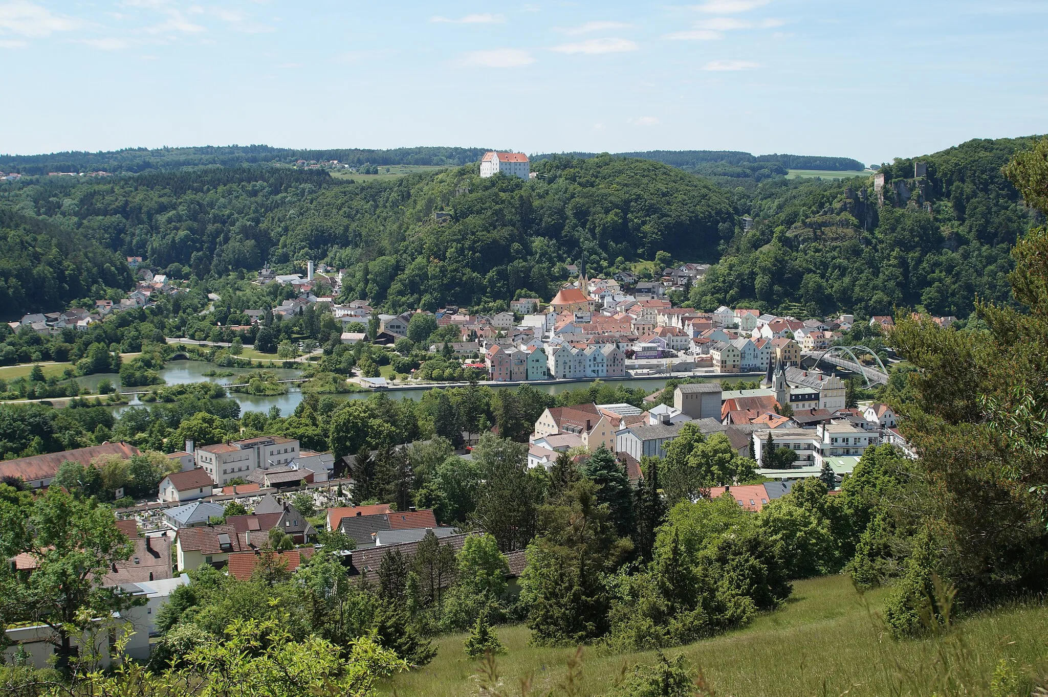
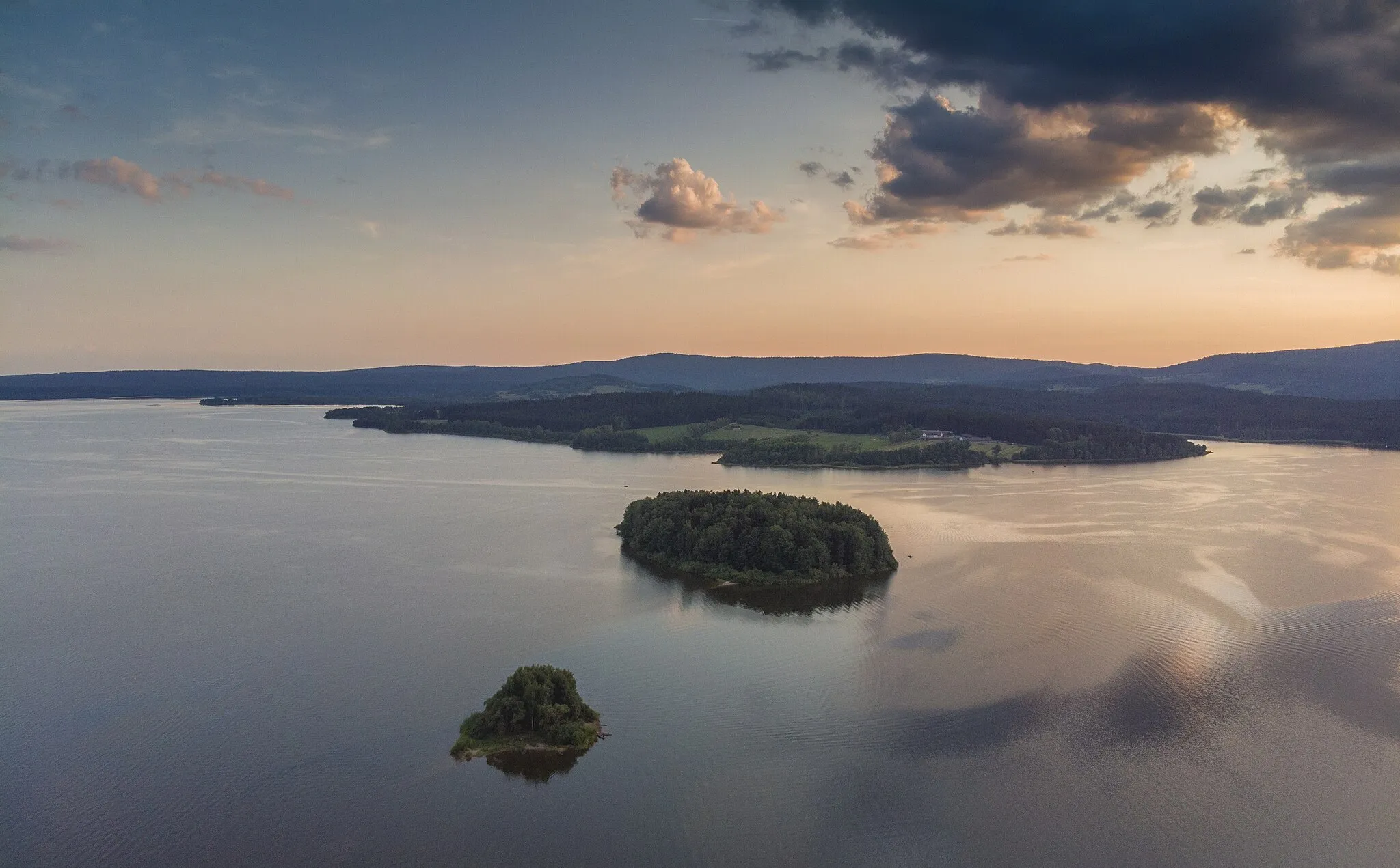
Tranquil cycling by the Danube River in Oberösterreich.
Cycling routes from Aigen im Muehlkreis
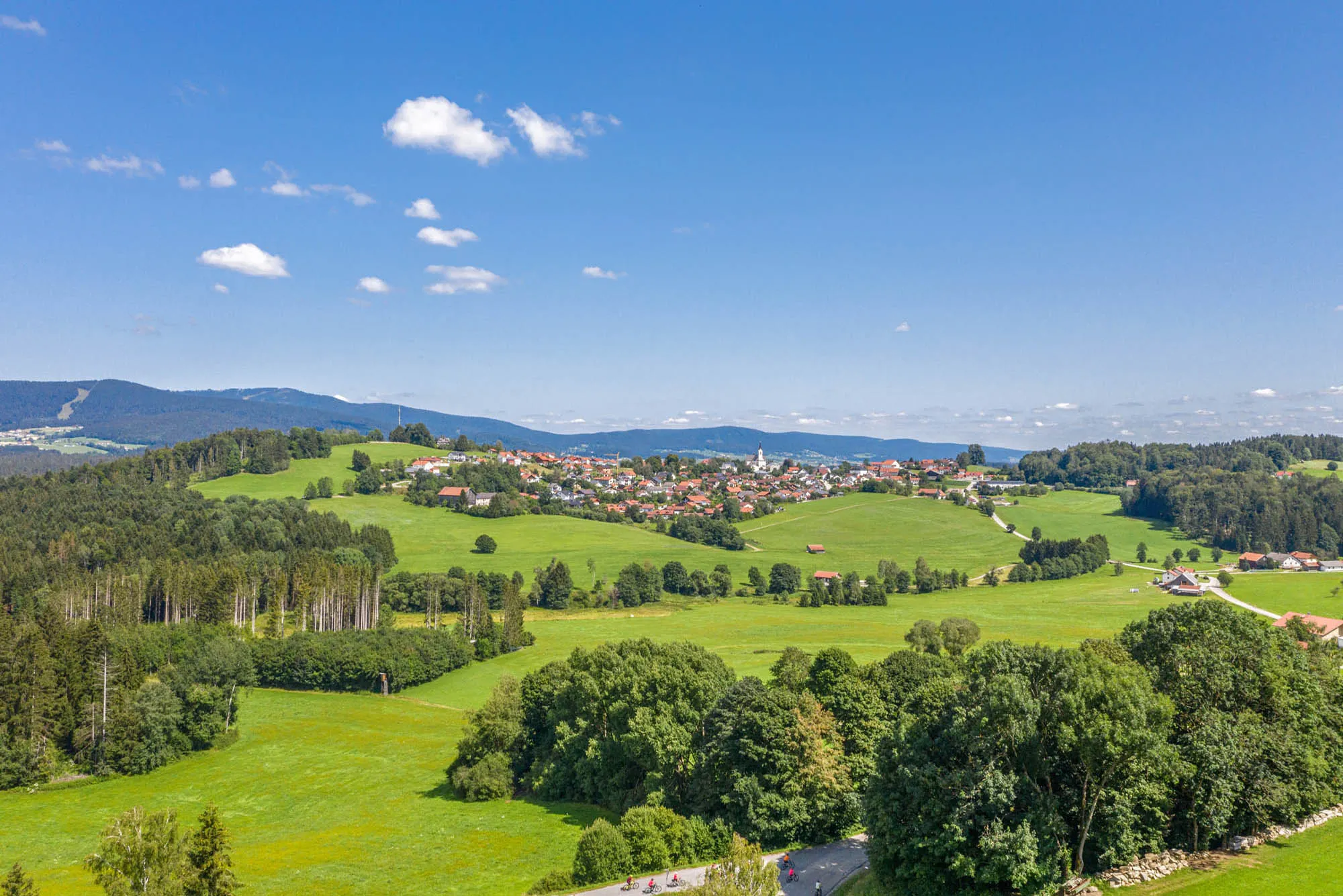
Aigen im Mühlkreis is a locality located in the Oberösterreich region of Austria. It offers a cycling-friendly environment with numerous road and gravel routes that showcase the stunning landscapes of the area. While there are no well-known climbs directly nearby, the region provides a variety of picturesque routes, including those along the scenic Danube River. Cyclists can enjoy the tranquility of the Danube Cycle Path or explore charming towns such as Linz or Grein. Aigen im Mühlkreis is a great destination for cyclists seeking beautiful natural scenery and a range of cycling routes.
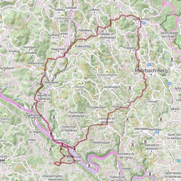
Embark on an exciting gravel cycling adventure near Aigen im Mühlkreis and explore scenic trails and historic landmarks
For gravel cycling enthusiasts, this adventure near Aigen im Mühlkreis offers an exhilarating experience. The route covers a distance of 92 km and includes an ascent of 2,293 m, making it a challenging ride for experienced cyclists. Highlights along the route include Aigen-Schlägl, Höglinger Gupf, Scheibe, Schloss Marsbach, Schloss Rannariedl, Penzenstein, Wegscheid, Spielberg, and Rudolfing. These locations offer a mix of natural beauty, historic landmarks, and challenging terrain for a truly memorable ride.
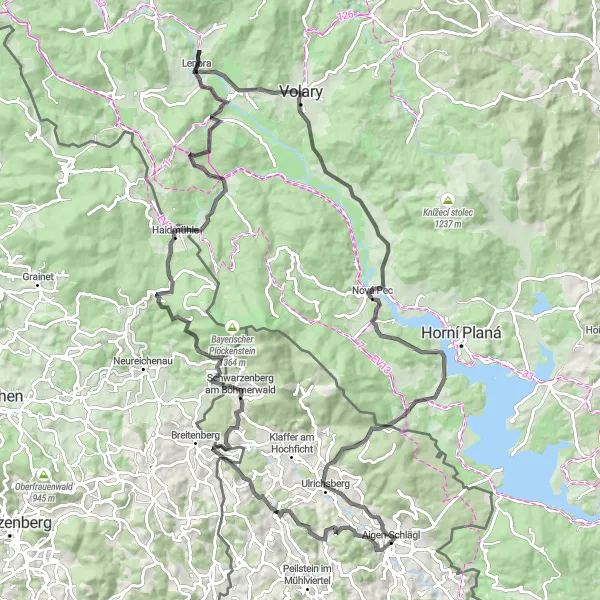
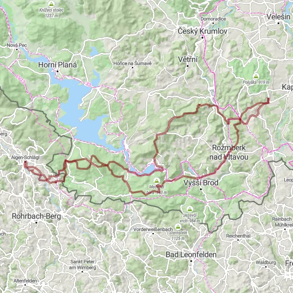
Embark on a challenging road cycling adventure through the Böhmerwald region
The Böhmerwald Adventure is a 115km road cycling route that commences in Aigen-Schlägl. With an ascent of 1930m, this demanding trail takes you through the stunning Böhmerwald region, showcasing its natural beauty and cultural highlights. It is a route suited for experienced cyclists seeking a thrilling and visually satisfying journey. Along the way, you will encounter various highlights, including panoramic viewpoints and historical landmarks, showcasing the richness of the region's heritage. The difficulty level of this route is rated at 5 out of 5, making it a challenging choice for even the most well-trained amateurs. In terms of epicness, it scores 4 out of 5, promising riders an exhilarating experience filled with breathtaking landscapes and intriguing historical sites.
Lichtenau Loop
Embark on a scenic road cycling journey from Aigen-Schlägl to Lichtenau
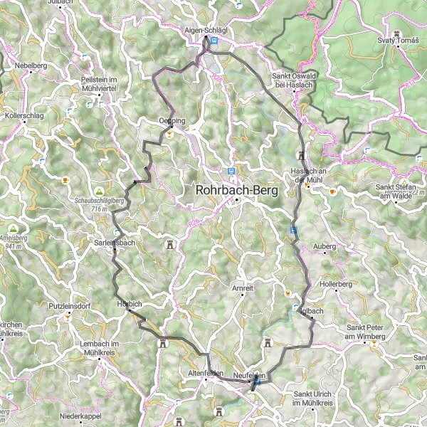
The Lichtenau Loop is a road cycling route starting in Aigen-Schlägl and spanning approximately 71km, with an ascent of 1294m. This picturesque journey takes you through beautiful landscapes and provides a unique perspective on the Mühlkreis region. The route is suitable for experienced road cyclists seeking a challenging adventure. Along the way, you will encounter several highlights, including impressive architectural landmarks and breathtaking viewpoints. With a difficulty rating of 4 out of 5, this route is best suited for well-trained amateurs looking for a physically demanding ride. In terms of epicness, it scores 3 out of 5, promising an exhilarating experience filled with scenic beauty and architectural marvels.
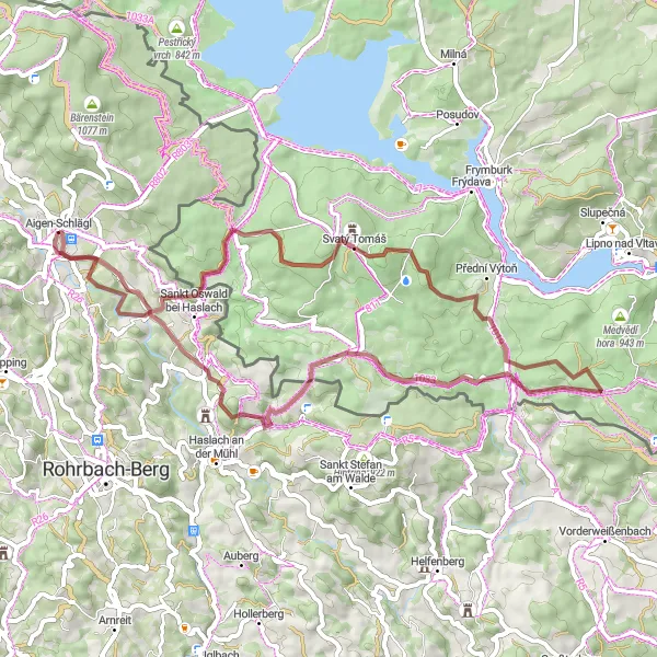
Embark on an unforgettable gravel adventure from Aigen im Mühlkreis to Lipno in the Czech Republic, experiencing stunning vistas and natural wonders along the way
For gravel cyclists seeking an unforgettable adventure, this route from Aigen im Mühlkreis to Lipno in the Czech Republic offers breathtaking vistas and stunning natural wonders. With a total distance of 118 km and an ascent of 2,714 m, it poses a significant challenge for experienced riders. Highlights along the route include Medvědí vrch, Svatý Tomáš, Medvědí hora, Hrudkov, Třešňovický kopec, Čeřín, Stezka korunami stromů Lipno, Slupečná, Vítkův kámen, and Sankt Oswald bei Haslach. These locations offer a mix of challenging climbs, scenic trails, and breathtaking views that make this gravel adventure truly epic.
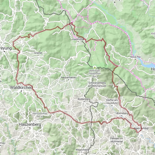
Embark on a gravel adventure through the stunning landscapes of Oberösterreich
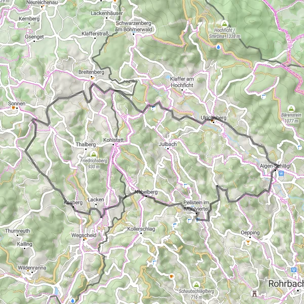
This epic gravel cycling route starting near Aigen im Mühlkreis challenges riders with a demanding ascent of 2388 meters over a distance of 109 kilometers. Along the route, cyclists will encounter breathtaking scenery and remote locations such as Dietrichschlag, Friedrichsberg, Schiefweg, Herzogsreut, Sulzberg, Kapraď, Nové Údolí, Steinwand, Pfaffetschlag, and Rudolfing.
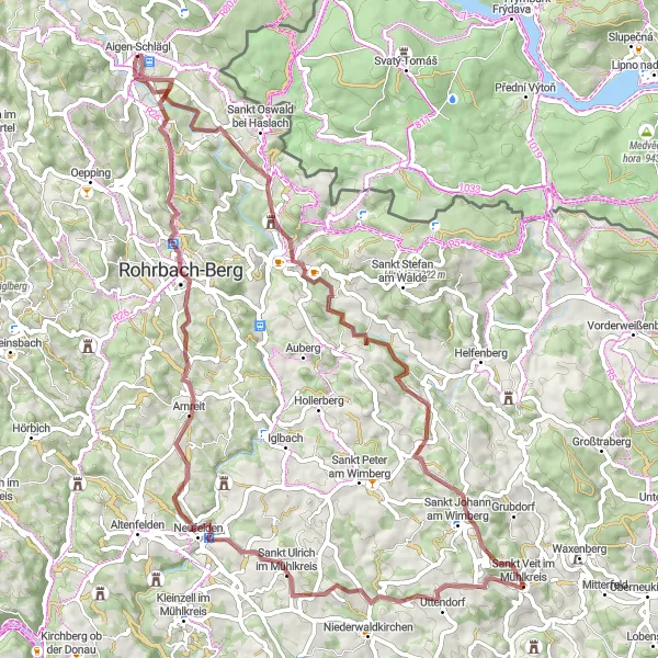
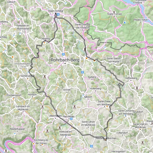
Experience the thrill of gravel cycling near Aigen im Mühlkreis on this challenging route with stunning natural beauty and cultural highlights
For gravel cycling enthusiasts seeking a thrilling adventure near Aigen im Mühlkreis, this challenging route is perfect. Covering a distance of 69 km and an ascent of 1,505 m, it offers a mix of tough climbs, exciting descents, and scenic trails. Highlights along the route include Aigen-Schlägl, Ekartsberg (Tanzboden), Sankt Johann am Wimberg, Hansberg, Sankt Ulrich im Mühlkreis, Rohrbach-Berg, and Winkl. These locations offer a mix of cultural attractions, scenic landscapes, and challenging terrain that will satisfy even the most adventurous gravel cyclist.
Aigen-Schlägl Gravel Adventure
Experience the beauty of Aigen-Schlägl countryside on a challenging gravel journey
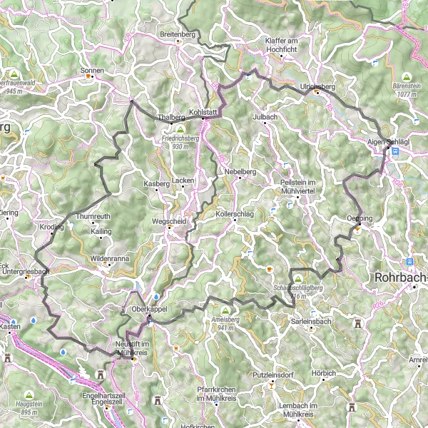
This gravel route starts in Aigen-Schlägl and covers a distance of 55km with an ascent of 1244m. The trail takes you through picturesque landscapes and highlights the natural beauty of the Mühlkreis region in Oberösterreich. It is a challenging ride suitable for experienced gravel cyclists looking for a thrilling adventure. As you cycle through the route, you will encounter several noteworthy landmarks and enjoy breathtaking views of the surrounding area, making it an unforgettable experience. The difficulty level of this route is rated as 4 out of 5, providing a considerable challenge for well-trained amateurs. On the epicness scale, it scores a solid 3, promising an exciting ride with stunning scenery.
Aigen-Schlägl Loop (Road)
Experience the picturesque countryside and charming villages on this scenic road cycling route near Aigen im Mühlkreis
This road cycling route near Aigen im Mühlkreis takes you through stunning countryside and picturesque villages. With a total distance of 59 km and an ascent of 1,285 m, it offers a moderate challenge for experienced cyclists. Highlights along the route include Aigen-Schlägl, Bründlberg, Neufelden, Kugelberg, Sarleinsbach, Oepping, and Natschlag. These locations offer unique cultural attractions and natural beauty that are worth exploring during your ride.
Aigen-Schlägl Scenic Ride (Road)
Enjoy a scenic road cycling tour near Aigen im Mühlkreis and discover stunning landscapes, charming villages, and cultural highlights
This road cycling tour near Aigen im Mühlkreis takes you on a scenic journey through beautiful landscapes and charming villages. With a total distance of 85 km and an ascent of 1,938 m, it offers a moderate challenge for experienced cyclists. Highlights along the route include Aigen-Schlägl, Schaubschläglberg, Zeinerberg, Neustift im Mühlkreis, Lämmersdorf, Großer Rathberg, Schönauberg, and Stollnberg. These locations showcase the natural beauty, cultural heritage, and historic landmarks of the region, offering a rewarding and enriching experience.
Aigen-Schlägl to Rudolfing Loop
Explore the diverse landscapes of Oberösterreich on this road cycling route
This round-trip cycling route starting near Aigen im Mühlkreis takes you through captivating landscapes and picturesque villages. The route offers a challenging ascent of 1092 meters over a distance of 57 kilometers. Cyclists will be rewarded with breathtaking views at various stages of the journey, including Aigen-Schlägl, Hochbühel, Nebelberg, Spielberg, Großer Rathberg, Schönauberg, Berdetschlag, and Rudolfing.
Cycling routes nearby:


Nearby regions: