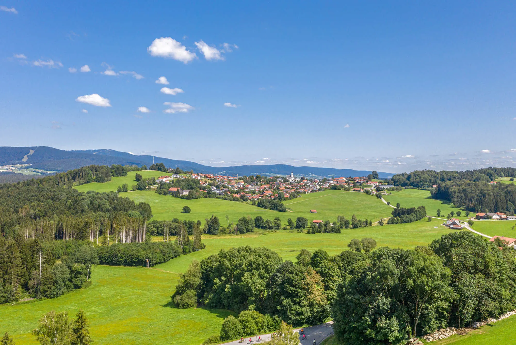
Discover scenic cycling routes in the charming town of Breitenberg, Germany.
Cycling routes from Breitenberg
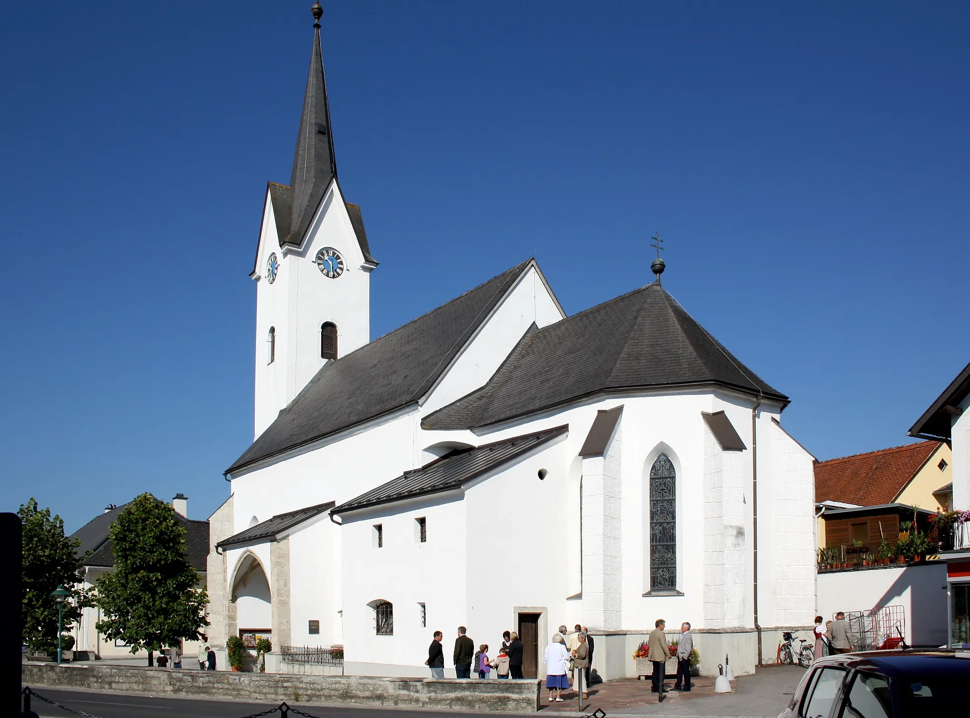
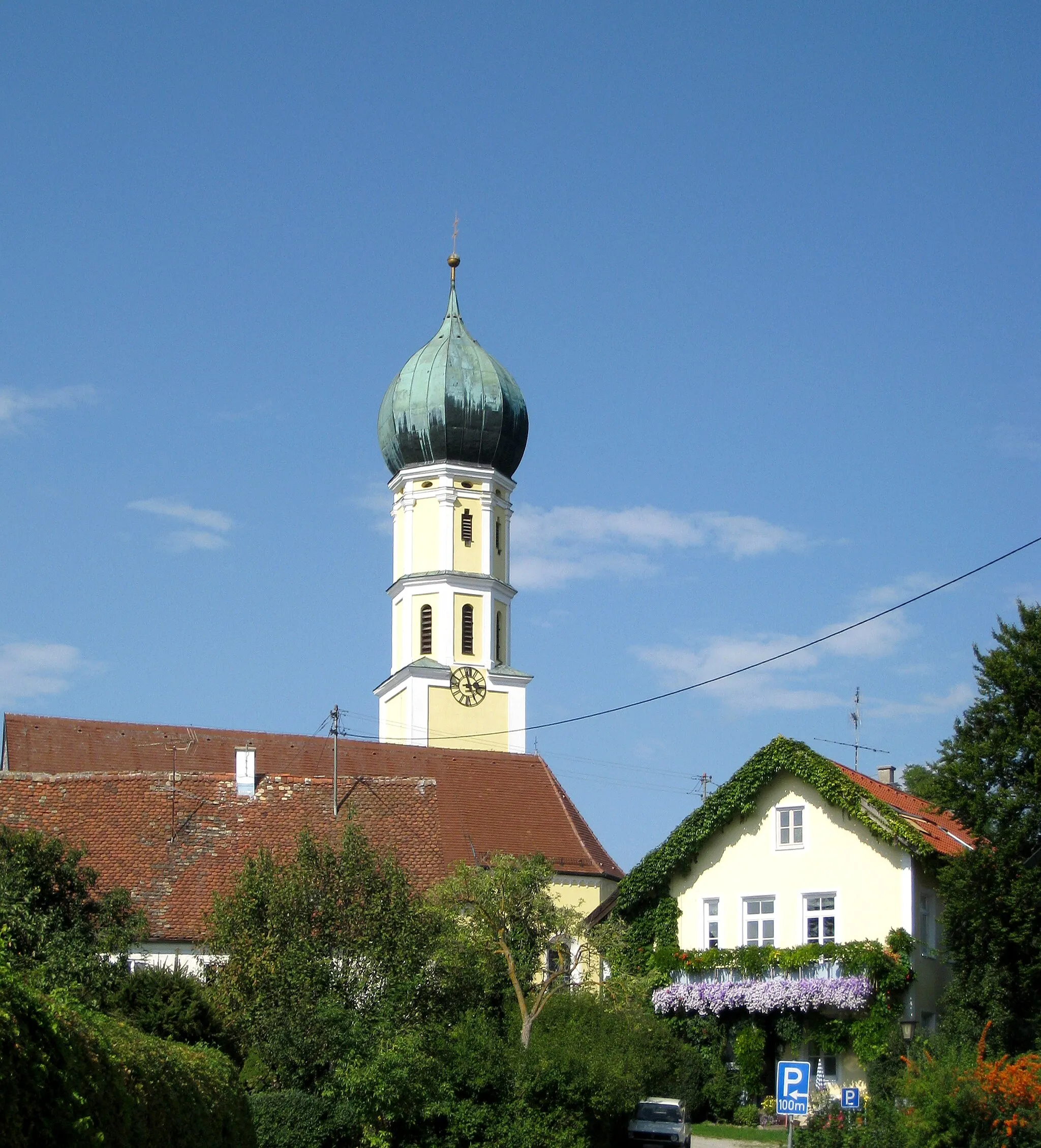
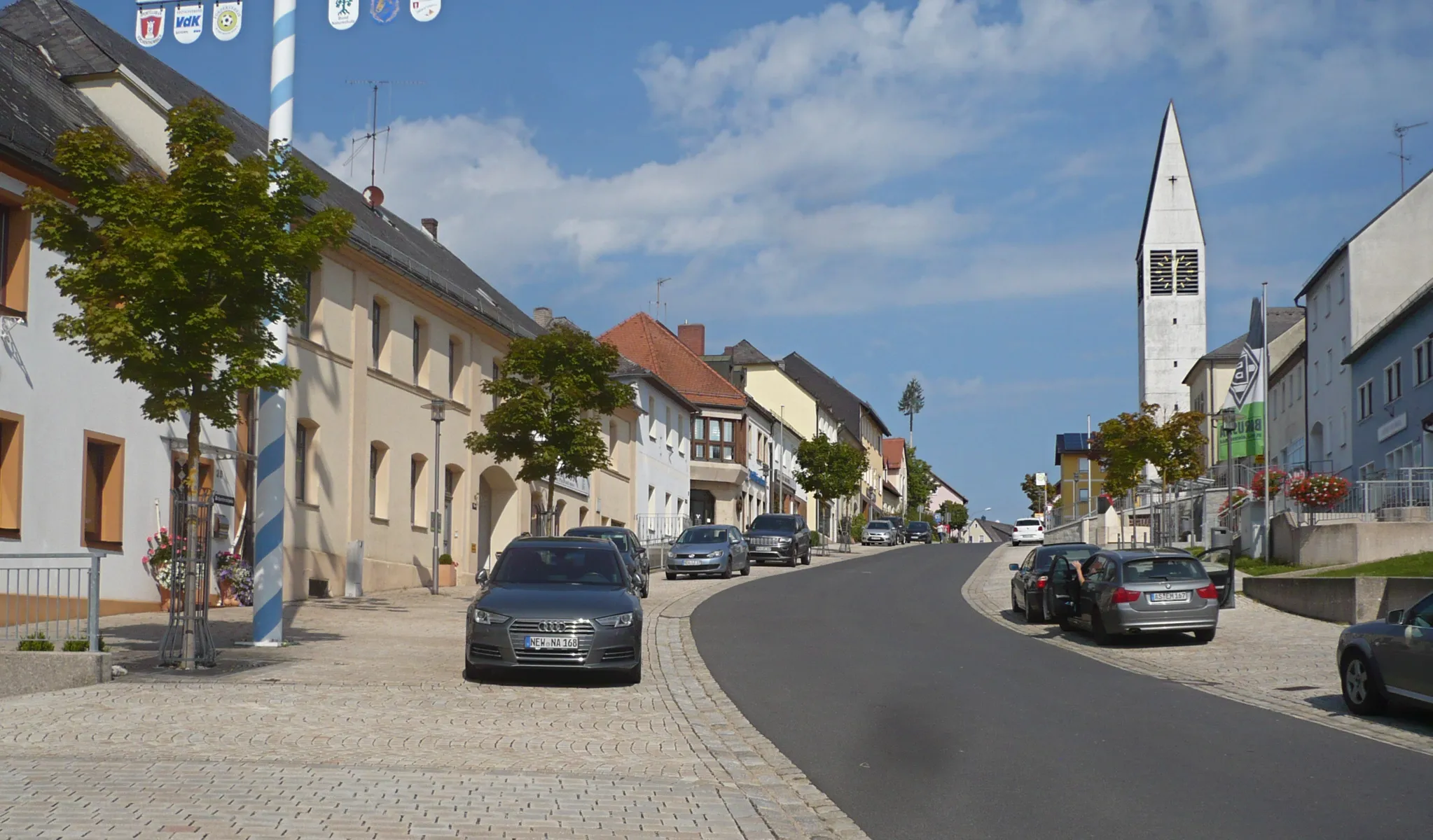
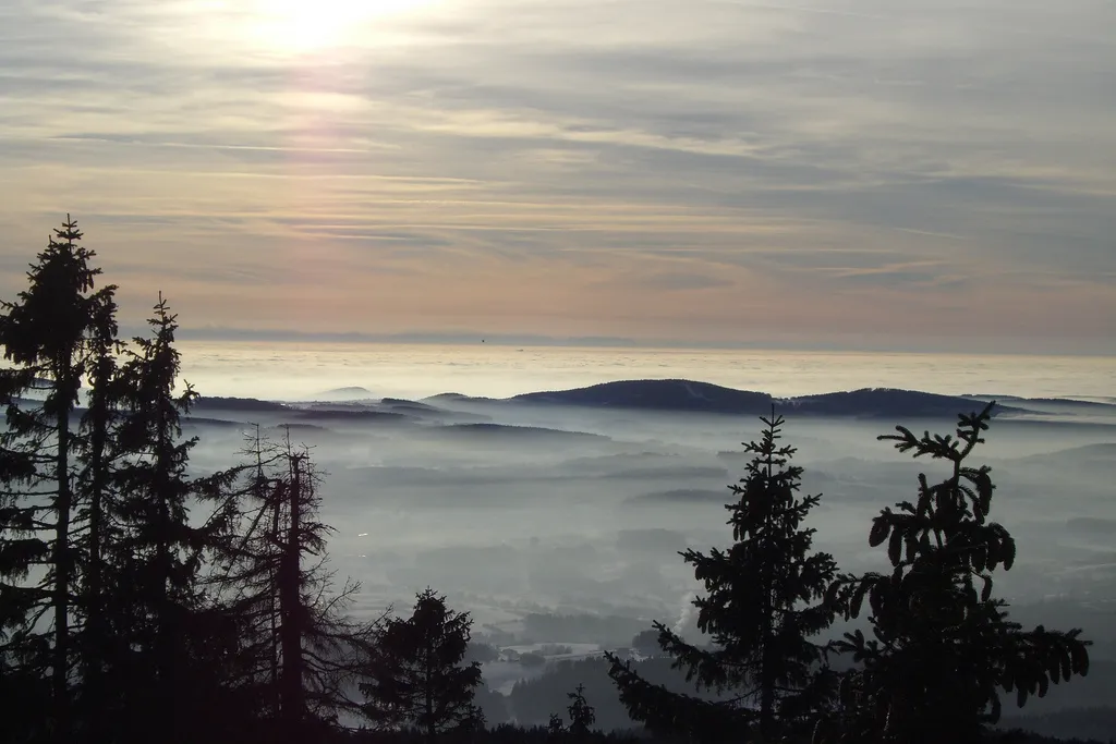
Breitenberg is a town located in Niederbayern, Germany. For road and gravel cyclists, Breitenberg offers diverse terrain and beautiful countryside views. Cyclists can enjoy riding through rolling hills and well-kept roads, taking in the stunning panoramic vistas along the way. The region is surrounded by dense forests and picturesque landscapes, making it a popular destination for outdoor enthusiasts. Additionally, Breitenberg is close to the Bavarian Forest National Park, which offers challenging off-road trails for mountain biking. Overall, Breitenberg provides a great cycling experience with its varied terrain, scenic routes, and proximity to natural parks.
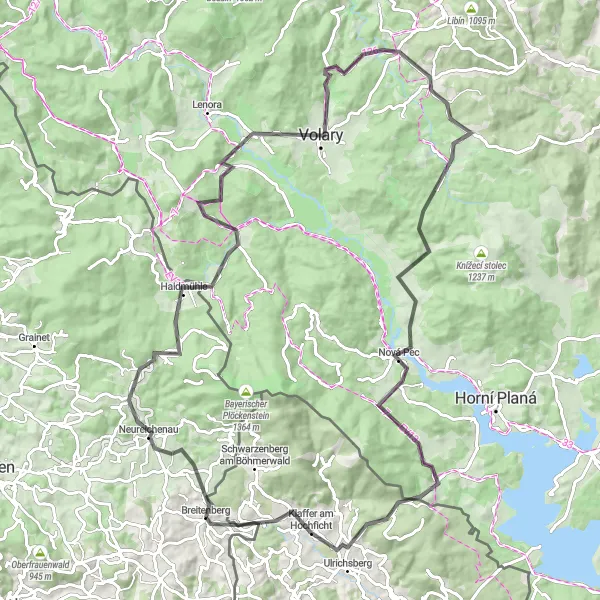
Embark on an epic road adventure from Breitenberg to Haidmühle, exploring diverse landscapes and enjoying breathtaking views.
This road cycling route starting near Breitenberg offers an exhilarating adventure through diverse landscapes and presents an opportunity to take in breathtaking views. With a total distance of 103 km and an ascent of 1912 meters, the route provides a challenging but rewarding cycling experience. Suitable for well-trained amateurs seeking a thrilling adventure, the difficulty level of this route is rated 4 out of 5. Highlights along the way include Neureichenau, Braunberg, Haidmühle, Ohradec, Dvorský vrch, Cudrovice, Křišťanov, Černý les, and bývalá Zadní Zvonková. Each of these highlights has a unique charm and offers something special for cyclists to enjoy. Neureichenau, for example, showcases stunning natural beauty, while Haidmühle is a picturesque town known for its traditional Bavarian architecture. Ohradec is famous for its historic castle, and Cudrovice offers panoramic views of the surrounding countryside. With a description provided for each highlight in the JSON format, cyclists can gain a better understanding of the significance and appeal of each spot on the route.
Breitenberg Nature Trail
Explore the natural wonders on the Breitenberg Nature Trail
Take a journey through the natural wonders of the Breitenberg Nature Trail. This 76km gravel route will lead you through pristine forests, verdant valleys, and sparkling rivers, offering a truly immersive nature experience. With 1437 meters of ascent, this route will challenge your cycling skills and provide a sense of adventure. Immerse yourself in the beauty of the Bavarian countryside and discover the hidden treasures along the way.
Road to Challenge
An adventurous road cycling route around Breitenberg with challenging climbs
This route takes you on a thrilling road cycling adventure around Breitenberg. With a total ascent of 1,528 meters and a distance of 81 kilometers, this route offers a challenge for experienced cyclists. The scenic highlights along the way include Schusterberg, Ulrichsberg, Haslach an der Mühl, Bründlberg, Neufelden, Sarleinsbach, Kugelberg, and Nebelberg. Whether you're seeking a thrilling cycling experience or simply want to take in the stunning countryside views, this road cycling route has it all.
Schönauberg Loop

A challenging road bike route with stunning views
Experience the breathtaking beauty of the Schönauberg Loop, a challenging road bike route that takes you through picturesque countryside and offers stunning views. As you climb the 1442 meters of ascent, you'll be rewarded with panoramic vistas of the surrounding landscape. This route will test your stamina and provide a truly memorable cycling experience for those seeking a challenge.
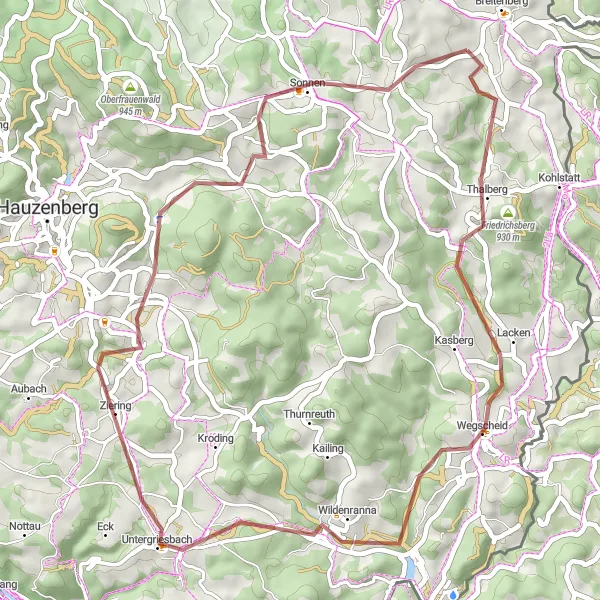
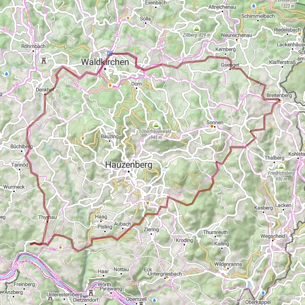
A pleasant gravel route featuring Wegscheid and Untergriesbach
Enjoy a pleasant gravel route near Breitenberg with this cycling tour. With an ascent of 956 meters and a distance of 48 kilometers, this route offers a moderate challenge for well-trained amateurs. Highlights include Wegscheid, a town known for its charming atmosphere and historical landmarks, and Untergriesbach, which offers stunning views of the surrounding natural landscapes. Along the way, riders will also pass through Ponzaun and Sonnen. This route provides a mix of natural beauty, cultural history, and enjoyable cycling conditions, making it a great option for cyclists looking for a satisfying ride.
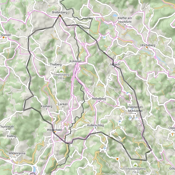
Experience the picturesque road cycling in Breitenberg and enjoy the stunning views of Schönberghäuser.
This road cycling route starting near Breitenberg takes you through beautiful scenic landscapes and offers stunning views of Schönberghäuser. The route is relatively short with a distance of 49 km and an ascent of 923 meters. It is suitable for well-trained amateur cyclists with moderate difficulty (3 out of 5). The route offers a unique and distinctive experience for road cycling enthusiasts, showcasing the beauty of the region. Highlights included in this route are Schönauberg, a 5-star attraction with breathtaking views, Peilstein im Mühlviertel, a 4-star attraction with a charming village atmosphere, and Hochstein, a 4-star attraction known for its historical significance. Other highlights such as Kollerschlag, Wegscheid, Großer Rathberg, and Schönberghäuser offer additional scenic beauty and cultural interest along the way. Each highlight provides 2-3 sentences of description in the JSON format to enhance the experience and knowledge about each spot.
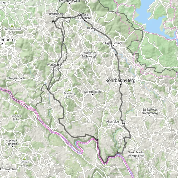
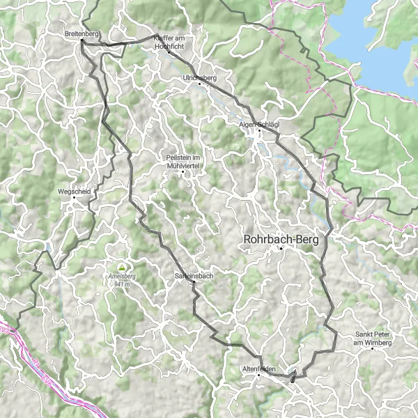
Embark on a challenging road cycling route from Breitenberg to Ulrichsberg, appreciating the diverse landscapes and cultural highlights along the way.
This road cycling route starting near Breitenberg presents a challenging adventure through diverse landscapes and cultural highlights. With a distance of 106 km and an ascent of 2158 meters, the route offers a demanding but rewarding experience for well-trained amateur cyclists seeking a challenge. Rated difficulty level is 4 out of 5. Highlights on this route include Schusterberg, Ulrichsberg, Arnreit, Schloss Neuhaus an der Donau, Rad Gupf, Niederkappel, Weinberg, Ponzaun, Wegscheid, Hirzenberg, and Schönberghäuser. Each highlight enhances the cycling journey through its unique appeal and history. Schusterberg, for example, showcases unique geological formations and offers stunning panoramic views. Ulrichsberg is renowned for its cultural heritage, and Schloss Neuhaus an der Donau is an impressive castle. Full descriptions for each highlight are provided in the JSON format to provide background information and create a more immersive experience for cyclists riding this route.
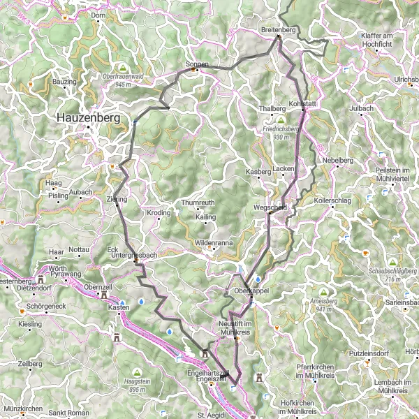
Immerse yourself in the stunning countryside on this scenic road cycling route near Breitenberg
Embark on a scenic road cycling journey near Breitenberg and immerse yourself in the picturesque Bavarian countryside. With a total ascent of 1,251 meters and a distance of 66 kilometers, this route offers a moderate challenge suitable for all levels of cyclists. Marvel at the highlights along the way, including Wegscheid, Ponzaun, Oberkappel, Zeinerberg, Aussicht am Ebenstein, Untergriesbach, and Sonnen. Breathe in the fresh country air, soak in the peaceful atmosphere, and enjoy the beauty of the surrounding landscapes as you pedal through this scenic route.

An exciting gravel adventure through the beautiful Böhmerwald
Embark on an exciting gravel adventure through the beautiful Böhmerwald region. This 75km route will take you along rolling gravel roads and through scenic forests, offering a true off-road cycling experience. With 1364 meters of ascent, this is a challenging ride that will test your skills and endurance. Immerse yourself in the natural beauty of the Böhmerwald and enjoy the thrill of exploring its hidden gems.
Gravel Adventure

Conquer the gravel roads around Breitenberg on this thrilling cycling route
Experience the thrill of gravel biking on this 64-kilometer route that takes you through Breitenberg's stunning gravel roads. With a total ascent of 1,079 meters, it offers a moderate challenge for gravel enthusiasts. Enjoy the serene beauty of Einsiedelberg, Schwarzenberg am Böhmerwald, Sperrbühel, Sonnenwald, U věže, Sankt Oswald bei Haslach, Ulrichsberg, Scheibenbühel, and Nanzelberg along the way. Immerse yourself in nature, take in the peaceful surroundings, and revel in the freedom of off-road cycling.
Cycling routes nearby:


Nearby regions: