Embark on thrilling climbs and revel in scenic views in the stunning landscapes of Grainet.
Cycling routes from Grainet
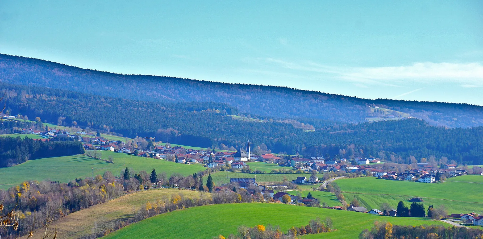
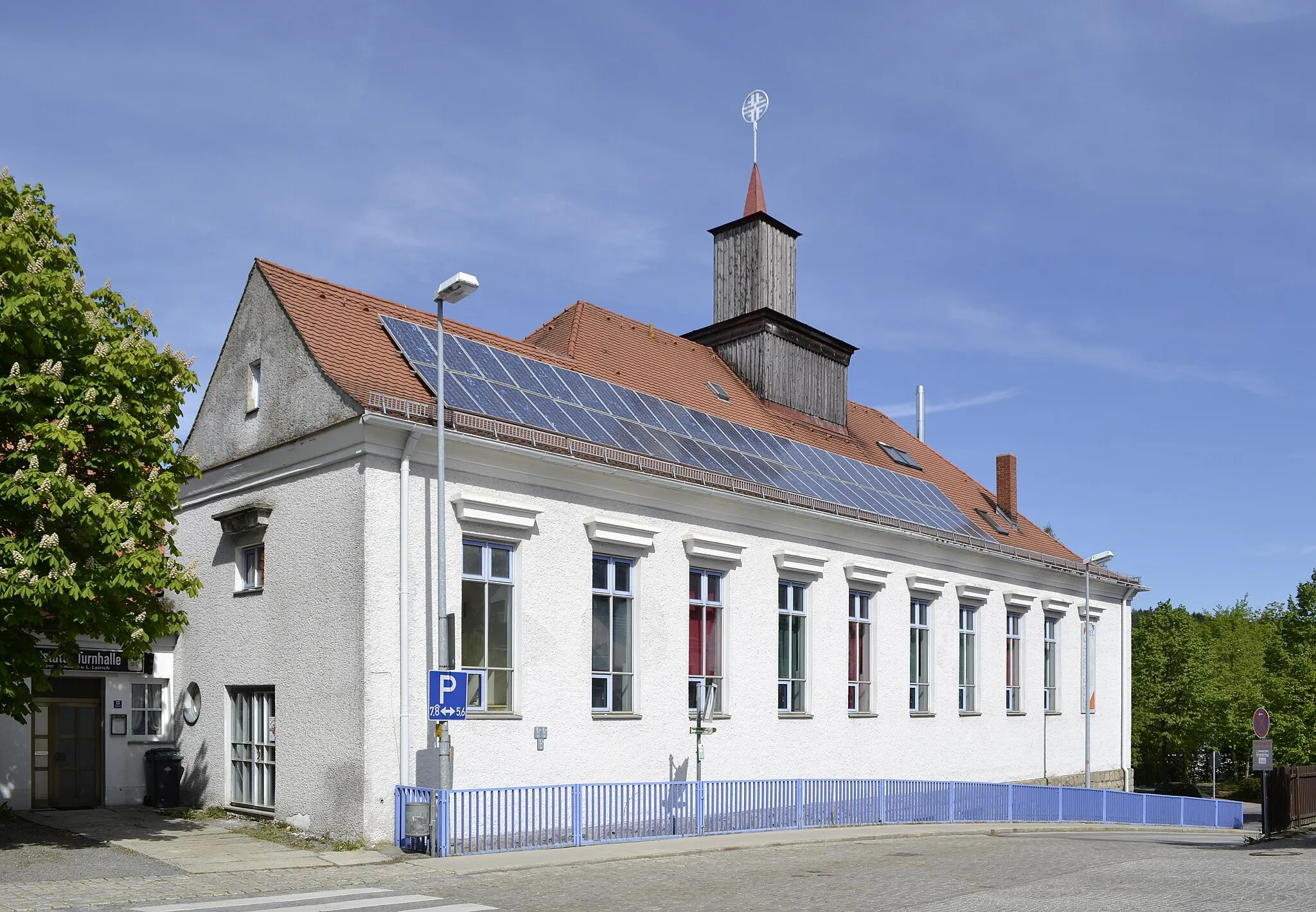
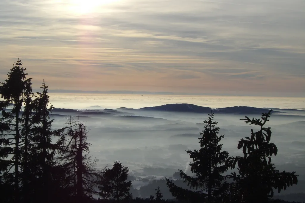
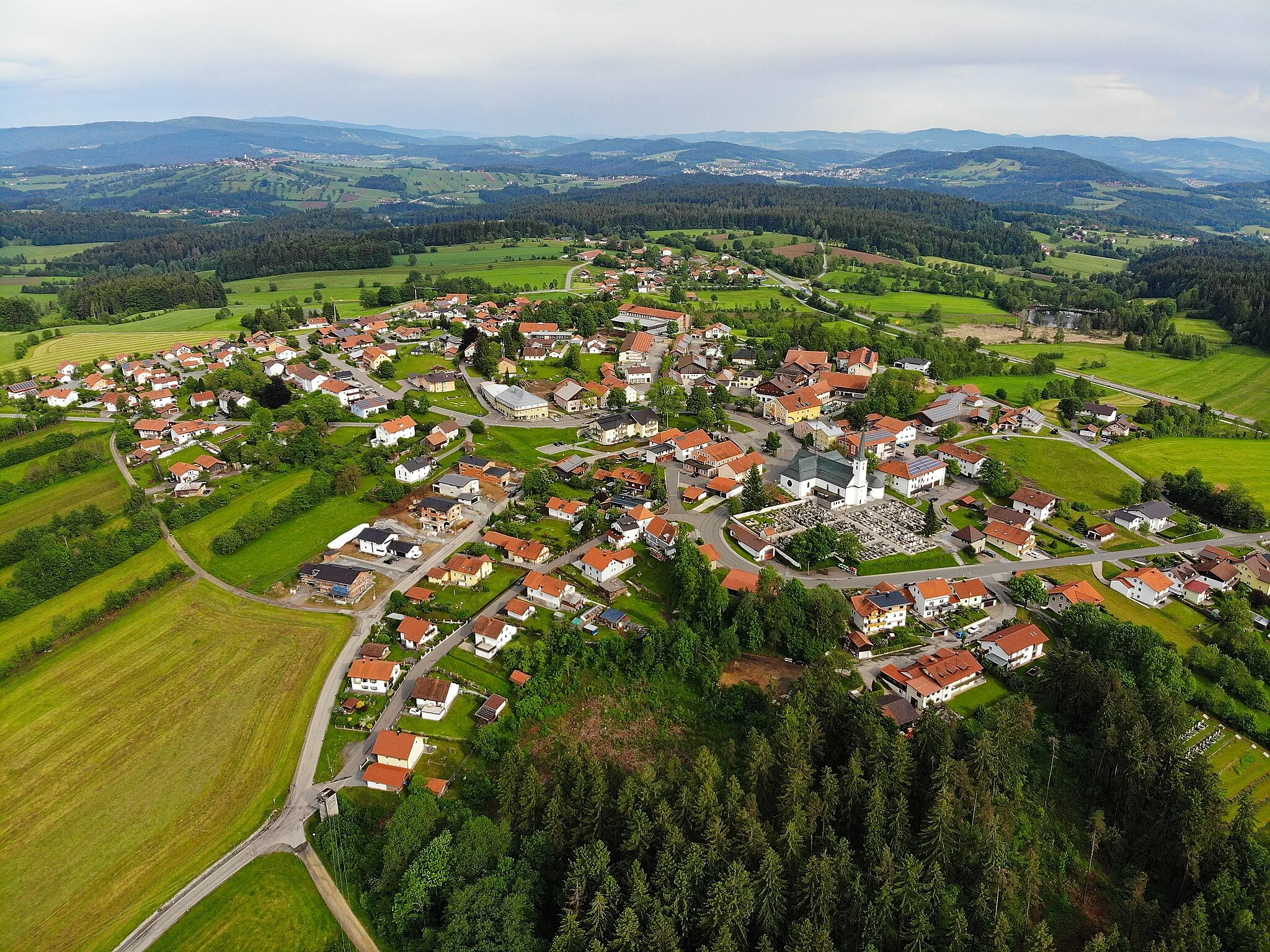
Grainet, located in Niederbayern, Germany, is a small locality surrounded by beautiful mountains and forests, making it an appealing destination for cyclists. The region provides a mix of challenging climbs and serene routes, catering to both adventurous and leisurely riders. The Bavarian Forest nearby presents a range of cycling options, including off-road trails for gravel riders. Grainet offers the perfect balance between nature and cycling, providing a peaceful and picturesque experience for all cyclists.
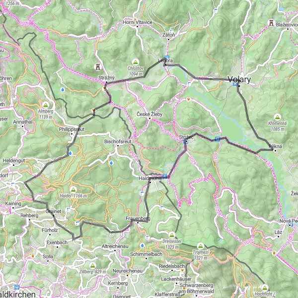
Conquer the Mühlberg, one of the toughest climbs in the region.
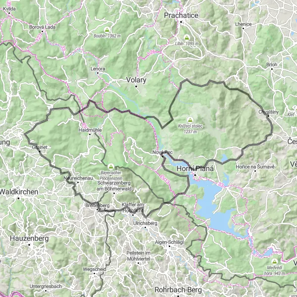
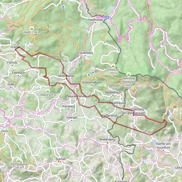
The Mühlberg Challenge is a demanding road cycling route starting near Grainet. With a total ascent of 2802 meters and a distance of 150 kilometers, it is suitable for experienced cyclists looking for a challenging ride. The route takes you through picturesque landscapes, quaint villages, and offers breathtaking views at various points along the way. The highlights of this route include the iconic Mühlberg climb, the panoramic viewpoint at Rohedělí, and the charming town of Horní Planá. Prepare to be tested both physically and mentally as you take on this epic cycling adventure.
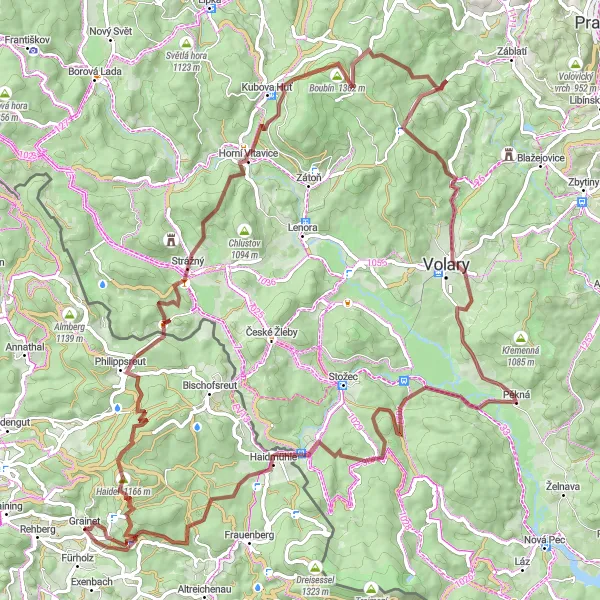
The Hillside Retreat
Embark on a scenic ride through rolling hills and charming countryside.
The Hillside Retreat is a road cycling route starting near Grainet with an ascent of 1165 meters and a distance of 74 kilometers. This route is perfect for cyclists who enjoy a mix of challenging climbs, fast descents, and beautiful scenery. The highlights of this route include the iconic Mühlberg climb, the charming town of Philippsreut, and the panoramic views from Spálený. Experience the beauty of the countryside as you ride through quaint villages and immerse yourself in the natural surroundings. This route offers a great balance between physical challenge and picturesque landscapes.

Embark on an epic cycling adventure through majestic hills and breathtaking landscapes.
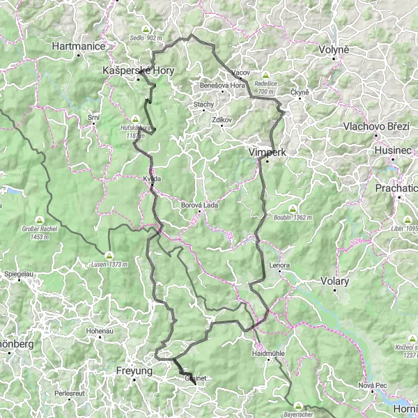
The Majestic Hills road cycling route is a challenging ride starting near Grainet with a total ascent of 2646 meters and a distance of 125 kilometers. This route is designed for experienced cyclists who crave a combination of demanding climbs and incredible scenery. Highlights along the way include the thrilling ascent of Sicklinger Berg, the historic town of Fürsteneck, and the panoramic views from the Baumwipfelpfad lookout. Immerse yourself in the natural beauty of the region as you pedal through rolling hills, dense forests, and charming villages. This route offers a great opportunity to push your limits while taking in the awe-inspiring landscapes.

Discover the rural beauty and rugged terrain on this gravel route near Grainet
Embark on a thrilling gravel cycling journey near Grainet to explore the picturesque landscapes and challenging terrains of Niederbayern. This route features a mix of off-road gravel paths and quiet country roads, taking you through charming towns and villages along the way. With a total distance of 96 kilometers and an ascent of 2111 meters, this route is perfect for experienced cyclists seeking an adventurous ride.
Grainet Gravel Adventure
Immerse yourself in the rugged gravel routes near Grainet
Explore the gravel roads near Grainet and experience a true adventure. This 99-kilometer route takes you through picturesque landscapes and offers stunning views. With a total ascent of 2359 meters, this challenging route is perfect for the adventurous cyclist. Encounter highlights such as Haidel, Philippsreut, Kubova Huť, and more as you navigate through the beautiful countryside. Whether you're an experienced cyclist or a lover of nature, this route will leave you with unforgettable memories.
Frauenberg Gravel Escape
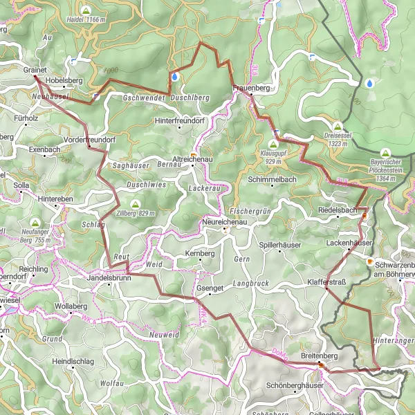
Embark on a thrilling gravel escape to Frauenberg and savor the rugged beauty of the region
Explore the rustic charm of the Frauenberg region on this gravel round-trip starting near Grainet. With an ascent of 1069 meters and a distance of 51 kilometers, this route promises an invigorating adventure for gravel enthusiasts. Along the way, make sure to stop by Frauenberg, Klausgupf, Klafferstraß, Einsiedelberg, Jandelsbrunn, Zillberg, and Grainet, which are the highlights dotting your path.
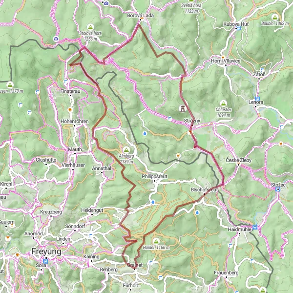
Embark on a thrilling cross-border cycling adventure near Grainet
This gravel cycling route near Grainet not only allows you to explore the breathtaking landscapes of Niederbayern but also takes you across international borders. Covering a distance of 68 kilometers with an ascent of 1648 meters, this route promises a challenging and exhilarating experience for intermediate to advanced cyclists. From the stunning beauty of Herzogsreut to the picturesque views of Borová Lada in the Czech Republic, this cross-border excursion offers a unique and memorable adventure.
Venture through the gravel paths of Grainet and explore its natural beauty
This round-trip cycling route starting near Grainet takes you through breathtaking gravel paths, offering you a unique adventure. With an ascent of 1157 meters and a distance of 51 kilometers, this route provides a thrilling challenge for gravel enthusiasts. Along the way, you will encounter several highlights, including Braunberg, Einsiedelberg, Schwarzenberg am Böhmerwald, Fuchsenstein, Altreichenau, and Hobelsberg.
The Road Warrior
Conquer the challenging roads and scenic routes near Grainet on this road cycling adventure
This road cycling route near Grainet is designed to test the limits of even the most experienced cyclists. With a total distance of 137 kilometers and a daunting ascent of 2901 meters, this route is not for the faint of heart. The breathtaking landscapes and stunning vistas along the way, however, make every pedal worth it. From Vorderschmiding to Philippsreut, you'll encounter epic climbs, thrilling descents, and hidden gems waiting to be discovered. Prepare to embark on an unforgettable road cycling journey filled with challenges and rewards.
The Hidden Trails

Embark on an off-road adventure to uncover Niederbayern's hidden gems near Grainet
This gravel cycling route near Grainet spans a distance of 56 kilometers and boasts an ascent of 1395 meters, making it an exciting challenge for adventurous cyclists. As you traverse the gravel trails and scenic country roads, you'll have the opportunity to explore lesser-known attractions and immerse yourself in the peaceful countryside. From the charming village of Vorderschmiding to the picturesque town of Neuschönau, this route promises unique discoveries at every turn.
Cycling routes nearby:


Nearby regions: