Challenging climbs and stunning mountain landscapes.
Cycling routes from Biviers
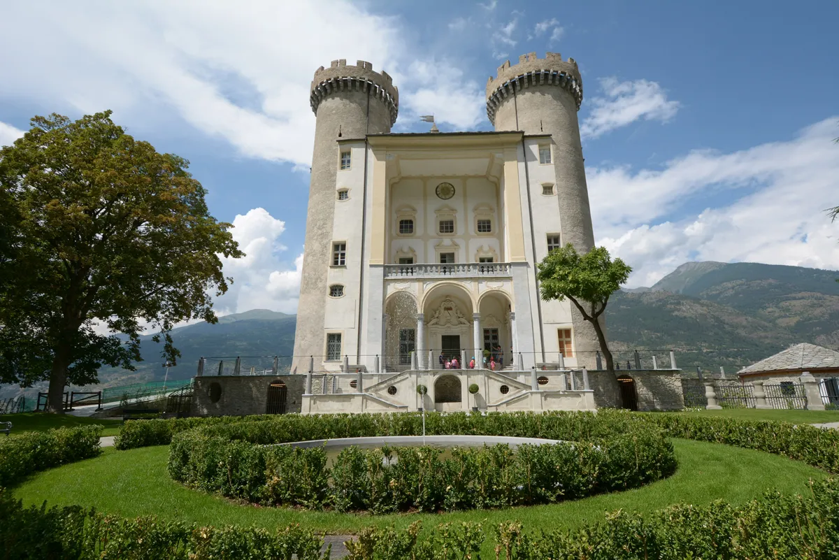
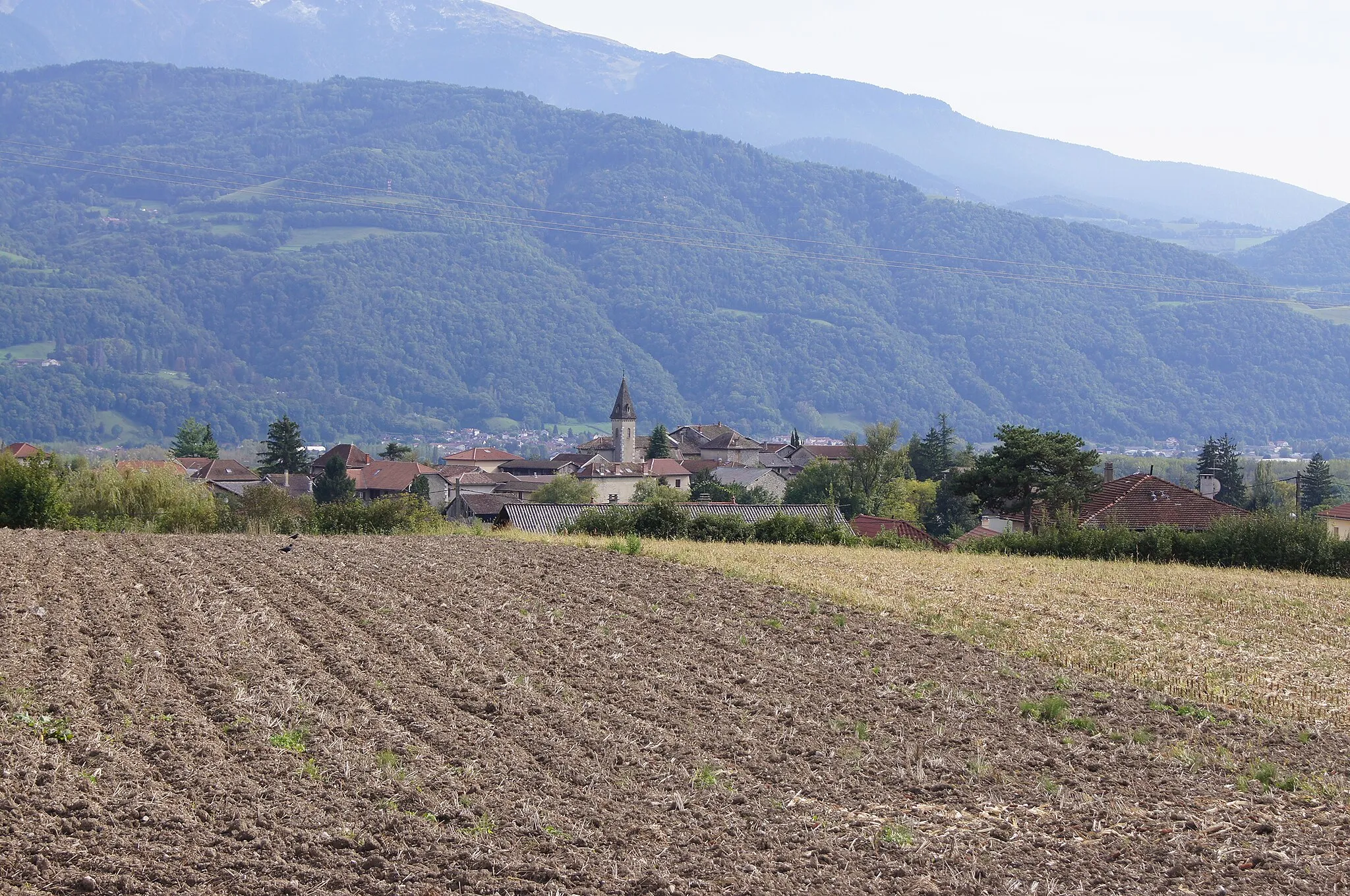
Biviers is a small locality located in the Rhône-Alpes region of France. From a cyclist's perspective, Biviers offers a mix of challenging climbs and scenic roads, making it suitable for experienced cyclists. The locality is surrounded by the stunning landscape of the Chartreuse Mountains, providing breathtaking views during rides. One of the famous cycling climbs nearby is the Col de Vence, known for its difficulty and stunning vistas. Overall, Biviers is a great cycling-friendly area with a rank of 5.
Crolles Explorer
Discover the enchanting beauty of Crolles on this 39-km road cycling route
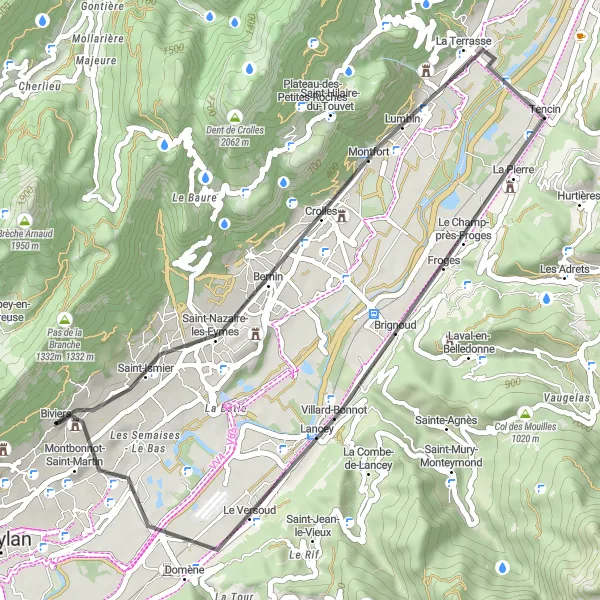
Embark on the Crolles Explorer, a captivating road cycling route that spans 39 km near Biviers. With a moderate difficulty rating of 3 and an ascent of 390 meters, this route is suitable for cyclists of various skill levels. Immerse yourself in the awe-inspiring beauty of Crolles as you ride through charming villages and marvel at panoramic views of the stunning Grésivaudan Valley. The route culminates in Montbonnot-Saint-Martin, a delightful town that invites you to relax and savor the splendid journey. This route promises a mix of natural wonders and cultural gems.
Circuito de los Siete Picos
Discover the stunning landscapes of the Rhône-Alpes region on this road cycling route.
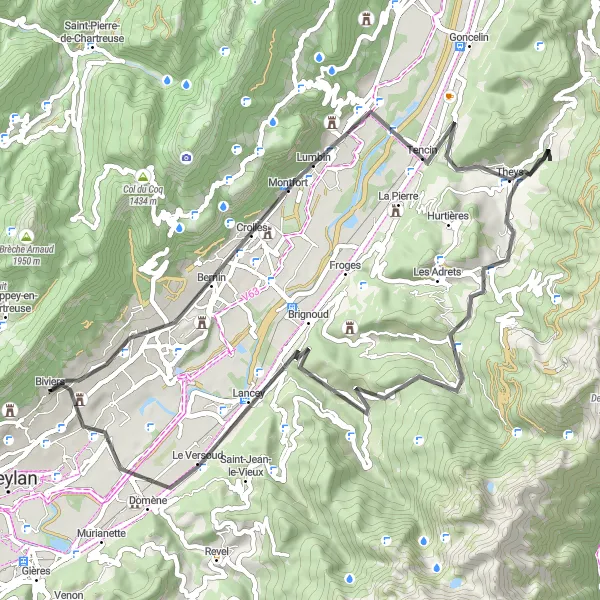
This road cycling route near Biviers takes you through some of the most beautiful and challenging terrain in the region. With a total ascent of 1523 meters and a distance of 61 kilometers, the route offers a good mix of climbs and descents. The highlights along the route include Crolles, a charming town with historic buildings, and Theys, a picturesque village known for its beautiful countryside. Col des Mouilles and Saint-Mury-Monteymond are two challenging climbs that provide stunning panoramic views of the surrounding mountains. This route is recommended for experienced cyclists looking for a challenging ride with exceptional scenery.
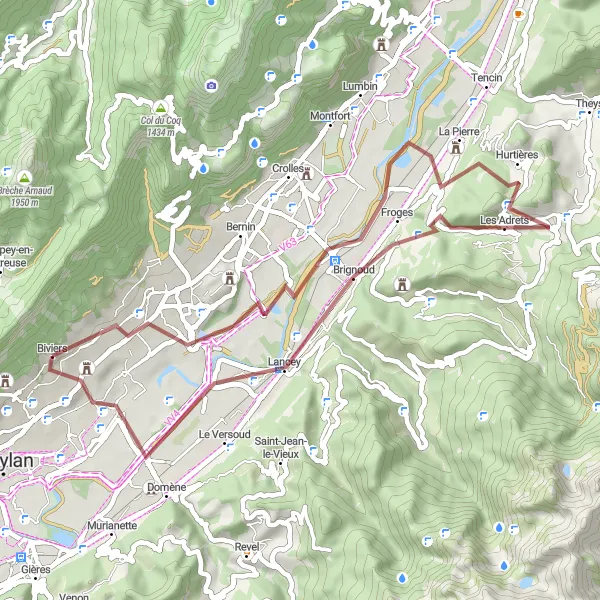
The Grésivaudan Scenic Ride
Immerse yourself in the natural beauty of Grésivaudan Valley on this scenic 31-km road cycling route
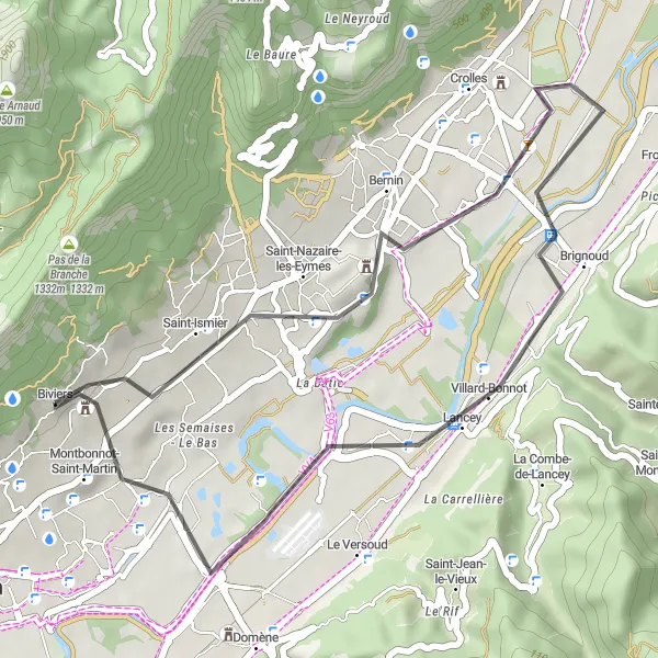
Indulge in a breathtaking road cycling experience with The Grésivaudan Scenic Ride, a 31-km route that allows you to immerse yourself in the captivating landscapes of Grésivaudan Valley near Biviers. Offering a moderate level of difficulty and an elevation gain of 321 meters, this route is perfect for cyclists seeking a peaceful ride amidst nature's wonders. Take in the glorious panoramic views of the valley as you pedal through picturesque villages and experience the tranquility that envelops the surroundings. Highlights include the idyllic village of Biviers, which serves as the starting point, and Saint-Nazaire-les-Eymes, a charming town that showcases the charm of rural France.
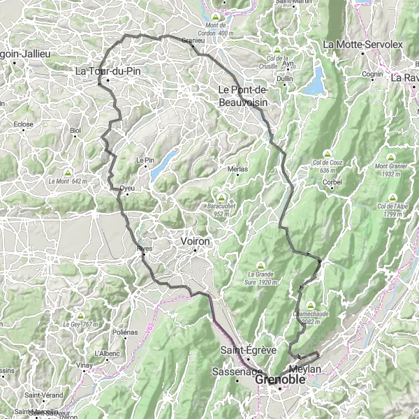
A challenging route starting near Biviers, taking you through the stunning landscapes of Rhône-Alpes.
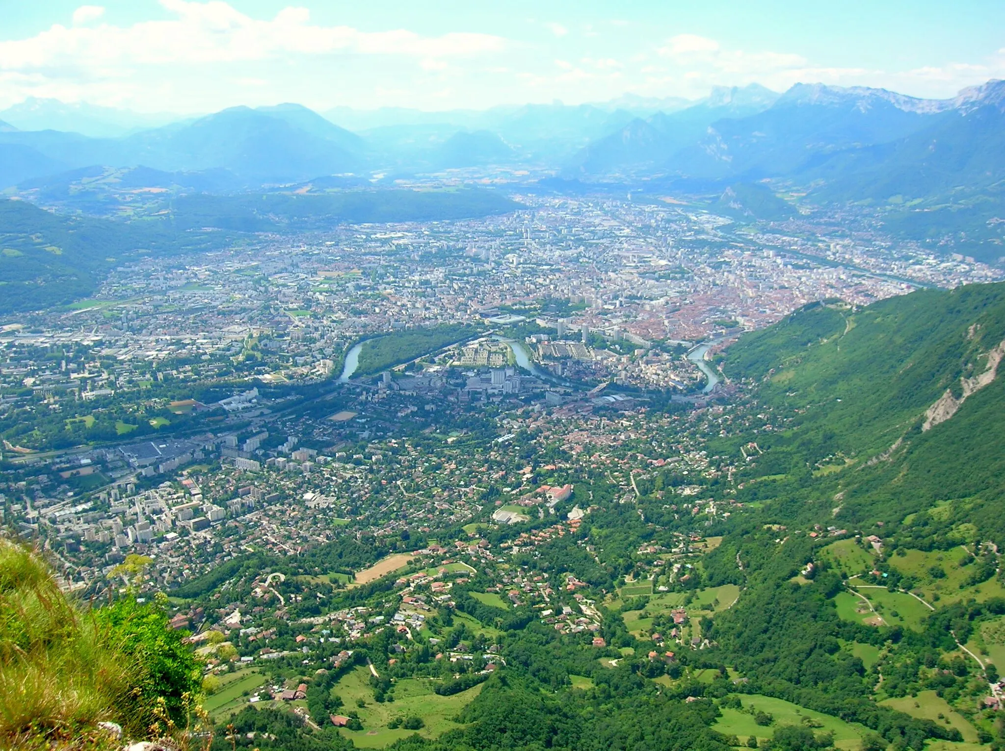
The Grenoble Epic is a 153 km round-trip cycling route that starts from Biviers and offers a challenging ride through the picturesque landscapes of Rhône-Alpes. With a total ascent of 2800 meters, this road route is not for the faint of heart, but it rewards cyclists with breathtaking views and memorable highlights along the way. The route takes you to famous spots like Mont Jalla, Veurey-Voroize, and the stunning Bec de l'Échaillon. You will also pass through charming towns including Rives, La Tour-du-Pin, Dolomieu, and Pont-de-Beauvoisin.
The Gravel Adventure
Experience the thrill of gravel cycling on this scenic 45-km route
Discover the joy of gravel cycling near Biviers with The Gravel Adventure. This 45-km route with an ascent of 1073 meters offers a thrilling ride through Rhône-Alpes' picturesque landscapes. Suitable for well-trained amateur cyclists, this moderate difficulty route provides an excellent combination of challenging sections and serene surroundings. Immerse yourself in the untouched beauty of nature as you venture through forests and charming villages. With an epicness rating of 3, this route offers a memorable adventure for gravel enthusiasts. Highlights include the enchanting village of Biviers, which serves as the starting point, and Montbonnot-Saint-Martin, a delightful town with a rich history.
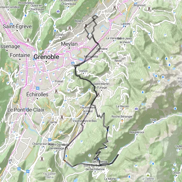
A charming road route featuring a stop at the Carousel
Embark on a picturesque road cycling journey starting near Biviers. The Carousel Loop is a delightful 82-km route with an elevation gain of 1820 meters. Enjoy the breathtaking landscapes as you pedal through the beautiful Rhône-Alpes region. With a difficulty rating of 4 and an epicness rating of 4, this route is perfect for well-trained amateur cyclists seeking a challenging and memorable ride. Explore highlights such as Vizille, a historic town known for its elegant château, and the charming village of Relais. Climb up to Col Luitel and marvel at the stunning panoramic views before making a stop at Château d'Uriage, a magnificent castle with a rich history. Montbonnot-Saint-Martin is a real gem that awaits at the end of the ride, offering a perfect spot for relaxation and celebration.

Embark on a challenging 85-km gravel adventure in the awe-inspiring Alpine landscapes near Biviers
Satisfy your hunger for adventure with The Alpine Gravel Challenge, an epic 85-km route tailor-made for seasoned gravel cyclists. Prepare to conquer an impressive ascent of 2357 meters and soak in the unspoiled beauty of the Alpine region near Biviers. Be captivated by the stunning views of mountains, forests, and serene valleys as you navigate through picturesque towns and charming villages along the way. With a difficulty rating of 5 and an epicness rating of 4, this challenging route promises an unforgettable experience for avid gravel enthusiasts seeking a true test of skill and endurance. Highlights include Crolles, a village nestled amidst breathtaking scenery, Col de Merdaret, which offers an exhilarating climb and rewards you with panoramic mountain vistas, and Villard-Bonnot, a historic town with fascinating heritage.

Challenge yourself with this road cycling route through the hilly landscapes of Corenc.
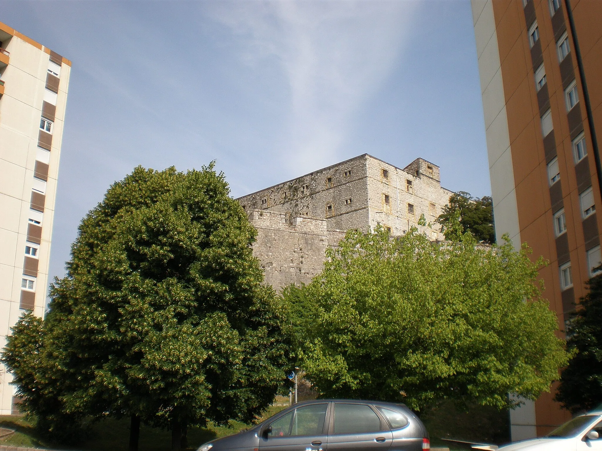
This road cycling route near Biviers takes you through the hilly landscapes of Corenc, offering a challenging and rewarding experience. With a total ascent of 2308 meters and a distance of 87 kilometers, this route is recommended for well-trained cyclists who enjoy climbing. The highlights along the route include Corenc, a picturesque village with stunning views of the surrounding mountains, and Col de Porte, a legendary climb known for its challenging ascent. Col du Cucheron and Col du Granier are two demanding ascents that test even the most experienced cyclists. Barraux is a historical town with a fascinating castle, while Château de Serviantin offers a glimpse into the region's rich history and architecture. This route is perfect for cyclists seeking a challenging ride through beautiful mountainous terrain.
Gravel Adventure

Experience the thrill of gravel cycling through the scenic landscapes of the Rhône-Alpes region.
This gravel cycling route near Biviers offers an exciting and adventurous journey through the scenic landscapes of the Rhône-Alpes region. With a total ascent of 2144 meters and a distance of 103 kilometers, this route is suitable for gravel enthusiasts looking for a challenge. The highlights along the route include Biviers, a charming village surrounded by stunning nature, and Goncelin, a picturesque town known for its beautiful architecture. Allevard is a historic spa town where you can relax and rejuvenate after a long day of cycling. Lumbin is home to a renowned paragliding spot, offering breathtaking aerial views of the surrounding mountains. This route is recommended for cyclists looking for a thrilling off-road adventure with picturesque scenery.
Gravel Trek
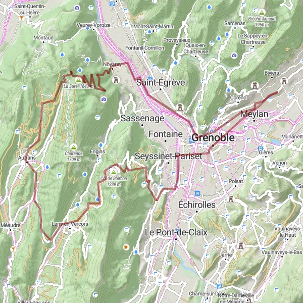
Embark on an exciting gravel cycling adventure through the scenic landscapes near Biviers.
This gravel cycling route near Biviers offers an exciting adventure through the scenic landscapes of the Rhône-Alpes region. With a total ascent of 2259 meters and a distance of 84 kilometers, this route is suitable for experienced gravel cyclists looking for a challenge. The highlights along the route include Meylan, a vibrant town with stunning views, and Col de Comboire, a demanding climb with breathtaking panoramic views. Autrans is a charming village known for its beautiful architecture and peaceful atmosphere. La Buffe offers stunning vistas of the surrounding mountains, while La Dent du Loup is a popular spot for hiking and outdoor activities. Saint-Martin-le-Vinoux provides picturesque views of the Rhône-Alpes region, and Hauts de Meylan offers a challenging climb rewarded with breathtaking views. This route is perfect for gravel enthusiasts seeking a thrilling off-road adventure in a stunning natural environment.
Cycling routes nearby:

Nearby regions: