Conquer the legendary climbs of La Clusaz and witness alpine beauty
Cycling routes from La Clusaz
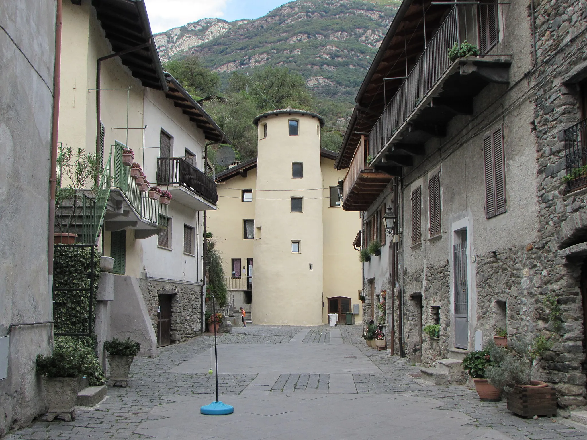
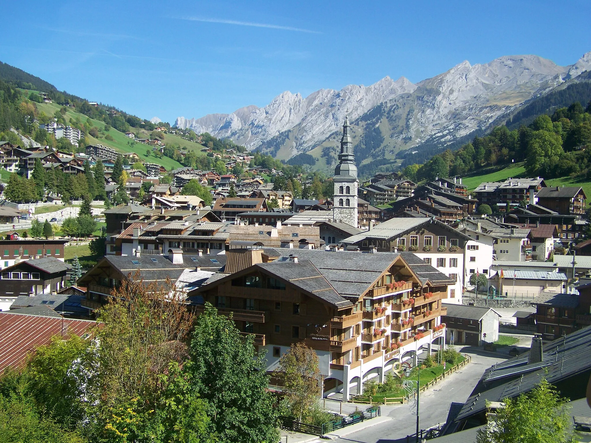
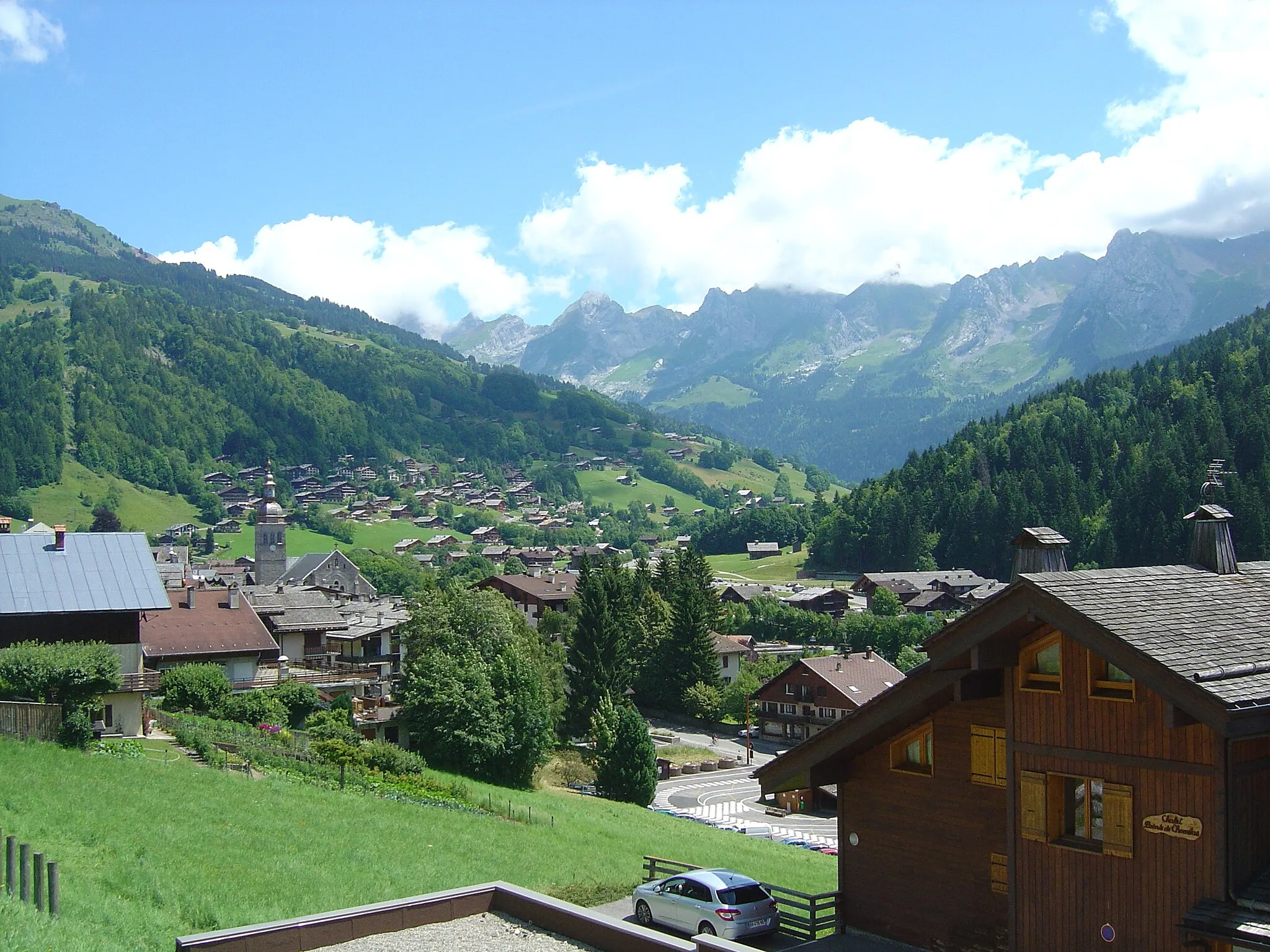
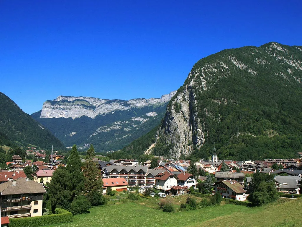
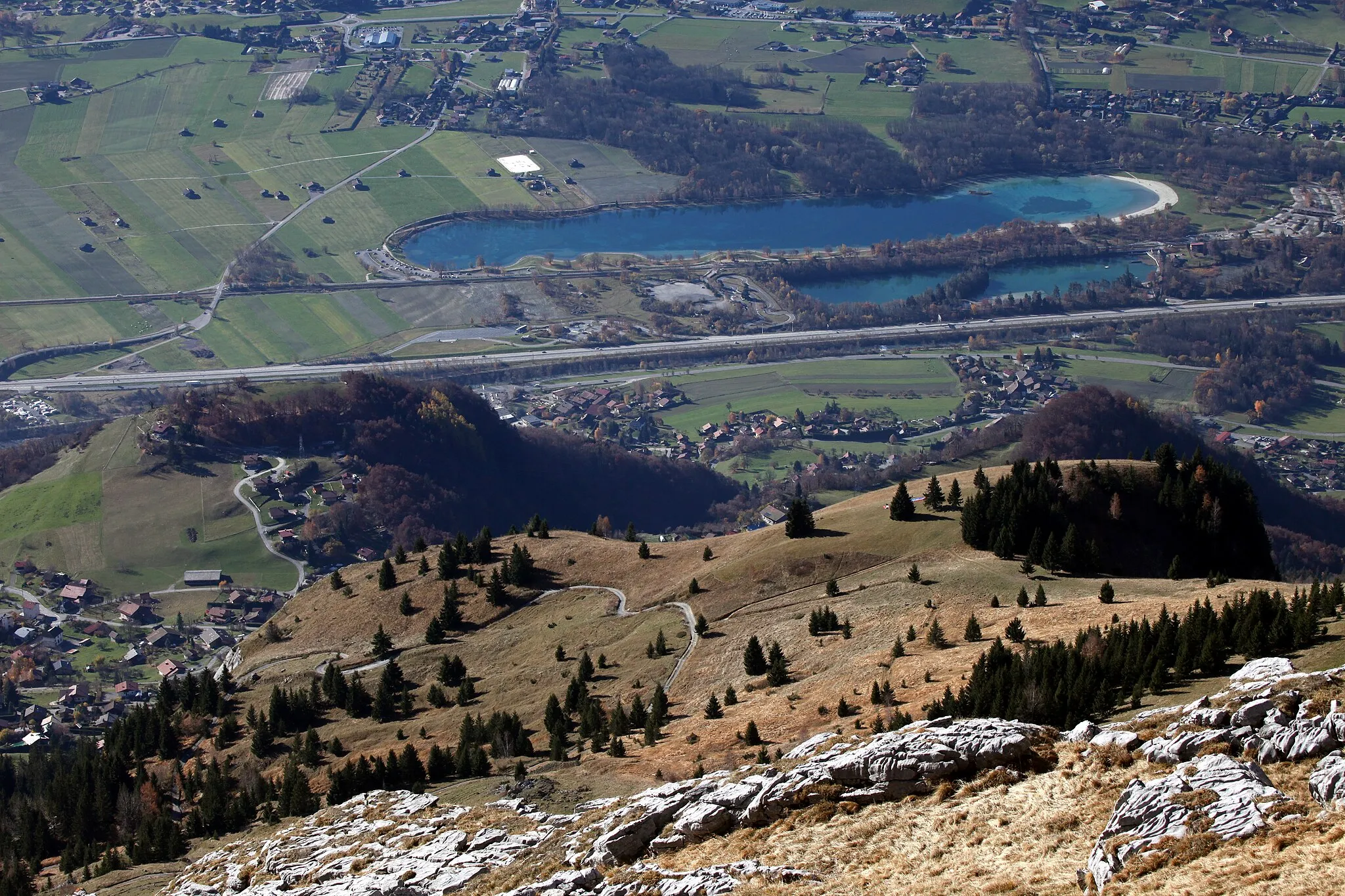
La Clusaz, located in the Rhône-Alpes region of France, is a renowned cycling destination in the French Alps. The locality offers an array of challenging climbs, including the famed Col des Aravis and Col de la Colombière. La Clusaz also provides access to breathtaking mountain scenery and thrilling descents. With its well-connected network of cycling routes and numerous cycling events, La Clusaz is a paradise for road cyclists seeking legendary climbs and mountain vistas.
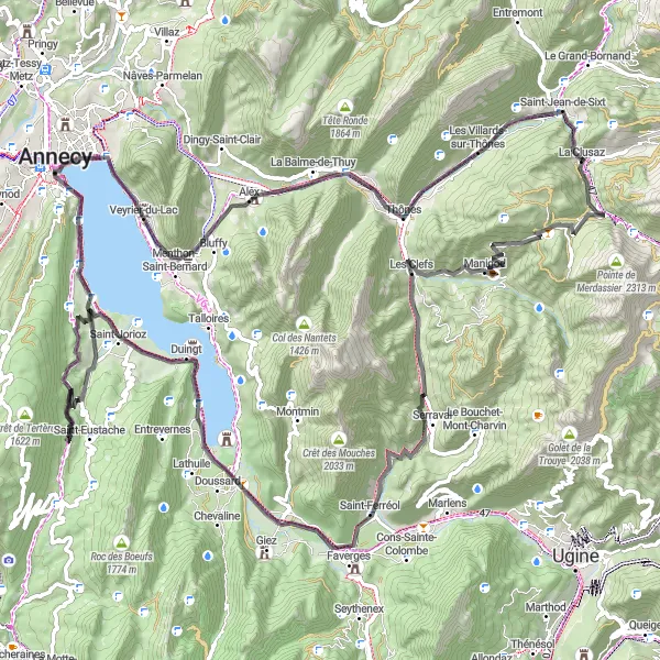
Conquer the legendary climbs of Rhône-Alpes
Embark on an epic cycling expedition through the stunning Rhône-Alpes region of France. This 107-kilometer route with 2068 meters of ascent will take you through iconic highlights such as Col de la Croix Fry, Manigod, Saint-Ferréol, Roc de Viuz, Crêt du Bourg, Duingt, Sevrier, Col de Bluffy, Alex, Thônes, and Col de St Jean de Sixt. Prepare for challenging climbs, hairpin bends, and awe-inspiring mountain vistas on this unforgettable journey.
Villards-sur-Thônes Loop
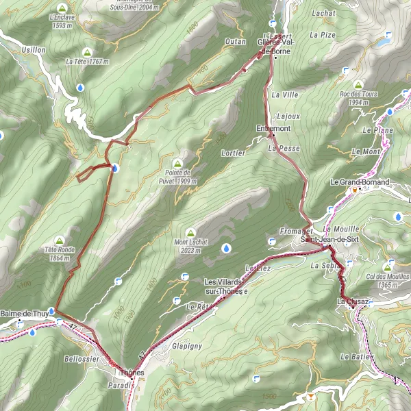
Explore the picturesque village of Villards-sur-Thônes and enjoy panoramic views of the Aravis Mountains.
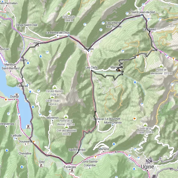
This gravel route takes you through the charming village of Les Villards-sur-Thônes, where you can immerse yourself in the rich local culture. With a total ascent of 1675 meters and a distance of 48 kilometers, this route offers a moderate challenge for experienced gravel riders. The highlight of the ride is the Belvédère de l'Arpettaz, where you can admire stunning panoramic views of the surrounding mountains. Other notable highlights include the Abri de la Chaille, an ancient shelter used by shepherds, and the Col des Glières, a historical site from World War II. Overall, this route provides a unique cycling experience with a mix of natural beauty and cultural heritage.
Conquer some of the most iconic alpine climbs and soak in breathtaking views of the Savoie region.
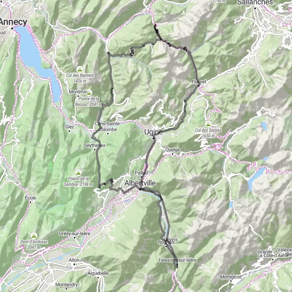
This road route is the ultimate challenge for experienced road cyclists, with a total ascent of 3627 meters and a distance of 135 kilometers. The highlight of the ride is the Col des Aravis, a legendary climb renowned for its beauty and steep gradients. Other notable highlights include the Château du Crest-Cherel, which offers impressive views over Albertville and the Combe de Savoie, and the Collet de Tamié, a historic pass that provides a thrilling descent. With its combination of epic climbs and picturesque landscapes, this route is admired by cycling enthusiasts from around the world. Prepare to push your limits and experience the awe-inspiring beauty of the Savoie region.
The Gravel Adventure
A thrilling gravel ride through the Rhône-Alpes region
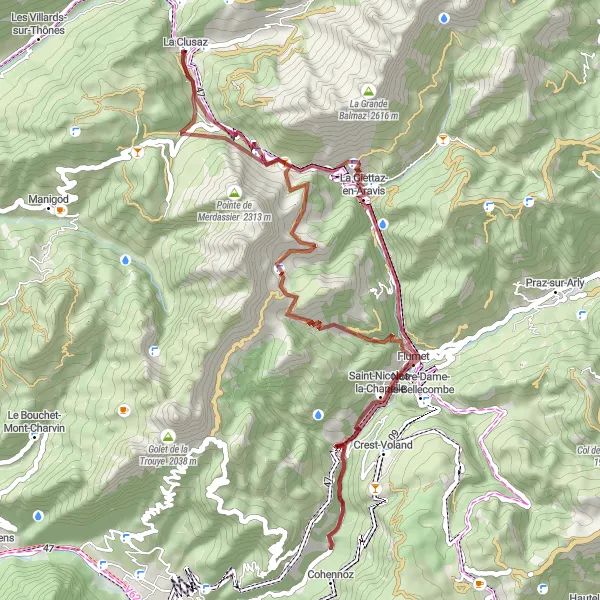
Embark on a challenging gravel cycling adventure in the beautiful Rhône-Alpes region of France. With a total ascent of 2782 meters and a distance of 57 kilometers, this route offers a mix of scenic landscapes, challenging climbs, and thrilling descents. Suitable for experienced gravel riders, this route will take you through highlights such as La Grenette, Col de la Croix des Frêtes, Chaucisse, Flumet, Col des Aravis, and La Clusaz.

Discover the scenic beauty of Rhône-Alpes on two wheels
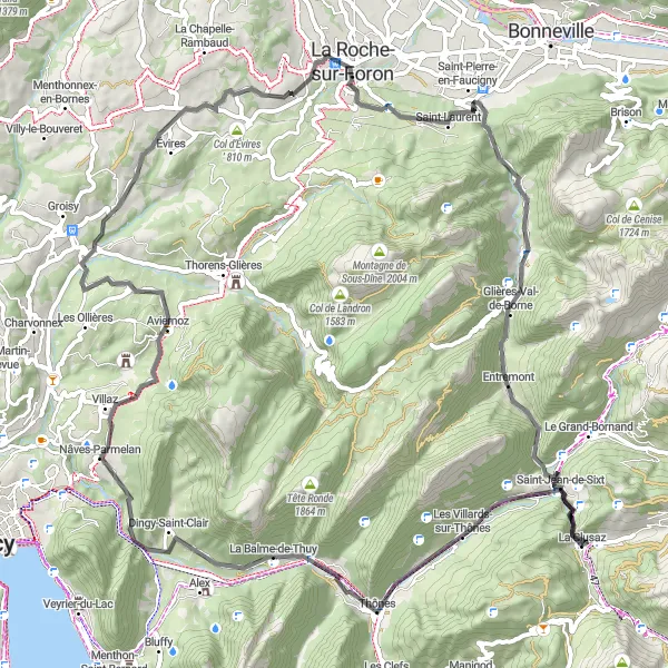
Take a leisurely road cycling tour through the picturesque Rhône-Alpes region of France. This 76-kilometer route with 1672 meters of ascent takes you through stunning highlights such as La Balme-de-Thuy, Tête à Turpin, Aviernoz, Saint-Sixt, Col de St Jean de Sixt, and Saint-Jean-de-Sixt. Enjoy the serene countryside, charming villages, and panoramic views of the surrounding mountains as you pedal along this gentle yet captivating road ride.
Mountain Escape
Escape to the mountains and indulge in the serene beauty of the Rhône-Alpes region.
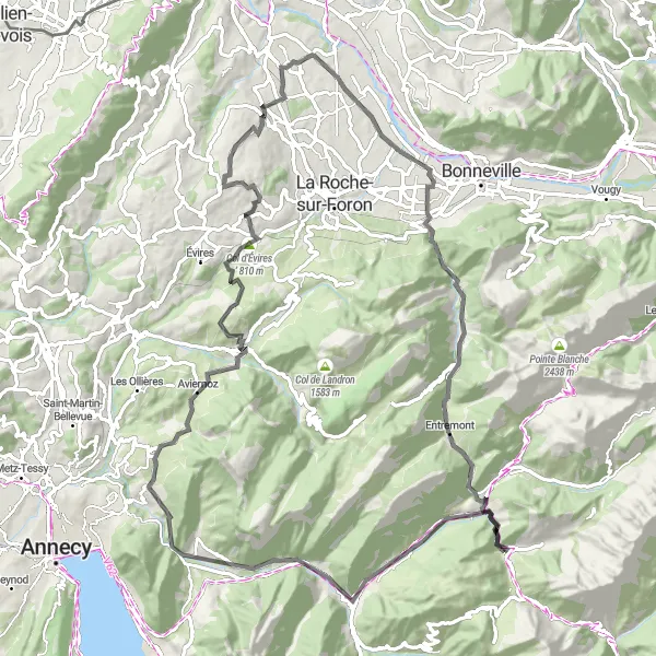
This road route allows you to escape to the mountains and experience the natural beauty of the Rhône-Alpes region. With a total ascent of 1709 meters and a distance of 76 kilometers, this route provides a moderate challenge for intermediate road cyclists. The highlight of the ride is the Col de St Jean de Sixt, which offers stunning views of the surrounding landscapes. Other notable highlights include the quaint village of La Balme-de-Thuy and the peaceful hamlet of Entremont. Overall, this route offers an opportunity to immerse yourself in the tranquility of the mountains and discover the hidden gems of the region.
Conquer the Alps on this challenging road cycling route
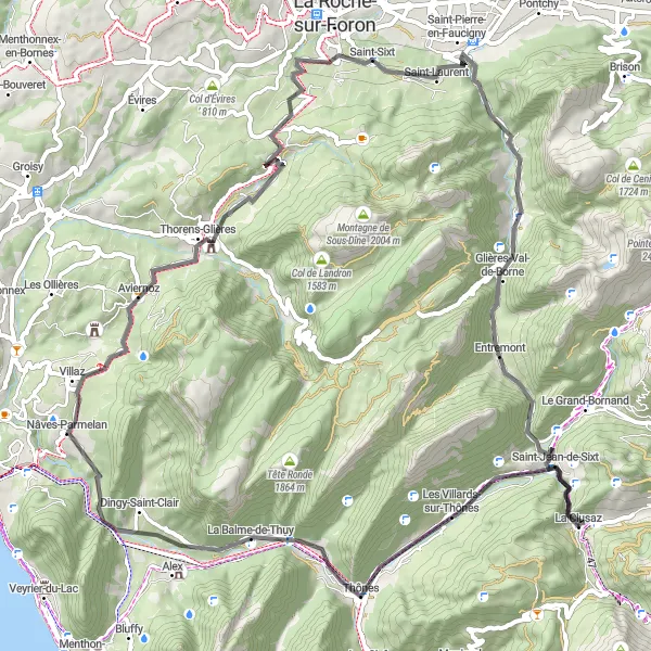
Embark on an exciting road cycling adventure through the majestic French Alps. This 83-kilometer route with 1804 meters of ascent takes you through highlights such as La Balme-de-Thuy, Tête à Turpin, Plan de Bacon, Aviernoz, Saint-Sixt, Col de St Jean de Sixt, and Saint-Jean-de-Sixt. Prepare for challenging climbs, thrilling descents, and breathtaking views of the alpine landscapes as you pedal through this unforgettable journey.
Climb to the iconic Arpettaz Tower and enjoy stunning views of the Alps.
This road route takes you on a scenic journey with a total ascent of 1918 meters and a distance of 95 kilometers. The highlight of the ride is the Arpettaz Tower, which offers breathtaking views of the Alps and is a popular spot for photographers. With its challenging climbs and picturesque landscapes, this route is recommended for experienced road cyclists looking for a thrilling adventure. Other notable highlights include the historical Château d'Arcine and the Col d’Évires, which provides a rewarding summit experience. Overall, this route promises an exhilarating ride with stunning mountain vistas and historical landmarks along the way.
A demanding gravel route featuring legendary climbs
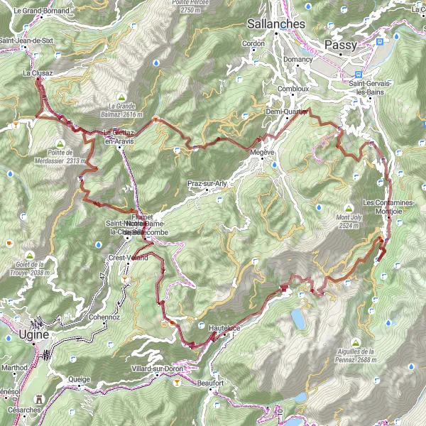
Experience the ultimate gravel cycling challenge with this 113-kilometer route, featuring a total ascent of 4665 meters. This thrilling route takes you through iconic highlights such as La Giettaz-en-Aravis, Côte de Megeve, Demi-Quartier, La Teête du Truz, Les Contamines-Montjoie, Col du Joly, Hauteluce, Col des Saisies, Notre-Dame-de-Bellecombe, Col des Aravis, and La Grenette. Prepare for an epic adventure filled with challenging climbs, fast descents, and breathtaking mountain scenery.
Alpine Adventure
Embark on an alpine adventure with challenging climbs and breathtaking views.
This road route offers an alpine adventure with a total ascent of 1811 meters and a distance of 77 kilometers. The highlight of the ride is the Col de la Croix Fry, which provides a thrilling climb and rewards riders with stunning panoramic views of the surrounding mountains. With its diverse terrain and challenging sections, this route is recommended for experienced road cyclists. Other notable highlights include the picturesque village of Manigod and the Roc de Viuz, an impressive geological formation. Overall, this route offers a memorable cycling experience for nature enthusiasts and those seeking a challenging alpine excursion.
Cycling routes nearby:

Nearby regions: