Exploring Mountain Trails in Hoppstädten-Weiersbach
Cycling routes from Hoppstadten-Weiersbach
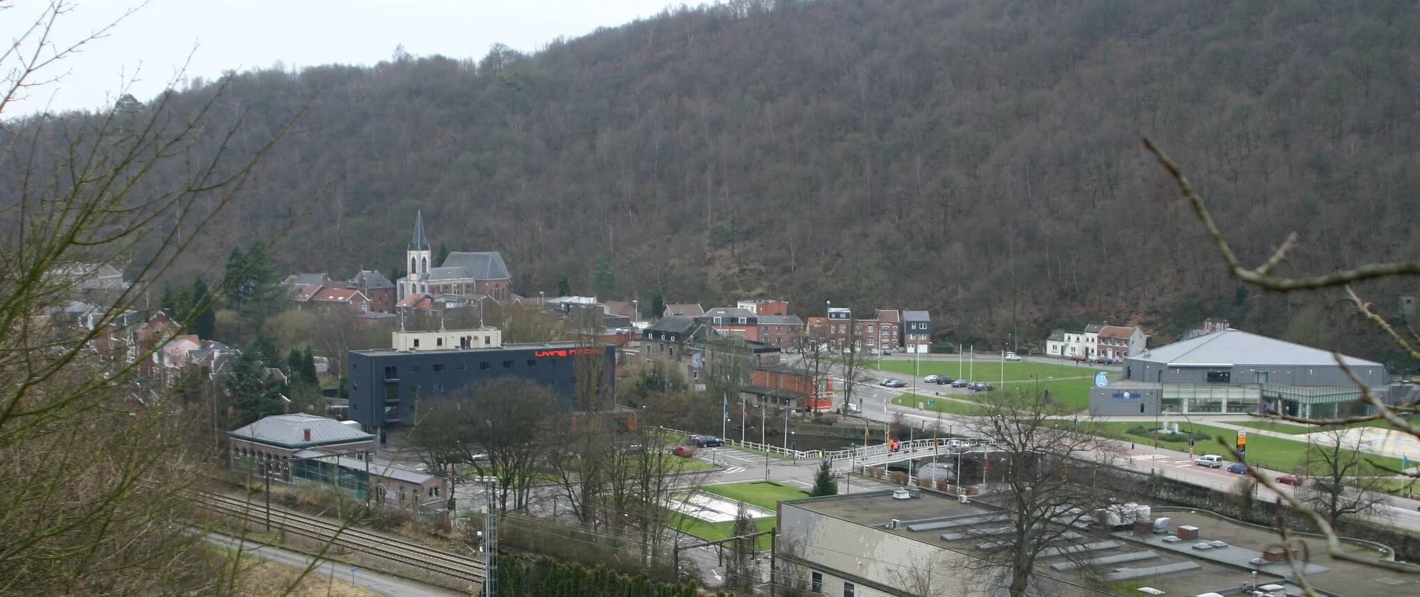
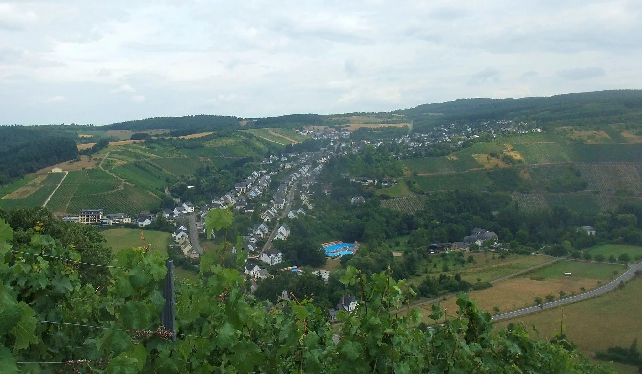
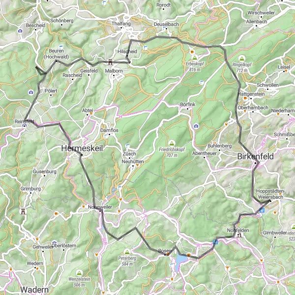
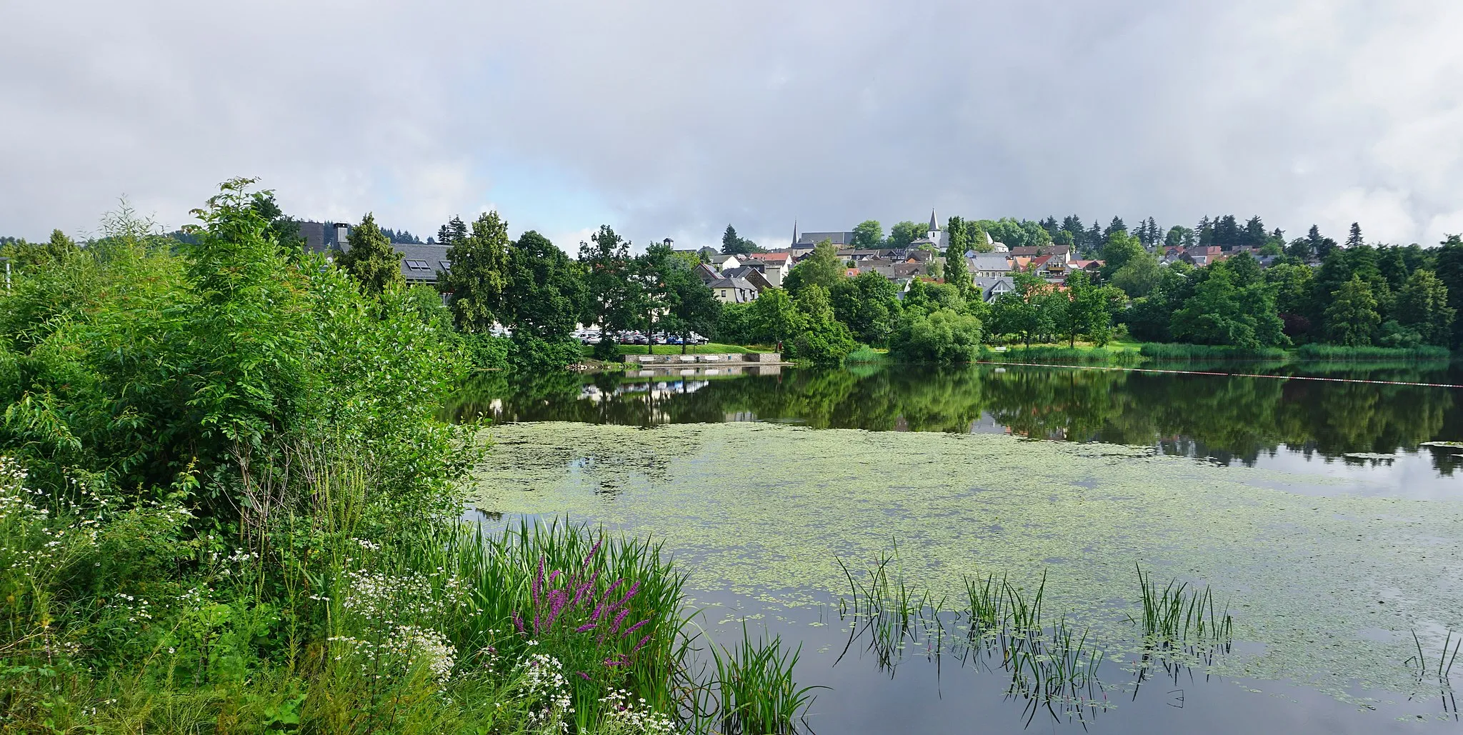
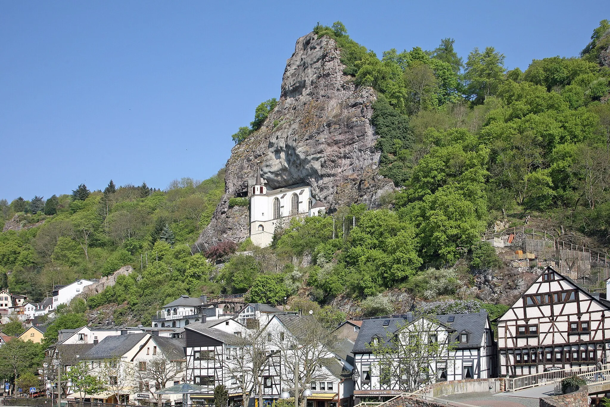
Hoppstädten-Weiersbach, located in Koblenz, Germany, is a small town with a lot to offer to road and gravel cyclists. The surrounding area is known for its stunning mountainous landscapes and forests, providing a challenge for experienced riders. Cyclists in Hoppstädten-Weiersbach can enjoy exploring the nearby Idarwald and the Hochwald nature parks, which offer a variety of cycling trails for all levels. With its scenic beauty and diverse terrain, Hoppstädten-Weiersbach is a great destination for cyclists seeking an adventurous ride.
Scenic Road Loop
Enjoy scenic landscapes and cultural highlights on this road cycling route
This road route near Hoppstädten-Weiersbach offers a delightful cycling experience with stunning landscapes and cultural highlights. Covering a distance of 51 kilometers and featuring 950 meters of ascent, it is suitable for well-trained amateur cyclists. You will pass through enchanting forests, charming villages, and rolling countryside, immersing yourself in the natural beauty of the region. Highlights along the way include Rinzenberg, known for its panoramic views, and Oberbrombach, with its serene atmosphere. Discover the undeniable charm of the Koblenz region as you pedal through picturesque scenery and immerse yourself in its rich cultural heritage.
Embark on an exciting adventure ride through the scenic Mauschbach region.
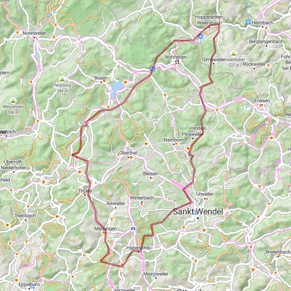
This 65 km gravel route offers a thrilling cycling experience through picturesque landscapes and charming villages. The route includes a challenging ascent of 1,065 meters and takes you through stunning viewpoints and natural attractions. Enjoy the beauty of Homerskopf at the 10 km mark, followed by the scenic village of Hofeld-Mauschbach at the 15 km mark. Experience the tranquility of Lanzenberg at the 19 km mark and explore the peaceful town of Marpingen at the 37 km mark. Discover the scenic beauty of Theley at the 43 km mark before reaching the famous Aussichtsturm Freizeitpark Neunkirchen at the 53 km mark. Conclude the ride by exploring the charming Stickelberg at the 61 km mark. Overall, this route provides a challenging and adventurous cycling journey.
An epic cycling route packed with highlights in the Koblenz region
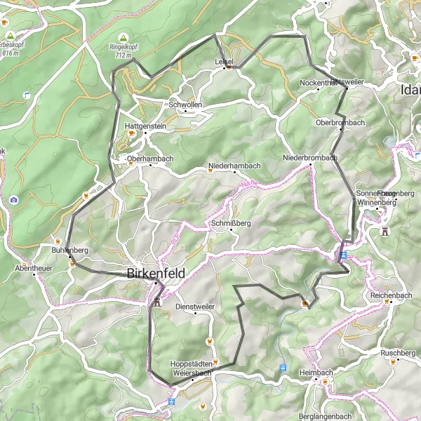
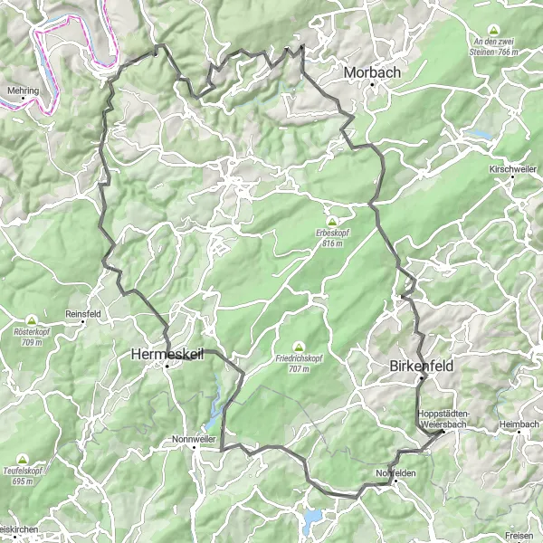
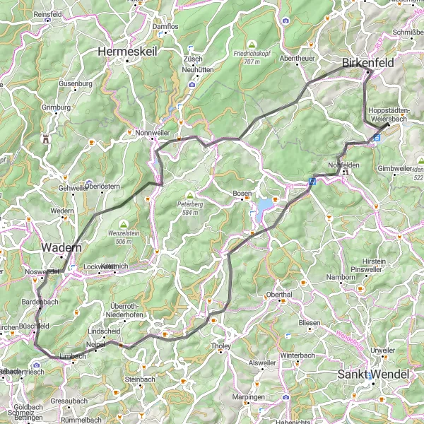
This round-trip cycling route starting near Hoppstädten-Weiersbach is an adventure that takes you through beautiful landscapes and cultural highlights. With a total ascent of 1917 meters and a distance of 107 kilometers, this road route offers a thrilling challenge for well-trained amateurs. The gravel route, on the other hand, covers 1465 meters of ascent and 64 kilometers, providing a more adventurous off-road experience. Both routes take you through forests, quaint villages, and picturesque scenery, allowing you to immerse yourself in the natural beauty of Germany. Whether you choose the road or gravel option, you can expect a memorable cycling journey.
Experience the rustic charm and rich history of the Kobelz countryside on this road cycling route
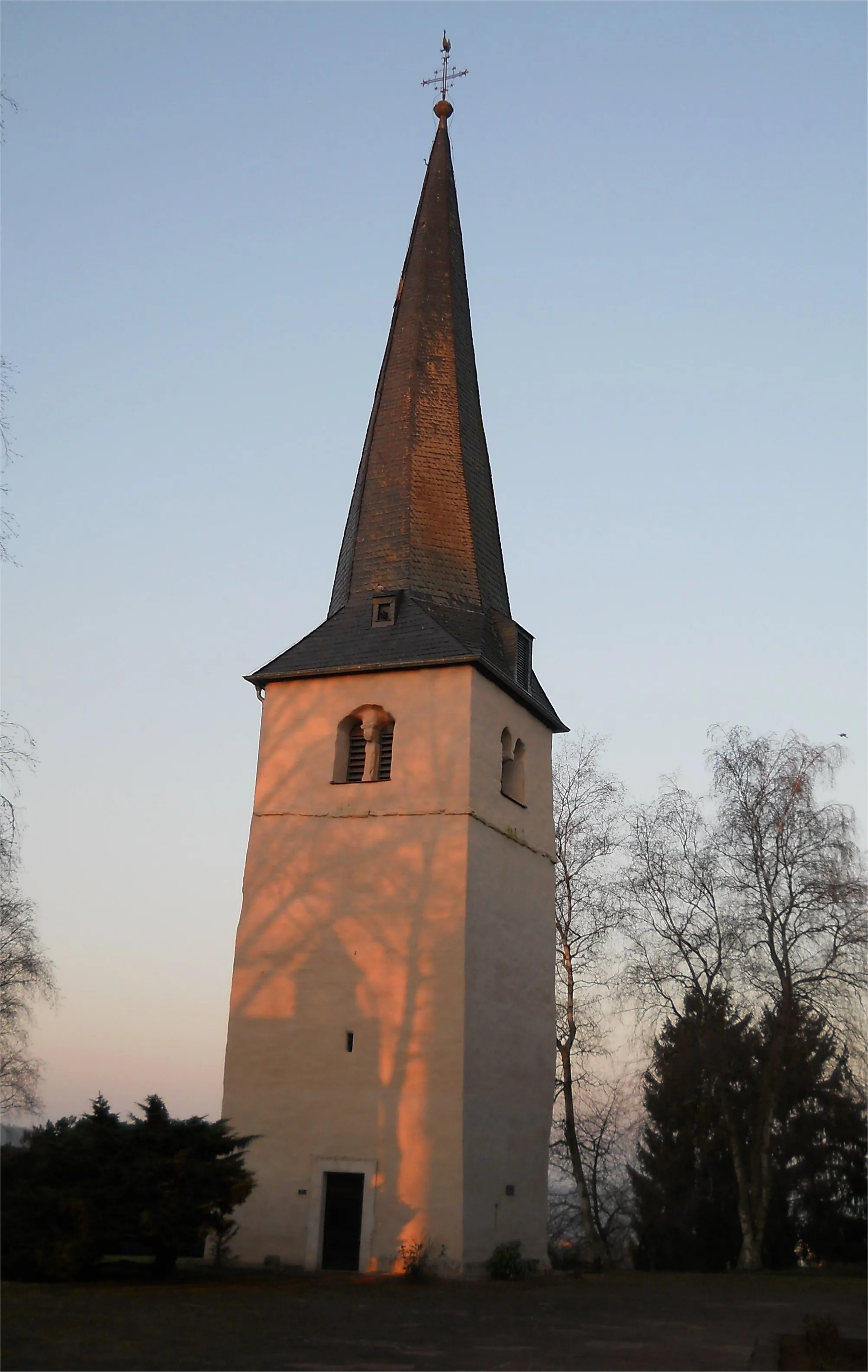
This road cycling route starting near Hoppstädten-Weiersbach offers an immersive journey through the countryside, showcasing the region's rustic charm and rich history. With a total ascent of 1187 meters and a distance of 90 kilometers, this route is suitable for well-trained amateurs seeking a moderate challenge. You will encounter serene forests, picturesque villages, and historic landmarks along the way. Stickelberg, with its stunning natural surroundings, and Nohfelden, known for its historical castle, are highlights not to be missed. Schatterberg and Rothenberg provide breathtaking panoramic views, capturing the essence of the Koblenz countryside. Embark on this classic countryside tour and delve into the cultural heritage and natural beauty of the region.
Embark on a thrilling gravel adventure through the picturesque Nahe Valley.
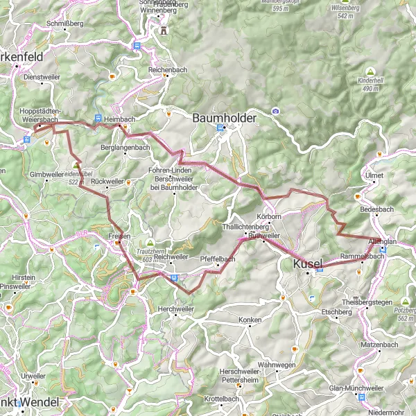
This 61 km gravel route offers a unique cycling experience through stunning natural landscapes. The route includes a challenging ascent of 1,037 meters and takes you through charming villages and scenic viewpoints. Enjoy the beauty of the Nahetal at the 3 km mark, followed by the picturesque town of Berglangenbach at the 6 km mark. Experience the tranquility of Oberalben at the 20 km mark before reaching the breathtaking Bistersberg at the 23 km mark. Explore the charming town of Kusel at the 33 km mark and discover the scenic Reichweiler at the 44 km mark. The highlight of the route is the Gewässer-Erlebnis-Pfad Obere Nahe at the 59 km mark, offering a unique riverside experience. Overall, this route provides an adventurous and scenic gravel cycling journey.
Gravel Adventure through Nahetal
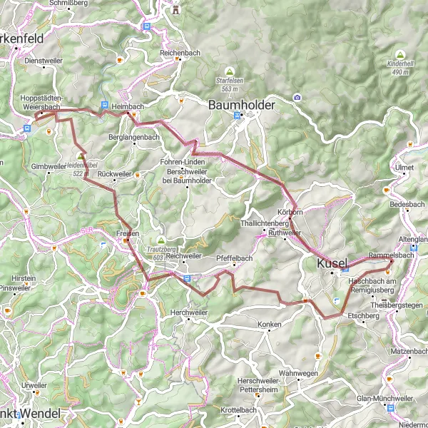
Embark on a thrilling gravel adventure through the picturesque Nahetal region.
This 61 km gravel route offers a unique cycling experience through beautiful landscapes and charming villages. Enjoy the beauty of the Nahetal at the 3 km mark, followed by the scenic village of Berglangenbach at the 6 km mark. Explore the charming town of Kusel at the 23 km mark and discover the tranquil village of Freisen at the 49 km mark. Experience the scenic beauty of the Heidenberg at the 53 km mark before reaching the Gewässer-Erlebnis-Pfad Obere Nahe at the 59 km mark, offering a unique riverside experience. Overall, this route provides a challenging and adventurous gravel cycling journey with stunning natural attractions.
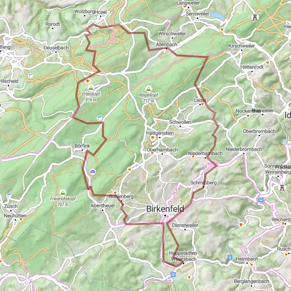
Discover hidden gems and enjoy rugged landscapes on this gravel cycling route
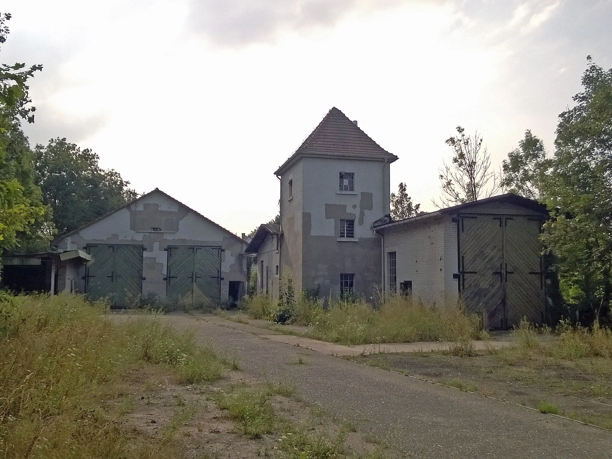
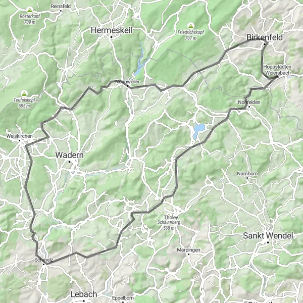
For those seeking an off-road cycling adventure starting near Hoppstädten-Weiersbach, this gravel route is an exciting choice. With a total ascent of 1465 meters and covering 64 kilometers, it promises a thrilling experience for well-trained amateurs. The route takes you through lesser-known villages and remote areas, allowing you to explore the hidden gems of the Koblenz region. Highlights along the way include Buhlenberg, a charming village surrounded by rolling hills, and Erbeskopf, home to the iconic Erbeskopfturm observation tower with stunning views. Burg Birkenfeld, with its historic castle ruins, is another highlight not to be missed. Immerse yourself in the rugged landscapes and discover the lesser-explored side of the region on this thrilling gravel cycling adventure.
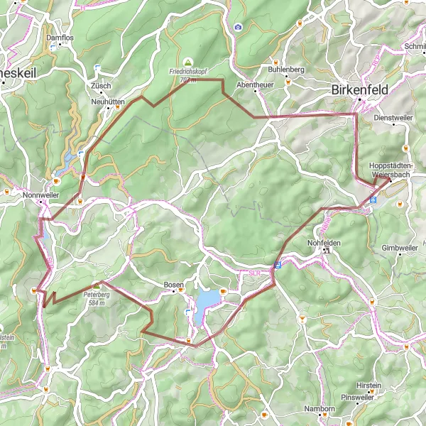
Take on the challenge of this scenic gravel trail starting from Hoppstädten-Weiersbach.
This 53 km gravel route offers a thrilling cycling experience with a total ascent of 863 meters. Explore the beauty of the countryside and pass through enchanting villages along the way. Enjoy the tranquil surroundings of Stickelberg at the 4 km mark followed by the scenic town of Türkismühle at the 7 km mark. Experience the stunning views from the Aussichtsturm Freizeitpark Neunkirchen at the 13 km mark before reaching the serene Dollberg at the 34 km mark. Explore the charming town of Abentheuer at the 42 km mark and visit the famous Burg Birkenfeld at the 47 km mark. The route concludes in Hoppstädten after passing through the picturesque town. Overall, this route offers a challenging and scenic gravel cycling experience.
Immerse yourself in the stunning natural landscapes of the Koblenz region on this road cycling route
Experience the raw beauty of nature on this road cycling route starting near Hoppstädten-Weiersbach. With 834 meters of ascent and covering 74 kilometers, this route takes you through lush forests, charming villages, and breathtaking vistas. Highlights along the way include Stickelberg, known for its peaceful landscapes, and Nohfelden, home to a stunning castle. Hasborn-Dautweiler showcases traditional architecture, while Schreck captivates with its picturesque charm. Immerse yourself in the gorgeous natural landscapes of the Koblenz region and discover the beauty that awaits around every corner on this unforgettable road cycling journey.
Explore the scenic countryside on this exhilarating cycling route starting from Hoppstädten-Weiersbach.
This 83 km road route takes you through beautiful landscapes and charming villages. The challenging ascent of 1,266 meters adds excitement to the ride. Experience the tranquility of Stickelberg at the 4 km mark, followed by the picturesque town of Nohfelden at the 5 km mark. Enjoy the views from the historic Bosenberg Castle at the 13 km mark before reaching the charming town of Hermeskeil at the 30 km mark. The highlight of the route is the stunning Burg Birkenfeld at the 78 km mark. Overall, this route offers a challenging and rewarding cycling experience.
Cycling routes nearby:


Nearby regions: