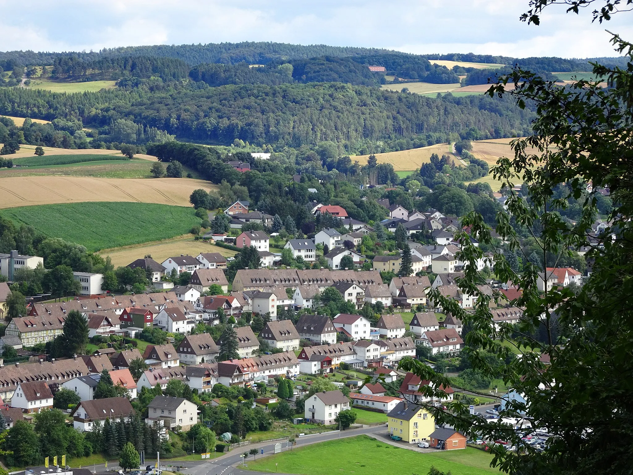
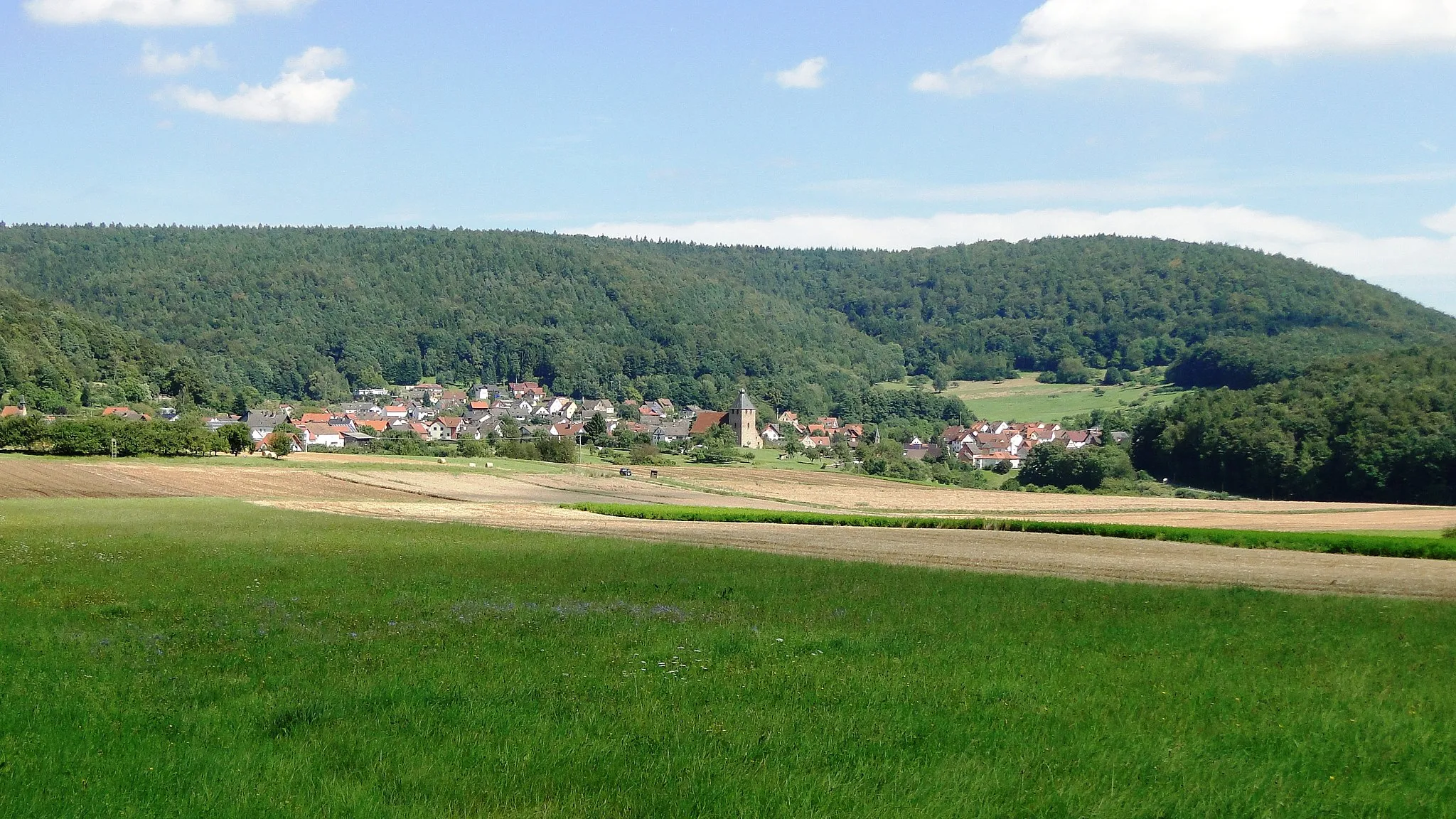
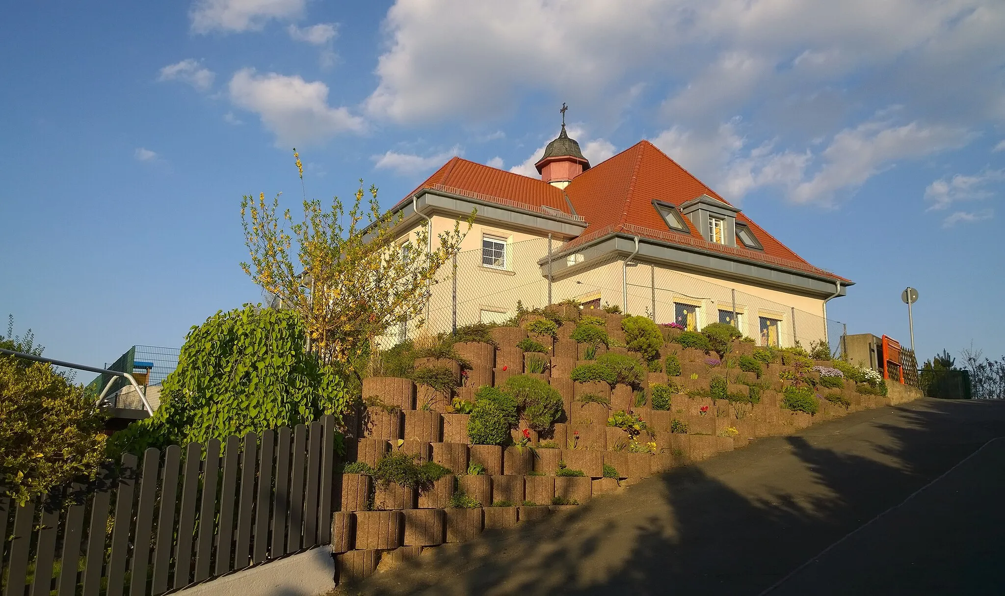
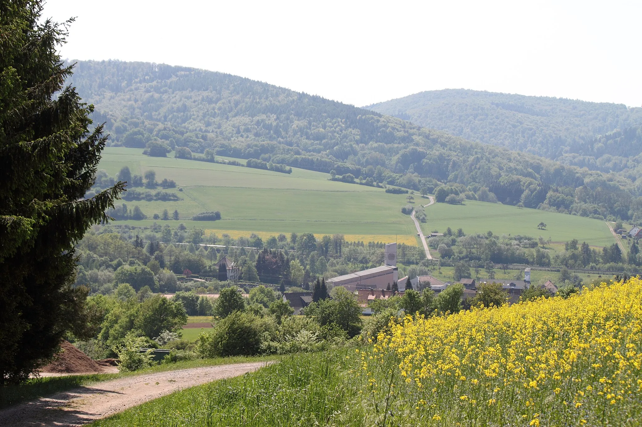
Serene country roads and picturesque landscapes in the Unterfranken region of Germany.
Cycling routes from Hosbach
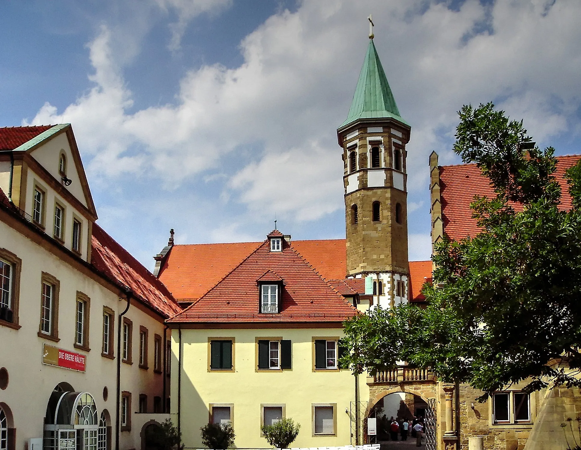
Hösbach is a charming town located in the Unterfranken region of Germany. From a cyclist's perspective, Hösbach offers a pleasant mix of serene country roads and picturesque landscapes, perfect for road and gravel cycling. The town is surrounded by rolling hills and scenic countryside, providing a peaceful environment for cycling enthusiasts. There are also several cycling routes and paths in the area, giving riders the chance to explore the beauty of the Unterfranken region. Additionally, Hösbach is close to the Spessart mountain range, which offers well-known climbs and challenging terrain for more advanced cyclists. Overall, Hösbach provides a great cycling experience with options for riders of all levels.
Mainfranken Loop
An adventurous loop exploring the enchanting Mainfranken region.
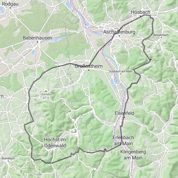
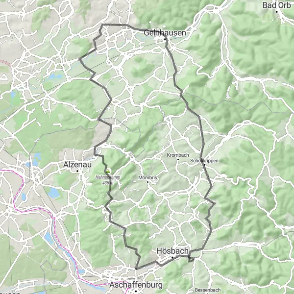
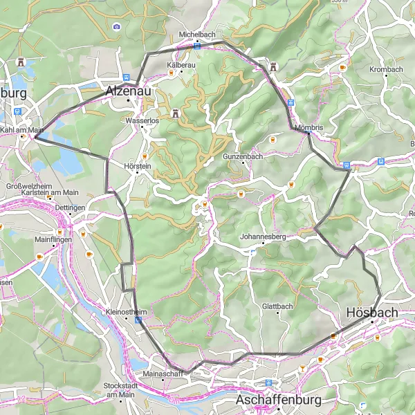
The Mainfranken Loop is a stunning cycling route that takes you through the picturesque landscapes of Unterfranken. The route starts near Hösbach and covers a distance of 92 kilometers, with a challenging ascent of 1120 meters. It is suitable for road bikes and offers breathtaking views of the surrounding hills and countryside. Cycling enthusiasts will appreciate the mixture of rolling hills and scenic valleys along the way. The Mainfranken Loop is a must-try for cyclists looking for a memorable and challenging ride in the heart of Germany.
Mainbogen Tour
Experience the diverse landscapes of Unterfranken along the banks of the Main River.
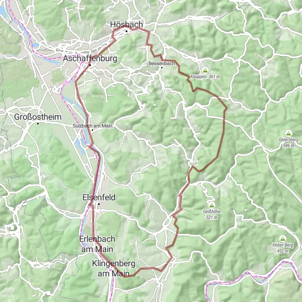
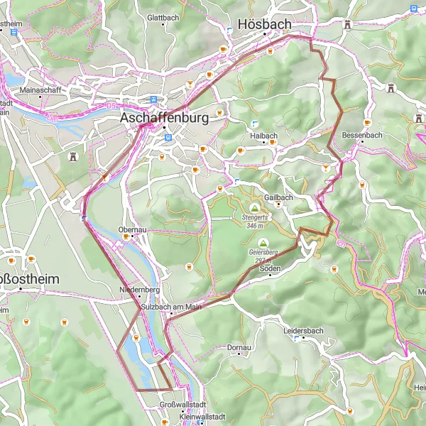
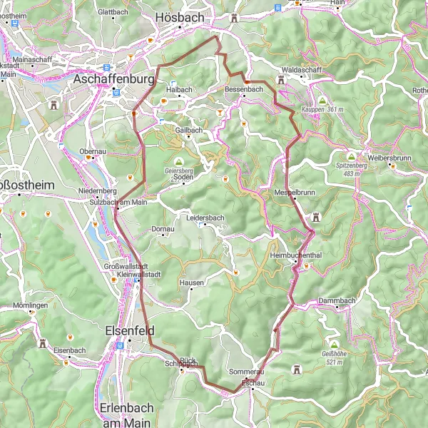
The Mainbogen Tour is a scenic gravel route that offers a diverse cycling experience through Unterfranken. Spanning 78 kilometers with an ascent of 929 meters, this route is suitable for experienced cyclists seeking a challenge. Cycle through picturesque villages, lush vineyards, and enchanting forests as you follow the winding path of the Main River.
Gravel Adventure
Explore the wild side of Unterfranken on a thrilling gravel adventure.
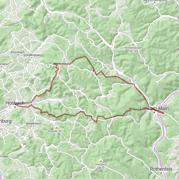
The Gravel Adventure is an 82-kilometer off-road cycling route that promises a thrilling and unforgettable experience in Unterfranken. With a challenging ascent of 1510 meters, this route is perfect for gravel bikes and adventurous riders. Expect a mix of forest paths, gravel roads, and some technical challenges along the way. This off-the-beaten-path route showcases the natural beauty of the region and rewards cyclists with breathtaking views. The Gravel Adventure is a must-try for gravel enthusiasts seeking an adrenaline-filled ride in the heart of Germany.
The Alzenau Mountain Challenge
Conquer the Alzenau Mountain Challenge and enjoy breathtaking views along the way.
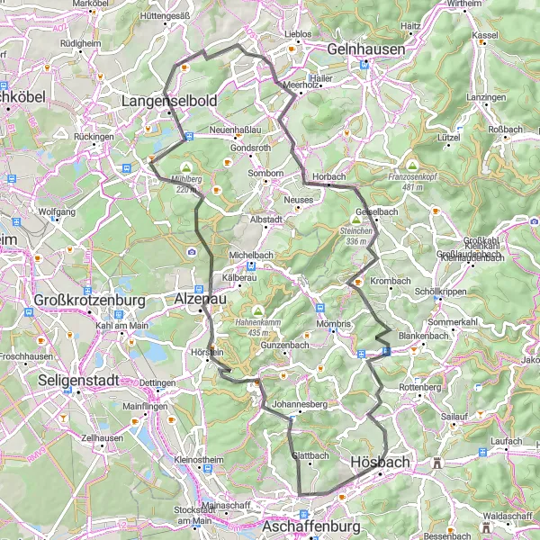
The Alzenau Mountain Challenge is a demanding road cycling route near Hösbach in Unterfranken, Germany. With an elevation gain of 965 meters and a distance of 76 kilometers, this route is perfect for experienced cyclists looking for a challenging climb. The highlight of the route is Klinger, a historic town with picturesque landscapes and charming architecture. Other notable highlights include Glattbach, Alzenau, Altenmarkskopf, Buchbergturm, Langenselbold, Riesenküppel, Geiselbach, Münchberg, and Hösbach. The Alzenau Mountain Challenge offers epic views, steep ascents, and a rewarding cycling experience for those seeking a challenge.
Embark on a thrilling road cycling adventure through the magnificent Spessart Mountains
This road cycling route takes you through the awe-inspiring Spessart Mountains, known for their challenging climbs and breathtaking vistas. With an ascent of 1087 meters and a distance of 81 kilometers, this route is recommended for experienced cyclists. Explore highlights including Klinger, Glattbach, Stempelhöhe, Michelbach, Weinberg, Lieblos, Rochusberg, Sommerkahl, Schloss Weyberhöfe, and Steinbuckel as you push your limits and enjoy the stunning scenery. Admire the panoramic views from various vantage points and soak in the adrenaline of conquering the demanding terrain.
Hoheberg Loop
Explore the hilly landscapes and charming villages of Unterfranken.
The Hoheberg Loop is a picturesque cycling route that takes you through the beautiful hilly landscapes and charming villages of Unterfranken. With a total distance of 42 kilometers and an ascent of 434 meters, this route offers a moderate challenge for cyclists. Enjoy the peaceful countryside, vineyards, and idyllic forests as you cycle along the well-maintained gravel roads.
Unterfranken Circuit
Embark on an epic circuit through the diverse landscapes of Unterfranken.
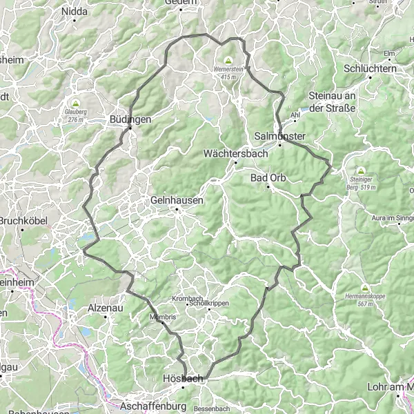
The Unterfranken Circuit is a challenging road cycling route covering a distance of 136 kilometers with an ascent of 1809 meters. This route offers a true test of endurance, perfect for experienced cyclists seeking a thrilling adventure. From majestic hills to rolling vineyards, immerse yourself in the beauty of Unterfranken's nature and take in panoramic views along the way. Explore historical towns, visit iconic landmarks, and embrace the uniqueness of each stop. The Unterfranken Circuit promises an unforgettable cycling experience through the heart of Germany's diverse landscapes.
Embark on an epic gravel exploration through the diverse landscapes of Unterfranken.
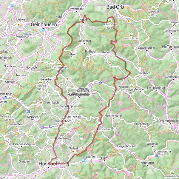
The Unterfranken Gravel Exploration is a thrilling gravel cycling route near Hösbach, Germany. With an elevation gain of 1639 meters and a distance of 78 kilometers, this route is perfect for experienced gravel cyclists looking for a challenging adventure. The highlight of the route is Münchberg, a scenic village known for its fantastic local cuisine and warm hospitality. Other notable highlights include Blankenbach, Hofstädten, Franzosenkopf, Molkenberg, Spindelberg, Bischlingsberg, and Sailauf. The Unterfranken Gravel Exploration offers stunning views, a variety of terrain, and a glimpse into the rich cultural heritage of the region.
Embark on this scenic road cycling route with moderate elevation gain.
The Alzenau Loop is a scenic road cycling route near Hösbach in Unterfranken, Germany. With an elevation gain of 406 meters and a distance of 49 kilometers, this route is perfect for amateur cyclists looking for a moderately challenging ride. The highlight of the route is Klinger, a small town known for its historic charm and cultural heritage. Other notable highlights include Mainaschaff, Kahlauensteg, Alzenau, Mömbris, and Münchberg. Overall, the Alzenau Loop offers stunning views of the surrounding countryside and provides a great cycling experience for riders of all levels.
Embark on an enchanting gravel ride through the scenic Spessart Forest
Experience the beauty of the Spessart Forest with this charming gravel ride. With an ascent of 811 meters and a distance of 57 kilometers, this route is suitable for intermediate-level cyclists seeking adventure. Discover highlights such as Buschhöhe, Mespelbrunn Castle, Eschau, Platte, Sulzbach am Main, Kippenburg, and Klinger as you meander through the tranquil forest trails. Enjoy the serenity of the surroundings and embrace the natural wonders that this region has to offer.
Cycling routes nearby:


Nearby regions: