![Cover image](https://images.tarmacs.app/cycling-routes/covers/united-kingdom/outer-london-east-and-north-east/welling-5.webp)
Leisurely cycling along the River Thames in Welling.
Cycling routes from Welling
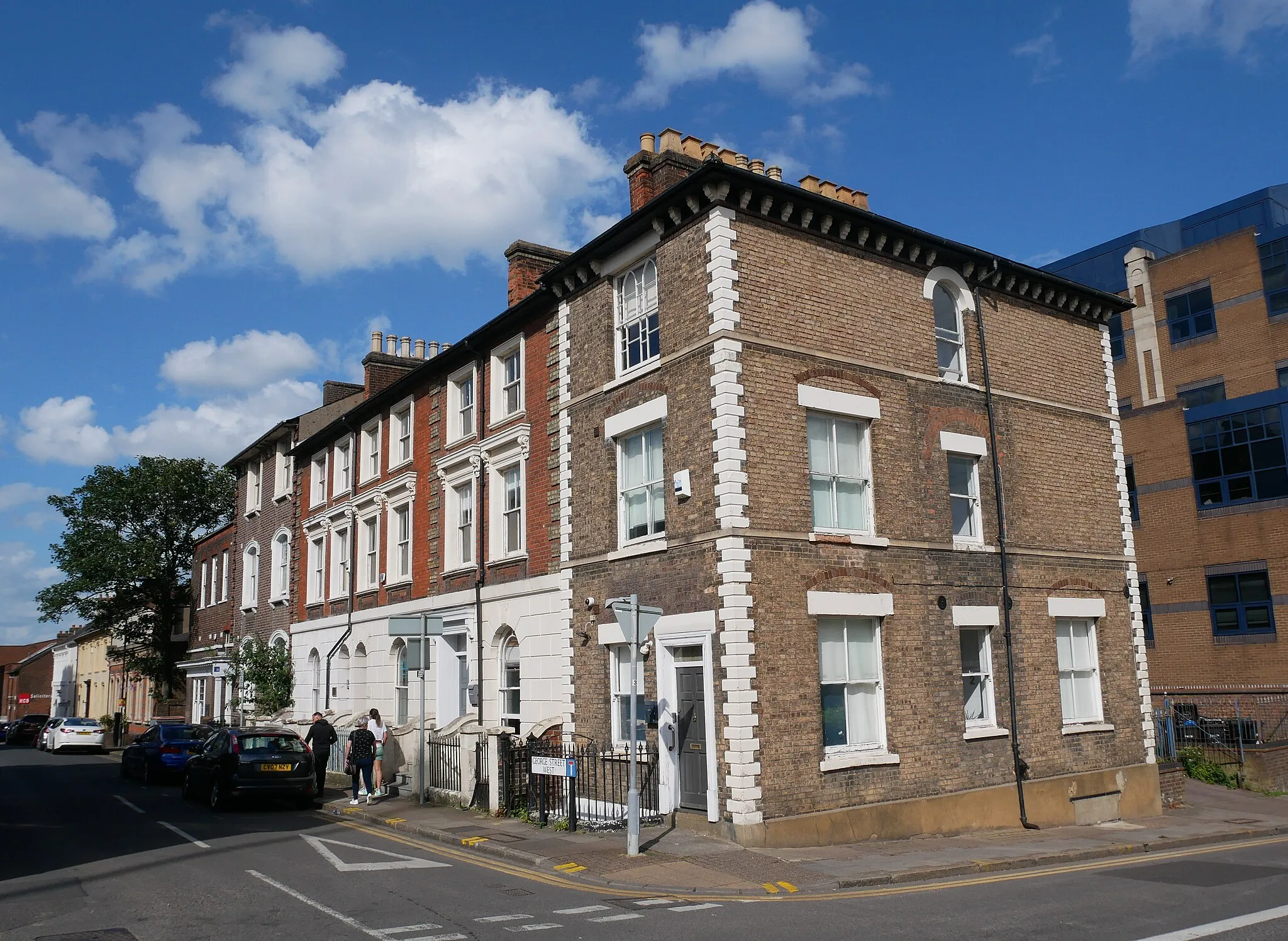
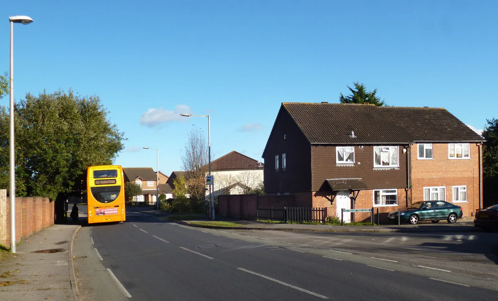
Welling is a locality situated in Outer London — East and North East, United Kingdom. As a cyclist, you can enjoy a mix of urban and suburban cycling routes while exploring Welling. It provides convenient access to cycling paths along the River Thames, such as the Thames Path. While not well-known for famous climbs or cycling spots, Welling offers a cyclist-friendly environment with relatively low traffic volume. It is a great location for leisure rides and casual cycling adventures.
![Map miniature of "Thames and Castle Gravel Ride" cycling inspiration in Outer London — East and North East, United Kingdom. Generated by Tarmacs.app cycling route planner](https://images.tarmacs.app/cycling-routes/routemaps/600/united-kingdom/outer-london-east-and-north-east/welling/gravel/68112.webp)
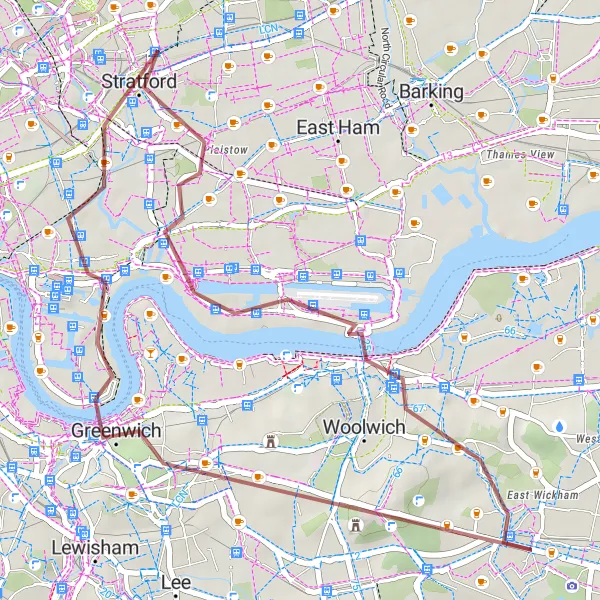
Embark on a gravel ride exploring the Thames and historic castles
The Thames and Castle Gravel Ride is a 35km route with an ascent of 162m. This scenic ride highlights the iconic Thames Barrier, Greenwich, and Severndroog Castle. It is a moderately challenging route suited for adventurers seeking beautiful landscapes and historical landmarks.
![Map miniature of "Historic Castles and Rural Landscapes" cycling inspiration in Outer London — East and North East, United Kingdom. Generated by Tarmacs.app cycling route planner](https://images.tarmacs.app/cycling-routes/routemaps/600/united-kingdom/outer-london-east-and-north-east/welling/gravel/68128.webp)
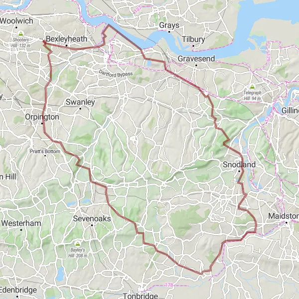
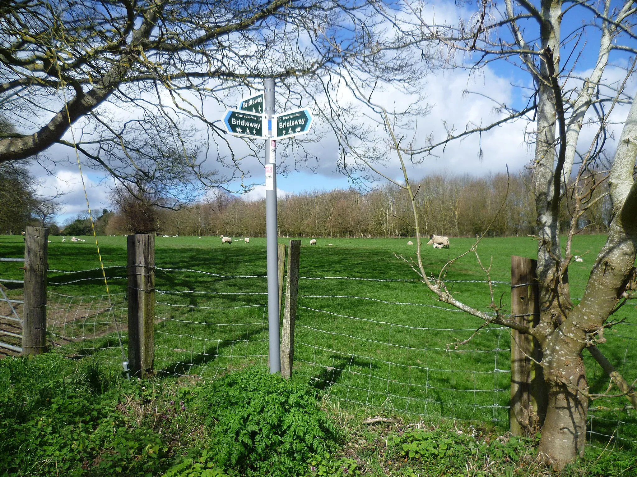
Explore historic castles and enjoy rural landscapes
Venture into a 103km gravel route showcasing the charm of Bexleyheath, Greenhithe, Snodland, East Peckham, Otford, St Mary Cray, and Blackfen. This route includes an ascent of 1047m, making it perfect for seasoned gravel riders who enjoy challenging terrains. Witness historic castles and idyllic rural landscapes along the way.
![Map miniature of "Maidstone and Beyond" cycling inspiration in Outer London — East and North East, United Kingdom. Generated by Tarmacs.app cycling route planner](https://images.tarmacs.app/cycling-routes/routemaps/600/united-kingdom/outer-london-east-and-north-east/welling/gravel/68121.webp)
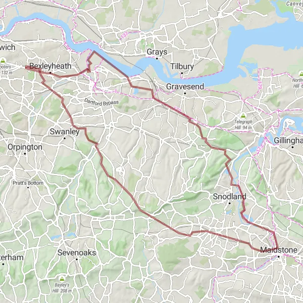
Embark on an epic gravel adventure through the stunning landscapes of Maidstone and surrounding areas.
With a distance of 94 km and an ascent of 886 meters, this demanding gravel route near Welling takes you through picturesque countryside, charming villages, and scenic trails. Explore notable highlights such as Greenhithe, Mill Hill, Wouldham, Maidstone, Wrotham, Farningham, and Broom Hill, each offering their own unique charm and character.
Banks and Hills
![Map miniature of "Banks and Hills" cycling inspiration in Outer London — East and North East, United Kingdom. Generated by Tarmacs.app cycling route planner](https://images.tarmacs.app/cycling-routes/routemaps/600/united-kingdom/outer-london-east-and-north-east/welling/gravel/68115.webp)
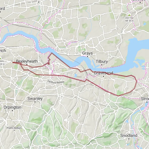
Discover the stunning views and challenging terrain of areas near Welling
The Banks and Hills route near Welling takes you on a 64km gravel adventure with a total ascent of 466m. This route showcases the scenic highlights of Barnehurst, Northfleet, Barrow Hill, Shorne, Dartford, and Welling. The terrain is moderate, suitable for well-trained amateurs looking for a thrilling cycling experience.
![Map miniature of "Beckton Escape" cycling inspiration in Outer London — East and North East, United Kingdom. Generated by Tarmacs.app cycling route planner](https://images.tarmacs.app/cycling-routes/routemaps/600/united-kingdom/outer-london-east-and-north-east/welling/road/68088.webp)
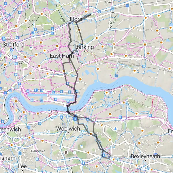
Embark on a road cycling adventure to Beckton Alps and discover hidden suburban gems.
This 33 km route with an ascent of 142 meters takes you through scenic suburban streets and green spaces near Beckton. Enjoy a relatively flat ride and discover hidden gems such as Beckton Alps, a former landfill transformed into a popular cycling spot. As you pass East Ham, admire its diverse community and vibrant cultural scene.
![Map miniature of "Kentish Countryside Challenge" cycling inspiration in Outer London — East and North East, United Kingdom. Generated by Tarmacs.app cycling route planner](https://images.tarmacs.app/cycling-routes/routemaps/600/united-kingdom/outer-london-east-and-north-east/welling/road/68107.webp)
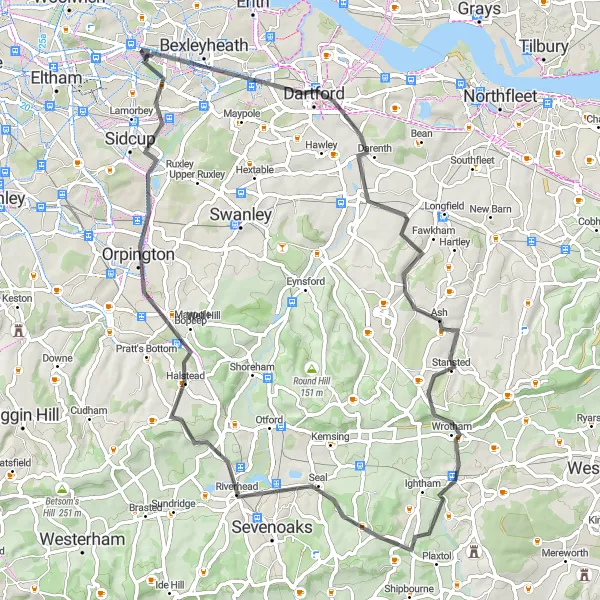
Take on the challenge of scenic rural roads and discover the beauty of Kentish countryside.
Prepare yourself for a challenging 70 km road route through the picturesque Kentish countryside. With a total ascent of 710 meters, this route near Welling offers stunning views and several moderate to challenging climbs. Pass through Dartford, Borough Green, Dunton Green, Orpington, and Blackfen, exploring charming villages, historic landmarks, and beautiful landscapes along the way.
![Map miniature of "East London Odyssey" cycling inspiration in Outer London — East and North East, United Kingdom. Generated by Tarmacs.app cycling route planner](https://images.tarmacs.app/cycling-routes/routemaps/600/united-kingdom/outer-london-east-and-north-east/welling/road/68113.webp)
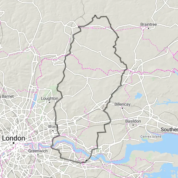
Embark on a road cycling journey through East London's landscape
The East London Odyssey is a 157km road cycling route with an elevation gain of 866m. This route showcases the wonders of Welling, Beckton Alps, Theydon Bois, Little Hallingbury, Great Dunmow, Writtle, Ingatestone, West Horndon, Chafford Gorges Visitor Centre, West Thurrock, and Bexleyheath. It offers moderate difficulty levels suitable for very well-trained amateur cyclists who enjoy long-distance rides.
![Map miniature of "The Gravel Adventure" cycling inspiration in Outer London — East and North East, United Kingdom. Generated by Tarmacs.app cycling route planner](https://images.tarmacs.app/cycling-routes/routemaps/600/united-kingdom/outer-london-east-and-north-east/welling/gravel/68114.webp)
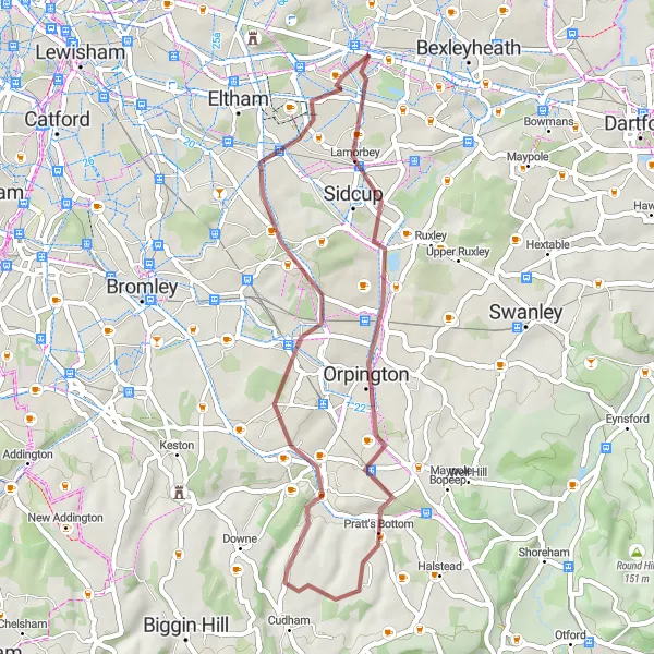
Explore the outskirts of London on a thrilling gravel adventure!
This 40 km route is perfect for gravel bike enthusiasts looking for a scenic adventure near Welling. With a total ascent of 325 meters, you'll experience some moderate climbs along the way. The route takes you through Orpington and Farnborough, offering beautiful countryside views and peaceful roads.
![Map miniature of "Challenging Hills and Landscapes" cycling inspiration in Outer London — East and North East, United Kingdom. Generated by Tarmacs.app cycling route planner](https://images.tarmacs.app/cycling-routes/routemaps/600/united-kingdom/outer-london-east-and-north-east/welling/road/68155.webp)
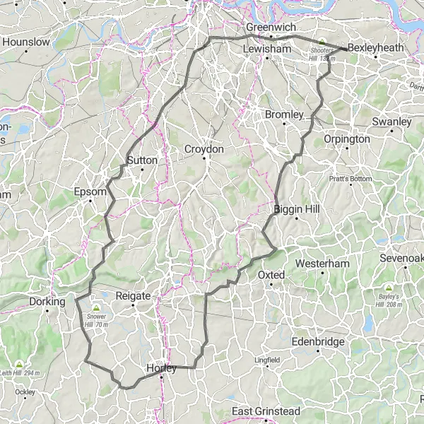
Conquer challenging hills and experience breathtaking landscapes
Suitable for avid road cyclists, the Challenging Hills and Landscapes route covers a distance of 116km with an elevation gain of 978m. Embark on a thrilling journey through Chislehurst, Keston, Botley Hill, Horley, Betchworth, Mitcham, Greenwich, One Tree Hill, and East Wickham. This route offers a moderate to difficult level of difficulty and presents panoramic vistas and iconic landmarks.
Road to Rural Bickley
![Map miniature of "Road to Rural Bickley" cycling inspiration in Outer London — East and North East, United Kingdom. Generated by Tarmacs.app cycling route planner](https://images.tarmacs.app/cycling-routes/routemaps/600/united-kingdom/outer-london-east-and-north-east/welling/road/68099.webp)
Embark on this scenic road route and venture into the rural beauty near Bickley.
With a distance of 48 km and an ascent of 372 meters, this road route near Welling offers a mix of picturesque countryside views and suburban streets. Pass through Bickley, home to grand Victorian houses and peaceful green spaces. The route features a challenging climb up One Tree Hill, known for its panoramic views of London.
Cycling routes nearby:
![Image of Abbey Wood](https://images.tarmacs.app/cycling-routes/covers/united-kingdom/outer-london-east-and-north-east/abbey-wood-5.webp)
![Image of Plumstead](https://images.tarmacs.app/cycling-routes/covers/united-kingdom/outer-london-east-and-north-east/plumstead-5.webp)
![Image of Bexley](https://images.tarmacs.app/cycling-routes/covers/united-kingdom/outer-london-east-and-north-east/bexley-4.webp)
![Image of Sidcup](https://images.tarmacs.app/cycling-routes/covers/united-kingdom/outer-london-east-and-north-east/sidcup-5.webp)
![Image of Eltham](https://images.tarmacs.app/cycling-routes/covers/united-kingdom/outer-london-east-and-north-east/eltham-4.webp)
![Image of Thamesmead](https://images.tarmacs.app/cycling-routes/covers/united-kingdom/outer-london-east-and-north-east/thamesmead-4.webp)
![Image of Erith](https://images.tarmacs.app/cycling-routes/covers/united-kingdom/outer-london-east-and-north-east/erith-4.webp)
![Image of Charlton](https://images.tarmacs.app/cycling-routes/covers/united-kingdom/outer-london-east-and-north-east/charlton-4.webp)
![Image of Kidbrooke](https://images.tarmacs.app/cycling-routes/covers/united-kingdom/outer-london-east-and-north-east/kidbrooke-5.webp)
Nearby regions:
![Image of Bedfordshire and Hertfordshire](https://images.tarmacs.app/cycling-routes/covers/united-kingdom/bedfordshire-and-hertfordshire/luton-2.webp)
![Image of Essex](https://images.tarmacs.app/cycling-routes/covers/united-kingdom/essex/east-tilbury-5.webp)
![Image of Inner London — West](https://images.tarmacs.app/cycling-routes/covers/united-kingdom/inner-london-west/holborn-4.webp)
![Image of Inner London — East](https://images.tarmacs.app/cycling-routes/covers/united-kingdom/inner-london-east/crouch-end-5.webp)
![Image of Outer London — South](https://images.tarmacs.app/cycling-routes/covers/united-kingdom/outer-london-south/carshalton-5.webp)
![Image of Outer London — West and North West](https://images.tarmacs.app/cycling-routes/covers/united-kingdom/outer-london-west-and-north-west/hillingdon-1.webp)
![Image of Berkshire, Buckinghamshire and Oxfordshire](https://images.tarmacs.app/cycling-routes/covers/united-kingdom/berkshire-buckinghamshire-and-oxfordshire/calcot-5.webp)
![Image of Surrey, East and West Sussex](https://images.tarmacs.app/cycling-routes/covers/united-kingdom/surrey-east-and-west-sussex/east-wittering-4.webp)
![Image of Kent](https://images.tarmacs.app/cycling-routes/covers/united-kingdom/kent/bridge-2.webp)