Challenging climbs and scenic rides in Provence-Alpes-Côte d’Azur.
Cycling routes from Saint-Zacharie
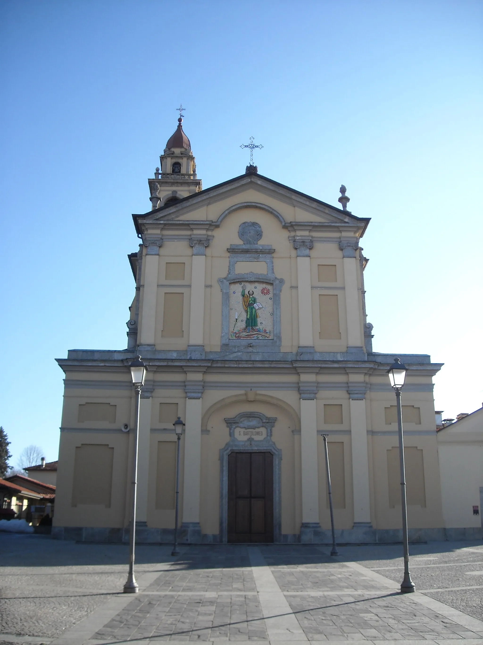
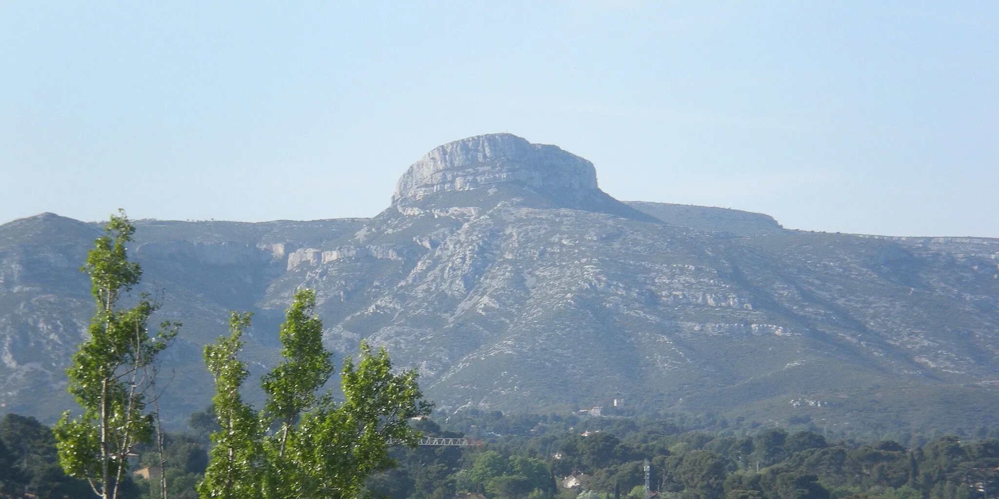
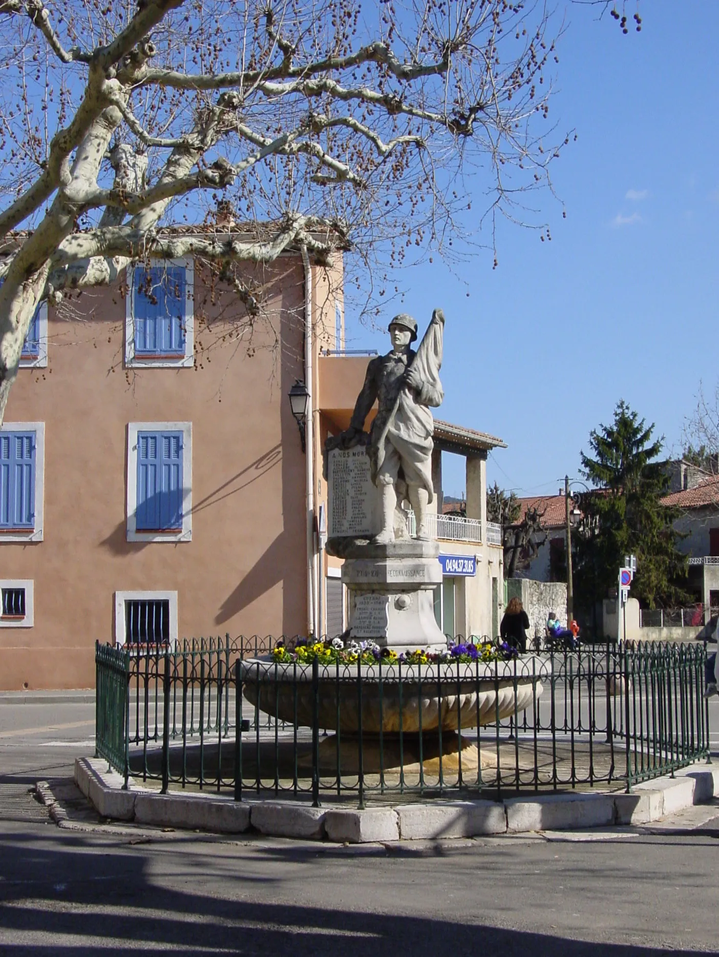
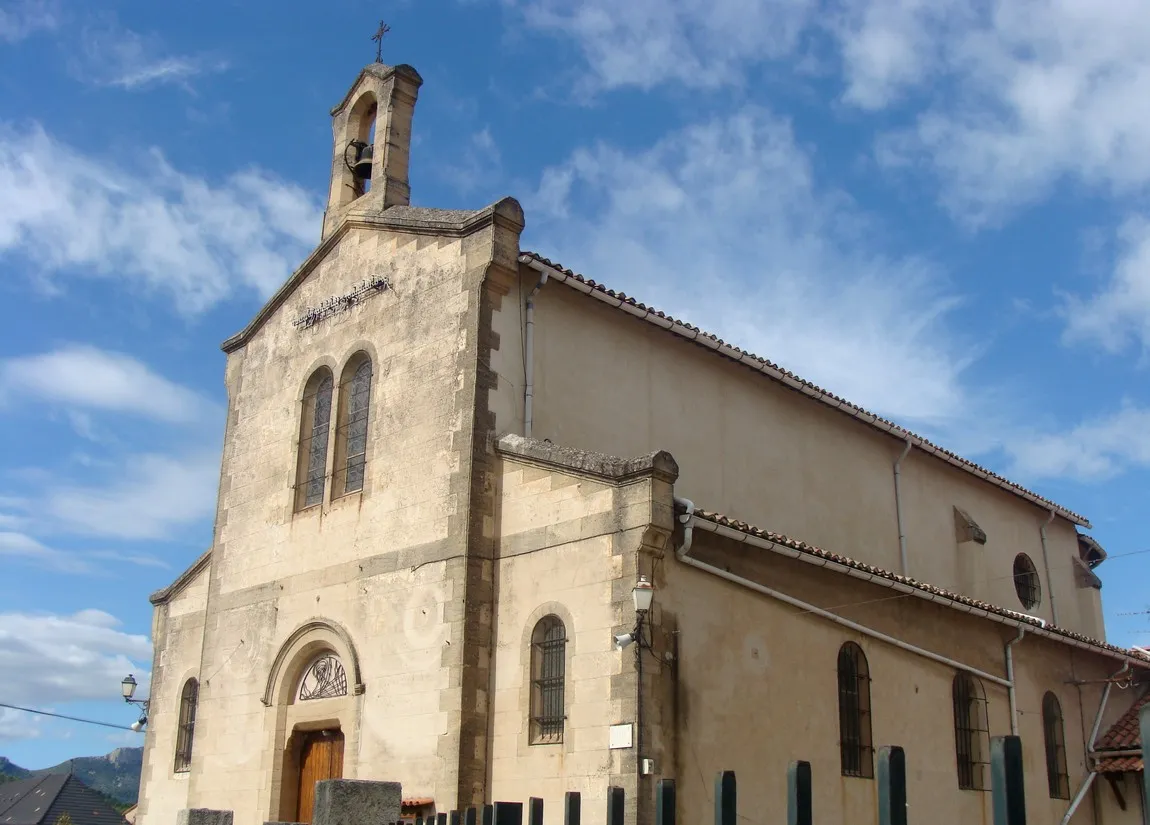
Saint-Zacharie is a picturesque town located in the Provence-Alpes-Côte d’Azur region of France. As a road and gravel cyclist, you'll find a variety of cycling options in this area. The nearby Montagne de la Sainte-Baume is a well-known cycling destination, offering challenging climbs and stunning views. With its beautiful scenery and cycling-friendly atmosphere, Saint-Zacharie is a great choice for cyclists looking for a mix of challenging routes and breathtaking landscapes.

Cycle through the beautiful landscapes surrounding Saint-Zacharie.
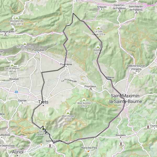
Embark on a challenging cycling route through the stunning scenery of Provence-Alpes-Côte d’Azur. This round-trip cycling tour starting near the quaint village of Saint-Zacharie will take you through the picturesque countryside, featuring breathtaking mountain views and charming rural hamlets. The route includes several highlights such as Pas de la Couelle, a mountain pass offering panoramic vistas, and the historic citadel of La citadelle. With an ascent of 1792 meters and a distance of 124 kilometers, this road route is suitable for very well-trained amateur cyclists seeking a satisfying challenge. Rated 4 for its epicness, this route offers a memorable and rewarding cycling experience.
Explore the natural beauty surrounding Saint-Zacharie on this gravel loop
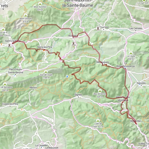
This 97-kilometer gravel loop offers cyclists the chance to immerse themselves in the natural beauty of the Saint-Zacharie region. With a total ascent of 2084 meters, it is a challenging route that takes riders through stunning landscapes. The route passes through Nans-les-Pins, Le Mourre d'Agnis, and Belgentier, offering a variety of terrain to conquer. With a difficulty rating of 4 and an epicness level of 4, this route is perfect for gravel enthusiasts seeking a thrilling adventure.
Scenic Road Cycling Route
Enjoy the beauty of Provence on this road cycling route
This 86-kilometer road cycling route takes riders on a scenic journey through the splendor of Provence. With a total ascent of 1068 meters, it provides a good challenge for amateur cyclists with proper training. The route passes through picturesque towns such as Pas de la Couelle, Trets, and Tourves. With a difficulty rating of 3 and an epicness level of 3, this route offers a delightful mix of scenic beauty and challenging climbs.
Cycle through the stunning landscapes of Provence on this scenic road tour.
Experience the beauty of Provence-Alpes-Côte d’Azur on this picturesque road cycling route. With a manageable ascent of 888 meters and a distance of 72 kilometers, this tour is suitable for amateur cyclists looking for a leisurely yet rewarding cycling experience. Rated 2 for its difficulty and 2 for its epicness, this route provides an ideal balance between enjoyment and challenge. Highlights along the way include Pas de la Couelle, offering breathtaking views, and Beaumort, a scenic spot with rolling hills and vineyards.
Exploring the rugged terrain near Saint-Zacharie
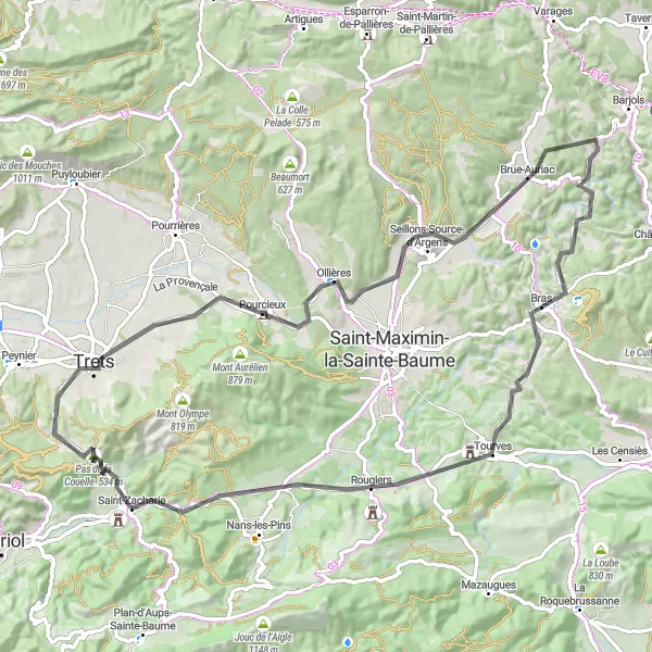
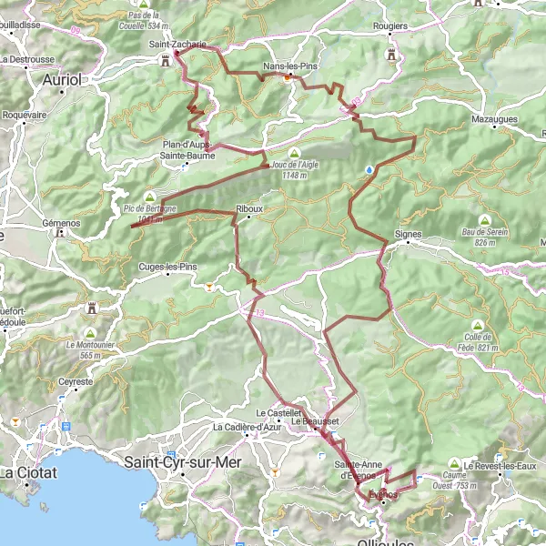
This 116-kilometer gravel route offers cyclists the chance to explore the picturesque landscapes around Saint-Zacharie. With a total ascent of 2693 meters, it is a challenging ride that rewards riders with stunning views. The route passes through charming towns such as Nans-les-Pins, Château Roux, and Riboux. With a difficulty rating of 4 and an epicness level of 4, this route is perfect for experienced gravel cyclists looking for a memorable adventure.

Uncover the lesser-known treasures of the region on this gravel cycling journey.
Embark on a captivating gravel cycling adventure through the lesser-known gems of Provence-Alpes-Côte d’Azur. This round-trip route offers a mix of stunning landscapes, historical spots, and challenging terrain. With an ascent of 1079 meters and a distance of 52 kilometers, this route is suitable for experienced gravel cyclists seeking a challenging and rewarding ride. Rated 4 for its difficulty and 3 for its epicness, this route guarantees an unforgettable cycling experience. Highlights include Château du Moulin Blanc, a historic castle nestled amidst nature, and Colline de la Jauberte, offering breathtaking views.

Unleash your gravel cycling skills on this thrilling route
This 78-kilometer gravel route takes riders through a network of challenging trails around Saint-Zacharie. With a total ascent of 1801 meters, it offers a thrilling adventure for experienced gravel cyclists. The route passes through Nans-les-Pins, Château Roux, and Pic de Bertagne, offering varied terrain and stunning views. With a difficulty rating of 4 and an epicness level of 3, this route promises a memorable gravel cycling experience.
Get off the beaten path and embrace a gravel cycling adventure near Saint-Zacharie.
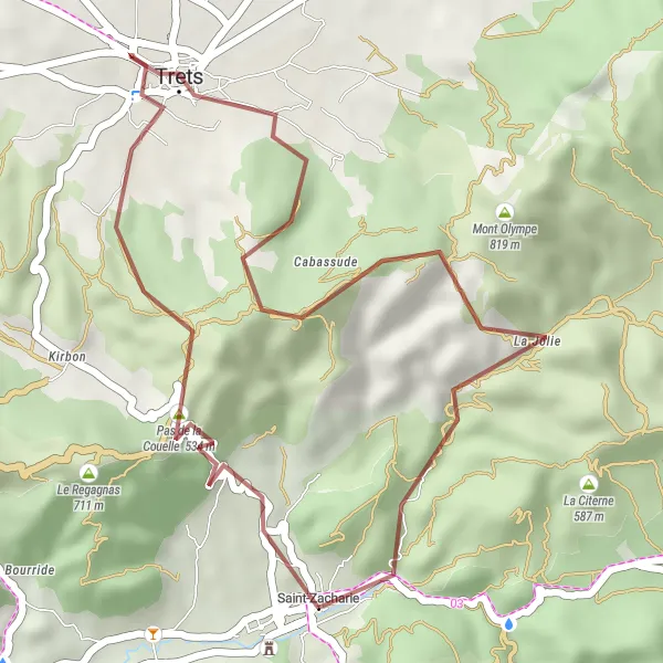
Escape the paved roads and venture into the rugged landscapes around Saint-Zacharie on this exciting gravel cycling route. With an ascent of 740 meters and a distance of 28 kilometers, this route is suitable for experienced gravel cyclists seeking a thrilling ride. Rated 4 for its difficulty and 3 for its epicness, this route promises an invigorating and memorable experience. Highlights include Pas de la Couelle, where you can enjoy stunning views, and Saint-Jean du Puy, a small village steeped in history and natural beauty.
Embark on an epic road cycling adventure to Saint-Zacharie
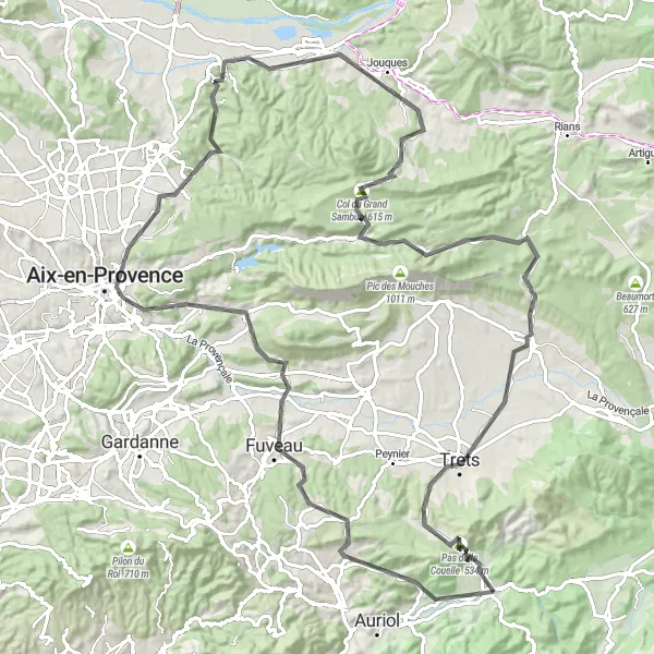
This 116-kilometer road cycling route takes riders on an epic adventure to the charming village of Saint-Zacharie. With a total ascent of 1794 meters, it challenges cyclists with varied terrain and incredible views. The route passes through Belcodène, Aix-en-Provence, and Peyrolles-en-Provence, offering a mix of scenic beauty and historic landmarks. With a difficulty rating of 4 and an epicness level of 4, this route is perfect for road cyclists looking for a challenging and rewarding journey.

Embark on a scenic cycling adventure through the idyllic countryside near Saint-Zacharie.
Explore the picturesque countryside near Saint-Zacharie on this beautiful road cycling route. This round-trip tour takes you through charming villages, historic sites, and stunning natural landscapes. With a total ascent of 1588 meters and a distance of 131 kilometers, this route is suitable for experienced amateur cyclists seeking a moderate challenge. Rated 3 for its difficulty and 3 for its epicness, this route provides an enjoyable and varied cycling experience. Highlights along the route include Pas de la Couelle, offering panoramic views, and Saint-Julien-le-Montagnier, a historical village with a rich cultural heritage.
Cycling routes nearby:


Nearby regions: