Gravel Loop from Saint-Genis-les-Ollières
A gravel cycling route starting from Saint-Genis-les-Ollieres
A picturesque gravel route through charming villages
Map
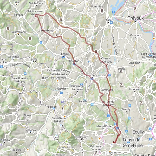
This gravel cycling route takes you through beautiful scenery and charming villages. The route is 64 km long with a total ascent of 1035m. It is suitable for gravel bikes and offers a mix of off-road and paved sections. You'll ride through Civrieux-d'Azergues, Oingt, Chautard, and enjoy stunning views of Le Bois d'Oingt and the Val d'Oingt. Overall, this route is moderately challenging and offers a unique and enjoyable cycling experience.
gravel
64 km
1035 m
Tough
Route profile
Highlights on the route
0 km
0 km
Start: Saint-Genis-les-Ollières Village centerSaint-Genis-les-Ollières: Challenging and Scenic Cycling Routes in Rhône-Alpes
Saint-Genis-les-Ollières is a town located in the Rhône-Alpes region of France. From a road and gravel cyclist's point of view, Saint-Genis-les-Ollières provides a mix of challenging and picturesque cycling routes. The rolling hills and beautiful scenery make it a popular spot for cyclists. One well-known cycling spot nearby is the Col de la Luère, offering a demanding climb and rewarding views. Overall, Saint-Genis-les-Ollières cater to both avid cyclists seeking a challenge and those looking for scenic rides.13 km
13 km
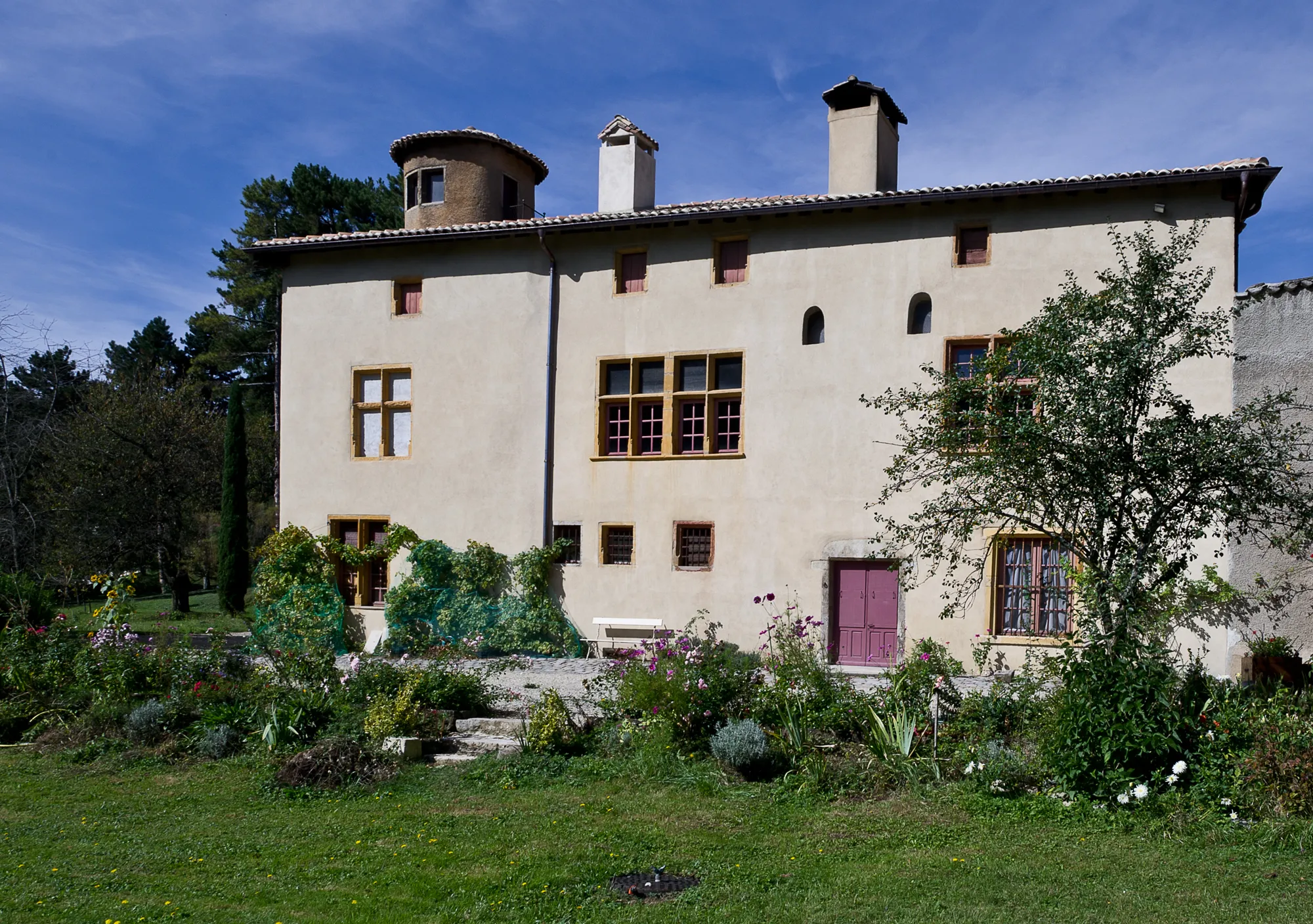
Civrieux-d'AzerguesVillageCivrieux-d'Azergues - This charming village is known for its historic buildings and tranquility. Take a break and explore its picturesque streets.
30 km
30 km
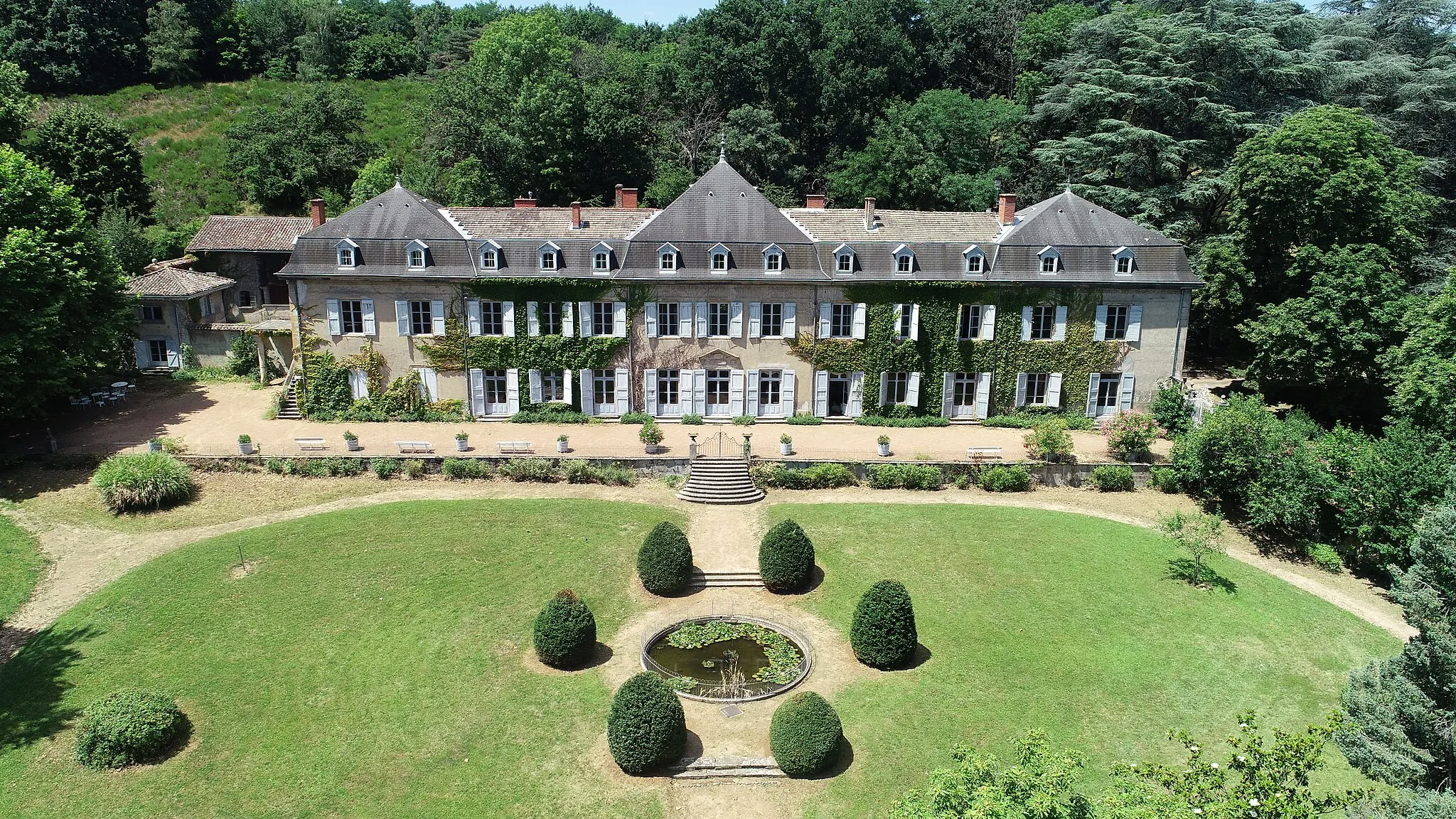
OingtVillageOingt - A medieval village rich in history and surrounded by vineyards. Stop and admire the beautiful architecture.
31 km
31 km
ChautardViewpointChautard - This small hamlet offers panoramic views of the surrounding countryside. Take a moment to soak in the natural beauty.
36 km
36 km
Vue sur Le Bois d'Oingt, Val d'OingtViewpointVue sur Le Bois d'Oingt, Val d'Oingt - Enjoy stunning views of the picturesque Le Bois d'Oingt and the Val d'Oingt. The scenery is particularly breathtaking from this vantage point.
49 km
49 km
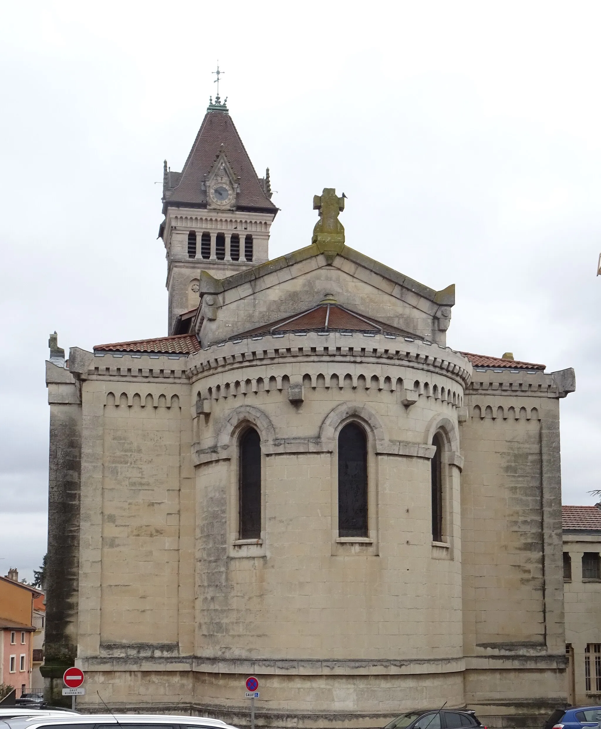
LozanneVillageLozanne - A charming village with quaint streets and a laid-back atmosphere. Explore the local shops and cafes to get a taste of the local culture.
61 km
61 km
Charbonnières-les-BainsVillageCharbonnières-les-Bains - Known for its thermal baths and lush green surroundings, this town is perfect for a rejuvenating stop during your ride.
64 km
64 km
Finish: Saint-Genis-les-Ollières Village centerSaint-Genis-les-Ollières: Challenging and Scenic Cycling Routes in Rhône-Alpes
Cycling routes from Saint-Genis-les-Ollieres:
Challenging Road Adventure from Saint-Genis-les-Ollières Monts du Lyonnias Challenge Gravel Exploration from Saint-Genis-les-Ollières to Lyon Discover the Lyon Countryside Nature and Heritage Tour Gravel Exploration from Saint-Genis-les-Ollières to Lyon Epic Road Cycling Journey through Rhône-Alpes Lyon Hillclimb Challenge Rural Charm Cycling Tour Gravel Adventure through Saint-Genis-les-Ollières Gravel Loop from Saint-Genis-les-Ollières Climbing Challenge from Saint-Genis-les-Ollières Scenic Gravel Ride near Saint-Genis-les-Ollières Exploring Nature near Saint-Genis-les-Ollières
Cycling routes nearby: