Forchheim to Atzelsberg Loop
A road cycling route starting from Langensendelbach
Enjoy a scenic ride from Forchheim to Atzelsberg Castle and back
Map
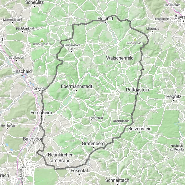
Take on the challenge of this 136 km road cycling route, which features a total ascent of 1877 meters. The route starts in Forchheim and takes you through picturesque landscapes and charming villages. Highlights along the way include the Kellerberg with its impressive views, the medieval Kreuzstein Castle, and the majestic Burg Pottenstein. The difficulty level of this route is rated 4 out of 5, making it suitable for well-trained amateur cyclists. With a score of 4 out of 5 for epicness, this route promises a memorable cycling experience. Enjoy stunning nature and cultural landmarks throughout the journey.
road
136 km
1877 m
Tough
Route profile
Highlights on the route
0 km
0 km
Start: Atzelsberg Village centerLangensendelbach: Serene cycling experience amidst picturesque countryside.
Langensendelbach is a locality located in Oberfranken, Germany. From a road and gravel cyclist's perspective, Langensendelbach offers a range of cycling opportunities suitable for all skill levels. The region is characterized by its charming countryside, with quiet roads and beautiful landscapes providing an enjoyable cycling experience. One notable cycling spot nearby is Gräfenberg Rail Trail, a popular route tracing the former railway line and offering a scenic cycling path. With its serene surroundings and cycling-friendly atmosphere, Langensendelbach is a great location for a cycling adventure.13 km
13 km
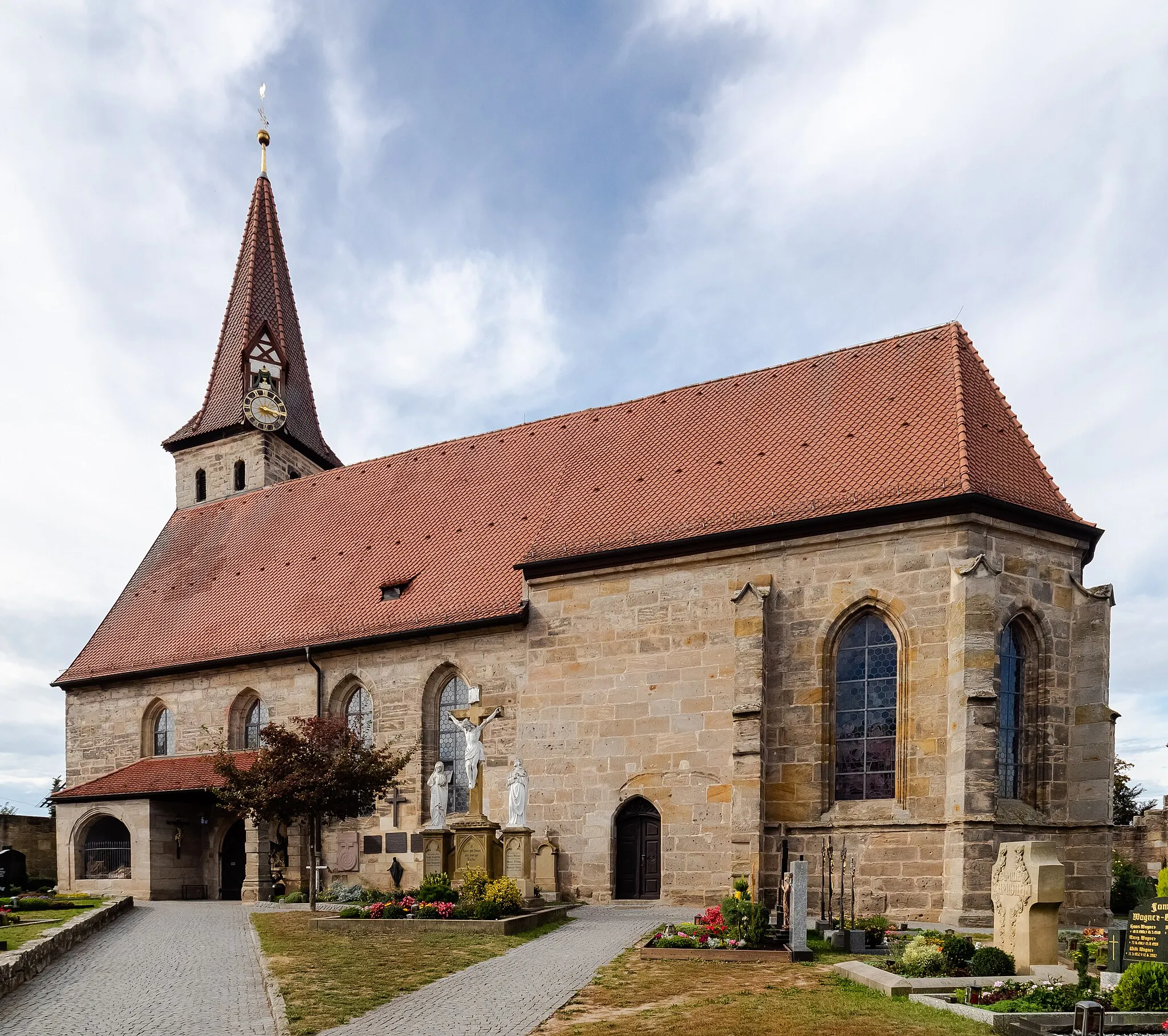
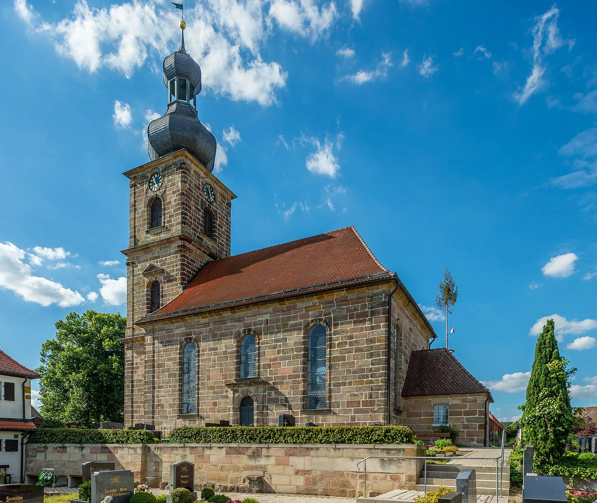
ForchheimTownForchheim, the starting point of the route, is a charming town known for its half-timbered houses and historic marketplace.
15 km
15 km
Kellerberg340 mPeakThe Kellerberg offers stunning panoramic views of the Franconian Switzerland region.
28 km
28 km
GötzendorfVillageGötzendorf is a small village with a picturesque setting surrounded by rolling hills.
38 km
38 km
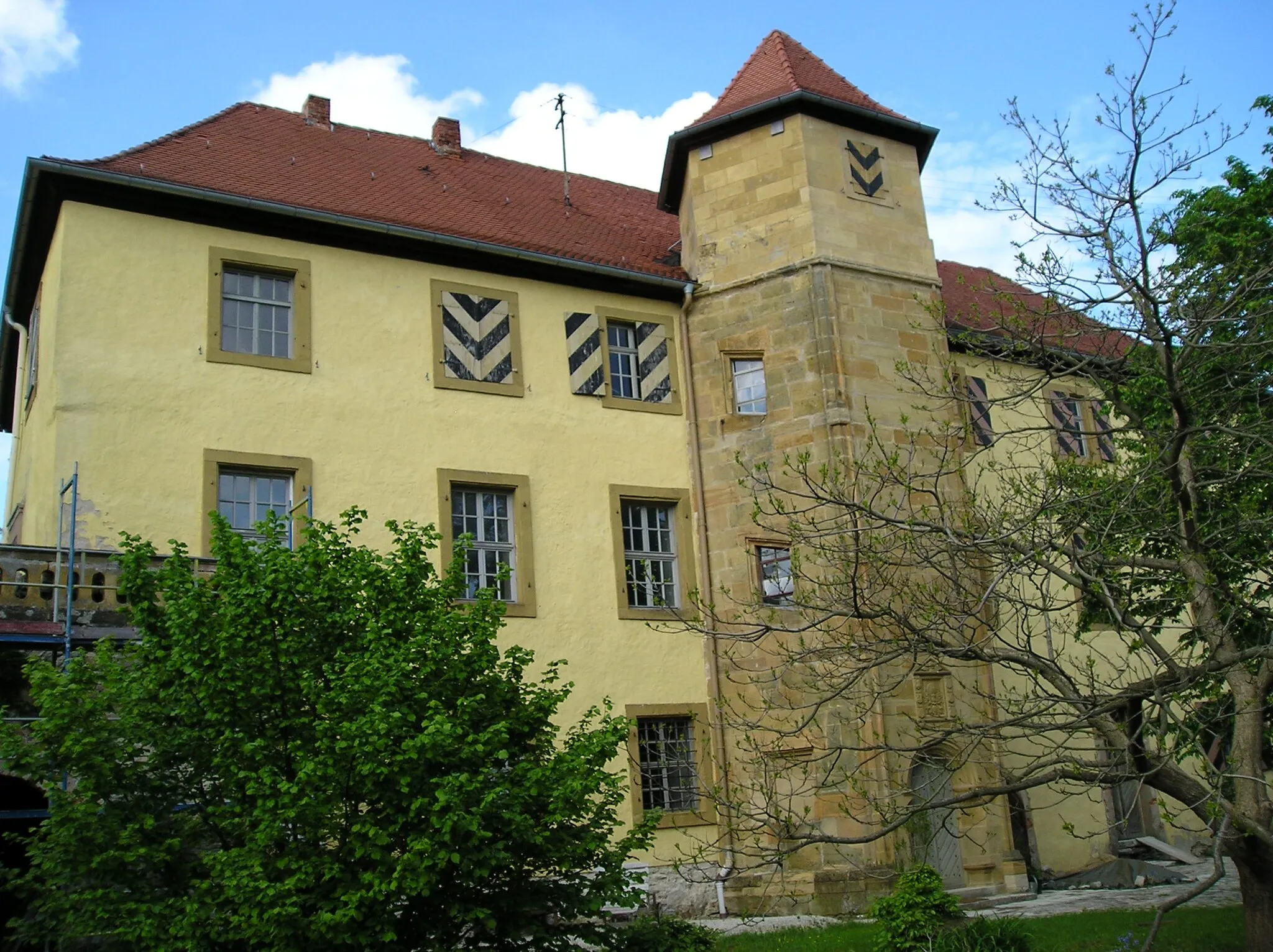
KreuzsteinViewpointThe Kreuzstein Castle is a fascinating medieval ruin that overlooks the surrounding countryside.
55 km
55 km
HollfeldTownHollfeld is a medieval town with a well-preserved old town area and historic buildings.
61 km
61 km
Rappersberg554 mPeakRappersberg is a charming village with lovely half-timbered houses and beautiful views.
72 km
72 km
GlashüttenVillageGlashütten is known for its glass art and offers a unique cultural experience.
73 km
73 km
Hollerberg538 mPeakHollerberg offers breathtaking views of the Franconian Switzerland landscape.
89 km
89 km
SängerhäuschenViewpointThe Sängerhäuschen is a traditional Franconian singing house where locals gather to sing folk songs.
89 km
89 km
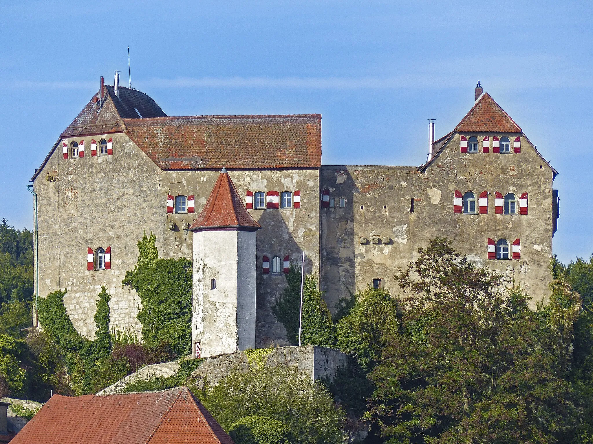
Burg PottensteinCastleBurg Pottenstein is a well-preserved castle that offers guided tours and a fantastic view of the valley.
105 km
105 km
Eschenberg598 mPeakEschenberg is a picturesque village with a rich history and architectural charm.
107 km
107 km
HiltpoltsteinVillageHiltpoltstein is a scenic village known for its beautiful castle and peaceful atmosphere.
127 km
127 km
DormitzVillageDormitz is a quaint village located amidst picturesque nature and charming rural landscapes.
135 km
135 km
View to NuernbergViewpointEnjoy a stunning view of Nuremberg from this viewpoint located on the route.
136 km
136 km
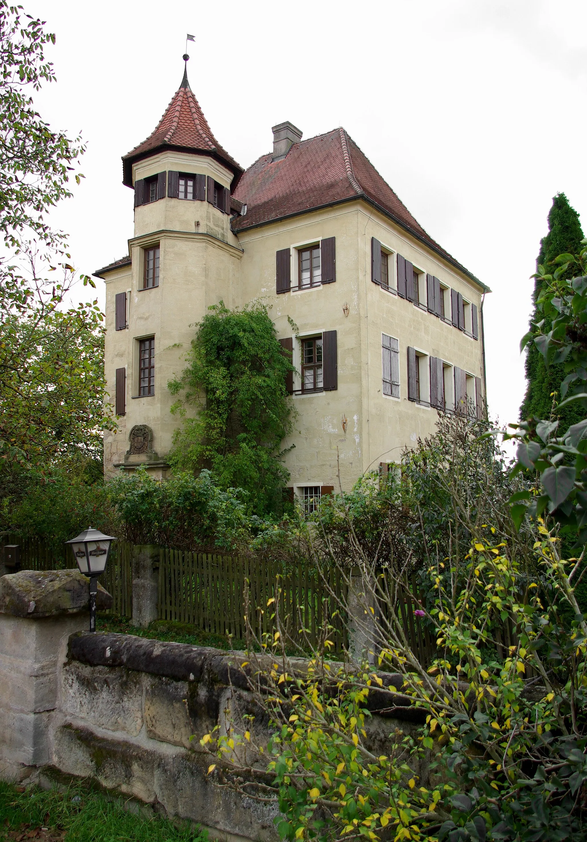
AtzelsbergVillageAtzelsberg is a picturesque village known for its medieval castle and beautiful surroundings.
136 km
136 km
Finish: Atzelsberg Village centerLangensendelbach: Serene cycling experience amidst picturesque countryside.
Cycling routes from Langensendelbach:
Cycling routes nearby: