Serene cycling haven in the heart of Northumberland
Cycling routes from Darras Hall
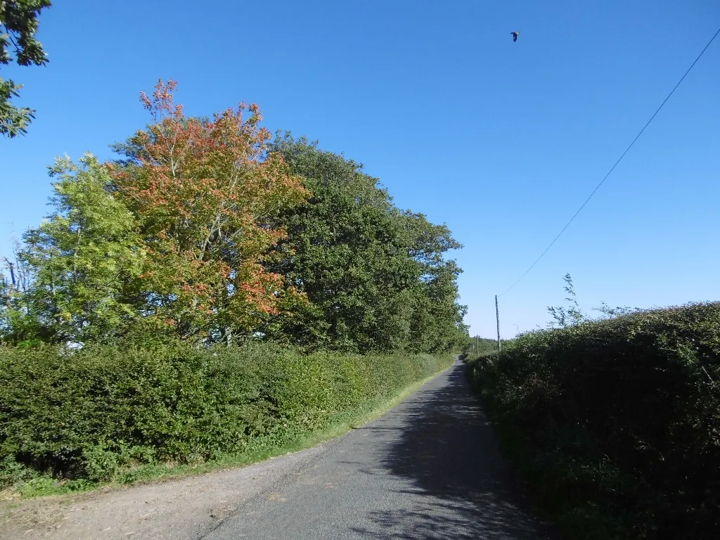
Darras Hall is a locality situated in Northumberland and Tyne and Wear region of the United Kingdom. As a cyclist, you'll appreciate the charming landscapes and serene roads surrounding Darras Hall. With its abundance of hidden country lanes and scenic routes, this area offers fantastic opportunities for road and gravel cycling. Several notable climbs can be found nearby, including the challenging Haydon Bridge climb. Darras Hall is a must-visit destination for cycling enthusiasts looking to explore the stunning British countryside on two wheels.
Harlow Hill and Matfen Loop
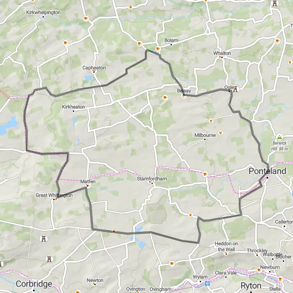
Cycle through the iconic Harlow Hill and enjoy the beautiful countryside of Matfen
This 61 km road cycling route starts in Darras Hall and takes you through the picturesque Harlow Hill, known for its stunning views. The route then continues to Matfen, where you can explore the historic village and its charming surroundings. With a moderate ascent of 488m, this route offers a good challenge for well-trained amateur cyclists. The epicness of this route is rated at 3, as it showcases the beautiful countryside of Northumberland and Tyne and Wear.
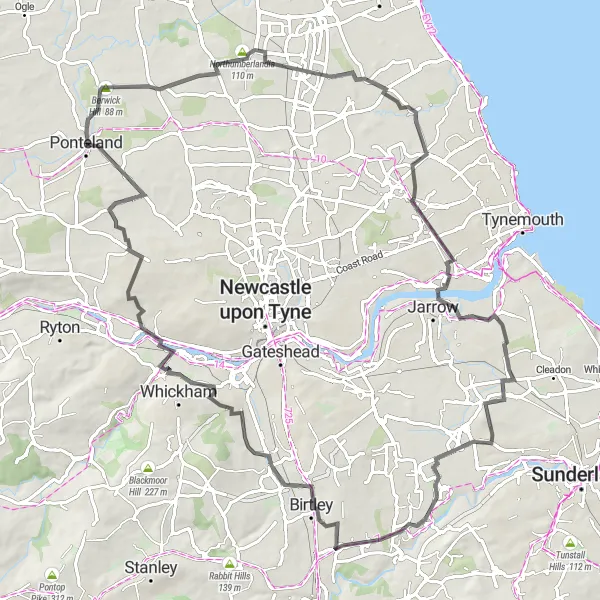
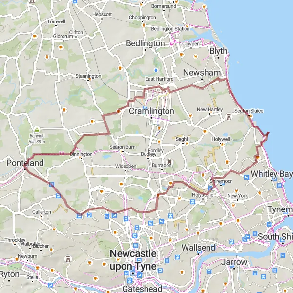
Embark on an adventurous journey from Berwick Hill to Westerhope, passing through iconic landmarks and picturesque landscapes.
This challenging 85 km road cycling route starts at Berwick Hill and takes you through various attractions, including the unique sculpture of Northumberlandia and the historic Monkwearmouth-Jarrow Abbey. With an ascent of 555m, this route is suitable for well-trained amateur cyclists looking for a thrilling adventure. The epicness of this route is rated at 4, as it showcases a diverse range of landscapes and iconic landmarks.
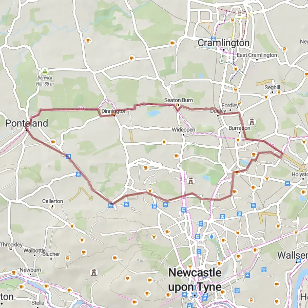
Embark on a thrilling gravel cycling adventure through picturesque natural landscapes
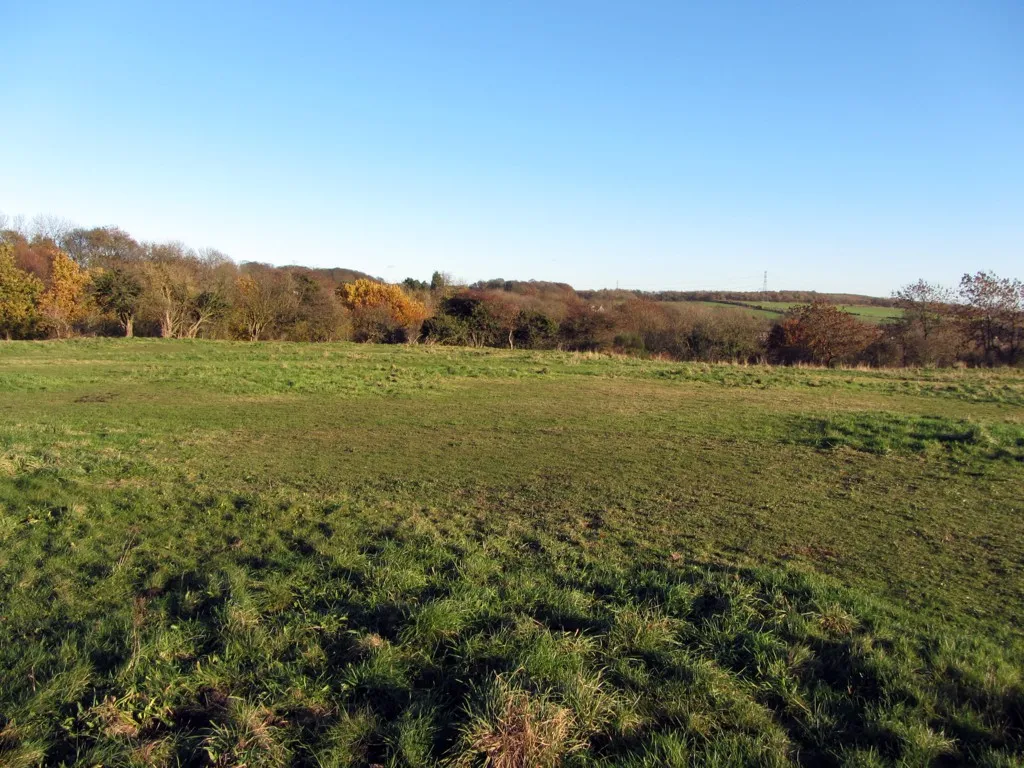
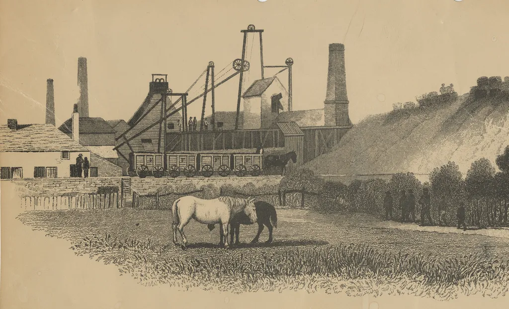
The Gravel Adventure is a 33-kilometer gravel cycling route that takes you through diverse and scenic natural landscapes. With minor elevation gain and a moderate distance, this route offers a thrilling experience for gravel enthusiasts. Highlights of the route include the peaceful town of Dinnington, the historic Weetslade Colliery Country Park, and the vibrant community of Killingworth.
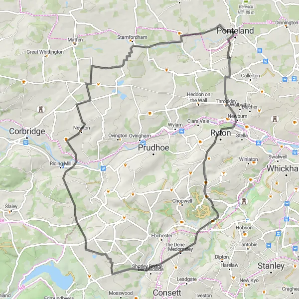
Experience the beauty of the countryside on this picturesque road cycling route from Ryton to Stamfordham.
This 67 km road cycling route takes you through the scenic countryside, passing by the charming village of Ryton and ending in Stamfordham. With an ascent of 888m, this route offers a challenging ride for well-trained amateur cyclists. The epicness of this route is rated at 3, as it showcases the natural beauty of Northumberland and Tyne and Wear.
The Northumberland Explorer
Embark on a road cycling adventure through picturesque landscapes and charming villages
The Northumberland Explorer is a 48-kilometer road cycling route that takes you through the beautiful Northumberland countryside. With moderate elevation gain and a pleasant distance, this route provides an enjoyable ride for cyclists of all levels. Highlights of the route include the historic Berwick Hill and the scenic Cow Hill, offering sweeping views of the surrounding area.
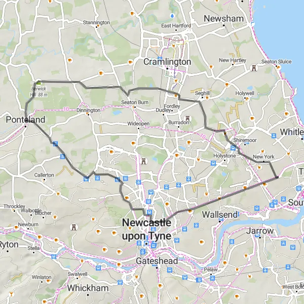
Embark on a thrilling gravel adventure, exploring the picturesque Old Hartley and Coxlodge.
This 56 km gravel cycling route offers a thrilling adventure through the scenic Old Hartley and Coxlodge. With an ascent of 207m, this route is suitable for well-trained amateur cyclists. The epicness of this route is rated at 2, as it provides a diverse range of gravel trails and beautiful scenery.
The Weetslade Loop
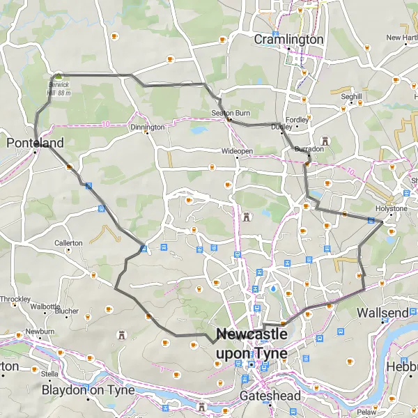
Traverse the Weetslade Colliery Country Park and enjoy scenic views along this road cycling route
The Weetslade Loop is a 43-kilometer road cycling route that takes you through the picturesque Weetslade Colliery Country Park. With moderate ascent and a pleasant distance, this route offers an enjoyable cycling experience for all skill levels. The highlight of the route is the Cow Hill, which provides stunning panoramic views of the surrounding countryside.
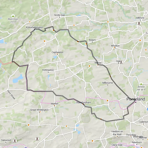
Embark on a challenging road cycling expedition through picturesque countryside and idyllic villages
The Darras Hall Challenge is a demanding 62-kilometer road cycling route that takes you through breathtaking countryside and charming villages. With significant elevation gain and a challenging distance, this route is suitable for experienced cyclists looking for a tough adventure. Highlights of the route include the historic Darras Hall, the enchanting village of Stamfordham, and the picturesque countryside of Kirkwhelpington and Belsay.
The Historic Hinterland
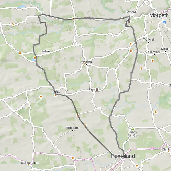
Embark on a road cycling journey through historic landscapes and visit iconic castle ruins
The Historic Hinterland is a 43-kilometer road cycling route that takes you through the enchanting Northumberland countryside and allows you to explore historic landmarks. With moderate elevation gain and a pleasant distance, this route offers a captivating experience for cycling enthusiasts. Highlights of the route include the majestic Belsay Castle, the picturesque Hartburn village, and the impressive Mitford Castle ruins.

Discover the beauty of the Ponteland area on this scenic gravel cycling route.
This 52 km gravel cycling route takes you on a journey through the peaceful Ponteland area, known for its idyllic trails and picturesque landscapes. With an ascent of 549m, this route offers a moderate challenge for well-trained amateur cyclists. The epicness of this route is rated at 2, as it explores the tranquil gravel trails and untouched beauty of the region.
Cycling routes nearby:
Nearby regions: