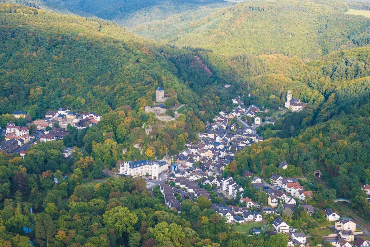
Cycling along the enchanting Rhine River.
Cycling routes from Bendorf
Bendorf is a town located in Koblenz, Germany. For road and gravel cyclists, Bendorf offers diverse terrain and scenic routes along the picturesque Rhine River. The Moselradweg, a well-known cycling path in the region, is a great option for those seeking a leisurely ride. Additionally, nearby hills like the Westerwald provide opportunities for more challenging climbs. With its combination of river views and rolling hills, Bendorf is a cycling-friendly locality suitable for riders of all levels.
Embark on an adventurous gravel cycling route from Bendorf to Koblenz and explore the unique landscapes along the way.
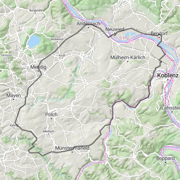
If you're a fan of gravel biking, this route from Bendorf to Koblenz is a must-try. With an ascent of 1879 meters and a distance of 112 kilometers, it promises a thrilling off-road experience. From challenging climbs to exciting descents, you'll encounter diverse terrain as you make your way through scenic villages and natural wonders. The highlights along the route offer the perfect spots to take a break and soak in the beauty of the surroundings.
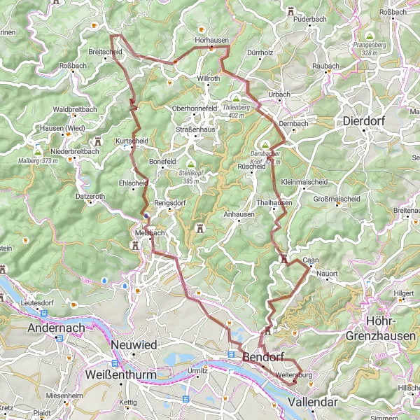
A challenging off-road adventure through the remote Rhine Valley
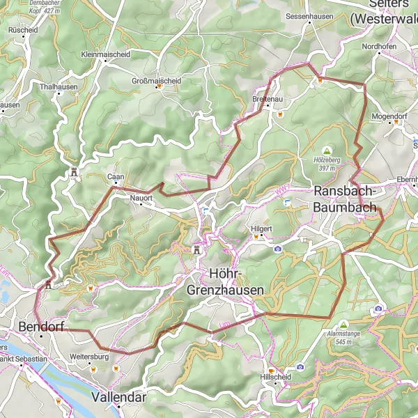
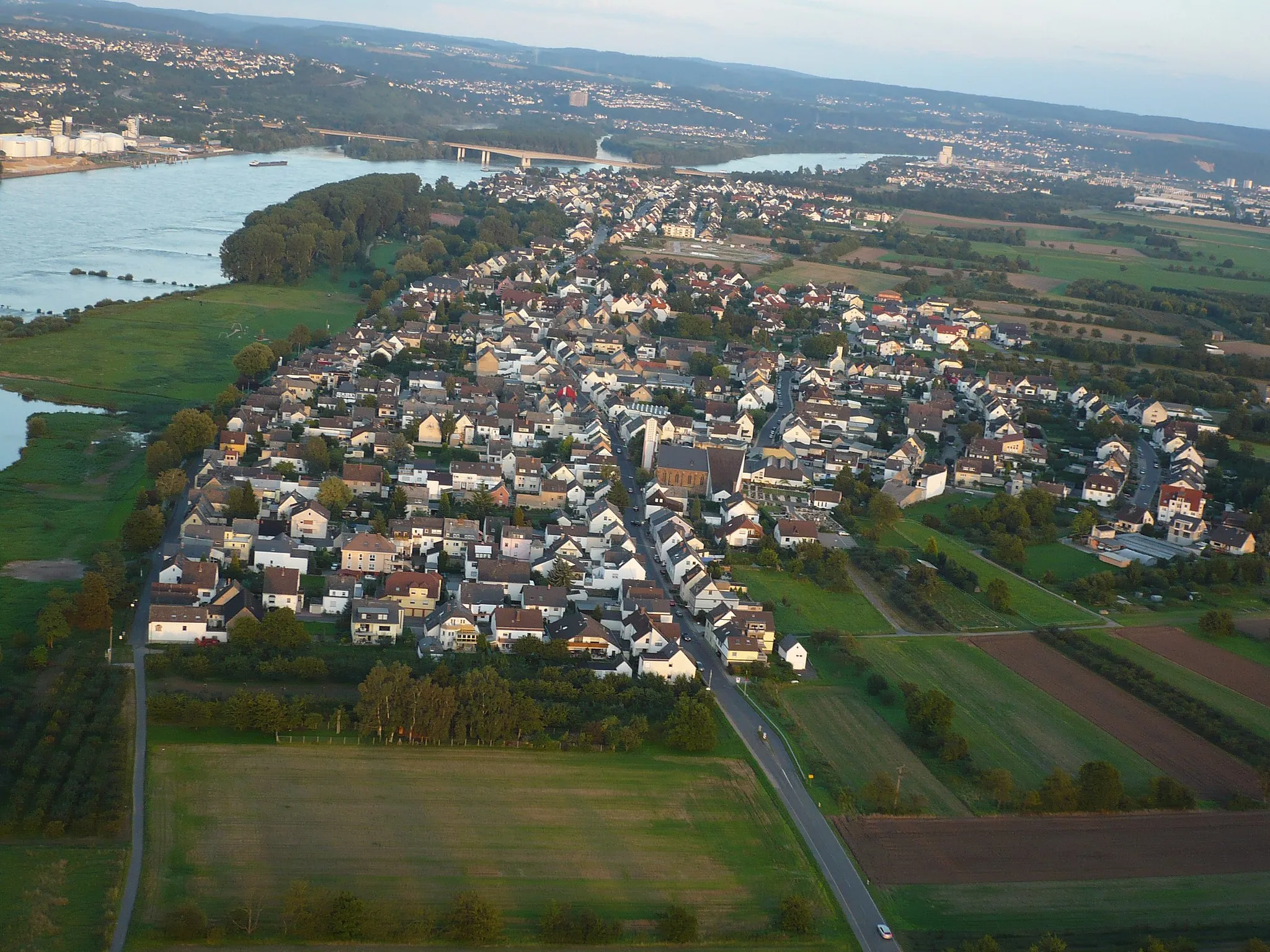
Immerse yourself in the remote beauty of the Rhine Valley with this gravel cycling route. Covering a distance of 73 kilometers and with an ascent of 1,333 meters, this route offers a challenging adventure for experienced gravel riders. Highlights along the way include the charming village of Sankt Sebastian, where you can admire historical architecture and cultural heritage. Krunkel, known for its idyllic location and panoramic views, is another must-visit highlight. As you navigate the route, you'll also encounter Dernbacher Kopf, a hill that rewards you with breathtaking vistas of the Rhine Valley. Don't miss out on exploring Isenburg, a medieval castle that transports you back in time.
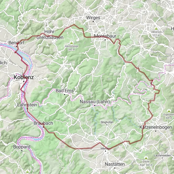
Conquer the Koblenz epic road challenge
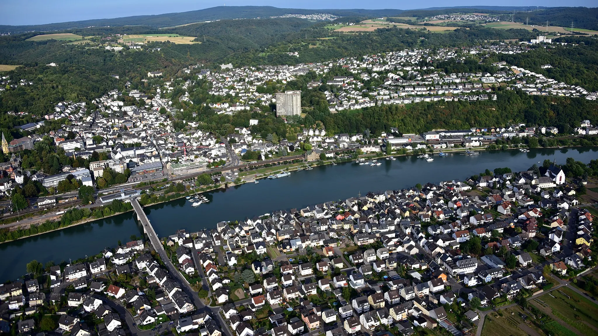
Prepare yourself for a challenging cycling experience on this road route near Koblenz. Covering a distance of 94 kilometers with a total ascent of 1568 meters, this route is reserved for experienced riders seeking an exhilarating and physically demanding adventure. Enjoy picturesque landscapes, historic sites, and the thrill of overcoming tough climbs.
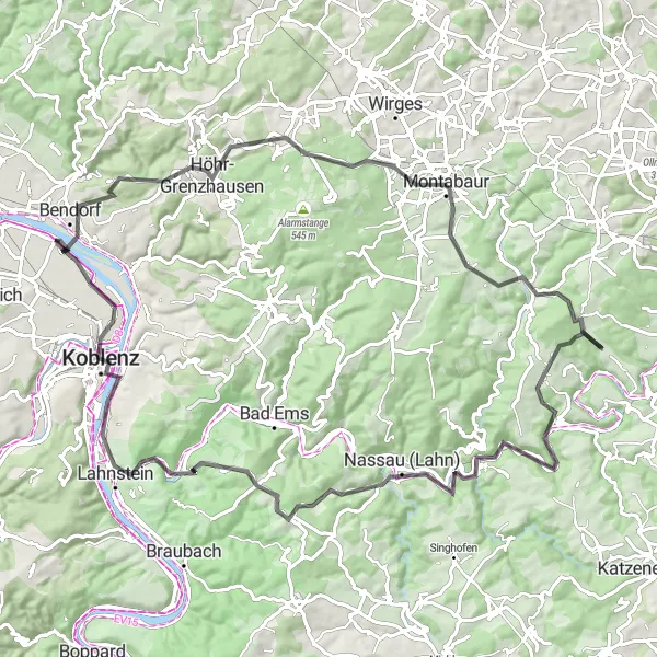
Koblenz Road Route

Experience the scenic road cycling around Koblenz
This road route near Koblenz takes cyclists on a journey through diverse landscapes, covering a total distance of 63 kilometers with an ascent of 564 meters. It offers a moderate challenge suitable for intermediate riders and provides an opportunity to discover the region's natural beauty and cultural highlights.

A challenging ride with breathtaking views of the Mosel River
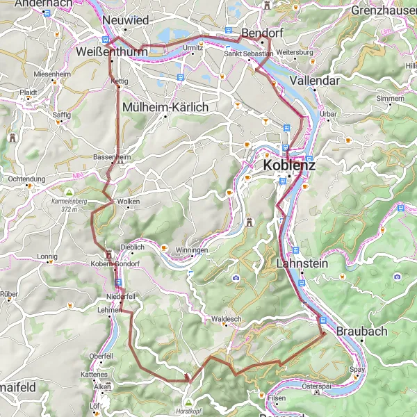
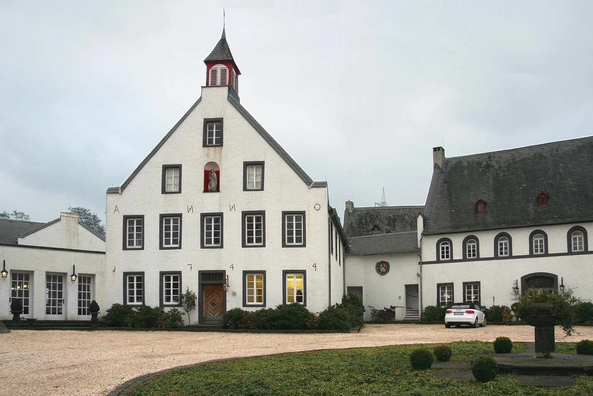
Climbing the Mosel River Hills is an epic road cycling route that starts near Bendorf and takes you through the scenic Mosel River region. Spanning a distance of 119 kilometers and with an ascent of 1,482 meters, this route is suitable for well-trained amateur riders looking for a challenge. Highlights along the way include the city of Koblenz, where the Mosel and Rhine rivers meet, offering stunning views of the two famous waterways. The Dommelberg is another highlight, known for its panoramic vistas of the Mosel Valley. As you continue along the route, you'll also encounter charming castles and historic sites, such as Ehrenburg and Pommerer Mart.
The Rhine Valley Loop
Gorgeous cycling through the Rhine Valley
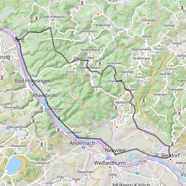
The Rhine Valley Loop is a stunning cycling route that takes you through the picturesque Rhine Valley. With a total distance of 72 kilometers and an ascent of 910 meters, this road bike route offers a good challenge for amateur riders. Along the way, highlights include the charming town of Andernach, known for its historic architecture and impressive city wall. Another highlight is the Krahnenberg, a hill that offers breathtaking views of the surrounding landscape. As you cycle through the route, you'll also pass through Linz, a charming town famous for its colorful half-timbered houses.
Bendorf Gravel Exploration
Discover the gravel routes around Bendorf
This gravel exploration near Bendorf covers a distance of 62 kilometers with an ascent of 605 meters. Suitable for intermediate-level cyclists, it takes riders through diverse landscapes and offers a mix of challenging sections and rewarding views.
Experience the scenic beauty of the Lower Middle Rhine Region on this challenging gravel route
This challenging gravel route starting near Bendorf takes you through the picturesque landscapes of the Lower Middle Rhine Region. As you pedal along the route, you'll be treated to breathtaking views of the Rhine River, charming villages, and rolling hills. The route covers a distance of 69 kilometers with a total ascent of 959 meters. It is suitable for experienced cyclists looking for a challenging off-road adventure.
Bendorf Gravel Route
Explore the scenic gravel roads around Bendorf
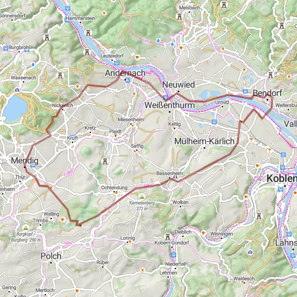
This gravel route near Bendorf takes you through picturesque landscapes with a total ascent of 987 meters over a distance of 48 kilometers. It offers a moderate challenge for intermediate cyclists and provides a unique and diverse experience.
Embark on an epic cycling adventure through the Rhine Valley
This challenging road route starts near Koblenz and allows cyclists to explore the beautiful Rhine Valley. With an ascent of 994 meters over a distance of 91 kilometers, this epic circuit is suitable for experienced riders seeking a truly memorable journey. Enjoy breathtaking views, historic landmarks, and picturesque villages along the way.
Cycling routes nearby:


Nearby regions: