Gravel Adventure to Bürgstädter Berg and Schwarzkopf
A gravel cycling route starting from Eichenbuhl
Embark on an adventurous gravel ride to Bürgstädter Berg and Schwarzkopf
Map
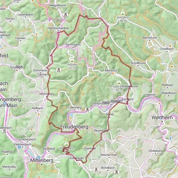
This gravel adventure takes you through varied terrain, including rolling hills and forested areas. One of the highlights along the route is Bürgstädter Berg, situated 6 km into the ride. Enjoy the splendid views from the top and appreciate the natural beauty of the surrounding landscapes. Another noteworthy highlight is Schwarzkopf, located 52 km into the route. Explore the dense forests and experience the tranquility of this secluded spot. With a difficulty rating of 3, this route offers a challenging yet enjoyable experience for intermediate cyclists.
gravel
84 km
1705 m
Tough
Route profile
Highlights on the route
0 km
0 km
Start: Eichenbühl Village centerEichenbühl: Idyllic Cycling Retreat in Unterfranken
Eichenbühl in Unterfranken, Germany provides a delightful cycling experience for road and gravel cyclists. Located in a region known for its picturesque landscapes, Eichenbühl offers scenic routes through vineyards, forests, and quaint towns. Cyclists can explore the beautiful Spessart Mountains and challenging ascents such as the nearby Mespelbrunn Castle climb. The locality also features well-maintained cycling paths, ensuring safe and enjoyable riding experiences. Overall, with its idyllic surroundings and cycling-friendly infrastructure, Eichenbühl receives a rank of 3.6 km
6 km
Bürgstädter Berg463 mPeakBürgstädter Berg, 6 km into the route, offers panoramic views of the surrounding countryside.
12 km
12 km
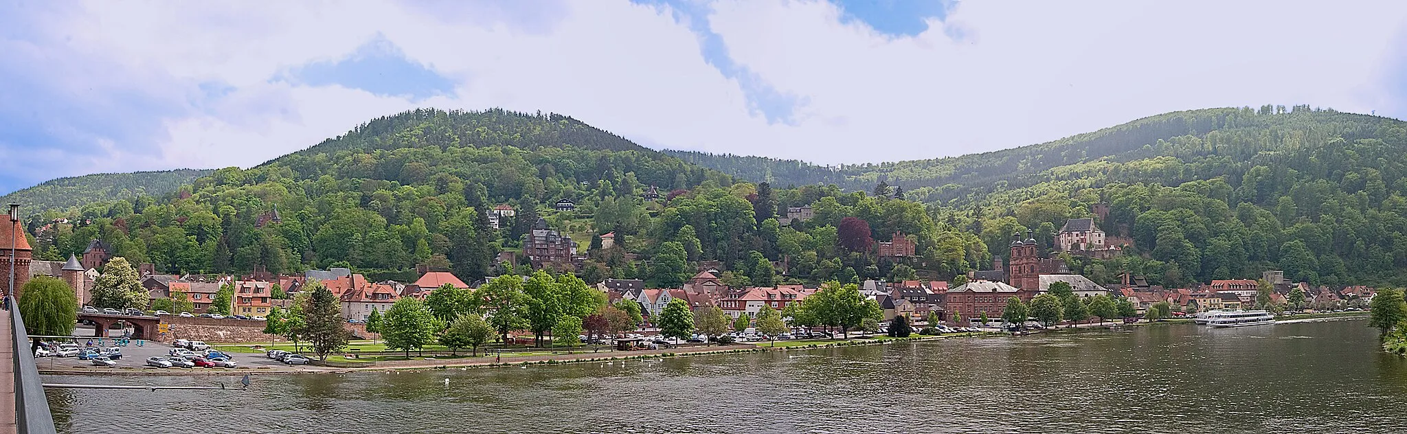
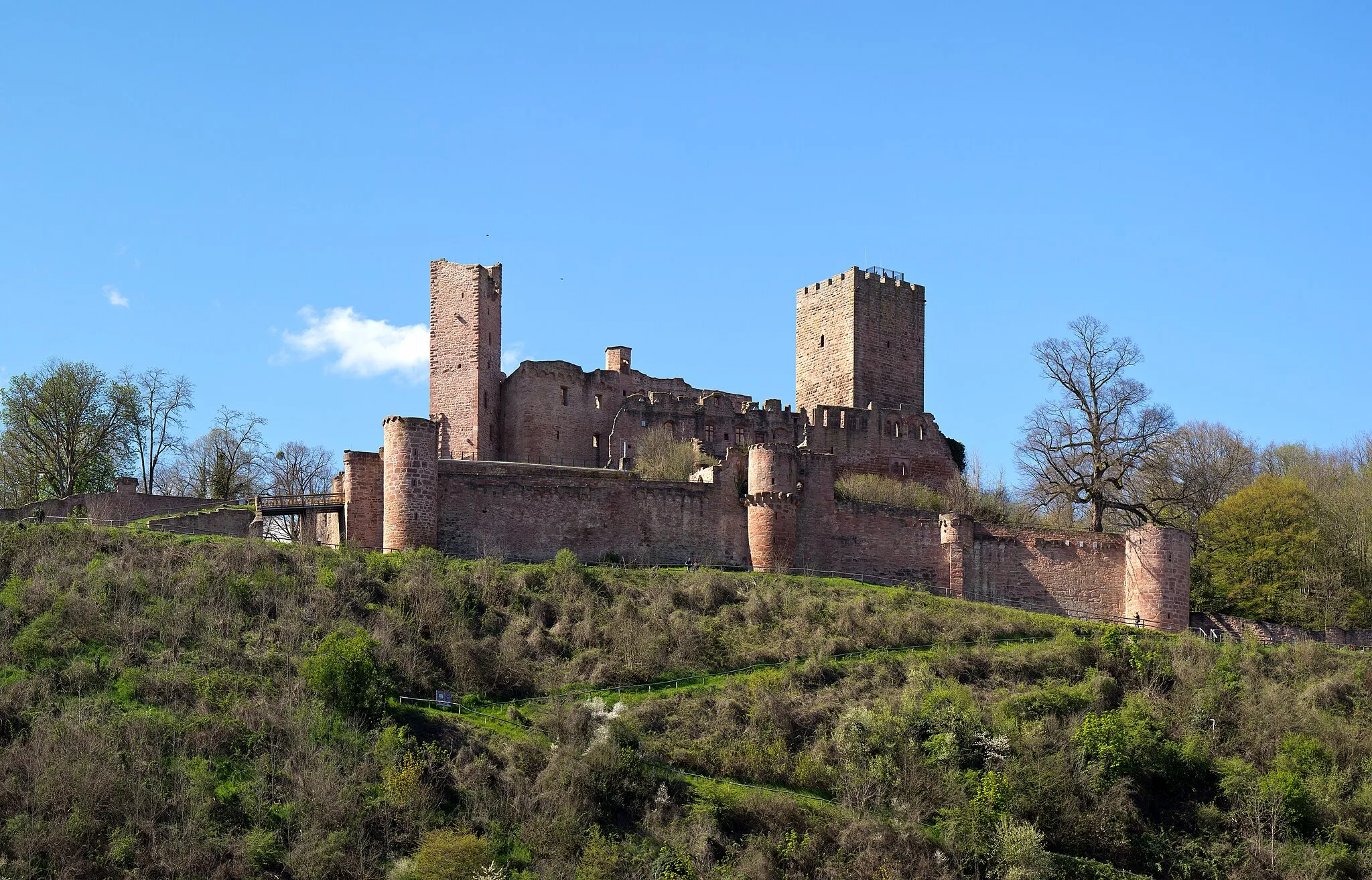
FreudenbergTownFreudenberg, located 12 km into the route, boasts charming architectural treasures and scenic landscapes.
22 km
22 km
Geiersberg512 mPeakExperience the thrill of climbing Geiersberg, situated 22 km into the route, with beautiful nature all around.
34 km
34 km
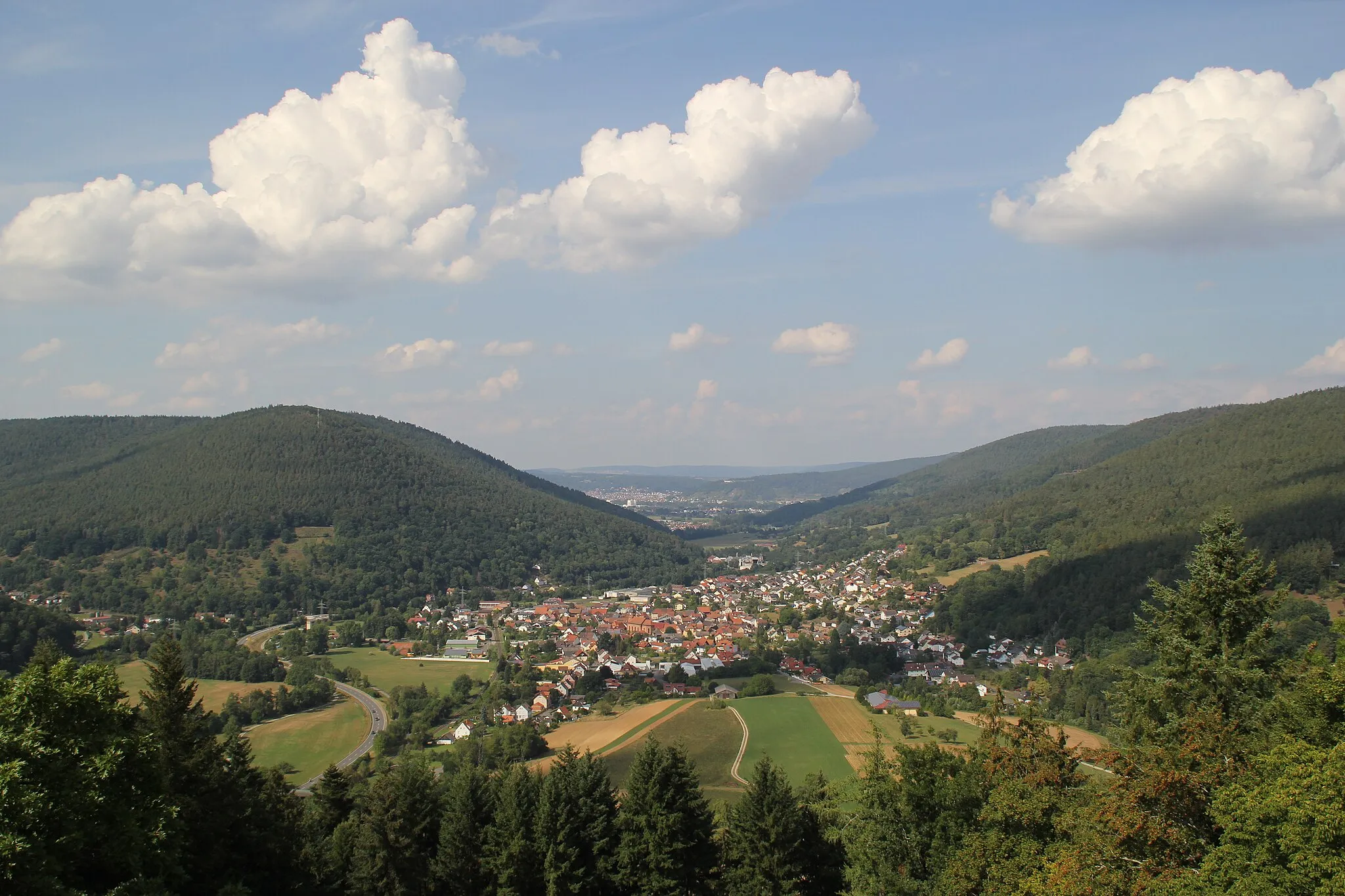
HobbachVillageHobbach, at the 34 km mark, is a picturesque village with half-timbered houses and idyllic landscapes.
49 km
49 km
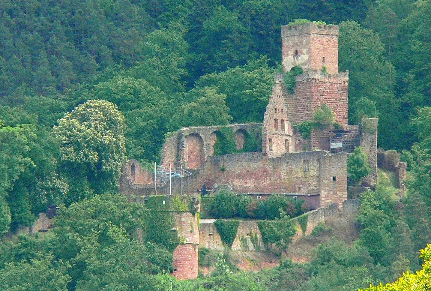
RohrbrunnHamletAt 49 km, Rohrbrunn captivates with its peaceful ambiance and surrounding nature.
52 km
52 km
Schwarzkopf568 mPeakSchwarzkopf, located at 52 km, offers a sense of tranquility as you cycle through the serene forests.
60 km
60 km
Eichhöhe455 mPeakEichhöhe, at 60 km, provides scenic views and invites you to enjoy the natural beauty of the region.
70 km
70 km
StadtprozeltenVillageStadtprozelten, 70 km into the route, is a picturesque town with traditional half-timbered houses and a historic market square.
79 km
79 km
EbenheidVillageEbenheid, 79 km into the route, is known for its charming village atmosphere and beautiful landscapes.
81 km
81 km
Eichenbühlhöhe397 mPeakEnjoy panoramic views from Eichenbühlhöhe, located at 81 km, and immerse yourself in the natural surroundings.
84 km
84 km
Finish: Eichenbühl Village centerEichenbühl: Idyllic Cycling Retreat in Unterfranken
Cycling routes from Eichenbuhl:
Road Cycling Route from Eichenbühl Gravel Cycling Route to Sonderriet Gravel Route to Nassig and Burg Wertheim Scenic Road Ride through Holzturm and Külsheim Mautturm Loop Nebelkappe Adventure Adventurous Route through Spessart Road Cycling Route to Nassig Exploring Odenwald's Gravel Trails Gravel Adventure to Bürgstädter Berg and Schwarzkopf Gravel Adventure in Unterfranken
Cycling routes nearby: