Road Cycling Route from Eichenbühl
A road cycling route starting from Eichenbuhl
Ride through forests, vineyards and historic towns
Map
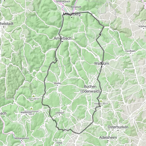
This road cycling route takes you through the beautiful landscapes of Unterfranken. With a distance of 97 kilometers and an ascent of 1325 meters, it is suited for experienced cyclists. Along the way, you will encounter several highlights such as the town of Walldürn with its picturesque streets and the historic Amorbach with its impressive abbey. An epicness score of 3 showcases the scenic beauty of the region.
road
97 km
1325 m
Tough
Route profile
Highlights on the route
0 km
0 km
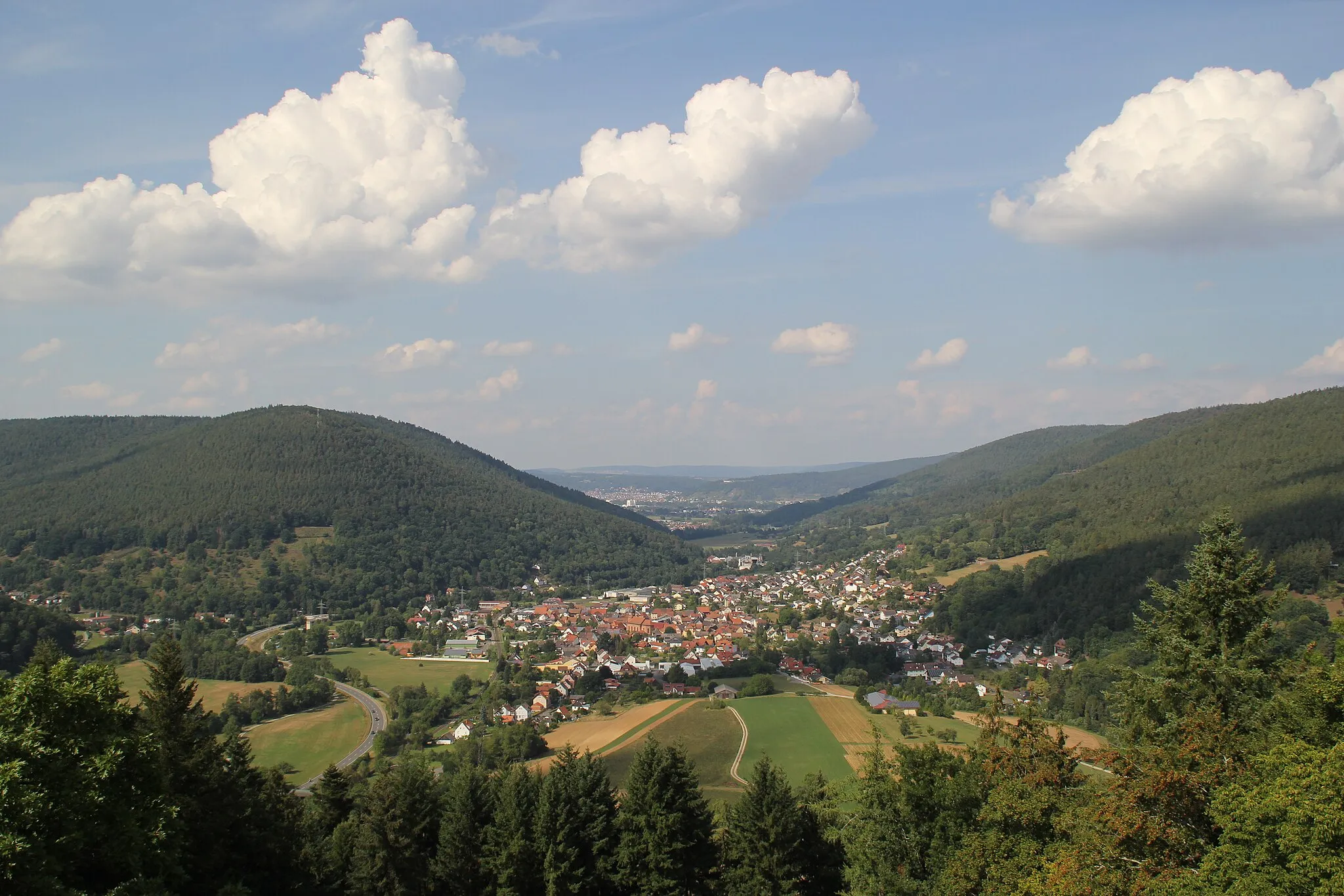
Start: Eichenbühl Village centerEichenbühl: Idyllic Cycling Retreat in Unterfranken
Eichenbühl in Unterfranken, Germany provides a delightful cycling experience for road and gravel cyclists. Located in a region known for its picturesque landscapes, Eichenbühl offers scenic routes through vineyards, forests, and quaint towns. Cyclists can explore the beautiful Spessart Mountains and challenging ascents such as the nearby Mespelbrunn Castle climb. The locality also features well-maintained cycling paths, ensuring safe and enjoyable riding experiences. Overall, with its idyllic surroundings and cycling-friendly infrastructure, Eichenbühl receives a rank of 3.17 km
17 km
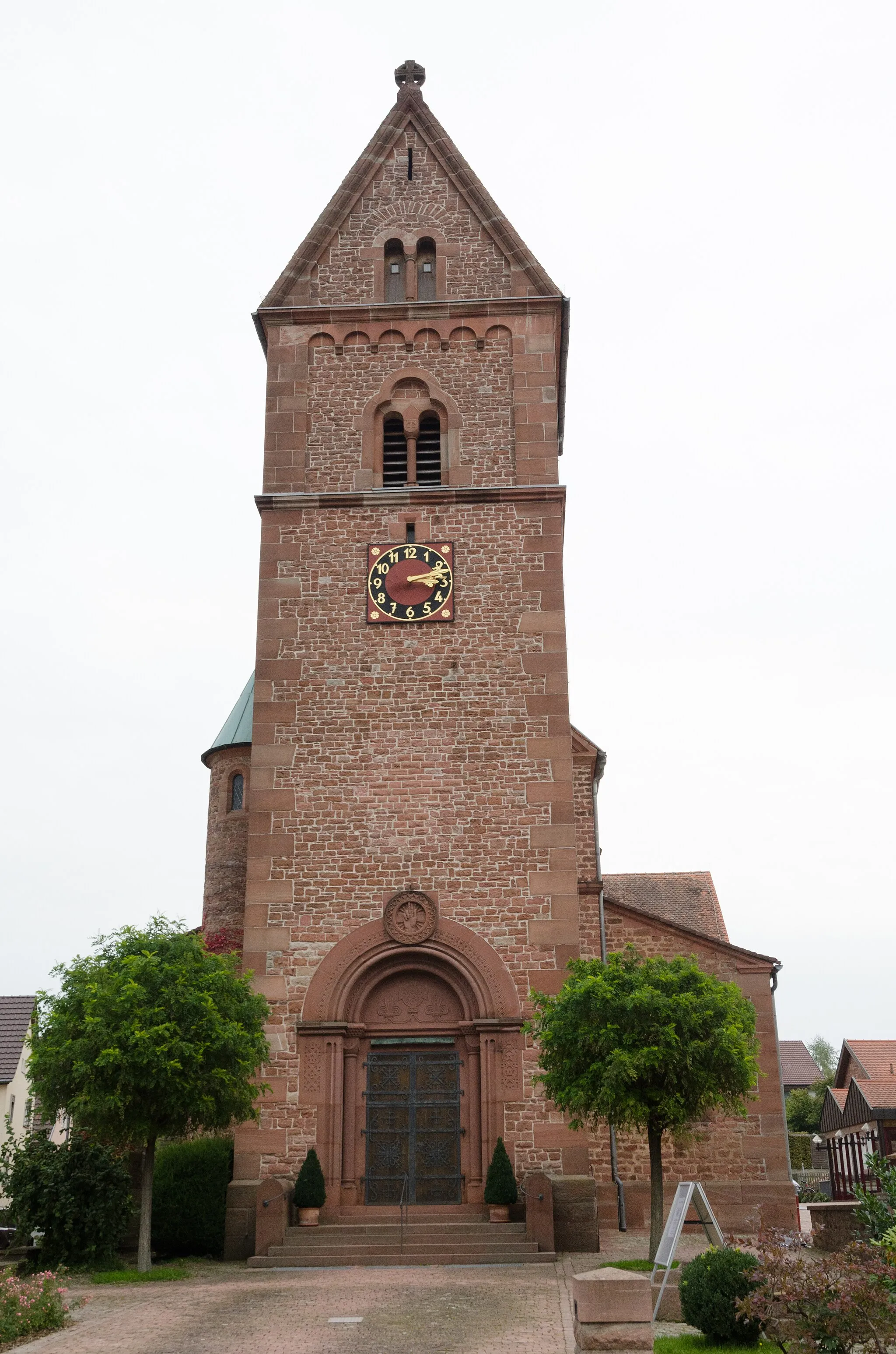
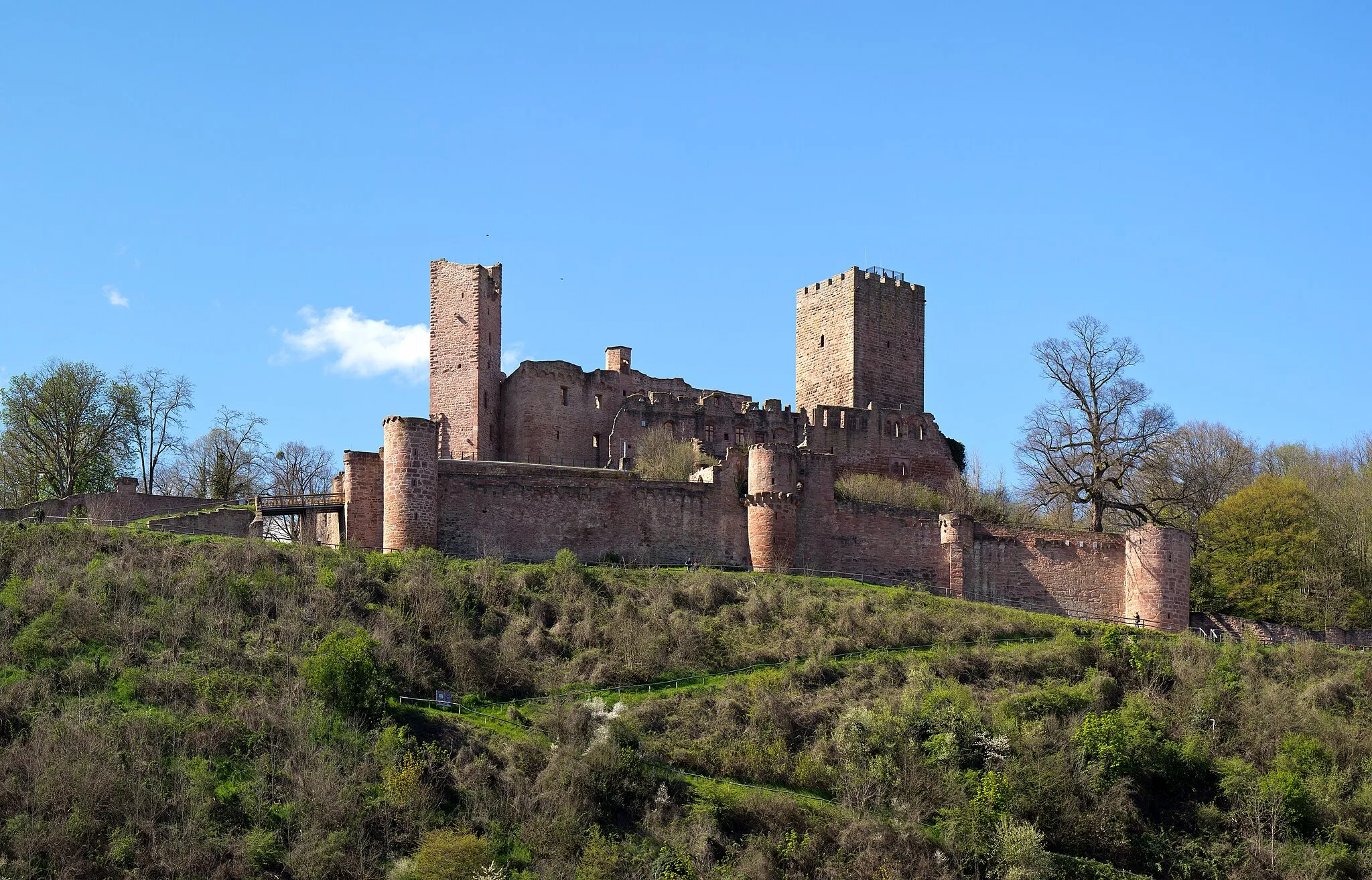
WalldürnTownVisit the small town of Walldürn, known for its beautiful old town and the pilgrimage church.
24 km
24 km
Eulsberg450 mPeakClimb up to Eulsberg and enjoy panoramic views over the surrounding countryside.
42 km
42 km
SchefflenzVillagePass through the charming village of Schefflenz with its historic half-timbered houses.
58 km
58 km
Heunenbuckel531 mPeakReach the top of Heunenbuckel, a hill offering great views of the region.
64 km
64 km
WaldauerbachVillageRide through the peaceful village of Waldauerbach and take in the tranquil atmosphere.
81 km
81 km
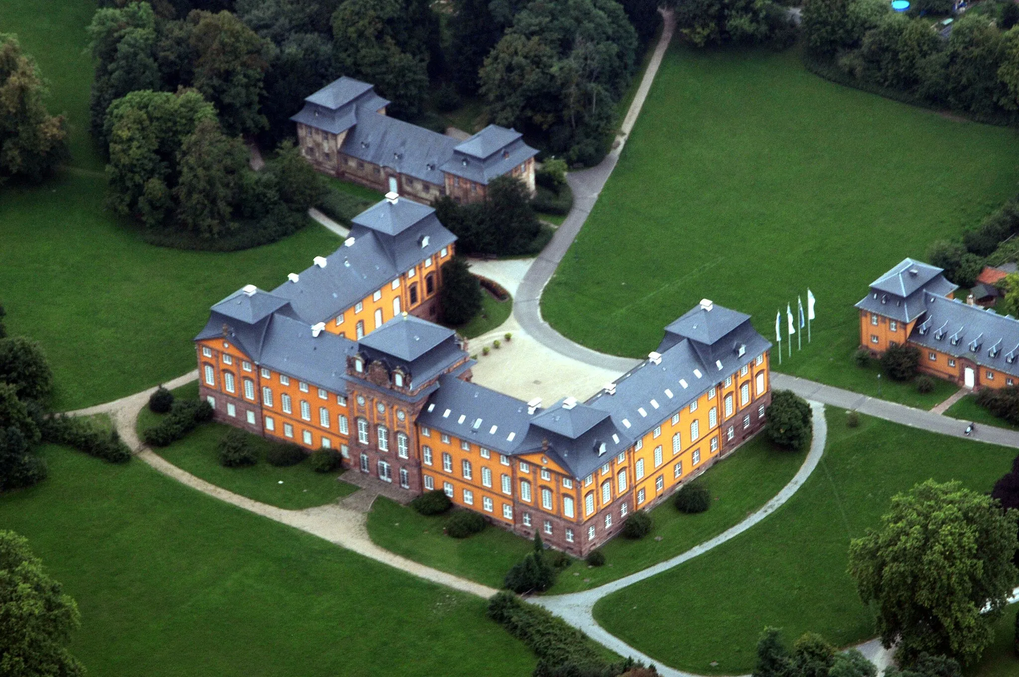
AmorbachTownExplore the town of Amorbach with its magnificent Benedictine abbey and beautiful market square.
82 km
82 km
Gotthardsberg299 mPeakMake a stop at Gotthardsberg, a hill with a panoramic lookout point.
90 km
90 km
PlattformViewpointPause at the Plattform viewpoint, offering stunning views of the surrounding area.
91 km
91 km
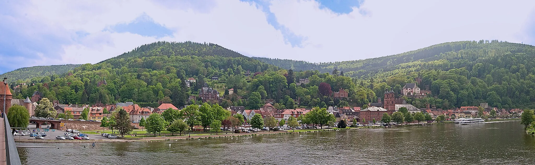
MiltenbergTownVisit the historic town of Miltenberg and explore its charming streets and half-timbered houses.
97 km
97 km
Finish: Eichenbühl Village centerEichenbühl: Idyllic Cycling Retreat in Unterfranken
Cycling routes from Eichenbuhl:
Road Cycling Route from Eichenbühl Gravel Cycling Route to Sonderriet Gravel Route to Nassig and Burg Wertheim Scenic Road Ride through Holzturm and Külsheim Mautturm Loop Nebelkappe Adventure Adventurous Route through Spessart Road Cycling Route to Nassig Exploring Odenwald's Gravel Trails Gravel Adventure to Bürgstädter Berg and Schwarzkopf Gravel Adventure in Unterfranken
Cycling routes nearby: