Exploring the scenic Franconian Switzerland and tackling the Round Franconian Switzerland route.
Cycling routes from Ruckersdorf
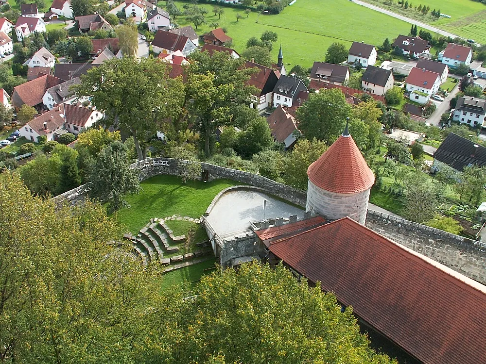
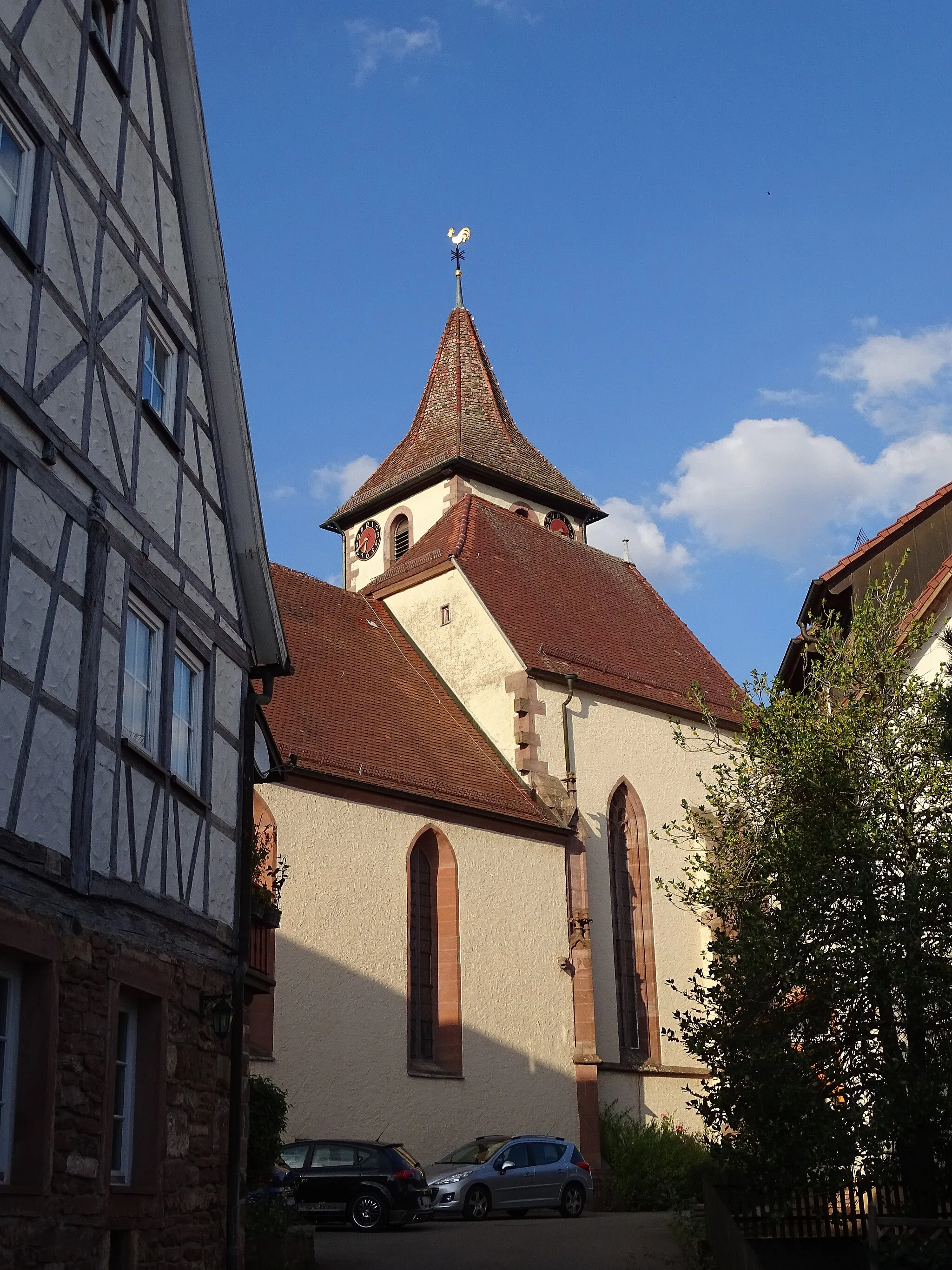
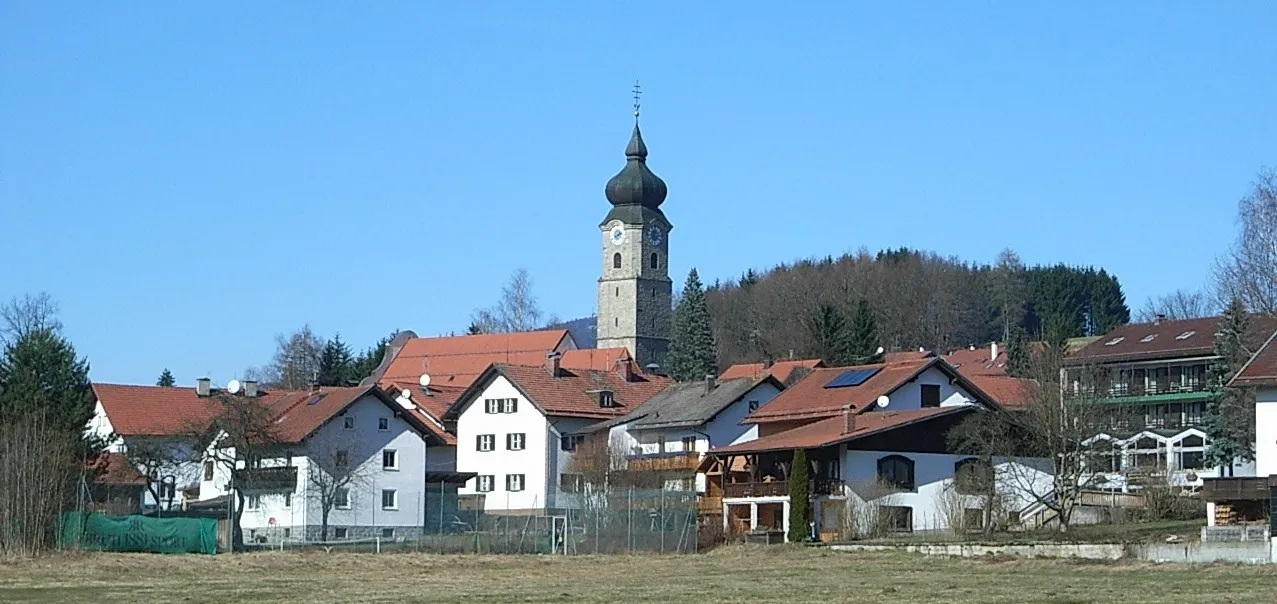
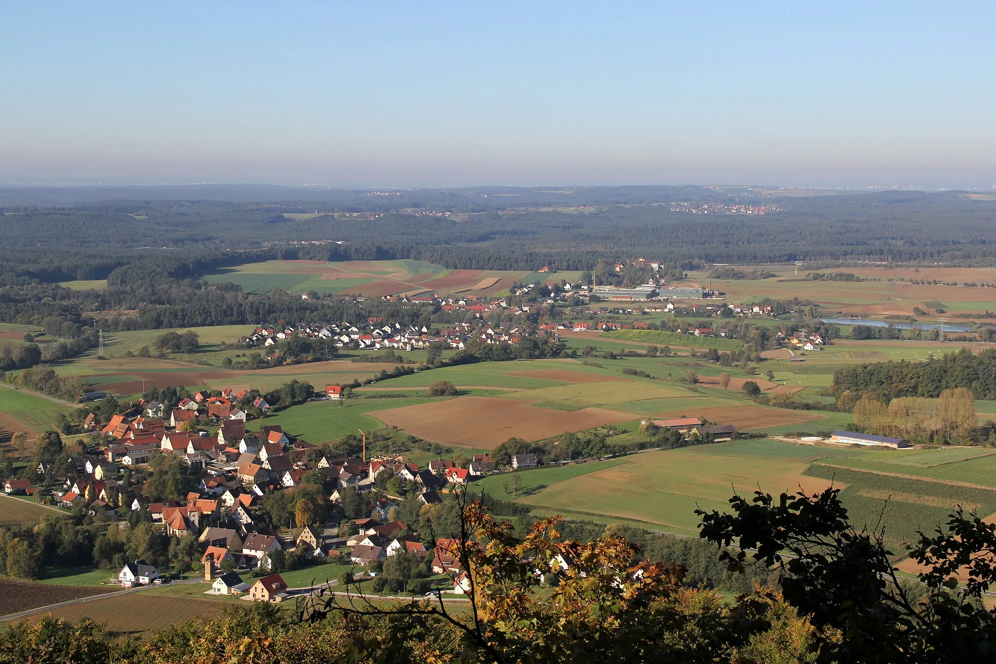
Rückersdorf, located in Mittelfranken, Germany, offers diverse cycling routes for road and gravel cyclists. The locality features rolling hills, picturesque landscapes, and charming villages, providing varied scenery throughout the rides. Rückersdorf is surrounded by the Franconian Switzerland region, offering challenging climbs and rewarding descents. Cyclists can explore the famous Round Franconian Switzerland cycling route, known for its stunning vistas and geological formations. With its combination of scenic landscapes and cycling opportunities, Rückersdorf is an excellent destination for cyclists of all levels.

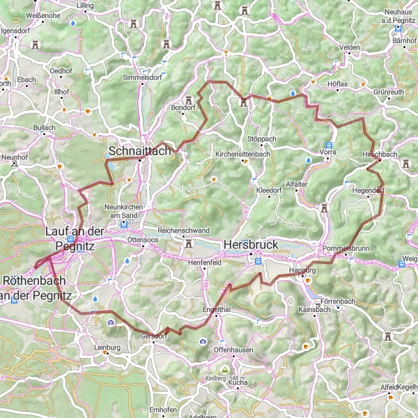
A challenging gravel route through Mittelfranken with stunning views and interesting highlights.
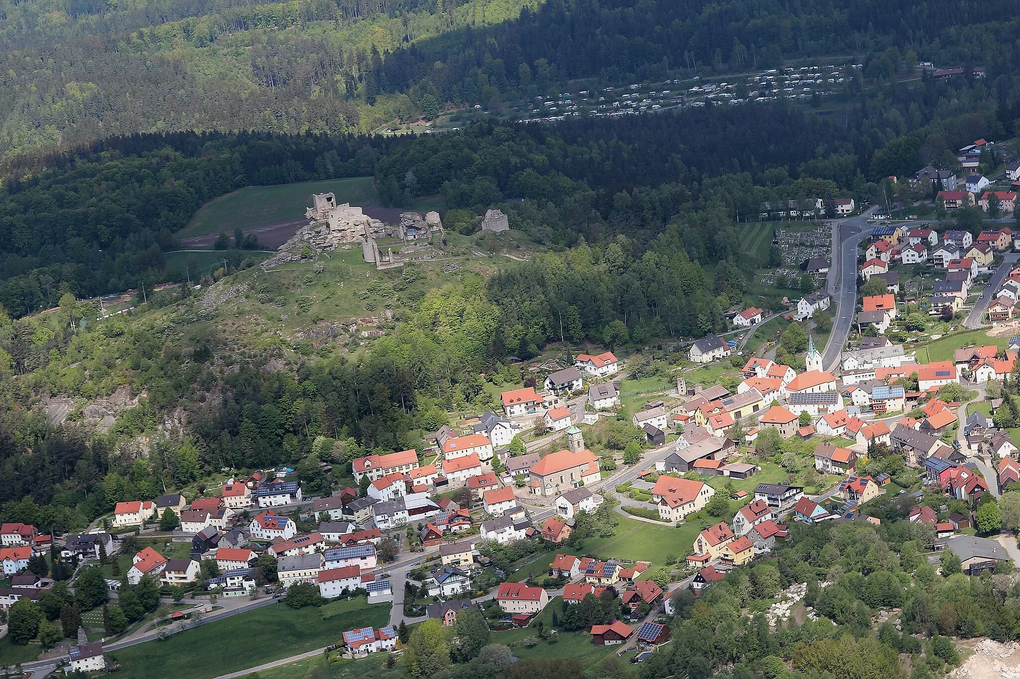
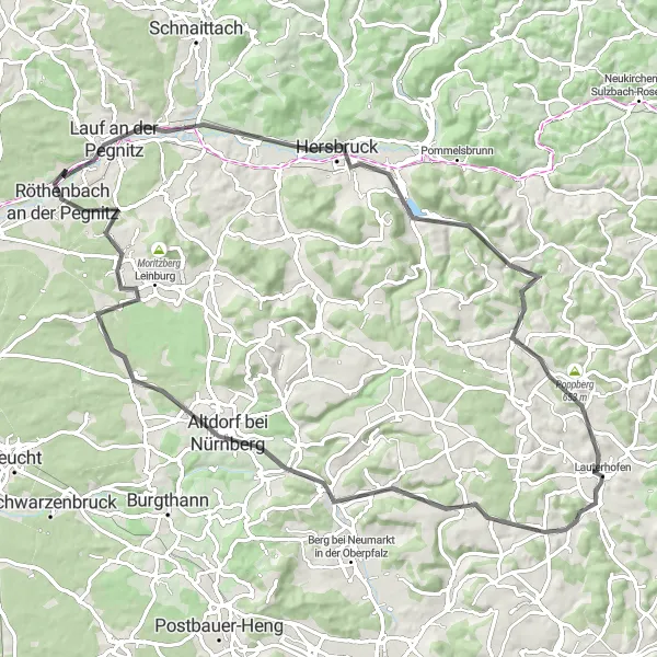
This round-trip cycling route starting near Rückersdorf takes you through the beautiful landscapes of Mittelfranken. With a total distance of 94 kilometers and an ascent of 1300 meters, this gravel route offers a challenge for experienced cyclists. Highlights along the route include Ottensoos, known for its medieval architecture, Michelsberg with its panoramic views, and Trollberg, famous for its unique rock formations. Other notable highlights include Illschwang, where you can visit the historic Illschwang Castle, and Kauerheim, a picturesque village with traditional Bavarian charm. The route also passes by Raschbach, a small town surrounded by lush green forests, and ends with the ascent of Reuther Berg, offering a thrilling finale. Overall, this route provides a mix of natural beauty and cultural attractions, making it a fantastic choice for cyclists looking for adventure in Mittelfranken.
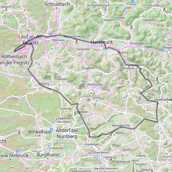
Explore the scenic countryside and historical landmarks along this road cycling route near Rückersdorf.
Glide through picturesque landscapes and soak in the history of the region as you cycle this scenic road route near Rückersdorf. With a total distance of 85 km and an ascent of 797 m, this route offers a challenging yet rewarding experience. The Hohenzollern Bridge Loop takes you through charming towns such as Reichenschwand, Alfeld, and Röthenbach an der Pegnitz. Don't miss the opportunity to stop at highlights like Schweineberg and Bug, which offer stunning views and interesting stories. This route is suited for well-trained amateurs and provides a memorable cycling adventure.
Panoramic Road Tour
Marvel at scenic panoramas and explore charming towns on this road cycling adventure near Rückersdorf.
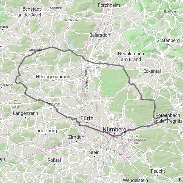
Embark on an exhilarating road cycling adventure near Rückersdorf, where magnificent panoramas await at every turn. This 99 km route with an ascent of 622 m offers a scenic escape through rolling hills and charming towns. Enjoy breathtaking vistas at Rechenberg and Gaugelberg, and discover the historical delights of Nuremberg. As you pedal through Puschendorf and Mistelberg, immerse yourself in their rustic beauty. Conquer challenging terrain as you approach Bug, a serene natural spot ideal for a rejuvenating break. This route is suited for well-trained amateurs seeking stunning vistas and cultural exploration.
Conquer the ultimate gravel challenge through Rutschen and Happurg
Embark on an ultimate gravel challenge starting near Rückersdorf, venturing into the heart of Mittelfranken's rugged terrains. This demanding 78-km gravel route with 1692 meters of ascent will push your limits and provide a true test of both endurance and skill. Begin by tackling the formidable climb of Schmalzberg, setting the tone for the challenging route ahead. Discover the medieval charm of Schnaittach at the 13 km mark, known for its well-preserved historic architecture. Ascend to the summit of Steinensittenbach at 24 km, savoring the panoramic views that await you. Push your limits further by conquering the iconic climb of Rutschen at 41 km, followed by a thrilling descent towards Happurg, offering exhilarating vistas along the way. This route is highly recommended for experienced gravel riders seeking the ultimate adventure.
Picturesque road cycling journey through Lauf an der Pegnitz and Häuselsteiner Höhe
Embark on a picturesque road cycling journey starting near Rückersdorf, passing through charming towns and scenic landscapes. This 72-km road route with 825 meters of ascent is perfectly suited for intermediate riders seeking a balance between challenge and enjoyment. Begin by exploring Lauf an der Pegnitz, a town renowned for its historical architecture and rich cultural heritage. Ascend to the summit of Michelsberg at the 15 km mark, where mesmerizing panoramas await. Push further to reach Dürrberg at 25 km, offering stunning views of the surrounding Bavarian countryside. Climb Häuselsteiner Höhe at the 42 km mark, and experience the thrill of conquering this challenging ascent. This route is highly recommended for road cycling enthusiasts who appreciate picturesque landscapes and cultural exploration.
Off-road adventure to scenic Gauchsmühle and high point of Hoher Bühl
Embark on a rugged gravel adventure starting near Rückersdorf, taking you through picturesque landscapes and up to breathtaking viewpoints. This challenging 58-km route with 465 meters of ascent will test your endurance and bike handling skills. Experience the peaceful serenity of Gauchsmühle, a historic mill located 19 km into the route. Push further and conquer the Dreibrüderberg at the 20 km mark, offering a panoramic view of the surrounding hills. The highlight of the ride comes at 39 km with the ascent to the summit of Hoher Bühl, providing majestic vistas across the region. We recommend this route to gravel enthusiasts seeking thrilling off-road experiences.
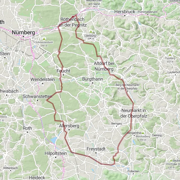
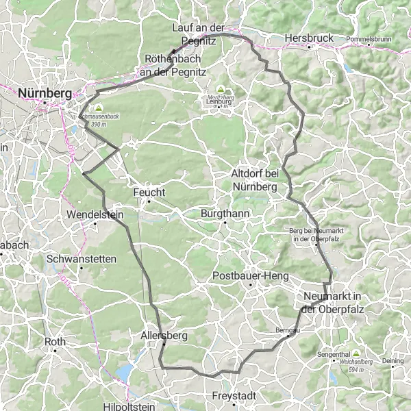
Thrilling off-road expedition to Neumarkt's Oberpfalz and Eulenhof
Prepare yourself for an epic off-road adventure from Rückersdorf towards Neumarkt in der Oberpfalz, encompassing picturesque landscapes and thrilling climbs. This demanding 111-km gravel route with 877 meters of ascent is a perfect challenge for experienced cyclists. Along the way, you will discover the scenic beauty of Heiligenmühle, a historic mill located 12 km into the route. Pedal further to reach the charming town of Neumarkt in der Oberpfalz at 36 km, known for its rich history and architectural treasures. Ascend to the summit of Kruppach at the 49 km mark, where you'll be rewarded with awe-inspiring vistas. Take a moment to stop by Eulenhof, a hidden gem at the 70 km mark, nestled amidst tranquil surroundings. This route is highly recommended for gravel enthusiasts seeking an adrenaline-fueled expedition.
Historical Road Journey
Embark on a historical road journey passing through charming towns and majestic landscapes near Rückersdorf.
Embark on a historical road journey through the enchanting landscapes near Rückersdorf. This 108 km route with an ascent of 841 m takes you on a memorable journey through picture-perfect sceneries and picturesque towns. Along the way, stop at Engelthal, where you can marvel at its stunning monastery. Visit Berg bei Neumarkt in der Oberpfalz and its medieval castle, and enjoy panoramic views from Möninger Berg. Finish your ride with a visit to Bug, where you can unwind in the tranquil surroundings. This challenging route promises a mix of history, natural beauty, and memorable road cycling.

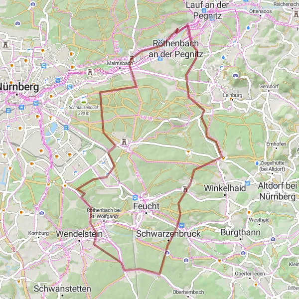
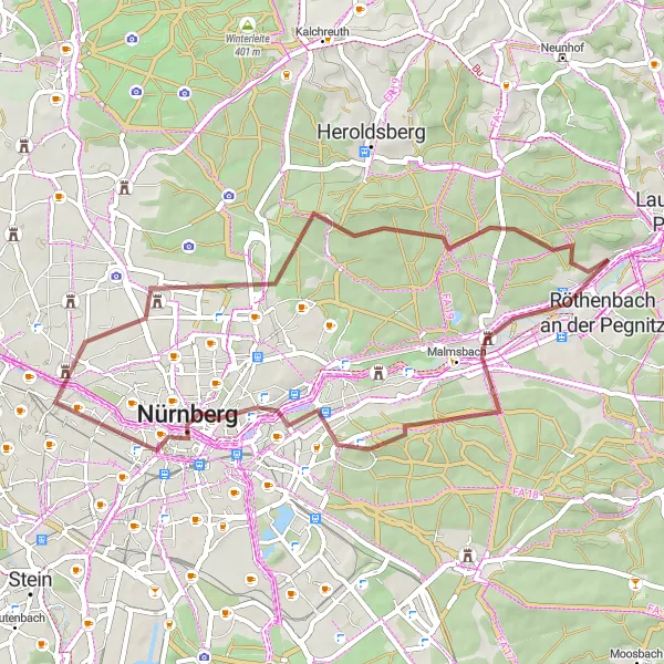
Embark on an adventurous gravel ride through nature's untouched beauty near Rückersdorf.
Escape into the wilderness and experience the serenity of nature on this gravel cycling route near Rückersdorf. Spanning 52 km with an ascent of 428 m, this route is perfect for gravel enthusiasts seeking a peaceful adventure. Explore highlights like Moosbach, an idyllic village with traditional charm, and Röthenbach an der Pegnitz, known for its medieval castle. Bug, with its tranquil surroundings and vibrant flora, is a great spot to take a break along the way. This route is moderately challenging and offers a unique and unforgettable cycling experience.
Enchanting Gravel Getaway
Immerse yourself in the enchanting beauty of gravel roads and picturesque landscapes near Rückersdorf.
Immerse yourself in the enchanting beauty of the countryside on this gravel cycling route near Rückersdorf. The 46 km route with an ascent of 306 m is a magical journey through captivating sceneries and charming villages. Highlights include Behringersdorf, a village with a rich historical heritage, and Nuremberg, where you can explore its iconic sights. Don't miss the opportunity to stop at Bug, a tranquil spot with serene lakes and lush greenery. This moderately challenging route is ideal for gravel enthusiasts seeking a blend of natural beauty and cultural exploration.
Cycling routes nearby:


Nearby regions: