Embarking on a cycling adventure in the scenic landscapes of Bad Lobenstein in Thüringen, Germany.
Cycling routes from Bad Lobenstein
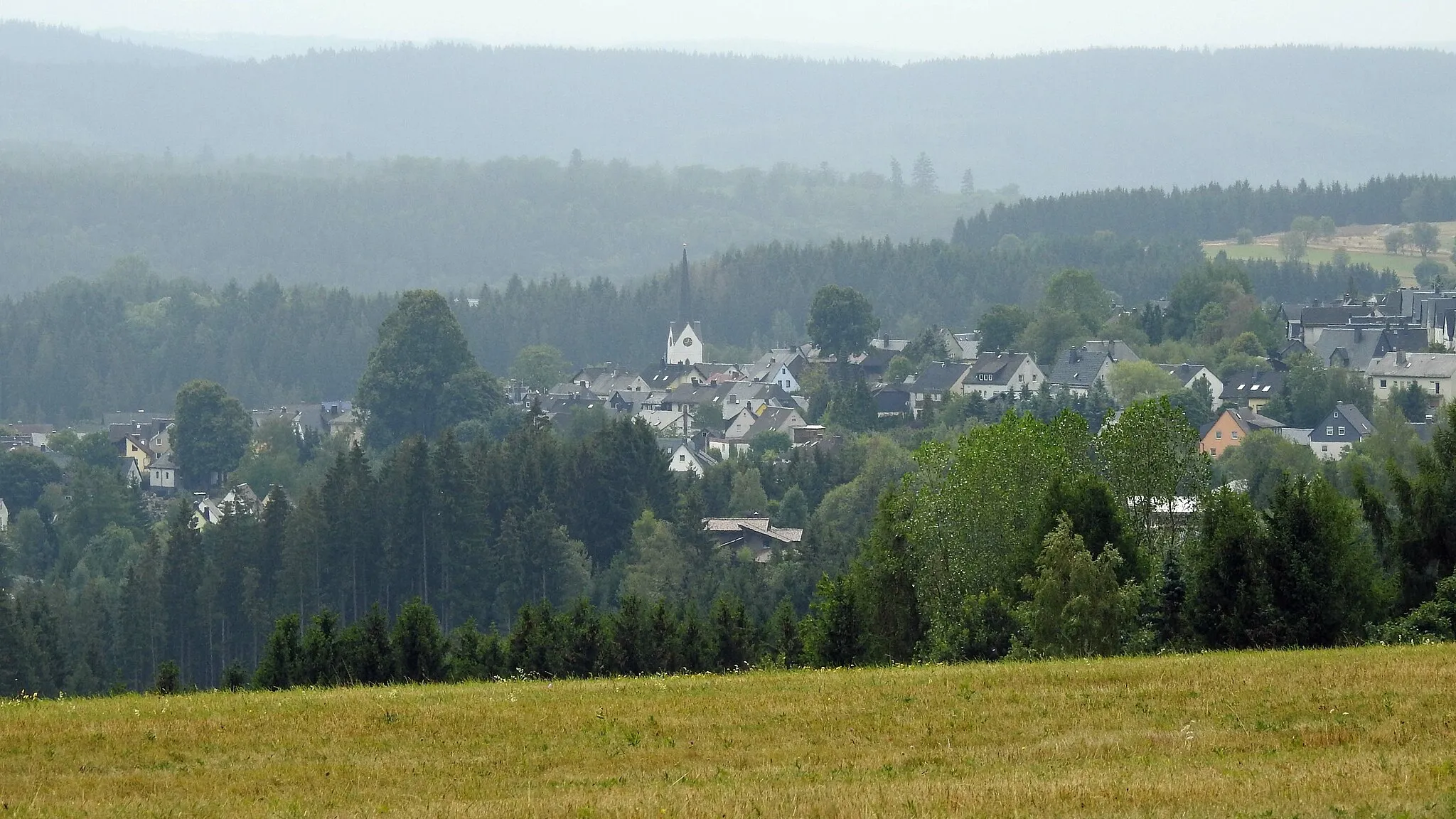
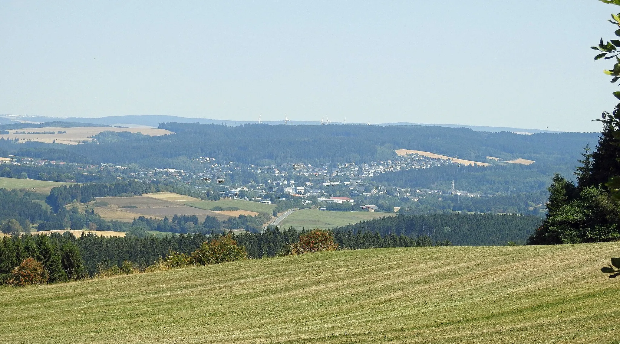
Bad Lobenstein in Thüringen, Germany is a scenic locality known for its natural beauty and cycling opportunities. With its rolling hills and picturesque landscapes, it provides an ideal setting for road and gravel cyclists. Cyclists can explore the lush Thuringian Forest nearby, admiring its dense forests and charming villages along the way. The area also offers well-known climbs such as the Schlossberg, a challenging ascent that rewards riders with panoramic views from the top. Bad Lobenstein is a cycling paradise for nature lovers and those seeking a refreshing escape from city life.
Experience the tranquility of rural landscapes on this gravel cycling route near Bad Lobenstein
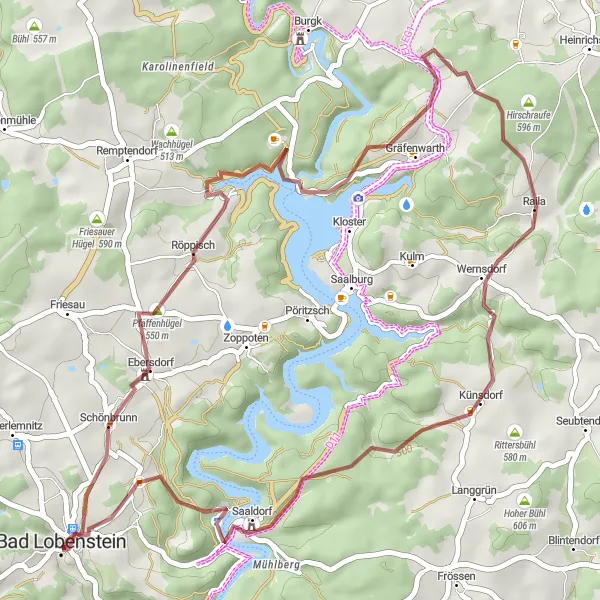
Escape the hustle and bustle of city life on this rural gravel cycling adventure starting near Bad Lobenstein. The highlight of the route is the climb up Pfaffenhügel, which offers stunning views of the surrounding countryside. With a difficulty rating of 2, this route is suitable for experienced amateur gravel cyclists. It has an epicness rating of 2, making it a moderately challenging and enjoyable ride. The route covers a distance of 45 kilometers and includes about 969 meters of ascent.

A short and scenic road cycling route
The Hornsgrün Loop is a relatively short road cycling route near Bad Lobenstein, Thüringen, Germany. Covering a distance of 31 km and featuring an elevation gain of 608 m, this route is suitable for cyclists of all levels. Along the way, cyclists will encounter beautiful landscapes and charming villages. Some highlights of the route include Hornsgrün, Kirchhügel, Haidekoppe, and Wurzbach. With its manageable distance and scenic beauty, the Hornsgrün Loop offers a delightful cycling experience for nature enthusiasts.
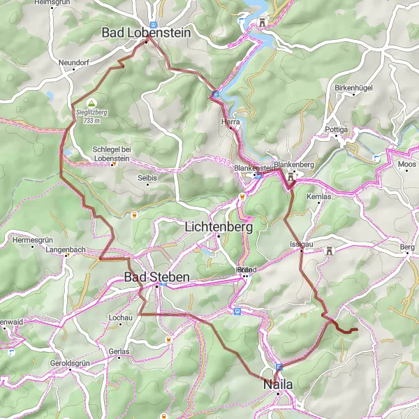
Lemnitzhammer Loop
A scenic cycling route with plenty of highlights
The Lemnitzhammer Loop is a picturesque cycling route near Bad Lobenstein, Thüringen, Germany. With a total distance of 45 km and an elevation gain of 1030 m, this gravel route is a great choice for adventurous cyclists. The route features several highlights along the way, including the historic Lemnitzhammer, Blankeneck, and Naila-Froschgrün. With its challenging terrain and stunning landscapes, this cycling route is perfect for those looking for a thrilling adventure.

A road cycling route with scenic views from Bellevue hill
Experience the beauty of the Thuringian countryside on this road cycling route starting near Bad Lobenstein. The highlight of the route is the climb up Bellevue hill, which offers breathtaking views of the surrounding landscape. With a difficulty rating of 3, this route is suitable for well-trained amateur cyclists. It has an epicness rating of 2, making it a moderately challenging but rewarding ride. The route covers a distance of 72 kilometers and includes about 1135 meters of ascent.
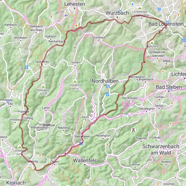
Experience a challenging gravel ride through the natural beauty of the Thuringian Forest.
This challenging gravel route takes you through the stunning scenery of the Thuringian Forest. With a total ascent of 1,687 meters over a distance of 81 kilometers, it is suitable for experienced cyclists seeking an adventurous ride. The route starts near Bad Lobenstein, a beautiful town surrounded by mountains and forests. Along the way, you will encounter highlights such as Sieglitzberg, known for its picturesque views, Stebenberg, an ancient castle ruins, and Hohe Wart, a mountain peak offering panoramic vistas. Prepare to immerse yourself in the rich nature and history of this region.
Frössen Tour
An epic road cycling route with stunning views
The Frössen Tour is an epic road cycling route starting near Bad Lobenstein, Thüringen, Germany. Spanning a distance of 62 km and featuring an elevation gain of 1179 m, this route offers a challenging yet rewarding experience for cyclists. Along the way, cyclists can enjoy breathtaking views and picturesque villages. Some highlights of the route include Frössen, Hexenhaus, Saalenstein, and Marxgrün. With its combination of stunning landscapes and thrilling climbs, the Frössen Tour is a must-try for avid cyclists.
Pfaffenhügel Round Trip

A challenging road cycling route with a climb up the Pfaffenhügel hill
This road cycling route takes you through the picturesque countryside near Bad Lobenstein. The highlight of the route is the ascent up the Pfaffenhügel hill, which offers breathtaking views of the surrounding landscape. With a difficulty rating of 4, this route is suitable for well-trained amateur cyclists. It has an epicness rating of 3, making it a great choice for cyclists looking for a challenging ride without extreme difficulty. The route covers a distance of 69 kilometers and includes about 1210 meters of ascent.

An epic gravel route with challenging climbs
The Rodacherbrunn Adventure is a thrilling gravel route starting near Bad Lobenstein, Thüringen, Germany. Spanning a distance of 91 km and featuring an elevation gain of 1851 m, this route is designed for experienced and adventurous cyclists. Along the way, riders will encounter challenging climbs and breathtaking views. Some highlights of the route include Kirchhügel, Rodacherbrunn, Kurfürstenstein Hütte, and Höhkuppe. With its demanding terrain and stunning landscapes, the Rodacherbrunn Adventure is guaranteed to provide an adrenaline-fueled experience for cyclists seeking a challenge.
Gravel Adventure

Explore the picturesque countryside on this gravel cycling adventure near Bad Lobenstein
Escape the beaten path and immerse yourself in the stunning nature of Thuringia on this gravel cycling adventure. Starting near Bad Lobenstein, this route takes you through scenic countryside and offers opportunities to explore charming villages. With a difficulty rating of 2, this route is suitable for experienced amateur gravel cyclists. It has an epicness rating of 3, making it a moderately exciting and enjoyable ride. The route covers a distance of 55 kilometers and includes about 1129 meters of ascent.

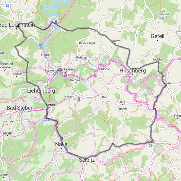
Conquer the challenging Thuringian Heights on this road cycling route near Bad Lobenstein
Embark on an epic journey through the stunning Thuringian Heights on this road cycling route starting near Bad Lobenstein. The highlight of the route is the climb up Naturdenkmal Steinerne Rose, a rock formation that offers breathtaking views of the surrounding landscape. With a difficulty rating of 5, this route is suitable for experienced and well-trained cyclists. It has an epicness rating of 4, making it a challenging yet tremendously rewarding ride. The route covers a distance of 114 kilometers and includes about 1905 meters of ascent.
Cycling routes nearby:


Nearby regions: