Odenwald Road Cycling Adventure
A road cycling route starting from Monchberg
Experience the breathtaking beauty of the Odenwald Mountains on this challenging road cycling route.
Map
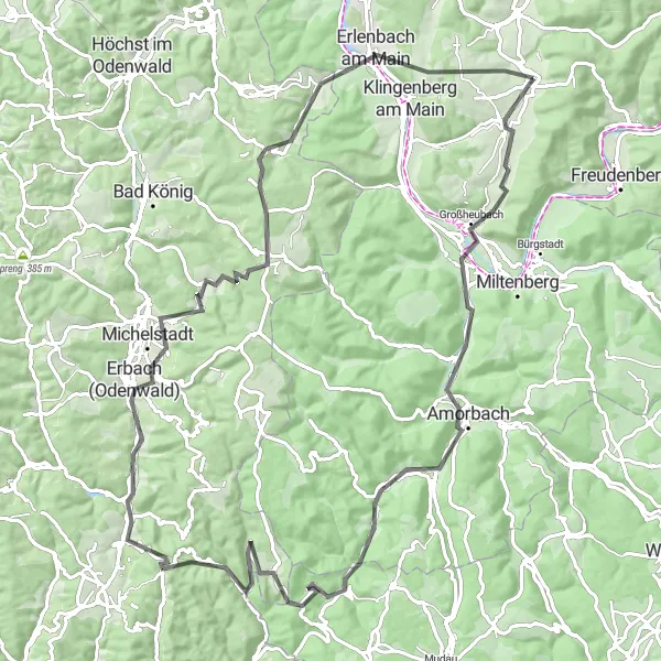
The Odenwald region in Unterfranken, Germany offers stunning landscapes and exhilarating cycling opportunities. This road cycling route takes you through picturesque villages, dense forests, and challenging climbs. The 97-kilometer route with 1478 meters of ascent will test your endurance and reward you with breathtaking views at every turn. Whether you're a novice cyclist looking for a challenge or a seasoned rider seeking an epic adventure, this route has something for everyone.
road
97 km
1478 m
Tough
Route profile
Highlights on the route
0 km
0 km
Start: Mönchberg Village centerMönchberg: A charming locality for road and gravel cyclists in Unterfranken, Germany.
Mönchberg in Unterfranken, Germany is a charming locality for road and gravel cyclists. The region is characterized by beautiful vineyards and picturesque countryside views. One of the well-known climbs nearby is the Geiersthal, which provides a thrilling challenge for cyclists. Mönchberg is an excellent choice for cyclists looking for a relaxed and scenic ride.8 km
8 km
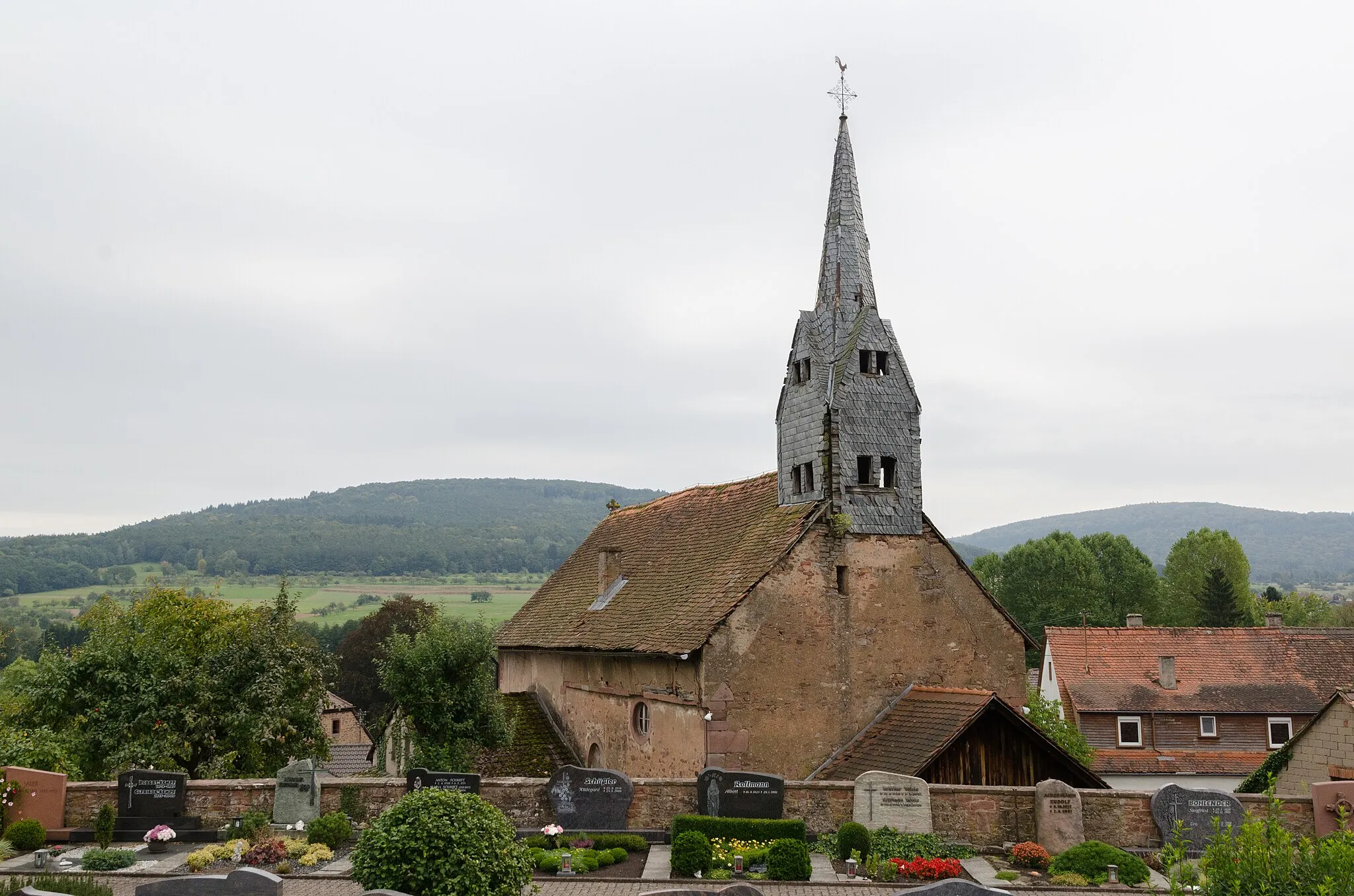
Nebelkappe267 mPeakAt 8 kilometers into the route, you'll reach Nebelkappe, a charming village with traditional half-timbered houses and a historic church. Take a moment to enjoy the peace and tranquility of this quaint spot before continuing your journey.
9 km
9 km
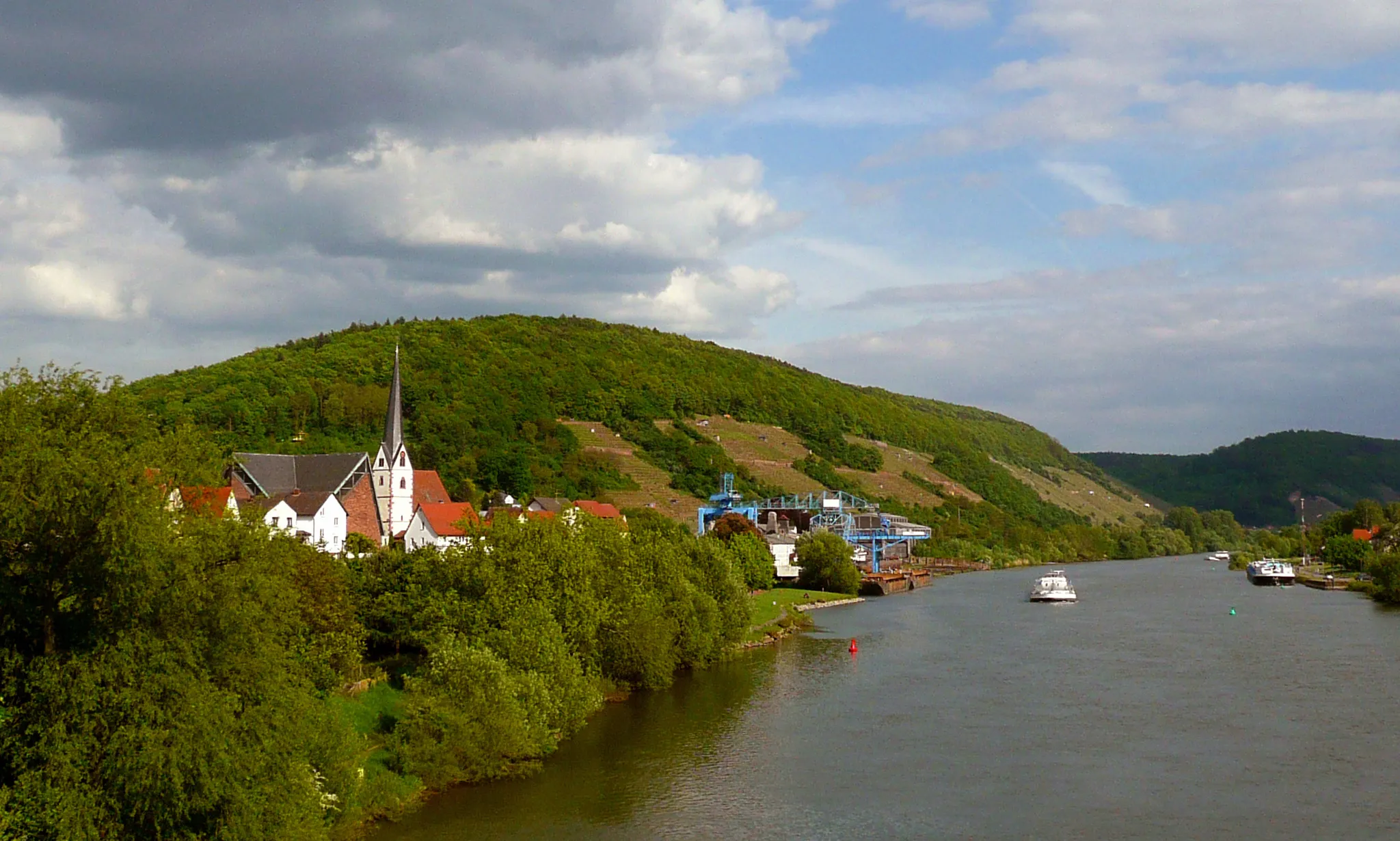
KleinheubachVillageKleinheubach, located at the 9-kilometer mark, is a gem of a village known for its beautiful vineyards and stunning views of the Main River. Pause here to savor the scenery and perhaps indulge in a glass of locally produced wine.
25 km
25 km
KirchzellVillageKirchzell, located 25 kilometers into the route, is a must-visit highlight. This charming village is famous for its medieval monastery, Kloster Engelberg. Explore the monastery's beautiful grounds and admire the stunning architecture before continuing your ride.
34 km
34 km
Hoheberg464 mPeakAt the 34-kilometer mark, you'll reach Hoheberg, a picturesque hill with panoramic views of the surrounding countryside. Take a moment to catch your breath and enjoy the awe-inspiring vistas before tackling the next segment of the route.
50 km
50 km
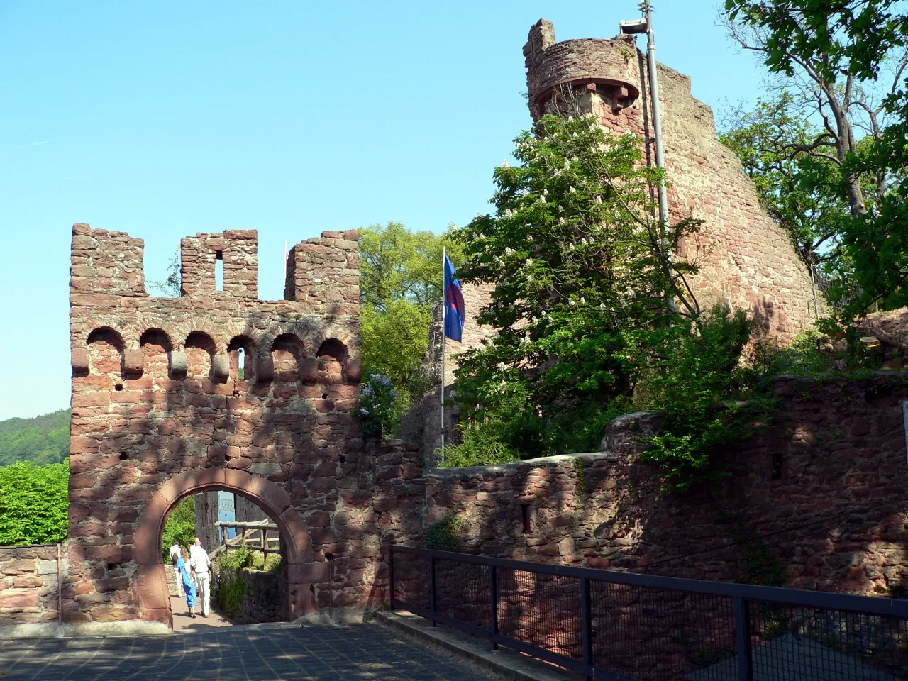
Krähberg554 mPeakKrähberg, located at the 50-kilometer mark, is a challenging climb but offers rewarding views as you ascend. Once at the top, you'll be greeted by the impressive Jagdschloss Krähberg, a hunting lodge with a rich history. Explore the lodge and take in the majestic beauty of the Odenwald Mountains.
50 km
50 km
Jagdschloß KrähbergCastleAs you continue your journey, don't miss the opportunity to visit Jagdschloss Krähberg. Located at the 50-kilometer mark, this historic hunting lodge is a true hidden gem. Wander through its stately halls and immerse yourself in its fascinating history.
60 km
60 km
Erbach (Odenwald)TownErbach (Odenwald), located at the 60-kilometer mark, is a charming town known for its well-preserved half-timbered houses. Take a stroll through the town's narrow streets, visit the picturesque marketplace, and perhaps indulge in some local delicacies.
71 km
71 km
Katzenbuckel449 mPeakKatzenbuckel, located 71 kilometers into the route, is the highest peak in the Odenwald Mountains. This challenging climb rewards cyclists with breathtaking panoramic views of the surrounding countryside. Take a moment to absorb the natural beauty before descending towards your final destination.
87 km
87 km
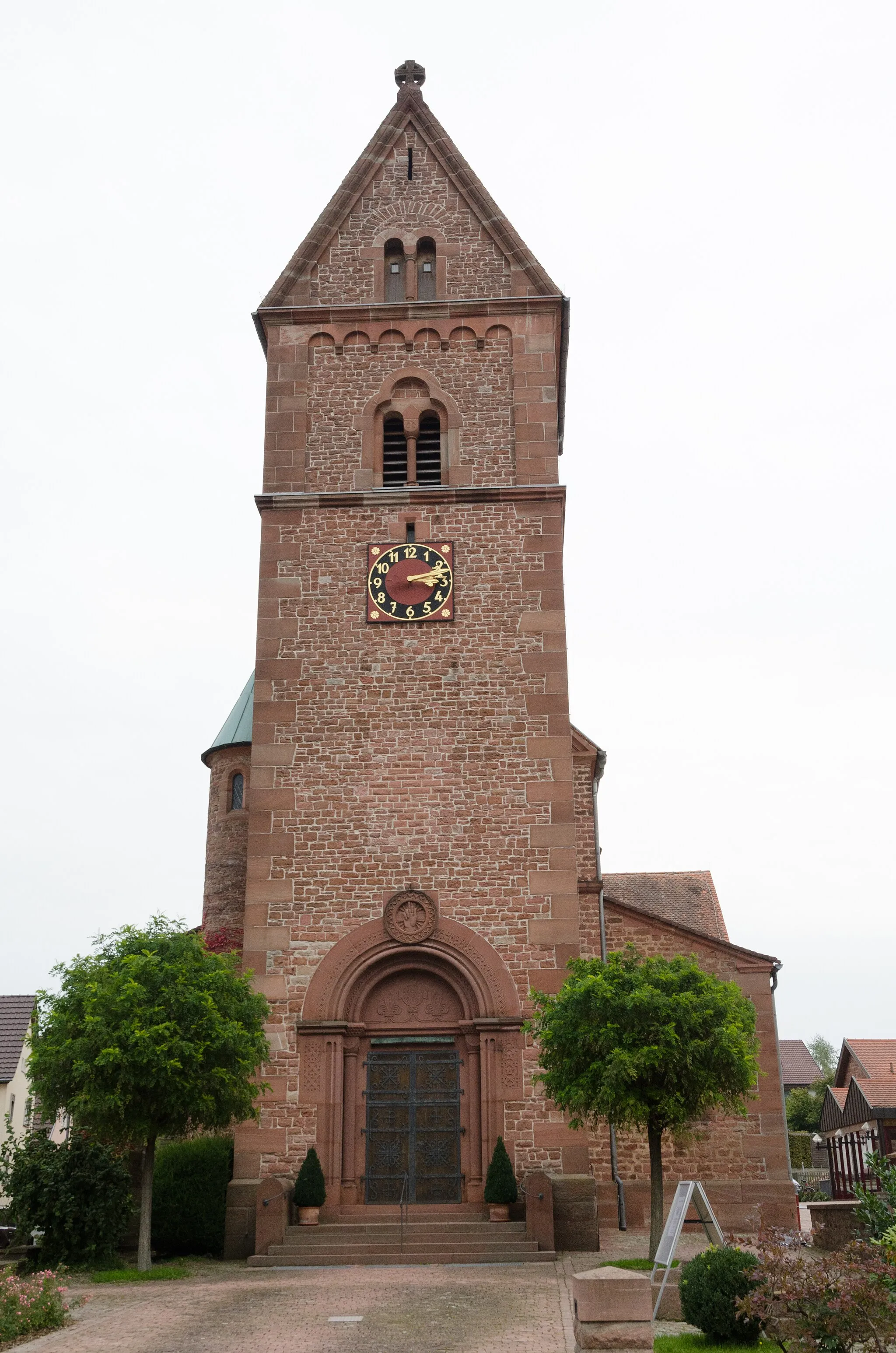
Wörth am MainTownWörth am Main, located at the 87-kilometer mark, is a charming riverside town known for its picturesque scenery. Stop here to enjoy a leisurely lunch by the river, visit the historic town center, or simply relax and soak in the tranquil atmosphere.
92 km
92 km
Galgenberg320 mShelterGalgenberg, reaching a height of 92 meters above sea level, offers stunning views of the Main River and the surrounding countryside. Take a moment to appreciate the beauty of this vantage point before completing your cycling adventure.
97 km
97 km
Finish: Mönchberg Village centerMönchberg: A charming locality for road and gravel cyclists in Unterfranken, Germany.
Cycling routes from Monchberg:
Kleinwallstadt - Plattenberg - Eschau Route Nebelkappe - Roter Buckel - Adlerstein - Bad König Route Heimbuchenthal - Dürrenberg - Rohrbrunn - Spitzenstein Route Ospis - Kleinheubach - Röllbach Route Dammberg - Schollbrunn - Auf der Schneide - Geiersberg - Waldschlösschen Route Mönchberg Loop Main Valley Ride Unterfranken Gravel Adventure Odenwald Explorer Odenwald Road Cycling Adventure The Gravel Adventure Monchberg Road Cycling Route
Cycling routes nearby: